


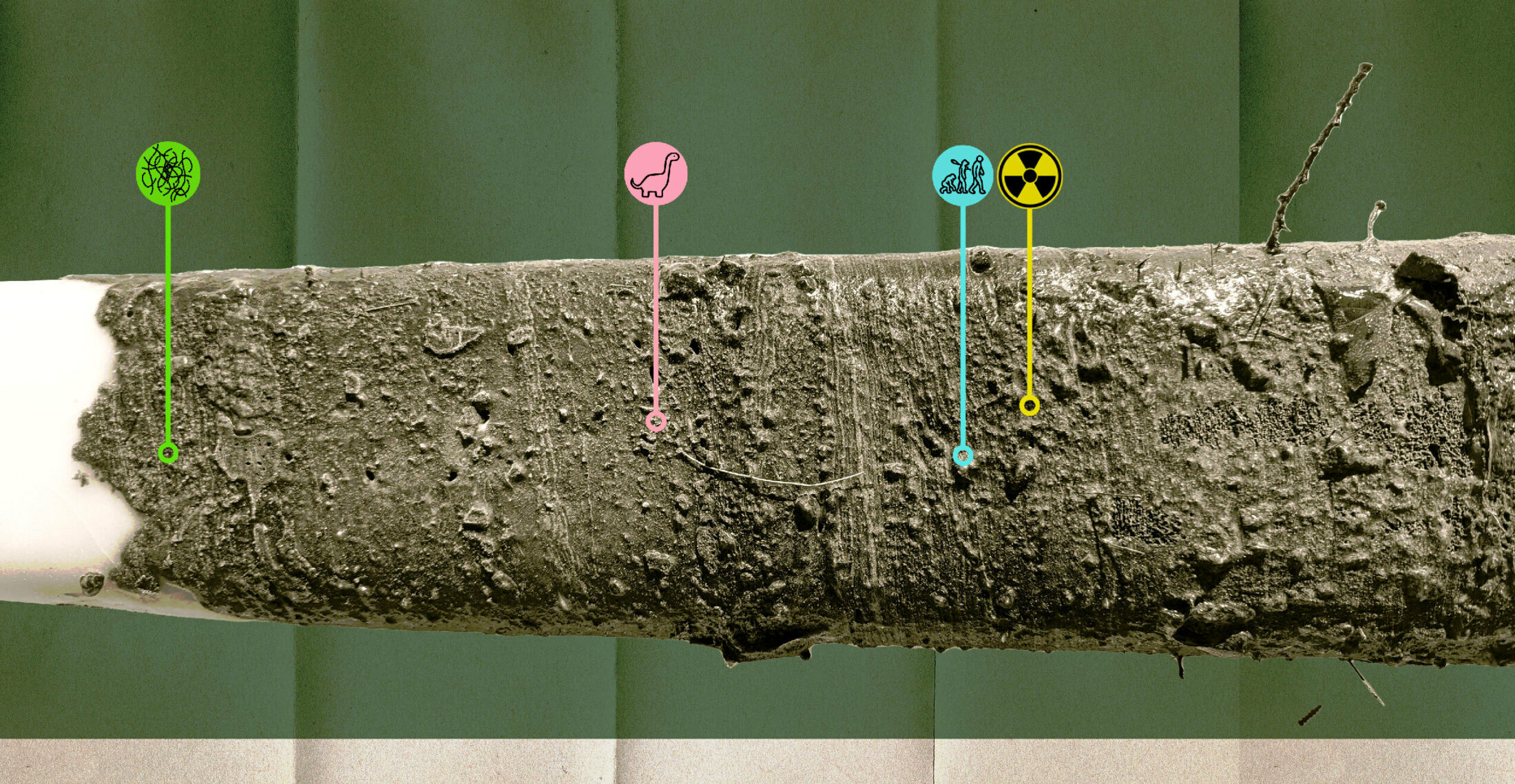
In art and activism, the word “Anthropocene” refers to the era that we’re living through now, one so clearly defined by human-caused climate change that it deserves a big, scientific-sounding name. But for geologists, a word ending in “ocene” isn’t scientific-ish, but actual science: it defines an epoch, a period of time so different from the preceding one that it’s clearly visible in the Earth’s layers, or strata, no matter where you are on the planet.
“Geologists, when they have intervals of geologic time, they’re pretty fussy about it meaning the same thing to everyone,” said Francine McCarthy, a professor of earth sciences at Brock University. With non-geologists insisting that the Anthropocene is a thing, the International Commission on Stratigraphy has decided to impose some rigour on the discussion, and figure out if and when the new, human-driven epoch actually began.
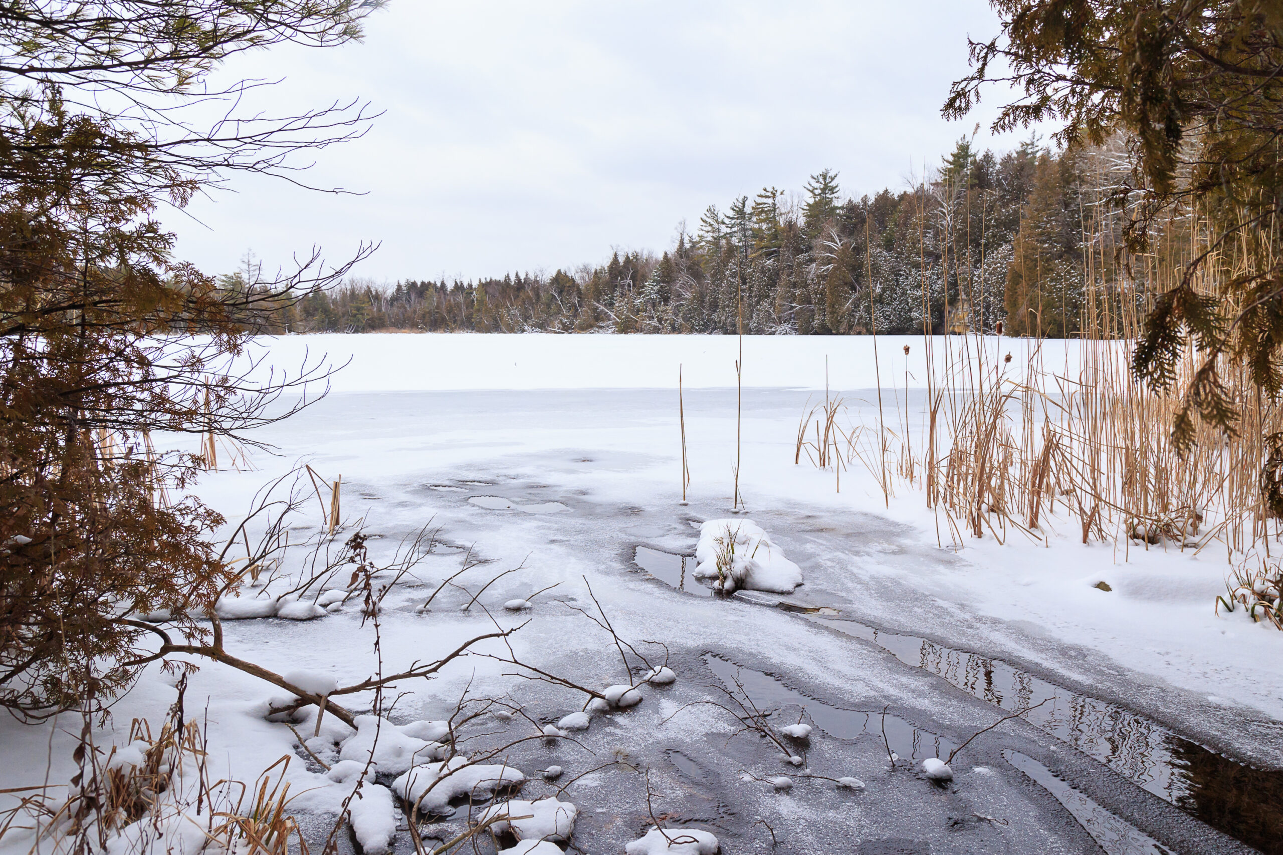
McCarthy has long studied Crawford Lake in Ontario’s Niagara Escarpment, beneath which the Earth’s strata, or layers, are “exquisitely preserved.” In 2018, she joined the commission’s Anthropocene Working Group, named after its efforts to consider how humans have altered the planet. The small, deep water body is now one of 12 global sites geologists are studying for a shared marker. They’re looking for something that pinpoints just when human activity began to make a big enough impact on the planet that it became visible in all of the Earth’s formations at the same time, whether coral reefs, ice sheets or freshwater lake sediment.
They think they’ve found it: the nuclear age in the mid-20th century, when the fallout from bomb tests and wartime detonations created a unique, traceable layer of radioactive particles that fell on every surface of the Earth. “Until they tested the first bomb in the New Mexico desert in 1945, those chemicals, those particular radionuclides, did not naturally occur on our planet,” said McCarthy. Soon after the nuclear layer, fossil fuel residue really began to pile on.

Now that the timestamp has been (mostly) settled, McCarthy and others like her are working to find the perfect example of what it looks like, to take to the full International Commission on Stratigraphy this fall. If the commission agrees that a new epoch should be recognized, it will pick a sample from one of the 12 global locations to be the standard. Like other epochs, the sample will be marked with a Golden Spike, named for the colour of the marker hammered into the layer that indicates exactly when everything changed.
McCarthy spoke with The Narwhal about why Crawford Lake is so special, and the geological controversy over whether the Anthropocene is truly definable.
What’s the Anthropocene?
The term “Anthropocene” was coined back in the ‘80s … to refer to the impact on Earth systems of human activities, primarily industrial activities and the burning of fossil fuels.
What is the Anthropocene Working Group? Who’s in it?
A subgroup of the larger International Commission on Stratigraphy. It’s an international group of people. Not only geologists or stratigraphers, it includes anthropologists, philosophers, historians, various social scientists, as well as biologists and geographers and so on. Social scientists and natural scientists who are interested in [marking] on the geologic timescale a new epoch that is going to say Anthropocene.
And how do you decide that?
What it requires is that there is a place on the planet where you can put your finger on a geologic unit and say everything above that point is going to be called Anthropocene, and everything below that will be the preceding interval of geological time. We’re still now on the Holocene, until this new interval is formally defined.
So there will be, if we are successful, a place on the planet which will define what it means to the Earth to be existing in a time that the amount of human impact is so great that it is experienced in gaseous and particulate emissions that are recorded in the sediments of the geologic units that we’re looking at. Just like we can see the difference between before the meteorite hit … to get rid of the dinosaurs and after.
Is a new epoch an easy thing to define?
Before I joined [the Anthropocene Working Group], it was still a matter of vigorous debate when this Anthropocene would begin. The people who had coined the term had kind of assumed that the Industrial Revolution would be the big turning point. And it turns out that upon further scrutiny, that is a very regional thing: the Industrial Revolution in England started well before the Industrial Revolution in China, and so on.
There was a lot of debate, and there still is debate in certain quarters, about whether there even should be an Anthropocene and when it should be. But in 2016, at the International Geological Congress in Cape Town, South Africa, there was an overwhelming vote in favour of pursuing this. Twelve sites were chosen to be the site that will define what it means to be Anthropocene.
The good thing from the working group’s perspective is that all 12 sites, whether they’re stalactite [a mineral formation that hangs from the ceiling of a cave, like an icicle], ice sheet, a lake sediment, ocean sediments, coral reef, they all do show the same thing at around the same time in their own way: a strong response to the changes in the Earth’s system in that mid-20th century. There is a marker that settled all over the Earth simultaneously with the detonation of atomic bombs. All of those products of nuclear fission that fall out of the atmosphere, fall out all over the world. And they did not naturally form before humans got involved.
The most likely year, currently, is 1952. Even though there were atomic bombs detonated in 1945 with terrible consequences, the nuclear arms race really only kicked in, in 1952. The French and the Russians (or the Soviets at that time) and the Americans, all these different nations were proving that they could do it. So the record really becomes readily detectable in 1952. It peaks in 1963 with the Bay of Pigs, at which point there was a nuclear disarmament treaty. And it falls off dramatically.
In all of these different environments, geologic settings, there is evidence that our planet reacted in a fundamental way to these stressors in a way that did not happen before.
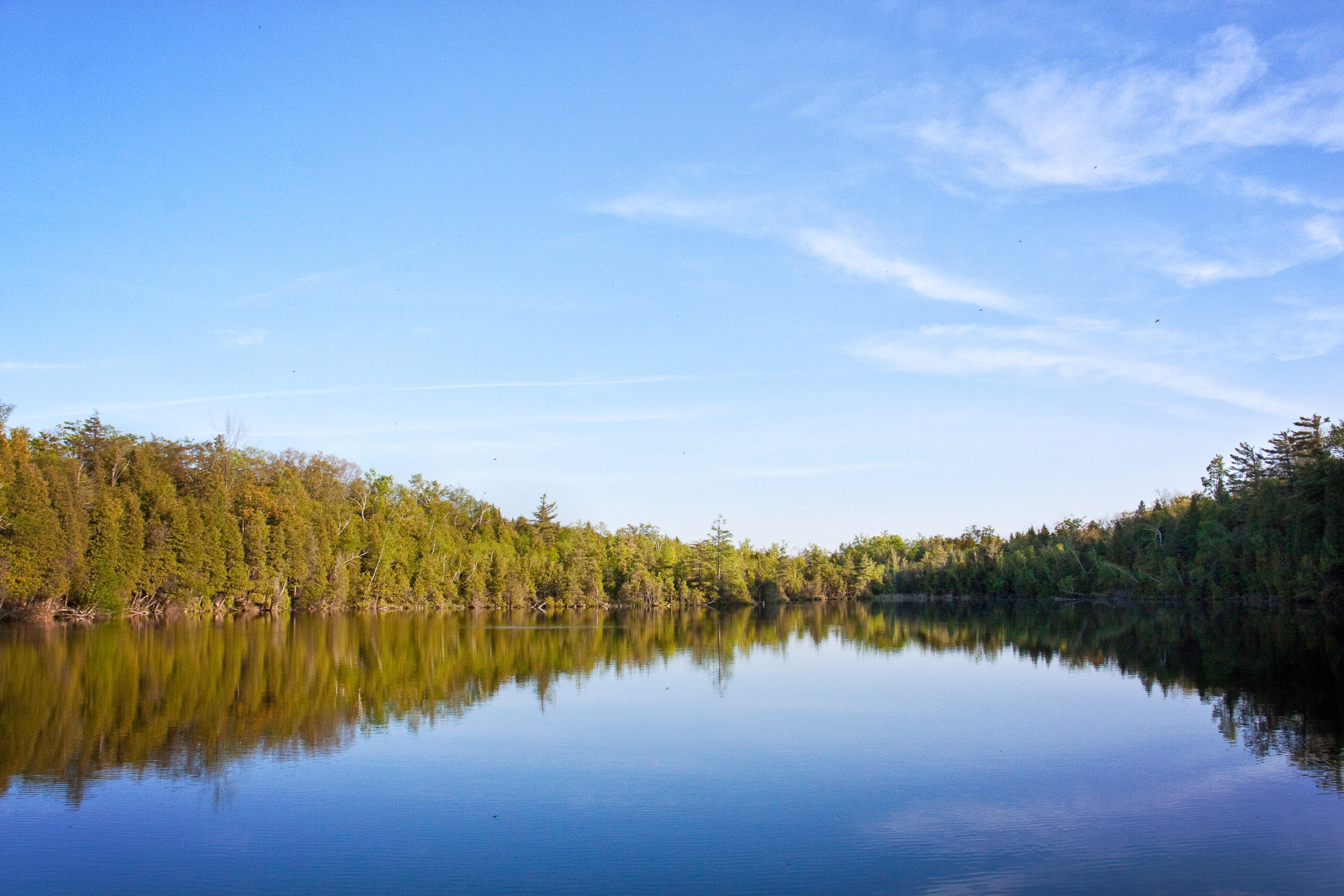
So you are studying Crawford Lake in the Niagara Escarpment. What makes Crawford Lake special?
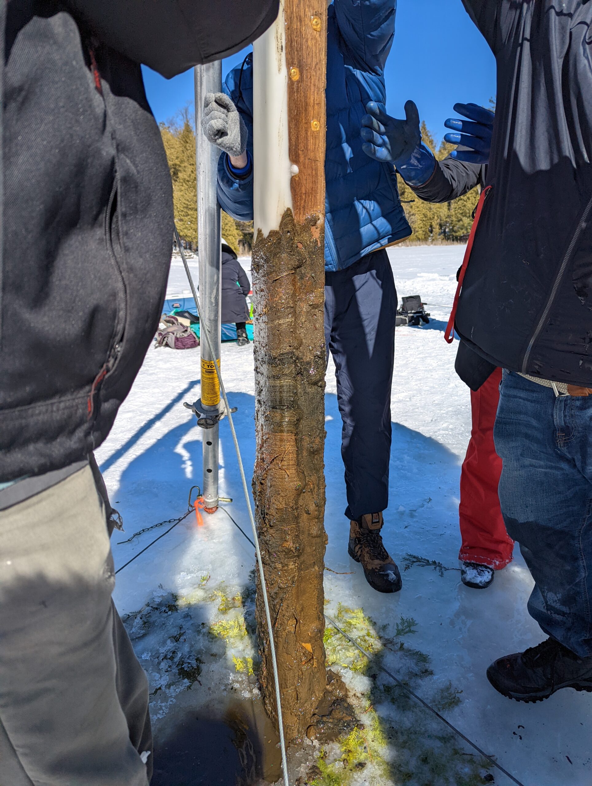
Crawford Lake is small but very, very deep. It’s 24 metres deep and you can walk around it in 15 minutes. Because of that ratio of circumference to depth, the bottom waters of the lake don’t mix with the surface. They’re not disturbed by wind or wave action. They’re not disturbed by organisms burrowing. They’re not disturbed, so that accumulates yearly.
And Crawford Lake is in a sinkhole-like cave in the calcareous limestone escarpment. In the summer, when the water gets warm enough, the dissolved calcium and carbonate ions in the water from the surrounding bedrock precipitate. They form little crystals that fall to the lakebed. So every summer, like snowfall, a little white layer accumulates, and it caps what had accumulated the rest of the year, the organic stuff, the bodies of algae and their consumers.
So what we have then at the bottom of Crawford Lake is an undisturbed annual record of white layer in the summer, capping the rest of it. So you can count like tree rings and find 1952 or any other year that you’re interested in finding. And any two people would find the same year. You don’t need to be a specialist. Because those layers are undisturbed, everything is exquisitely preserved.
In a paper that you wrote, you said that, ironically, unseasonably warm weather delayed you being able to get the core sample you needed?
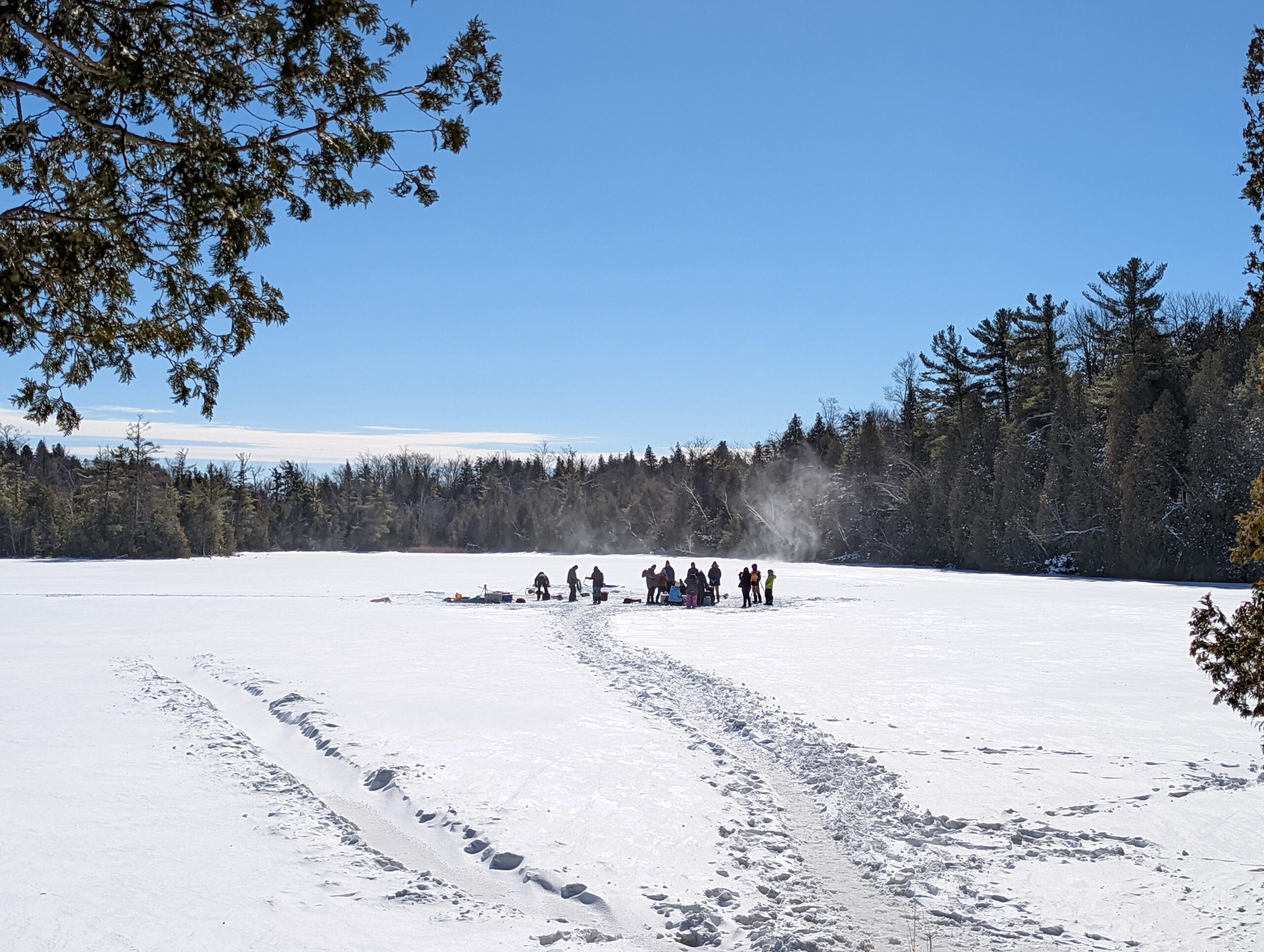
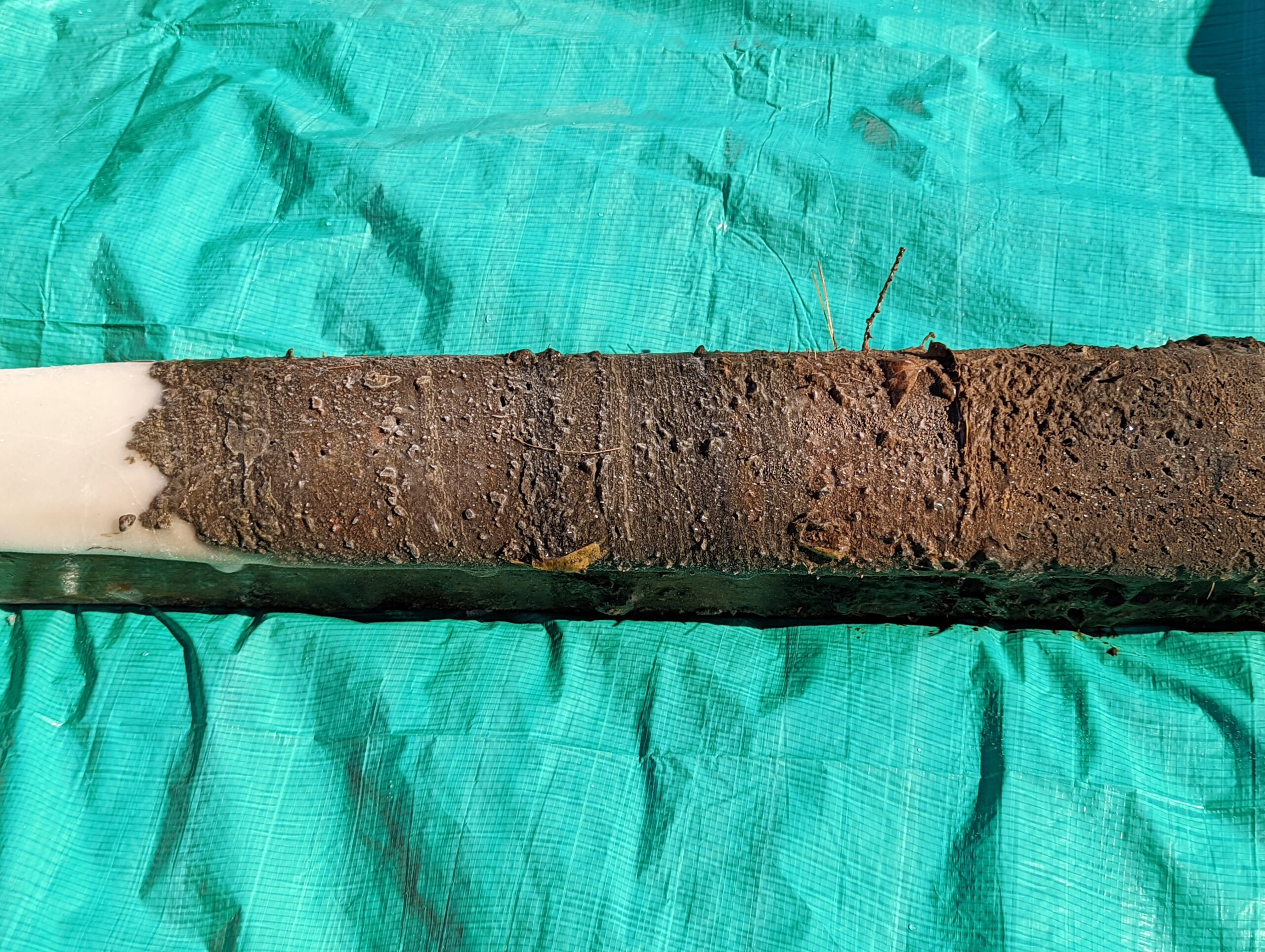
We took the initial sediment cores that were to be the candidate for this Golden Spike in February of 2019. We started working and discovered we underestimated the volume of sediment that was needed for all of the tests. And so we thought, “well, we’ll come back next winter.”
The next winter was too warm. We have these huge, enormous tripods, and you have to have a huge amount of force to lift these things from the 24-metre-deep basin. We couldn’t take that risk.
So that was in 2020, just before lockdown. In 2021, the issue wasn’t climate, it was lockdown. And then finally, finally, this year, in 2022, the Ontario government lifted the restrictions on travel and so on.
So you go out when it’s cold, and you take a big sample, and then it’s analyzed to see if the year 1952 is marked with radionuclides?
We don’t look to see if it’s marked by radionuclides because radionuclide analysis is really expensive. It’s like $500 a sample and you would need to do a bunch of samples. What we do is we make sure that the layers that mark everything from the lakebed through the mid-20th century and on down are there. A lot of people have been taking freeze cores since the late 1960s, so every now and again, we accidentally kind of hit a pre-existing hole.
Then we take the cores back to various labs. Of the three cores that we took in February of this year, one came back with me to Brock, one went directly to Carleton University and one went to the Canadian Museum of Nature in Ottawa [to be] archived in perpetuity in their cryogenic facility. If these sediments of Crawford Lake are chosen, one of the requirements of Golden Spikes is that they’d be readily accessible to other scientists.
Also, the site is of cultural importance to Indigenous people. We understood that their concerns were that we not continue to poke holes in this site that is important to them. So we agreed that this last time would be the last time. That’s why it’s important that there is a frozen core at the Canadian Museum of Nature.

Tell me about what you’ve found from Indigenous settlements.
The markers associated with Indigenous occupation back in the middle of the last millennium are what led to the initial interest in Crawford Lake back in the ‘60s and ‘70s. The Indigenous layer is super interesting. During two and a half centuries, there were people who occupied a small area that has thick soil and they built longhouses and they tilled the ground. They inhabited the site over a 250-ish-year span, which we can tell from later counting how many years they were there.
We can see evidence from the pollen of the crops that were growing, we can see evidence from the fungi that attack those crops. There are all kinds of different fossils and chemical signals that record human impact in the environment. Once we finish focusing on the Industrial Revolution to today, we will revisit that Indigenous record, in part to compare and contrast the impacts of Indigenous people over two and a half centuries with the impacts of the European colonists.
It’s when Indigenous people first settled the site that the annual layers became visible. It’s become obvious that their activities lead to a fundamental change in the lake system itself, that we are really anxious to work on.
Did you say you’re working with a local Indigenous community or a nation?
Yes. So through our colleagues at Conservation Halton, they have been working closely with the people who are thought to be the descendants of the people who built the longhouses. Now that in and of itself is slightly contentious because it’s really hard to be sure. I mean, you have archaeological evidence: they definitely built longhouses and grew corn, beans and squash, the Three Sisters crops, there is no doubt about that. They were not Anishinaabe but they could be … Haudenosaunee. The most likely descendants are the Wendat.
The idea of pinpointing the Anthropocene has been controversial in geological circles, hasn’t it? I’ve seen criticism of using radionuclides as a date stamp, because they do disappear at some point.
Yes, the radionuclides have a finite span. They’ll never be zero, but they will cease to be detectable. But there are other things that are not going to disappear. And that’s why there are multiple proxies, multiple indicators that are being measured at each site.
The one that is most clear in Crawford Lake is what are called SCPs or spheroidal carbonaceous particles. They are little round soot balls that are emitted from smokestacks of fossil fuel-emitting, combusting factories. And so these SCPs, these little soot balls are never going to go anywhere. They sort of start in the 1940s, they peak in 1952. And then they decline a little bit after that, and sharply decline after the ‘70s.
The reason for that really strong signal at Crawford Lake is that Hamilton is upwind. All of those nasty steel industries were spewing out emissions unchecked in the ‘50s, ‘60s, ‘70s. Then they cleaned up their act quite a lot. But there was that several-decades period of unchecked emissions. And so that’ll always be there. In 10,000 years after the plutonium is no longer measurable, those little soot balls, they’re still gonna be there.
The choice of the early 1950s was based on the one marker that would settle around the world, synchronously, that had not existed before. The beauty, if you will, of nuclear fallout is that it is manmade. And it’s not like you’re going to mix it up with a couple 100 years ago because it didn’t exist. Around the world, fallout fell on the Antarctic ice sheet and on Crawford Lake simultaneously because of the nuclear arms race.
I also saw some criticism along the lines that the working group had decided that the 1950s was the timestamp and was now working to prove that, versus looking to see what the samples actually said on their own.
Having chosen the mid-20th century as the easiest thing to correlate exactly around the world timewise, we then looked at various sites … to see, is there a change? And it was surprising to us how intense the change was. No matter whether you’re looking at the Great Barrier Reef or where you are … there is evidence that the planet experienced an existential change.
These tests are being done by groups of people in different labs around the world and four things are being analyzed for all the sites, at specific labs. It would be impossible for us to collude to the degree that we’re all seeing the same thing. As scientists, it is gratifying and reassuring when multiple lines of evidence are pointing to the same thing. And when that one same thing is so blinking obvious, that makes it even more important to us to have this interval of geologic time defined.
Honestly, in 2018, when I started working on this, I was not convinced. Crawford Lake was a really neat place to study but the bigger picture of if there should be an Anthropocene, I was not a devoted disciple. But I am now.
What’s important about defining the Anthropocene geologically? The above-ground impacts of climate change seem pretty clear.
From my personal perspective, there is hope that by getting societal agreement that we have so altered the world that it is fundamentally different than it was 80 years ago is important for ownership of the issue. Formally, that’s not a rationale for the Anthropocene Working Group because the International Commission on Stratigraphy is not interested in cause, it’s not interested in the politics of the issue. But I think the aspirations of a majority of people in the group is that this will be meaningful in a bigger way.
If enough people recognize that the changes are so great that a bunch of staid, boring, geologists are willing to put a new marker on the geologic timescale, then maybe it will be one additional thing that people will pay attention to.
This interview has been condensed and edited.
Updated April 25 at 10:17 a.m. ET: This article was updated to clarify that Francine McCarthy is not a member of the International Commission on Stratigraphy. The Narwhal would also like to clarify that the main illustration is creative, not scientific.
Updated on April 10, 2024, at 1:40 p.m. ET: This story has been updated to remove reference to Indigenous representatives who The Narwhal was unable to reach in order to confirm their roles or relationships to the region.