


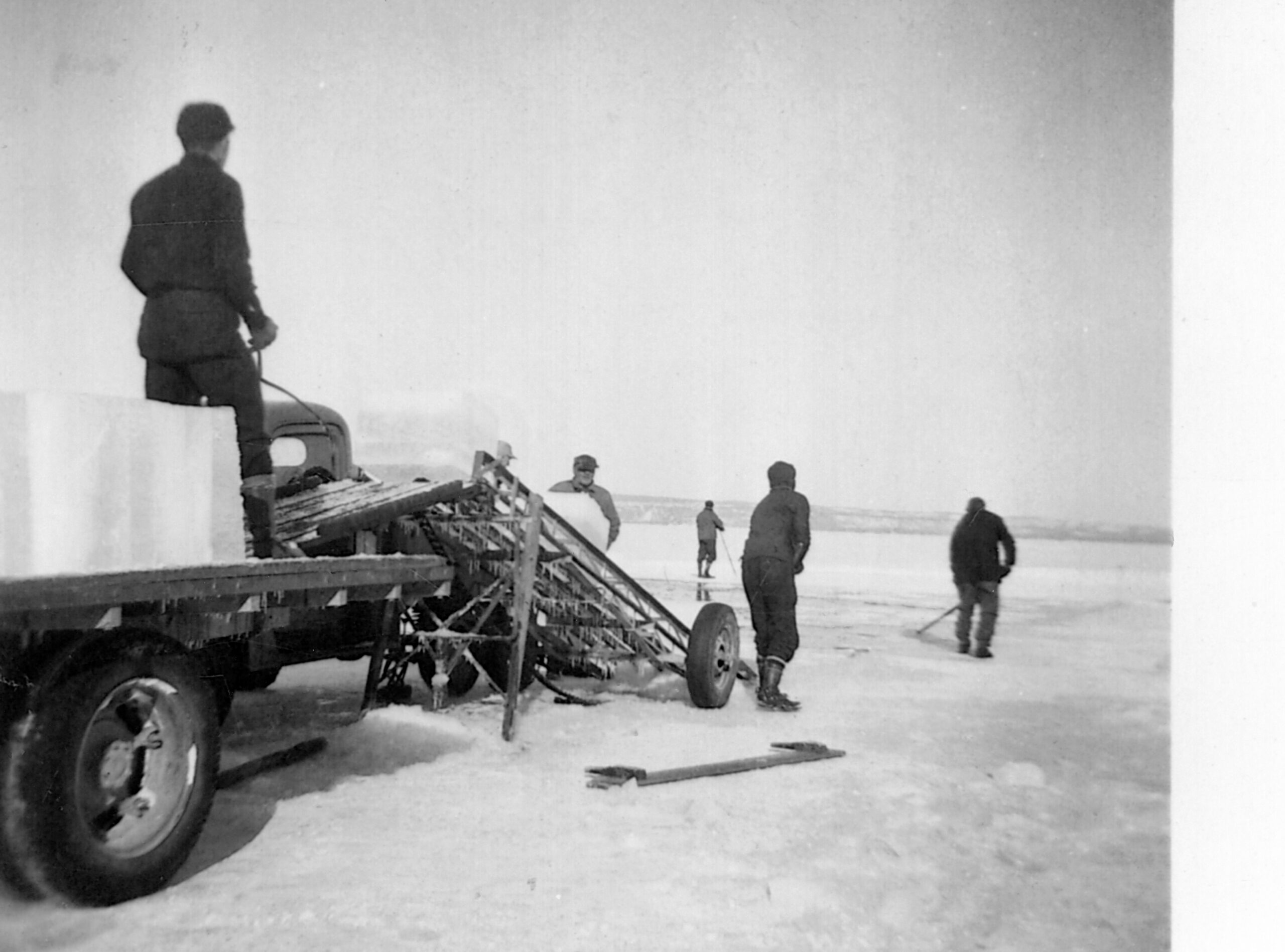
Sometime in the early 1990s, the ice was so unusually thick and smooth on Gitchigumi that Anishinaabe fisherman Phillip Solomon drove his car, a 1984 Monte Carlo, across the lake from Fort William First Nation to Pie Island with a friend. “There was seven feet of ice,” says Phillip, who everyone calls “Benny.” “There was no snow. We cut the hole, standing in the hole. I was standing in six feet of ice.” By the time he and his friend cut all the way through the ice, there was only a foot of water to fish in, and the two had to set their net somewhere else.
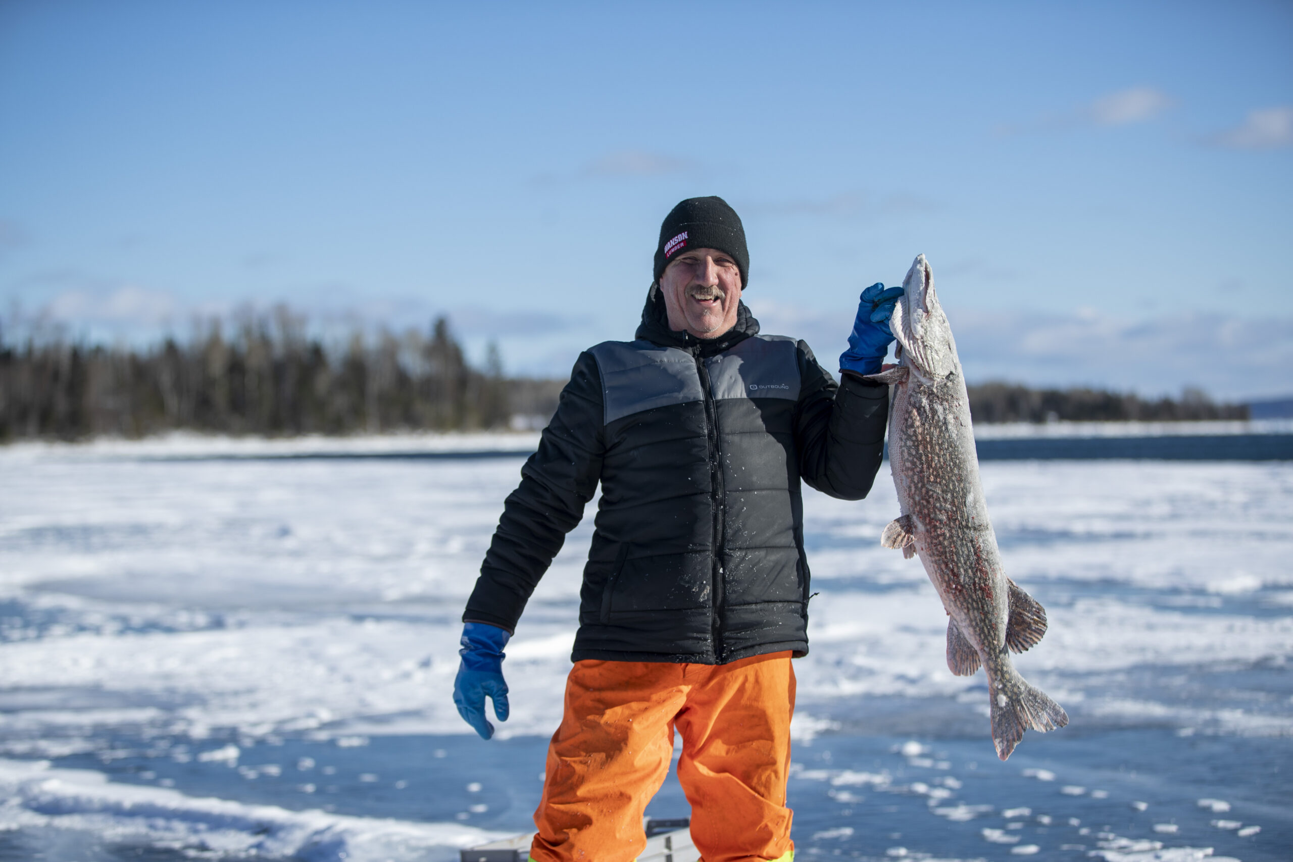
A quiet man who is generous with the fish he pulls out of the lake, Benny was born and raised on Fort William First Nation on the northern shores of Gitchigumi, which means Great Lake in Anishinaabemowin — in English, it’s known as Lake Superior. When he was growing up, commercial fishing was a significant economic resource: northern pike sold for about 35 cents a pound and on a good day, a fisherman could make $2,000 on that fish alone. Of course, not everything caught was sold to local fish markets or restaurants. It was also shared throughout Fort William First Nation and with others in need. Gitchigumi fish have long been a major source of food sovereignty for Benny’s community.
As a young adult, Benny veered away from traditional ways of living and being for a while, sometimes getting into trouble. But there were always a few community members looking out for him and when they invited him to take up fishing again, it became his way of life. For the past 40 years, he’s been fishing all year round.
Over that time, Benny has noticed a lot of changes to the lake. He’s had to set his fishing net out farther and farther each year: nearby rivers and streams are drying up or becoming noticeably shallow, and docks are being extended as shorelines grow.
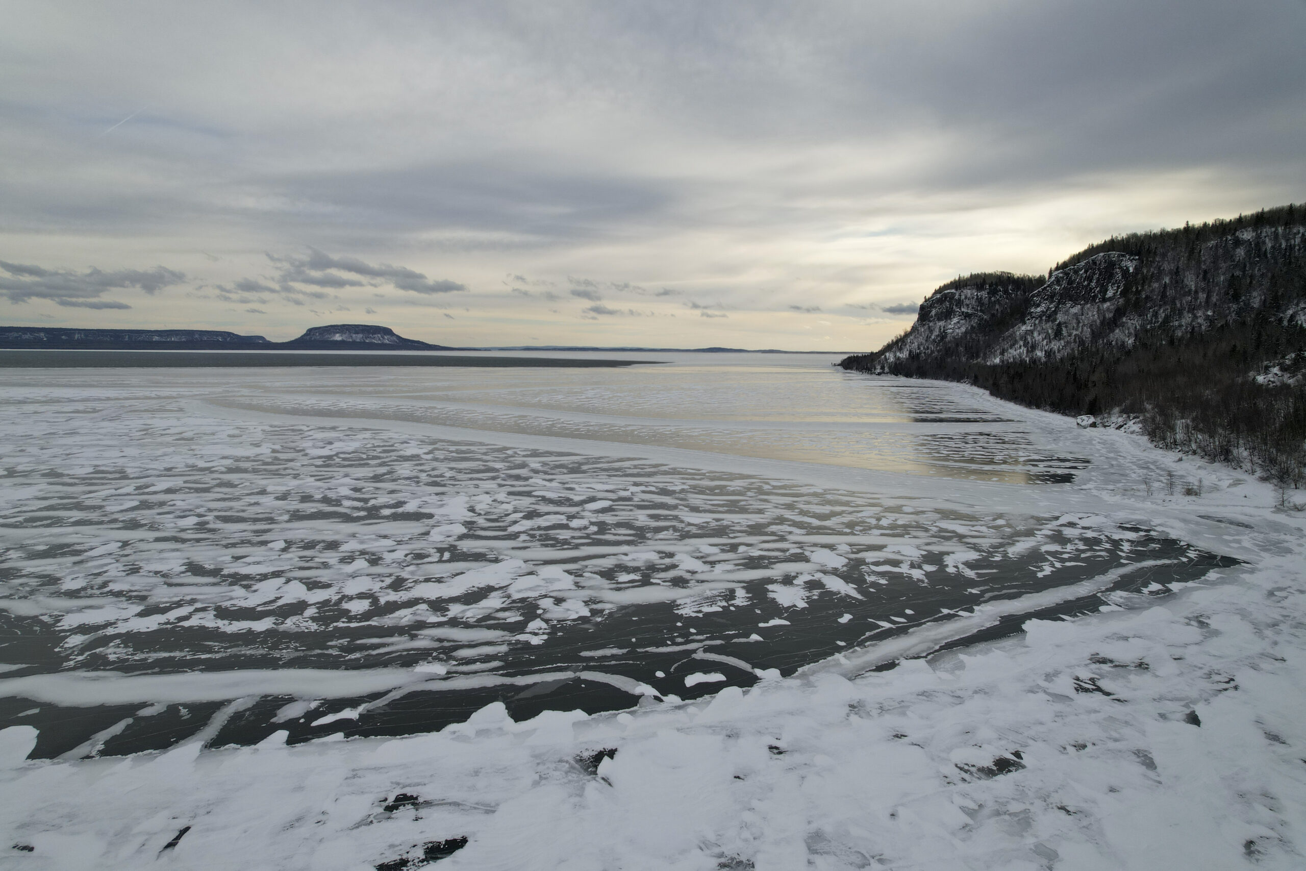
And in the winter, Benny can’t predict when the ice will be thick enough to hold him up the way it did the year he drove his car across the lake. This year, the lake didn’t freeze until mid-January, at least a month later than it did when Benny was younger.
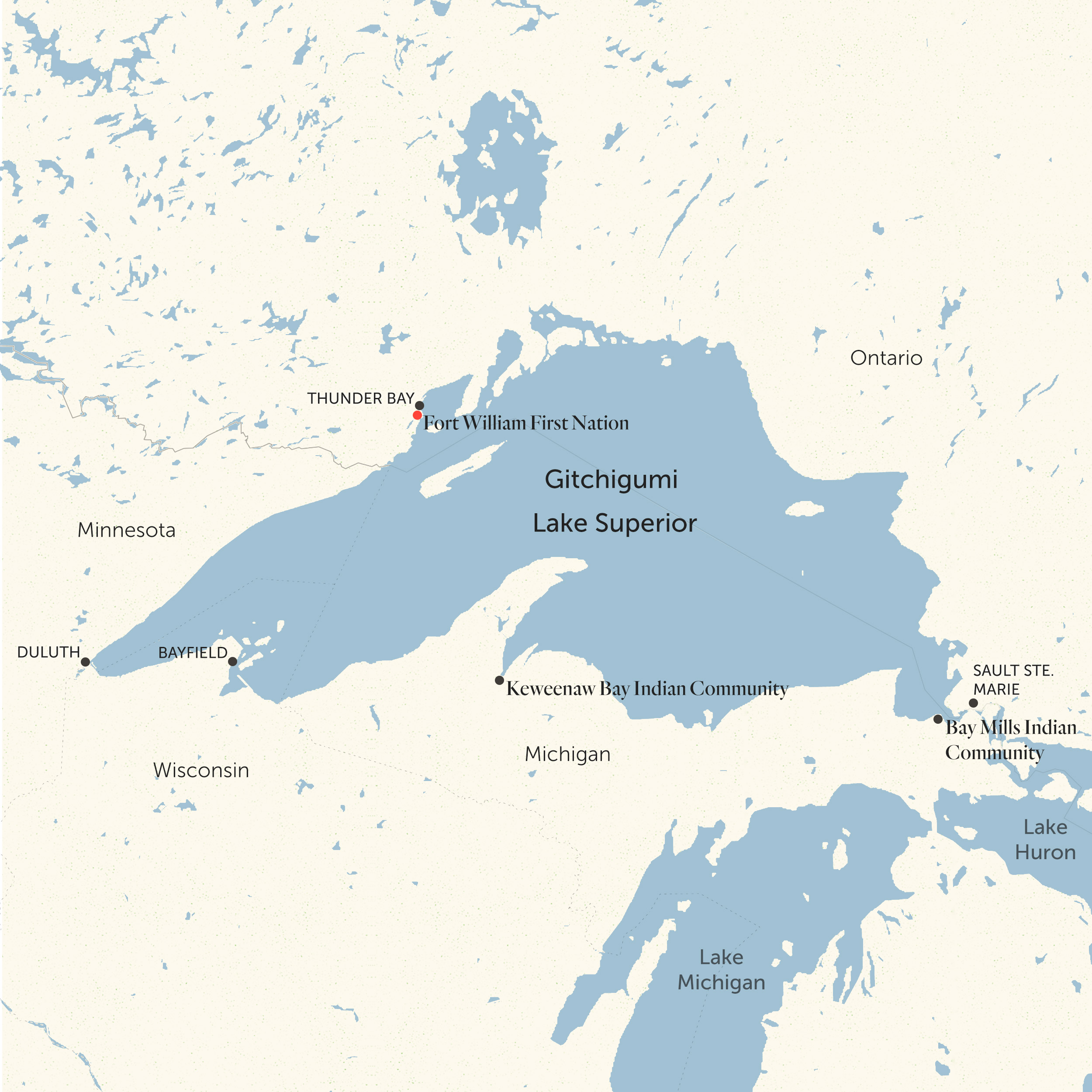
Gitchigumi is vast. The largest of the Great Lakes, it contains a staggering 10 per cent of all the surface freshwater in the world. The region has been home to many Indigenous communities since before Canada or the United States were imagined and today, it touches Ontario, Minnesota, Wisconsin and Michigan. About 600,000 people live around the lake on both sides of the border, using its water at home and in countless industries, from mills to microbreweries.
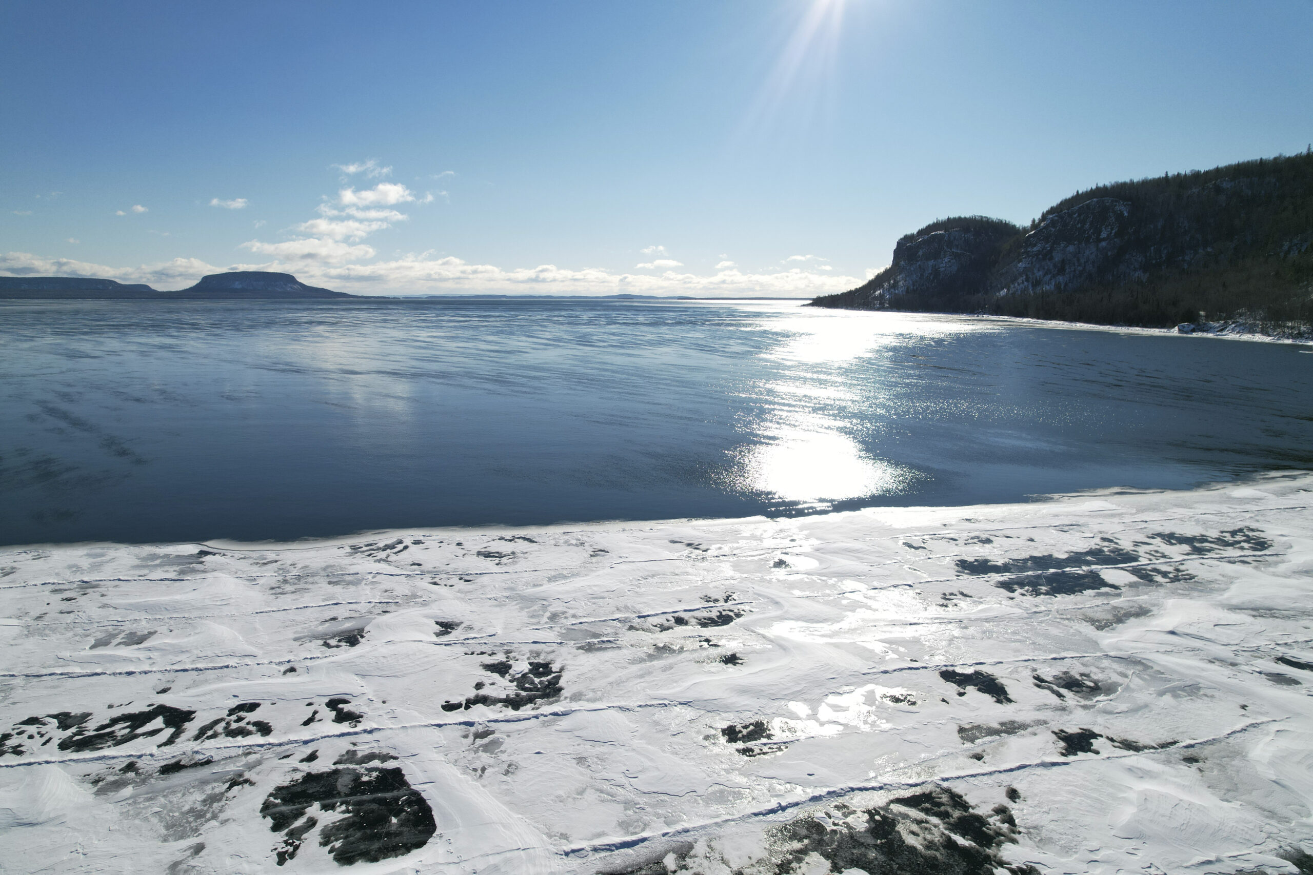
In Anishinaabek world views, the lake is a living being, an entity — she is life, not merely a resource, and in need of all people to take up the responsibility to care for her. Our Ancestors lived in harmony with Gitchigumi for thousands of years and caused no harm. But she’s not as healthy as she used to be. Scientific data lines up with Benny’s observations: Lake Superior is freezing over for less time than it used to. It’s warming the fastest of all of the Great Lakes, and the consequences are already troubling. With a warming lake posing increasing risks to the wildlife and people that depend on it, it is time for Indigenous people to take the lead in caring for it, before it’s too late.
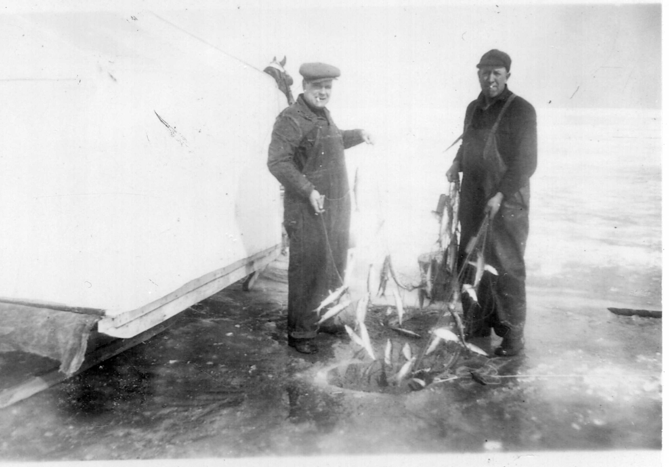
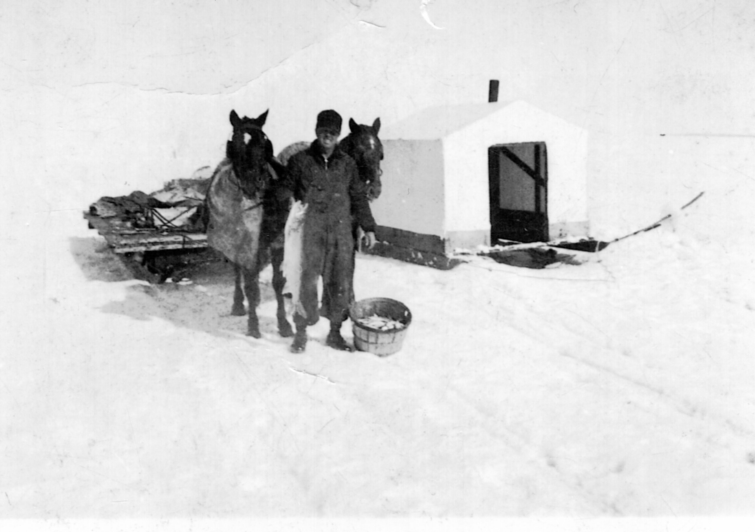
Benny remembers fishermen pulling big catches — herring, northern pike and pickerel — out of the Kaministiquia River at the mouth of the harbour. Nearly all were First Nations and lived on the reserve. One was Tim Bannon, who learned the fishing trade from his own father and eventually married into a commercial fishing family. He was one of the people who drew Benny back to fishing.
“I learnt everything I know from him. He led me on the right path, got me turned around,” Benny said of his teacher and friend. Bannon tells a story of teaching a young, impatient Benny to fish: after two days of setting and checking empty nets, Benny gave up and headed to the bush to cut wood. The next day, Bannon pulled out enough fish to fill the back of his truck.
By the mid ‘80s, Bannon said, it was becoming increasingly hard for people like him to make a living fishing. One of the biggest buyers of herring, Presteve Fresh Fish, began paying only for eggs to sell as caviar, instead of per pound of whole fish. And Indigenous fishermen were losing their livelihood to development and pollution over which they had no control.
First Nations that lived along the shoreline here hadn’t been consulted about the building of two pulp and paper mills in the early 20th century. For decades, the mills regularly released waste and sewage, which had devastating impacts on Lake Superior. By the 1990s, the government of Thunder Bay — a city of about 110,000 people on the north side of the Kaministiquia River — and various federal departments were discussing how to clean up the lake. The Anishinaabe people that lived along the waterfront were again given no input when berms made of filter and fabric were built at Mission Bay, between Fort William First Nation and Thunder Bay, and then used to store dredged, contaminated soil.
“I was really upset as a young fisherman. I used to fish out of the bay at the Kam,” Bannon said. “And then they started building the berms. They filled all that area of water in, which are now berms and land and a dumpsite.”
Eventually, the water quality at a nearby beach called Chippewa Park was deemed no longer safe for swimming. And hearing rumours of contamination, many buyers stopped sourcing fish from Fort William’s fishermen. Various government departments are still trying to figure out what to do with approximately 400,000 cubic metres of mercury-contaminated pulp sitting in the north harbour: dredging and towing it over to the confined underwater disposal facility at Mission Bay is regularly mentioned as a solution, despite Fort William First Nation’s insistence that not happen.
Pollution is one reason fishing isn’t the same as it used to be. Another is invasive species: zebra and quahog mussels filter out many of the nutrients that various types of whitefish need. Benny has even pulled out a rock bass, a fish typically found in smaller, warmer lakes that’s considered a voracious, invasive predator that will eat anything and everything without stopping. Much of the forage that gets eaten by invasive bass is what cool water fish like pickerel or lake trout rely on for sustenance. Layers of pressure threaten native species, including warming temperatures: low water levels can disrupt spawning grounds for whitefish and lake trout.
Sapna Sharma has been studying centuries’ worth of data on ice coverage on Northern Hemisphere lakes, as well as 25 years of data on water temperature of lakes worldwide. “What we’ve quantified is that we’re losing ice coverage at a rapid rate,” said Sharma, an associate professor in the biology department at York University.
Superior isn’t just the fastest warming Great Lake, she said: it’s losing ice cover quicker than any other lake in the Northern Hemisphere. Parts of it are starting to go full winters without ice. Sharma says that from 1867 to 1997, the bay in Bayfield, Wisconsin froze every single year. Since then, there have been four years where the bay, about a five hour drive south of Fort William First Nation, hasn’t frozen at all.
Since 1867, warming temperatures have robbed Gitchigumi of two months of ice coverage, meaning that there are about 60 fewer days below zero degrees every year. “Winter is not that long and losing two months of winter is going to have dramatic consequences,” Sharma said.
It already has. Less ice coverage allows for faster evaporation in the winter months, lowering water levels. It also means a longer open water season and earlier spring stratification, when the lake separates into two sections: a top warmer layer and a bottom cooler layer. More algae grows after winters when there is little or no ice, which negatively affects water quality. “When you have too much primary production and algal growth, you can end up with algal blooms, some of which can be toxic,” Sharma said.
Decomposing algae and warmer water also reduce oxygen concentration, which can cause fish to die or become stressed out from difficulty breathing. “We’re seeing even further cases of degraded water quality,” Sharma said. Last year she co-published a research paper on ice cover on Northern Hemisphere lakes that used historical data to predict future ice coverage: it stated that without significant greenhouse gas reductions, Lake Superior and Lake Michigan could both permanently lose their ice covers by 2060.
Indigenous Peoples have worried about changes in the Great Lakes waters for a long time. In 2003, the late Anishinaabe Elder, grandmother and water protector Josephine Mandamin-ba — in Anishinaabe culture, ba is added to the end of a name to signify someone has passed on — walked around Lake Superior after hearing a prophecy about how sick our water was and what it would take to save her. The walk was Anishinaabe ceremony: for a month in the spring, she walked around the nearly 3,000-kilometre perimeter of Gitchigumi from sunrise to sunset. Mandamin-ba carried a copper pail, as copper holds antimicrobial properties that can help water get and stay clean. The pail strengthened her prayers for the water as she honoured that relationship with water the way she should be, clean.
“When we were young we didn’t have to carry water bottles,” Mandamin-ba told CBC in 2017. “We just drank from wherever we could; lakes, rivers. Now people have to carry water. People walk with water containers. We never had to do that before.” By the time of her death in February 2019, Mandamin-ba had walked over 17,000 kilometres and covered the perimeter of all five Great Lakes.
Following in her footsteps is Tasha Beeds, a nêhiyaw with Scottish-Metis and Bajan ancestry who has walked over 7,000 kilometres, including alongside each of the Great Lakes. She is a mom, a kokum and a member of Midewiwin from Minweyweywigaan Lodge in Manitoba.
“By doing something like a water walk, it’s like you activate that ancestral remembrance again, that ancestral knowledge and you get to know the water on her terms,” said Beeds, adding another teacher and mentor is Elder Shirley Williams, who leads water walks in southern Ontario. “Often we go, we swim, we lay, you know, we take our boats, we fish, we take, we take and take and take, and we forget there’s a reciprocity there. And so the water walk is about entering into that reciprocal relationship again, the way that our ancestors did.”
As Beeds walks various shorelines, it’s evident to her that society has forgotten its reciprocal relationship with water. She sees a lot of garbage, like fishing lines, water bottles, pop cans, tires, chairs and plastic bags. During a walk along the Saskatchewan River last summer, Tasha noticed that it was eerily quiet. She didn’t hear any birds or small animals, just silence. Bogs were dried up, and there was no greenery or berries: the area seemed like a timber box ready to ignite.
Her group of walkers set up camp. That meant picking up garbage left by previous campers, who had also buried food on the site, enticing a bear to keep coming around. The group set off a few bear-bangers to scare it away, but soon Beeds put her fears aside and thought about why the bear was being a nuisance.
“They were being habituated to the human race because they had nothing left,” she said. “People want to come and visit, to take in the beauty of the Great Lakes or the mountains or the scenery but they’re often leaving their imprint, they’re forgetting to be good guests. We can either continue on our path and we will continue to destroy all we rely upon for life, destroying ourselves in the process, or we can become united in the protection of the Great Lakes.” She plans to walk the Saskatchewan River Forks to Lake Winnipeg this spring.
On Gitchigumi, one Indigenous community has reclaimed a traditional role by officially becoming stewards of its part of the lake again. Keweenaw Bay Indian Community achieved “Treatment as Sovereign” status from the U.S. Environmental Protection Agency. This means responsibility for enforcing the federal Clean Water Act (as well as the Clean Air Act) is in the process of being transferred from the state of Michigan. The Ojibwa community’s water resources specialist, Justin Woodruff, said in an email that Keweenaw Bay will begin by establishing surface water quality standards, while its natural resources department will continue to run programs around native plant restoration, fisheries and fish stocking and wildlife and wetland stewardship.
In a 2019 story about Keweenaw Bay’s Treatment as Sovereign application, Environmental Health News wrote that 60 other Indigenous communities in the U.S. hold the status and have used it to “tackle environmental issues specific to their area, including reducing phosphorus in Florida water; preserving clean water in a Montana lake; forcing upstream users in New Mexico to stop sending waste down the Rio Grande; and halting a controversial mine project in Wisconsin.” Woodruff said the community also has concerns about mining, and plans to address the effects of legacy mine tailings in Lake Superior, which send heavy metals up onto beaches and into rock beds where lake trout and whitefish spawn.
Keweenaw Bay’s traditional diet includes waterfowl, fish, wild rice and berries and the water quality standards being drafted are more strict than the existing federal standards. “Water quality is an essential part of the community’s way of life and is protected with the seventh generation principle in mind,” Woodruff wrote. “What we do now should be beneficial seven generations into the future.”
Deb McGregor is Anishinaabe from Whitefish River First Nation on Lake Huron, and the Canada Research Chair in Indigenous Environmental Justice. “The unique and distinct perspective that Indigenous environmental justice brings is recognizing the rights and responsibilities of the waters themselves,” she said.
McGregor laid out the many purposes of water in Anishinaabe culture: for nourishment, of course, but as part of governance, integral to understanding how to live and coexist with the natural world, with other nations living along the lakes and with the Great Lakes themselves for thousands and thousands of years. “I don’t read it from any text book, I don’t learn it from reading stuff,” she said. “I learn it from being in the community, being with people, listening to their stories, listening to what they say. That’s really, actually where, to me, the most valuable knowledge is.”
McGregor grew up understanding how much she depended on Lake Huron. Her family lived not even 50 metres from the lake, without running water. Engagement was constant, as she hauled water many times a day for drinking, cooking, cleaning, everything. While many Indigenous communities in Canada still live without access to clean water, most Canadians haven’t had to haul water for drinking. Not everyone even knows where their water comes from.
“I think there’s a huge disconnect,” said McGregor, who still lives in her community, about Canada’s highly urbanized population. “People just don’t think about where their water comes from because it’s coming out of a tap. You look at where you live on a map, it looks like this dot beside a big lake, but you never see it. You have to purposely commute for an hour and a half to get downtown, to get by the water’s edge.”
McGregor sees an opportunity for Indigenous People to become leaders in protecting water, especially those living by or near it. It can seem difficult, since colonial governments in nations like Canada and the U.S. make the big decisions, with Indigenous Peoples only sometimes given input. But grassroots initiatives, like the Indigenous Environmental Network, organize regularly to protect water: the 2016 camp at Standing Rock Indian Reservation grew in large part out of concern over the threat that the Dakota Access Pipeline poses to Lake Oahe and the Missouri and Mississippi Rivers. The Indigenous Environmental Network is currently organizing against the rebuilding of Line 3, a pipeline that takes oil from Edmonton to the edge of Lake Superior in Wisconsin.
Indigenous Peoples resist further damage to the environment by raising awareness, by walking around the Great Lakes, by returning to our original laws and traditions. “We have to trust our own knowledge, our own systems, our own laws. So much of formal education, residential school education, was to dismiss it,” McGregor said. She is thankful that strong relationships with traditional knowledge holders afforded her a reciprocal relationship with the water.
Benny sometimes takes his granddaughters with him when he goes out to set his nets. They’re in grade school, around the same age he was when he started fishing with his dad. He’s passed along the knowledge that he was taught, and has gathered. “I want them to see me fishing and see how it’s done. They help me out. They grab the nets,” Benny said, adding that being out on the lake is a chance for some quality time together, unplugged from the TV.
He can tell that the ice fishing season on his part of Gitchigumi is getting shorter and shorter. In recent years, rather than cutting a hole into the ice, he sometimes just goes out in his boat to set his nets, which feels like an odd thing to do in the middle of winter.
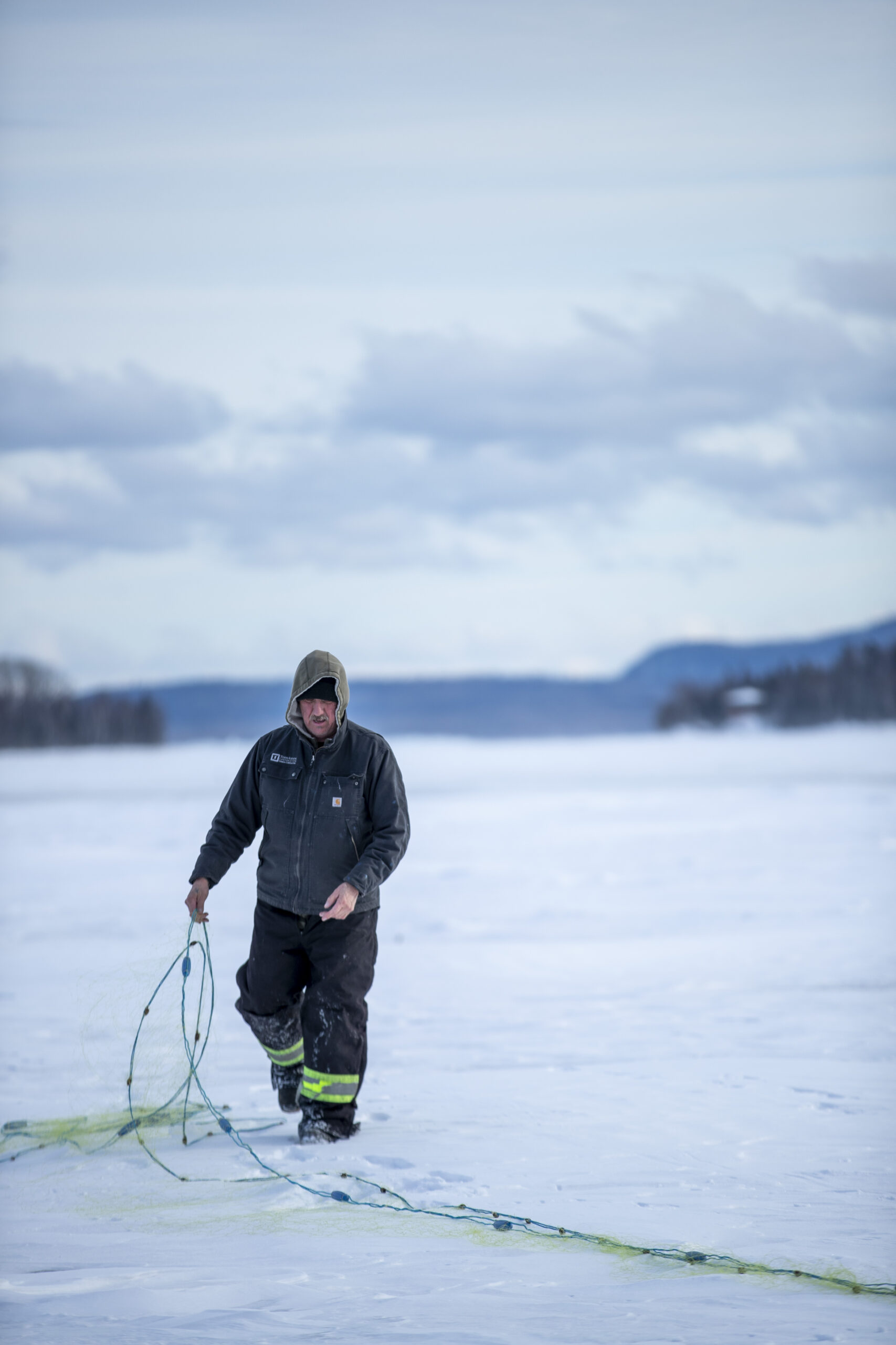
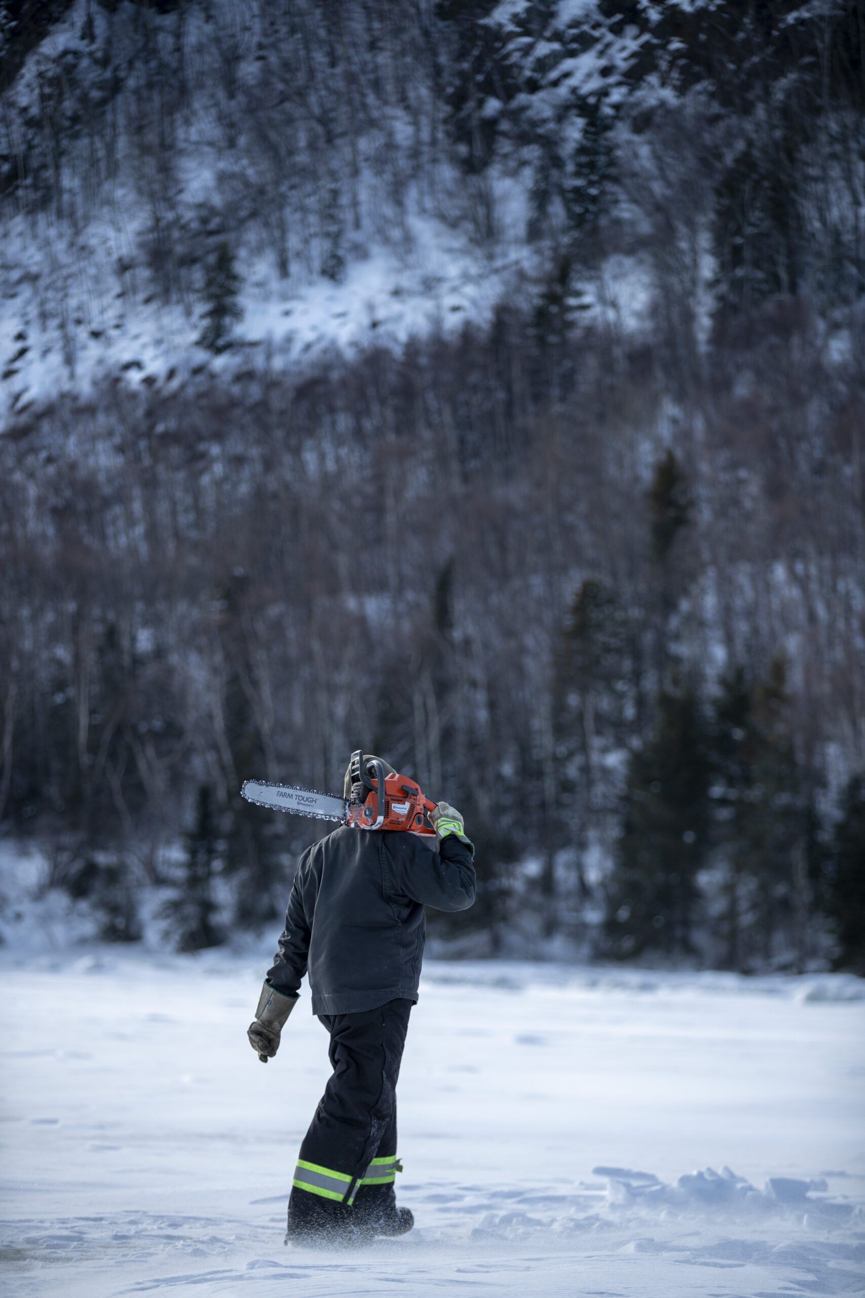
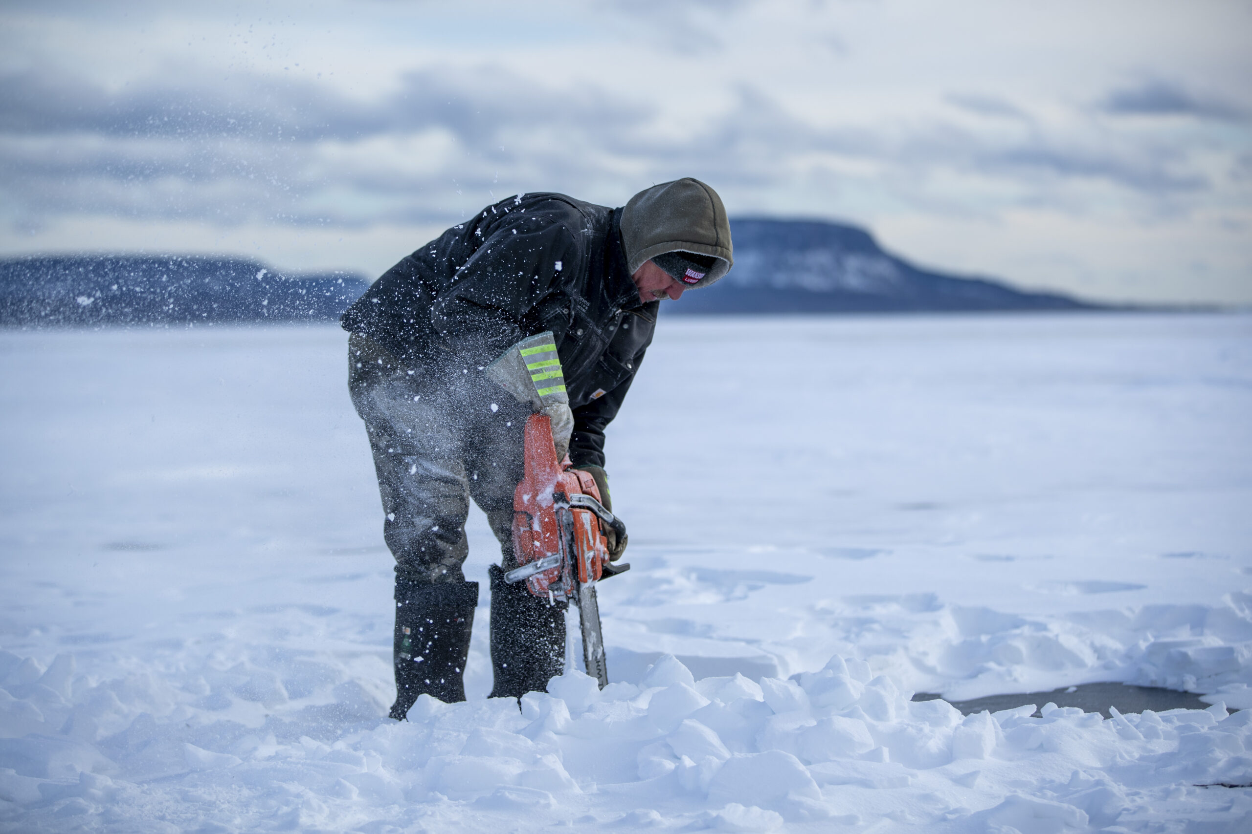
This year, as January drew to a close, Gitchigumi finally froze solid enough for Benny to head out ice fishing. As skaters and hikers also enjoyed the lake, there was a constant booming sound as the ice shifted and moved. On a cold Saturday, Benny used a chainsaw to cut a one-foot square hole in the ice, then picked out all the ice chunks. “I’m hoping to catch a rainbow tomorrow, rainbow trout,” he said. “Maybe a salmon.”
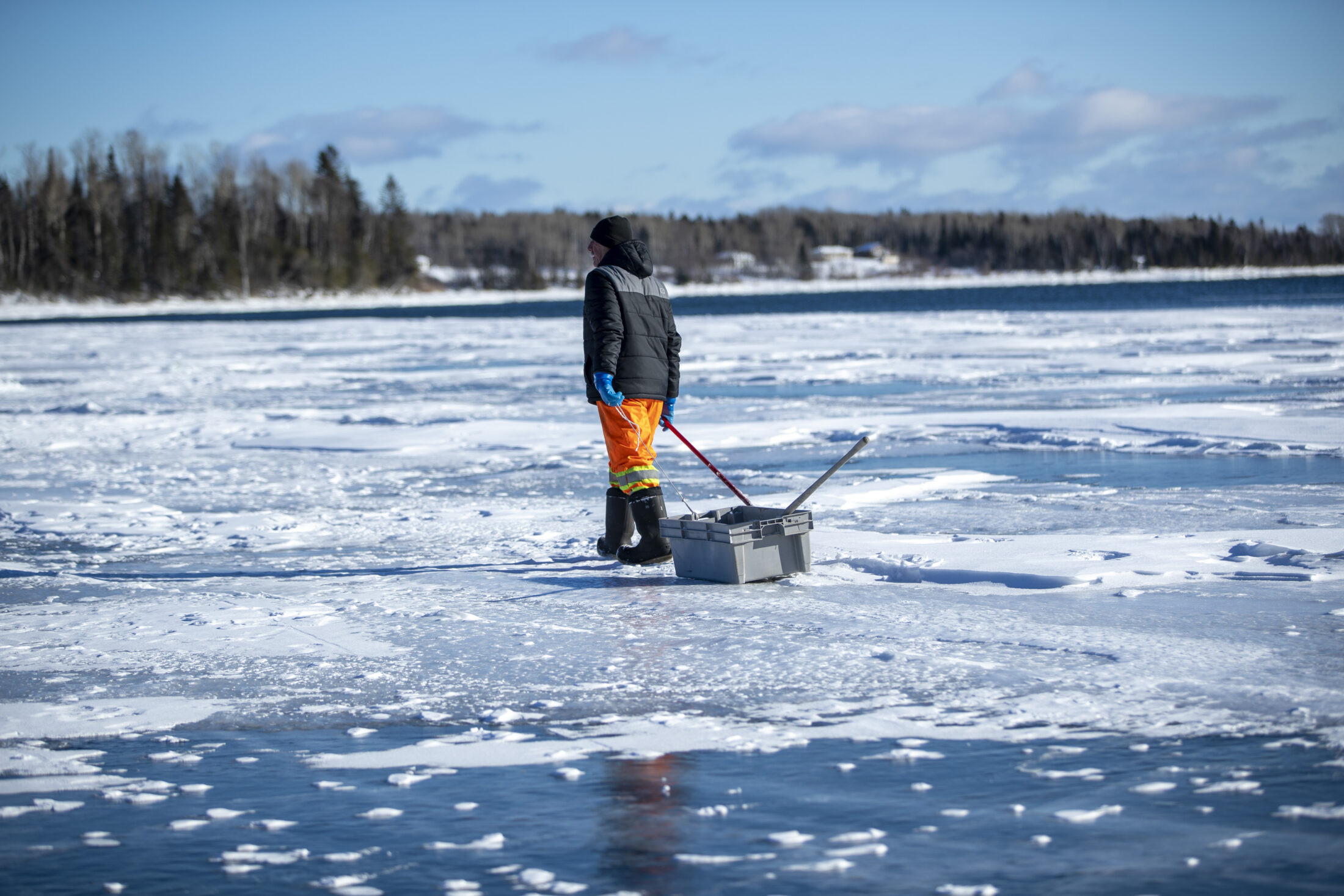
Next, he sent a jigger into the water and cut a second hole the length of the net, 300 feet away. A braille line tied to the jigger dragged the net under the water. “There’s maybe four inches of ice out there,” Benny said, comparing it to the seven feet of ice he drove over in the ‘90s.
And it didn’t hold. The next day, the ice in over half of the bay was broken up and there was open water. Benny dug out the hole he had made in order to drag the net out of the lake and assess his catch, pulling out a rainbow trout and immediately giving it away to The Narwhal’s photographer. Then he pulled his nets out and kept them out.
The following day, there was even more open water. Benny might end up fishing on his boat this winter, after all.
Updated Feb. 22, 2022 at 3:40 p.m. ET: This story was updated to correct the population of Thunder Bay, which is 110,000, not 11,000.