IMG_0381.jpg

In Photos: This Valley Will Be Flooded if a Third Dam is Built on the Peace River

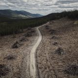
A third hydroelectric dam proposed for the Peace River would flood 83 kilometres of the Peace Valley in between Fort St. John and Hudson's Hope, B.C. Dubbed the "Site C" dam, if built, it would put more than 3,800 hectares of Agricultural Land Reserve farmland — an area nearly twice the size of the city of Victoria — under water.

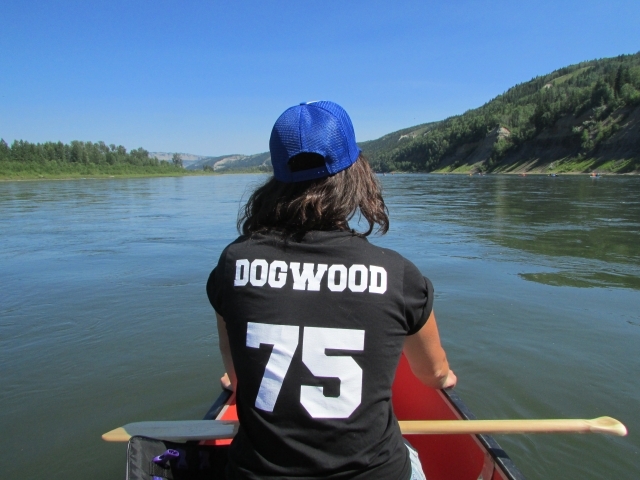
DeSmog Canada recently visited the Peace Valley for the ninth annual Paddle for the Peace, which attracted hundreds of paddlers from across North America. While we were there, we met with the farmers and ranchers who stand to be impacted if the dam is built.

Check out our photos below and learn more by reading our in-depth series on the plight of the Peace Valley and the Site C dam.

We’ve got big plans for 2024
Seeking out climate solutions, big and small. Investigating the influence of oil and gas lobbyists. Holding leaders accountable for protecting the natural world.

The Narwhal’s reporting team is busy unearthing important environmental stories you won’t read about anywhere else in Canada. And we’ll publish it all without corporate backers, ads or a paywall.

How? Because of the support of a tiny fraction of readers like you who make our independent, investigative journalism free for all to read.

Will you join more than 6,000 members helping us pull off critical reporting this year?
We’ve got big plans for 2024
Seeking out climate solutions, big and small. Investigating the influence of oil and gas lobbyists. Holding leaders accountable for protecting the natural world.

The Narwhal’s reporting team is busy unearthing important environmental stories you won’t read about anywhere else in Canada. And we’ll publish it all without corporate backers, ads or a paywall.

How? Because of the support of a tiny fraction of readers like you who make our independent, investigative journalism free for all to read.

Will you join more than 6,000 members helping us pull off critical reporting this year?

Mines, logging, sprawl — but no wind turbines. Here’s what Alberta is still doing in ‘pristine viewscapes’

Last week, the Alberta government released a draft map outlining new buffer zones prohibiting new wind energy developments, saying "wind projects are no longer permitted...

Continue reading

Recent Posts

Thousands of members make The Narwhal’s independent journalism possible. Will you help power our work in 2024?
Will you help power our journalism in 2024?
… which means our newsletter has become the most important way we connect with Narwhal readers like you. Will you join the nearly 90,000 subscribers getting a weekly dose of in-depth climate reporting?
A line chart in green font colour with the title "Our Facebook traffic has cratered." Chart shows about 750,000 users via Facebook in 2019, 1.2M users in 2020, 500,000 users in 2021, 250,000 users in 2022, 100,000 users in 2023.
Overlay Image