


A new study casts doubt on the long-term ability of the Athabasca River to supply the water Alberta’s oil sands industry relies on.
Water is allocated to oil sands operations based on river flow data collected since the 1950s, but that doesn’t necessarily represent an accurate assessment of the Athabasca River’s flow variability over the longer term, according to a report published this week in the Proceedings of the National Academy of Sciences.
Development of Alberta’s oil sands, the world’s third-largest crude oil reserve at an estimated 168 billion barrels, uses a lot of fresh water — more than 3 barrels of water for every barrel of oil produced. Currently, the oil sands industry is allocated 4.4% of the mean annual flow of the Athabasca River to meet that demand. In 2010, the oil and gas industry accounted for 74.5 percent of total surface water allocations in the Athabasca River Basin, the report says.
That allocation takes into account seasonal fluctuation, but not long-term climatic variability and change, the authors of the report write — even though the region has a history of droughts and future droughts are likely, suggesting the industry's water use might be unsustainable.

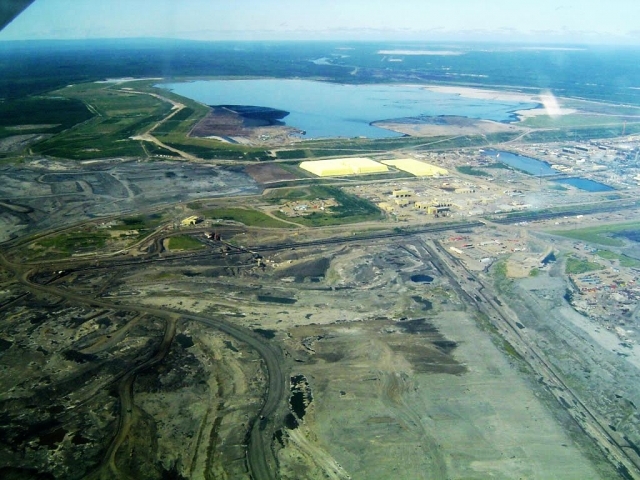
Syncrude's Mildred Lake oil sands operation in Alberta, Canada. Photo via Wikimedia Commons.
Researchers from the University of Regina and the University of Western Ontario, both in Canada, analyzed the measured river flow record for the Athabasca River Basin while accounting for the effects of climate oscillations that can confound attempts to spot long-term trends, like the Pacific Decadal Oscillation, the Pacific North American mode and El Niño.
Their analysis revealed declining flows throughout the river basin, which is consistent with the record of regional warming and the resulting loss of glacier ice and snowpack at high elevations in the Rocky Mountains, the origin of much of the Athabasca’s water.
The team also reconstructed the annual flow of the Athabasca River over the past 900 years by examining tree rings in the river basin, which they say indicated much greater variability in flow than is apparent from the measured record. They found that there were several periods of severe drought over the past nine centuries, some lasting for decades.
Many of the historical droughts were far worse than any that have occurred in the six decades that instruments have been in place to measure the Athabasca’s flow. The researchers found there was one drought in the Athabasca River Basin that lasted for 50 years.
These two sets of results taken together, the authors argue in the report, show that current and projected surface water allocations from the Athabasca River for the exploitation of Alberta’s oil sands are based on an “untenable assumption” of how representative the short instrumental record really is.
This post originally appeared on Mongabay.com.
Image Credit: Wikimedia Commons