
Ontario’s public service heads back to the office, meaning more traffic and emissions
For 15 years and counting, my commute from Mississauga to Toronto has been mired by...
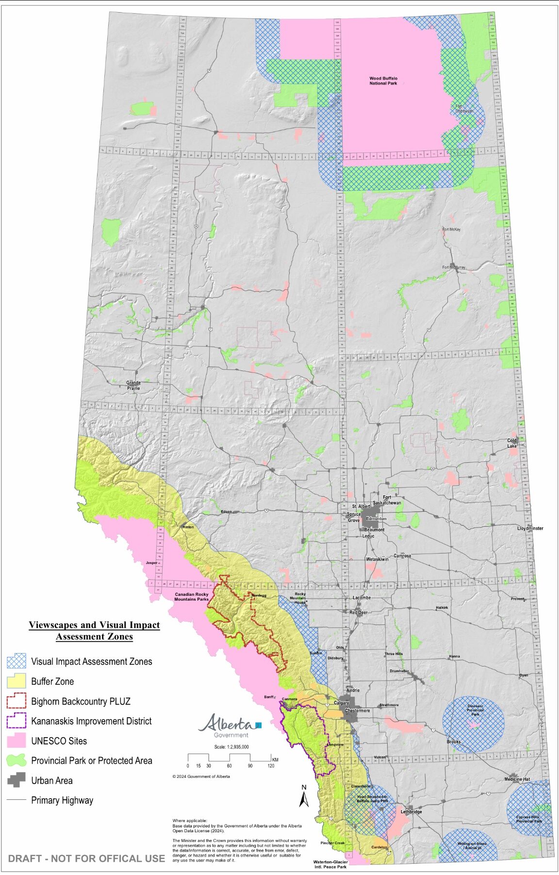
Last week, the Alberta government released a draft map outlining new buffer zones prohibiting new wind energy developments, saying “wind projects are no longer permitted in the buffer zones due to the impact of their vertical footprint.”
Speaking to the media in late February, Alberta’s Affordability and Utilities Minister Nathan Neudorf had announced the government’s plan to establish 35-kilometre buffer zones around protected areas and other “pristine viewscapes.” Neudorf added there is no universal definition of what constitutes a pristine viewscape, but generally refers to “areas that are unobstructed, natural landscapes.”
The buffer zones in the draft map encompass much of the eastern slopes of the Rocky Mountains, extending as far east as Calgary. It’s an area dotted with oil and gas facilities and coal mines. Much of the area has been farmed or logged.
In other areas not totally off-limits, the government said renewable energy projects will have to pass through increased regulatory scrutiny in the form of “visual impact assessments.”
As Evan Wilson of the Canadian Renewable Energy Association has pointed out, the Alberta government’s new rules — from pristine viewscapes and beyond — apply only to the renewables industry. “Why is this something that is just impacting wind and solar?” he asked, speaking to CBC.
Wind turbines have been getting larger, with towers double the average height compared to 20 years ago, and some new turbines stretching upwards of 200 metres tall. Other permitted activities are not as tall as a turbine, but that doesn’t mean they should be treated differently, according to the Alberta Utilities Commission.
The commission, the regulator of power development in the province which conducted the government-ordered inquiry into renewable energy development, said in its first report any prohibition to “achieve viewscape protection” should be “industry agnostic” and “apply to all forms of development within the restricted zone.”
A spokesperson for Neudorf confirmed only new wind energy projects would be barred from the buffer zones, but said all forms of generation, including natural gas plants, would be subject to visual impact assessments in other specified areas.
Geoff Scotton, a spokesperson for the Alberta Utilities Commission, said the organization has no information on when areas off-limits to wind development will be more clearly defined and that it is “up to the Government of Alberta.”
With wind energy likely off the table in large swaths of the province — and new restrictions on solar farms in others — here’s a look at some of the things Albertans can still do in those “unobstructed, natural landscapes.”
As the Alberta government seeks to create buffer zones around many of the Rocky Mountain national parks — extending as far east as Calgary — there has been no indication that construction would be stopped on new developments and urban sprawl.
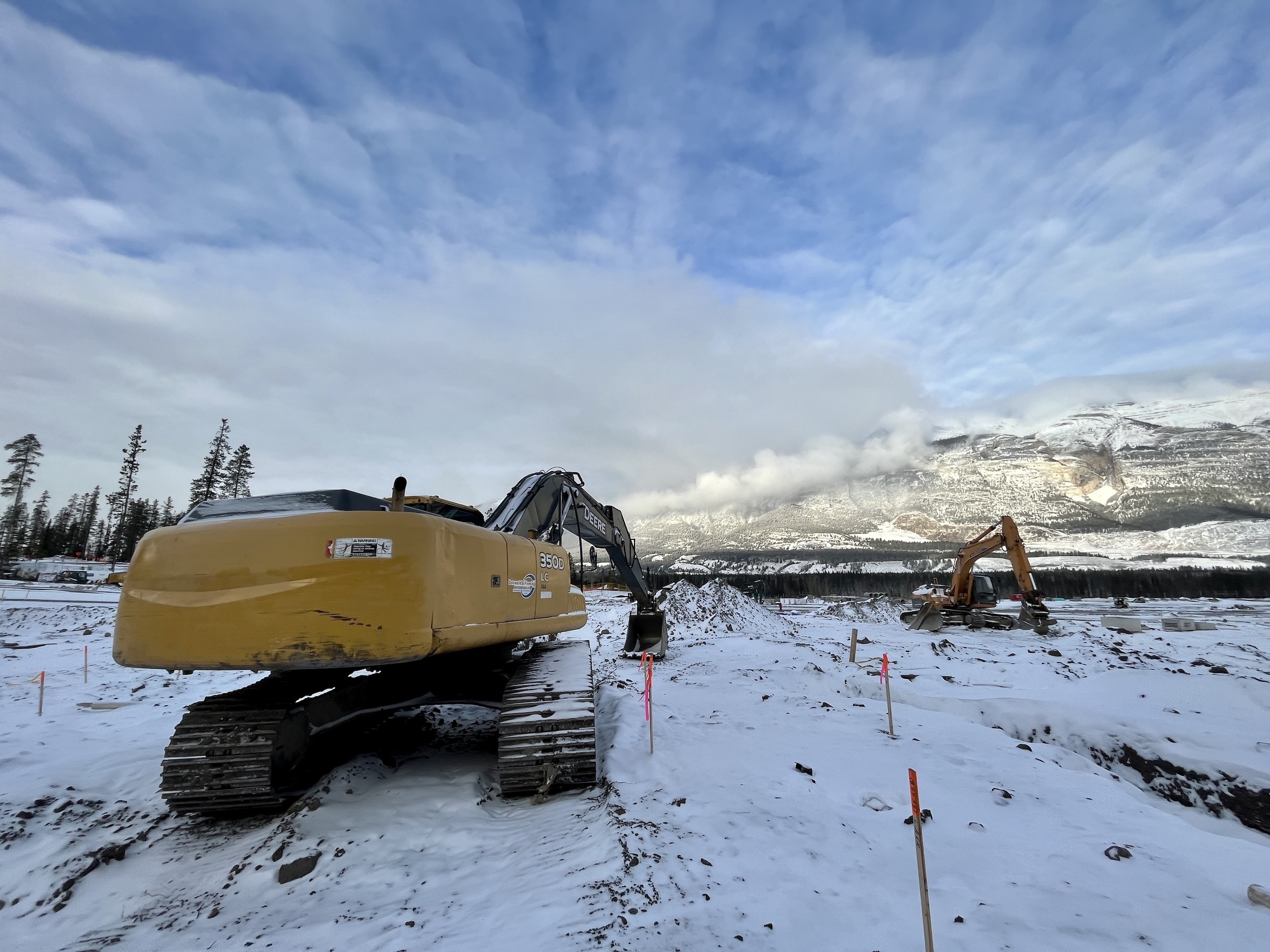
In Canmore — approximately five kilometres from the boundary of Banff National Park — plans have forged ahead for a massive new development that would take up almost all of its remaining developable land, nearly double the population and eat into critical wildlife habitat.
In Calgary, numerous new communities have been approved on the city’s outskirts extending west towards Bragg Creek. Cochrane too has seen rapid population growth — a 23 per cent increase in five years and much faster than officials had predicted — and now predicts “increased demand for land to support this growth.”
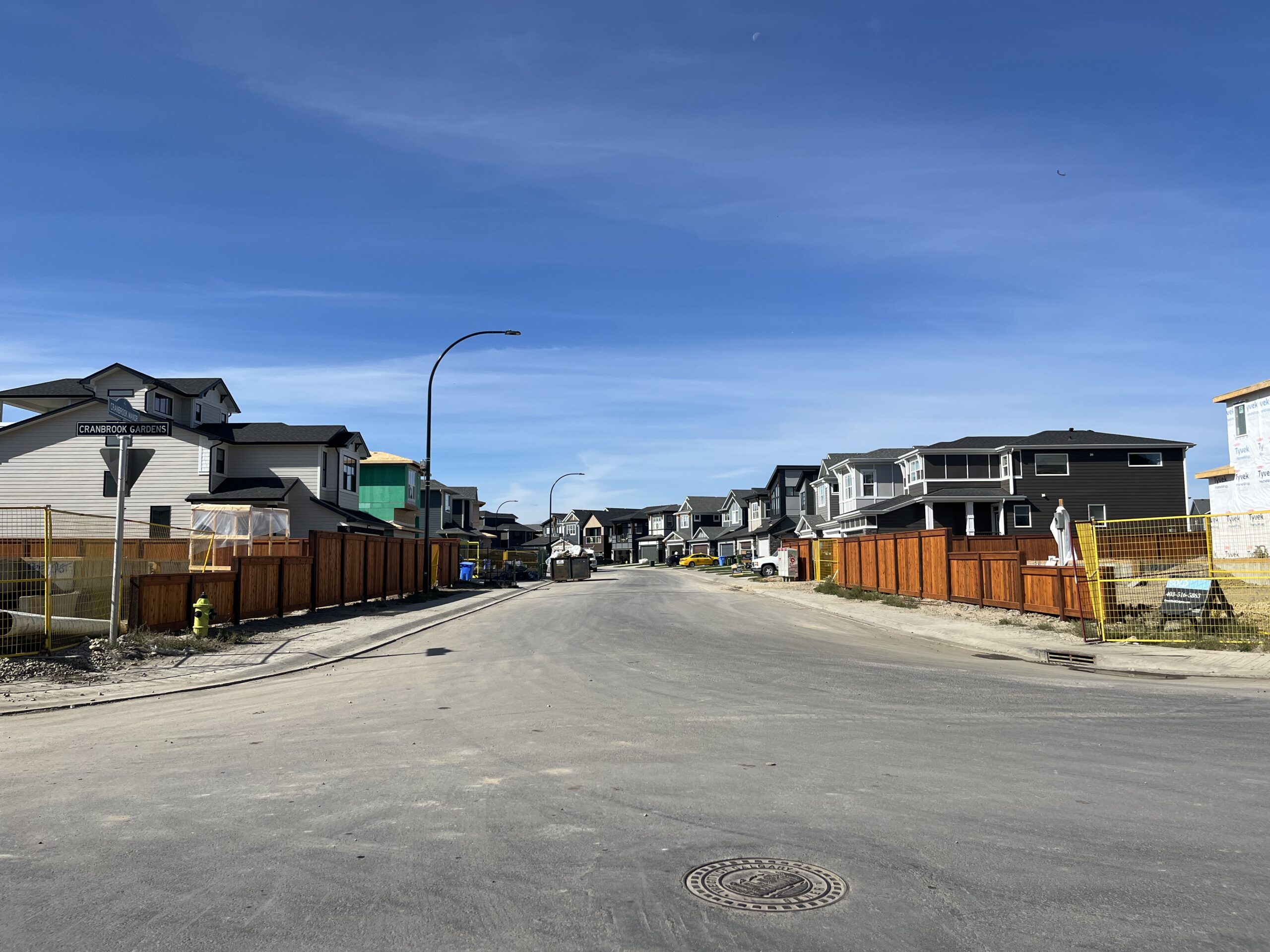
All of this means urban boundaries are likely to sprawl farther, into land that is part of the government’s buffer around pristine viewscapes and protected areas.
Kananaskis Country is something of an iconic outdoor destination for Calgarians and tourists alike — more than four million people visited in 2023. In Kananaskis, provincial parks are knitted together with public lands and recreation areas with varying levels of protection: some are off limits to most activities while others are open to industry. Just 60 per cent of the region is fully protected.
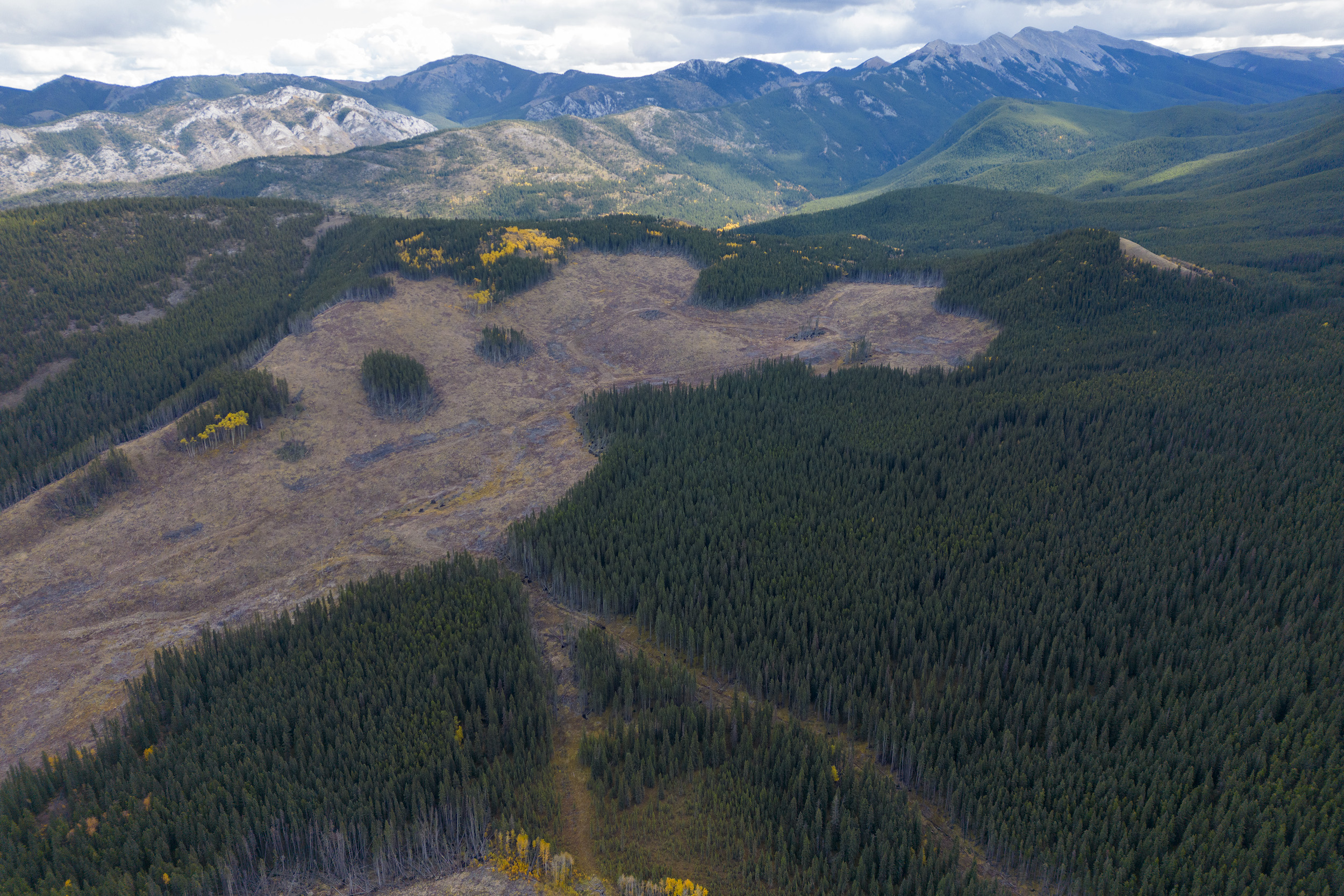
That means logging continues in the area — with cutblocks often earmarked smackdab in the middle of wilderness destinations. According to the Alberta government’s new map of buffer zones, no wind turbines will be allowed in Kananaskis Country, but the government has made no similar move to create a blanket ban on logging. Plans to log areas like West Bragg Creek, for example, are moving ahead. Canadian forestry company West Fraser Timber, which recently bought Alberta-based Spray Lake Sawmills, is allowed to log approximately 800 hectares in the area in 2026.
Farther north, West Fraser Timber also has rights to log a wide area along the border with Jasper National Park, and just days after the buffer zone map was released, the government celebrated investment in an existing pulp mill in Hinton, within the no-go zone for wind turbines.
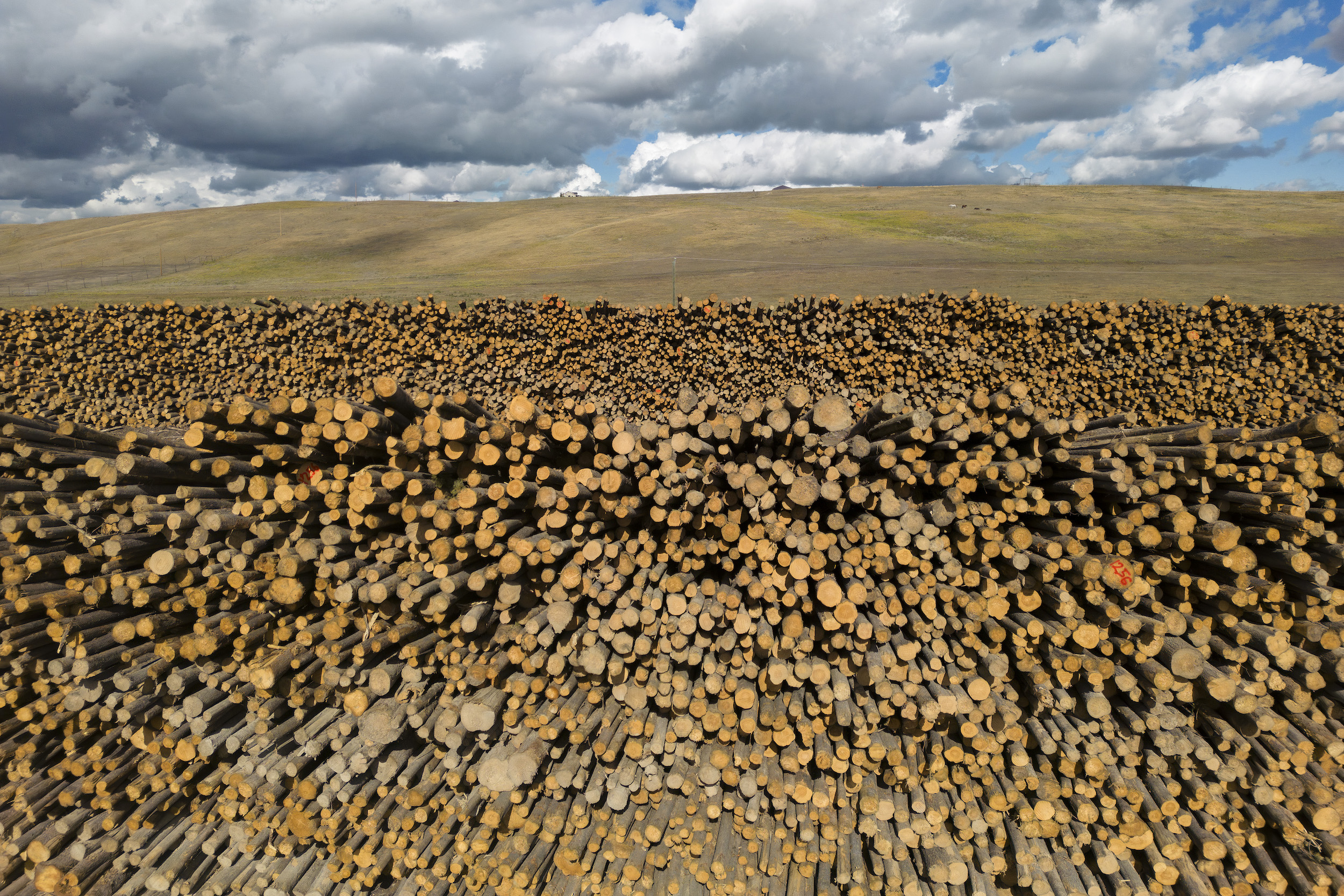
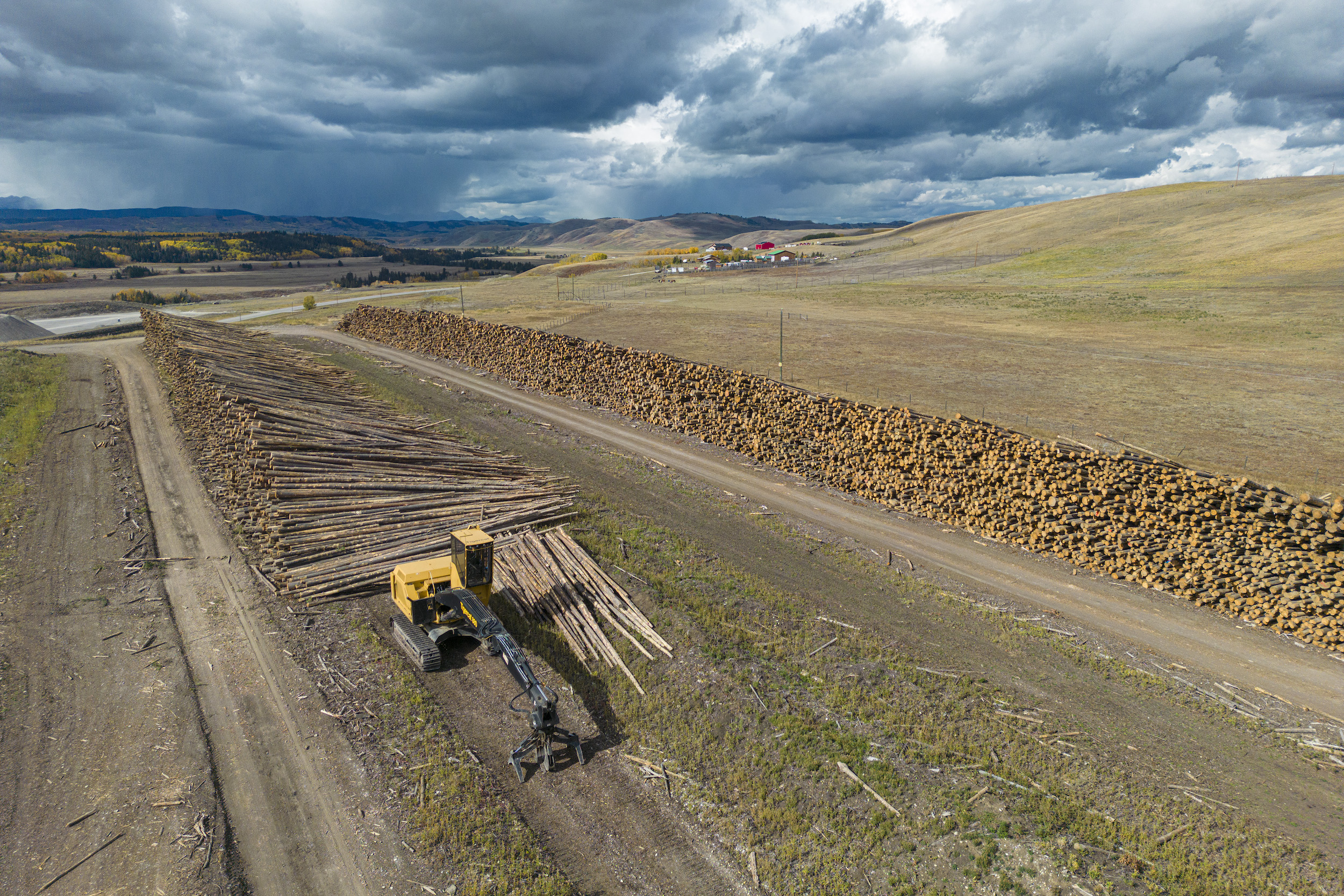
“Our investment-friendly policies, competitive corporate tax rate and highly educated workforce continue to draw in world-class companies that can feel confident about spending their money here,” a government statement said as the new investments in the pulp mill were announced.
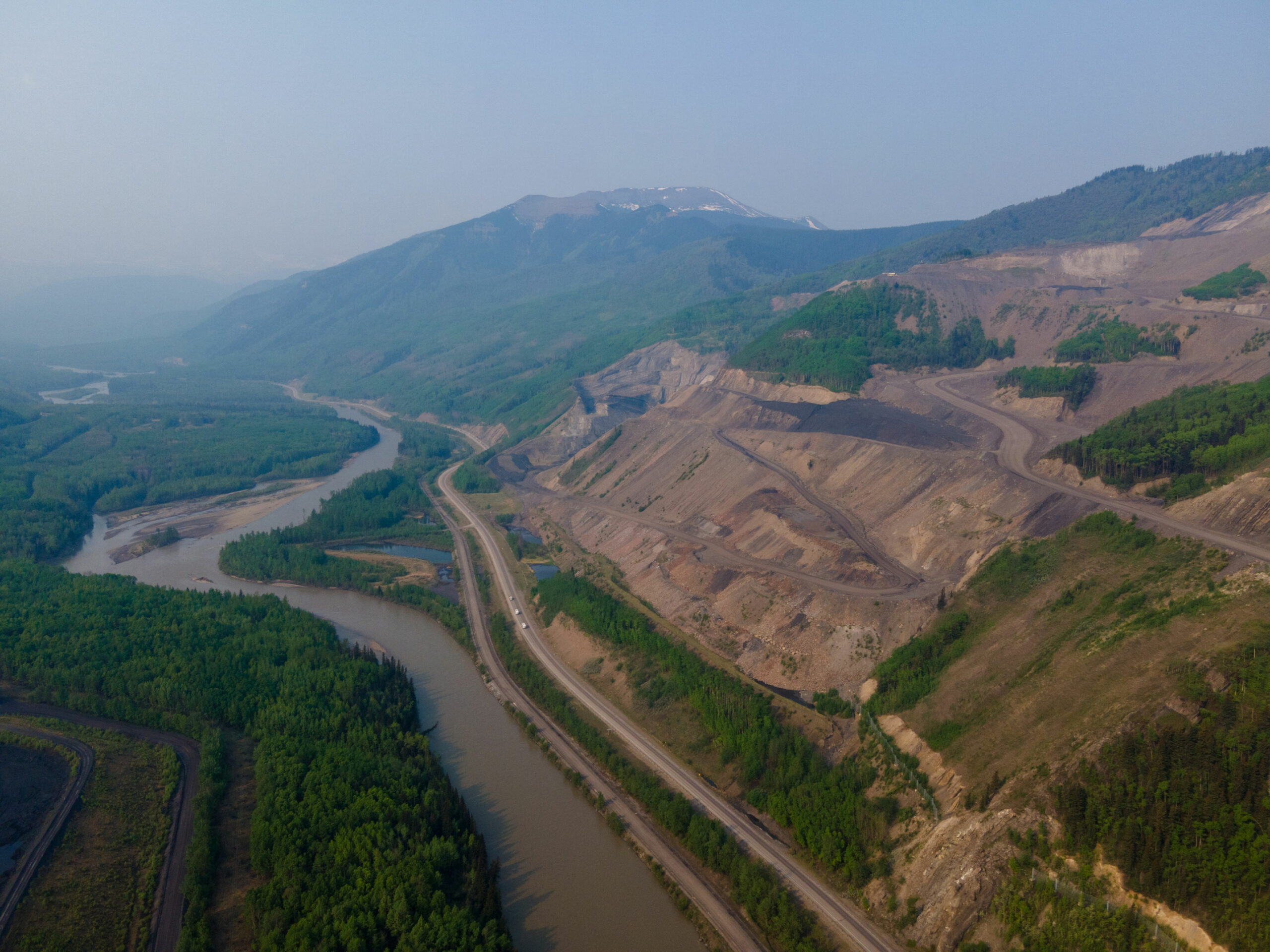
The eastern slopes of the Rocky Mountains were the focus of much outrage when the previous United Conservative Party government tried to open up large swaths of them to coal mining in 2020. That decision was ultimately reversed, but a number of projects — essentially grandfathered in — were allowed to carry on. Coal mines are currently operating in communities from Grande Cache to Hinton, which are areas that overlap with the Alberta government’s new draft map of buffer zones around protected areas, with a large focus on the eastern slopes of the Rocky Mountains.
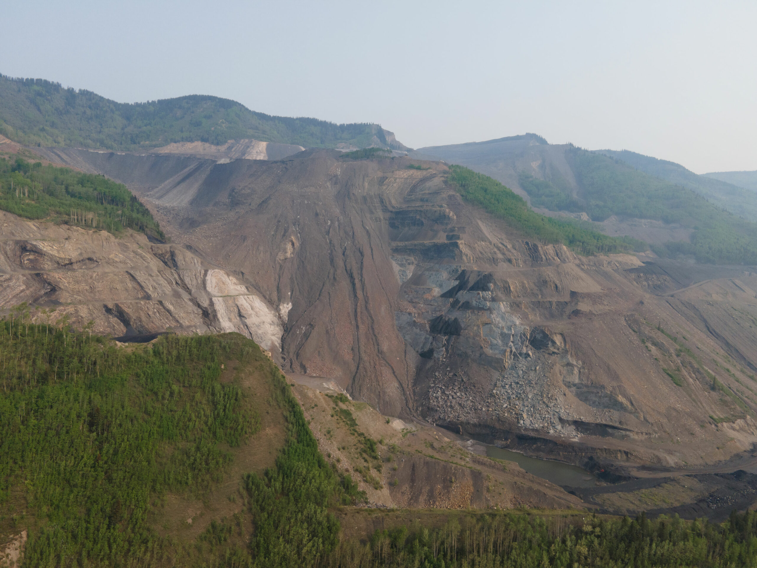
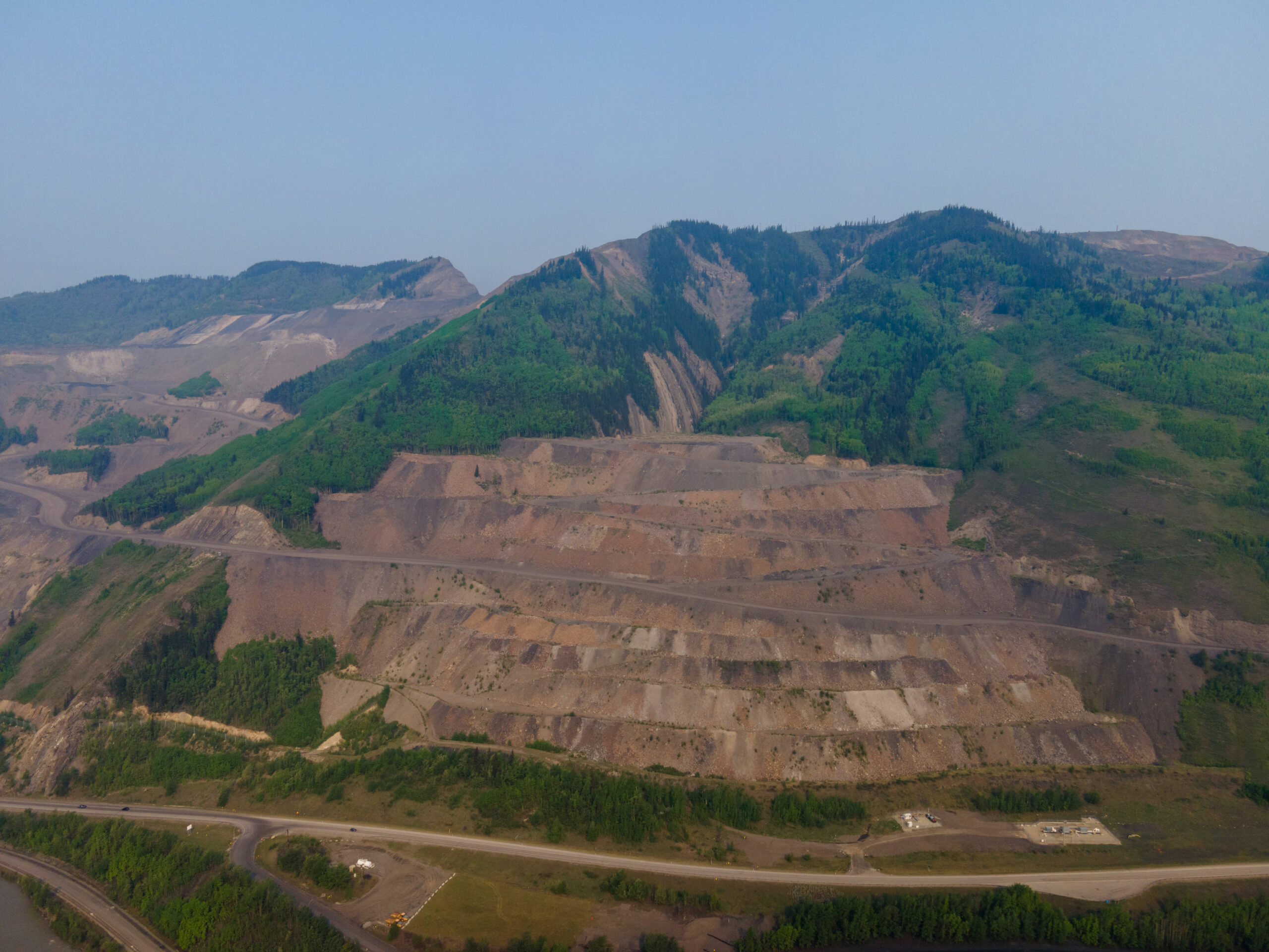
In March 2022, the Government of Alberta decided four “advanced” coal mine proposals would be allowed to proceed despite a moratorium on coal development in Alberta’s eastern slopes.
Those advanced proposals include Summit Coal Mine 14. That new project will be four kilometres northeast of Grande Cache on Grande Mountain, a forested peak popular with hikers, horseback riders and snowmobilers, that is within the new no-go zone for wind turbines. The mine would create a footprint of 53.5 hectares on the mountain and would involve 91 drill holes, creating an underground footprint of 512 hectares.
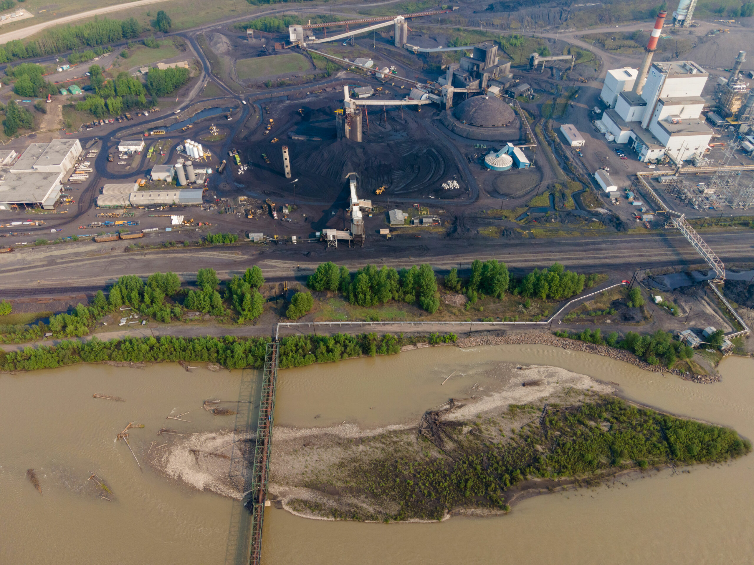
The Northback Grassy Mountain open-pit coal mine is currently being considered by the provincial regulator even after it was rejected twice in previous years, and new mining activities are underway at the Vista Mine near Hinton — both of which fall into the buffer zones on the government’s draft map.
The Alberta government’s ban on wind turbines in buffer zones around protected areas and pristine viewscapes includes large swaths of private land. Landowners will no longer be permitted to agree to lease their land to a renewable energy company to build wind turbines — but they can’t say no to leasing it to an oil and gas company.
The government has also made no moves to restrict other uses of private land: from building mega mansions to starting RV storage lots, both of which can be a common site along some stretches. Landowners must apply for the necessary development permits but face no blanket ban based on their impacts on the viewscapes or protected areas.
Oil and gas wells are a common sight on Alberta’s landscape, stretching from the mountains all the way into Saskatchewan to the east.
In 2024, there were 328,436 wells in Alberta that had not yet been reclaimed. Approximately 157,000 of them are currently active and producing fossil fuels.
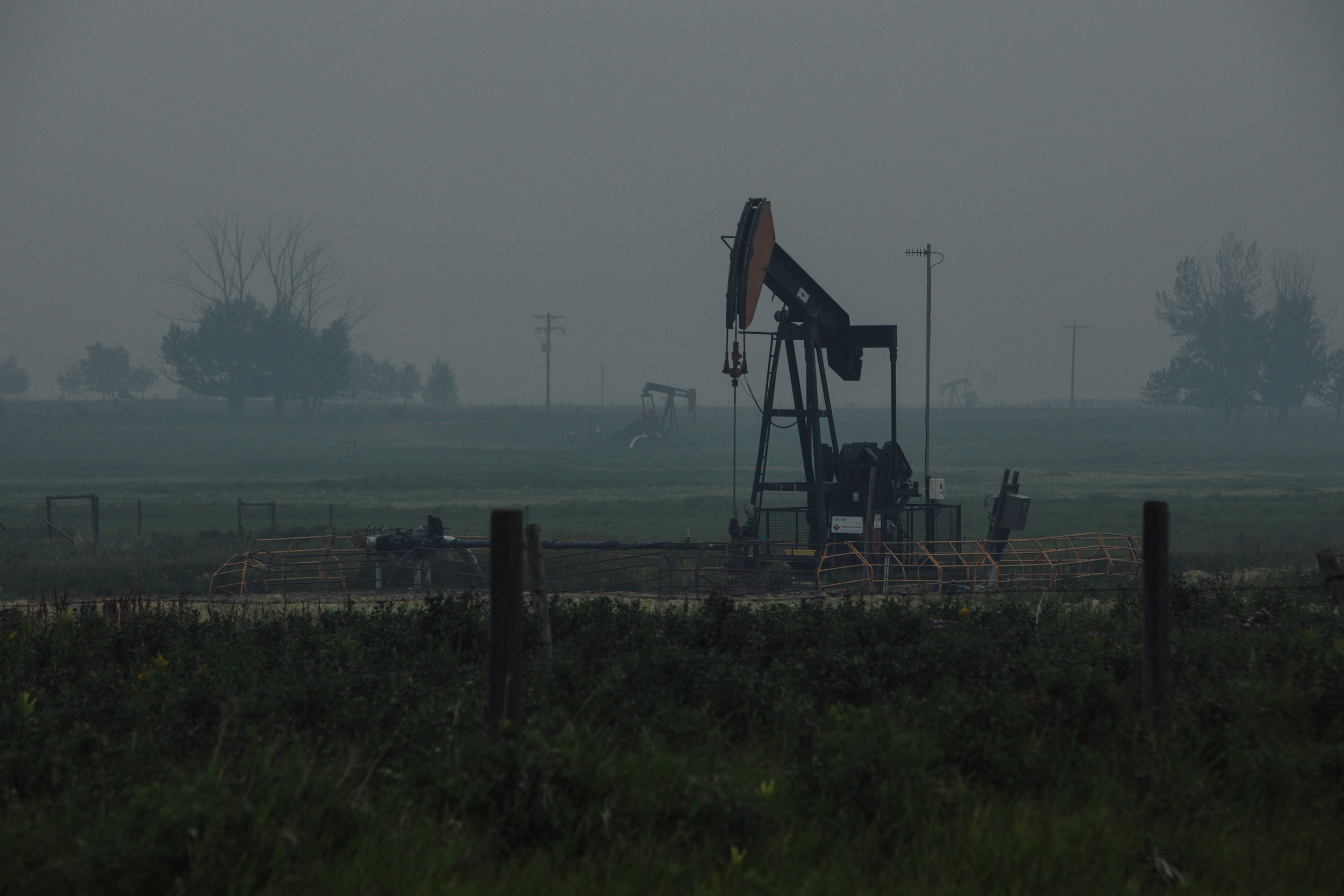
The Alberta government has not announced any new restrictions on oil and gas development in the buffer zones now off limits to wind turbines.
The buffer zone is a hotbed of hydraulic fracturing, or fracking, in Alberta.
The major formations where oil and gas is held in tight, rocky spaces far underground all kiss the edge of the western buffer zone. This includes the Cardium formation, which extends the length of the zone from Grande Prairie in the north down to the U.S. border.
Fracking activity is sparse in the south, picks up west of Calgary and then intensifies dramatically moving north adjacent to Jasper.
As drought threatens the province, new drilling continues to be approved by the Alberta Energy Regulator — though some areas are facing the possibility of such an intense water shortage that fossil fuel companies have been warned they might be forced to cut back.
Overall water use for fracking saw a 252 per cent increase between 2013 and 2022. Intensity of water use has increased even more, a 260 per cent change, according to the regulator.
In 2022 producers used 25.4 billion litres of water for fracking.
Updated on April 4, 2024, at 2:44 p.m. MT: This story was updated to say the pulp mill near Hinton is not new, as previously stated, but will receive significant investments under a new owner.
Enbridge Gas will face Waterloo Region in a hearing before the Ontario Energy Board to renew an agreement that would allow the company to continue...
Continue reading
For 15 years and counting, my commute from Mississauga to Toronto has been mired by...

For our last weekly newsletter of the year, we wanted to share some highlights from...

The fossil fuel giant says its agreement to build pipelines without paying for the right...