


Biologist Eric Balke was biking through Richmond, B.C., a few years ago when something caught his eye. He stopped at the dike and looked over to the other side — and saw a huge salt marsh expanding in front of him. He was surprised he’d never known it was there.
“I’m a biologist. I should have known better,” he mused. “It’s like you build a dike and that’s the end of the world, that’s the end of the area we care about.”
“But these marshes are truly the gem of the Fraser estuary.”
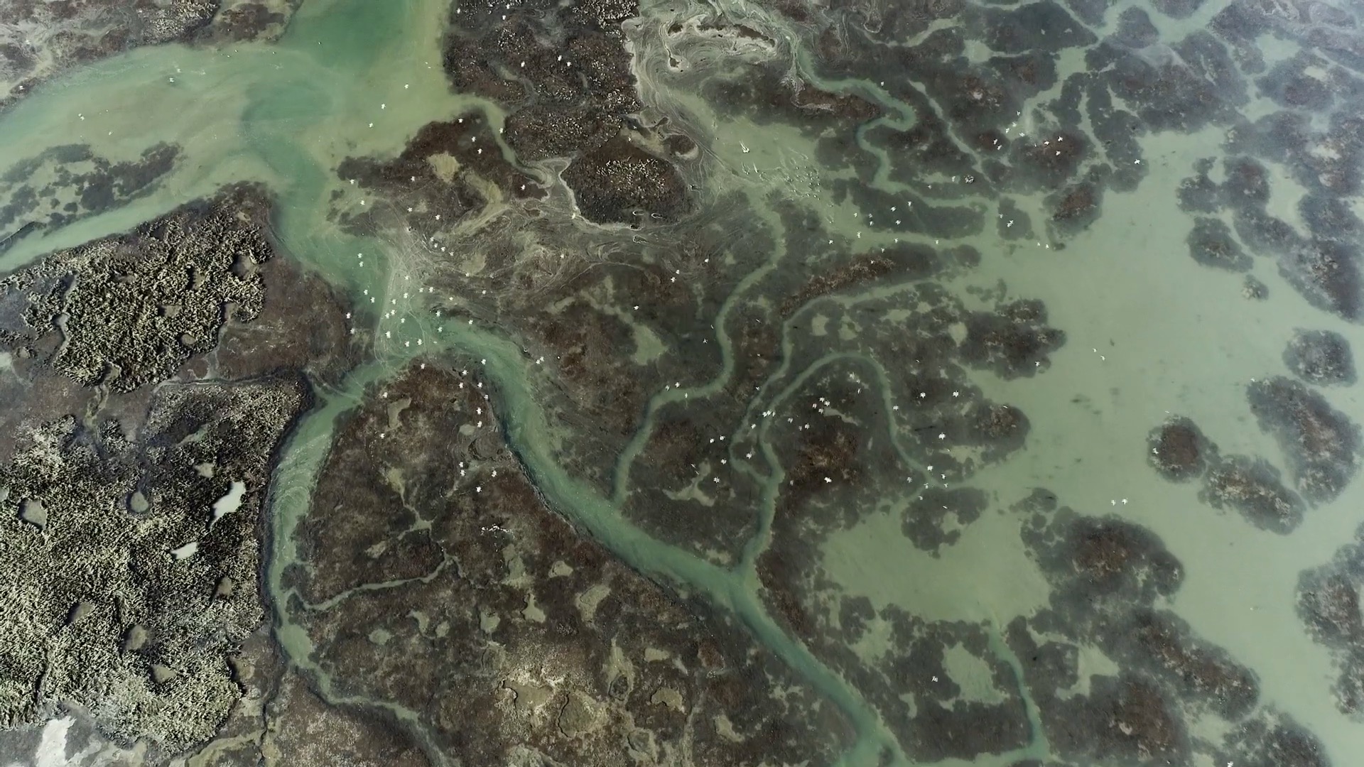
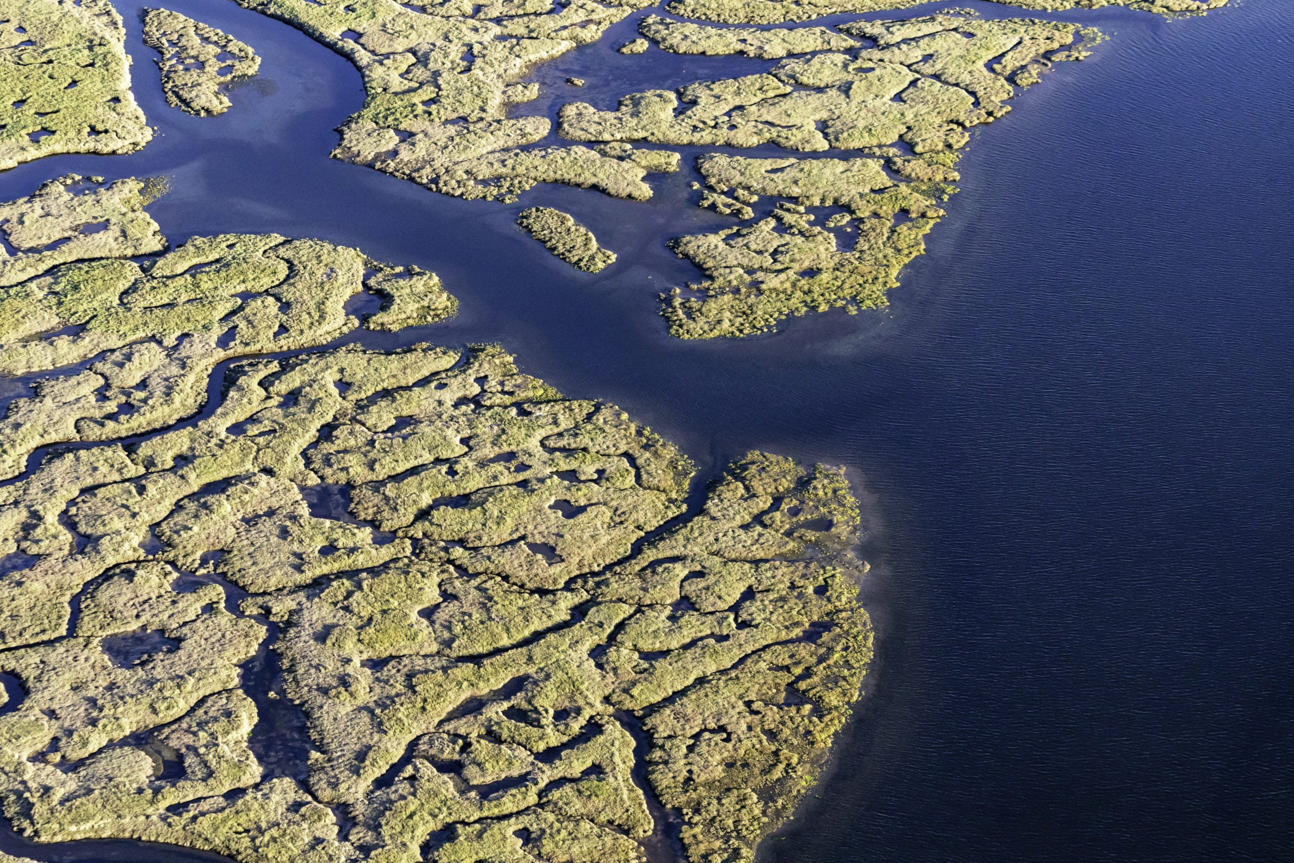
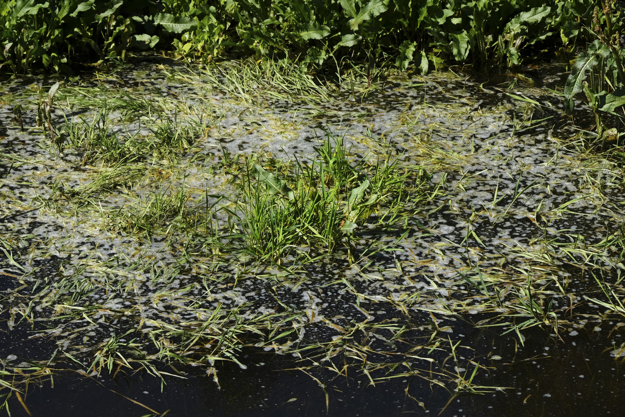
Salt marshes — coastal wetlands flooded and drained by salt water — can be found butting up against dikes throughout the Fraser River estuary, an internationally recognized centre of biodiversity with 17,000 hectares of wetlands. The sandy banks of salt marshes are filled with seagrass and low brush. Eagles fly overhead, eyeing sturgeon stranded on the bank. Packs of coyotes howl at nightfall.
But sea level rise caused by climate change threatens these rich ecosystems, which support migratory birds, salmon, seals and other marine life. Dikes, built to prevent flooding, make them even more vulnerable. When the sea level rises, salt marshes can migrate landward — but not if they’re blocked by structures like dikes. This phenomenon is called coastal squeeze. Communities behind those dikes are also at risk of catastrophic flooding if the ocean breaches the dikes.
The salt marshes in Boundary Bay are being conscripted in a novel fight against climate change-induced sea level rise as part of a ‘living dike’ solution. Photo: City of Surrey
Coastal squeeze is threatening Boundary Bay, home to another salt marsh in the estuary. But making the existing dike taller would also mean making it wider, encroaching on the salt marsh on one side or agricultural land on the other.
To protect the salt marsh and nearby communities, a coalition — which includes the City of Surrey, the City of Delta and the Semiahmoo First Nation — has formed to try an innovative solution.
It is creating a “living dike.”
In a pilot project at Boundary Bay, a 250-kilometre stretch of seashore that spans the three jurisdictions, the partners plan to deposit sediment in the marsh over three decades to raise its elevation and create a natural dike that can survive sea level rise. The gradual pace will allow plant life to adapt. Adding sediment too fast could bury plants and affect animals that use those plants for food or shelter.
The hope is the marsh will survive and continue to provide wave protection for the people living nearby. Salt marshes in front of coastal dikes can reduce wave heights near the shore by as much as 40 per cent, slowing down wave energy and reducing the risk of flooding. They can also attenuate rainwater. Balke said eelgrass, which is abundant in salt marshes, can stabilize sediment, reduce erosion and further cushion wave action.

Ducks fly along the waters of Boundary Bay. Photo: Tim Fitzgerald / Ducks Unlimited Canada

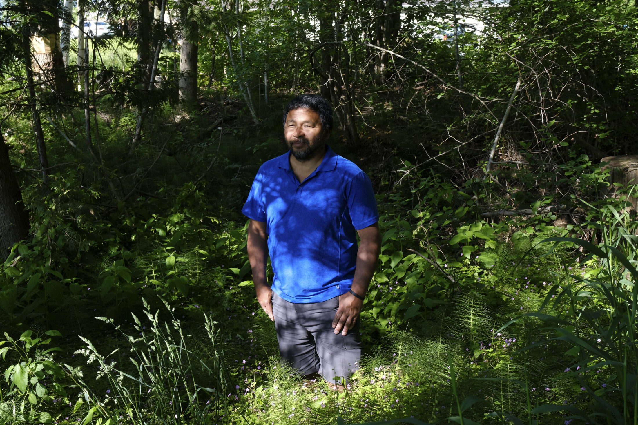
Biologist Eric Balke is working on a pilot project to turn the salt marsh in B.C.’s Boundary Bay into a living dike. Photo: Jennifer Osborne / The Narwhal

Wild horsetail along McNeeleys Trail in Boundary Bay. Photo: Jennifer Osborne / The Narwhal
The vision is: homes will remain, the salt marsh will remain, the dike will remain. While it will take decades of work and hundreds of millions of dollars, if the project is a success, no one will notice a thing.
This is drastically different from the notable concrete, human-made infrastructure to mitigate flooding, which has disrupted natural processes in the Fraser estuary such as salmon migration. This pilot project aims to strengthen the built-in protection of this ecosystem.
“These ecosystems are infrastructure. The whole point of the living dike is harnessing that power,” said Balke, who is coordinator of the South Coast Conservation Land Management Program and part of the Boundary Bay Living Dike Roundtable, a group providing input and guidance for the project.
West Coast Environmental Law estimates the cost for the living dike will be $175 to $250 million. For the pilot phase, Delta and Surrey have committed just under $3.5 million combined. The federal government pledged more than $76 million to mitigate coastal flooding in Delta, Surrey and the Semiahmoo First Nation, which includes funding for the project. Some costs will be covered by the province.
Design work is set to start later this year.

A map of the Fraser estuary. Map: Carol Linnitt / The Narwhal
Using ‘the most important ecosystems in B.C.’ to prevent flooding
Flooding has always happened in the Fraser delta, but intense spring thaws and storm surges have put more people at risk. According to the Insurance Bureau of Canada, 1.7 million Canadian households — or 19 per cent of Canada’s population — are at risk of river and surface water flooding.
A 2016 report by the Fraser Basin Council said a major flood in the Lower Mainland could be the most costly disaster in Canadian history. The report predicts a coastal flood would result in losses of $19 billion and a Fraser River flood would lead to losses of almost $23 billion.
In another study, the council found that dikes in B.C. “generally do not meet current provincial standards and none fully meet or exceed the standards.”
Salt marshes remain an often-underrated ecosystem, even though they have a role to play in mitigating the impacts of sea level rise, which the Intergovernmental Panel on Climate Change predicts will likely exceed one metre globally by 2100 (though predictions vary).
Over the next three decades, sediment will slowly be deposited in the salt marsh in Boundary Bay to turn it into a living dike. Photo: City of Surrey
Balke said these marshes are “arguably the most important ecosystems in B.C.” since they support millions of migratory birds and provide critical habitat for juvenile salmon on their journey from the Fraser River to the ocean.
The marshes provide space for salmon to grow, eat, rest and adapt to saltwater life. When the tide is high, the marshes are filled with invertebrates for salmon to feed on. When the tide goes out, the sand is picked over by small mammals and birds hunting for molluscs.
Boundary Bay is home to a salt marsh that’s at the heart of an ambitious plan to protect nearby communities from sea level rise. Photo: City of Surrey
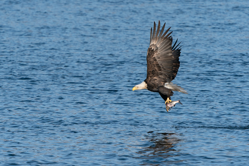
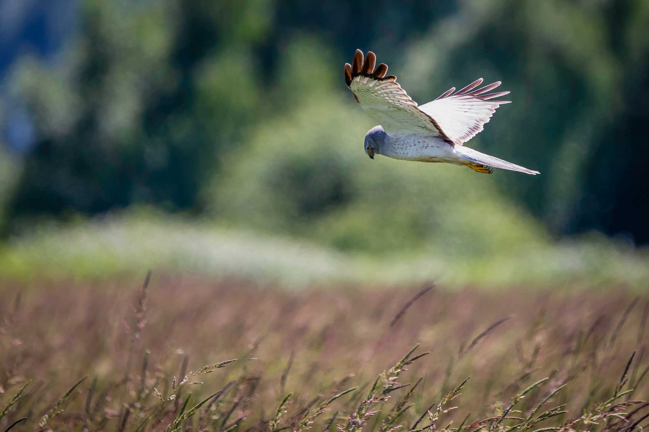
A eagle flies over the water near Boundary Bay, a 250-kilometre stretch of seashore that provides important habitat to bird species. Photo: City of Surrey
The rich soils support microbial life and can absorb as much atmospheric carbon per unit area as soils in tropical rainforests.
Human-made infrastructure gets in the way of salt marshes doing their job. For instance, jetties and dikes disrupt natural sediment deposit processes and restrict salmon movement.
Concrete versus natural infrastructure
Sumas Lake in Abbotsford once absorbed freshet from the Fraser River in the spring, mitigating flooding. But settlers disliked the mosquitos and drained the lake in 1924, building an artificial canal and pump station to control water flow.
Murray Ned, councillor for Semá:th (Sumas) First Nation, said the lake was their “livelihood” and was home to salmon, wolves and elk.
“It was probably the biggest impact on our community at the time, and even today, because we now no longer have that resource at our front door, so to speak,” said Ned, whose ancestral name is Kwilosintun.
The living dike provides an opportunity to return to a more harmonious approach to working with nature as communities adapt to climate change, said Deborah Carlson, a staff lawyer at West Coast Environmental Law, who is also part of the living dike roundtable.
“It’s having a relationship with that coastal ecosystem,” she said. “A relationship that acknowledges that salt marsh is taking care of us, and [we’re] taking care of it.”
She said it can be complicated to experiment in areas with “complex, overlapping jurisdictions” like Boundary Bay but collaborative projects like this will be needed to adapt to climate change.
Semá:th (Sumas) First Nation Councillor Murray Ned said it’s imperative that First Nations work with all levels of government on flood mitigation. Photo: Jennifer Osborne / The Narwhal

Juvenile fish swim in an Abbotsford waterway during an interview with Semá:th (Sumas) First Nation Councillor Murray Ned. Photo: Jennifer Osborne / The Narwhal
Matt Osler, Surrey’s program manager for disaster mitigation, agreed.
“Flooding doesn’t get held back by jurisdictional boundaries,” he told The Narwhal.
Compared to all the dikes, jetties and pump stations, Osler said the living dike will be more “adaptable and resilient” — able to migrate or grow. He has high hopes for what this project could mean for the communities involved.
“We know we just have to try it and see if it works,” he said. “Maybe with climate change, we have to do things differently. We at least have to be asking the question of how we can do it differently.”
The Semiahmoo First Nation was not available for comment before publication.

A butterfly in the wild grasses along the Boundary Bay dike. Photo: Jennifer Osborne / The Narwhal
Boundary Bay marsh in a part of the coastal wetlands that are flooded and drained by salt water. Photo: Jennifer Osborne / The Narwhal

Horseback riders enjoy the Boundary Bay Dike Trail on May 18, 2020 in the territory of the Semiahmoo First Nation. Photo: Jennifer Osborne / The Narwhal
Climate change adaptation must be ‘collaborative effort’ with First Nations
The living dike project also provides an example of working in equal partnership with First Nations on flood management instead of working around them, Ned said.
In 2014, the City of Abbotsford undertook emergency flood work without consulting the First Nation and destroyed a Semá:th fishing site in the process. Last year, Abbotsford and the province signed a memorandum of understanding with the Semá:th agreeing to consult with the nation on flood response from now on.
“That was a major crisis in our community, the loss of that fishing site,” Ned said.
In addition to being on council for the Semá:th First Nation, Ned is part of the Emergency Planning Secretariat, an Indigenous organization that works with First Nations to help them build capacity to respond to floods. The secretariat wants to facilitate a coordinated flood management strategy across Coast Salish communities along the Fraser River. The secretariat is also participating in discussions around the living dike.

The Serpentine Fen is a part of the larger wetland supported by a system of dikes in the Fraser estuary and is protected as a nature reserve. Photo: Jennifer Osborne / The Narwhal

Agricultural land adjacent to the Serpentine Fen. Photo: Jennifer Osborne / The Narwhal
He said it’s integral for First Nations to work on equal footing with other jurisdictions.
“This work we’re talking about can’t be done solely by First Nations or solely by the provincial or federal governments,” Ned said. “It has to be a collaborative effort.”
First Nations are often in low-lying areas at risk of floods and have little protection, largely due to colonization.
“When the Indian Act came into effect and constrained them to these small areas, they happened to be at their fish camps at the time, so that’s why a lot of reserves are near the river,” said Gillian Fuss, project coordinator for the secretariat.
First Nations are at risk of losing fishing sites, cultural sites and graveyards to flooding. But band councils are often too overstretched to have an employee dedicated to emergency planning. The secretariat works with First Nations to increase that capacity.
Tyrone McNeil is also on the secretariat and is vice-president of the Stó:lō Tribal Council. He said his community, the Seabird Island Band, has lost 600 hectares of land to erosion and has been struggling to build up infrastructure that also protects salmon habitat.

Boundary Bay’s West Dike Trail is home to a large marsh area. Photo: Jennifer Osborne / The Narwhal

A duck takes off in the wetland of Beach Grove, an important part of the Fraser estuary marsh system. Photo: Jennifer Osborne / The Narwhal
He said planning is much more difficult due to climate change.
“Say, 40 years ago, we had a pretty good idea of what to expect for freshet,” he said. “Now, with climate change, you can take every predictive modelling and toss it out.”
Richmond’s West Dike Trail looking toward the Fraser River and, beyond that, the North Shore mountains. Photo: Jennifer Osborne / The Narwhal
McNeil wants to prepare for a two-metre sea level rise.
He said another challenge that hasn’t been talked about enough is the probability of needing to move reserves to higher elevations due to flooding and sea level rise, something that would take years to complete. He said this will also take collaboration between First Nations and federal and provincial governments to find new reserves and start building as soon as 2040.
“[First Nations] need that long-term planning ability. We’re at the earliest stages of developing that,” he said.
Without that capacity, “We’re going to be losing a whole lot more land,” he warned.
And the solution for that, without major impacts on the ecosystem, won’t be found in concrete.