


This story is part of When in Drought, a series about threats to B.C.’s imperilled freshwater systems and the communities working to implement solutions.
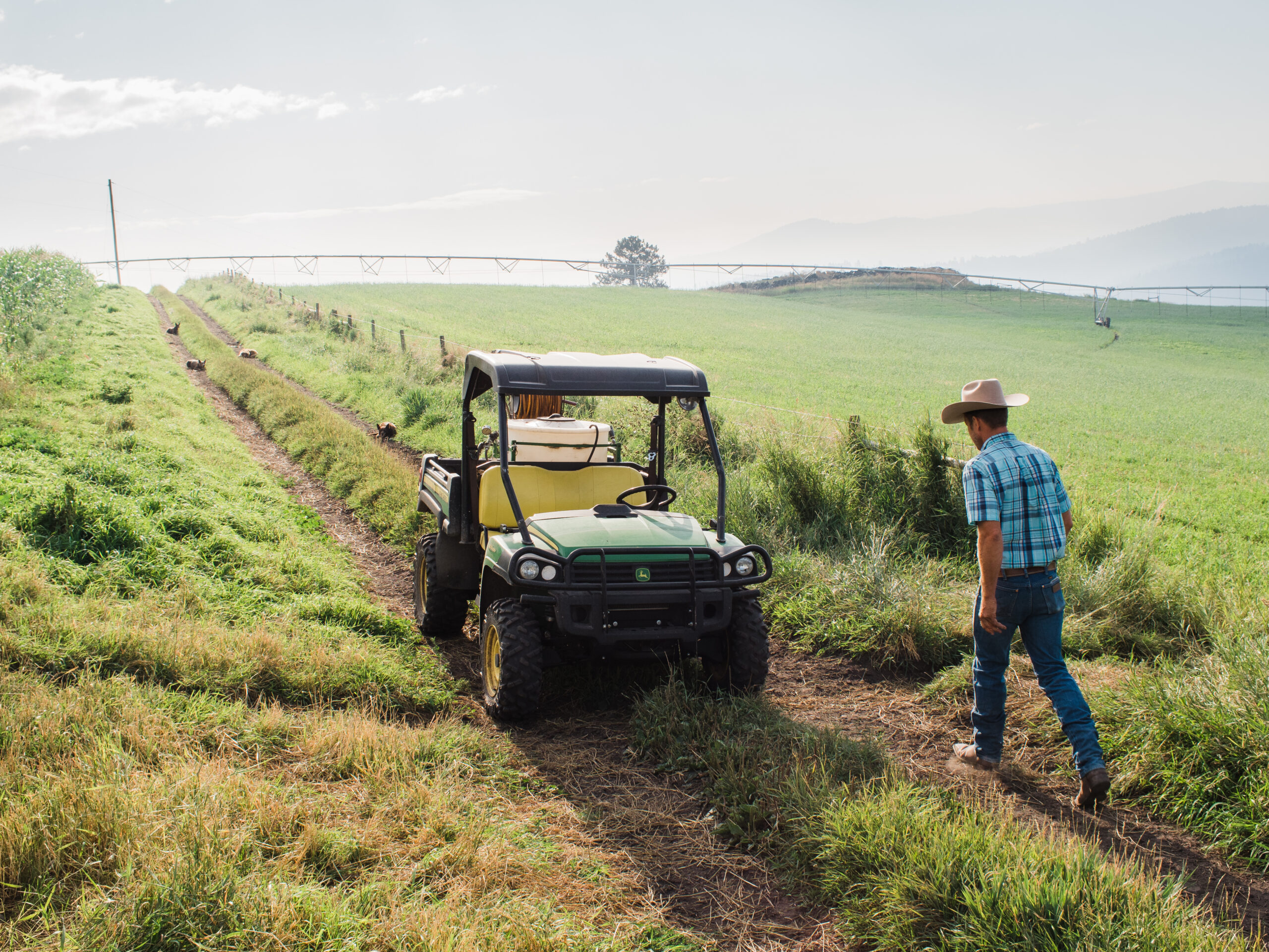
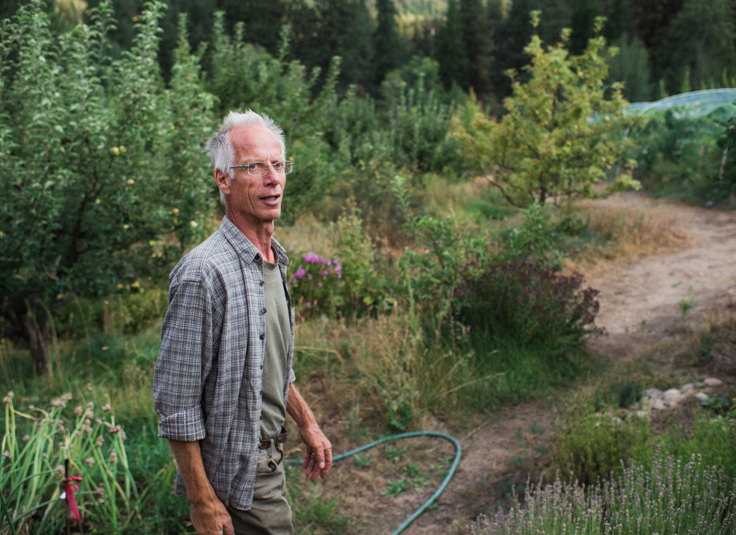
Doug Fossen’s cowboy hat bobs rhythmically as he strides across his family’s ranchland west of Rock Creek, British Columbia. Beneath a large, oval belt buckle bearing his surname, his boots swish through a pasture of green alfalfa. To the right, rows of tightly spaced feed corn stretch uphill towards an open forest of ponderosa pine and Douglas fir.
Abruptly, the sound of his walking changes. Instead of whispering, each footfall crunches, dead grass breaking beneath hard soles, dust and insects beginning to rise in his wake. He stops and points to the parched earth. “See? As soon as you leave our irrigation area you enter grasshopper land,” he tells The Narwhal.
Since the first week of August, the Kettle River watershed, located in central southern B.C., has been under level five drought, the provincial government’s highest rating. According to the B.C. drought information portal, areas assigned level five are “almost certain” to face adverse impacts on socio-economic and ecosystem values. Until recently, the region was the only one listed at level five, but in the past two weeks the Salmon River basin east of Kelowna and both East and West Vancouver Island have joined the extreme rating.


Fossen gestures towards a field of private land that borders the Crown land where his cattle graze. On wet years Fossen often wonders if having grazing rights to multi-use government land is worth the headache of dealing with all the people involved. But on drought years like this one, having pasture beyond his own private pastures is vital. Photo: Louis Bockner / The Narwhal 
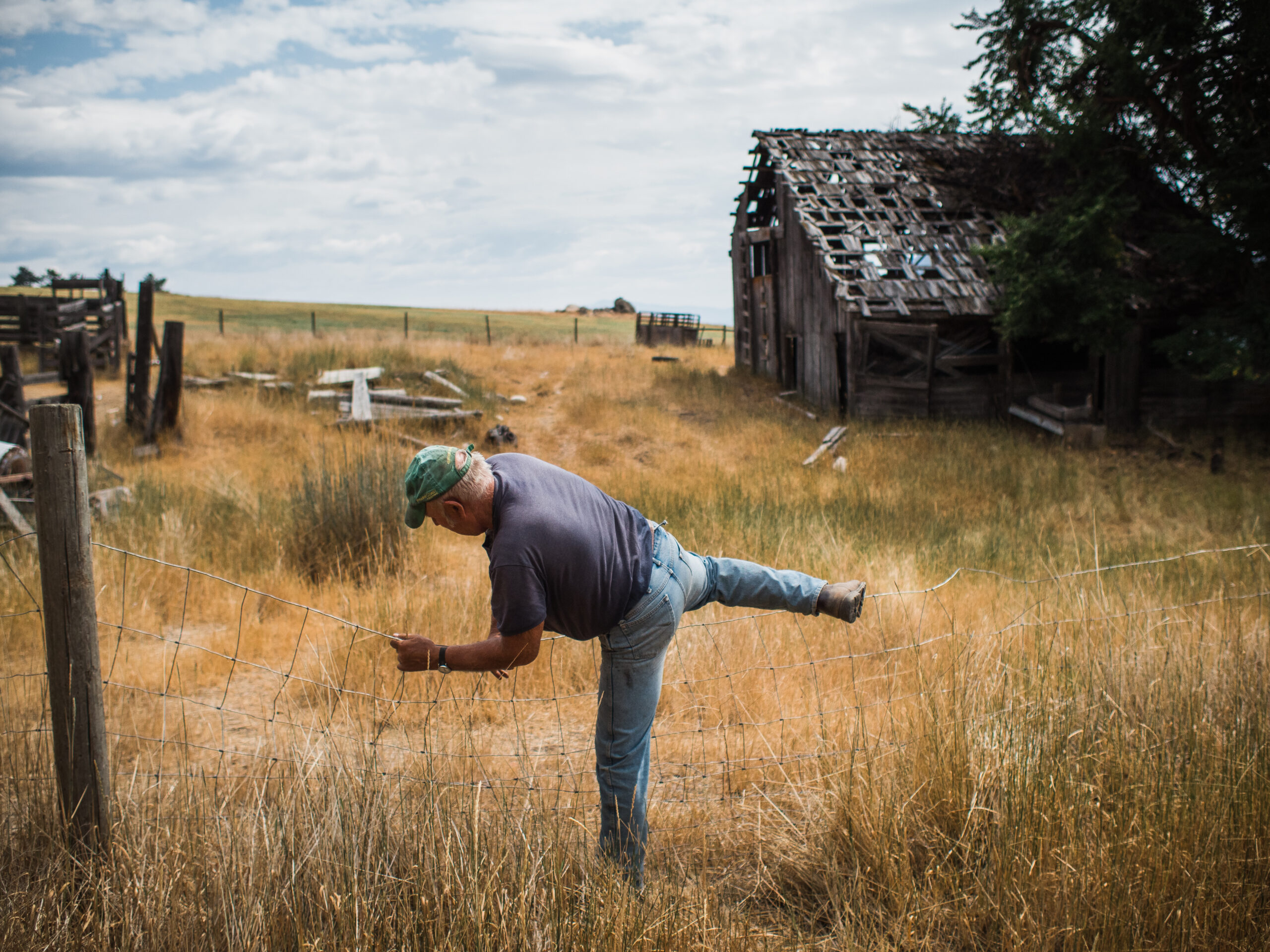
Fossen, who owns 2,300 acres east of Rock Creek, B.C., points to the dry land outside the coverage of his centre-pivot irrigation systems. “As soon as you leave our irrigation area you enter grasshopper land.” Photo: Louis Bockner / The Narwhal


Since a province-wide heat wave in June, stream flows across the Kettle River watershed’s eight sub-basins have been dangerously low. For cattle ranchers like Fossen, who rely on creeks to irrigate pasture and feed crops, this means making adjustments and praying for rain.
“We’ve consolidated a lot of our irrigated land to conserve water,” he says, adding that they recently installed centre-pivot irrigation systems which, although expensive, use water more efficiently. “It’s just really stressful right now and you’re not sure if you’ll make it.”
According to an Aug. 13 article in the government of Alberta’s Agri-News, severe drought affecting much of Western Canada and the U.S., is leaving ranchers facing tough choices when it comes to managing their herds. A scarcity of feed due to strained, dry pastures has led to increased feed costs forcing many farmers to cull large portions of their stock, which could flood the beef market, lower the price and compound the hardship — something that Fossen is already thinking about.
“Our biggest problem is this fall we’re going to have to deal with a price drop,” he says. “That’ll be our biggest hit.”

A water trough installed by Fossen on the crown land where he grazes his cattle during the summer months. These troughs take advantage of natural springs and seeps to provide water for his cattle and other wildlife that live in the area. Photo: Louis Bockner / The Narwhal 
Fossen’s dog Flint cools down in the runoff from a watering trough Fossen installed on the Crown land where he has grazing rights. Over the past 30 years he estimates he and his family have installed between 40 and 50 of these tanks which utilize natural springs or water seeps to provide water to his cattle herds. Photo: Louis Bockner / The Narwhal


Despite this, Fossen, who serves as the president of the Kettle River Stockman’s Association, considers himself lucky. Since his father bought the ranch in 1976 they have been combating drought by adding seep-fed water troughs on the Crown land where their herd — currently sized at 350 mother cows and their calves — graze between spring and fall. They have also built weirs on some small creeks to create pond-like reservoirs from which they can pump water. Because of this and their irrigation systems they, unlike some other ranchers in the region, may not have to buy feed in the fall at exorbitant prices.
“That’s what ranching teaches us,” he says, “in these drought years we are living off our management decisions of the last 20 years.”
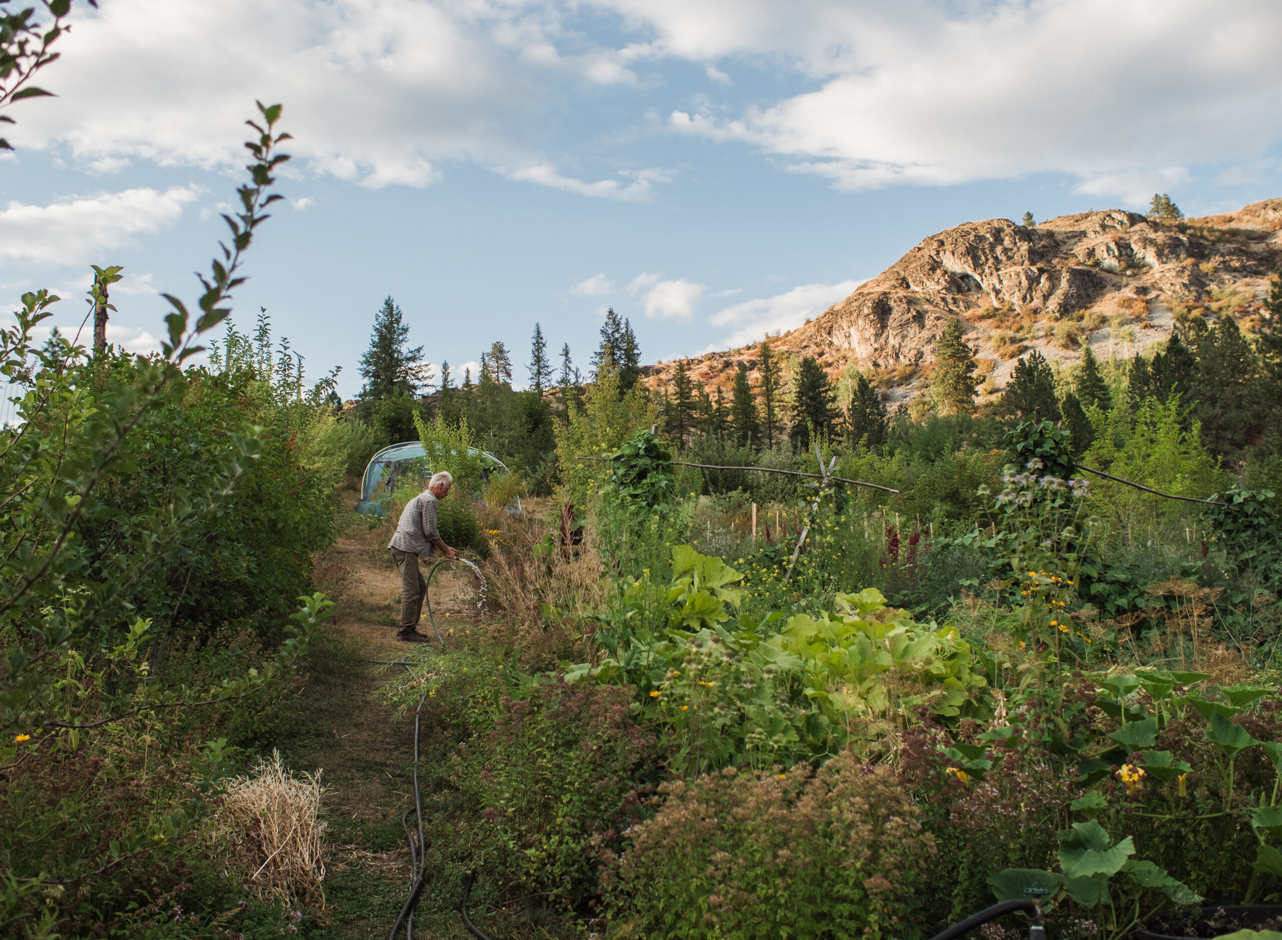
A pump house on the Fossen ranch is used to pump water from a reservoir to a centre-pivot irrigation system. Since installing the water-saving systems, Fossen says he has been able to run the pump for only three days a week as opposed to seven which saves both money and water. Even so, the last power bill for one pump house was $4,500. “In a sense, we’re buying feed in a different way,” Fossen says. Photo: Louis Bockner / The Narwhal 
The reservoir created by the Fossens is used to irrigate fields where feed is grown to provide food for cattle during the winter months. It has also become a home to fish, birds, otters and other wildlife and appears as an oasis during years of extreme drought, like this one. Photo: Louis Bockner / The Narwhal


Fossen throws his dog Tuff into a water trough on his ranch east of Rock Creek. Photo: Louis Bockner / The Narwhal 
Tuff cools down in a water trough on the Fossen ranch. Beside Tuff, the body of a dead skunk can be seen floating. The skunk presumably drowned after falling into the trough while searching for water. Photo: Louis Bockner / The Narwhal 
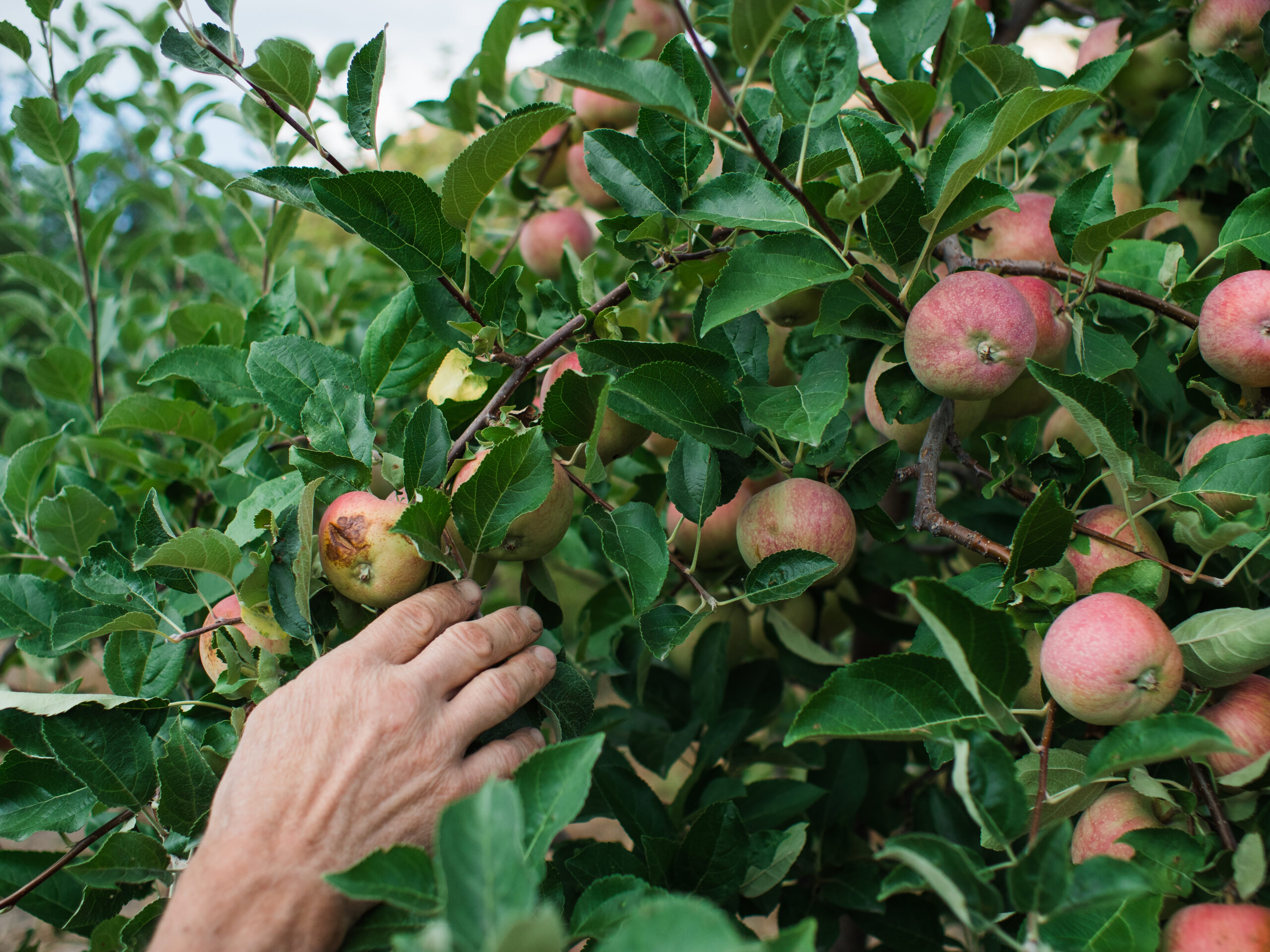
Fossen fishes the body of the skunk which died after falling into a water trough on his property. In years of drought, the divide between wilderness and ranchland becomes increasingly crossed as wildlife seek out the green pastures of irrigated fields and vital watering holes. Photo: Louis Bockner / The Narwhal


Connecting the dots between clearcuts and drought
According to a drought management plan published by the Regional District of Kootenay Boundary in 2020, the Kettle River watershed is dominated by a “nival hydrological regime,” meaning the watershed relies primarily on snowmelt to sustain the flows of its rivers and streams. This makes the watershed especially susceptible to both flooding and drought as the majority of the yearly flow is released during the spring freshet when the bulk of the snowpack melts.
In 2018, Grand Forks experienced severe flooding which some residents and industry professionals linked back to excessive clear cut logging in the Boundary timber supply area. Residents of Grand Forks launched a lawsuit against B.C.’s Ministry of Forests, Lands and Natural Resources and several logging companies in September 2020 over damages caused by the flooding. The defendants included Interfor, which operates a mill across the Kettle River from downtown Grand Forks.
According to Peter Waldmann, the lawyer representing the plaintiffs, only one of the companies has filed a defence and the case, which is being overseen by Justice Gaul of the Victoria Registry, is waiting for a case conference to be set.
In these times of drought, similar connections are being made by people across the region, including ranchers, biologists and retired forestry workers.
Jamie Haynes, a 70-year-old farmer from Rock Creek who also ranches and runs a small-scale, selective logging company, believes “massive logging” to be one of the biggest issues impacting drought in the region. “The future of our forests is in jeopardy because we’re not managing them properly,” he says. “I know this is off the subject of agriculture, but it’s all connected. It all starts in the watershed.”
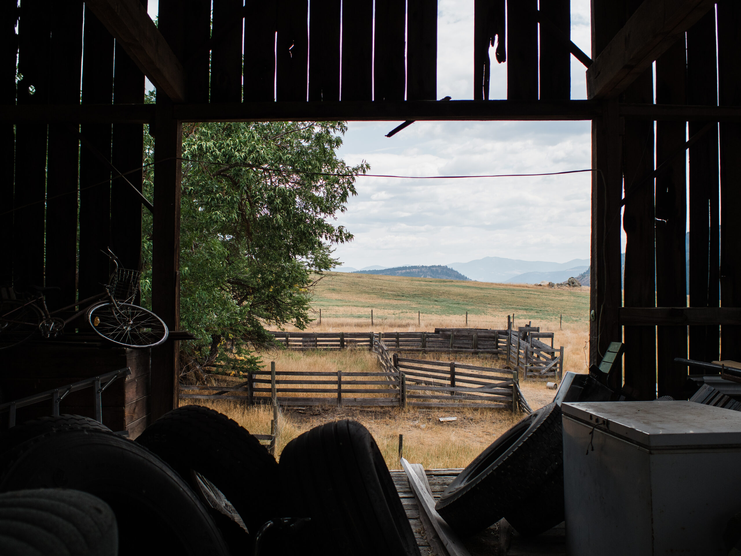
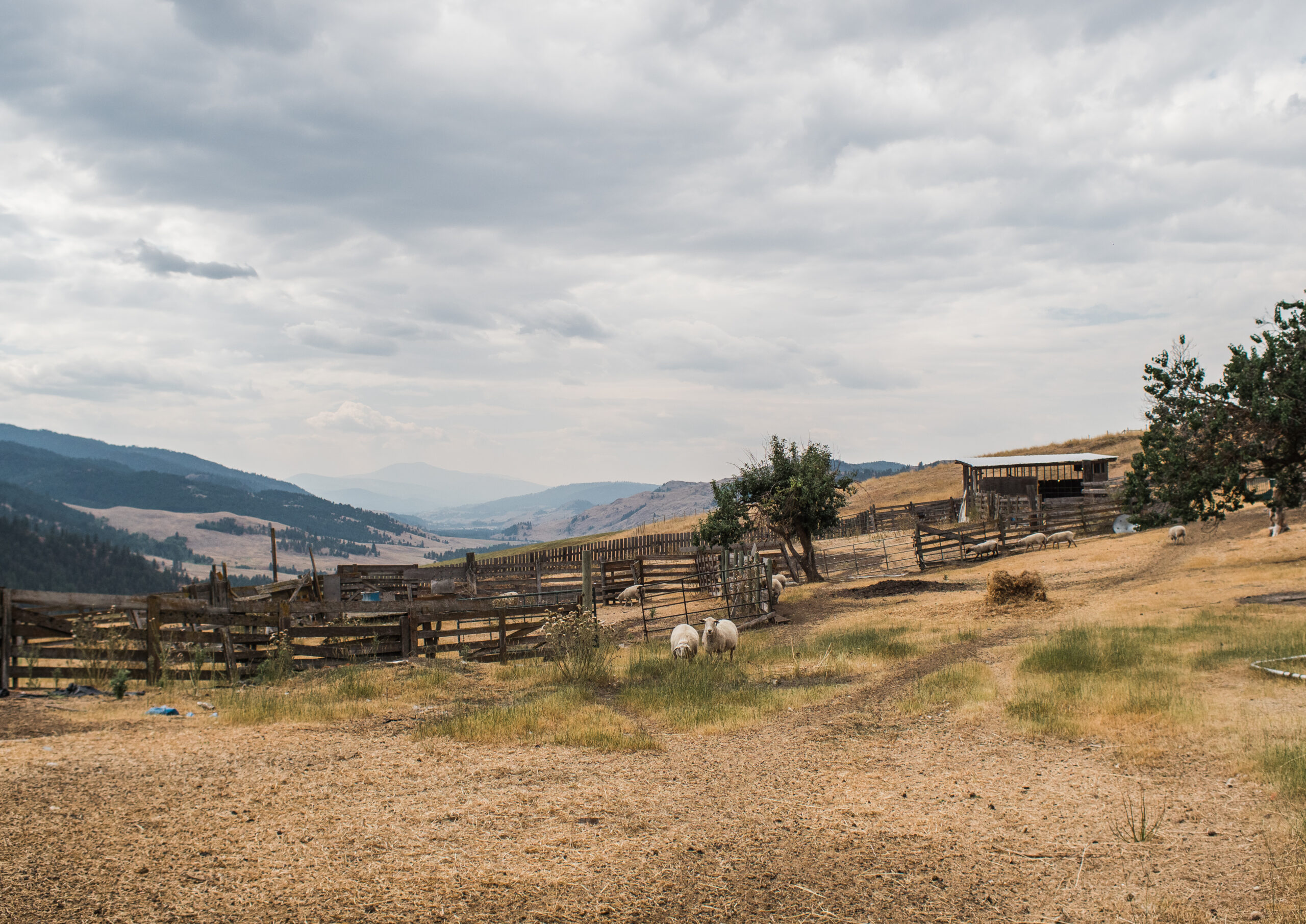
Haynes has lived in the region his whole life and now resides on the family land where, in 1907, his grandfather built the existing barn with hand-hewn timbers masterfully erected atop dry-rock masonry. Up until 15 years ago they kept all their cattle on the property but a lowering water table forced them to relocate the herd to lower pastures.
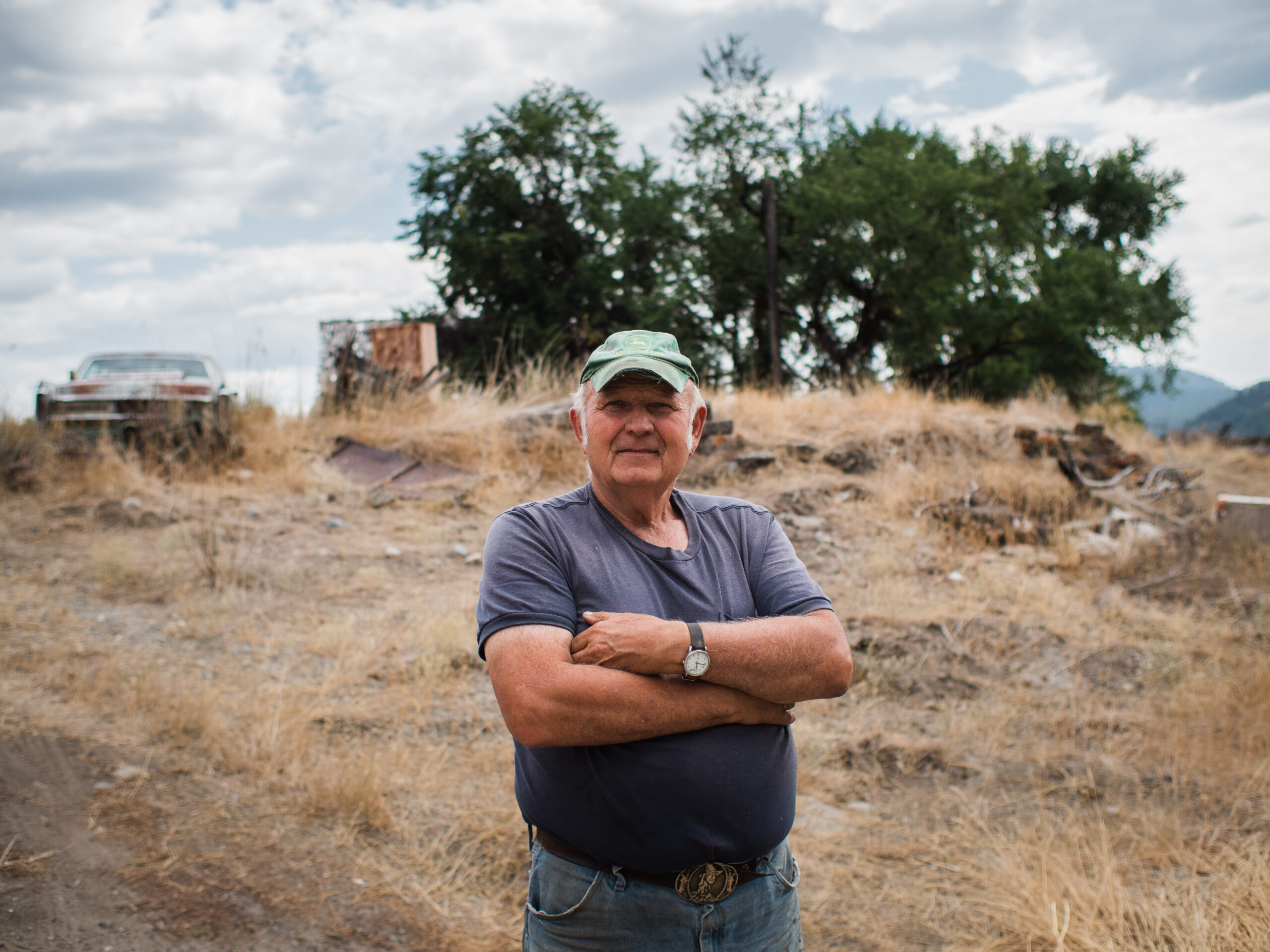
About a decade ago Haynes turned to no-till, regenerative agriculture to help conserve water. This method maintains moisture in the soil because it isn’t being exposed to sun and wind which induces evaporation. He’s also moved to growing more cover crop mixtures that include daikon radishes, triticale, peas and oats. The results have been tangible, especially on dry years like this when water retention in the soil is paramount.
According to Ray Hanson, a retired forester from Grand Forks who worked for the Ministry of Forests for 32 years, this simple act of water retention, across all parts of a watershed, holds the key to mitigating both drought and flood.
In an intact watershed, Hanson says, the forest floor is made up of a thick layer of debris called humus which collects over decades or centuries. This layer, along with the root systems of trees and plants, acts like a sponge, soaking up the melting snow before releasing it later, once the initial spring freshet has passed. This not only lessens the effects of spring runoff but also injects a vital source of water to streams and creeks once the heat of summer sets in.
The other piece that intact forests provide is shade, something that plays a big role in how fast snow accumulates and melts. With healthy forests, drastic temperature swings, like the Kettle Basin experienced in June, are mitigated, again helping to slow runoff.
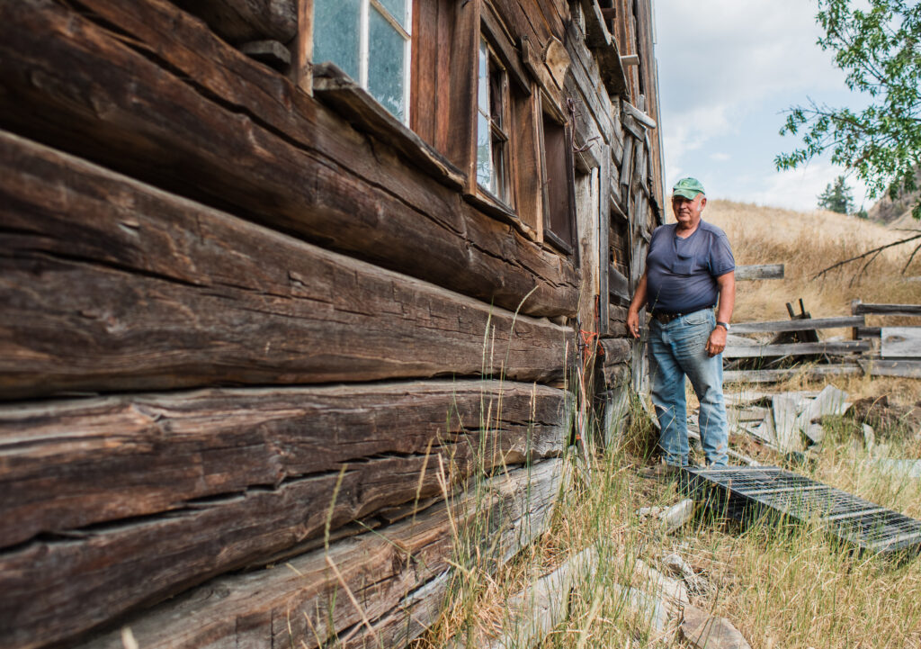

Dovetailed timbers, hand-hewn by Haynes’ grandfather, make up the structure of the Haynes’ barn which was built in 1907. Photo by Louis Bockner/The Narwhal 
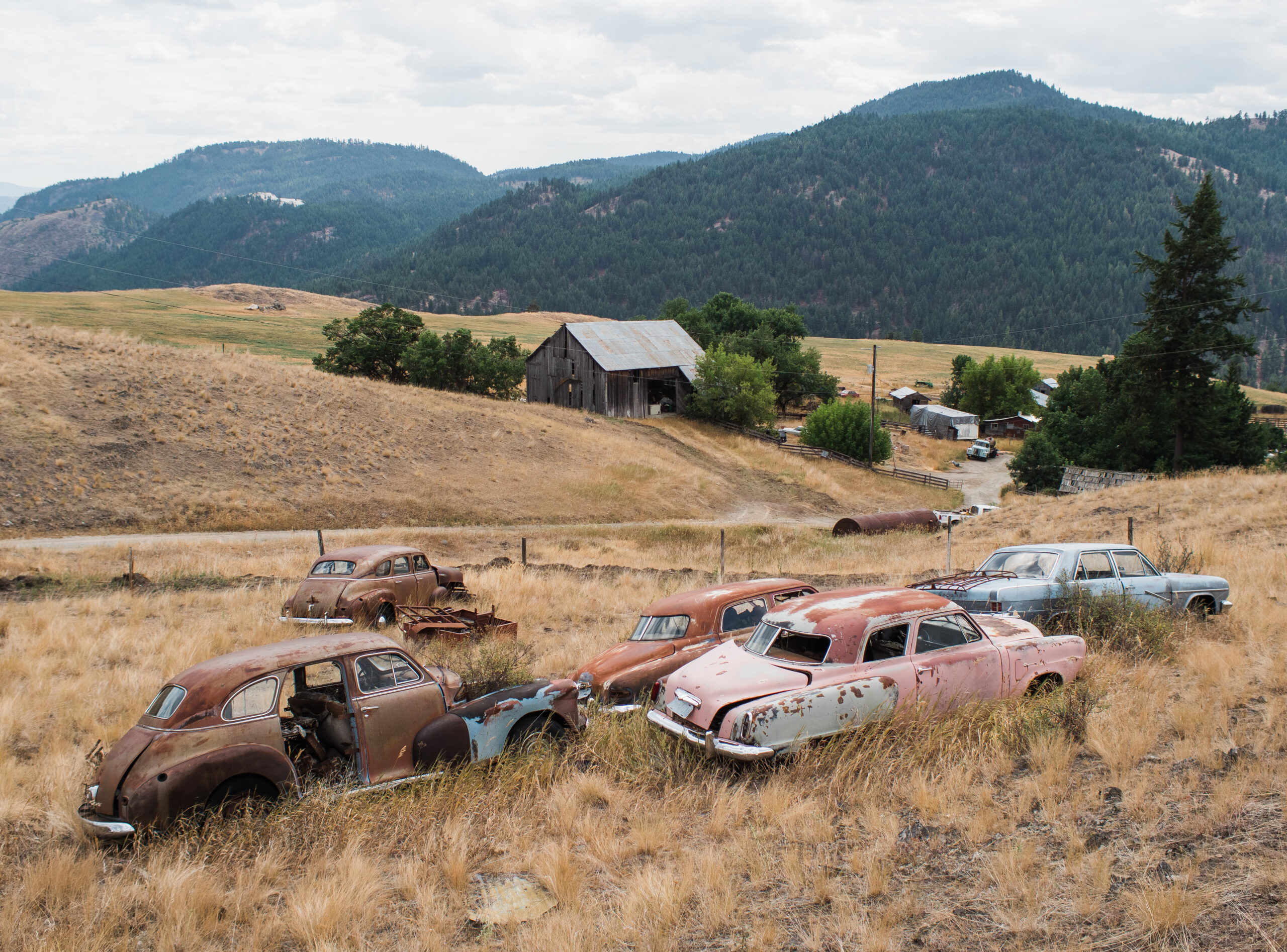
An old car sits on the Haynes family land. Photo by Louis Bockner/The Narwhal


The opposite scenario, where a forest fire or intensive logging has decimated the humus layer, leads to increased flow volatility and rapid erosion. “It’s a cumulative effect,” he says. “If you’ve lost the shade and burnt up or disturbed the humus layer too much then the ability of the topography to manage the water is diminished and that’s basically a lot of what the problem is here in the Kettle River drainage.”
In a report published on the provincial government’s website, Rita Winkler, an adjunct professor in the Department of Forest Resource Management at UBC, states that harvesting with large machinery, including skidders and feller-bunchers, “can compact soil surfaces and cause overland flow,” which can then lead to an “increase in the flashiness of streamflow response and the magnitude of surface erosion.”
The report goes on to note that the “significance of this soil compaction and resulting overland flow depends on the degree of compaction and how much of the watershed area is disturbed.”
When asked about the links between clear cutting and forest hydrology in the Boundary timber supply area, the Ministry of Forests said they were unable to comment due to pending litigation of the class action lawsuit.
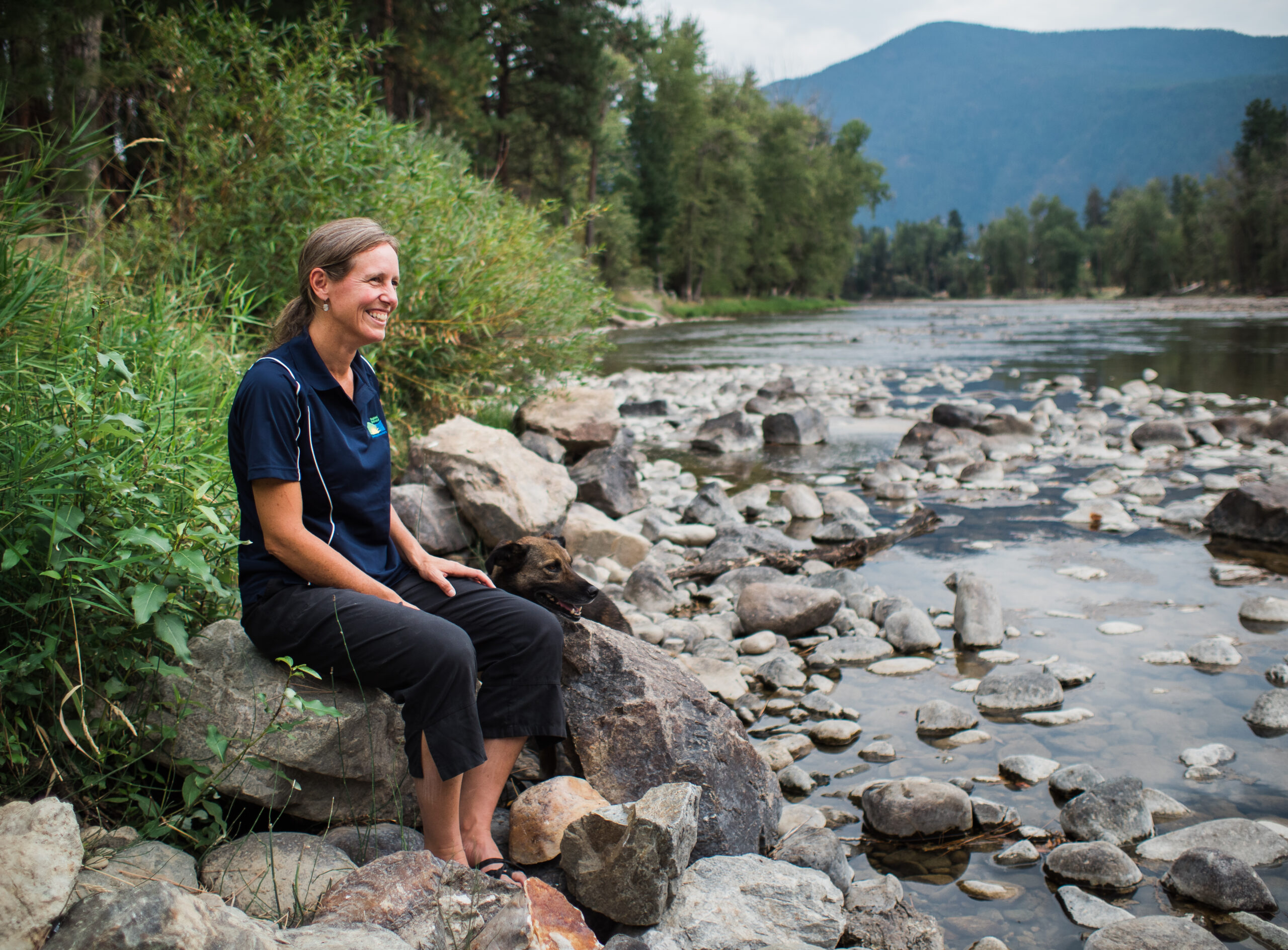
Kristina Anderson, who works as the watershed planner for the Regional District of Kootenay Boundary, has spent the summer monitoring water levels and temperatures across Kootenay Boundary and compiling weekly drought reports which are made available to residents. What she has been seeing is alarming.
Many creeks and rivers, including the upper West Kettle and Granby River drainages, are breaking new lows and the mean annual discharge — a measurement used to determine the health of fish ecosystems — in most water courses continues to be dangerously low despite recent rain and cooler temperatures.
Anderson says that people are responding well to municipalities and water suppliers requesting a curtailing of water use, something that isn’t always easy given the agricultural nature of the Kettle River watershed.
“We’re also in a high to extreme fire season at the moment and I’m very conscious of that,” Anderson says. “I really want to make sure we message water conservation in line with strong fire smart practices.”
Despite this, on August 30 the provincial government issued water restrictions for the West Kettle River watershed limiting water usage for the irrigation of forage. The bulletin states that provincial staff are “monitoring the situation, as well as the protection orders that are in place, and will continue to work to balance water uses with environmental flow needs.”
This delicate balance between industrial use, human need and ecosystem health is becoming increasingly tenuous. For Michael Zimmer, a fisheries biologist who works for the Okanagan Nation Alliance, the core of the issue lies in the relationship between human settlement and something as fluid and changing as a river and its riparian zones.
“We like the river,” he says. “We like coming to places like this so we can enjoy the aesthetics, we like floating it with our kayaks and our tubes. But the minute it imposes on us, well we’ve gotta engineer something to control it.”

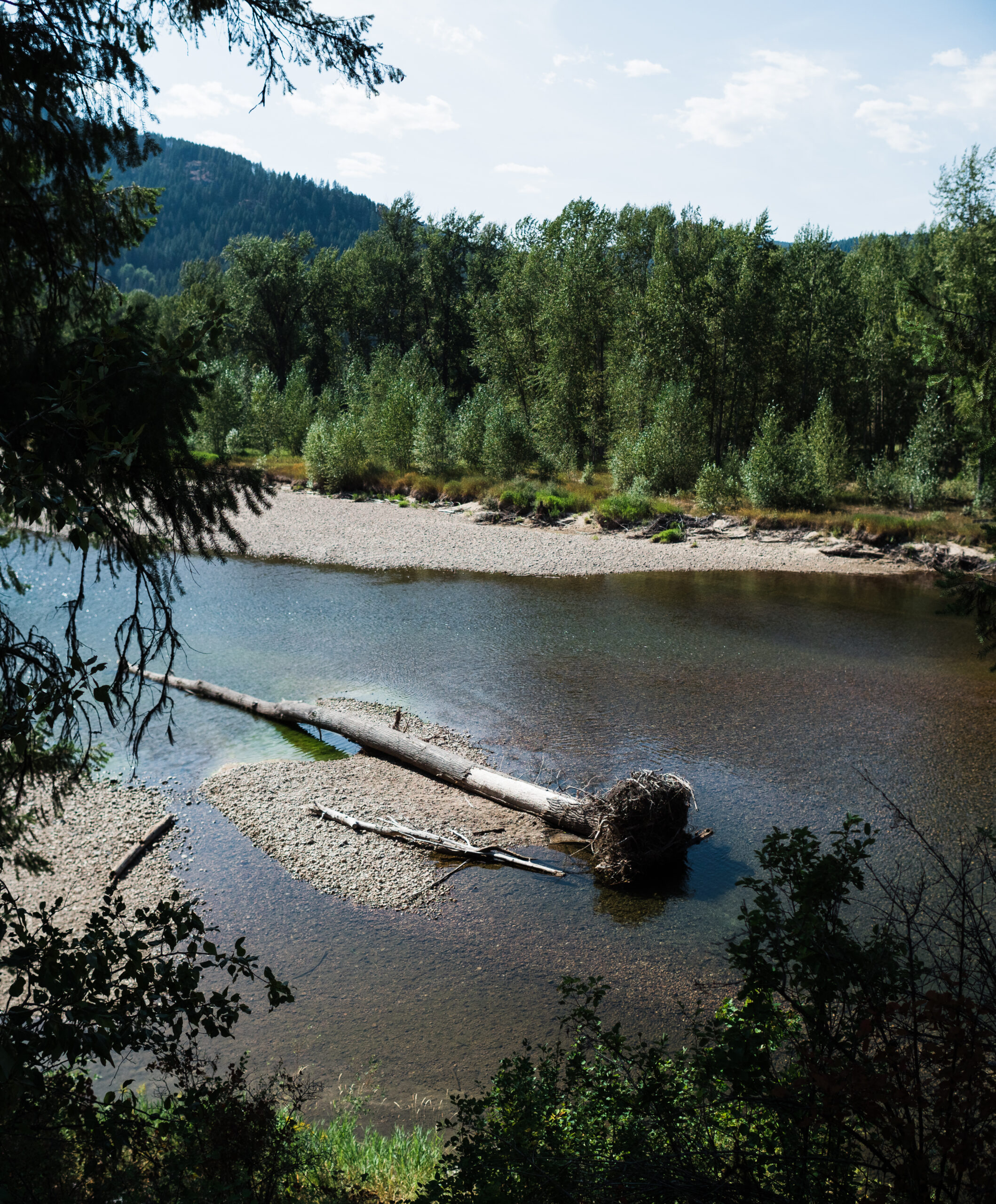
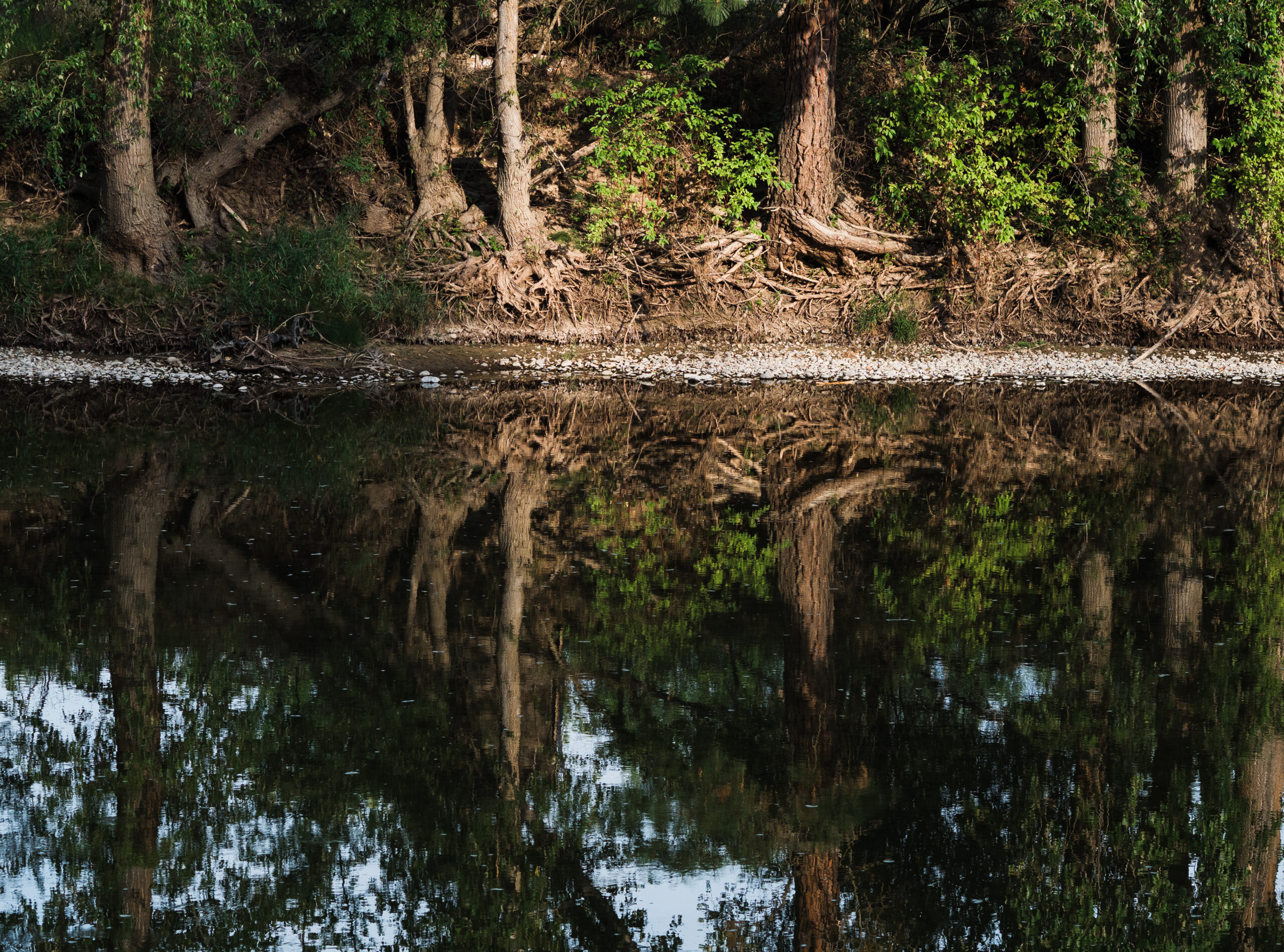
Lynch Creek, a tributary of the Granby River, has run completely dry, as have many of the smaller tributaries in the Kettle Valley watershed, which is experiencing one of its worst drought years on record. Photo by Louis Bockner/The Narwhal 
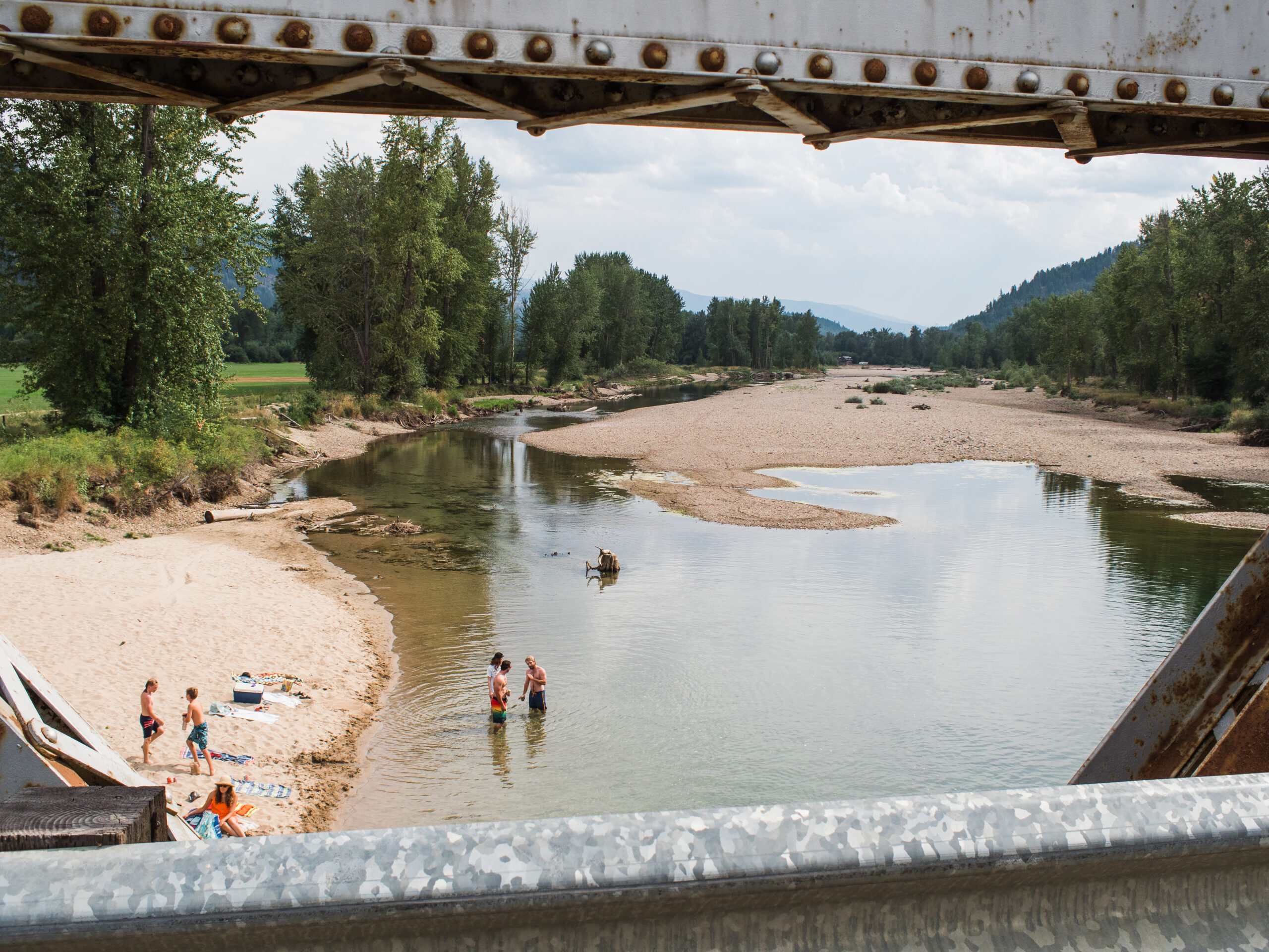
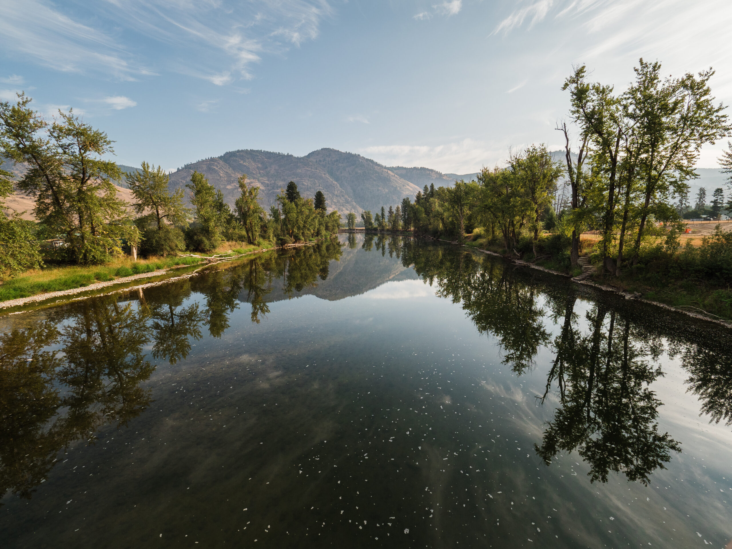
People enjoy the Kettle River just downstream from Grand Forks. The river is a popular place of multi-use recreation, including fishing, tubing and kayaking. However, due to low flows and high water temperatures, fishing has been closed since July 19, 2021. Photo by Louis Bockner/The Narwhal


During the heatwave in June, when air temperatures in Grand Forks reached 48 C for three straight days, water temperatures in the Kettle River spiked to 25 C — a dangerous temperature for the trout that call the river home. This, coupled with low flows, prompted the province to close all streams across the Boundary region to fishing from July 19 to Sept. 15.
Zimmer says that despite being an avid angler, he has rarely fished in the Kettle River since moving to Grand Forks in 1999 because he knows how hard it is for fish to make it in the struggling waterway. “Knowing that the trout are in trouble — knowing that they’re struggling just to survive — makes putting them through more stress unappealing to me.”
Anderson says that one of the major concerns with the river is the “really, really high water temperature.” Shade from overhead vegetation can be an important factor in offsetting that relationship between air temperature and water temperature, she says. But much of the riparian area (the often-lush, transitional zones between water and land) surrounding the river have been degraded or destroyed.
In an emailed response to The Narwhal, the Ministry of Forests accredited the Kettle’s warm temperatures in part to high ambient air temperatures, especially overnight, which “give fish little reprieve.”
Bringing back the riparian
Near the banks of the Granby River, a half hour’s drive north of Grand Forks, tall black cottonwoods rise from a green understory, thick with dogwood, ferns, tall grasses and a myriad of other plant life. A kingfisher appears as a streak of blue, landing for a moment on the outstretched branch of a cedar tree, before returning back to the river’s edge. The air here is cool and the soft, moist earth seems worlds apart from the dusty farmland found only a stone’s throw away.
For Jenny Coleshill, a biologist who coordinates projects for the Granby Wilderness Society, the unique ecosystems found in riparian areas make an important contribution when it comes to limiting the impacts of both droughts and floods.
“Riparian areas help shade the river and provide a lot of both habitat and ecosystem services,” Coleshill says, adding that they can also be a source for seeds and propagation following severe drought and fire events.

Biologist Jenny Coleshill stands in a black cottonwood riparian ecosystem near the Granby River north of Grand Forks. Coleshill, who is the project coordinator for the Granby Wilderness Society, believes riparian areas provide a key in battling both flooding and drought. “You can just walk along in a riparian area and underneath the trees it’s all green,” she says. “They help shade the river and provide a lot of habitat and ecosystem services.” Photo by Louis Bockner/The Narwhal A young boy jumps off a bridge into the Granby River. Photo by Louis Bockner/The Narwhal


According to Coleshill — much like an intact forest higher up in the watershed — low-elevation riparian zones act as buffers between water and land, soaking up water during times of high flow and protecting against floods. Those same zones then release that stored water later in the year, offering much-needed, cooled groundwater to summer streams suffering from low flows and high temperatures.
But even beyond their ability to help regulate flood and drought, for Coleshill, the foremost benefit of healthy riparian zones is habitat.
“Seventy-five per cent of birds in western North America use riparian areas for nesting and over 90 per cent of vertebrates use them at some point in their lifecycle,” she says. “They’re used as travel corridors for animals and they protect our waterways by filtering out bad pollutants, dust and agricultural runoffs.”
Coleshill believes that a lack of regulations governing riparian areas in the Kettle River watershed, coupled with a lack of understanding regarding their ecological importance, has led to a regional history of these areas being damaged or altered. Farmers, who prize low-lying, damp soil clear out riparian zones; cattle trample understories in their search for water and shade; developers wipe them out to create desirable housing near waterways; and settlers of all stripes manipulate them in an effort to control water, whether in the name of agriculture, personal use or safety.
In a riparian threat assessment report that Coleshill co-authored for the Granby Wilderness Society, she performed a historical comparison to showcase the extent of riparian loss in the region. In the city of Grand Forks, it was found that there had been a 50 per cent loss of vegetation within 100 metres of the river — a loss Anderson believes has a negative impact on waterways during times of flood and drought.
And there’s indication that damaged riparian zones can and should be brought back to life. Research published in Ecohydrology in 2018 found that riparian areas disturbed due to cattle ranching could be successfully restored. Researchers Emily Fairfax and Eric Small from the University of Colorado Boulder, used remote sensing to monitor two creeks in Nevada and found reestablished riparian areas were repopulated by beavers, which, in turn, contributed to water retention. This eventually led to resilient, moist areas that provided oases of habitat in an otherwise arid landscape.
“Your intact riparian ecosystem helps with erosion as well as water temperature,” Anderson says. “If you have channels with overhead vegetation you’re able to moderate heat spells like the one we had earlier in June.”
These effects on water temperature and fish habitat are subtle and cumulative, Zimmer says, which makes them difficult to pin down. “It’s not an instantaneous thing but rather what they call a continuum. You can’t point to a certain spot and say ‘Oh, I know exactly what the impact is right here.’ It’s all these cumulative things that happen along the way.”
Yet in this continuum Zimmer also sees a solution, one that Coleshill and others have been working on for years.
“All the problems are stretched out,” he says. “But if you do the reverse and you do little projects here and there, working your way upstream, then you can reestablish those riparian areas.”
Although replanting cottonwoods and native plant species might seem like a simple task Coleshill says it is both challenging and expensive. Naturally sandy soil makes erosion common and white-tail deer, which followed agriculture into the Boundary in the 1920s, feed on small cottonwood shoots, making it almost impossible to replant them without human protection.
Despite this Coleshill and her colleagues at the Granby Wilderness Society have been working with local farmers, ranchers, and residents to establish areas of regrowth. “We’ve probably got 20 landowners across the Boundary that are working on restoration with us on their properties,” she says, adding that she believes riparian projects are the biggest bang for your buck and, as a bonus, they aren’t controversial. “No one can get mad at us or tell us we’re bad for planting trees.”
Sitting in Grand Forks’ City Park, near an informative sign explaining the importance of riparian areas, Zimmer commends those taking these difficult steps towards restoration. “It’s important to do this riparian work because, the alternative is, that we write off this river completely.”

White-tailed deer graze on the green grass of City Park in downtown Grand Forks. The species followed agriculture to the area in the 1920s and have since exploded in population, becoming a common fixture across neighbourhoods and downtown streets. They also impact riparian zones by eating new growth, making it nearly impossible to replant the areas without human protection. Photo: Louis Bockner / The Narwhal 
Sprinklers water a lawn at dawn in Grand Forks. While municipalities and water suppliers have made advisories asking residents to curtail water use, there are no firm regulations in place. Photo by Louis Bockner/The Narwhal


‘People don’t notice the little things’
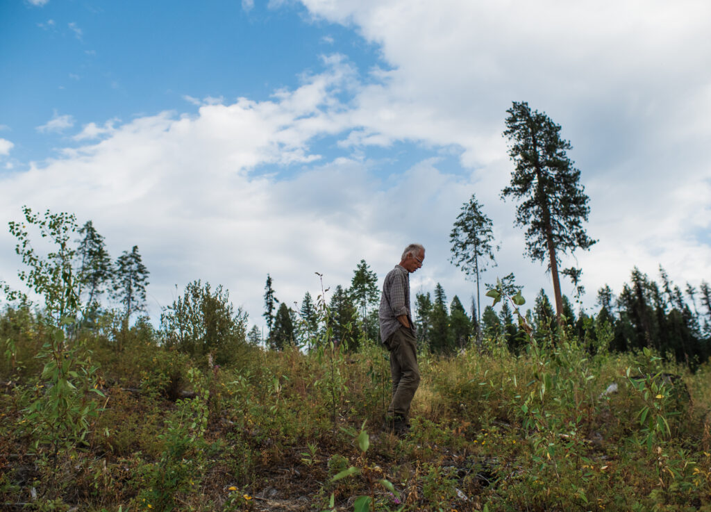
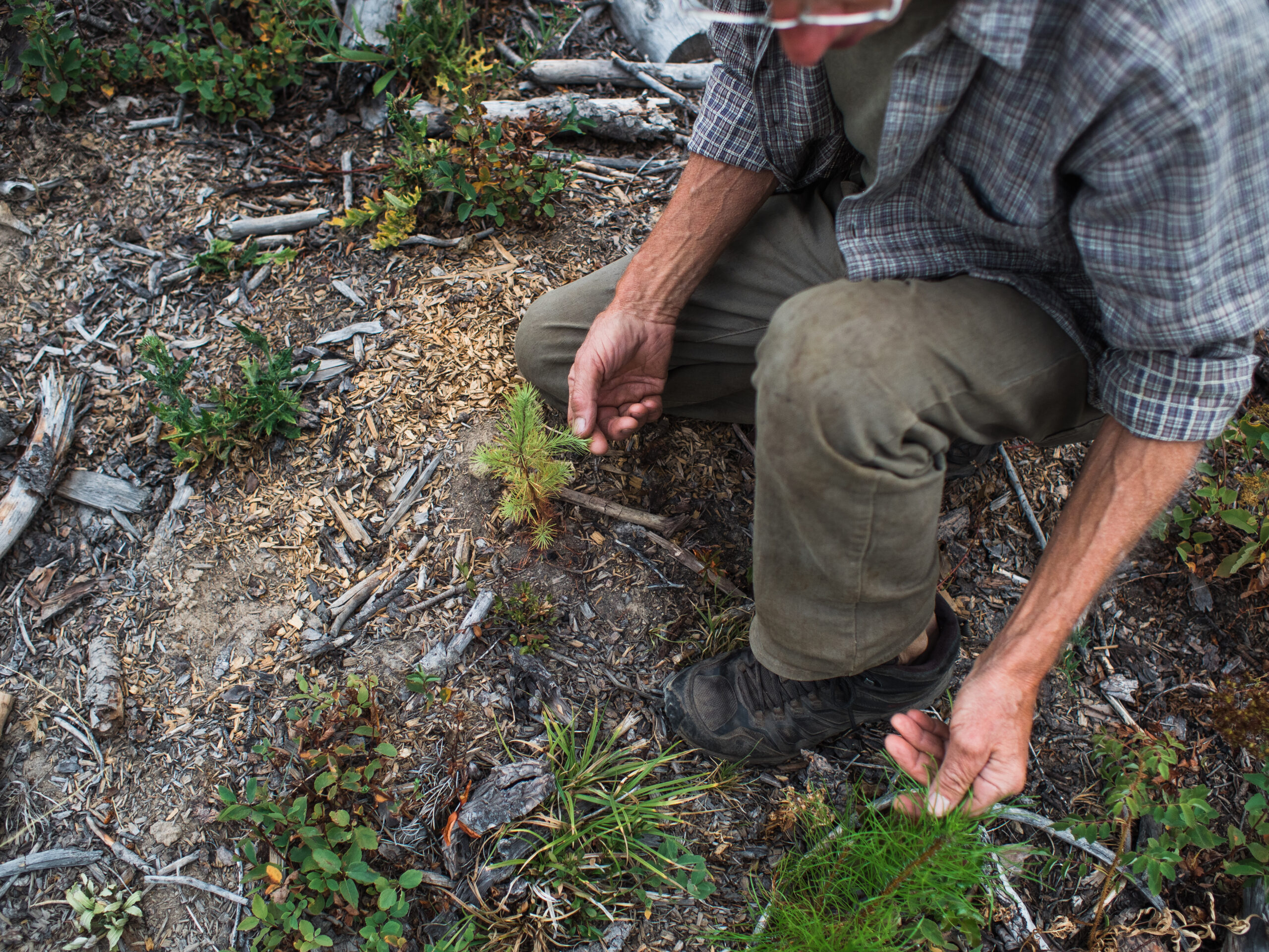
Near the Sand Creek watershed to the northwest of Grand Forks, Dieter Bay walks through a cutblock. Stooping to the ground, he examines a brown, larch seedling planted this spring and shakes his head. This is the second time the block has been planted and with the heatwave, the drought and a lack of overstory to protect these fragile trees, they hardly stood a chance. Bay sighs, slowly rises and continues walking.
Bay, who worked as a landscaper for 30 years, lives with his wife Elizabeth near the lower banks of Sand Creek where it enters the Granby River. They operate a modest, 1.5 acre permaculture market garden and supply a local food co-op with fruits and vegetables, including grapes, apples, raspberries and peaches.

Bay points to a clear cut in the Sand Creek watershed, the same watershed that provides the groundwater for his and his wife’s well. Photo: Louis Bockner / The Narwhal “It just makes me cry,” Bay says in regards to the clearcutting he sees throughout the Kettle Basin’s watersheds. “It’s criminal negligence. It’s greed. It’s money.” Photo Louis Bockner / The Narwhal


With five more cutblocks slated for the Sand Creek watershed, Bay worries for his water source, a well that draws from the same water table that Sand Creek feeds. But more than that, he is deeply concerned about natural ecosystems as a whole and what global losses of habitat and biodiversity means for people and the planet.
“What worries me is that people don’t notice the little things,” he says. “It’s like the whole world is a symphony and if one violinist stops playing nobody notices. But if 50 violinists stop, then all of a sudden it doesn’t sound the same anymore. If you look at it as a net of life, the holes get bigger and bigger with every species disappearing.”
Originally from Germany, Bay has experienced this species loss first hand and worries that Canada, known for its wilderness, wildlife and freshwater is slowly following suit.
“That kind of scenario worries me a lot because it’s almost undetectable,” he says. “The forest relies on a healthy water table and we rely on a healthy forest. It’s all connected. It’s that simple.”
To the Syilx Okanagan people, whose traditional territory includes the Kettle basin, this connection to water — or siwɬkʷ — is everything. Siwɬkʷ in nsyilxcən, the language spoken by the Syilx Okanagan, translates into “humans and animals lapping water equally.” To Tessa Terbasket, a member of the Lower Similkameen Indian Band who works for the Okanagan Nation Alliance in natural resources, this is a clear indication that water needs to be respected and kept healthy.
“I think one of the biggest challenges in our work is to try and get others to see that water is a living entity and not just a resource that we can control,” she says. “It’s for all life and we’re only a small piece of that.”
She also sees years like this, when water is scarce, as an opportunity to spark change and raise awareness around its use and conservation. “In times of drought you really see what water brings and that it’s really the essence of all life,’ she says. “There’s just so much to be learned and I think youth awareness and more water outreach in our education system is a good place to start enhancing [our] relationship with water.”
Back in Grand Forks, Zimmer glances out at the low, slow-moving water of the Kettle River.
“All the things that are happening here,” he says, “whether it’s medicines, things you can eat, or water you can drink, is our responsibility to take care of so it’s always there for generations, not just right now.”
The Narwhal’s When in Drought series is funded by the Real Estate Foundation of BC, which administers the Healthy Watersheds Initiative, and the BC Freshwater Legacy Initiative, a project of the MakeWay Foundation. As per The Narwhal’s editorial independence policy, no foundation or outside organization has editorial input into our stories.