The federal government ‘sees a long-term future for the oilsands.’ Here’s what you need to know
An internal document obtained by The Narwhal shows how the natural resources minister was briefed...
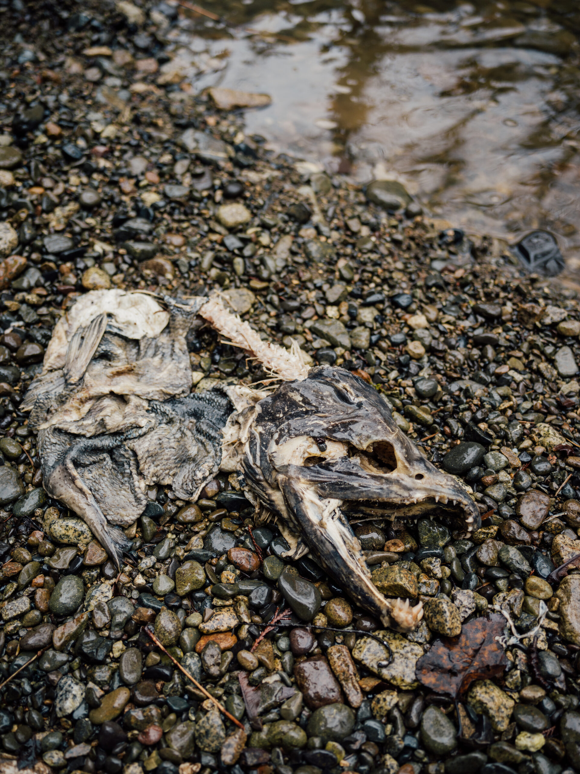
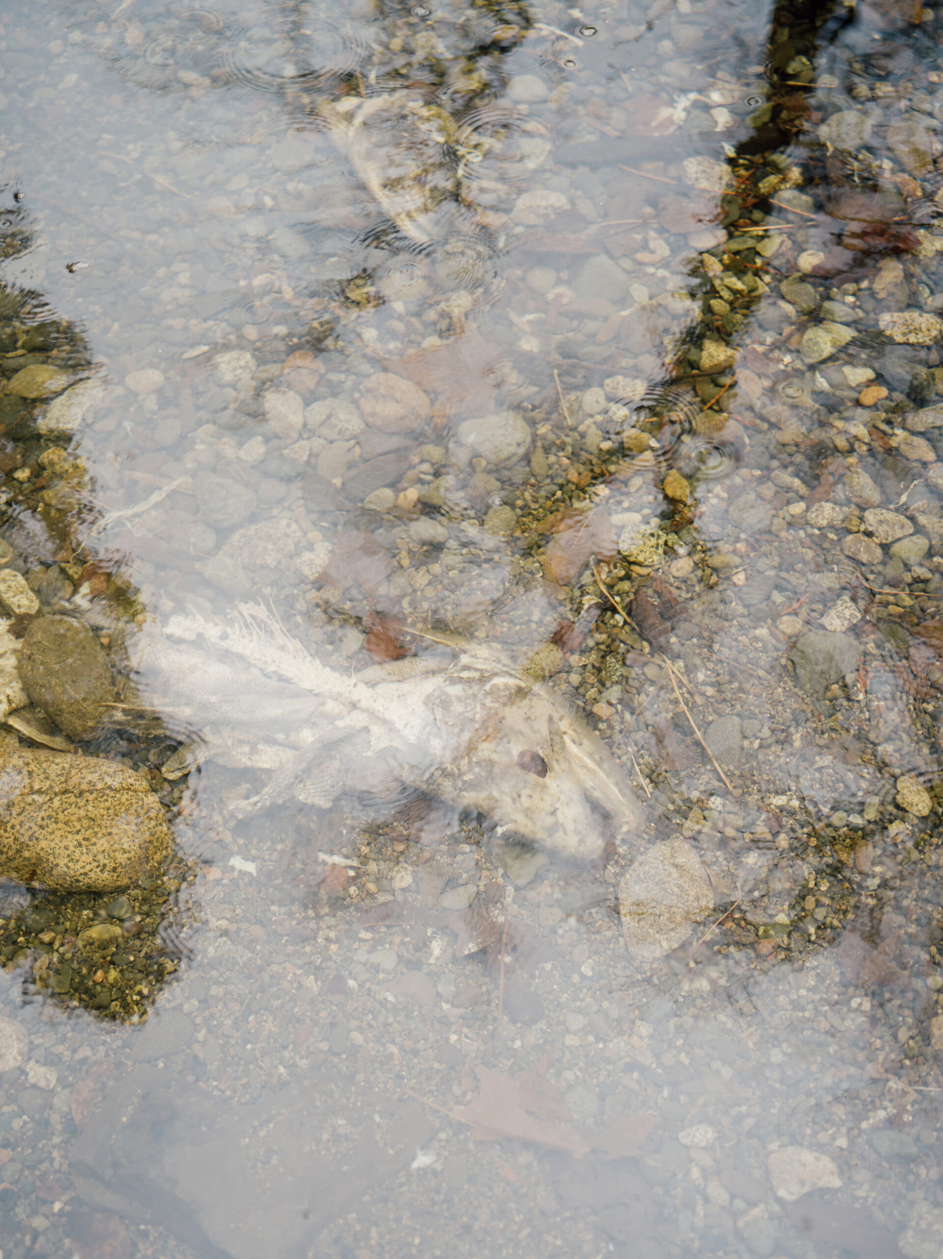
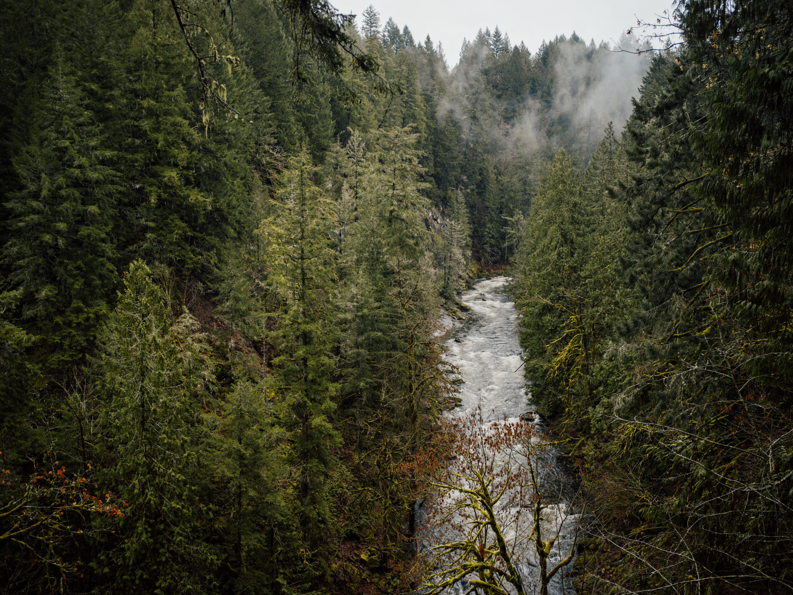
The rain is pounding relentlessly, stirring up silt in muddy side channels of the Koksilah River on eastern Vancouver Island, where a few picked-over chum salmon carcasses attract the attention of eagles. In the adjacent, fast-flowing main channel, mergansers gracefully ride the rough water while an ambitious seal has made its way kilometres up-river to snack on what remains of the season’s salmon run.
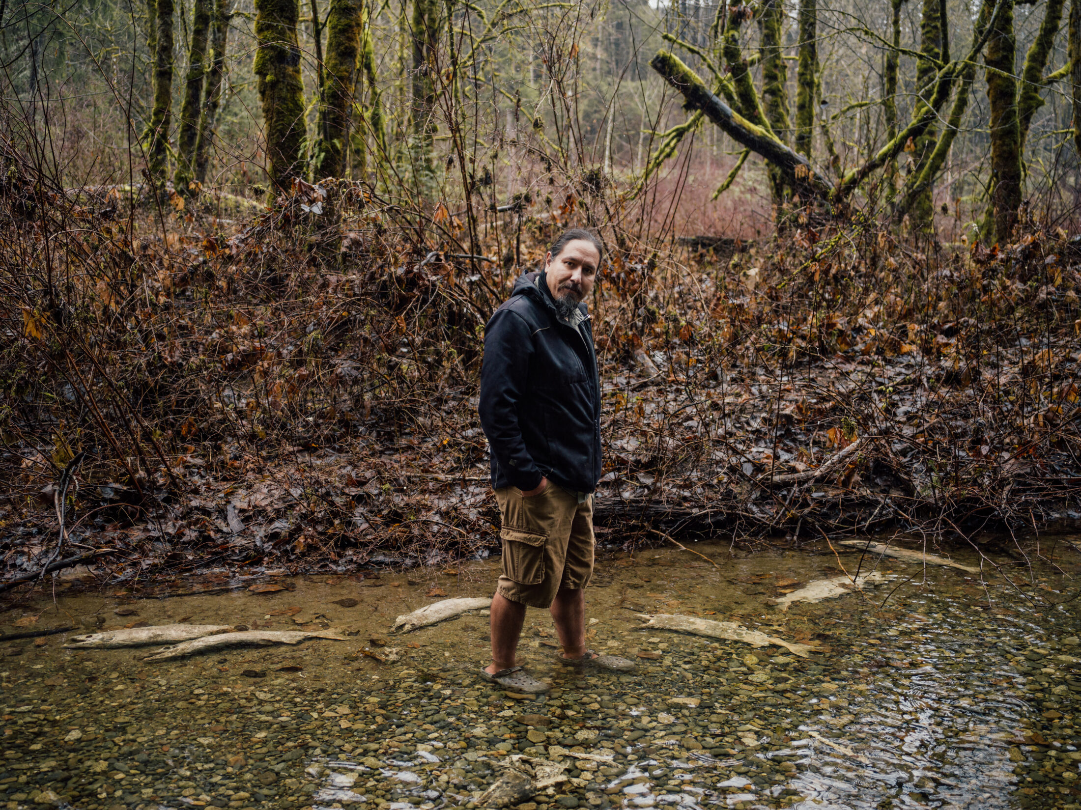
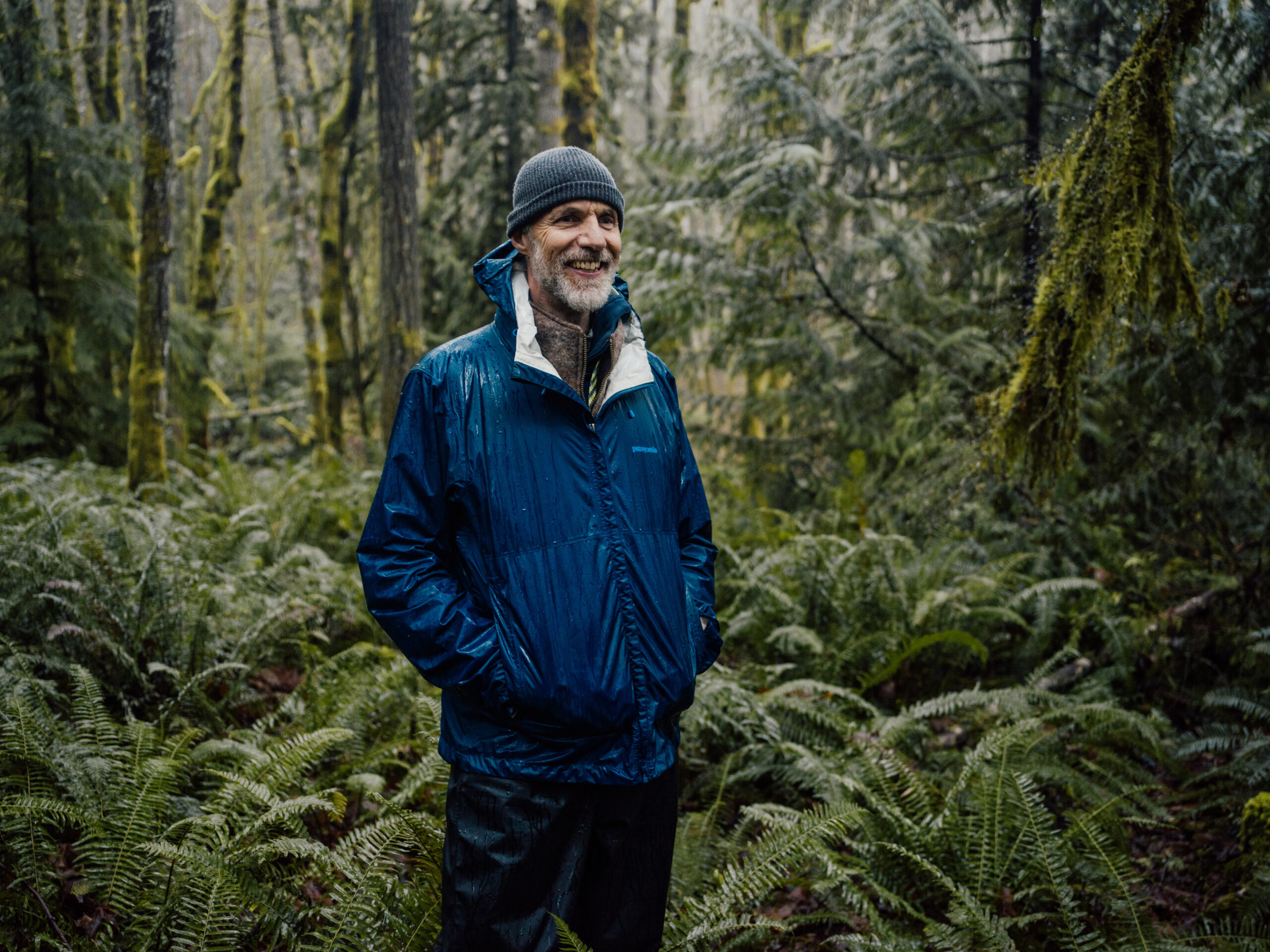
Ignoring the December chill, Tim Kulchyski, Cowichan Tribes fisheries biologist and resource consultant, wades into a channel wearing shorts and Crocs to gauge the water’s flow and assess the decaying fish.
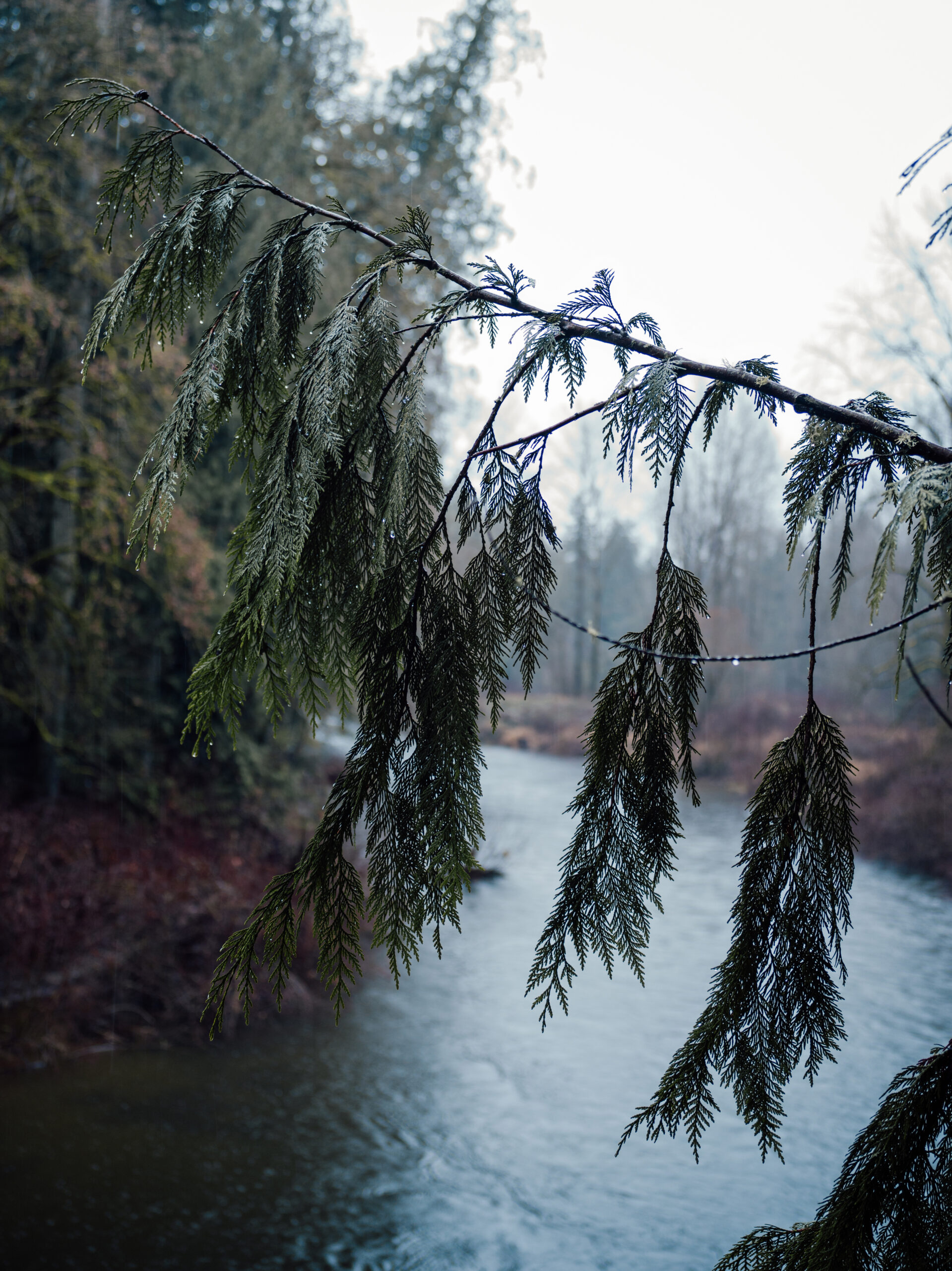
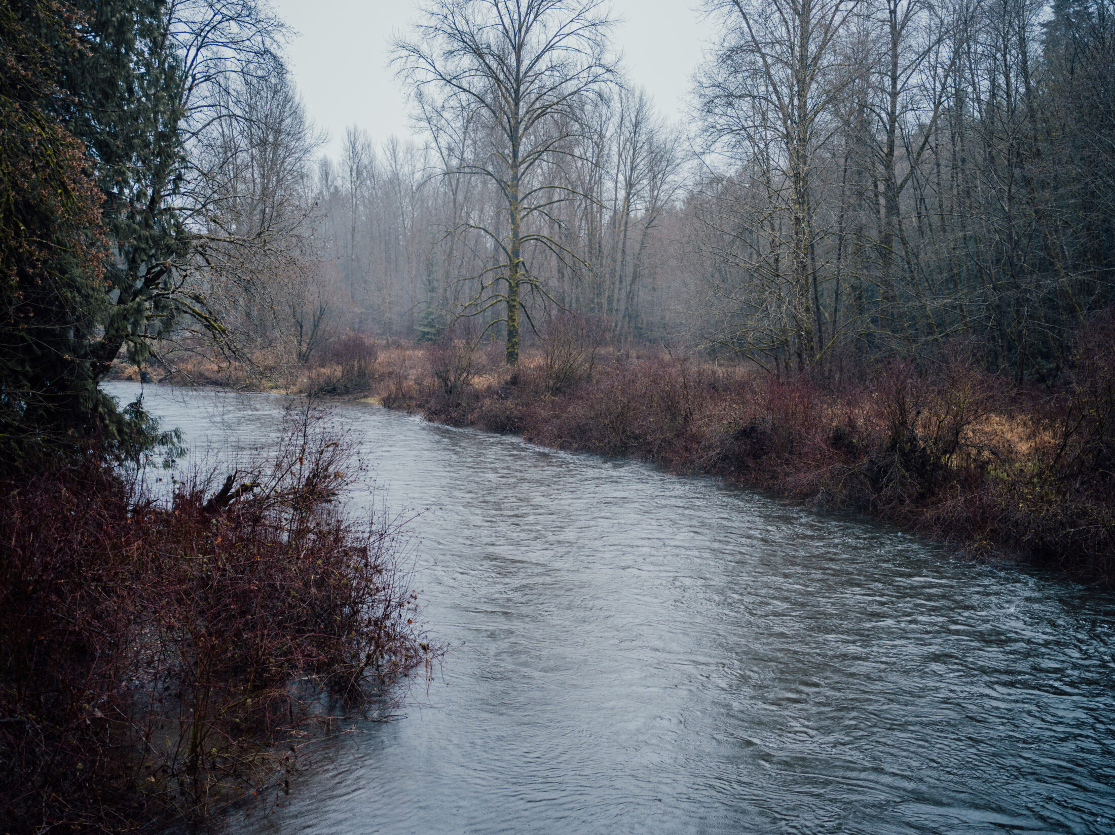
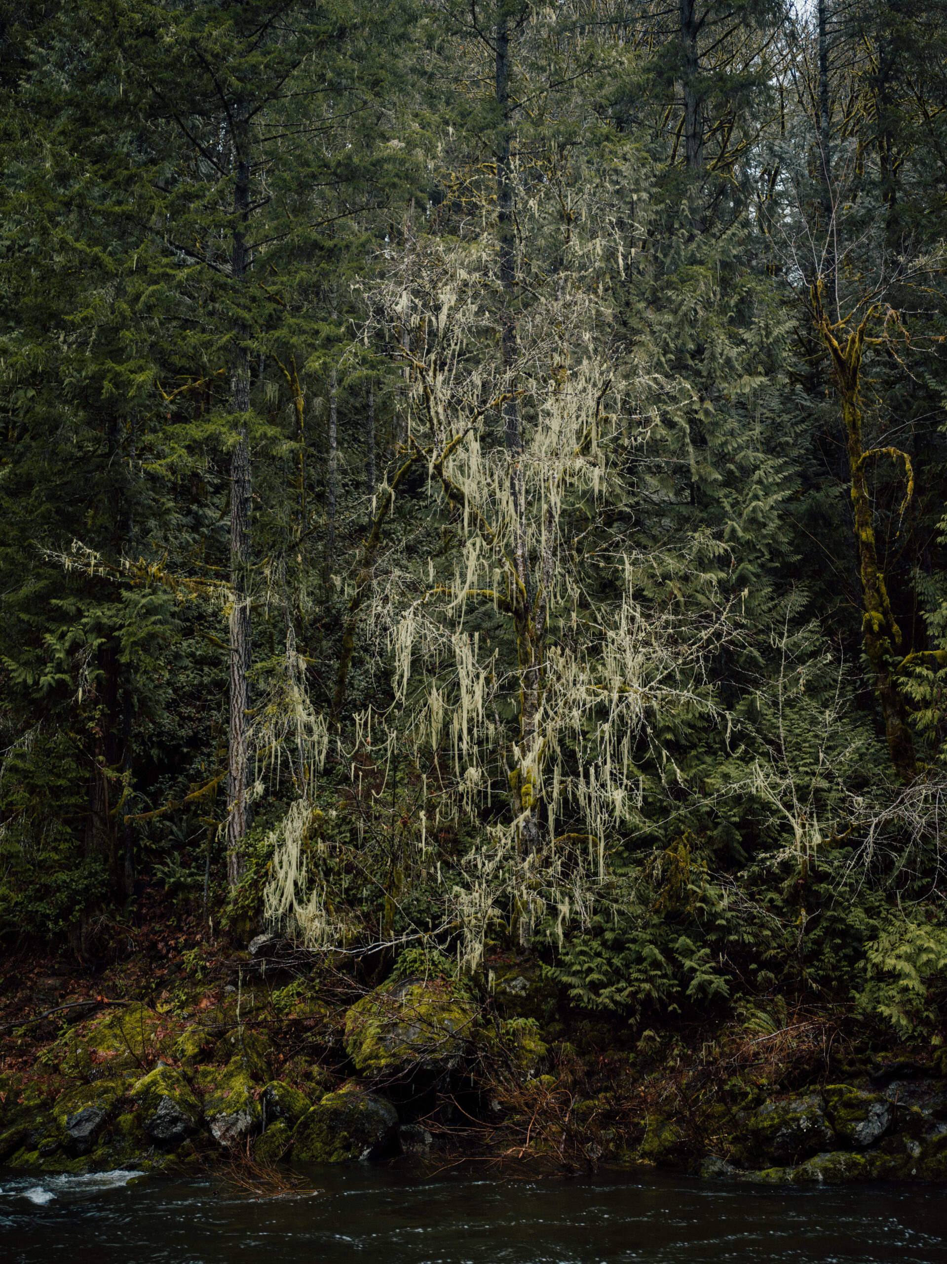
Surrounded by scenic forests, acreages and farms, the Koksilah originates on the slopes of Waterloo Mountain, southwest of Shawnigan Lake, and flows through the Cowichan Valley eastward for 44 kilometres before emptying into the Strait of Georgia. The river races through rocky canyons, waterfalls and rapids, descending a total of 550 metres before reaching the shared Cowichan/Koksilah estuary where the flow slows and widens among fans of sand and gravel.
Standing on the edge of the river’s emerald green waters — which teem with steelhead and cutthroat trout and, every fall, see the return of chinook, coho and chum salmon — you would be forgiven for not knowing the Koksilah is a river in crisis.
Though the river’s bounty has sustained Cowichan Tribes since time immemorial, the health of the Koksilah and its salmon are on the decline.
“Take a species like chinook,” Kulchyski says. “You could catch a 90 pound chinook in our system years ago. Now if you catch a 30 or 40 pound fish it is like ‘wow, amazing.’ With 10 or 12 pounds you are still pretty happy.”
Tim Kulchyski, Cowichan Tribes member and fisheries biologist, stands in the Koksilah River in Bright Angel Park. Photo: Taylor Roades / The Narwhal
A decaying chum salmon at the end of its lifecycle along the banks of the Koksilah River. Photo: Taylor Roades / The Narwhal
The Koksilah is a spawning river for chinook, coho and chum salmon. Although in recent years, the health of the runs has been imperilled by low river flows in the summer. Photo: Taylor Roades / The Narwhal
The challenges that face the Koksilah and the Cowichan River — the Koksilah’s larger and more famous neighbour — threaten not only fish but also the lifestyles and economy of the rapidly growing Cowichan Valley. Local Indigenous communities, forestry operations, farmers and homeowners are all dependent on water from the rivers and the aquifers they sustain — a dependency that is becoming more apparent and worrisome in recent years.
Hydrological changes, wrought by climate change, are exacerbating the Koksilah River’s tendency to alternate between drought and flash floods. Both extremes are affecting the cleanliness and availability of the water, which in turn affects the survival of salmon.
In times of drought, low water flows can prevent fish from reaching their spawning grounds. Floods can wash away gravel, obliterating spawning beds. Warmer weather can also mean warmer water, which can be dangerous to sensitive fish species adapted to survive and reproduce only within certain temperature ranges.
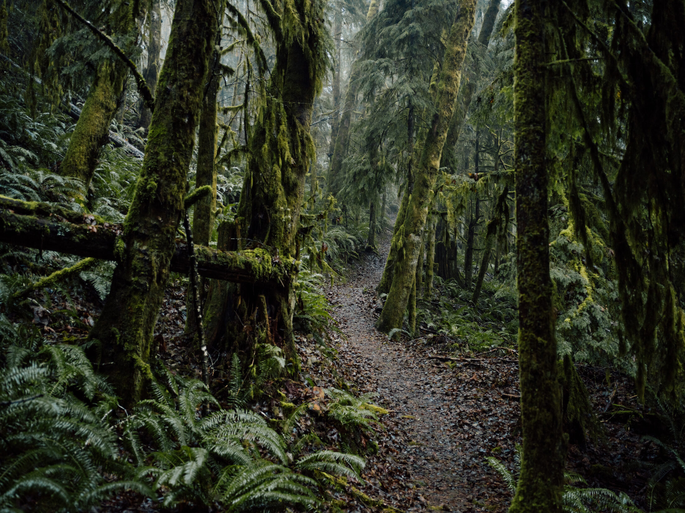
For the Koksilah, climate change is adding pressure to a water system already impacted by a very active forestry industry which, through decades of logging, has left ancient forests crisscrossed with roads and slopes denuded of trees. The presence of roads and the absence of trees in watersheds can dramatically increase the amount of silt and debris that washes into waterways. During heavy rainstorms, which are now happening with greater frequency in the region, water now runs into rivers faster than when old-growth forests acted like sponges, slowly absorbing and releasing moisture.
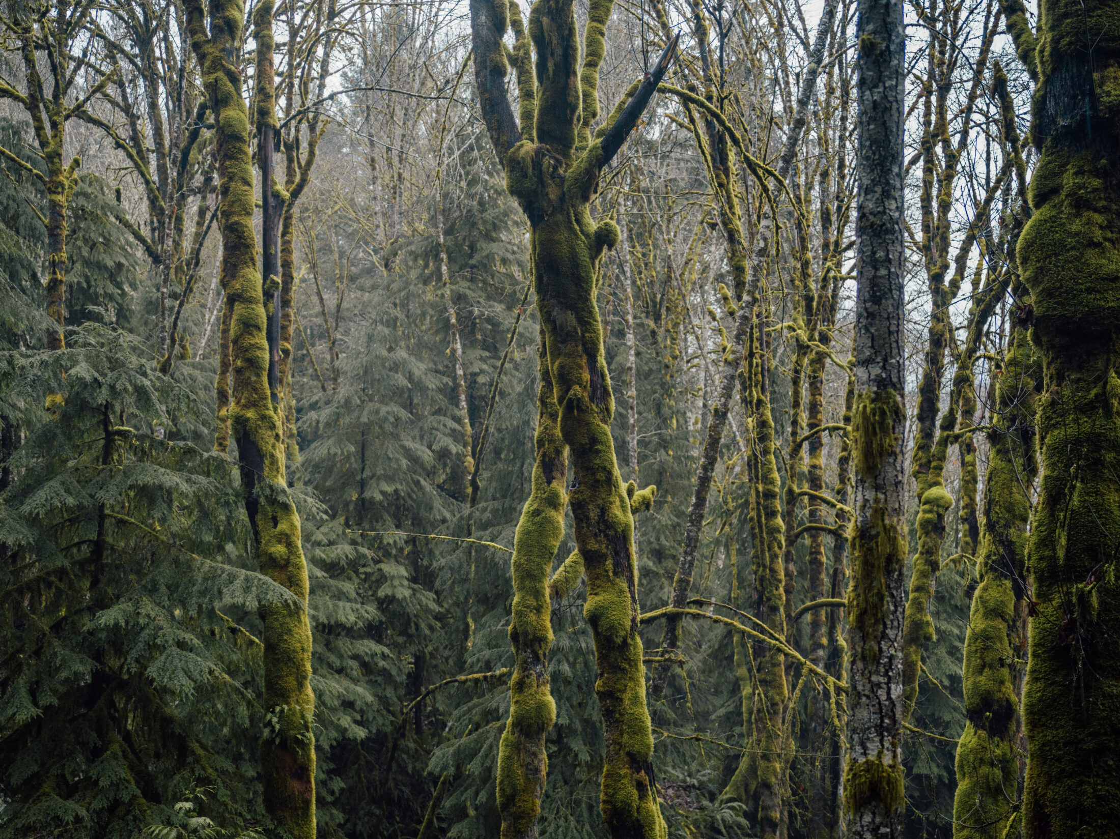
Forests in the Koksilah watershed have been intensively logged over the last century and a half. Photo: Taylor Roades / The Narwhal
Overall, the river’s water levels are lower than in previous years and the region’s water reserves are depleting, with deep wells beginning to run dry. Tests show some aquifer levels have dropped by 30 metres.
During the last 150 years of intensive development and logging in the region, only one per cent of the Koksilah watershed has been left intact.
“There’s a lot of angst, there’s a lot of despair with climate change and development pressures and logging and all these things that people don’t feel they can do anything about,” Kulchyski says.
But there is hope.
The province of B.C. and Cowichan Tribes, B.C.’s largest First Nations band, have signed an interim agreement and are on their way to creating the province’s first-ever water sustainability plan under the 2016 Water Sustainability Act.
If Cowichan Tribes and B.C. can flesh out a final agreement, the resulting plan could become a showcase for watershed stewardship province-wide. But getting there is going to require the cross-sector buy-in of all Koksilah water users from vintners, to foresters, to Indigenous fisher, to kayakers and everyone else in between.
The first challenge is bringing everyone to the same table.
The new Water Sustainability Act represents a sea change from the former B.C. Water Act, enacted in 1909. In the intervening century, policy wonks and ecologists alike have learned that watersheds can’t be managed for economic interests alone.
Just as water resources tend to serve diverse — and sometimes competing — needs, so too must modern water rules.
The challenge for the community dependent on the Koksilah watershed is balancing the needs of various water users — some of which may have very different ideas of what a sustainable plan for water management in the Cowichan Valley might look like.
“ … what goes on in the land affects the water.”
Finding that balance starts with making up for lost consultations and conversations, says Tom Rutherford, executive director of Cowichan Watershed Board, a partnership between Cowichan Tribes and the Cowichan Valley Regional District.
“The people who manage fish don’t talk to the people who manage forests, who don’t talk to the people who manage water, who don’t talk to the people who manage linear development,” he says. “It’s like we are all in our little silos and that’s not the way this works.”
It’s no easy task to convince myriad sectors — including those with substantial financial interests — that potentially painful changes are necessary to protect the river, says Rutherford, who is a former federal fisheries biologist and a member of the steering committee for the B.C. and Cowichan Tribes’ Water Sustainability Plan Scoping Initiative.
Tom Rutherford is a resident of the Koksilah watershed and executive director of Cowichan Watershed Board, one of the partners engaged in the creation of the Koksilah watershed sustainability plan. More collaboration is needed to develop a robust strategy to bring the Koksilah River back to health, Rutherford tells The Narwhal. “It’s like we are all in our little silos,” he says. Photo: Taylor Roades / The Narwhal
The province and Cowichan Tribes are in the lead, “but unless the farmers and the horse people and the wine people and kayakers understand and support what is going on, it is not going to happen,” Rutherford says.
“The cool thing about this is, if it happens, it is not just a plan, it’s an enforceable plan, so it could be a lever not only to influence water use, but land use,” Rutherford says. This is important for the Koksilah watershed, a place where it is increasingly clear that “what goes on in the land affects the water.”
A community-based scoping process underway is already yielding important insights. Last year, a survey conducted by Modus Planning and Design found that a high percentage of local residents, both Indigenous and non-Indigenous, reported feeling a deep spiritual and cultural connection to the watershed. However, the survey also surfaced another, more challenging finding: while almost all respondents agreed personal responsibility must be part of the equation, answers to a question on water conservation revealed most people do not see themselves as the problem.
“The vast majority of respondents were very detailed about what other
people could do to conserve water: ‘those farmers are using too much water, those loggers shouldn’t be cutting the trees, there are new people drilling wells,’ ” Rutherford says.
“So that’s a challenge.”
And the stakes of that challenge are increasing by the day.
The Cowichan Valley saw a population mini-spike between 2011 and 2016, with a 4.2 per cent increase; and in 2018, it had the fourth highest regional growth rate in the province at 1.7 per cent over 12 months, according to BCStats. On the region’s First Nations reserves, the population grew by 13.3 per cent between 2006 and 2016.
The Cowichan Valley Regional District expects that this growth will continue, reporting a projected growth rate of 28 per cent between 2017 and 2050, with the number of residents increasing from 85,234 to 108,905.
A 2018 study conducted by the Watershed Watch Salmon Society estimates that 70 per cent of water used in the Koksilah watershed is well water drawn from aquifers. The report notes that an uptick in the drilling of wells in the watershed began back in the 1980s, long before any groundwater regulations were in existence. And although the province now requires property owners to register groundwater extraction, any retroactive efforts to close off wells would likely be met with strong opposition.
About 15 per cent of the lower watershed is agricultural, so the list of water users includes the wineries, the vegetable, beef and dairy farms, the poultry operations and countless small hobby farms that collectively make the Cowichan Valley such a charming place to live.
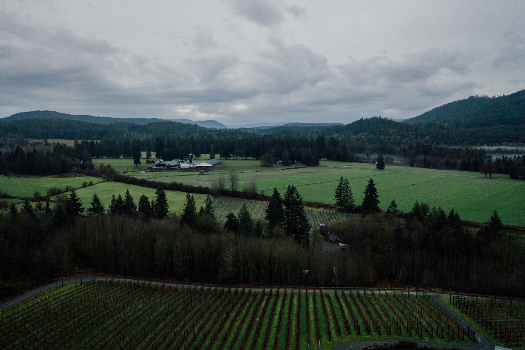
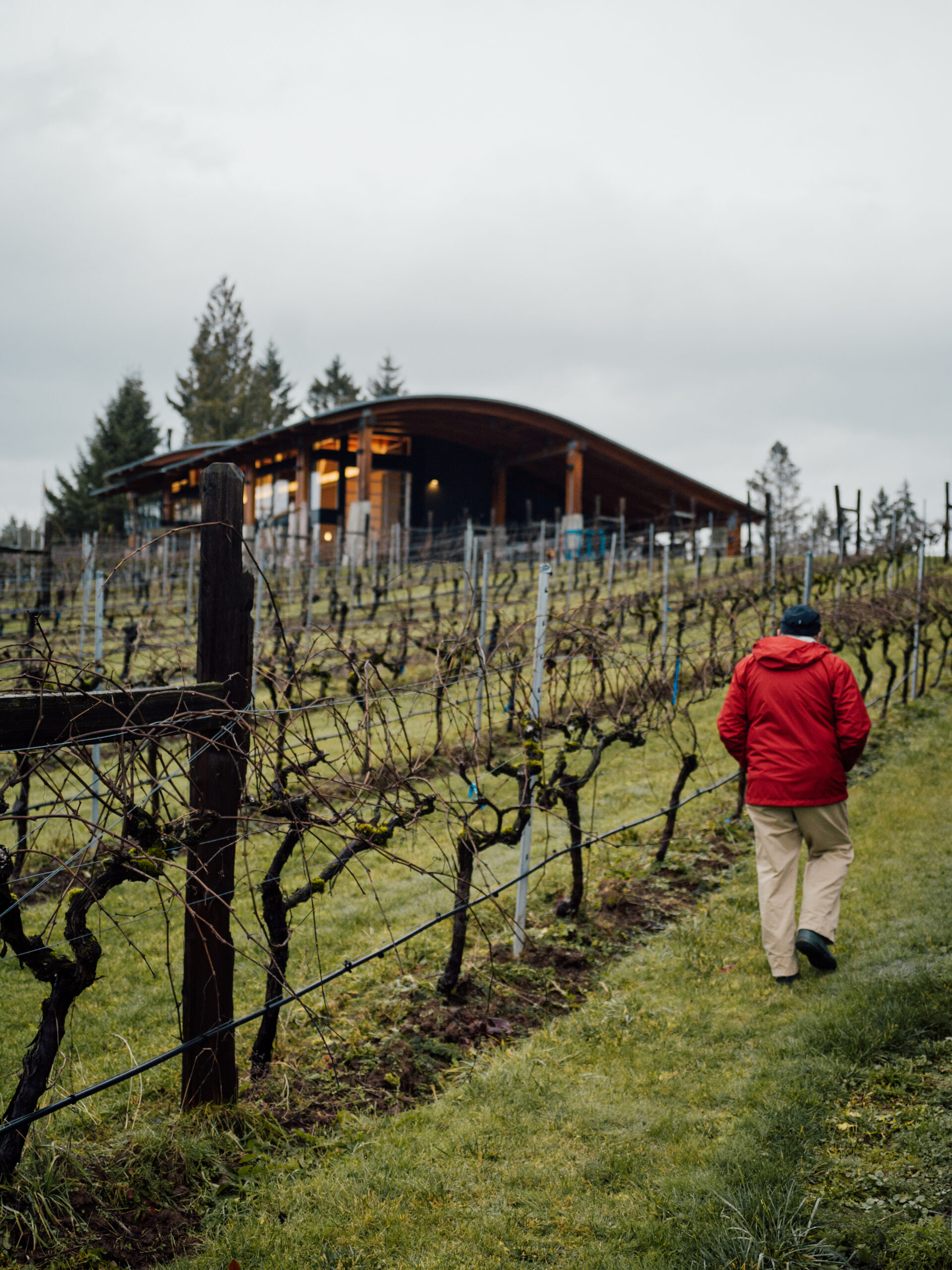
Blue Grouse Vineyards in the Koksilah watershed. In 2017 the Cowichan Valley was home to 85,234 residents. That figure is expected to climb to 108,905 by 2050. The vast majority of the Koksilah wastershed’s population in the valley relies on well water drawn from groundwater. Photo: Taylor Roades / The Narwhal
And, increasingly, the Koksilah is becoming a prized recreational destination. Kayakers are drawn to the river’s canyons and challenging rapids, while families flock to popular swimming and picnic areas such as Bright Angel Park.
But while the watershed is populated by a myriad of water users, decision-making authority over industrial activity in the area, particularly logging, is not equally distributed. Almost 80 per cent of the 30,000-hectare Koksilah watershed is privately managed forest land, with 65 per cent of the watershed controlled by Mosaic Forest Management, an amalgamation of TimberWest and Island Timberlands.
Achieving buy-in across the board, especially when a water plan will inevitably require farms and businesses to use less water, is going to be difficult, Rutherford says. It will require a kind of coordinated and holistic approach to water management that B.C. hasn’t seen before.
But this isn’t news to the Cowichan Tribes, Kulchyski says. They’ve known for decades that communication, collaboration, and relationship-building are the keys to building a foundation for change.
“When did confrontation benefit anyone?” Kulchyski asks, sharing the Hul’qumi’num phrase “mukw’stem ‘o’ slhihukw’tul” — “everything is interconnected.”
“Collaboration is the only way to get anything done. … Communication and relationship-building are absolutely the crucial foundation.”
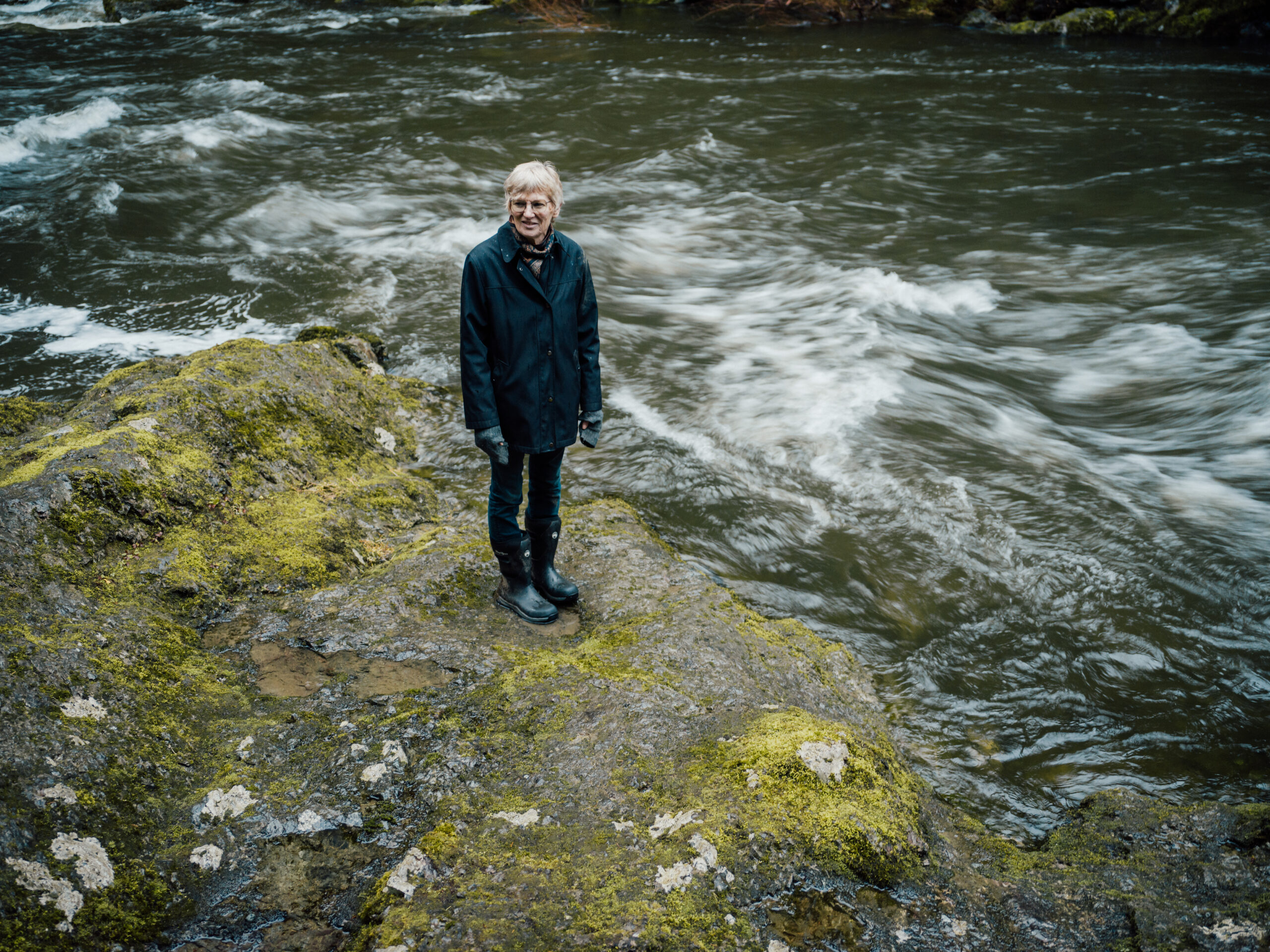
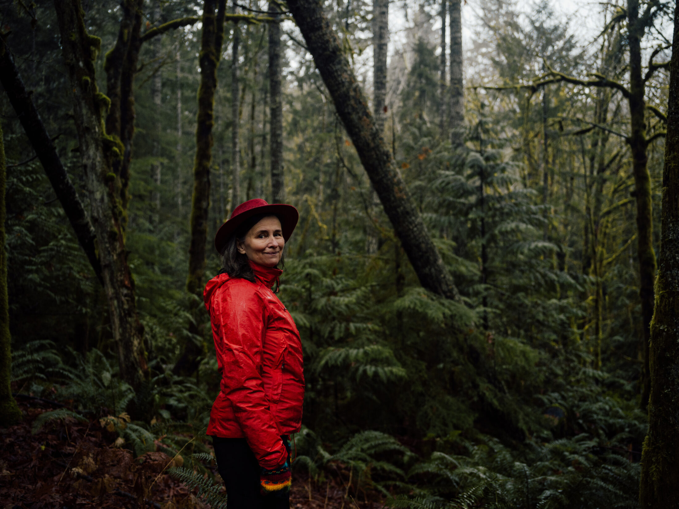
Cheri Ayers, a biologist, fisheries consultant and hobby farmer, has lived in the watershed all her life and has taken note as people flooded into the Cowichan Valley, putting greater demands on the water supply.
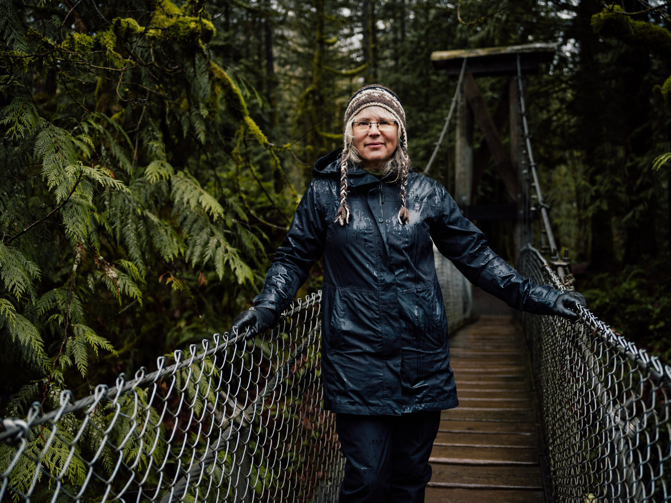
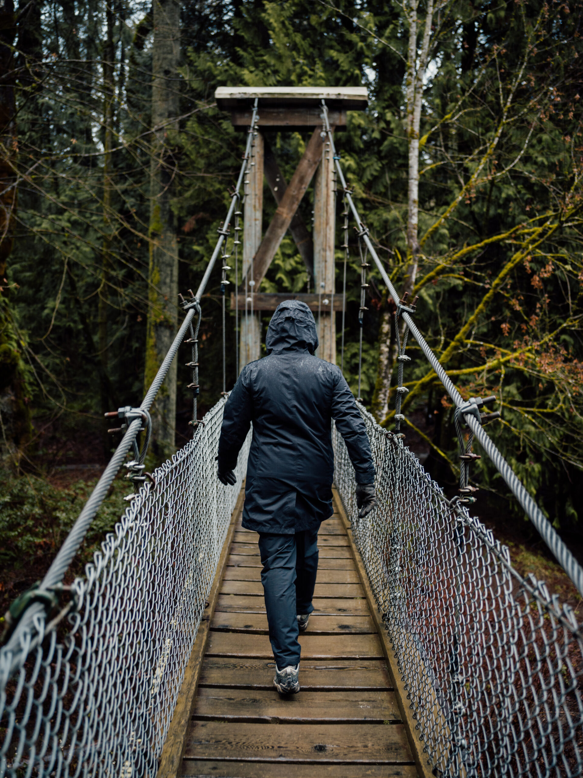
Standing on a small suspension bridge in Bright Angel Park, Ayers casts her gaze down to the river’s surface. “It is clear that the river needs help,” she says.
“As a child I swam right here in the river in big deep pools. I used to jump off trees into pools down here and now [in the summer] there is not the depth to do that. [The pools] are very shallow and lots of sediment has moved in from land development,” she says.
Cheri Ayers, a biologist, hobby farmer and lifetime Koksilah watershed resident, says she has seen a significant decline in the river’s levels and water quality since she was a child. Photo: Taylor Roades / The Narwhal
Bright Angel Park is a popular recreation destination along the Koksilah River. Photo: Taylor Roades / The Narwhal
Ayers, who has lived along the Koksilah all her life, says “it is clear that the river needs help.” Photo: Taylor Roades / The Narwhal
The river’s dramatic water fluctuation is something being tangibly felt by many in the watershed.
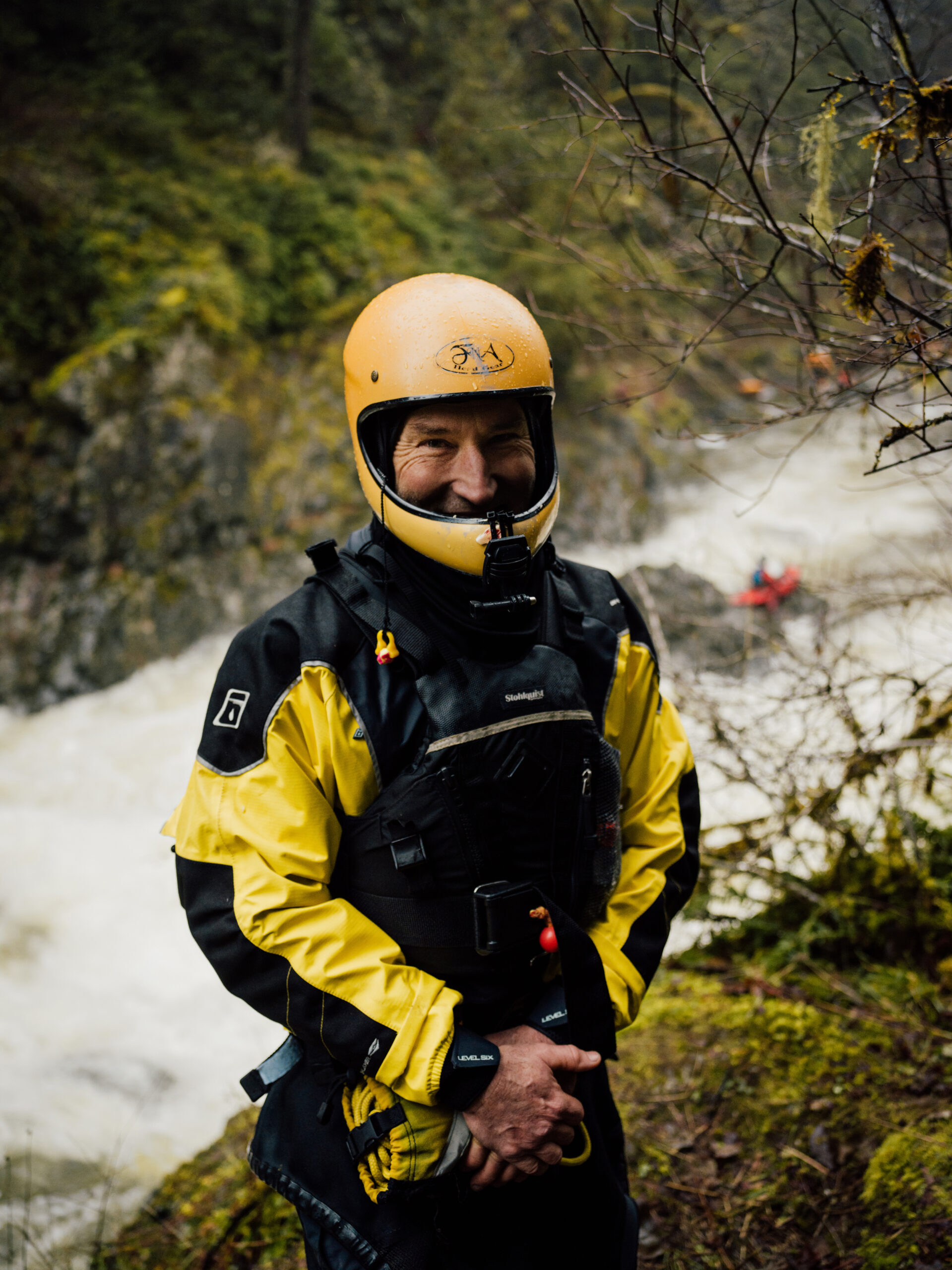
As we watch more than two dozen paddlers being tossed in churning whitewater rapids, avid whitewater kayaker Steve Mcgeragle of the Vancouver Island Whitewater Paddling Society describes the Koksilah as a fantastic whitewater resource.
But, he adds, the Koksilah is not like it used to be.
“Nowadays we get a lot more of these big spikes up and down, so we get extremes in water levels and it leads to a bit of unpredictability,” he says.
“Is there something going on further up in the watershed that is making these fluctuations so great, with low water in summer, or it is the total package of climate change? I guess more research is needed,” Mcgeragle says. The Cowichan Valley Regional District’s climate projections indicate the region can expect five per cent more precipitation by the 2050s. But this increased precipitation is anticipated to arrive during extreme weather events in the fall and winter, while summer precipitation is expected to decline by 17 per cent.
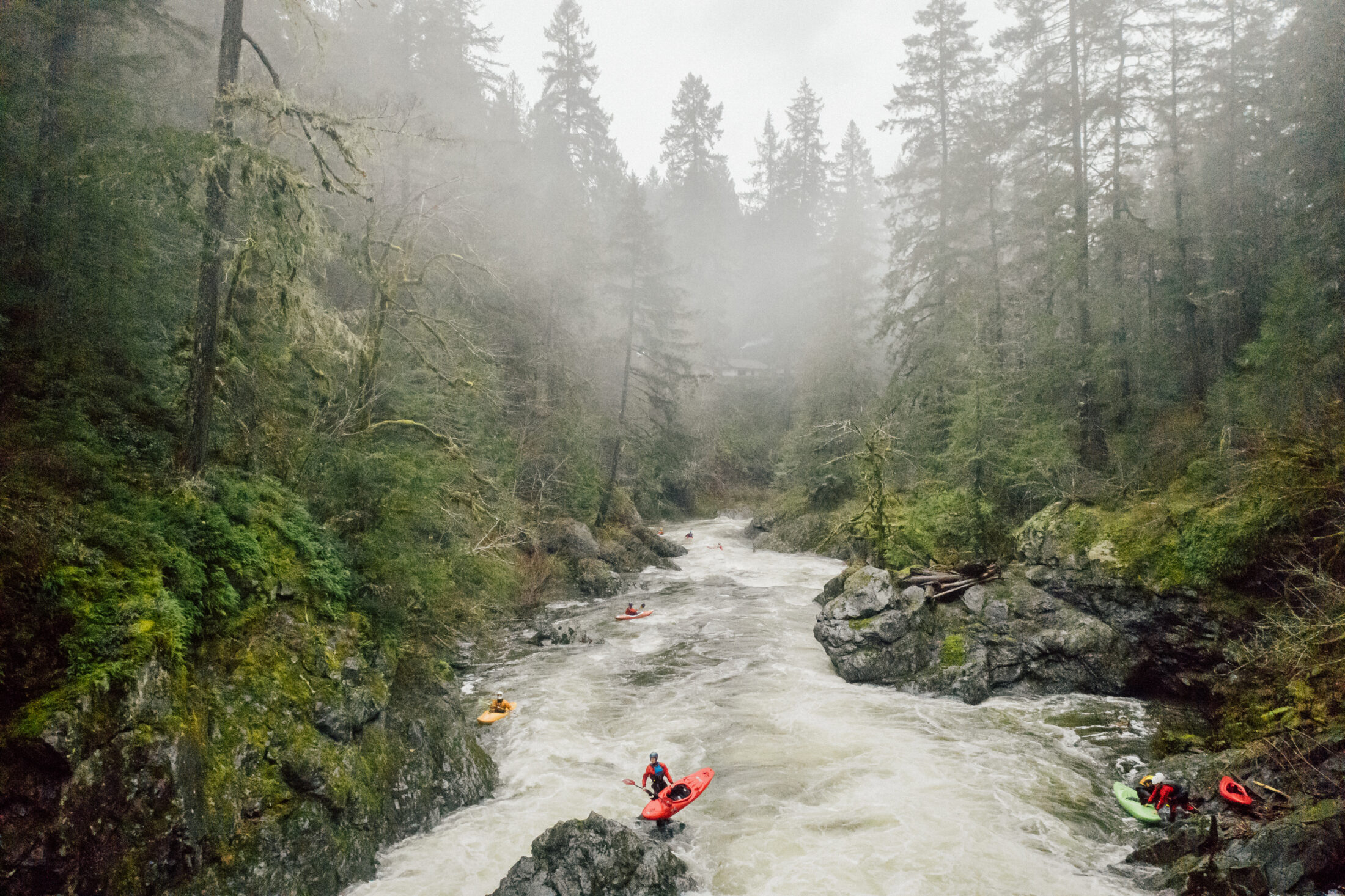
Whitewater kayakers are drawn to the Koksilah River’s rapids. Although some kayakers have noticed in recent years the river’s flow has become less predictable. Photo: Taylor Roades / The Narwhal
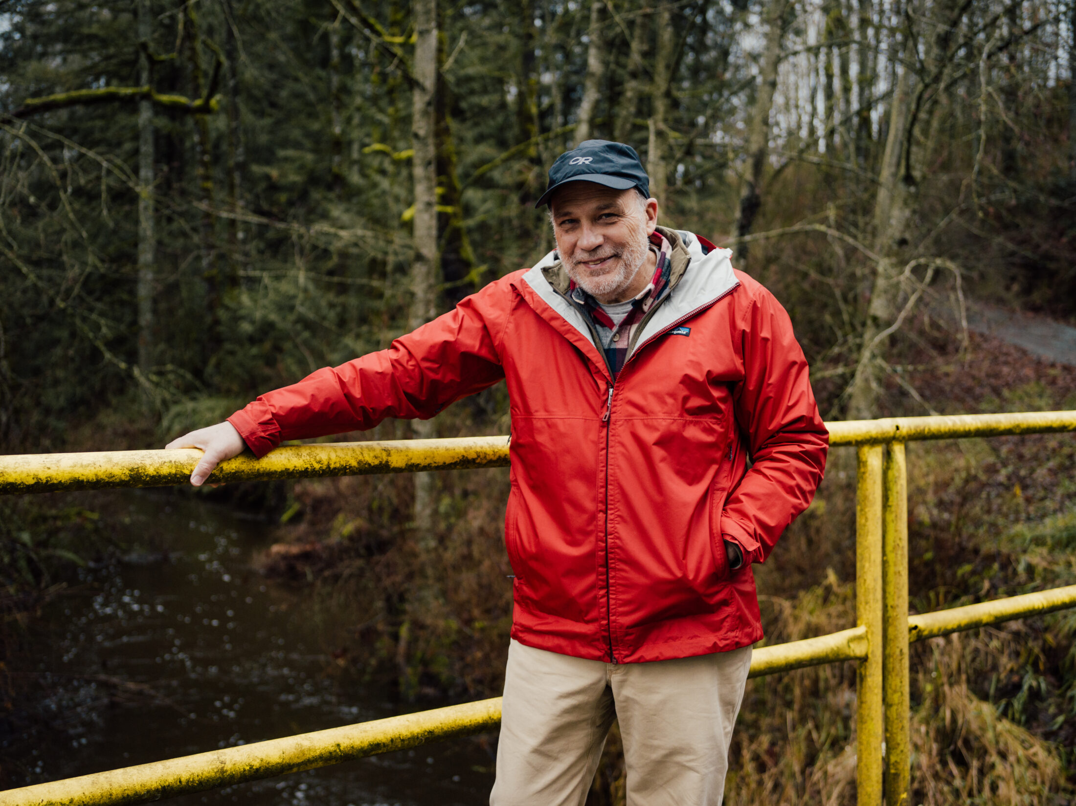
Stephen Hunt is a whitewater kayaker and a local blueberry farmer. Hunt is photographed here just before his run down the raging Koksilah in a kayak. Photo: Taylor Roades / The Narwhal
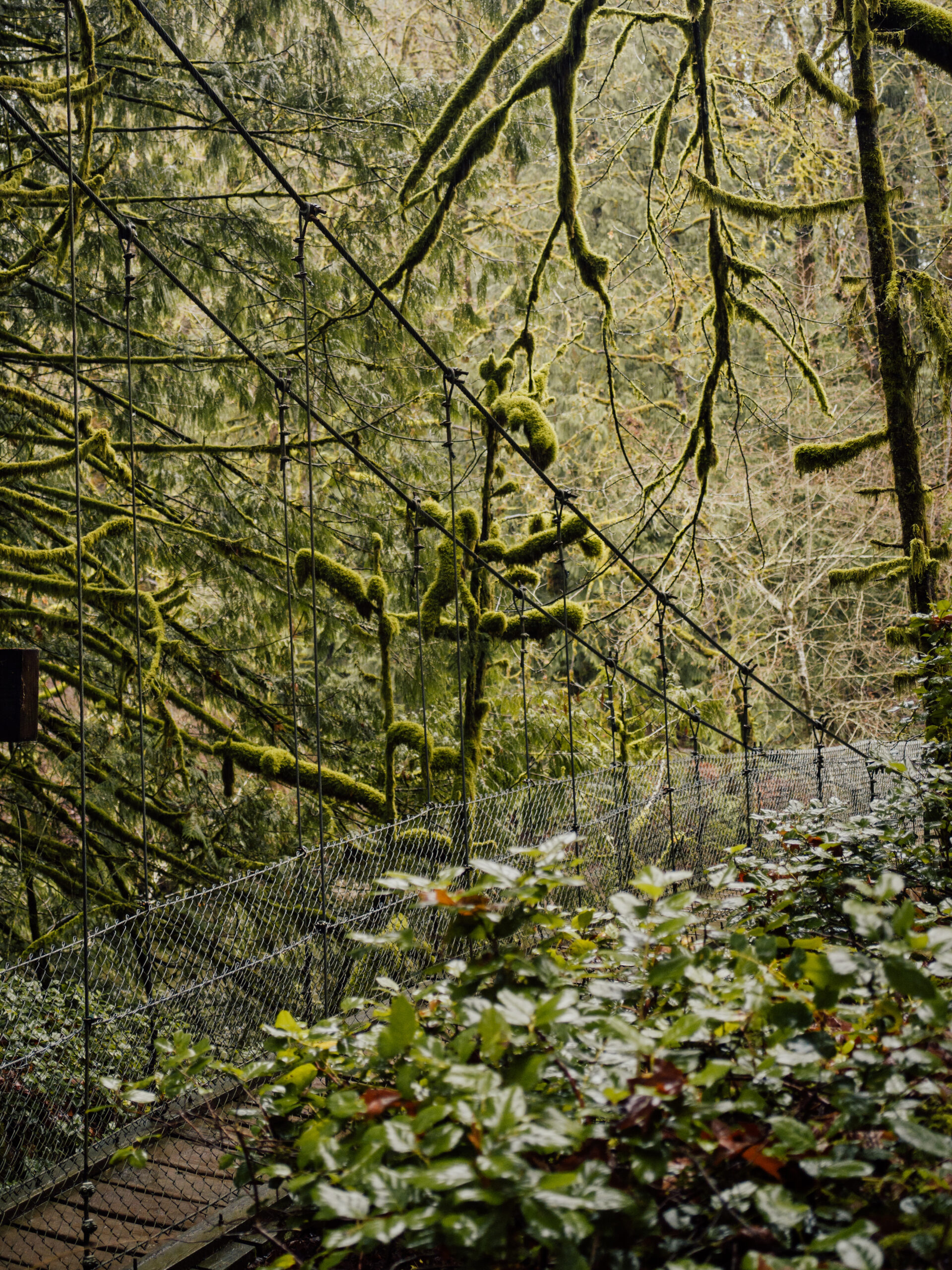
The entrance to the suspension bridge at Bright Angel Park where onlookers can catch a glimpse of kayakers below. Photo: Taylor Roades / The Narwhal
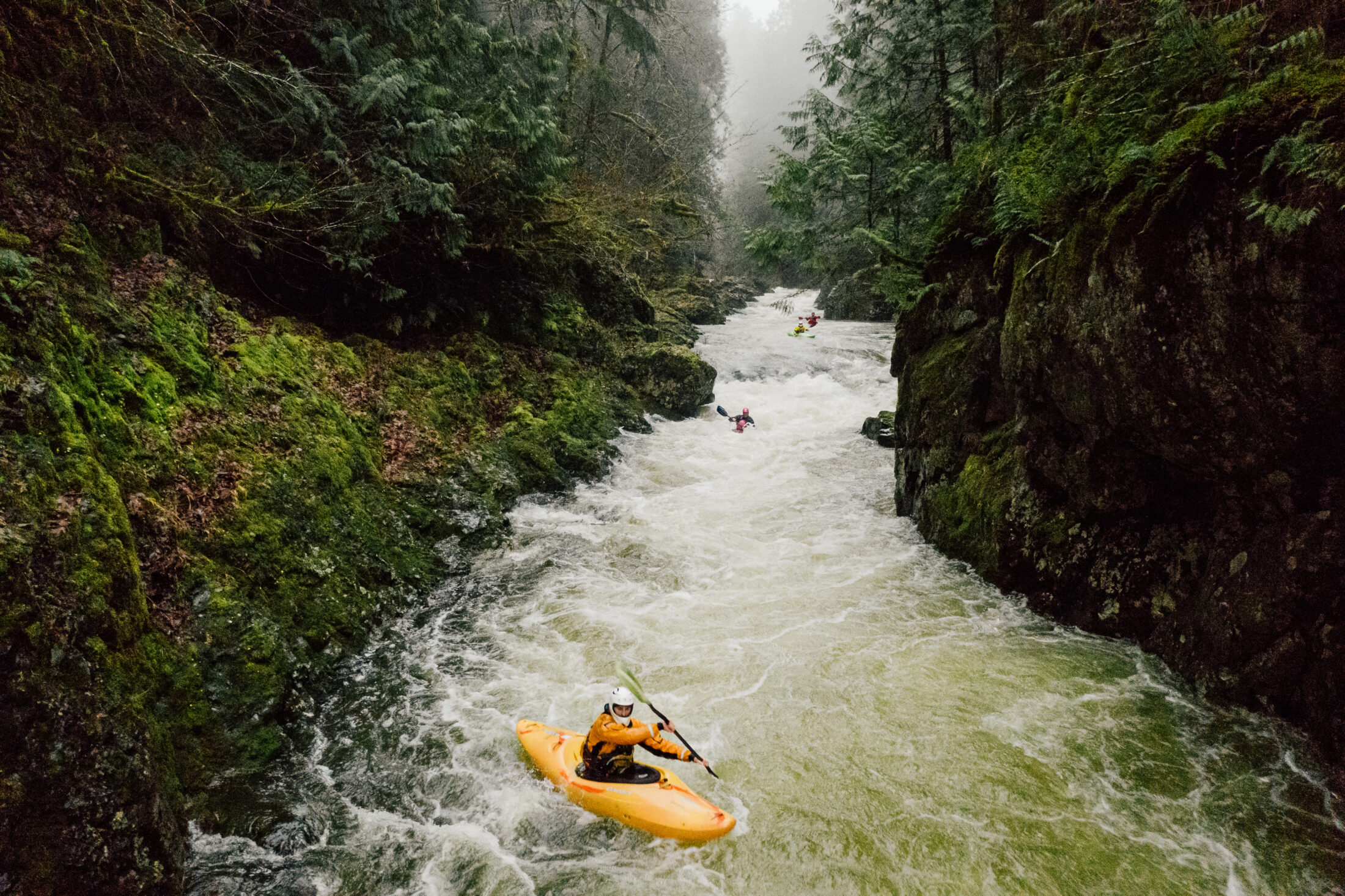
Whitewater kayakers have their own unique relationship with the the river and have even helped identify issues with polluting farm runoff along the river’s flats. Photo: Taylor Roades / The Narwhal
Mcgeragle says that in addition to the unpredictability of the Koksilah’s flow, he notices the water quality decline when he kayaks into agricultural zones in the river’s lower regions.
“There are a few creeks that come in further down the canyon where you can actually smell a sort of sulphur smell. I would guess it’s whatever is being put on crops or maybe livestock runoff, so, especially as it is a salmon stream, there needs to be some research about what exactly is coming in and what are the effects on the ecosystem,” Mcgeragle says.
In his work with the Cowichan Water Board, Rutherford says tests did confirm cow operations were, in fact, affecting water quality. The board and partners conducted two detailed water quality studies in 2012 and 2017, drawing water from dozens of sample sites during both summer low flows and higher flows during freshets.
“Some of the e.coli results in 2012 in the lower Koksilah and tributaries were very scary,” Rutherford says. “DNA analysis indicated the source was bovine.” A plan was put in place after the 2012 tests to improve nutrient management practices and by 2017, tests showed water quality had improved. Rutherford says there is a plan to repeat the tests again next year.
Farmers may be among the group most impacted by the river’s fluctuating water levels.
In recent years, farms have been forced to adjust their water use to cope with extremely low summer flows. In 2019, levels dropped so significantly, the river’s flow could not support the survival of fish. As an emergency measure, the province stepped in to restrict water use. Farmers in the watershed were ordered to cut back on irrigation for forage crops such as hay and corn.
The following year, farmers came together to develop a new irrigation plan so they could take turns drawing water from the river, alternating from farm to farm.
So while farms represent a major drain on the watershed’s supply, many local farmers are also finding ways to become part of the Koksilah’s water solutions.
Paul Brunner, who has owned Blue Grouse Winery and Vineyard since 2012, thinks a lot about water usage, even though vineyards don’t have huge water requirements.
“All the water we use is collected,” Brunner says. “We have a grey water and black water stream, and we have the water that comes from the winery that is high in acid and high in sugar, so that is treated separately with bioreactors.”
“We collect, we treat, then put it into our leachfields and recharge the aquifer,” Brunner says.
Paul Brunner, owner of Blue Grouse Vineyard, stands beside a small creek that runs along the back of his property. Photo: Taylor Roades / The Narwhal
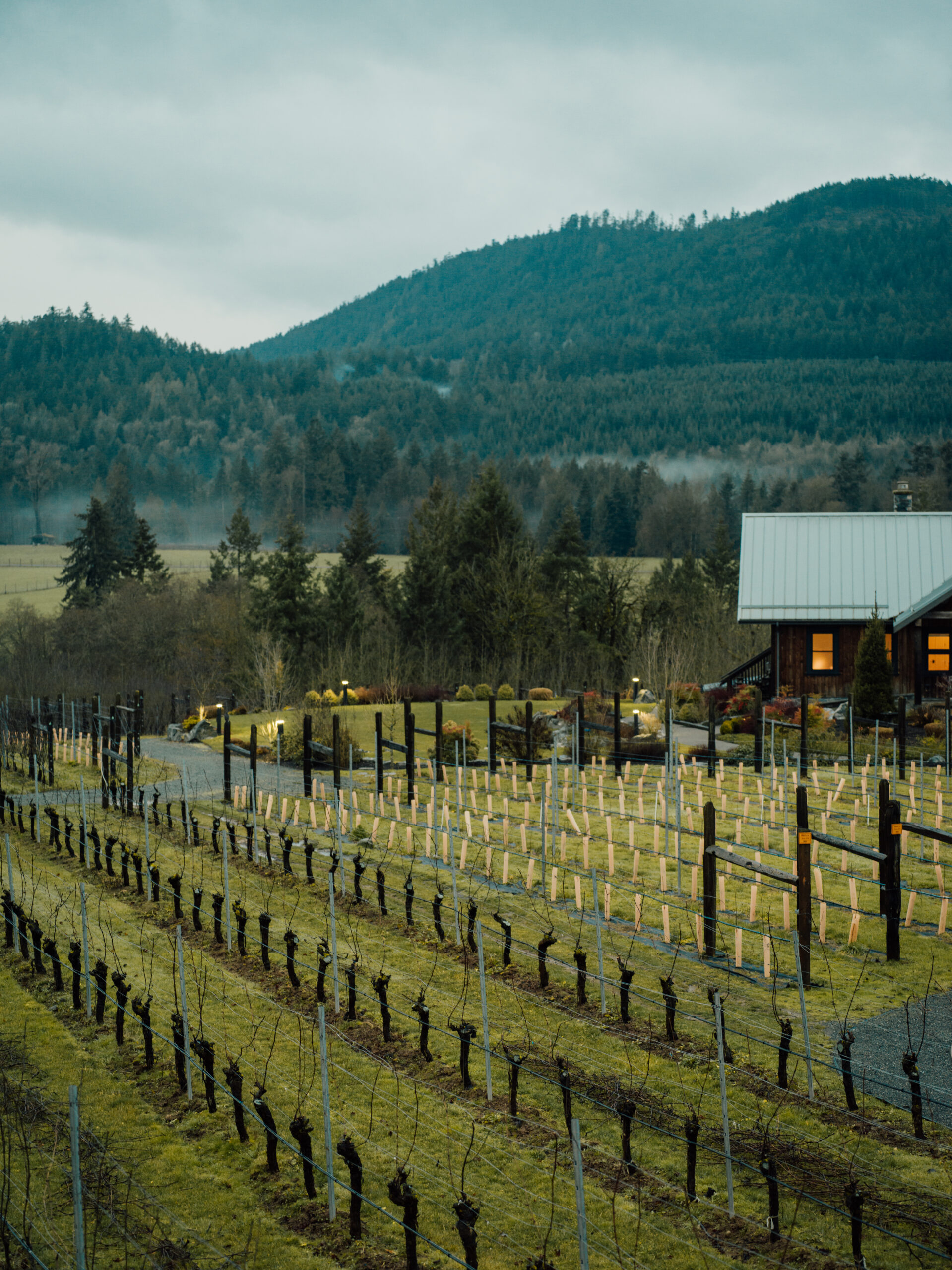
Blue Grouse Vineyard, photographed here at sunrise, uses organic farming practices to protect the watershed from polluting runoff. Photo: Taylor Roades / The Narwhal
Brunner uses a water collection and treatment system at Blue Grouse Vineyard to lessen the winery’s impact on the Koksilah watershed. Photo: Taylor Roades / The Narwhal
Roads on the Blue Grouse property are gravel, rather than paved, which means that approximately five to 10 per cent of rainwater will soak into the ground, and help recharge the aquifer, rather than running straight into the drainage system and out to the Pacific.
Brunner’s winery is also about to receive organic certification — meaning that buyers are assured the winery uses at least 95 per cent organic ingredients and does not use pesticides, herbicides or synthetic fertilizers to grow its grapes.
Steps like these could help to address serious water quality issues researchers say are attributable to agriculture.
Alison Nicholson, a forest ecologist who runs a small organic farm on Riverside Road, and is serving her second term as a Cowichan Valley Regional District director, is another local farmer committed to the Koksilah’s restoration.
Standing on her patio, which overlooks the river, Nicholson says she walks down to the water every single day. “It’s an ecosystem I love and I am committed to protecting it and restoring it because the watershed is in deep trouble,” she says.
Alison Nicholson, hobby farmer, forest ecologist and elected official with the Cowichan Valley Regional District, stands along the Koksilah River on her property. Nicholson says she thought local government would have more clout when affecting land use and especially logging in the watershed. Photo: Taylor Roades / The Narwhal
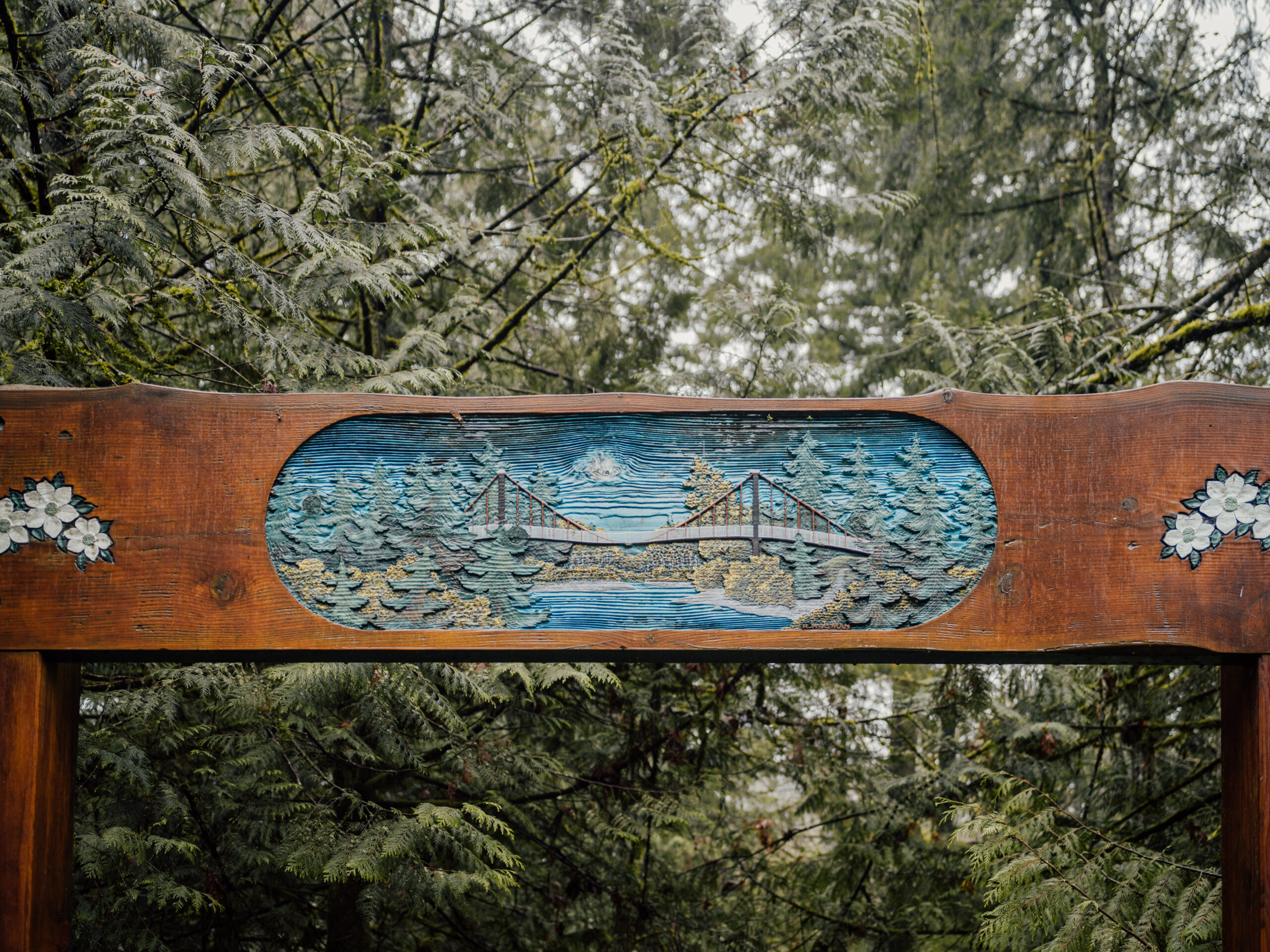
A sign for the treasured suspension bridge in Bright Angel Park. Photo: Taylor Roades / The Narwhal
When the 100-year-old Cowichan Station school closed in 2006, Nicholson was instrumental in transforming it into The Hub, a community centre where, among other programs, a Koksilah Working Group was formed.
“Most of us got involved because we were concerned about the watershed. We had seen it degrade over the years,” Nicholson says.
The group commissioned an ecosystem-based analysis of the watershed; a second report on protecting the watershed is underway. Their website acts as an educational hub for watershed resources.
Between the efforts of the working group and gaining a seat on the regional district board, Nicholson was optimistic positive changes could be made to protect the watershed. When first elected, Nicholson had high hopes that local government had enough clout to persuade logging companies to take a precautionary approach to watershed management and ensure water was considered during land use planning processes.
But progress has been glacial, Nicholson says.
“Local government doesn’t have the tools it needs. We have outdated policies on the books and we don’t have the resources and the sophistication. Pressure in the valley from developers is big right now.”
But Nicholson says an official water sustainability plan, if approved for the Koksilah watershed, could change all that by bringing development into balance with a broader set of community needs.
The parking lot at the Catalyst Pulp and Paper mill is filled with pickup trucks, a sign of the valued 600 jobs the facility provides. Steam is belching from the mill’s stacks and a mist rises from the slurry tanks. The entire operation relies on a steady water supply from the Cowichan River.
And that’s been harder and harder to come by in recent years, says Brian Houle, Catalyst environment manager. The mill’s water requirements are significant: the province currently permits Catalyst to use 89.3 million cubic metres of water per year. Catalyst has operated a licenced weir at Lake Cowichan, the headwaters of the Cowichan watershed, since 1951 that is used to ensure the river, and thus the mill, is fed a steady supply of water.
But Catalyst’s water guarantee from the province became problematic as drought conditions, climate change and other environmental factors started wreaking havoc on the system, says Houle.
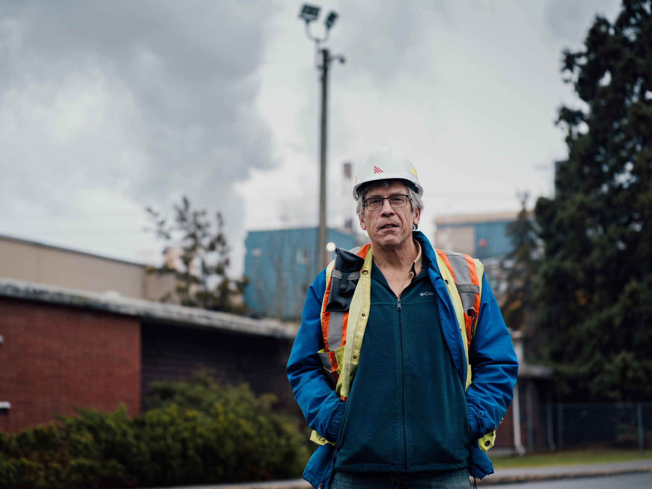
Brian Houle stands outside the Catalyst Pulp and Paper mill in Crofton. Catalyst, owned by Paper Excellence, is a significant water user in the Cowichan Valley watershed, and was forced to work closely with the community when climate change and drought began affecting the availability of water for other users along the Cowichan River. Houle says the water challenges brought the community together to seek solutions. Photo: Taylor Roades / The Narwhal
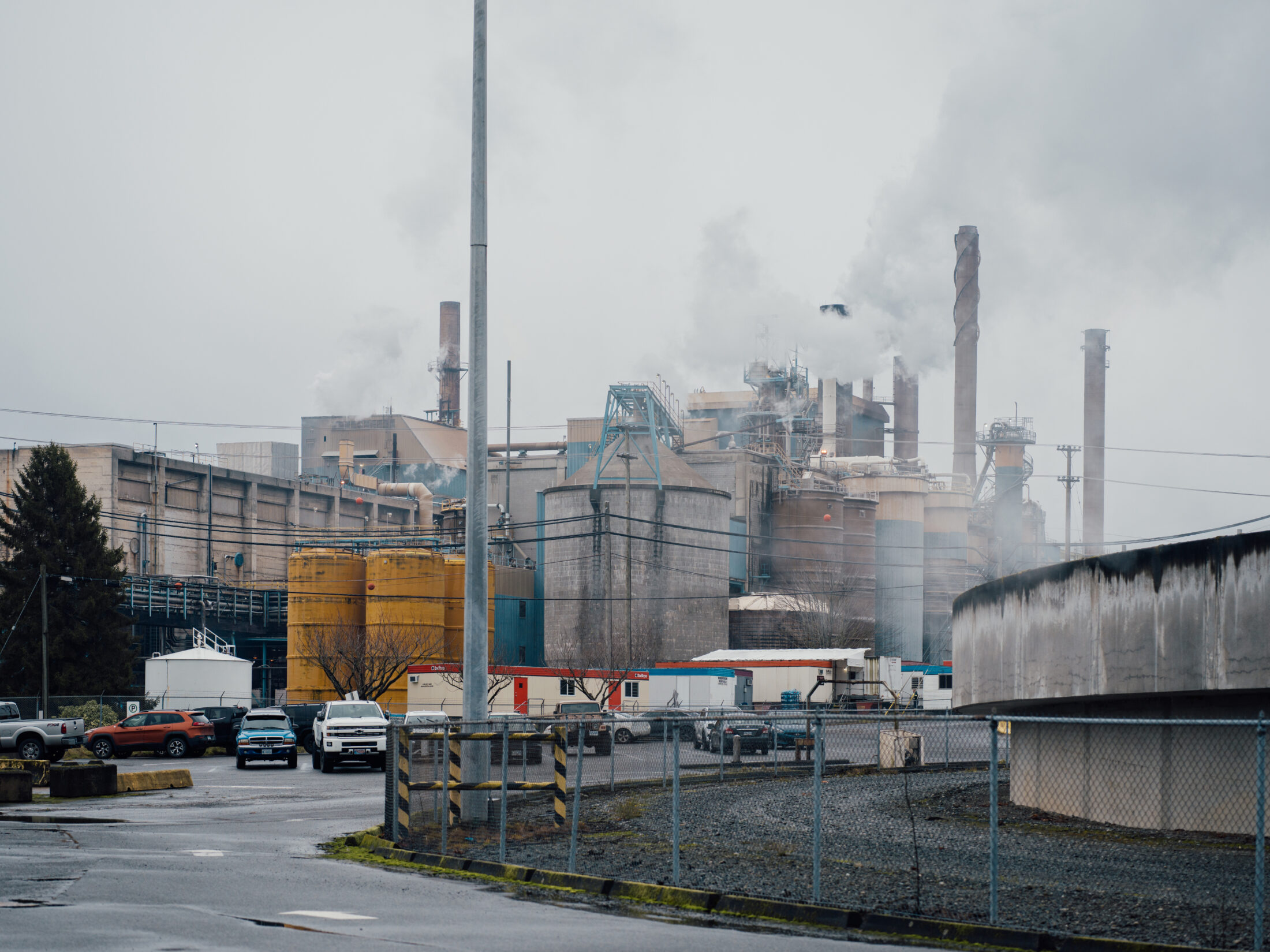
The Catalyst Pulp and Paper mill is a major employer in the Cowichan Valley. The mill has a provincial licence to use 89.3 million cubic metres of water each year and that water is regulated through a weir on Lake Cowichan, the headwaters of the Cowichan watershed. The weir is being heightened to ensure there is more water available for all in the watershed during dry summer months. Photo: Taylor Roades / The Narwhal
That’s when the fighting and finger-pointing began, he adds, with special interests such as industry, lakefront cottage-owners, environmental groups and recreational users arriving at loggerheads over who should have access to the river’s water.
But Houle said rather than squabbling, the pressure of not having enough water brought the different groups together.
“We all need the same thing. We all need that the river never goes below a minimum flow,” Houle says.
As part of a long-term solution, the federal government agreed to put $24.2 million into a seven-year program, led by Cowichan Tribes, to help restore the watershed. The plan includes replacing the weir with a new structure, 70 centimetres higher than the current weir, allowing more water to be stored and released during the summer droughts.
The so-far successful and collaborative efforts to restore the Cowichan hold important lessons for the Koksilah. But the parallels can only be drawn so far: unlike the Cowichan, the Koksilah River isn’t fed by a single large body of water and instead relies on flow generated from precipitation and melt from the mountains. The Koksilah watershed’s water is stored in wetlands, a handful of small lakes and underground aquifers. It’s because no large body of water regulates its flow that the Koksilah River’s levels fluctuate from a trickle during hot, dry summers to ferocious tumbles of water during winter’s torrential rains.
The Koksilah River is expected to experience greater water level fluctuations due to climate change. A climate change projections report prepared for the Cowichan Valley Regional District estimates the river will receive 17 per cent less precipitation in summer months by 2050. Photo: Taylor Roades / The Narwhal
Houle says that historical water level charts used to be instrumental in deciding how to regulate the Cowichan River. But with climate change, those historical benchmarks are no longer useful.
During a recent Cowichan water use planning meeting that Houle attended with Rutherford and other parties, a consensus decision was made to disregard that historical data altogether when planning for the watershed’s future.
“The first decision that table made was to throw [the data] out and just ignore it and, instead, we used the [regional district’s] climate change forecasts,” Rutherford says.
“That was a real wakeup call for all of us. By 2050 our severe drought will be every year. That’s why we are all coming from different places, but we all want to get to water sustainability,” he said.
While there is no single reason for the watershed’s problems, concerns around clearcut logging provokes much of the controversy.
Sarah Davies-Long, who grew up in the Cowichan Valley and lives on an acreage above the river, says she is frustrated by the ongoing logging in the watershed. She says she feels there is little willingness by the industry to address community concerns or consider a more precautionary approach.
“The trees are younger than me and they are still cutting,” Davies-Long says.
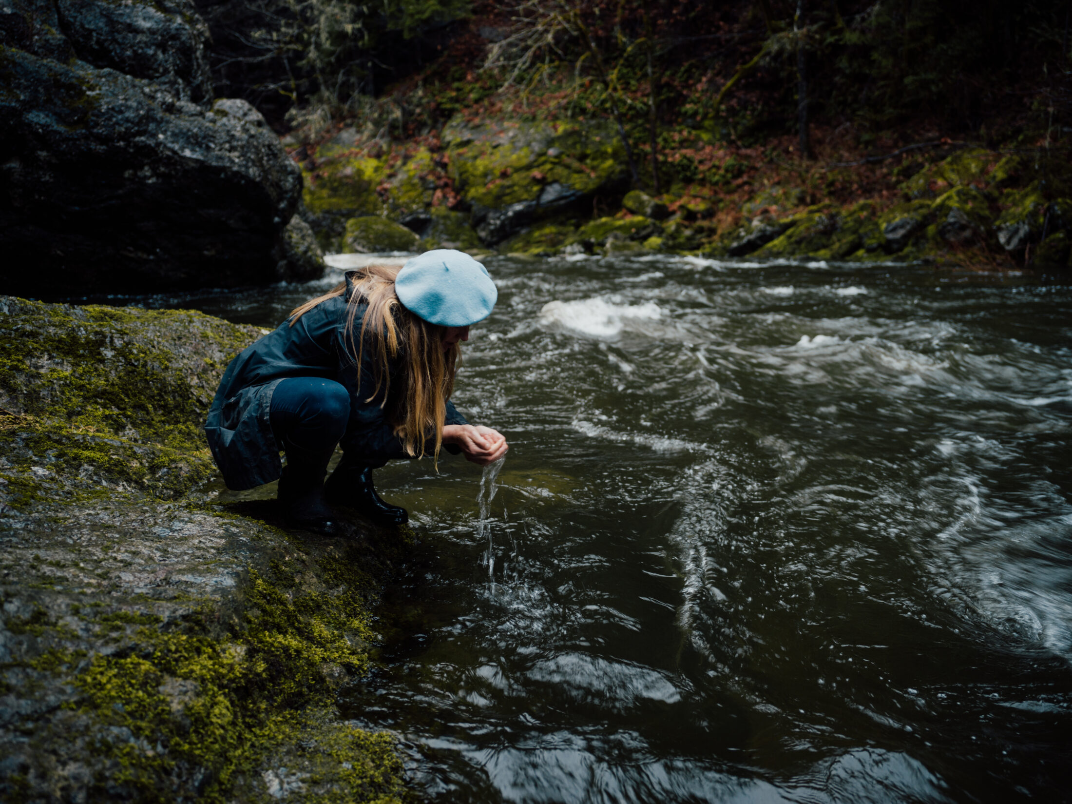
“I have been drinking, cooking and bathing in unfiltered Koksilah water all my life,” she says, balancing on the rocks below her home, cupping water in her hands to drink. Davies-Long, who is troubled by changes to the river, in particular by runoff from clearcuts, recalls how she cried when she saw a clearcut for the first time at age eight. “They have a history of cutting too much,” she says.
Sarah Davies-Long was born and raised along the Koksilah and fears not enough is being done to limit the impacts of logging on the watershed. Photo: Taylor Roades / The Narwhal

The suspension bridge hangs over the Koksilah in Bright Angel Park. Photo: Taylor Roades / The Narwhal
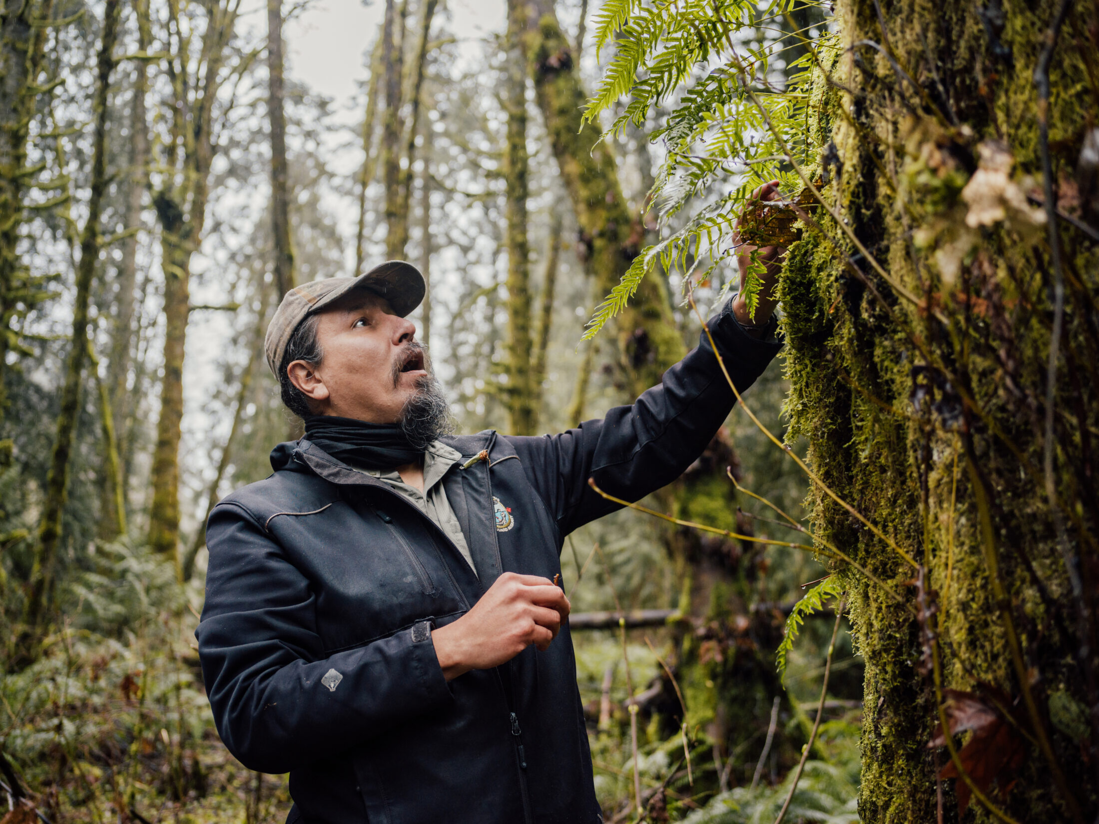
It is not only a question of volume, it is also how the logging is conducted and what is left on the ground, adds Heather Pritchard, an ecologist, registered professional forester, and the co-author of The Hub’s report on the watershed.
Pritchard, standing in a clearing in tiny Kingburne Park under towering second-growth trees, points to stumps that show, like the rest of the watershed, this area used to be old-growth. Some trees in the Koksilah watershed were between 1,000 and 1,300 years old at the time of logging, she says.
For Pritchard, a forest is so much more than trees. It consists of underbrush and dead trees that rot and produce rich soil. It can take about 6,000 years to form the complete ecosystem but over the past 150 years, 99 per cent of the watershed’s original trees and underbrush have been removed and replaced with tree farms, which lack the diversity of the old-growth, Pritchard points out.
Heather Pritchard, eco-forester and consultant stands in second-growth forest in Kingbourne Park. Pritchard says old-growth and vital areas in the watershed should be mapped so some areas can be set aside for protection. Photo: Taylor Roades / The Narwhal
When the old-growth forest was in place, the river was shaded during the summer months and dead wood, which holds 25 per cent more water than soil, would release the moisture slowly, instead of running over cleared surfaces and roads, Pritchard says.
“Now you have a situation where the water is picking up soil where it’s going over the top of the clear cut area. It picks up sediment and it’s racing down to the river, so it’s depositing a lot of water quickly and it’s dirtier water, more turbid water,” says Pritchard, who wants to see the Koksilah’s vital areas mapped for protection so forest restoration efforts can begin.
Pritchard’s research found that over 150 years of development, only one per cent of the original Koksilah watershed has been left intact. Photo: Taylor Roades / The Narwhal
Pritchard points out the beauty of 100-year-old second-growth forest, which demonstrates the ability of forests to come back, if allowed. “You have to have a healthy ecosystem to have healthy people,” she says. Photo: Taylor Roades / The Narwhal
Much of the watershed is now being clear cut for the third time, meaning insects and other elements of the forest are disappearing, Pritchard says.
Domenico Iannidinardo, Mosaic vice-president and chief forester, said the company is involved in the work of the Koksilah Watershed Working Group and Cowichan Watershed Board, but did not reply to questions from The Narwhal on whether a water sustainability plan could affect logging operations.
“We continue to support their efforts using the best science and data to inform decisions,” Iannidinardo said in an emailed response to questions.
The Koksilah second and third-growth managed forests are a “living testament to the renewability of the resource” and operations are subject to dozens of regulations, Iannidinardo said in the statement.
There is hope that, with local collaboration and the possibility of a water sustainability plan, the watershed can be restored to some degree, even if the old-growth is not coming back, Pritchard says, pointing to the beauty of the park’s 100-year-old second growth.
“You have to have a healthy ecosystem to have healthy people,” she says. “And it’s only when you have healthy people and a healthy society that you can create a healthy economy.”
A Koksilah watershed sustainability plan may help determine where additional logging can take place in the region — and where it should not. But partnership and collaboration is needed since almost 80 per cent of the 30,000-hectare Koksilah watershed is privately managed forest land. Photo: Taylor Roades / The Narwhal
For Rutherford and Kulchyski, signs that widely varying interests are willing to work together and look for solutions to the Koksilah crisis are encouraging and, if the scoping procedure is successful, the next step will be to come up with terms of reference for a long-term agreement — and more community consultation.
It is uncertain what that will look like as the process is ground-breaking, but the keywords in the planning documents are collaboration, creativity and effective, science-based planning.
One of the absolute points of agreement is that none of it will be easy.
“As much as trying to figure out what this process looks like, it’s about building trust,” Kulchyski says. “You have representatives from the two levels of government and there’s a lot of water under the bridge between the province and First Nations and it’s all muddy.”
Kulchyski says more work is needed to build trust between the province and Cowichan Tribes and that trust is essential for restoration of the river. Photo: Taylor Roades / The Narwhal
If successful, the Koksilah water sustainability plan could help other communities across B.C. identify collaborative ways to manage their watersheds. Photo: Taylor Roades / The Narwhal
Rutherford says the significance of the Koksilah watershed is about more than trees and salmon. “It’s about something more important,” he says. Photo: Taylor Roades / The Narwhal
The inclusive approach being taken in the Koksilah is important because the region is likely to jumpstart new visions for watershed security all across the province, according to Oliver Brandes, associate director at the University of Victoria’s Centre for Global Studies and co-director of the POLIS Project on Ecological Governance.
Brandes, who has been working on B.C. water sustainability for many years, was the lead author of a 2015 POLIS report that notes: “Twenty-first century water governance requires a more collaborative approach where all governments, rights holders, communities and stakeholders in a watershed have roles and responsibilities for water management.”
Efforts in the Koksilah are a demonstration of what such governance looks like unfolding in real time, amid the increasing pressures of the environmental crisis and growing communities.
Rutherford says he hopes the work being done in the Koksilah will be a game-changer for other watersheds across B.C.
“It’s not just about natural values, the trees and the fish. It’s about something more important.”
The photography for this story was made possible in part by financial support from the Real Estate Foundation of BC.
Updated April 4, 2021, at 8 p.m. PT: This article was updated to indicate that the Koksilah River is on the eastern side of Vancouver Island, not the western, as originally written due to an editor’s error. Also due to an editor’s error, this story was corrected to note a decision to use climate change projections, rather than historical water data, was made at a meeting about the Cowichan watershed and not the Koksilah watershed as previously stated.

Get the inside scoop on The Narwhal’s environment and climate reporting by signing up for our free newsletter. On March 17, federal Conservative Leader Pierre Poilievre...
Continue reading
An internal document obtained by The Narwhal shows how the natural resources minister was briefed...

Notes made by regulator officers during thousands of inspections that were marked in compliance with...

Racing against time, dwindling habitat and warming waters, scientists are trying to give this little-known...