


In late 2021, the Mamalilikulla First Nation unilaterally declared protections for a 10,416-hectare tract of land and sea north of Vancouver Island off the coast of British Columbia under Indigenous law. The nation, eager to reconnect with traditional territory from which it had been forcefully separated, established the Indigenous Protected and Conserved Area without the provincial or federal governments.
Now, Ottawa is officially recognizing the marine portion of the Mamalilikulla protected area, with Fisheries and Oceans Canada Minister Joyce Murray announcing on Sunday the fragile ecosystem, rich with rare shallow-water corals and sponges, will be protected for “the long term.”
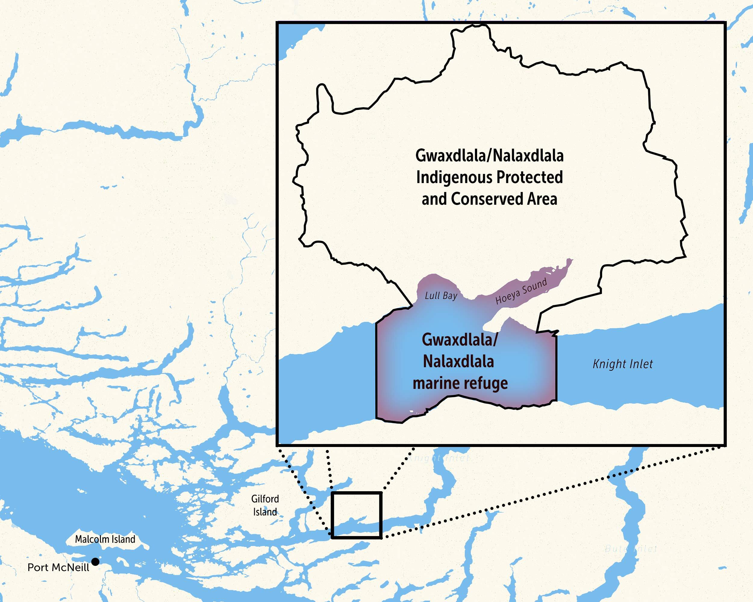
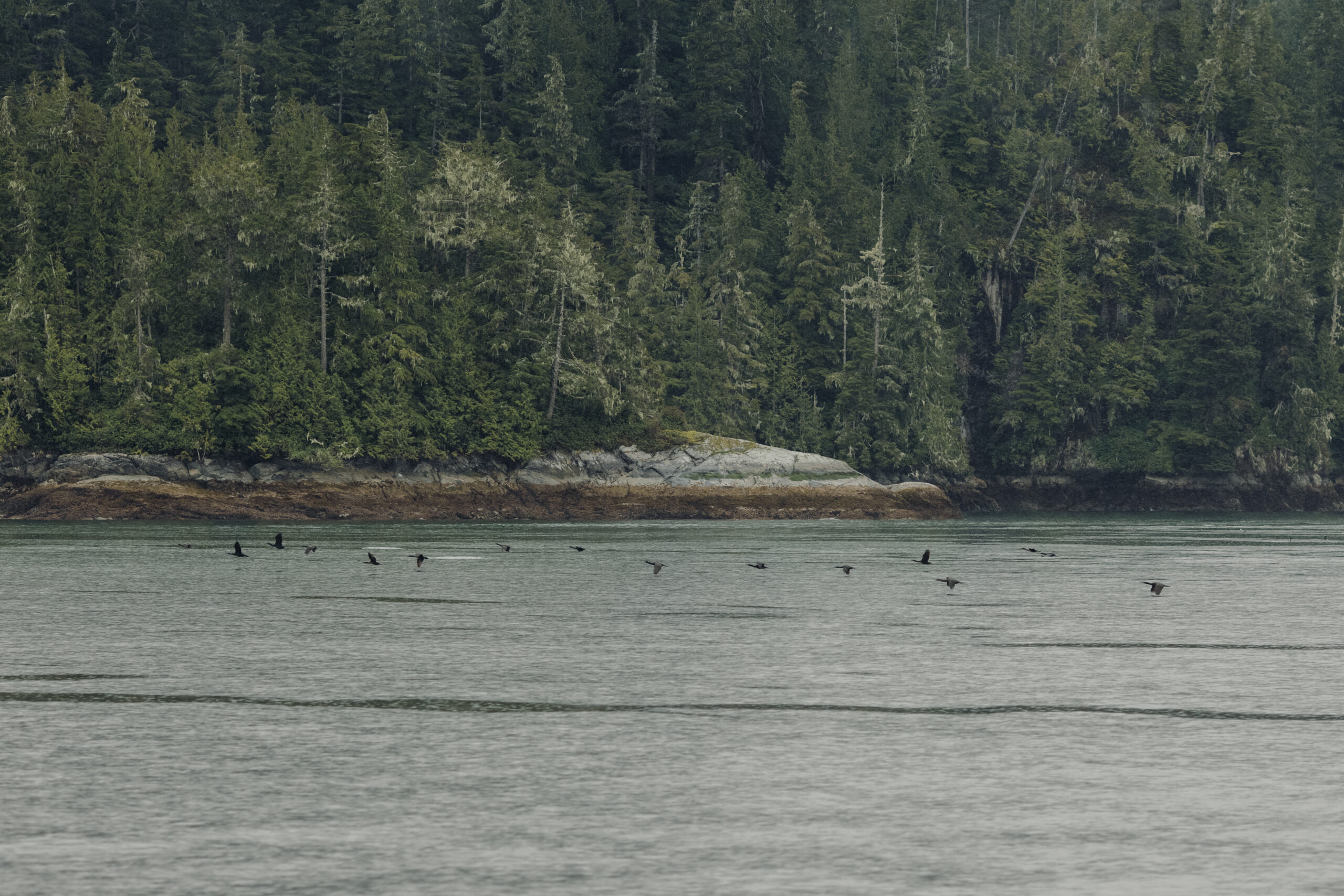
The creation of the Gwaxdlala/Nalaxdlala marine refuge, an area also known as Lull Bay and Hoeya Sound in Knight Inlet, comes as officials and experts from around the globe are gathered in Vancouver for an international forum on marine protected areas.
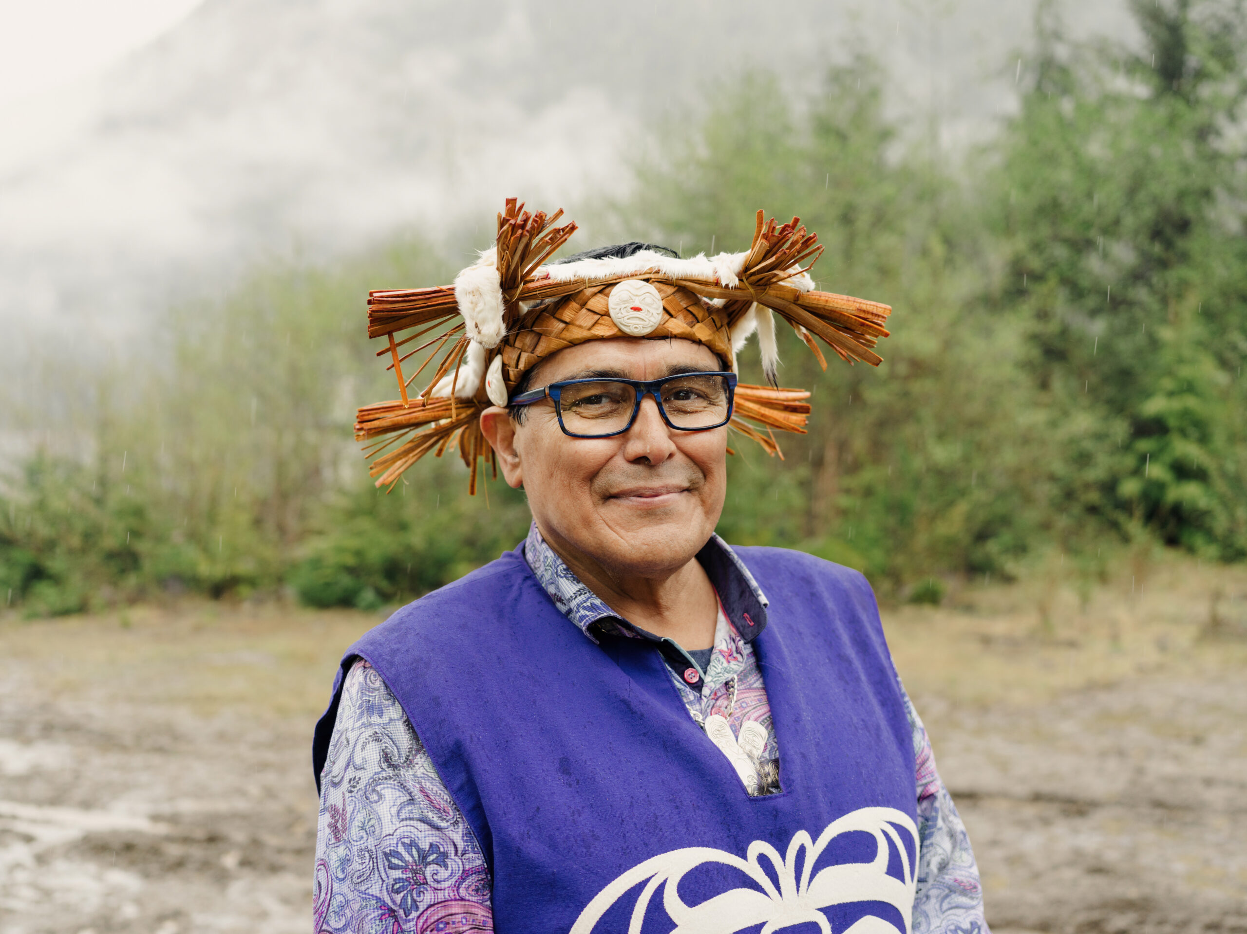
Mamalilikulla Chief Councillor Winidi John Powell said the announcement would bring happiness to his ancestors.
More than a century ago, the federal government forced the Mamalilikulla people from their central village sites, leaving generations disconnected from their lands. The Gwaxdlala/Nalaxdlala Indigenous Protected and Conserved Area is meant not only to protect Mamalilikulla territory, but also to help restore the community’s connection to their homelands.
During Sunday’s announcement Powell reflected on a powerful gathering nine months ago, when Mamalilikulla members, chiefs from neighbouring nations and guests travelled to Gwaxdlala and Nalaxdlala “to symbolize our commitment and reconnect our community members to this significant area in Mamalilikulla territory.”
“As we celebrated in the pouring rain it was said that it had been over 100 years since the Mamalilikulla people danced, sang our songs and drummed on that land,” he said. “I think that the rain there was the tears of our ancestors; I think they would all be happy to see what we’re doing here today.”
Fisheries Minister Murray emphasized the rich marine biodiversity of the area, 2,000 hectares of which will now be federally protected.
“Over 240 marine species can be found in this region, which has been identified as a globally unique ecosystem of fragile and slow-growing corals and sponges,” Murray said.
B.C. Water, Land and Resource Stewardship Minister Nathan Cullen acknowledged the protection of Gwaxdlala/Nalaxdlala marine refuge has been a long time coming for the Mamalilikulla First Nation.
“This is more than a century in the making and the recognition of the rights that were always there, but for so long ignored by the province and our federal counterparts,” he said.
“The province is committed to seeing the implementation of the vision expressed by the nation for this marine refuge and in a way that respects the interests of everyone in the region,” he added.
New marine refuge adds to Canada’s conservation targets
Under the Fisheries Act, the marine refuge is considered what’s known as an area-based fisheries closure, meaning no fishing will be allowed within its bounds. Salmon, rockfish, crab and prawns are all found in the area.
“The aim is that the nursery effect of protection will actually increase abundance outside of the marine refuge, which will maintain fisheries opportunities for the decades to come,” Murray said.
According to the federal government, marine refuges can be counted towards Canada’s international target to conserve 30 per cent of lands and waters by 2030. That target is considered the bare minimum of what’s needed to stem the global loss of biodiversity and maintain vital ecosystem services, such as natural water filtration through wetlands or carbon storage in oceans and forests.
Canada has to date protected almost 14 per cent of marine areas.
Murray acknowledged the Gwaxdlala/Nalaxdlala marine refuge is a relatively small contribution by area to Canada’s conservation goals, but said “we cannot overstate the value of conserving and protecting this priceless area.”
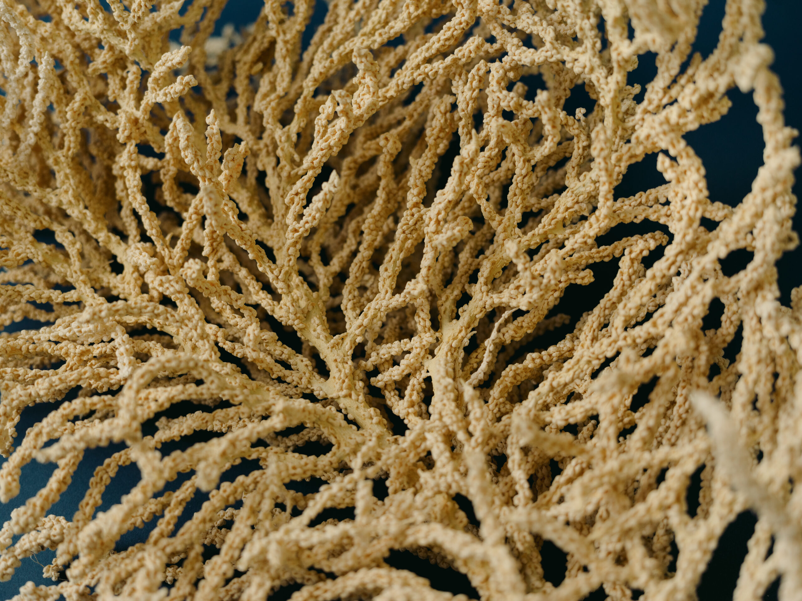
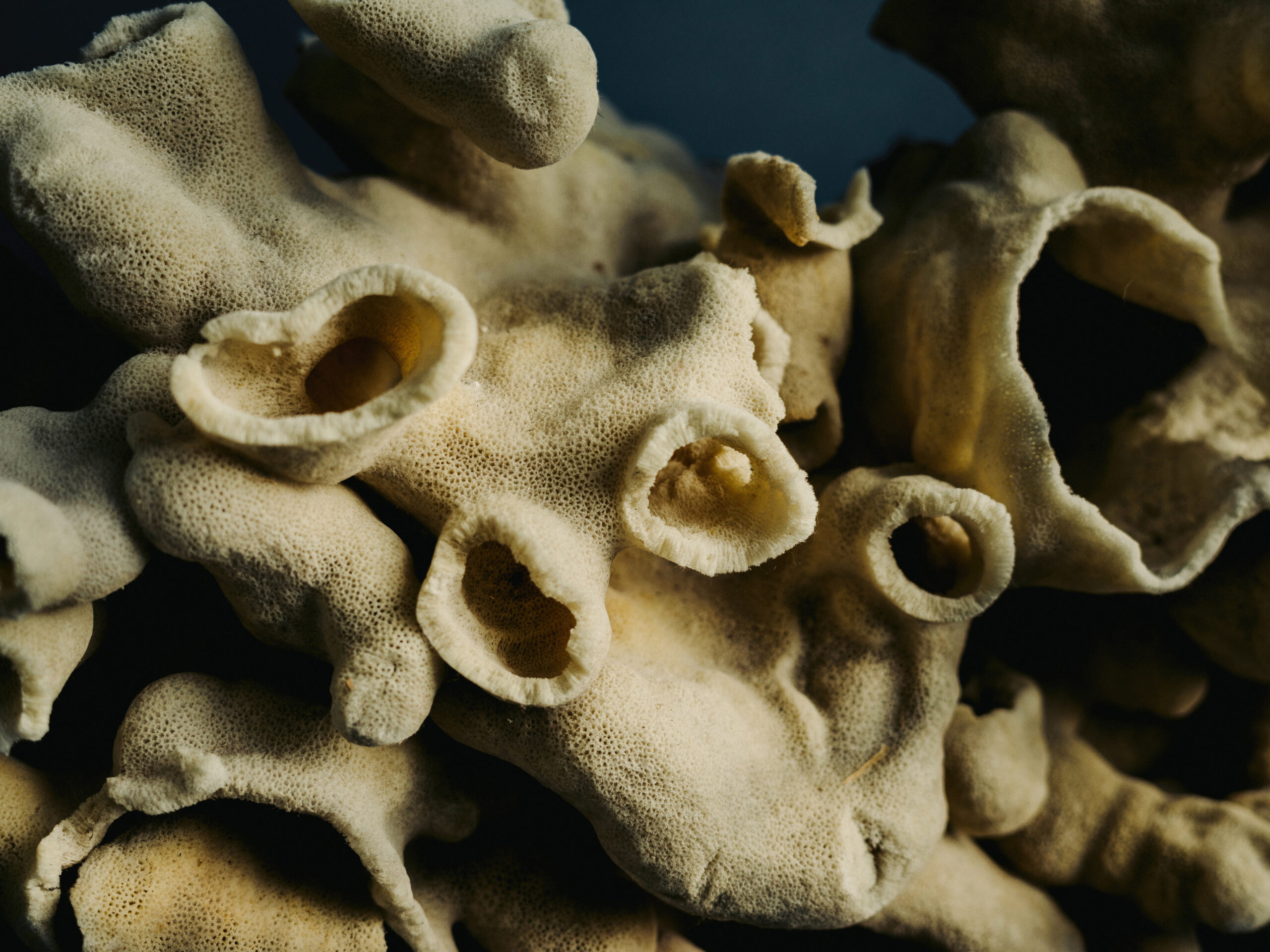
Among the unique features of the Gwaxdlala/Nalaxdlala marine refuge are gorgonian corals, which are typically found in deeper waters. These soft, colourful corals can resemble dense underwater shrubs or delicate fans. Alongside eelgrass beds and kelp forests, the corals offer refuge for fish and other marine species.
Powell noted that when the Mamalilikulla declared the Indigenous protected area, they made an urgent call to protect the Hoeya Head Sill corals, which are now protected in the new marine refuge. The Hoeya Head Sill is a uniquely biodiverse underwater environment where fresh surface and deep water mix to create a home for more than 46 different species of coral, sponges and anemones. He asked they be protected “in accordance with the law of Aweenak’ola, which requires us to take care of all the living beings in the sea, in the sky and on the land, as if they were our brothers and sisters.”
Gwaxdlala/Nalaxdlala first marine refuge established under Northern Shelf bioregion action plan
Gwaxdlala/Nalaxdlala is the first marine refuge recognized under the Northern Shelf Bioregion Marine Protected Area Network planning process.
Earlier in the day Sunday, 15 Coastal First Nations and the B.C. and federal governments endorsed the Marine Protected Area Network Action Plan for the Northern Shelf bioregion, following years of negotiations.
The Northern Shelf bioregion, which Murray described as an “extremely unique area on our planet,” stretches from Campbell River north to B.C.’s border with Alaska.
According to a federal government background document, the action plan offers a “planned approach to the creation of new protected areas in the [Northern Shelf bioregion],” and supports efforts to achieve the 30-by-30 target.
The proposed marine protected area network would cover more than three million hectares — about 30 per cent — of the Northern Shelf bioregion, through new and existing protected areas. Between 20 to 50 per cent of the protected areas would have high levels of protection, meaning fishing and industrial activities would be prohibited, while the remaining areas would allow some human uses.
The 15 First Nations, federal and provincial governments will collaboratively govern the marine protected area sites and network and work to develop a permanent source of financing that draws together public, private and philanthropic funds.
With files from Stephanie Wood.