


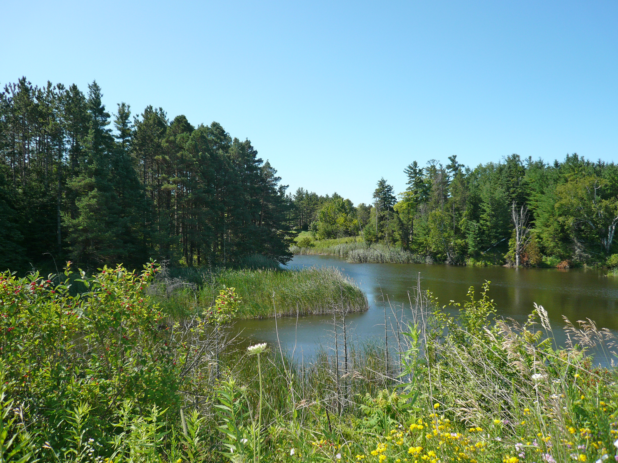
Trickling through the suburbs east of Toronto, Carruthers Creek quietly passes by some of the most sought-after land in Ontario.
Beginning just south of the province’s protected Greenbelt, the streams feeding into the creek are surrounded by farmland in northern Pickering, about an hour’s drive from downtown. To many developers and politicians, these are prime parcels of undeveloped land snuggled alongside a middling creek.
Though the headwaters seem unassuming, decisions here are pivotal, shaping what happens downstream. Officials in the Lakeridge Health system — a hospital network serving the more than 699,000 people who live in Durham Region — are considering a proposal to build a new hospital in Pickering at the head of Carruthers Creek. It’s a controversial idea and the latest blow in an ongoing battle over the area’s future, bringing the tension between a growing population and the need to preserve the environment to the forefront.
Proponents argue that if the region needs a new hospital, Pickering is well-positioned to play host. Opponents — who have long called for the headwaters to be added to the Greenbelt and protected from development — point to warnings from scientists that building there could lead to increased flood risks in the downstream town of Ajax and issues with water quality.
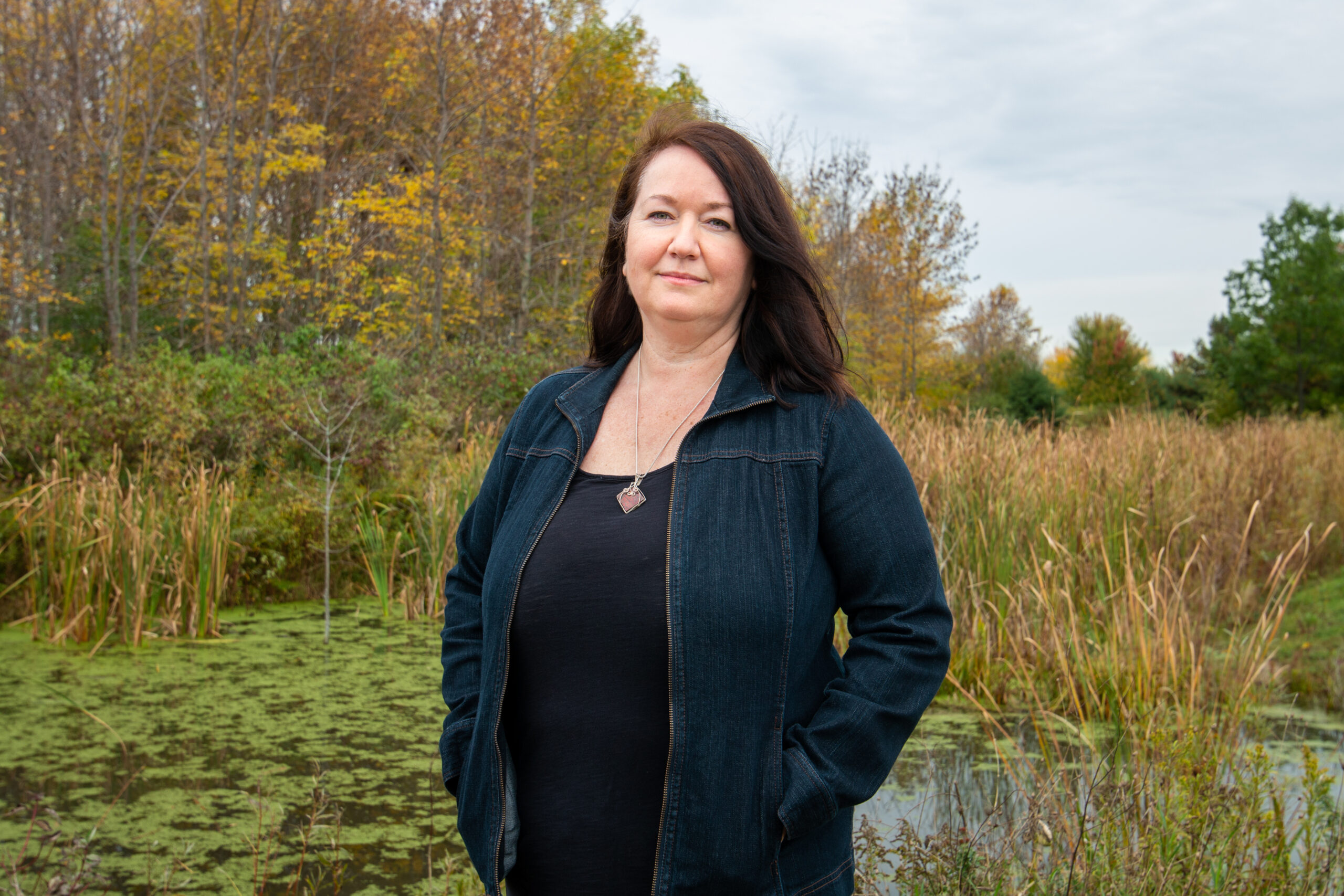
“I guess we just have to decide: do we want to protect this system that’s already degraded, or further exacerbate the problem?” said Andrea Kirkwood, an aquatic ecologist and associate professor at Ontario Tech University who studies creeks in the Durham Region, of which Pickering and Ajax are a part.
“If you start developing the headwaters, you’re absolutely removing any kind of fresh clean water coming down, flowing downstream, and so it pretty much tanks the entire creek. It’s like, if you’re gonna poop in a pool, it’s ruined for everybody.”
‘Carruthers Creek is pretty much maxed out when it comes to human development’
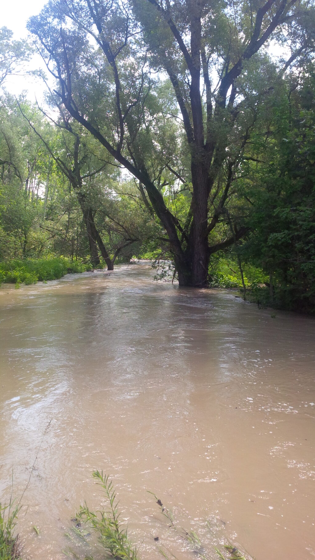
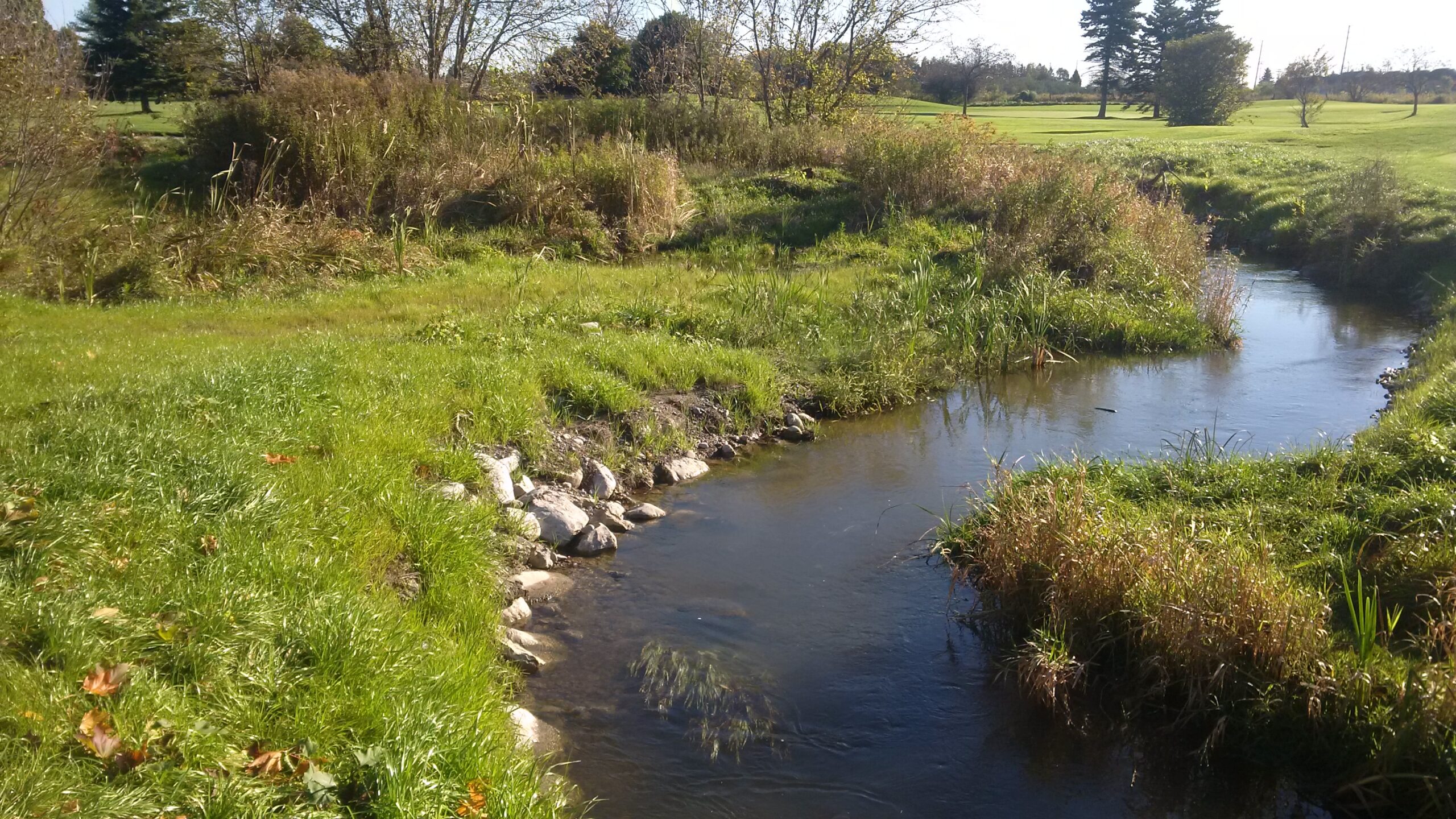
Natural landscapes absorb water. Unpaved places — wetlands in particular, but also the average soil in backyards and parks — act like a sponge during heavy storms, slowing down creeks that overflow their banks.
When the same rains hit pavement, the land can’t soak up as much, said Geneviève Ali, an eco-hydrologist and associate professor at the University of Guelph. Floods may come more often or strike harder.
“Those two different landscapes could be subjected to exactly the same climate, and your pavement-dominated landscape would flood much more frequently,” Ali said. “For example, when you have landscapes or systems with a lot of impervious surfaces, your tendency will be to have flash floods. They happen very, very quickly because your system is overwhelmed very quickly.”
In the densely populated Greater Golden Horseshoe, a region that rings around the western shore of Lake Ontario to encompass Toronto, Hamilton and surrounding suburbs, about two-thirds of the undisturbed land that once existed is already gone.
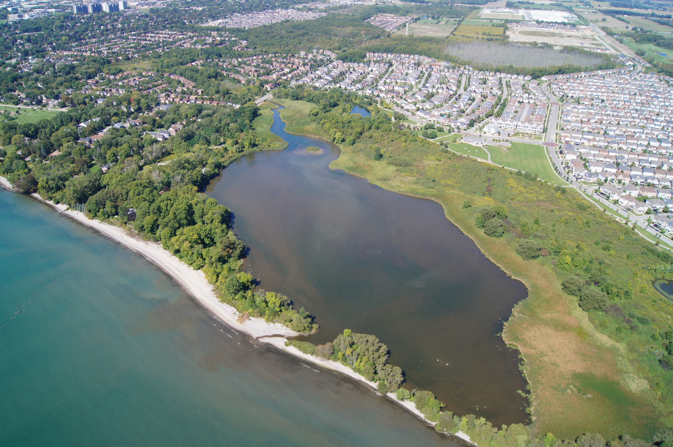
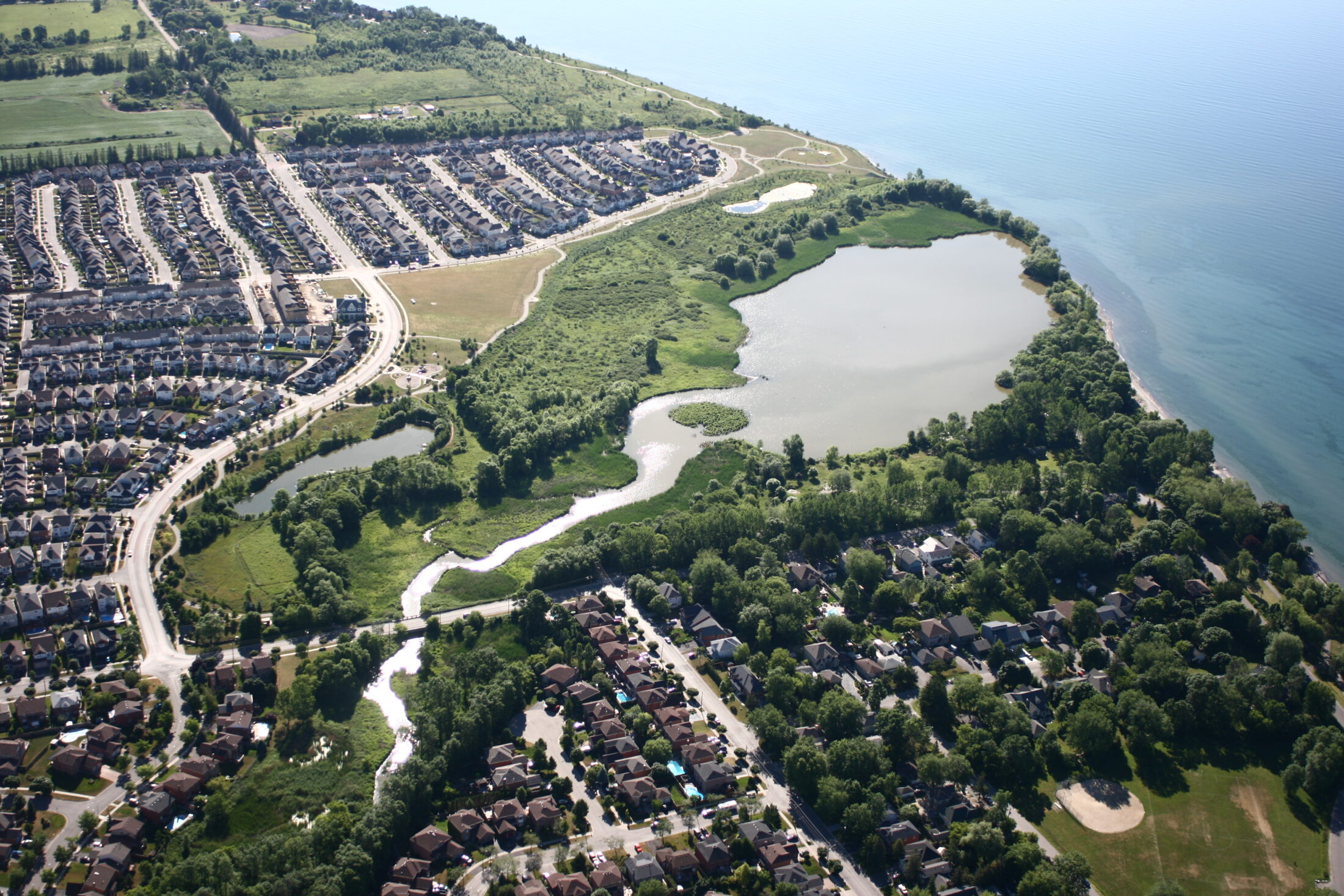
In the case of Carruthers Creek, the headwaters remain fairly rural, but downstream, the landscape gradually becomes more urban. That urbanization has brought enormous change, as documented by the Toronto and Region Conservation Authority in its 10-year plan for the region, finalized in September. (In Ontario, provincially-regulated conservation authorities oversee key watersheds in partnership with municipalities. The Toronto and Region Conservation Authority isn’t taking a position on the Durham Region hospital proposal.)
“The flow of water through the watershed is out of balance and there are flooding and erosion issues,” the conservation authority’s Carruthers Creek plan reads, pointing to a zone downstream in Ajax that’s particularly vulnerable. The zone includes some parkland, but also some residential neighbourhoods.
More change is almost certainly ahead. The population of Durham Region is expected to nearly double by 2051, the plan notes. At the same time, the climate crisis is expected to increase the frequency of extreme weather events such as floods and severe storms.
Something like the hospital could be “devastating” to Carruthers Creek, Kirkwood said. It’s a relatively small waterway, which means it’s not able to absorb as much impact.
“Carruthers Creek is pretty much maxed out when it comes to human development,” she said.
The Carruthers Creek plan includes a set of forecasts for how throwing more development into the mix could affect the watershed. If the headwaters are developed — save an existing system of natural areas, which the conservation authority is seeking to expand — the watershed could deteriorate significantly, the plan shows.
The conservation authority modelled what would happen if a storm like Hurricane Hazel, which killed 81 people in southern Ontario in 1954 and caused widespread floods, were to strike Carruthers Creek. It found that if the headwaters were urbanized, peak flows would be about twice as high as they would be today, with the headwaters undeveloped.
This doesn’t mean development on the headwaters would immediately lead to flooding, said Laura DelGiudice, the associate director of watershed planning and ecosystem science at the Toronto and Region Conservation Authority. The projections don’t account for new flood mitigation infrastructure that could be built, such as stormwater management ponds.
“[Developers] would have to come up with something very, very innovative, and different kinds of [stormwater management] strategies to apply to address those flooding concerns,” DelGiudice said, referring to issues that could arise if the headwaters are urbanized.
Even if the hospital isn’t built on the creek, the conservation authority has already recommended Ajax take a series of steps to flood-proof the community, including retrofits. Its downtown, built in the 1950s, had no stormwater control infrastructure at all. A 2017 environmental assessment found certain manholes have already flooded fairly regularly during storms that are relatively common. The town’s 2019 climate plan included a commitment to enhance its stormwater management.
This isn’t the only place in Ontario where the need for healthcare infrastructure has bumped up against a distaste for developing rural land. In Windsor, Ont., residents have fought for years against a push to build a $2-million mega-hospital on farmland far from the city’s core. Though a new hospital is badly needed in the area, critics say the chosen location encourages car-oriented urban sprawl. The project is “100 per cent” forging ahead, MPP and government house leader Paul Calandra said earlier this month.
The Ottawa Hospital’s plans to build a new site to replace its nearly century-old campus have raised similar ire: the proposal would encroach on the northeastern edge of the Central Experimental Farm, an agricultural research facility and working farm that includes a beloved arboretum. (The eight hectares that would be affected aren’t used for research, but residents have protested the loss of trees on the land.) Ottawa City Council approved the plan Oct. 12 — newly-elected Liberal MP Yasir Naqvi campaigned on a promise to protect the rest of the farm site from development.
‘Bait to drive sprawl’ in Durham Region
Last spring, shortly after Lakeridge Health announced plans to pick a site in Durham for a new hospital, Pickering started working on its pitch. The city’s plan is in competition with sites in the neighbouring cities of Oshawa and Whitby.
The 28-hectare site for Pickering’s proposal, located near Highway 407 by the headwaters, sits on land donated by a group of developers who are also helping the city pay for the costs of hiring consultants to hone the plan. A lawyer for the developers, who are organized under the North East Pickering Landowners Group Inc., didn’t answer questions about which companies are included but an Aug. 30 Pickering city council document lists Dorsay Development Corp., Tribute Communities, Trinison Management Corp., Coughlan Homes, 2750 Hwy 7 Inc., the Brown Group and Armland Group.
The lawyer also didn’t answer when asked why the landowners donated the site. The same group of developers has asked Pickering to expand the boundary of its planned settlement area, the built-up zone where land is either already developed or slated to be developed. This would widen the city’s footprint to include the headwaters.
Last year, Dorsay also asked the provincial government to fast-track another development on the headwaters using a special land zoning power, then withdrew the request amid backlash from Ajax and Durham Regional Council.
Environmentalists say they fear the hospital proposal is being used as a Trojan horse. Right now, the site is in a rural area — the city would need to improve roads and build sewers. That in turn would make it easier for services and stores to be built around it, said Environmental Defence’s Ontario program manager Phil Pothen.
“A new hospital is very transparently being used as bait to drive sprawl,” Pothen said, adding that Durham Region and Pickering have an ample supply of open land within their existing urban boundaries. “The idea of developing this land should be dead in the water.”
Beyond the flood risks, Pothen said he’s also worried about the impact such development could have on the redside dace, an endangered minnow that lives in Carruthers Creek. In 2017, the Toronto and Region Conservation Authority noted that although 49 species of fish have historically been found in Carruthers Creek, 15 have not been spotted since 1999.
About 50 km northeast of Ajax is another affected community, the Mississaugas of Scugog Island First Nation, which has ties to the region that stretch back to the 1700s. Chief Kelly LaRocca said her community has sought to protect the Carruthers Creek area going back to the 1788 Gunshot Treaty, and is taking a close look at the proposals but hasn’t taken a position yet.
“The Lakeridge Health people know that the First Nation will be most concerned, obviously, with the environmental impact of such a hospital,” she said.
The headwaters of Carruthers Creek should be conserved, LaRocca said. “There is a diversity of voices that will have much to say about that, and I’m but one, but I know my community will want to see that protected.”
Michael Borie, who has lived in Pickering for decades, has been organizing a campaign against the proposal as part of a local group called Environmental Action Now Ajax-Pickering. Borie is a founding member of the group, which formed last year to protest a suggested development in the wetlands along Duffins Creek, just west of Carruthers, that has since been withdrawn. In recent weeks, members have been co-ordinating letters to officials at Lakeridge Health and local politicians, hoping to sway them away from Pickering’s proposal.
“I called the group together again, I sent out letters to them explaining what was going on, and said that we need to get our group active,” Borie said. “These lands should not be developed because of the environmental disaster it will create.”
A spokesperson for Pickering Mayor Dave Ryan declined an interview on the proposal. As part of the bid process, the city cannot comment to avoid unduly influencing Lakeridge Health.
In the Aug. 30 report to council, city staff said the proposal would “fill a void” in Durham Region and support Pickering’s expected growth.
Ajax Mayor Shaun Collier also declined to comment on the hospital specifically, but said the town has long opposed development on the headwaters. “It’s about balance. But it’s also about following the rules, which we do,” he said. “I absolutely believe that we can have very strong economic development while still protecting the environment.”
In a statement, Lakeridge Health spokesperson Sharon Navarro said its expert panel is taking the environmental impact of development into account as it considers locations.
Carruthers Creek headwaters located just outside of Ontario’s Greenbelt
Disagreements about what to do with Carruthers Creek are not just about one hospital.
When Ontario established the Greenbelt in 2005, protecting a vast stretch of environmentally sensitive land looping around the Greater Toronto Area, the headwaters of Carruthers Creek were not included. Instead, they’re in what’s known as the “whitebelt,” an unofficial zone between the Greenbelt and urban areas.
Environmentalists tend to see the whitebelt as countryside that should be protected, an important buffer that’s ecologically connected to the Greenbelt. Many developers and municipal officials, however, see valuable land that was left purposely open to be urbanized. Members of the North East Pickering Landowners Group own “about 755 hectares, or roughly half of the whitebelt lands, in northeast Pickering that form part of the headwaters of the Carruthers Creek watershed,” according to minutes from a Durham Region planning meeting last June.
Municipalities often make decisions about parcels of land there on a case-by-case basis. For her part, LaRocca would rather see a long-term protection plan. Collier said he’s suggested the developers just donate land they hold on the headwaters to the Greenbelt to take it off the table, once and for all. “That hasn’t happened yet,” he said.
His predecessor as mayor, Steve Parish, also called for the headwaters to be added to the Greenbelt in 2016. The Liberal government of the day, however, did not deliver — a decision criticized at the time by the Progressive Conservative MPP for Ajax, Rod Phillips, who is now the minister of long-term care. At a May 2018 debate hosted by Rogers TV, he said he supported the idea of protecting the area permanently.
“It’s unclear why the headwaters of the Carruthers weren’t included in the Greenbelt to begin with,” said Phillips, whose government is now in power. His office didn’t respond when asked whether he still stands by the statement, and why the headwaters weren’t added to the Greenbelt when he served as environment minister from 2018 to 2019.
And though the Ontario government announced in February that it would begin working on a proposal to expand the Greenbelt, it’s also under fire over its plans to construct two new highways through it, and for using a controversial land zoning power to fast-track development. And it’s not clear which areas an expansion might include — the province suggested it might protect more urban river valleys but didn’t name Carruthers Creek.
The office of Municipal Affairs Minister Steve Clark, which is spearheading the idea, said the new proposed boundaries of the Greenbelt will be announced this fall, ahead of public consultations, but didn’t answer when asked whether Carruthers Creek would be included. Meanwhile, the expert panel convened by Lakeridge Health is expected to make a decision on its preferred site for the hospital by the end of 2021.