


Dickson Wood is sitting on his back deck listening to a pair of nesting redwing blackbirds chatter in the nearby reeds. He’s pretty sure there are babies in the nest. “They get a little bit more aggressive when the eggs start to hatch,” he says with a chuckle.
It’s peaceful scenes like this one that are reminiscent of his younger days spent exploring the eastern slopes of the Rocky Mountains in and around Clearwater County, west of Red Deer, Alta.
Sixty years ago, when he first started coming to his family’s cottage, the region was what he described as “wilderness territory” — an area with boundless opportunities to hike, fish and camp.
“Over the years I’ve seen it evolve, frankly sadly,” he tells The Narwhal.
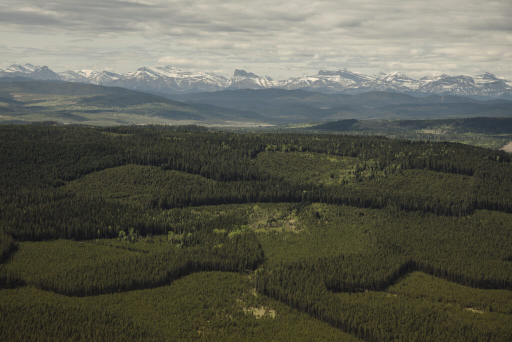
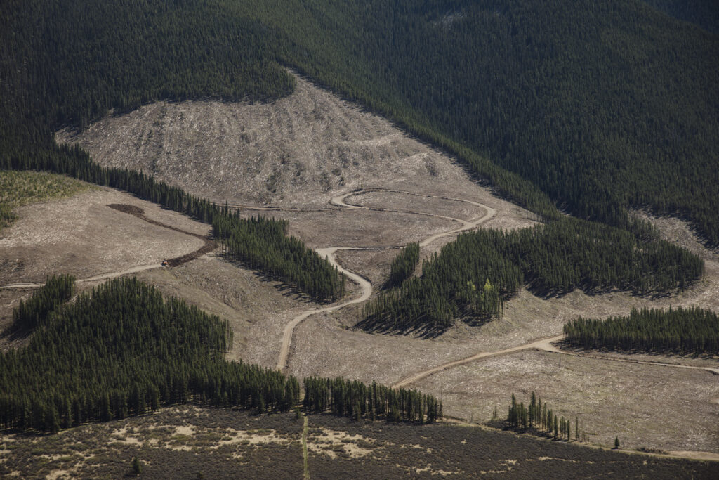
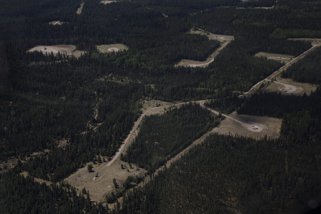
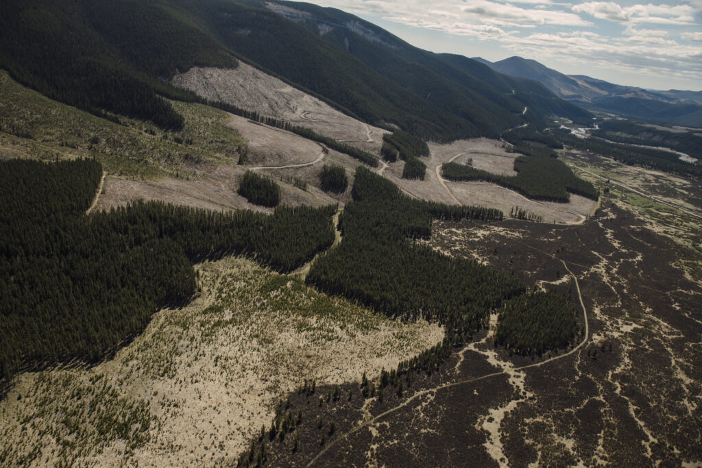
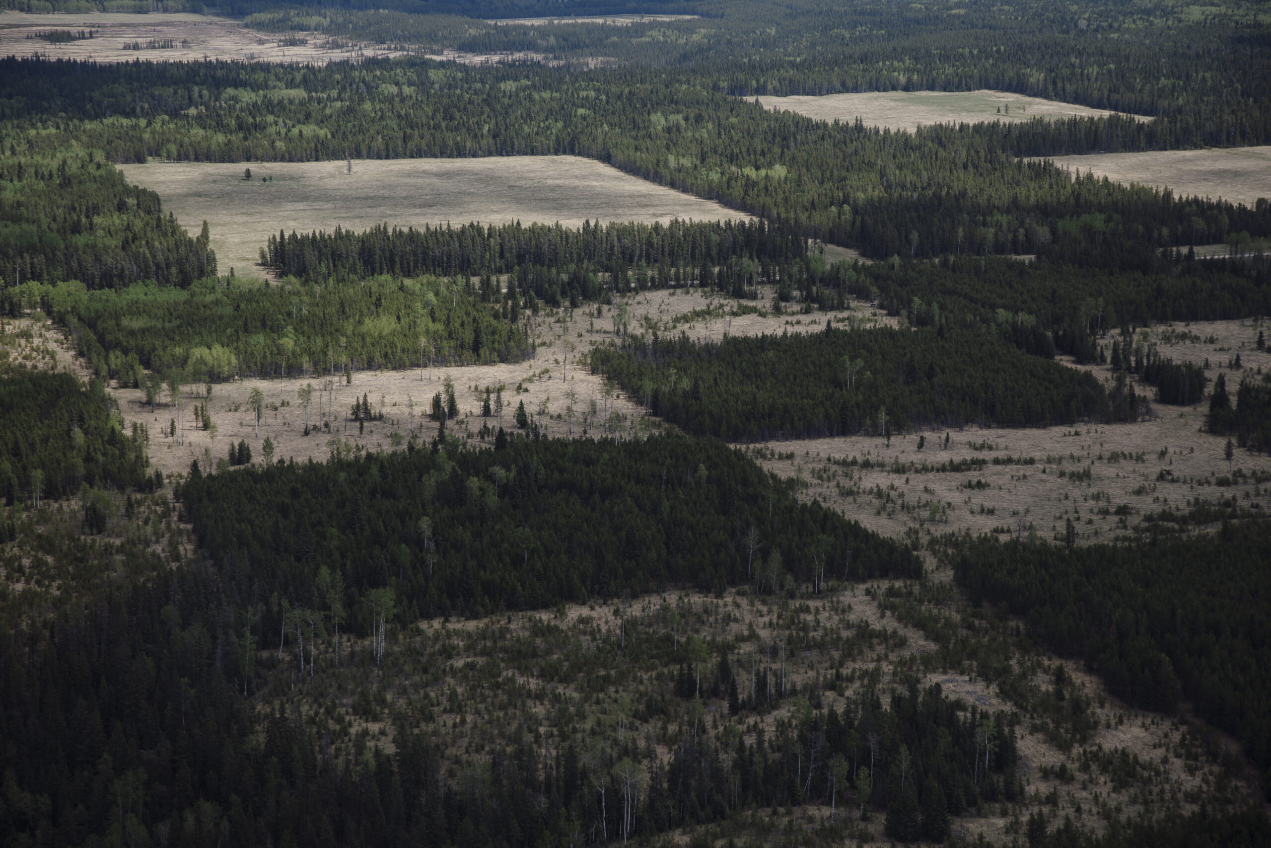
Forestry, oil and gas activity and coal exploration have turned much of the region from what Wood describes as a “pristine” forested area to one chopped up by seismic lines, cutblocks, well pads and boreholes.
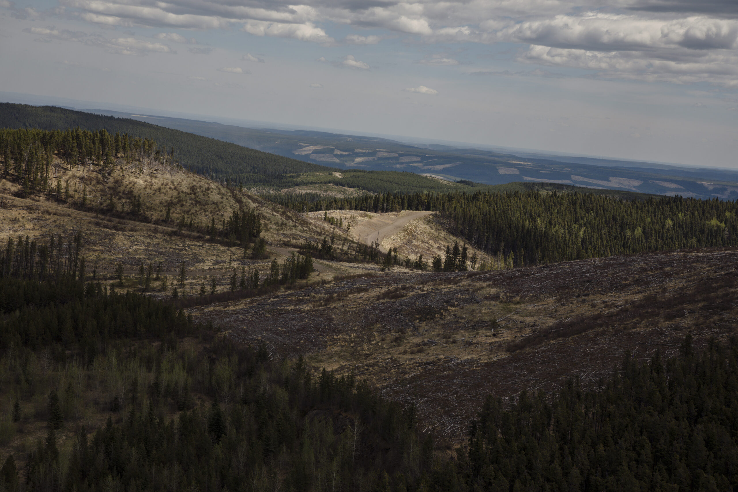
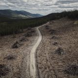
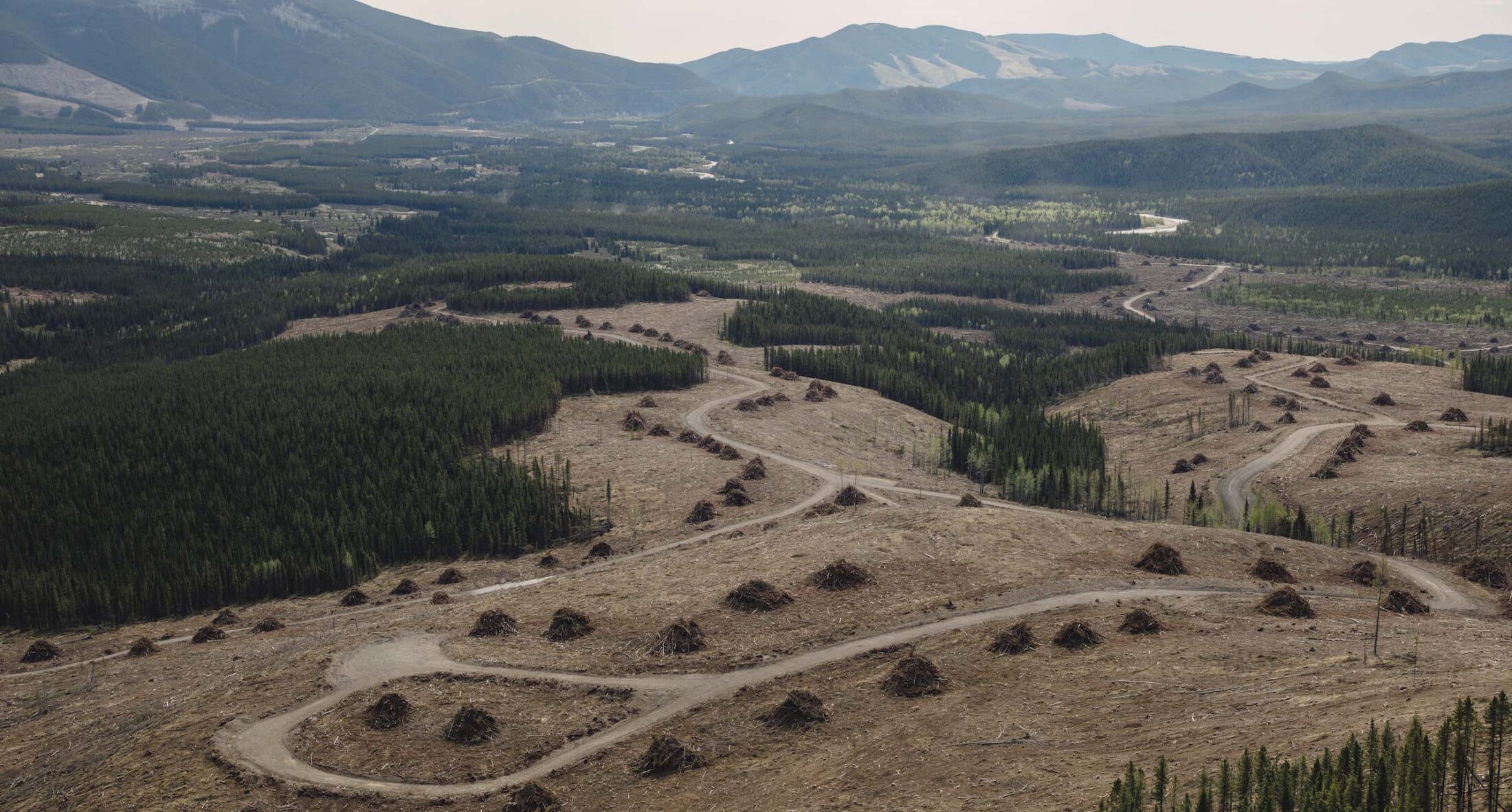
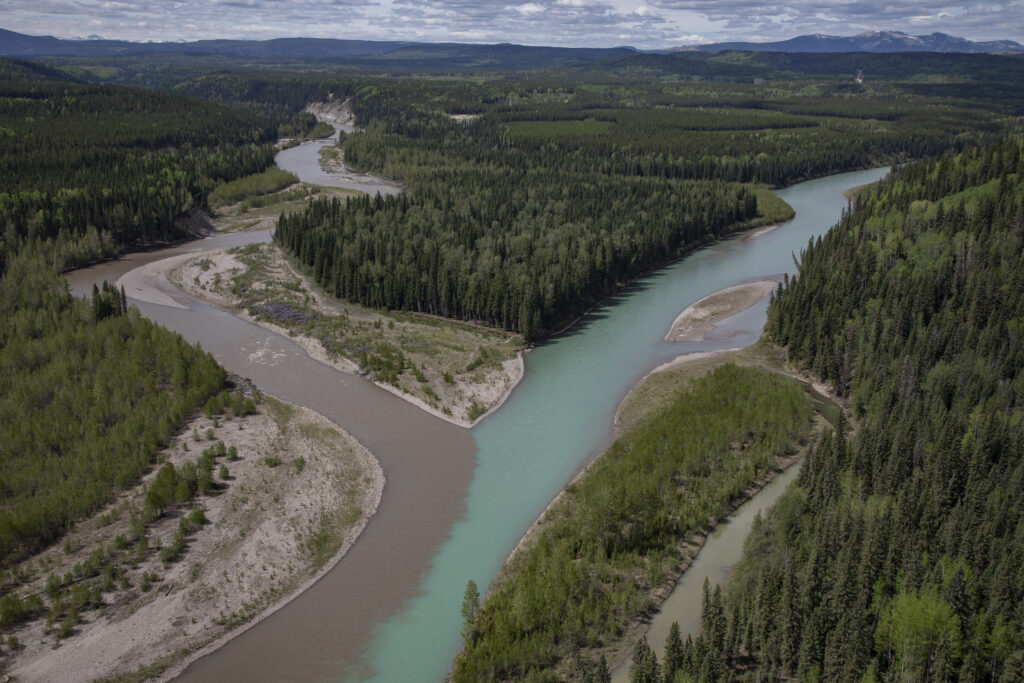
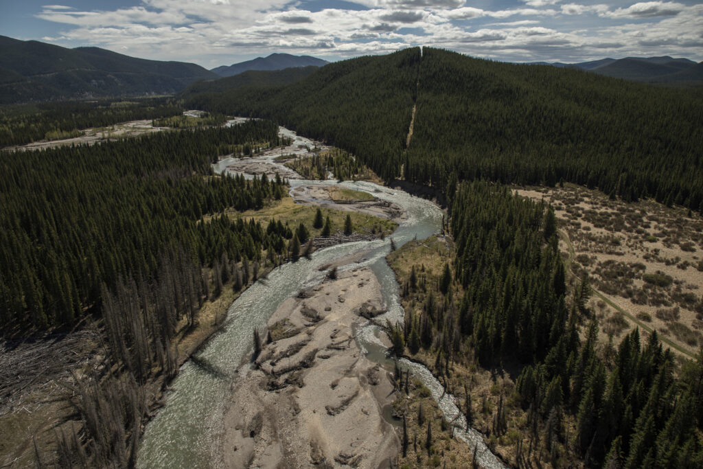
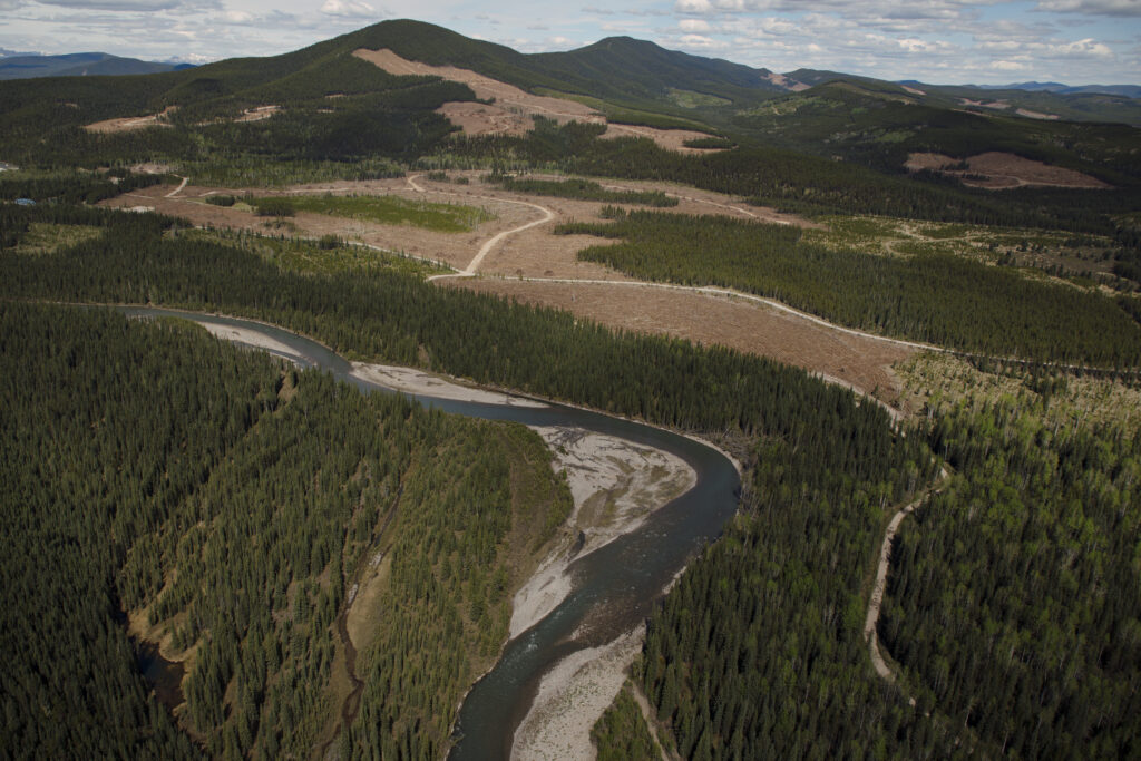
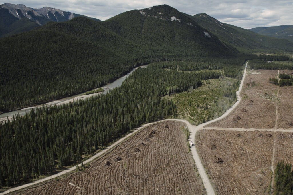
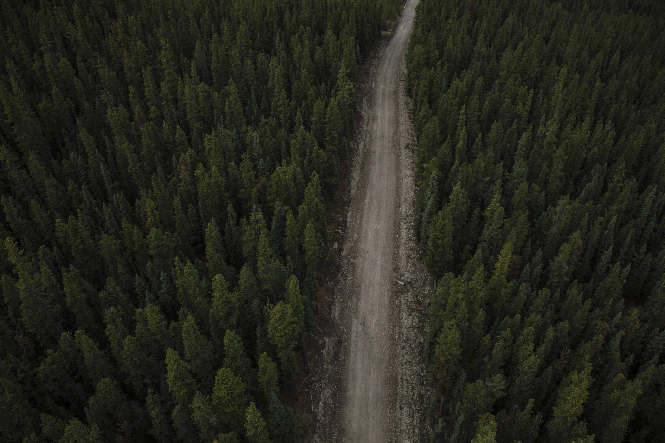
On a recent helicopter flight over Clearwater County, The Narwhal got a bird’s eye view of the area, which includes exploration for the Ram River Coal Corporation’s Aries Mine and Valory Resources’ Blackstone project.
Projects like these had many Albertans up in arms over the last year, after the United Conservative Party government announced in May 2020 it had rescinded the longstanding coal policy which prohibited most coal mining in areas like these (known in the policy as category 2 lands).
Alberta’s coal policy — in place since 1976 — allowed for exploration, but getting approval to build an actual coal mine was much more arduous. That changed when the coal policy was rescinded, sparking backlash: ranchers upset over deteriorated water quality, tourism operators concerned about destruction of remaining wilderness and concern over what Wood described as “disingenuous” communication of its plans.
The government dialled back its efforts to open up the eastern slopes to open-pit coal mining, and also eventually paused exploration.
“We admit we didn’t get this one right,” Energy Minister Sonya Savage said at a press conference in February announcing the government’s course-reversal.
But residents and advocates are concerned that many Albertans may view the issue as settled, and for those The Narwhal spoke to, the eastern slopes are far from free of future threats from coal mining.
“Everyone’s let their guard down,” Travis Boschman, a wildlife photographer in Red Deer, told The Narwhal. “I’m happy that [exploration] is stopped for now but I don’t have a lot of faith that it’s going to stop forever.”
This leaves some advocating for not just a reprieve from industrial activity, but a conscious effort to protect the region from the cumulative impacts of numerous industries.
“There are certain areas where it’s a non-starter and the eastern slopes just has to be one of those,” Wood said.
Coal exploration quietly chugged along in recent years
Clearwater County was blanketed in coal leases following the government’s announcement that it would rescind the coal policy.
Coal leases soon covered nearly 10 per cent of the county’s area, according to data from the Canadian Parks and Wilderness Society. The area of coal leases more than quadrupled after the government’s announcement that the coal policy would be rescinded, according to the group. Then, facing pressure, the government paused the sale of new leases in category 2 lands in January.
That didn’t stop companies holding existing leases from pursuing exploration, though not all coal leases had active exploration activity.
Then, facing more backlash, the government announced another pause in April on all existing and new exploration on Category 2 lands. At the time, Energy Minister Sonya Savage directed the Alberta Energy Regulator to pause all approvals for coal exploration programs until December 2021. (Tonya Zelinsky, a spokesperson for the Alberta Energy Regulator, told The Narwhal by email that “beyond that date, regular processes would resume unless otherwise directed by the Government of Alberta.”)
But coal exploration in the area had quietly proceeded before the pause, with roots many decades in the past.
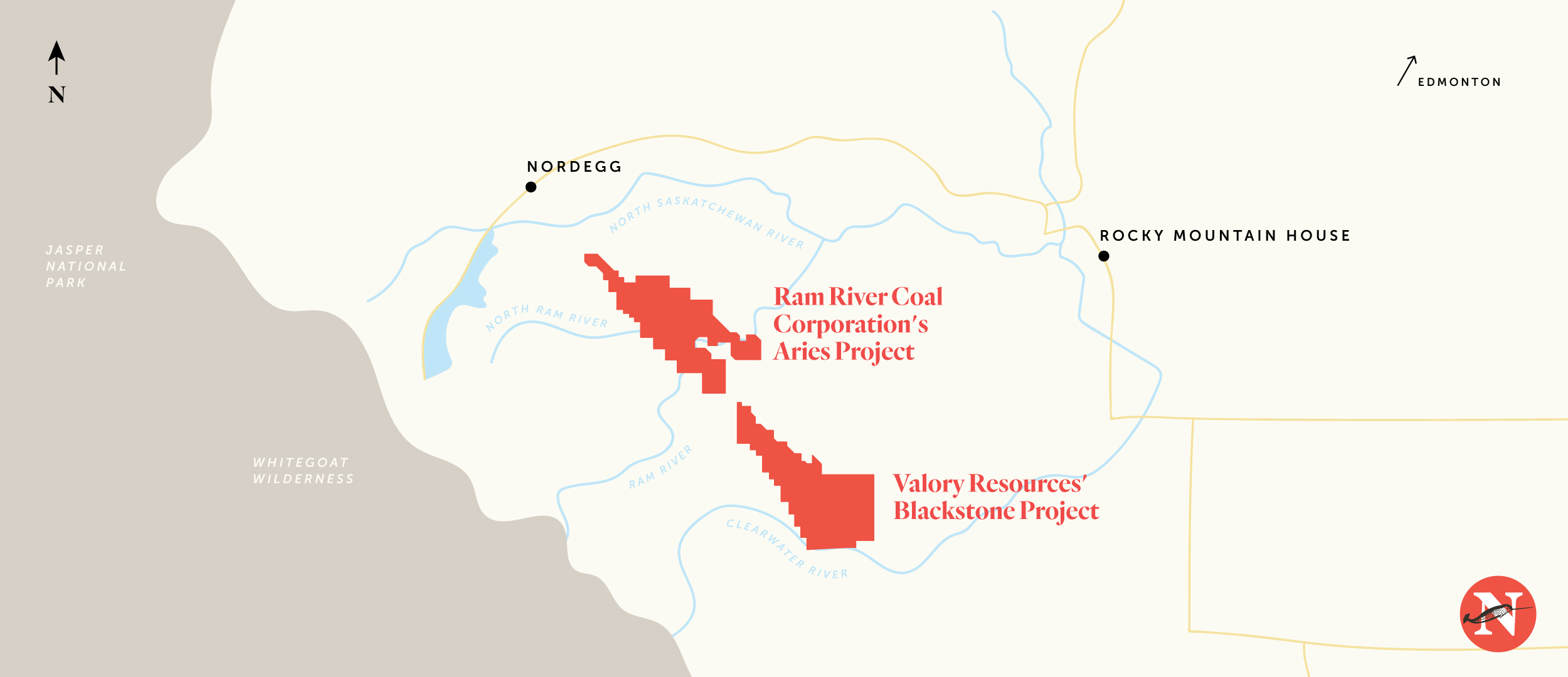
The Blackstone project, near the Clearwater River, saw early exploration dating back to the 1970s, and was first mapped by the Geologic Survey of Canada in 1945, according to a 2020 investor presentation from the company.
By 2020, the company had drilled 110 boreholes, drilling a total distance of 17,600 metres. In its 2020 investor presentation, the company noted it had plans to further its exploration program by adding another 20,000 metres of drilling, as well as 100 kilometres of seismic lines.
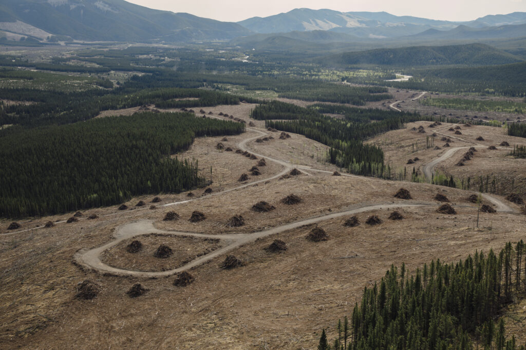
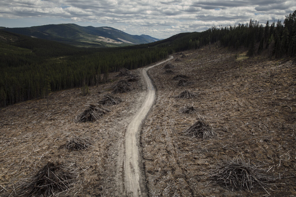
Boreholes, also known as drill holes, are drilled to assess a coal resource, and though they often represent a small footprint on land — some are 15 centimetres in diameter — they can reach down hundreds of metres below the earth’s surface.
To drill a borehole, companies must transport a drilling rig, often mounted on a skid, through the forest to the proposed site, resulting in visible disturbances on the landscape in the form of removed trees and, oftentimes, new access roads.
To the north, the Aries Ram River coal project has also been drilling bore holes for decades. Between 1970 and 2013, 608 drill holes were completed, for a total drilling distance of more than 63,000 metres, according to a 2017 technical report completed for the company.
Representatives of Ram Coal and Valory Resources did not respond to The Narwhal’s request for an interview.
All this activity has chugged along relatively quietly, leading advocates to wonder what the landscape looked like as a result.
A bird’s eye view
Fields of dandelions bowed their heads in the wind as a helicopter alighted on a recent flight over the coal exploration area for Ram Coal and Valory Resources.
The flight was arranged by the Canadian Parks and Wilderness Society to take its own videographers as well as three journalists up for a birds-eye view of coal exploration activity.
Cumulative impacts highlight the need for land use planning: advocates
The long list of industries active on the eastern slopes has long been a concern for residents and conservation advocates.
“The environment doesn’t operate on the basis of single projects; it’s the cumulative impacts that are a concern,” Wood said.
Recognition of the cumulative impacts of industrial activity in a region has slowly been gaining traction in Alberta, and the province has gradually been introducing what it calls regional plans. (The Alberta government did not respond to The Narwhal’s request for an interview about regional planning.)
The province is divided into seven regions, two of which — the South Saskatchewan and the Lower Athabasca — have seen the implementation of completed regional plans, which are legally binding documents that replace older versions from the 1980s, according to Christopher Smith, parks coordinator with the Canadian Parks and Wilderness Society.
Updated regional plans, he said, attempt “to manage land more on a holistic level and on a landscape level, in order to address cumulative effects.”
The South Saskatchewan regional plan, for example, “uses a cumulative effects management approach to balance economic development opportunities and social and environmental considerations.”
Without a master document like a regional plan, Smith said, “there’s just too many layers for any one particular ministry to be able to fully address within their portfolio.”
But regional planning has stalled in recent years.
“Land-use planning at the landscape level has been a tough sell in Alberta for decades,” Ian Urquhart, the executive director of the Alberta Wilderness Association, told The Narwhal. “Serious cumulative effects management always has been a dream — or an illusion — when it comes to managing lands and natural resources in Alberta.”
Consultation for a North Saskatchewan regional plan, which includes the Aries and Blackstone project areas, began in 2014 but a plan has not yet been completed. “Snails progress at faster paces than regional development in Alberta,” Urquhart said. “This government doesn’t, in my opinion, want anything to do with serious consideration of cumulative effects.”
Without a regional plan, critics fear cumulative impacts won’t properly be addressed.
“No one ministry can deal with the cumulative effects if there’s impacts being felt from other activities outside of their jurisdiction.”
Chris Smith, the Canadian Parks and Wilderness Society
“The government can’t keep dragging their feet on this regional planning, because in the meantime, we’re creating patchwork policies that are trying to plug the gaps,” Smith said.
“That’s what the regional planning was meant to address — these reactive piecemeal plans to address issues as they cropped up.” Instead, he said, these issues could be addressed by the frameworks created by a regional plan: data could be gathered, baselines established and big-picture impacts better accounted for.
“What it was really meant to do was to bring all these siloed ministries together to deal with these problems holistically,” he said. “No one ministry can deal with the cumulative effects if there’s impacts being felt from other activities outside of their jurisdiction.”
In neighbouring B.C. the Blueberry River First Nations just won a precedent-setting decision that marks the first cumulative impacts Aboriginal Rights case in Canada. In her ruling, B.C. Supreme Court Justice Emily Burke wrote “the province’s mechanisms for assessing and taking into account cumulative effects are lacking and have contributed to the breach of its obligations under Treaty 8.”
Minister putting ‘cart before the horse’: advocate
Speaking at a news conference in April, Savage made it clear that the province’s efforts to update the coal policy were going to happen before any broader, landscape-level planning.
“These consultations are about coal policy, it’s not about the broader land-use planning initiatives,” she said. “It’s about coal. … Let’s get the coal policy and vision done first.”
That leaves advocates concerned about whether the whole picture of industrial activity has been fully considered.
“The Minister is putting the cart before the horse here,” Urquhart told The Narwhal. “You want land-use planning: you want to have an idea of where you think coal fits in on the land, if it fits in at all.”
“You don’t go ahead and look at developing a coal policy before you’ve made those basic land use decisions.”
Urquhart and others are concerned the UCP government has prioritized industrial development, including coal, over other priorities.
“This government has operated in a way that just wants to open the door for industrial use of the land,” he said. “Any serious consideration of cumulative effects just doesn’t just work in that sort of world.”
‘Needs to be a balance’
It’s not just the cumulative effects of industry on the landscape of Clearwater County’s mountain slopes that are a concern. Advocates also worry about the individual impacts of any potential coal mines.
The Canadian Parks and Wilderness Society is concerned the Blackstone and Aries projects, should either move forward, would impact habitat for bull trout and grizzly bears, both threatened species in Alberta and federally designated species at risk. The society says the Aries project, at its closest point, would be within one kilometre of the Ram River.
It’s a concern echoed by others concerned about the future of the region.
“One of the concerns, like with the Aries project, is contaminants can get into the groundwater, and ultimately end up in the Ram River, either by surface runoff or groundwater,” Vance Buchwald, a retired fisheries biologist, told The Narwhal. “And the lower Ram has one of the best bull trout populations in central Alberta.”
“Overall, provincially, we are losing the battle for bull trout,” he said. “All of these insults to the landscape are not helping.”
“There needs to be a balance,” Buchwald said of the multiple uses of the landscape. “I’m not convinced that we’re at the right balance.”
For advocates and long-time lovers of the land along the eastern slopes in Clearwater County, the loss of more wilderness to industrial activity remains a looming threat.
“There’s places where we used to hike into the backcountry and camp … it was a 30 or 40 kilometre hike in any direction to get to a road,” Boschman, the photographer in Red Deer, told The Narwhal.
“Fast forward to now and it’s all logging roads and clear cuts. That sort of land barely exists up there anymore — those big vast chunks of wilderness.”
Amber Bracken’s photos were shot for The Narwhal and The Canadian Press.
Updated July 10, 2021, at 9:30 a.m. MT: This article was updated to clarify that both grizzly bears and bull trout are federal designated species at risk and listed as threatened in Alberta.