


Mercury levels have risen to 16 times the regional "background" levels in an area around oilsands developments in northeastern Alberta, according to Environment Canada researchers.
Environment Canada researcher Jane Kirk, who presented the as-yet unpublished report at a Society of Environmental Toxicology and Chemistry (SETAC) conference in Nashville last November, told Postmedia News the affected area encompasses 19,000 square kilometres around oilsands operations.
Margaret Munro of Postmedia News reports that Kirk told the conference the area is "currently impacted by airborne Hg (mercury) emissions originating from oilsands developments."
The mercury levels fall off gradually with increasing distance from the oilsands "like a bull's eye," said co-researcher Derek Muir, head of Environment Canada's ecosystem contaminants dynamics section. The highest mercury loadings, which reached up to 1,000 nanograms per square metre, were found in the "middle of the bull's eye," covering around 10 percent of the impacted area.
In October, Environment Minister Leona Aglukkaq signed a global treaty pledging to decrease mercury emissions.
The federal researchers stressed that the findings were still lower than mercury levels found in southern Ontario and southern Quebec, where toxins from incinerators and coal-burning power plants are affecting the environment.
But the scientists said that mercury is "the number one concern" when looking at toxins released by oilsands production, with "indications that the toxin is building up in some of the region's wildlife." The contamination is further worrying to environmental groups and First Nations concerned about the oilsands' impact on fishing, hunting and wildlife.
Environment Canada wildlife scientist Craig Herbert told the toxicology conference that the eggs of several species of waterbirds downstream of the oilsands have been showing increasing levels of mercury, with levels found in the majority of Caspian Tern eggs in 2012 exceeding "the lower toxicity threshold."
Kirk's team measured contaminants in cores of the snowpack collected from over 100 sites near the oilsands every March, to calculate how much pollution enters the ecosystem at spring melt after gathering in snow over winter.
The team's 2011 results confirmed that "aerial loadings" of 13 priority pollutant elements including mercury were 13 to 15 times higher at sites within 50 km of the upgraders that convert bitumen into synthetic crude oil, and "highest within 10 km of the upgraders," according to the presentation abstract.
The results "support earlier findings that the bitumen upgraders and local Oil Sands development are sources of airborne emissions to the Alberta Oil Sands Region."
The researchers also found up to 19 nanograms of methyl mercury per square metre near oilsands sites, which is 16 times the region's background level. Postmedia News reports that this is the first finding of this more toxic form of mercury in snow. The finding is significant because, as the abstract explains, "methyl mercury is a neurotoxin that bioaccumulates through foodwebs."
"Here we have a direct source of methyl mercury being emitted in this region and deposited to the landscapes and water bodies," Kirk told Postmedia News. "So come snowmelt that methyl mercury is now going to enter lakes and rivers where potentially it could be taken up directly by organisms and then bioaccumulated and biomagnified though food webs."
Muir said that microbes in the snow could be converting mercury into methyl mercury, or that it could be coming from "dust and land disturbances," though there is currently no data to support this.
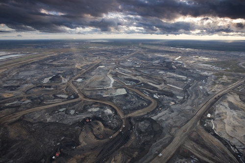
"To our knowledge, emissions data from blowing dusts due to various landscape disturbances (open pit mines, exposed coke piles, new roads, etc.) and volatilization from tailing ponds are not publicly available," the researchers said.
The research shows that zinc, nickel and vanadium levels in lake sediments peaked in the 1990s following oilsands development, but have fallen off since, which Kirk attributes to "improvements in the air pollution catcher technology at the upgraders."
But levels of mercury and other "crustal elements" in lake sediments have been "going up more or less continually" with the expansion of the oilsands, said Muir, with open pit mines and coke piles possibly contributing to the pollution.
The fact remains that more research is required on why mercury levels are going up and the impact it's having on ecosystems.
"Is it affecting fish levels and is it going to result in increasing fish consumption advisories? We don't know," said Kirk.
But Environment Canada's latest results only confirm the need to further study and address the serious impacts of oilsands development.
Image Credit: Elias Schewel / Flickr