


Before the flood waters overwhelmed Peguis First Nation last spring, local trappers noticed the beehives had been built much higher than in years past. The beaver dams looked different; the foxes and raccoons they usually snared had moved to higher ground.
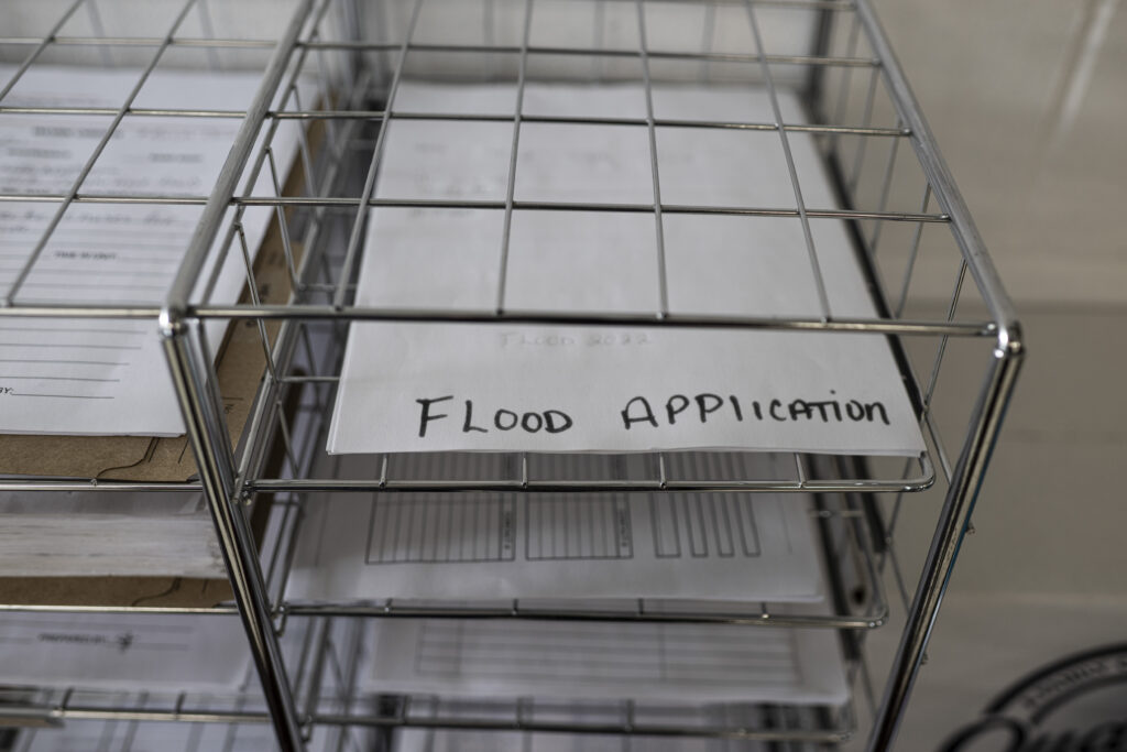
For the trappers, these were sure signs a flood was coming, says William Sutherland, Peguis’s director of housing and emergency management. Not to mention, decades of experience had taught the community to expect a major flood every five or six years, and the last one had been in 2017. Expecting the worst, Sutherland and his team applied for federal funding to help shore up homes and businesses against the rising waters of the nearby Fisher River.
“My god, there’s an elevated risk there,” Sutherland says. “But they didn’t see it.”
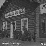
Instead, the federal government fell back on provincial flood forecasts, which had predicted a low risk of flooding in the boggy interlake region where Peguis — Manitoba’s largest First Nation — had been forcibly located more than a century ago. The funding was denied.
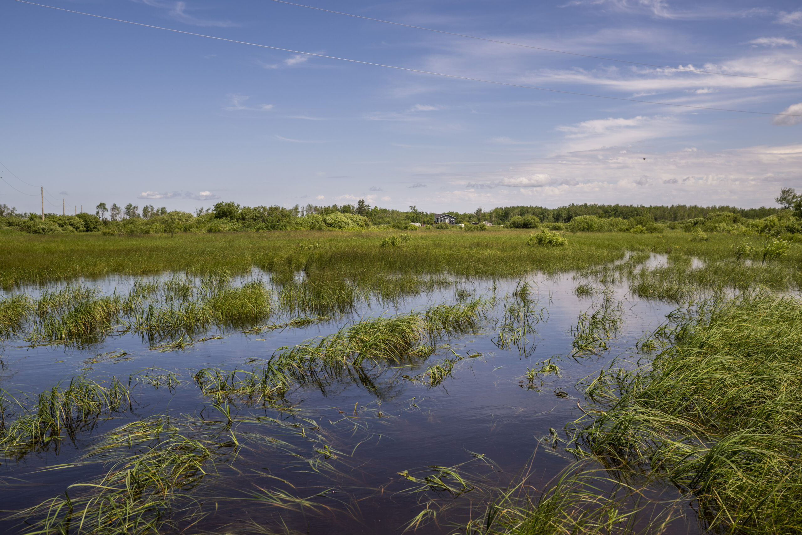
When the flood came, it was devastating. More than 300 homes were damaged, thousands of people were evacuated and the cost of repairs were estimated to exceed $300 million.
According to an estimate from Indigenous-owned Acosys Consulting, nearly 90 per cent of Manitoba First Nations have been affected by flooding, yet flood mapping and mitigation programs have repeatedly failed to adequately prepare, support and address the communities’ needs. In an effort to turn the tides as climate change spurs more frequent and intense floods across the province, Acosys has been commissioned by Natural Resources Canada to facilitate a project that would give First Nations a say in how flood maps are developed for their communities.
Last week, representatives from 34 Manitoba First Nations gathered in Winnipeg for an engagement session geared towards re-imagining flood maps with an emphasis on Traditional Knowledge and local community input. During a discussion, approximately 50 participants voiced concerns about the gaps in federal flood management programs that have left their communities out to dry — and how to design flood maps with their needs in mind.
Flood mapping traditionally focused on infrastructure, population density
Flooding is Canada’s most costly natural disaster, causing, on average, more than $1 billion in direct damage to homes, property and infrastructure, according to a federal government report. As climate change alters precipitation, weather and temperature patterns nation-wide, the scale of those damages is increasing.
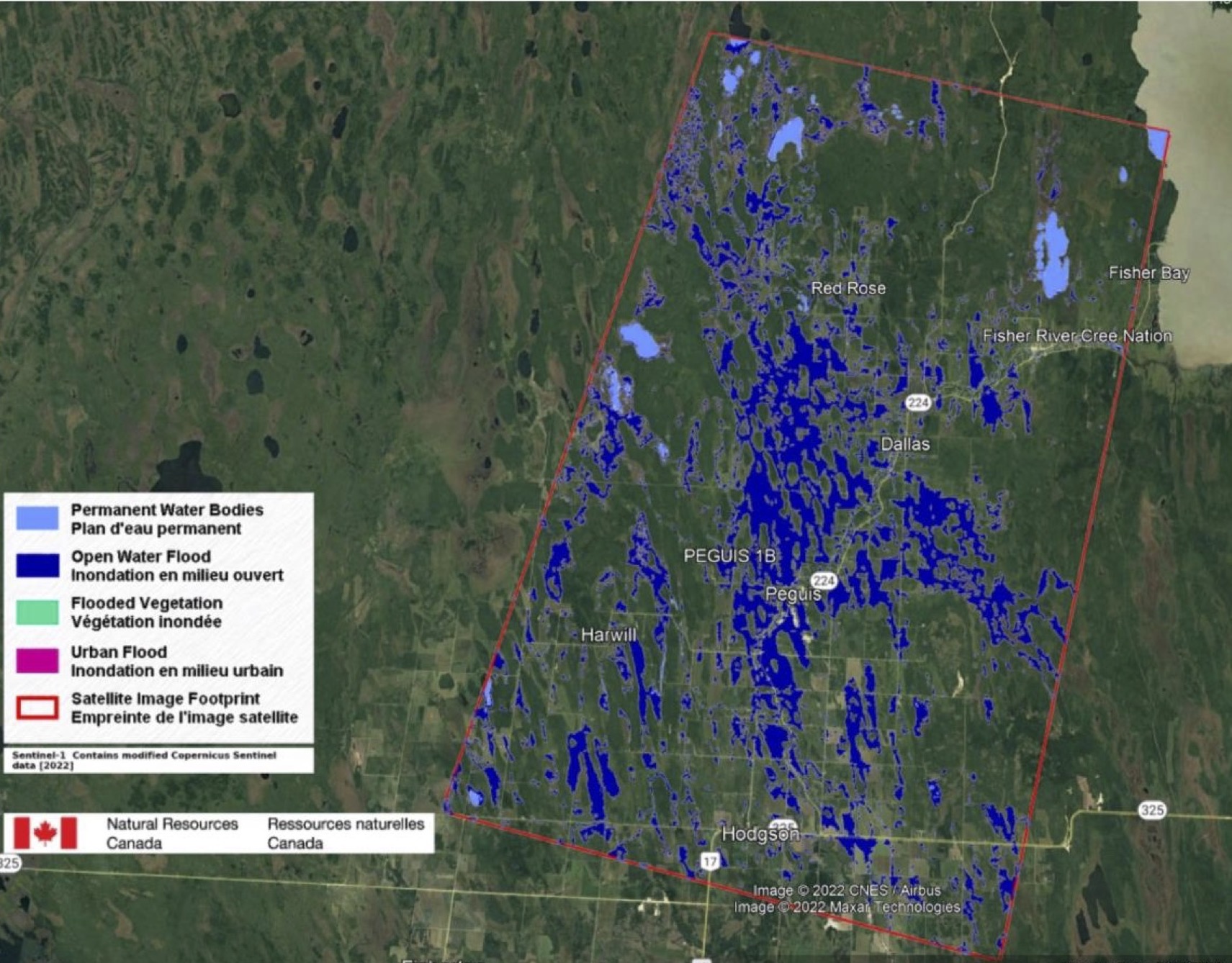
To help manage the risks associated with flooding, provincial and federal governments are responsible for developing a series of flood maps used for emergency response, land use planning and flood mitigation. The maps range from “inundation maps,” which show the extent of real flood events, to hazard maps that show engineers what areas might be susceptible to floods, to flood-risk maps that show potential consequences of a flood.
David Carrière-Acco, president of Acosys Consulting, says he had an “aha moment” when he learned flood mapping programs are traditionally designed for insurance companies. Though the maps are created and funded by government bodies, they typically prioritize urban areas with high population density and extensive infrastructure.
“But when you look at it in terms of where the impacts are really happening, that’s along the river system where Indigenous people have lived since time immemorial, or where the Indian Act moved us into a flood zone,” Carrière-Acco says.
Indigenous communities, he adds, “do not fit the model,” and have been left behind by policies that fail to consider the unique characteristics, history and knowledge of each nation.
“Flood management didn’t start 500 years ago … we were doing it right from the beginning,” he says. “What I’d like to see is the community actually informing and helping develop good legislation, good programs.”
At the engagement session, participants were asked to draw their own vision for flood mapping that prioritizes the knowledge and needs of their communities. The goal, Carrière-Acco says, is to help design a more “holistic” approach to emergency management that prioritizes the “downstream impacts” of flooding on the community’s way of life.
Community’s needs have been ignored: leaders, auditor general
Elder Theresa Bighetty of Mathias Colomb Cree Nation, also known as Pukatawagan, was the child of trappers, and grew up camping along the grassy river banks of northern Manitoba, near the Saskatchewan border. She remembers sleeping in teepees, playing in the water, running among the grass, listening to the music of birds, beavers and breezes.
“It was a nice living,” she recalls.
But as the years went on, Manitoba Hydro and the Saskatchewan Power Corporation built dams along nearby rivers, changing the water flow to the community and prompting frequent floods.
Nowadays, Bighetty says, her old camping ground “looks so ugly.” Floodwaters washed away the sandy shores and thriving ecosystems, leaving something barren behind.
“All kinds of medicines, they’re all gone. There used to be lots of fish in the river but now the fish are dying,” she says.
Ice and slush have destroyed docks and fishing equipment; the community’s ability to trap and fish has been severely hampered. Their way of life has changed. The community has been asking for help, Bighetty says, but their voices aren’t heard.
Farther south, in Peguis First Nation, Sutherland has seen the long-term effects of flooding, too. He’s noticed family breakdowns and rising rates of substance use that he attributes to the repeated and extended evacuations that have plagued the frequently flooded nation. There are still more than 700 people living away from their community as a result of last spring’s flood, and there hasn’t been enough money to rebuild their homes.
“I’m still responsible for bringing those evacuees back home,” Sutherland says. “I can’t do that if there’s no place for them to return to.”
Peguis has received millions in funding from the federal government to start home repairs and build new housing on higher ground, but the community is tired of only receiving reactive support. The community has been asking for capital investments in long-term flood mitigation strategies since 2009, but that support has never come.
A November report from Canada’s auditor general found Manitoba First Nations are right to be concerned their community’s needs have gone unnoticed.
The report found Indigenous Services Canada, which administers funding for emergency management, “did not provide the support First Nations communities needed to manage emergencies” like floods. In fact, the department was spending 3.5 times more on emergency recovery than it was on emergency preparedness and mitigation. More than 100 infrastructure projects that would help First Nations protect themselves from the impacts of natural disasters have been approved but not funded as the department works through a years-long backlog, the report found. All the while, the department failed to conduct risk assessments to determine and update emergency management plans for some vulnerable First Nations.
That audit has played “a major role” in the community’s fight, Sutherland says.
“That’s a good sign. It’s going to make our case stronger, and it’s going to hopefully improve the changes going forward.”
New approach to mapping could put power back in First Nations hands
The silver lining to last year’s floods, Sutherland says, has been a new, open line of communication between the community and the government. Events like the engagement session, he says, are “setting up another learning system” to understand the impacts of flooding with the knowledge of Elders, trappers and other local experts.
Incorporating warning signs like animal habitat changes and historical patterns into the provincial and federal data systems would help communities validate their requests for better flood mitigation infrastructure, while helping to avoid costly and devastating disasters.
“We can’t afford to get laughed at if we say: ‘There’s a beehive three metres higher,’ ” Sutherland says. “It’s got to be a convergence of all these things coming together that the government can take seriously, that can be verified by other communities.”
Communities that have lived on the land for many generations, Carrière-Acco says, have the foresight to know what their communities will need, and the expertise to develop their own datasets, maps and emergency management tools.
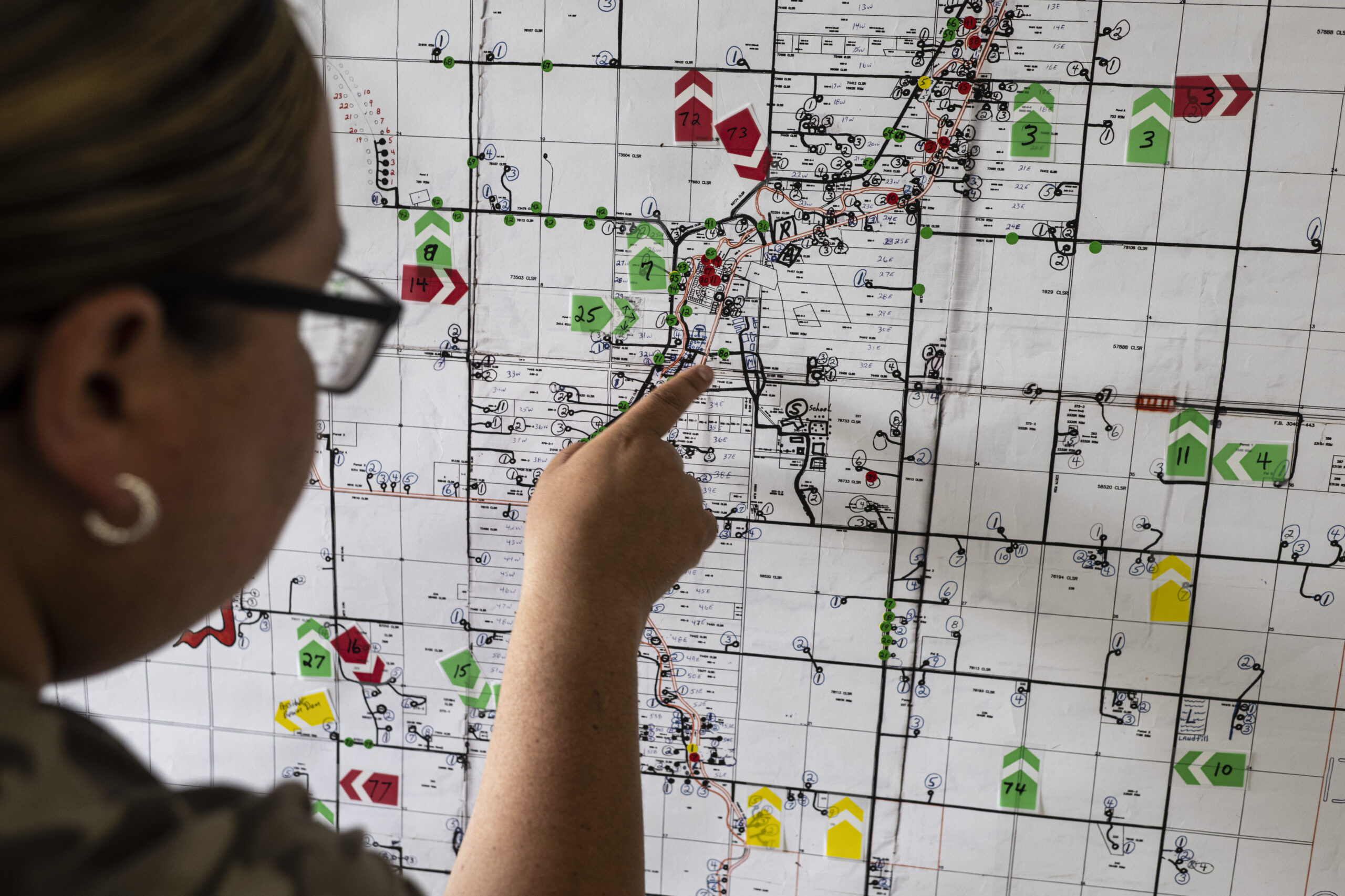
Carolyn Smeltzer, who heads up the technical unit for the eight northwestern Manitoba First Nations that make up the Swampy Cree Tribal Council, has been putting that foresight into action, helping develop localized, real-time mapping tools for emergency management.
The maps — which community leaders can access and edit through phone apps — show topography, existing infrastructure and even current and past extents of emergencies, but they also allow communities to mark features that are locally important and track real-time changes in the land.
“Our viewpoint of the world, as Indigenous people, is that we think of the world as connected,” Smeltzer says.
“If there was a change, even the slightest change, the animals and the birds’ behaviour would change. So we knew something was coming and we would be able to prepare for it. That’s what’s been missing all along.”
Real-time data, like fire maps that show how hotspots change with the wind, helps communities to adapt quickly with “the flow of nature,” she says. Having the power to develop their own visuals that illustrate those natural connections and changes gives communities the power to make their own decisions to protect what’s valuable on their land.
It’s that empowerment Acosys hopes the engagement sessions will facilitate as Natural Resources Canada re-imagines how it delivers mapping programs in First Nations. In a perfect world, Carrière-Acco says, the first-of-their-kind engagement sessions will help develop a collaborative emergency management process that meets the needs of Indigenous communities, as well as provincial and federal governments.
Acosys will present the results of their engagement to the federal government. From there, it will be in the government’s hands to decide how policy guidelines for flood mapping changes in the future, and how best to ensure Indigenous voices are front and centre in emergency management.
“It’s about mitigation, it’s about prevention, it’s about having foresight,” Carrière-Acco says. “I’d like to see a very powerful Indigenous voice within that.”