


This story is part of Carbon Cache, The Narwhal’s ongoing series about nature-based climate solutions.
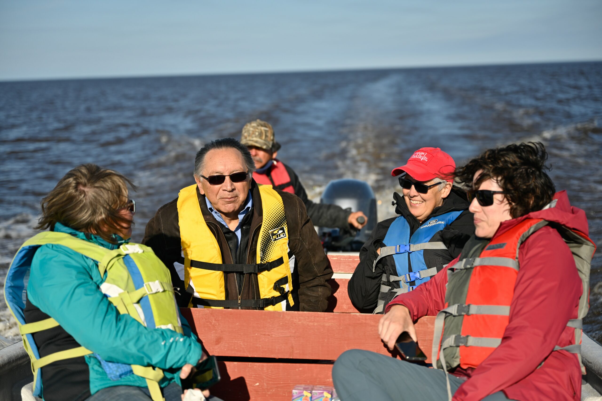
Lawrence Martin can’t put a date on when he first heard community Elders call for conservation efforts in James Bay and Hudson Bay — but the interest goes as far back as he can remember.
Martin is the marine region manager for a new conservation project spearheaded by the Mushkegowuk Council, which represents seven First Nations in the Hudson Bay Lowlands in northern Ontario. He says Elders have been encouraging an initiative like this for decades.
“They wanted to conserve the millions and millions of migratory birds that come up here. They see the seals, the belugas, the walruses, the polar bears roaming around. And as climate change happens, you see a lot of these animals coming inland.”
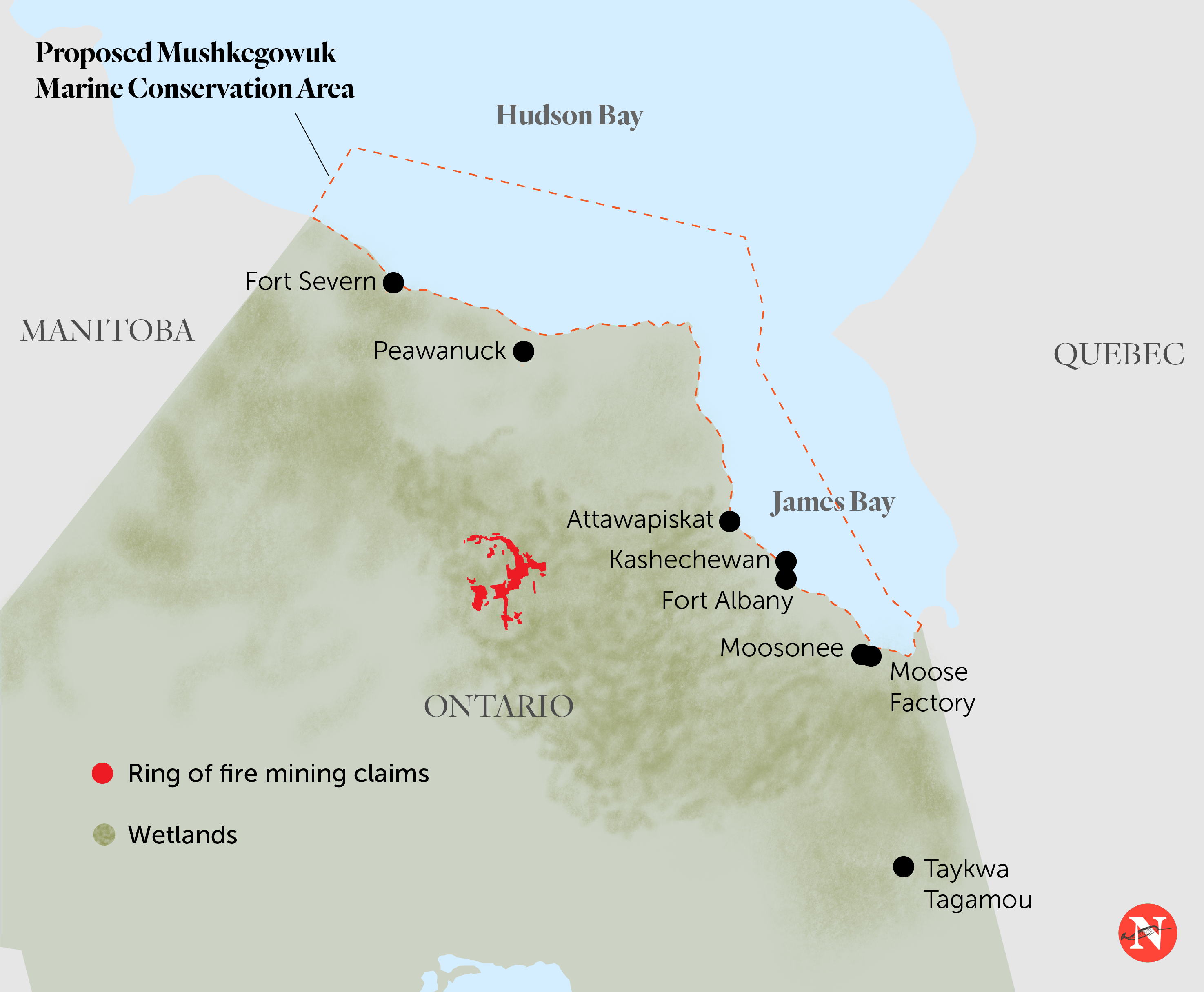
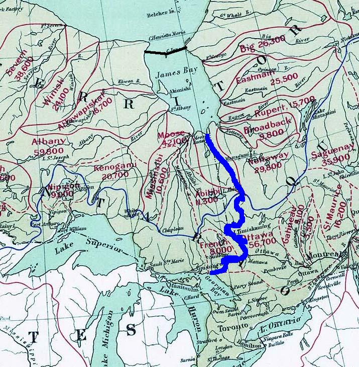
Northern Ontario’s James Bay and Hudson Bay — known in western Cree as Weeneebeg and Washaybeyoh — are 800-plus kilometres north of Toronto at their most southerly point, and unconnected to the rest of the province by road. The coastline and adjacent wetlands have long been understood as a globally significant site of migration and breeding for hundreds of bird species, and dozens of species at risk. The Mushkegowuk Council has resolutions on record from as early as the 1980s, calling for the creation of a Tribal Conservation Authority to manage this critical ecosystem.
In the last two years, it seems, the stars have aligned.
In August, the Mushkegowuk Council signed a memorandum of understanding with Parks Canada to establish a National Marine Conservation Area in James Bay and southwestern Hudson Bay. At more than 90,000 square kilometres — an area roughly the size of Portugal — the conservation area would be the largest in Ontario and second largest in the country, after Nunavut’s Tallurutiup Imanga.
The project is precedent-setting in Ontario. Not only has it been driven by Mushkegowuk community members and leadership from the very start, but community members and federal government representatives have come to the table with a mutual interest in establishing the conservation area.
“When the government and Crown of the day created the Chapleau Game Preserve or Polar Bear Provincial Park, they didn’t come to us,” then-Grand Chief Jonathan Solomon said at the signing of the memorandum, referencing land designations made in central and northern Ontario in the 1920s and 1980s, respectively, with little or no consultation with local Indigenous nations. Chapleau Game Preserve, in particular, stripped local First Nations of their right to hunt, trap and fish in the area.
“This time, it’s different,” Solomon continued. “We will drive that process. We will determine the future of our waters, of the shores, of the bays.”

A carbon cache and a perfect storm for conservation
In 2019, the council reopened the discussion around conservation after hearing of the Grand Council of the Crees’ plans to create a protected area on the Quebec side of James Bay. It didn’t make sense to protect just one side of the bay, says Vern Cheechoo, director of lands and resources at the Mushkegowuk Council. “The current comes from the west coast of Hudson Bay, James Bay and then goes up the east side. So whatever happens on the west side could be felt on the east.”
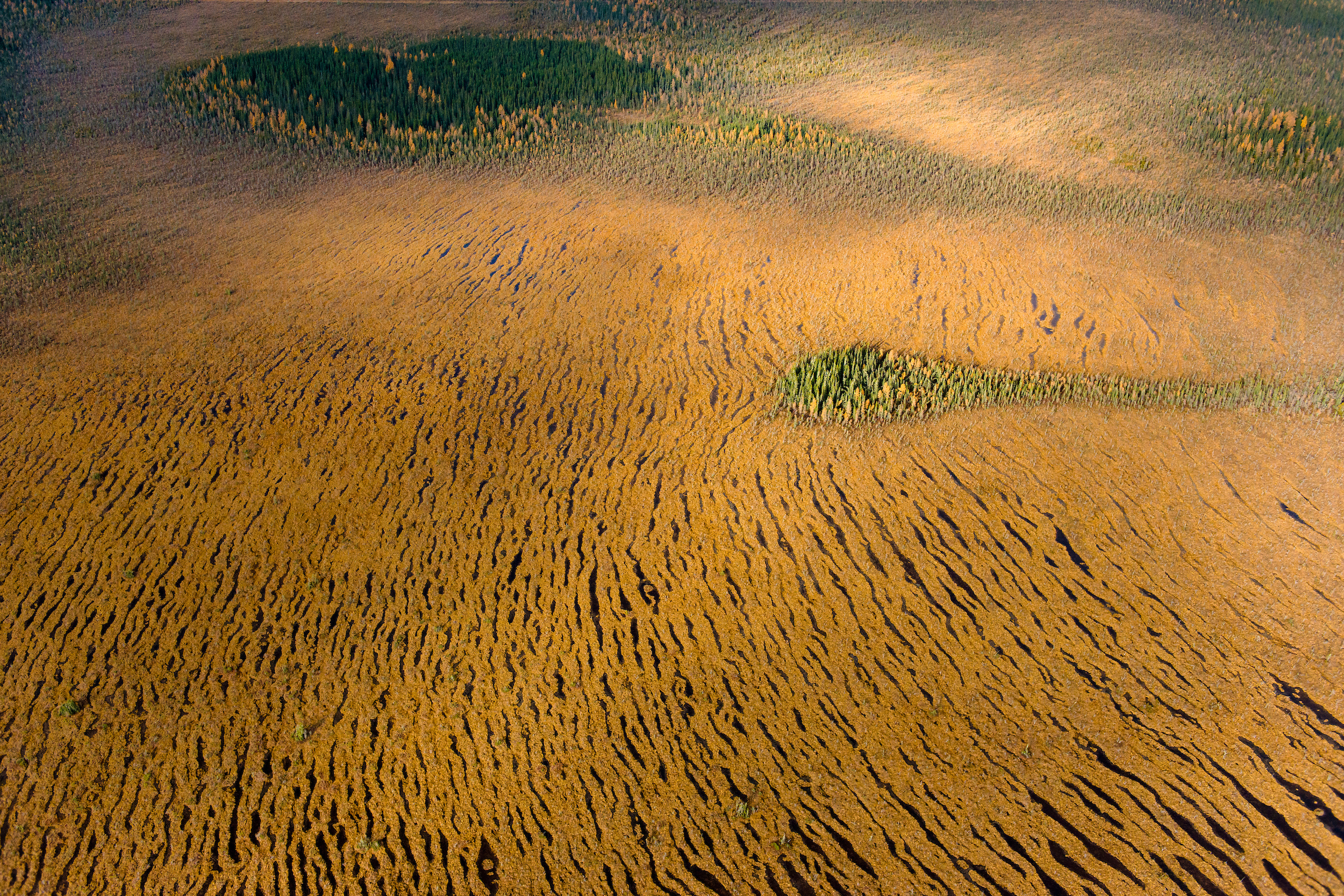
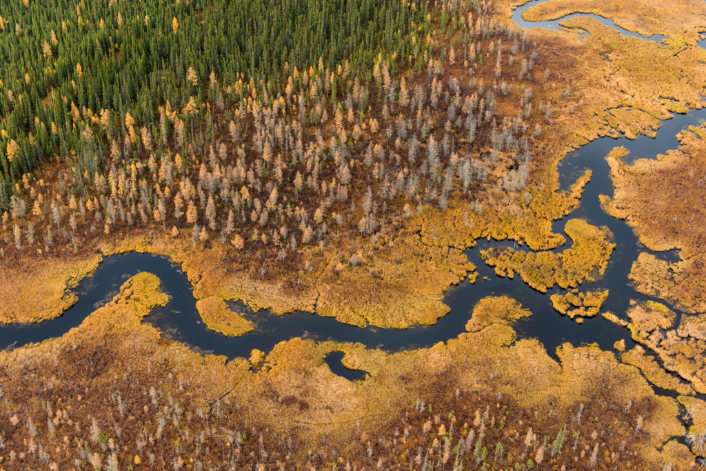
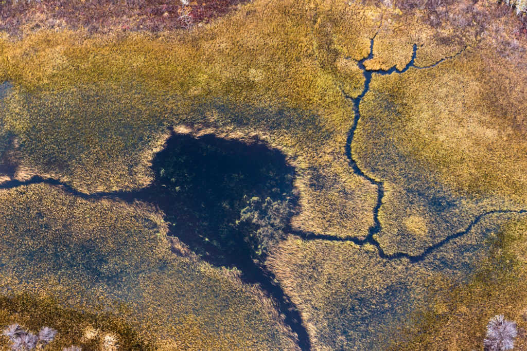
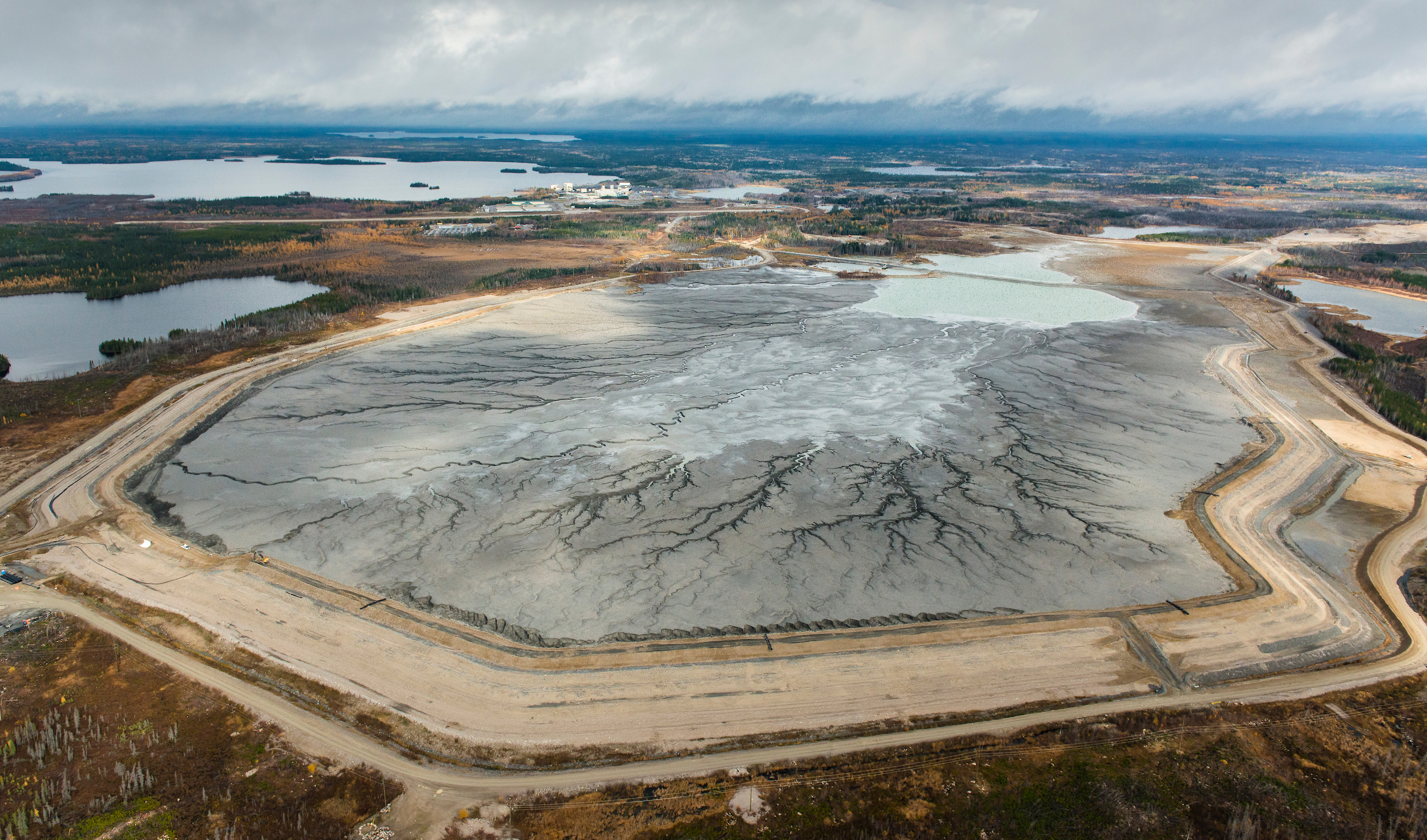
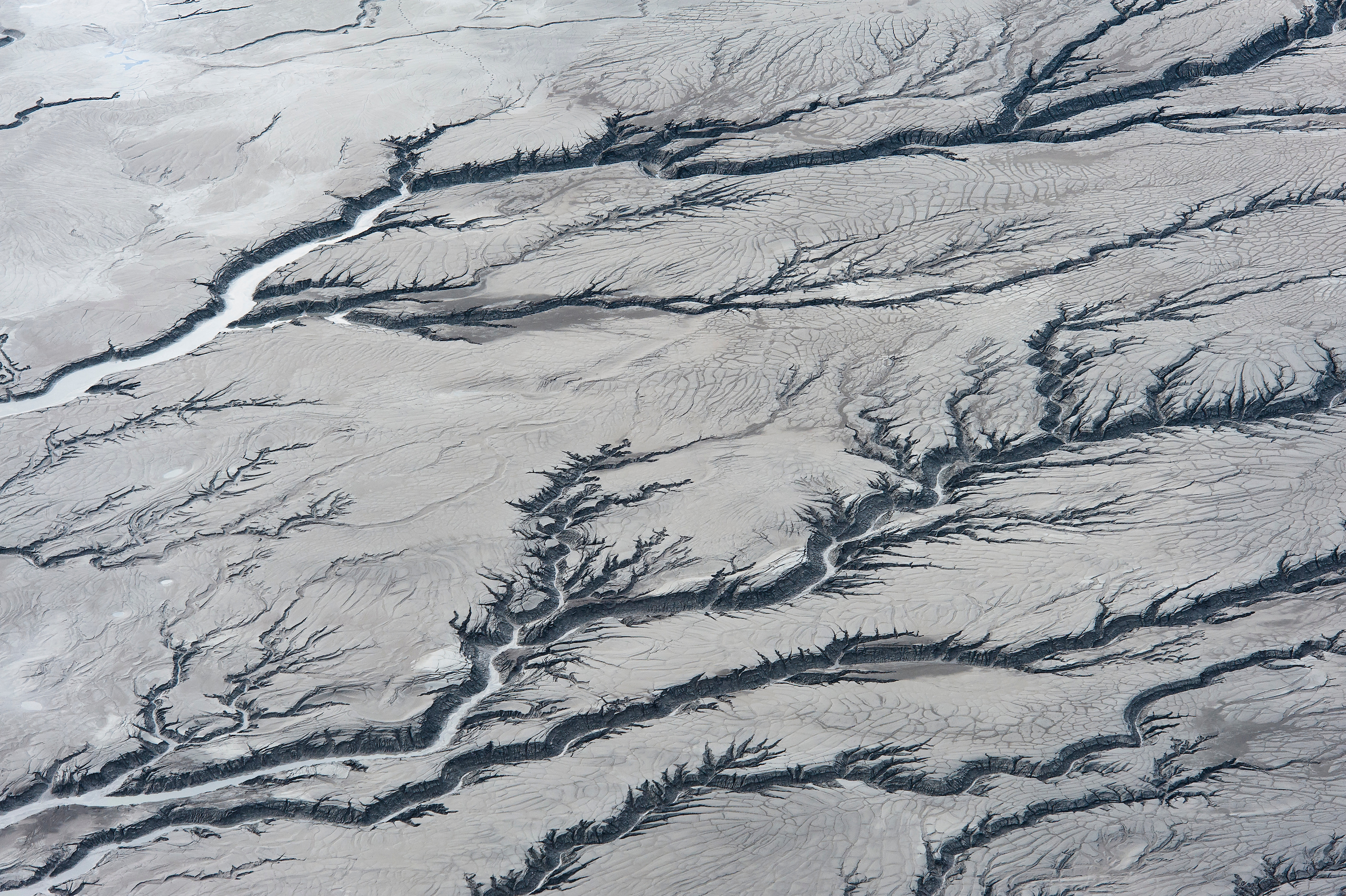
Establishing a marine conservation area on the west coast of James Bay would not only provide a protected habitat for vulnerable species, but give them greater opportunity to replenish wildlife populations that could go on to live elsewhere in the bay. The benefits would spread outwards, beyond the boundaries of the conservation area itself and into the adjacent rivers and wetlands — part of the world’s largest peatland complex, an underappreciated ecosystem composed of partially decomposed plant matter that builds up over centuries.
Known to the Omushkego as ‘The Breathing Lands,’ the peatlands serve as a crucial carbon store — containing more than 35 billion tonnes of carbon, and sequestering an additional 6 million tonnes, equivalent to taking nearly 6.5 million cars off the road, each year.
The peatlands in the Hudson Bay Lowlands can contain up to five times as much carbon as the Amazon rainforest per square metre. And this ecosystem is directly impacted by any changes that take place in the bay.
A perfect storm of political interest and will was beginning to form toward the end of 2019 among Mushkegowuk Council and, as it turned out, the federal government.
“Timing is everything,” Martin says. “When the federal government started announcing 2025 and 2030 being target dates, that played right into what the chiefs and Elders have been talking about over the years.”
In late 2019, the federal government made a commitment to protect 25 per cent of Canada’s land and oceans by 2025, and another five per cent by 2030. By the following April, Solomon had sent a letter to then-minister of environment and climate change Jonathan Wilkinson, writing: “Through Nation to Nation dialogue the Mushkegowuk Council seeks to explore with the Crown how best to conserve one of the richest most productive ecosystems on the planet for the direct benefit of our communities, for Canada and for the globe.”
From there, the process was faster than Mushkegowuk Council members and their non-profit partners had anticipated. That August, the council passed a motion supporting the creation of an official National Marine Conservation Area, with rigorous protections against ocean dumping, oil, gas or mineral exploration and industrial development.
A year on, continued meetings between the federal government, Omushkego leaders and non-profit environmental groups have led to the creation and signing of the memorandum of understanding, bringing the project to its next phase: a feasibility assessment. (While the study area does not include the islands within Hudson and James Bay that belong to Nunavut, consultations with the Government of Nunavut will also be a part of the process, Parks Canada told The Narwhal in an emailed statement.)
Now, a steering committee will be established to understand the impacts and benefits of creating the marine conservation area, consult with residents and stakeholders, and answer the numerous questions associated with a project of this scale. How do residents feel about the proposal and how best can the area be managed into the future? How does it fit into broader federal climate strategies and reconciliation?
The project team is expanding to include community representatives from each First Nation involved: Attawapiskat, Taykwa Tagamou, Kashechewan, Fort Albany, Moose Cree, Chapleau Cree, Missanabie Cree, Peawanuck and Fort Severn. While in-person engagement with some communities is still difficult given the threats posed by COVID-19 — which has placed immense pressure on communities with fragile healthcare infrastructure — the team has continued remotely engaging with locals through social media, the council website and the volunteer Cree-language radio station, Wawatay Radio Network.
“Historically, the bay has been neglected by a lot of governments,” says Anna Baggio, director of conservation planning for Wildlands League, a charitable organization working with Mushkegowuk Council on the project. “[So] it’s really important for the nations to assert themselves.”

Protecting land and water as one around James Bay
The proposed boundaries of the marine protected area trace the shoreline from the southern tip of James Bay at the border of Ontario and Quebec, skirting past Polar Bear Provincial Park at its mouth, and north to the Manitoba border on Hudson Bay.
During the feasibility assessment, the proposed boundaries for the marine conservation area could be altered. This is where the Mushkegowuk Council faces one of its greatest challenges — or opportunities. The siloed Canadian approach to conservation gives the federal government jurisdiction over James Bay and Hudson Bay, and the Ontario government has jurisdiction over the adjacent peatlands.
This worldview diverges significantly from that of the Omushkego organizers, for whom there is no division between the land and water: they’re part of the same system and thus need to be protected holistically. Waterways flow from the peatlands and rivers into the bay, and animals travel between the two freely.
“The Elders talk about the otters — you don’t see the otter swimming up the river, but all of a sudden, they appear way inland, because there are water systems in the Muskeg, in the peatlands, that the otters use to get up into other parts of the area,” Martin says.
The result is a landscape that can’t be divided, where what happens upstream impacts habitats, biodiversity and human life downstream, and vice-versa. Leaving the peatlands unprotected while conserving the bay leaves them open to the impacts of industry, risking wildlife and water — and vast stores of carbon.
Hydro dams, mines threaten vast network of Hudson Bay peatlands
The protection of James Bay and Hudson Bay is, in part, a means to prevent the worst potential impacts of development. While risk to the bays may not be immediately apparent, given neither commercial fishing nor mineral exploration take place here, historical and current proposals do threaten this vast, interconnected ecosystem.
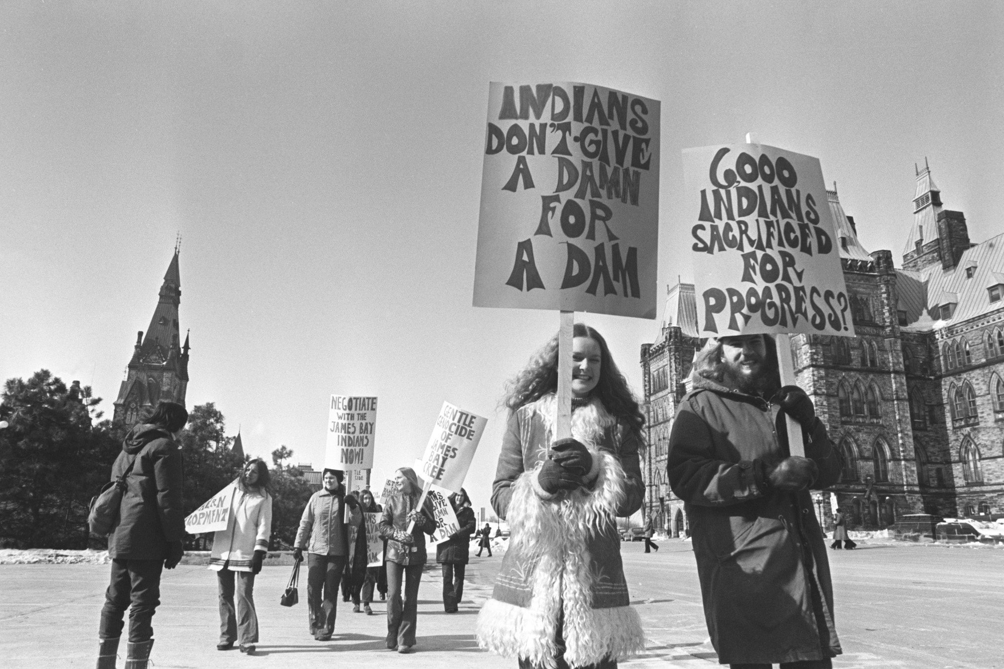
In the 1960s and ’80s, concerns around access to freshwater permeated Canada and the U.S. A proposal was drawn up, first in the ’60s and reinvigorated in the ’80s, to dam James Bay at its mouth, effectively turning the bay into a lake whose freshwater could then be pumped south through canals and existing waterways to top up the Great Lakes. Research at the time found that the dam could effectively wipe out all marine life and “result in the destruction of all, or a substantial portion of, many North American migratory bird populations.” It would drastically and forever alter the lives of people who live on the shores of the bay.
The proposal lost steam and public favour after its 1980s resurgence, despite support from former Prime Minister Brian Mulroney.
But dam development along rivers within the peatlands is an ongoing concern, with fluctuating water levels posing the risk of increased riverbank thawing, erosion and the release of carbon stored in the permafrost. The devastating environmental and cultural impacts of the James Bay Project, a massive hydro dam system on the Quebec side of the border, led to the signing of the James Bay and Northern Quebec Agreement — the first land claims agreement signed between the province of Quebec, the federal government and Indigenous nations.
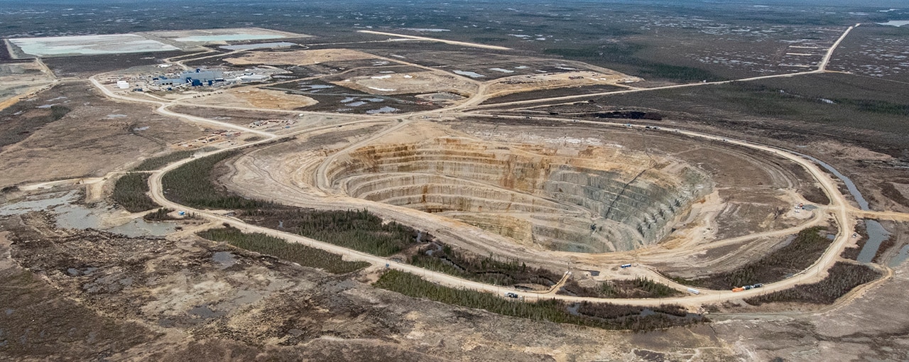
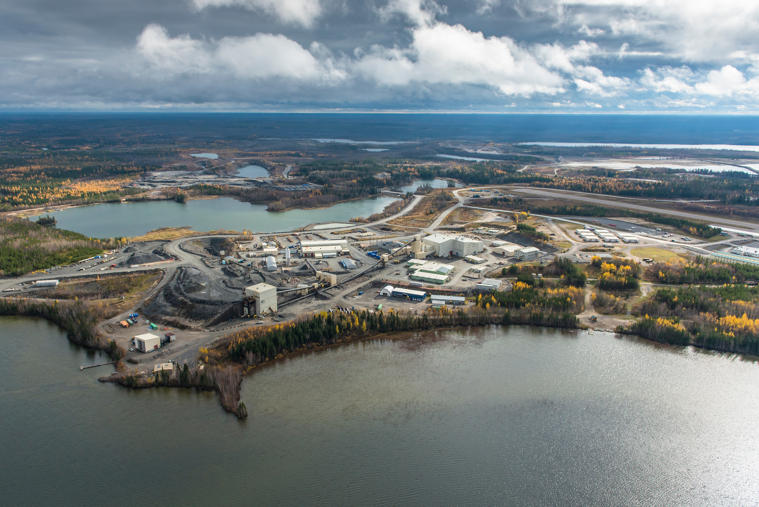
In the 2000s, as De Beers built up its Victor Mine about 90 kilometres west and upstream of Attawapiskat First Nation, residents of the region expressed concerns about the potential risk of fuel spills into James Bay through the introduction of both tanker transport and an on-site diesel generator at the diamond mine. The mine operated from 2008 to 2019, and this year DeBeers pleaded guilty to failing to disclose mercury monitoring data, a requirement of its permit. Environmental groups claim this led to undisclosed elevated mercury levels in the water pumped from the mine into the Attawapiskat River — this was not proven in court, and De Beers maintains that while the results weren’t reported, samples were taken and mercury levels were within the approved range.
The Victor Mine is seated on the mineral-rich grounds of northern Ontario’s Ring of Fire. Here, the impacts of local industry development remain at the forefront of conversations about conservation. Earlier this year, Chiefs from the Mushkegowuk council called for a moratorium on mining exploration and related development, saying that protection plans for the peatlands need to be instituted first.
Local politicians, environmental groups and the Omushkegowuk Women’s Water Council followed up with a letter of support for the moratorium, also asking that the federal and provincial governments make access to clean water, shelter and health infrastructure for communities around the Ring of Fire a priority over mining. The First Nations have repeatedly emphasized, including to The Narwhal, that their position isn’t about being against development — it’s about assessing priorities and impacts, and weighing the costs of disrupting the peatlands’ massive carbon storage against the profits of resource extraction.
“How much mining is enough? How much is too much?” Cheechoo asks. “We’re calling on the provincial government, the Impact Assessment Agency [of Canada], to create a committee with First Nations as nations, like the Mushkegowuk nation, the Oji-Cree nation, together, to talk about the Ring of Fire. To be involved in that process, not just be used as another stakeholder. We’re the only ones that have the connection to the land — the companies don’t.”
There are several known potential impacts of mining on the environment: contamination of water bodies through tailings spills or toxic effluent, shifts in air quality when dust from the mines becomes airborne, displacement of wildlife through mine construction and operation, to name a few.
Further still, Mining Watch Canada co-ordinator Jamie Kneen explains that mercury stored in the northern Ontario peatlands could be activated when water is pumped out of a site, to dig down into the mine, and then it’s re-flooded, potentially releasing previously stored mercury into the water system.
“The bottom line is, any mining is going to cause damage to ecosystems: it’s a question of how severe it is, and whether it is held to be justifiable,” Kneen says.
Mining companies have sought to rationalize their exploration for minerals like cobalt and lithium in northern Ontario, as being in the name of the necessary energy transition because these minerals are key components of the batteries that power electric vehicles, for example.
But Kneen and many others aren’t convinced: “One of the ironies actually is now coming to First Nations communities and leadership and asking them to make more sacrifices, for the sake of a larger society that has already taken as much as it can from them. Especially in the North, where climate change itself is already having a devastating impact.”
Support of Ontario government needed to expand boundaries of Meshkegowuk marine conservation area
Expanding the boundaries of the Mushkegowuk Marine Conservation Area to include part of the peatlands would involve bringing the provincial government to the table. At this stage, organizers aren’t certain exactly how far inland they’d want to propose extending the boundary; that’s something only time and extensive consultations will reveal.
But it would be fair to feel daunted by the task: the current provincial government has been criticized throughout its tenure for prioritizing industry expansion over conservation. In 2020, Premier Doug Ford’s government overhauled the environmental assessment process in an attempt to speed up assessments to incentivize and retain business interests in the province. Environmental organizations argue the assessment process was already poorly regulated and had little oversight — conditions that will only worsen with these legislative changes.
But the Mushkegowuk conservation project organizers feel resolute, perhaps even cautiously optimistic, especially given the interest expressed by the federal government.
“The path ahead is huge,” Martin says. “But I’m a believer of sorts. … It’s not something that we’re going to be able to do on our own — this is where we need allies.”
The Carbon Cache series is funded by Metcalf Foundation. As per The Narwhal’s editorial independence policy, the foundation has no editorial input into the articles.
Updated Nov. 8, 2021, at 3:32 p.m. ET: This article was updated to correct a link. The source for the statement, “The peatlands in the Hudson Bay Lowlands can contain up to five times as much carbon as the Amazon rainforest per square metre,” is the Wildlife Conservation Society of Canada.