Two years ago, a Manhattan-sized piece of the Milne Ice Shelf was lost. This past July, a small team of researchers touched down on one of the planet's northernmost points to study what led to the collapse.
Video: Dustin Patar
After the collapse: checking for vital signs on a fading Arctic icescape
At the extreme northern tip of the world, a team of scientists battles time and weather to ponder the aftereffects of a giant ice shelf collapse at Milne Fiord
Two years ago, the world lost a Manhattan-sized piece of the Milne Ice Shelf, one of the last, thickest — and at the time, most intact — ice shelves of its kind in the Canadian Arctic. In July, for the first time since that calving event, a small team of researchers touched down on one of the northernmost points on the planet to study what led to that collapse. They were also seeking answers about what it means for the entire ecosystem.
Although an ever-growing array of space-based technology allows scientists to observe and collect data on the Arctic remotely — including the satellite cameras that first alerted scientists with the Canadian Ice Service that 79 square kilometres of once land-fast ice was adrift in the Arctic Ocean — there’s no substitute for actually being there.
That’s why scientists like Derek Mueller, a glaciologist with the Water and Ice Research Laboratory at Carleton University in Ottawa, have made an annual trip to the Milne Fiord for the past 14 years.
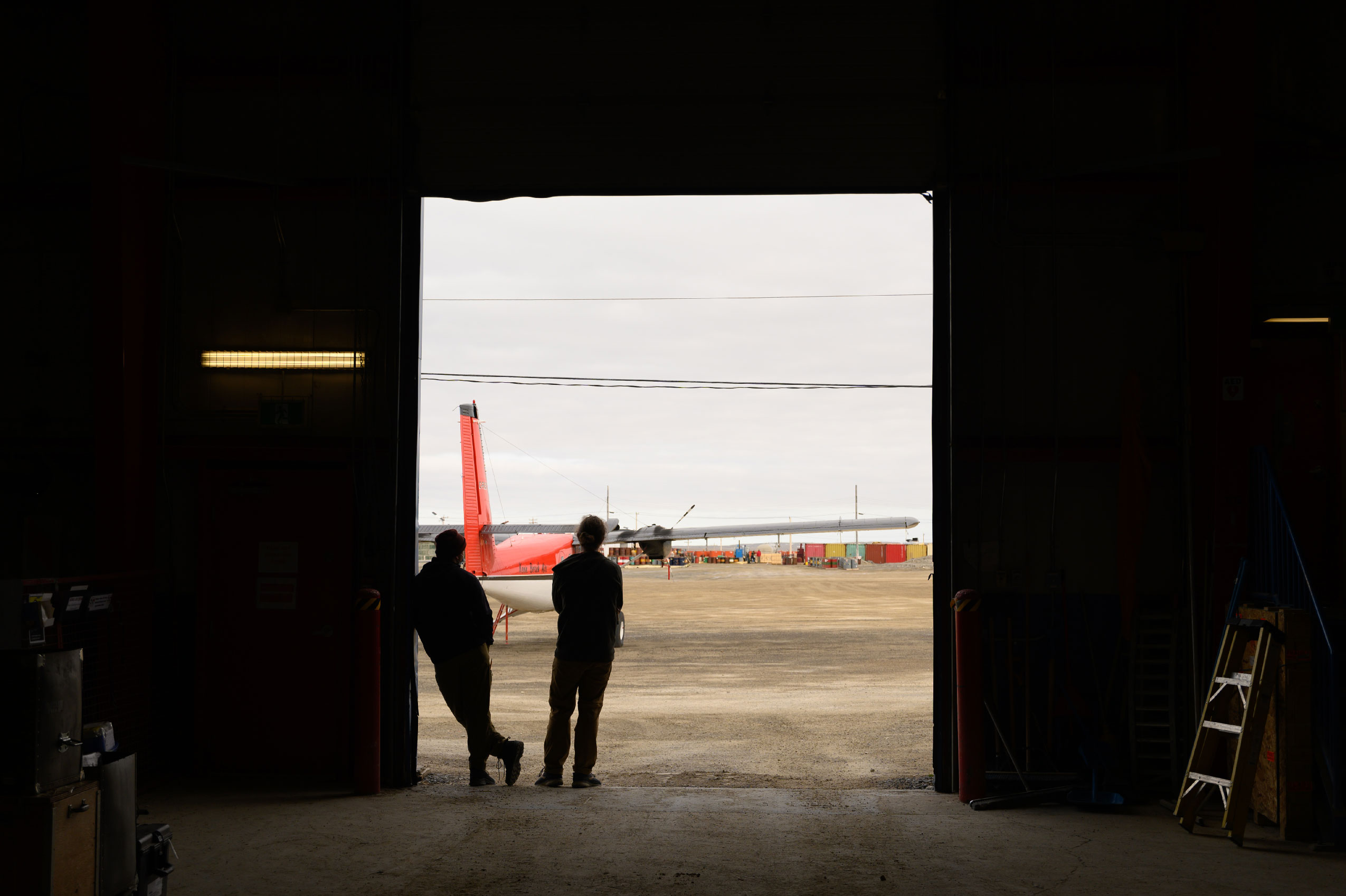
Getting to this remote location north of Resolute, Nvt., is no small feat. As the crow flies, Milne Fiord is roughly as far from Toronto as Halifax is from Victoria. Natural Resources Canada’s Polar Continental Shelf Program supports this Far North research by providing field equipment, accommodations in Resolute and transportation to the fiord. But like so many things these last two years, the pandemic made these trips impossible.
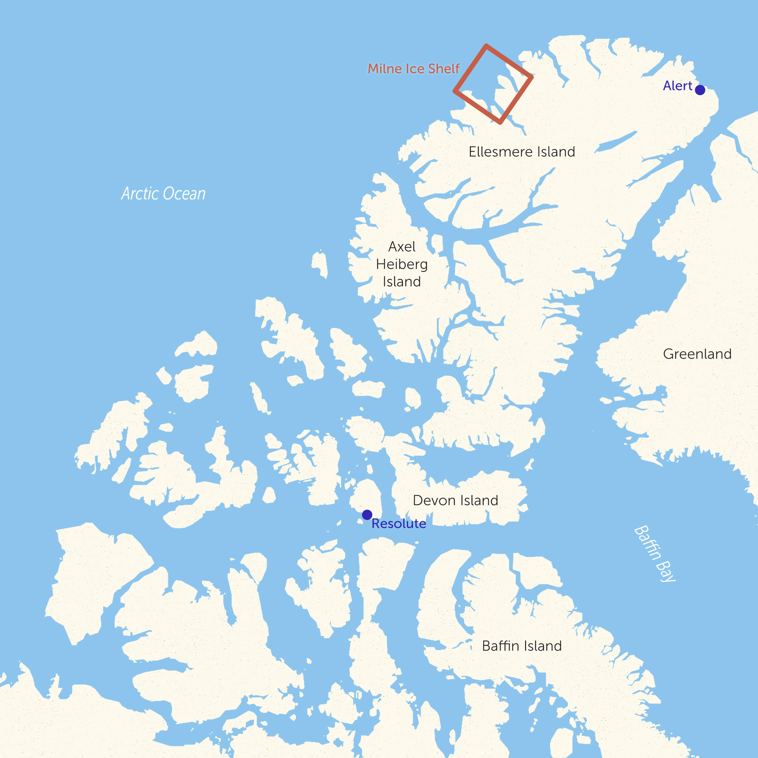
Milne Fiord is located north of Resolute, Nvt. in the Canadian Arctic. Map: Shawn Parkinson / The Narwhal
The anticipation was almost palpable on a cloudy July day when Mueller and a team of international scientists finally boarded a De Havilland Twin Otter aircraft loaded with camping gear, scientific tools and minds full of post-calving event questions.
They hoped the instruments they placed under the ice three years ago would provide answers — assuming they were intact and could be found. Other investigations would require a medley of hands-on work orchestrated around the availability of a helicopter, needed to effectively navigate the icy expanse of the fiord, which extends more than 80 kilometres from the tip of the shelf to the top of the glacier.
But when conducting fieldwork at the top of the world, even the best-laid plans can change at a moment’s notice.
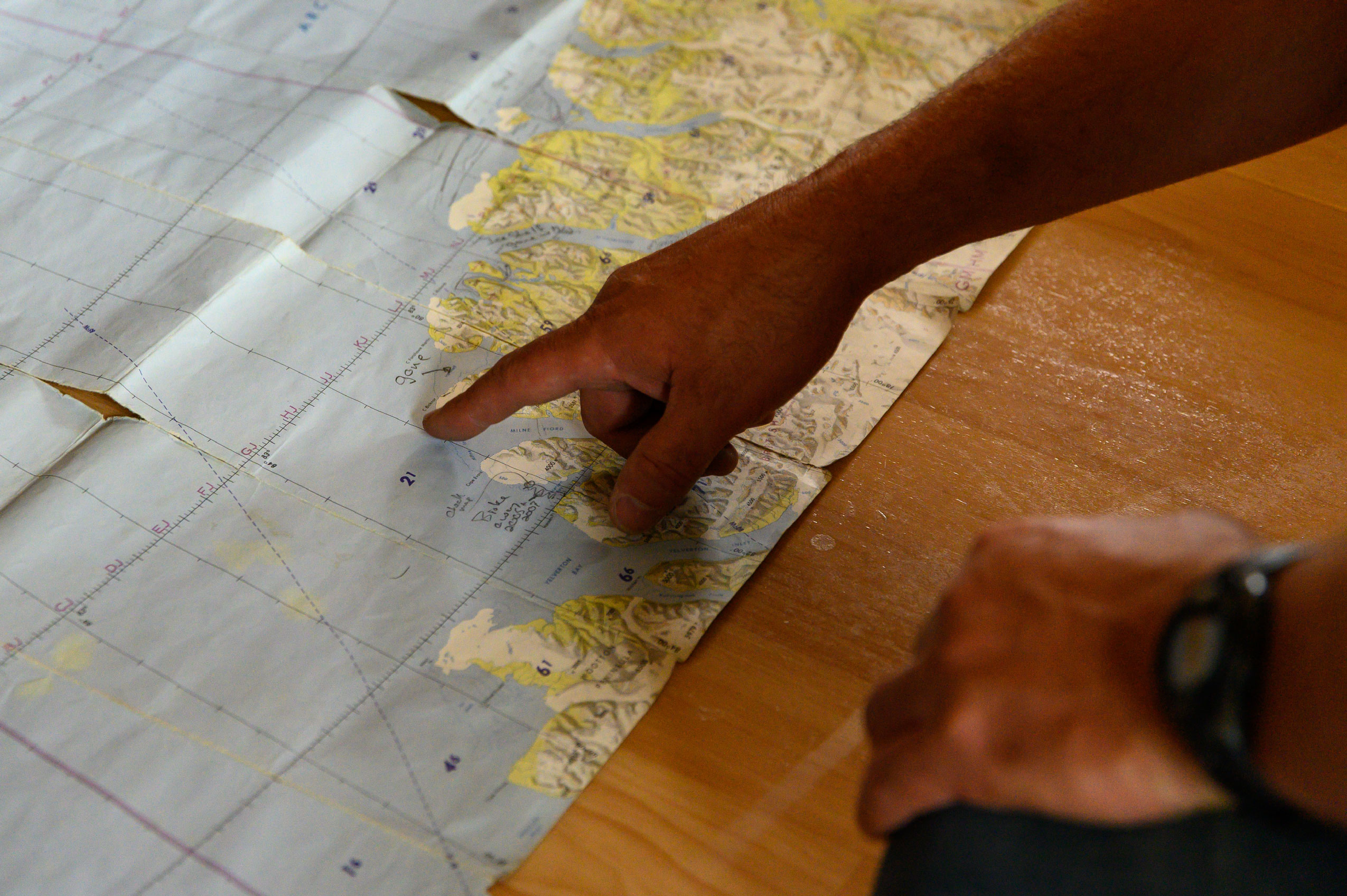
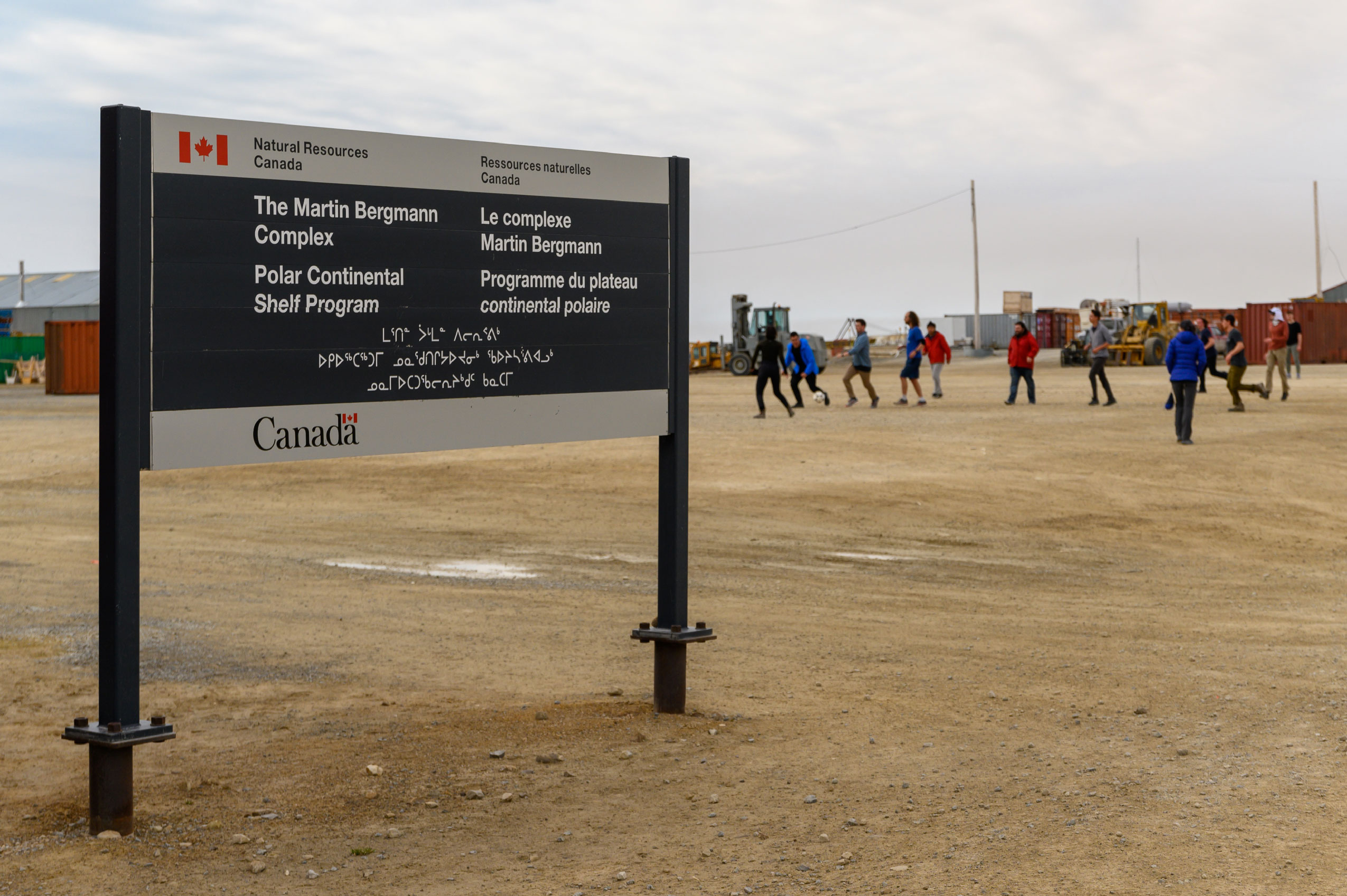
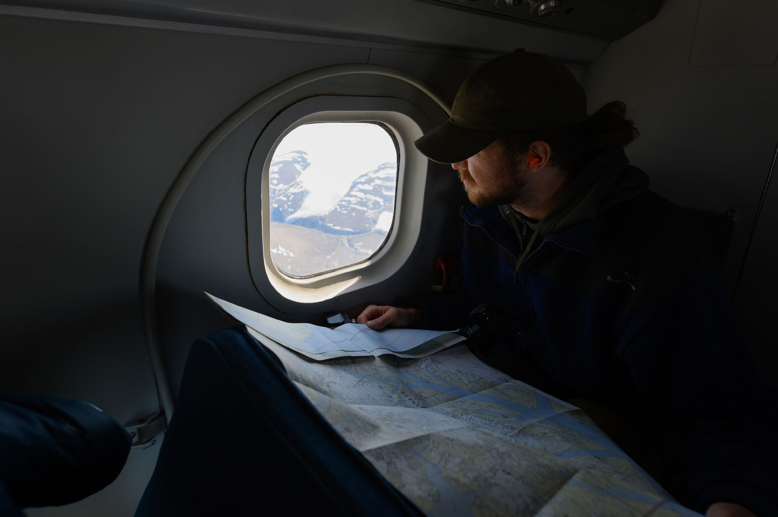
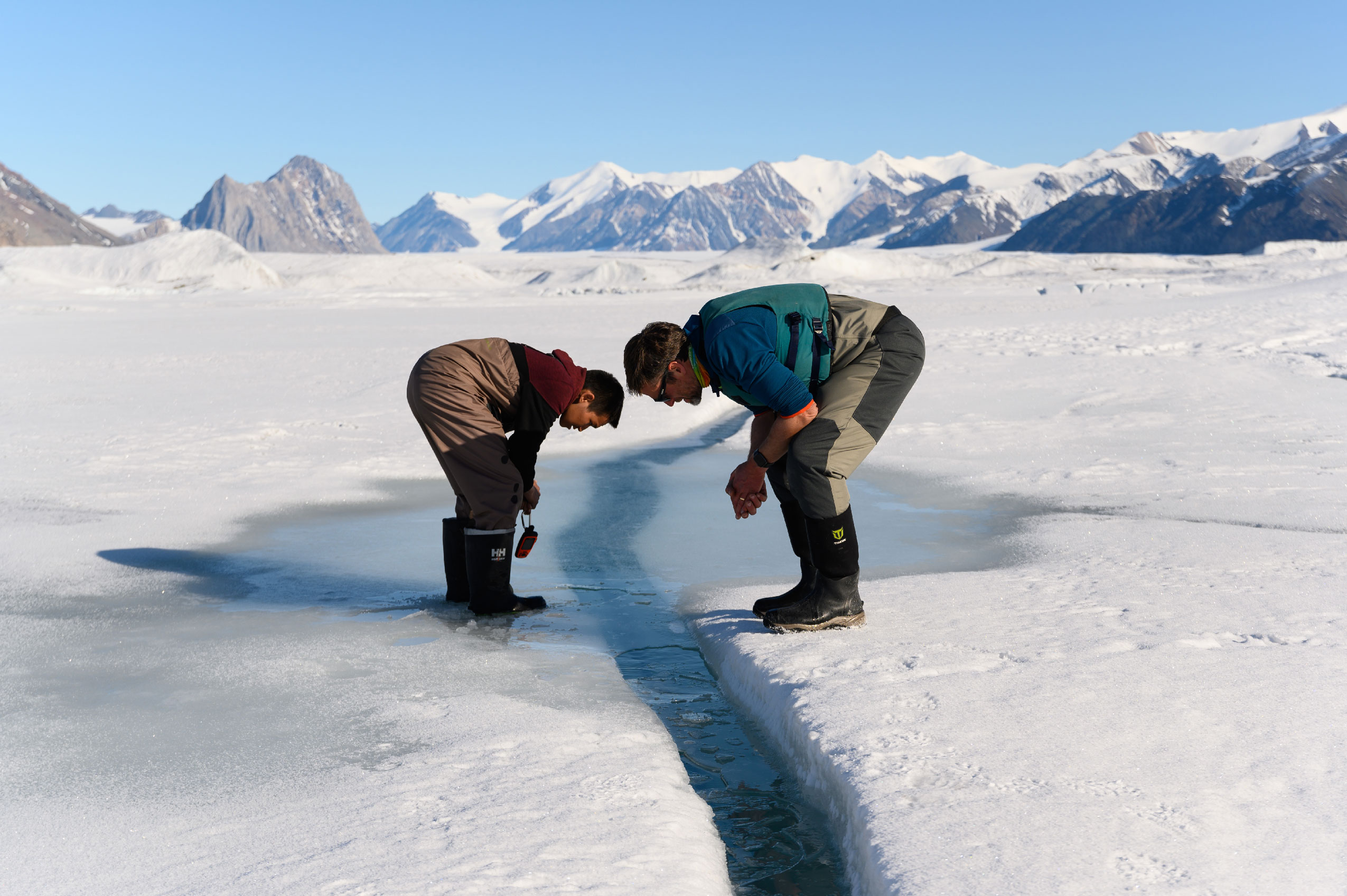
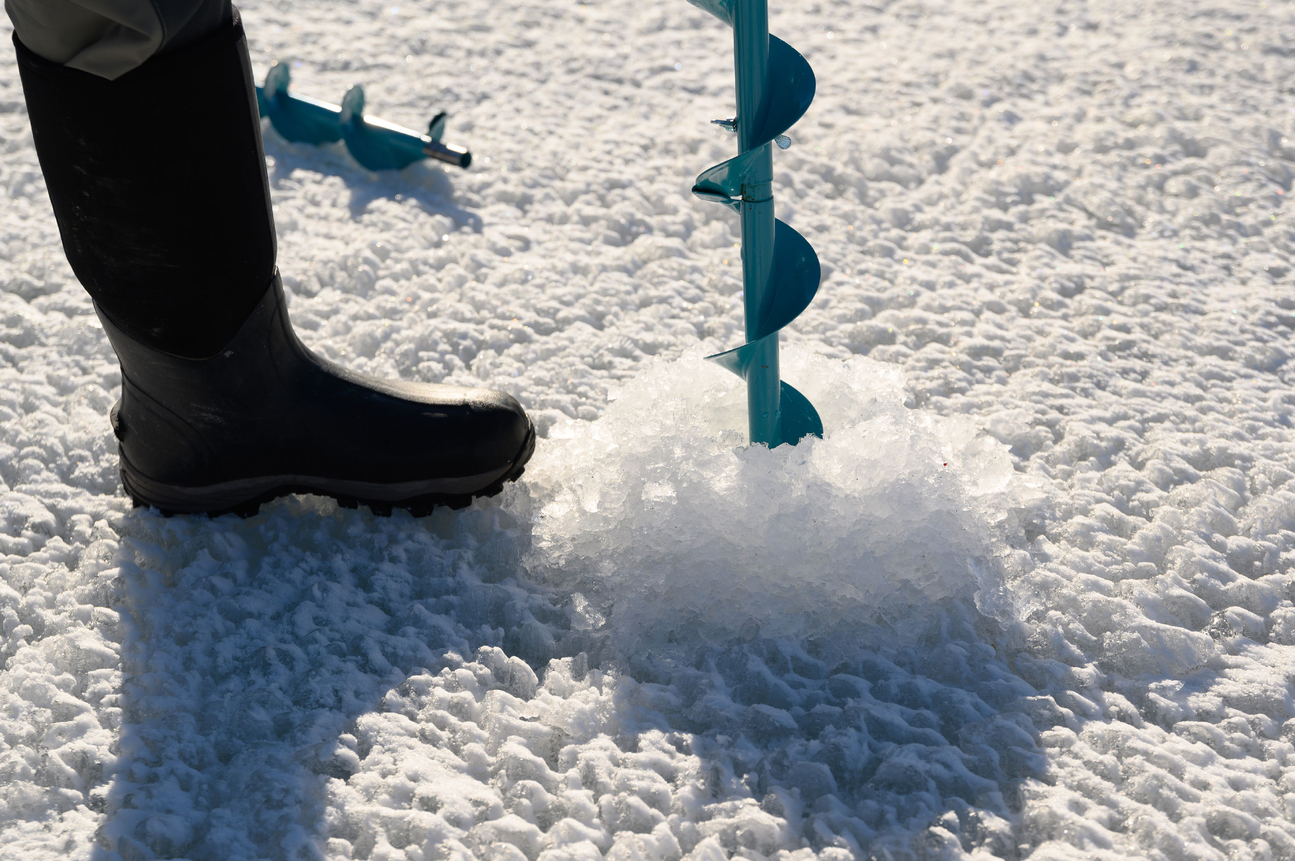
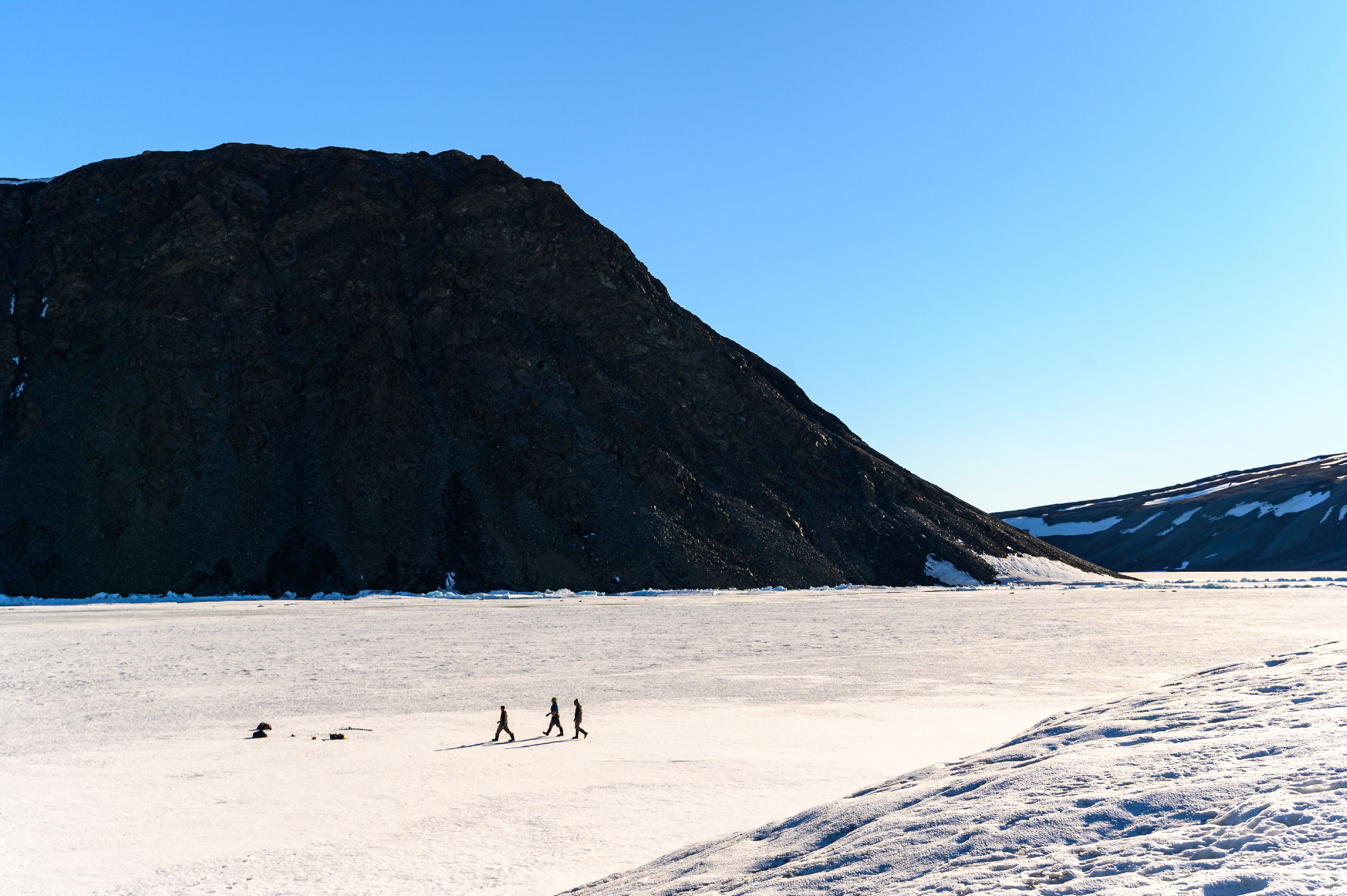
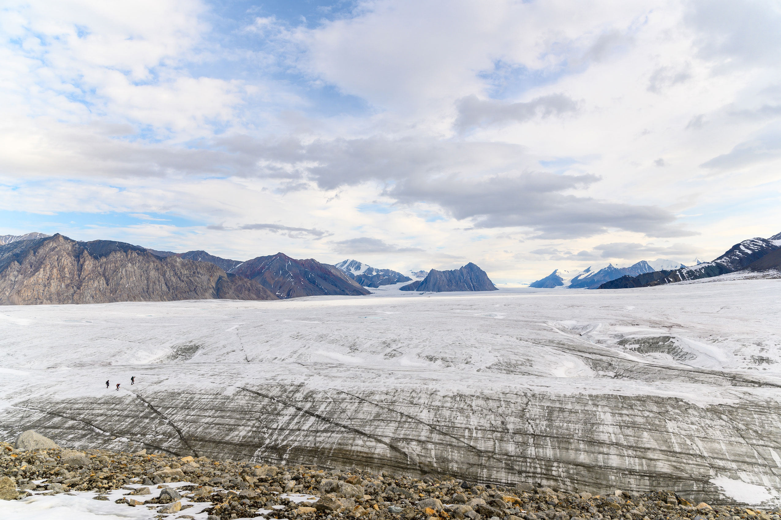
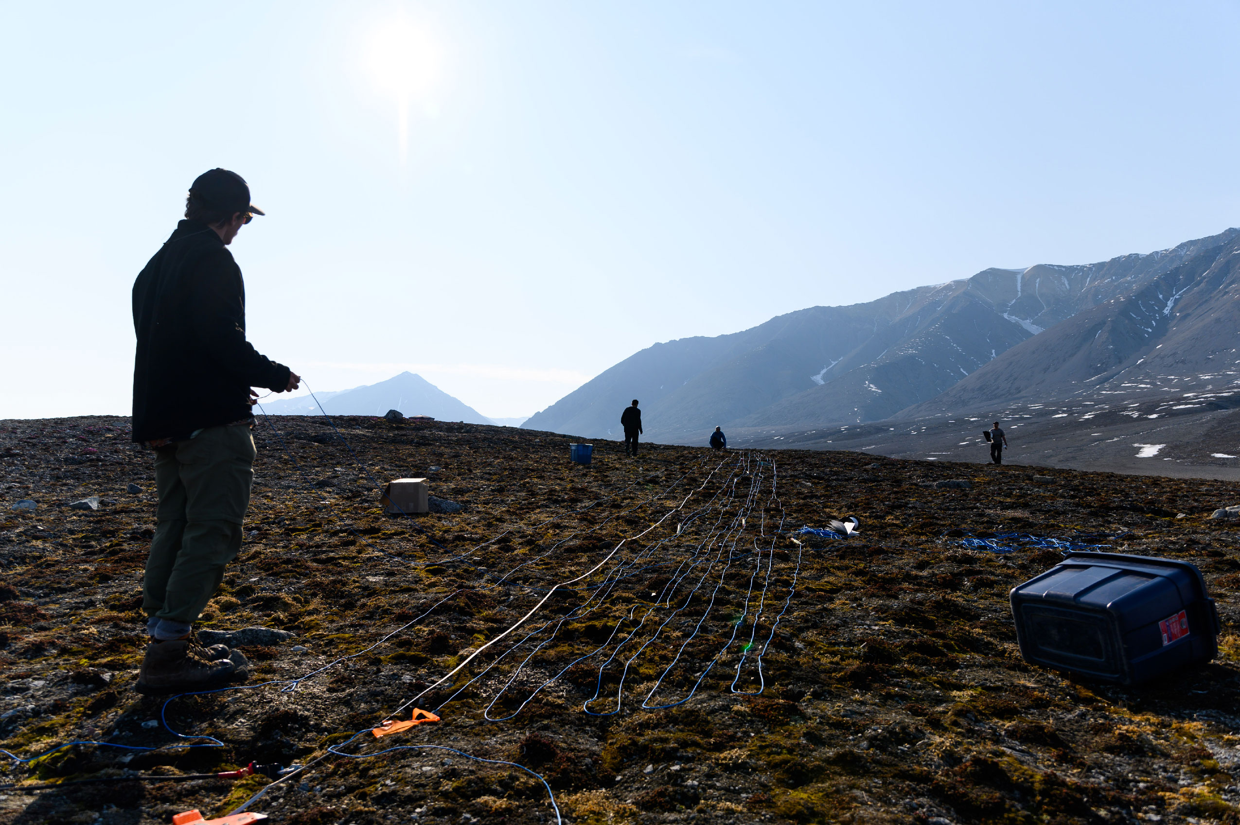
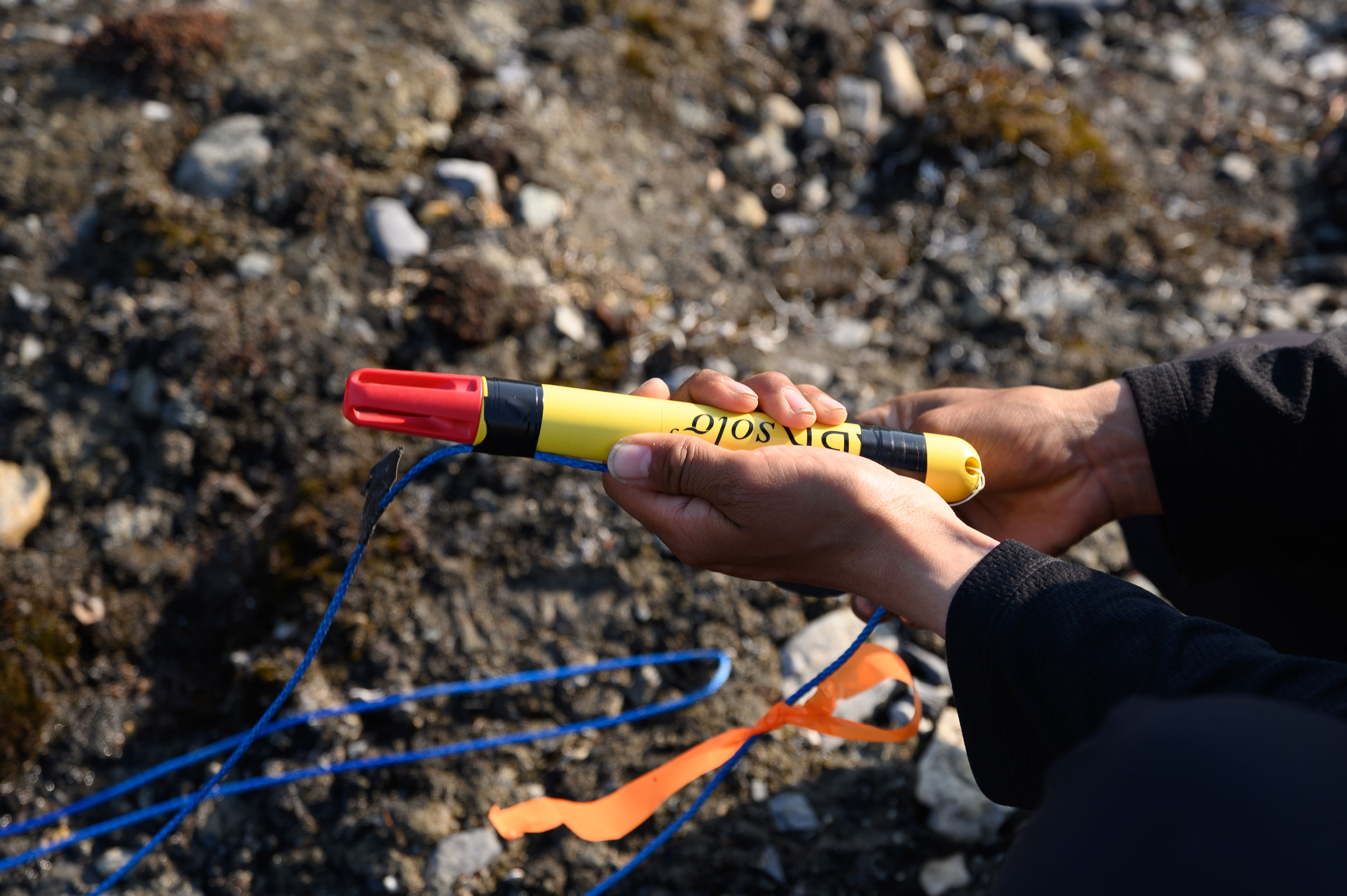
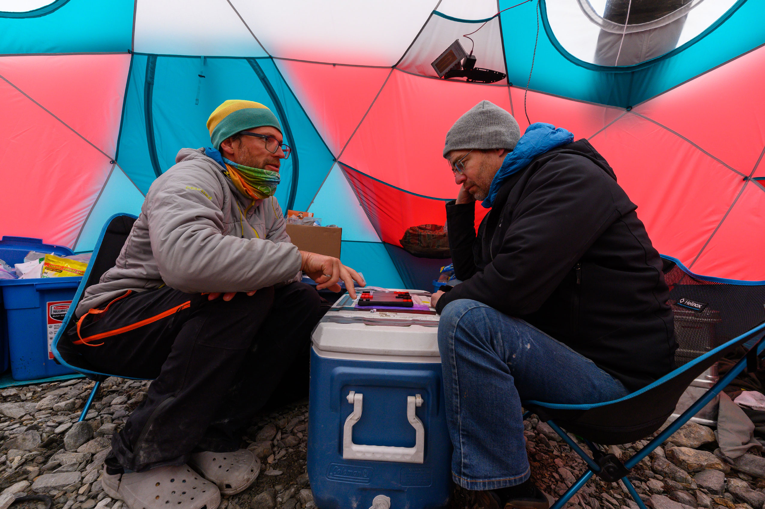
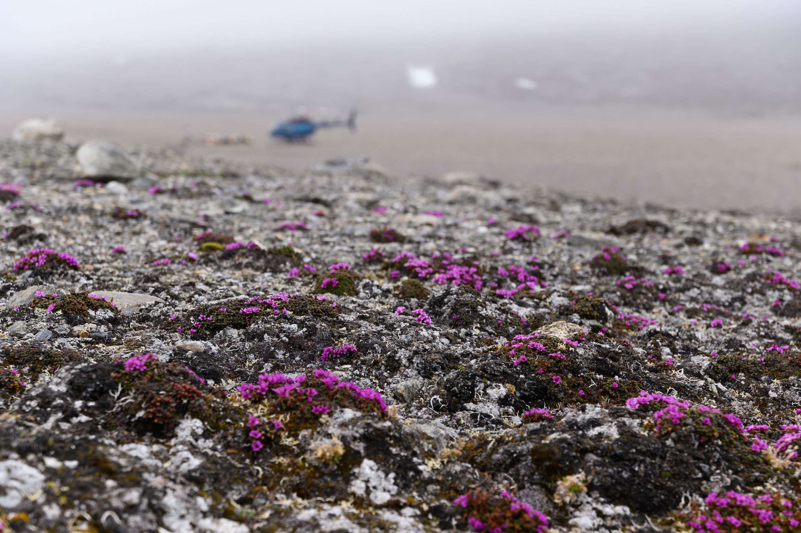
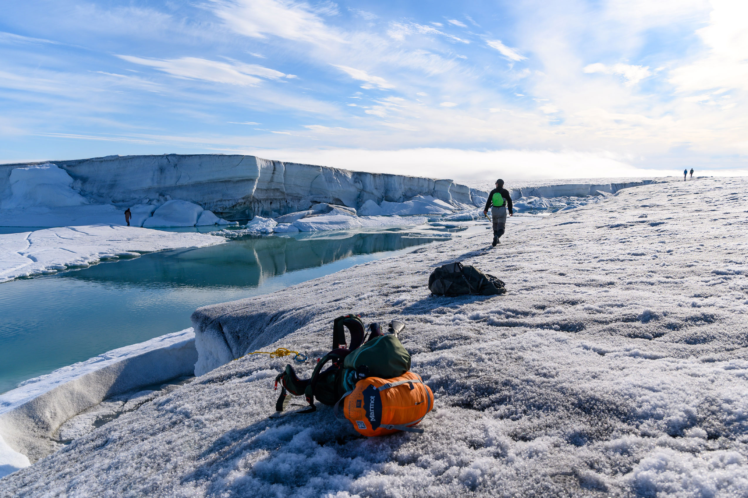
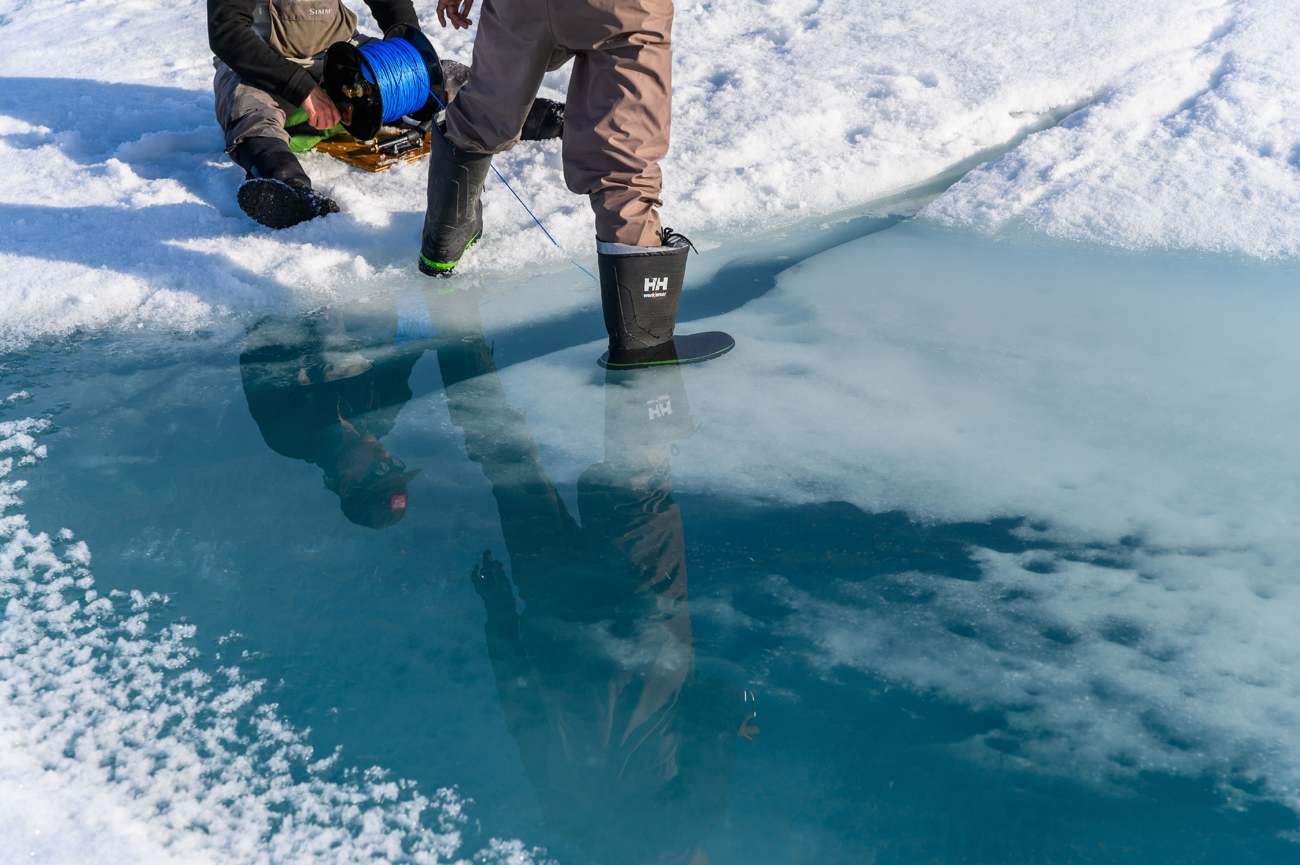
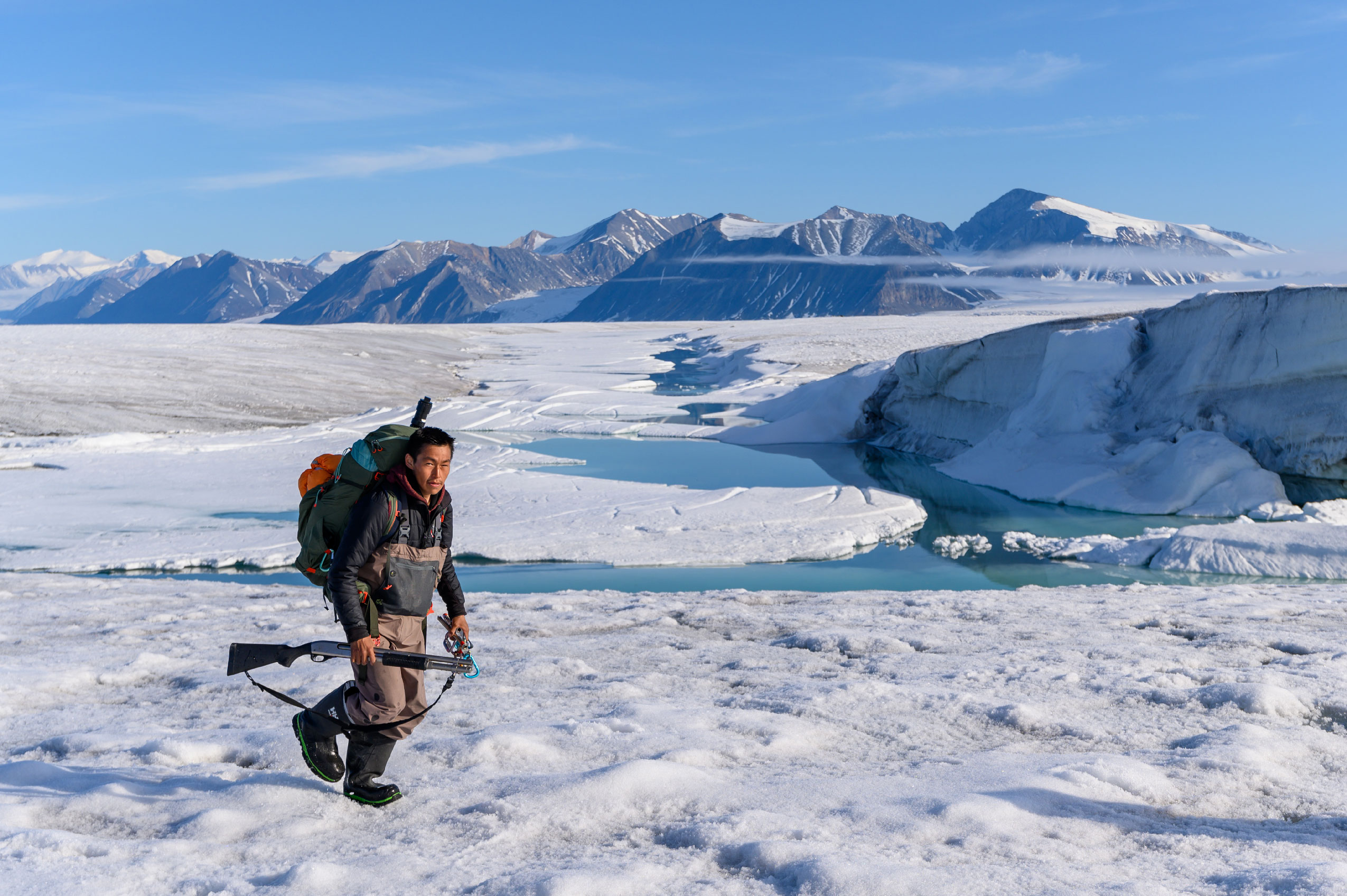
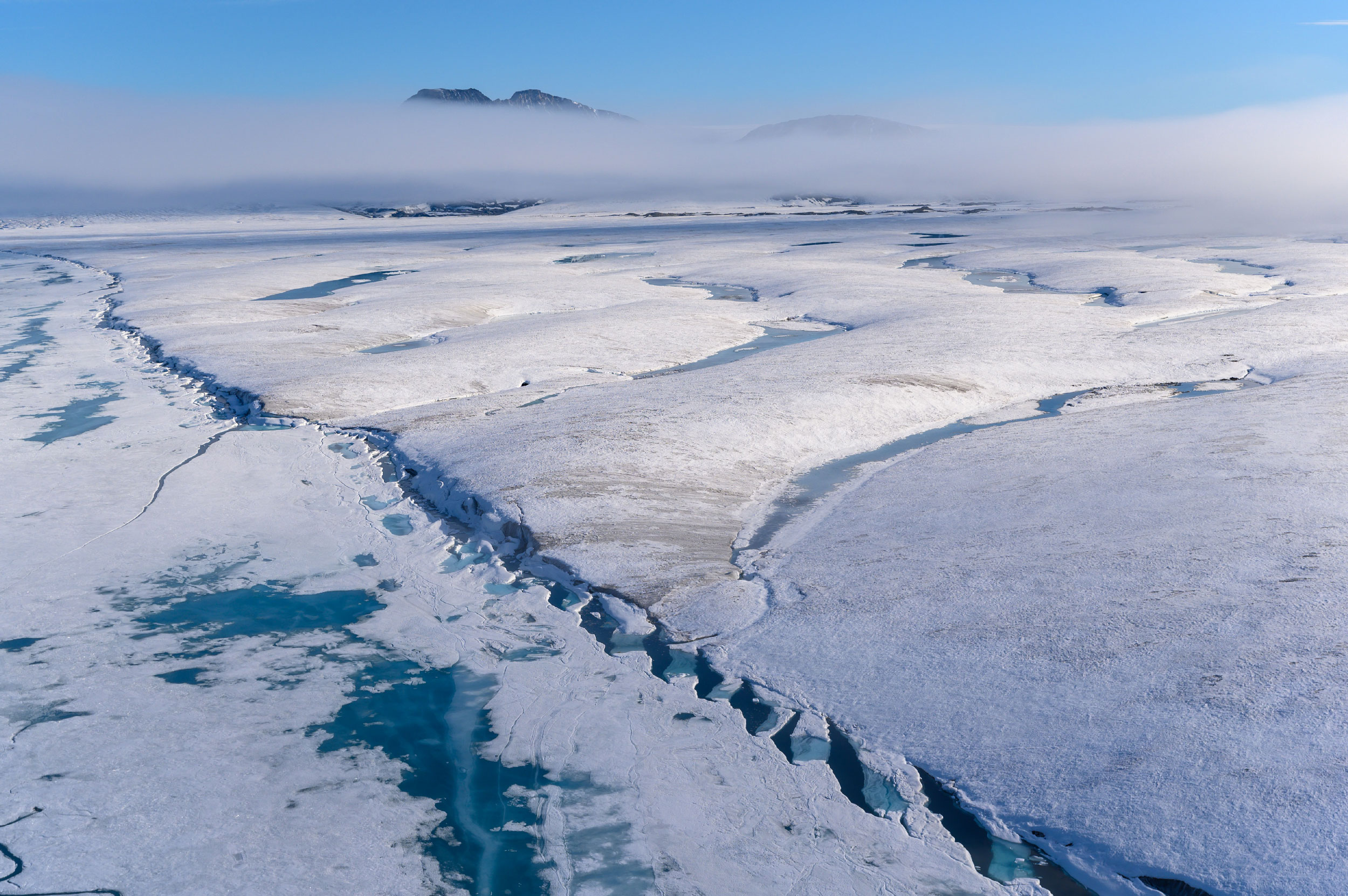
During a pre-trip meeting in Resolute, glaciologist Derek Mueller points to a map of Ellesmere Island, complete with notes indicating when various ice shelves in the region collapsed. The shelves are land-fast platforms of ice flowing away from a glacier to the opening of the inlet on the ocean. A century ago, the northern coast of Ellesmere was wrapped in a continuous edge of ice. Now, only bits and pieces of various shelves remain in the island’s deep fiords.There’s a lot of hurry-up-and-wait at the Polar Continental Shelf Program base. Here, physicists, glaciologists, microbiologists, undergraduate students and even a senior professor play a little pre-dinner soccer. Given the distance between Resolute and the research field site on the northwestern coast of Ellesmere Island, delays are part of the experience. This year, a recurring weather system from the North Pole meant a mix of fog, rain and snow condensed the time in the field down to 12 days from 20. Erik Wagenaar, a master’s student in glaciology at Carleton University, looks out onto Ellesmere Island from the window of a Twin Otter. The plane is finally en route to Milne Fiord after 10 days of weather delays in Resolute.Joseph Shoapik, a resident of Grise Fiord, Nvt., peers down into a crack in the ice alongside Alex Forrest, a limnologist from the University of California, Davis. Just below this ice, a thin layer of freshwater used to float on top of the seawater in what’s known as an epishelf lake — the last of its kind in Canada. Aside from finding naturally occurring cracks or holes in the ice, the team also uses a variety of hand-powered augers to drill through the ice, creating access points for instruments that measure conductivity, temperature and depth, colloquially known as CTD casting.Researchers hypothesized that the 2020 calving event at the edge of the Milne Ice Shelf meant the end of the epishelf lake. Since the ice shelf acted like a natural dam, trapping the floating freshwater behind it, they believed that once the dam broke, freshwater would drain away. This assumption was quickly confirmed with a series of salinity measurements taken where the epishelf lake existed: the once fresh water had mixed with the salty ocean. All that remains of the lake is the visually distinct ice that capped it, smooth and flat next to the thicker, rolling ice shelf and the glacial tongue, appearing in the foreground.Unsure of when or if a helicopter would be arriving, Mueller leads a small team over a tributary glacier in an attempt to find a path to a weather station located farther up Milne Fiord.While some conductivity, temperature and depth casts last only a few moments, others, called moorings, are left in the water to collect information between field trips.The team uses instruments to track the differences in water temperatures between what was once freshwater and the saltwater that has replaced it — now that the epishelf lake is gone. Based on visual observations of other glacial systems on Ellesmere, they think the loss will likely speed up the degradation of the back side of the ice shelf, as well as the floating glacial tongue. Grounded by fog, Forrest, left, passes the time by giving helicopter pilot René Gysler a refresher course in backgammon. While some of the time on the ground is spent extracting and logging data, unpredictable Arctic weather offers plenty of windows for recreation, especially during days without any darkness. A low-hanging fog delays the team’s ability to get into the field from its base camp in Purple Valley, aptly named for the purple saxifrage flowers that blanket the ground. On one day, fog clears with only hours to spare before the helicopter is needed elsewhere. During a flurry of work, the team scouts for a location to do a conductivity, temperature and depth cast in a channel on the ice shelf. It’s unclear where and how the epishelf lake drained, but the team hypothesizes that it may have occurred in a channel below the ice. Although channels like this are long-term features of the ice shelf, the relatively recent collapse of this one is thought to be connected to the ice shelf calving.Researchers try to find a crack through which do a conductivity, temperature and depth cast below the ice shelf.Fieldwork in the Arctic involves overwhelming safety challenges. While polar bear sightings in Milne Fiord are rare, each team is equipped with a shotgun like the one carried here by Shoapik. Ice shelves on the northwestern coast of Ellesmere Island are situated within the Tuvaijuittuq Marine Protected Area. The name means “the place where the ice never melts” in Inuktitut. “Being able to contribute to the management of these special environments that are under threat is a real privilege,” Mueller says. “But also, we do have to be mindful that our efforts globally need to match the local conservation efforts.” In 2019, the federal government gave the area “interim” protection, which prohibits “new or additional human activities” for a five-year period. The potential for longer term protection is being discussed by the Qikiqtani Inuit Association, the Government of Nunavut and the federal government.