


Craig Bamford passes through what used to be the Duffins Rouge Agricultural Preserve every Sunday on his way to church.
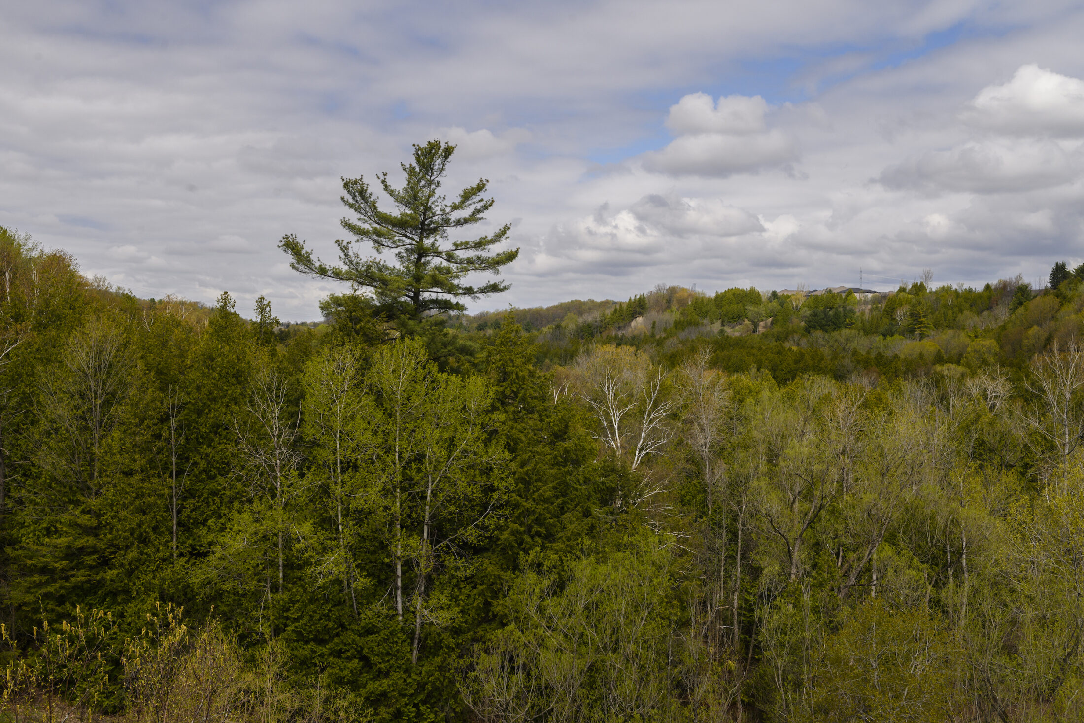
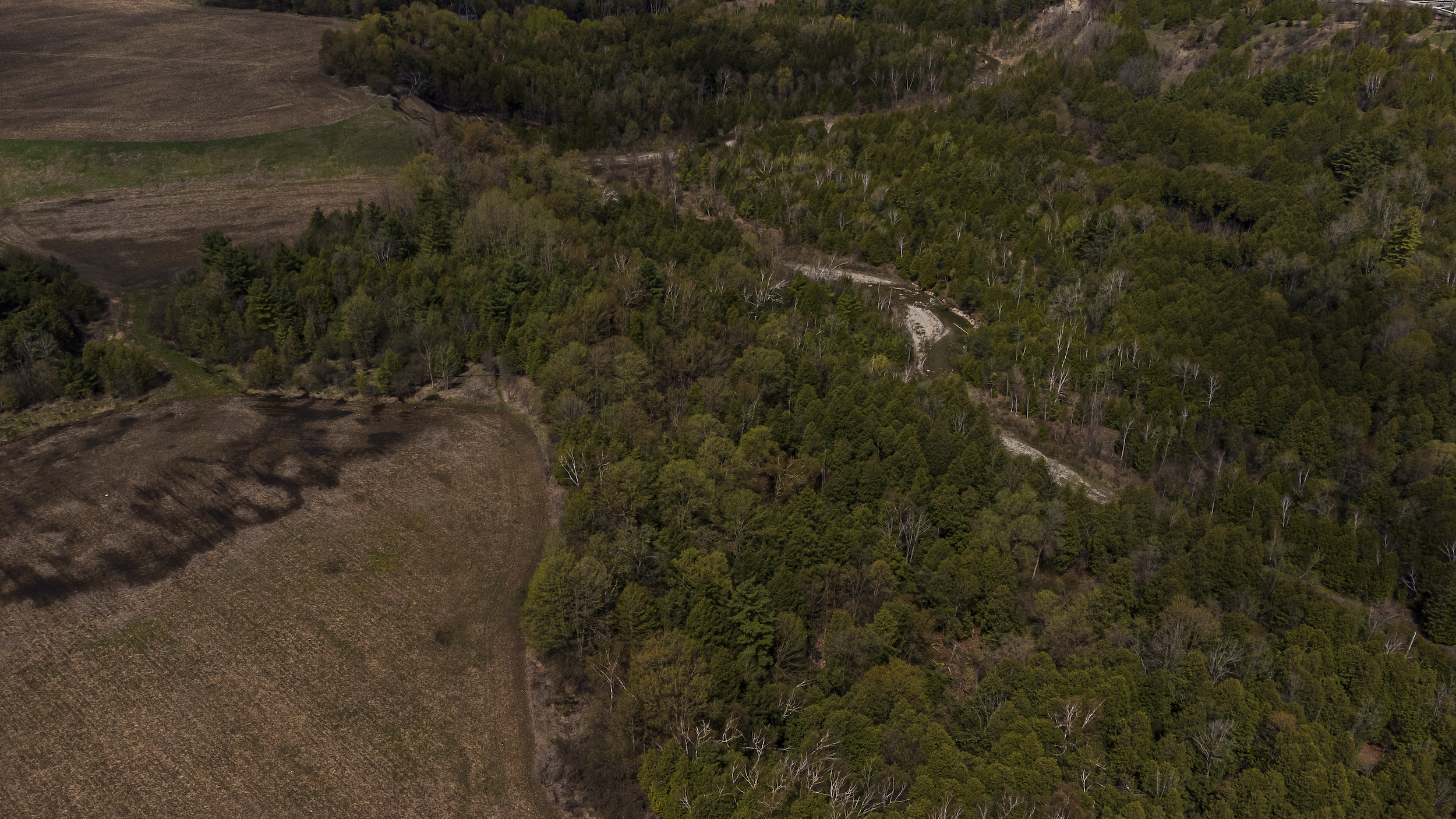
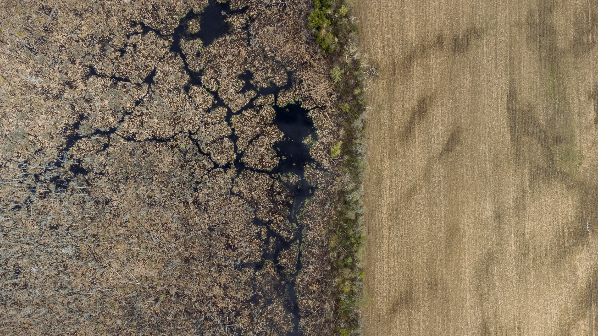
The preserve east of Toronto was a part of Ontario’s Greenbelt until the provincial government removed protections from it late last year. It’s lined with vast fields — some of the best farmland in the country — and lush stands of trees. But the drive has started to look a bit different in recent months. Crews in trucks have started to show up more often to do tasks like surveying and drilling wells, the type of work needed to inform future development.
“We have no idea what they’re planning,” said Bamford, who is a member of the local environmental group Stop Sprawl Durham. His wife grew up in the agriculture preserve, and they got married at a church there in 1989.
The fight over the lands removed from the Greenbelt last year is moving out of the legislature and into the places slated for development, like the fields Bamford drives past every week. The next steps are in the hands of local councils, which approve or deny housing projects. And as that process plays out, more eyes than ever are on the Duffins Rouge Agricultural Preserve, the biggest slice removed from the Greenbelt.
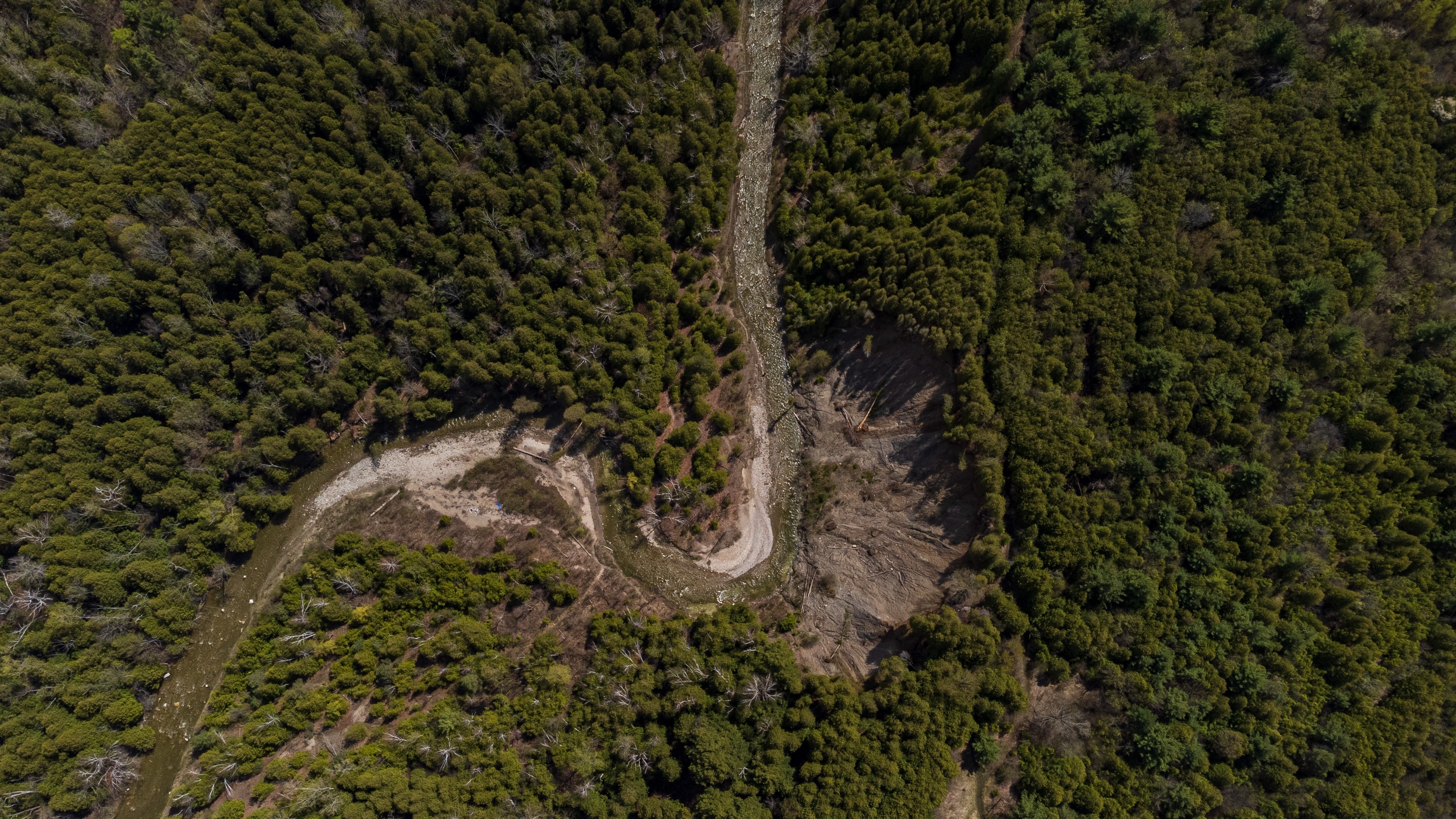
The preserve is also among the more environmentally-sensitive sections to see its protections stripped — environmental advocates have called it the “crown jewel of the Greenbelt” — and the most contentious. Located next to Rouge National Urban Park, the preserve is part of a crucial wildlife corridor and the federal government has said it may be willing to intervene to protect the area depending on where and what exactly developers propose to build.
Durham Region, a municipality that encompasses the 4,000-acre agricultural preserve, is now negotiating with the province and developers behind closed doors over what will happen next. People in Pickering — one of the 13 cities that are part of Durham, and the one that directly includes the preserve — is watching closely too.
Whatever the plan is, it’ll have to come together fast: the Ontario government has set a deadline of 2025 for shovels to go in the ground. Otherwise, the province has said it will return the land to the Greenbelt. Which is just one reason developers — some of whom have long-standing ties to Premier Doug Ford and his government — want to get started on building.
Pickering City Councillor Mara Nagy said it feels like the agricultural preserve is caught in limbo.
“We’re just waiting for the other shoe to drop,” Nagy said.
Up to 30,000 homes planned for Duffins Rouge Agricultural Preserve
The Progressive Conservative government announced plans to allow development on 15 sections of the Greenbelt, totalling 7,400 acres, last November. Most of that area, about 4,000 acres, came from the Duffins Rouge Agricultural Preserve. (To compensate for the loss, the province added 9,400 acres to the Greenbelt elsewhere — but the land was already protected under other mechanisms.)
The goal, according to the government, is to build 50,000 homes to address Ontario’s housing crisis, even though a provincial housing affordability task force had already concluded that Greenbelt land wasn’t needed to tackle the problem.
Durham opposed the plan, arguing that building on the agricultural preserve would set back the region’s environmental goals. It would also be difficult and expensive to deliver services like water, sewage and electricity that make housing developments possible, the region said, since little of that infrastructure exists on the preserve, which has been protected for nearly two decades. But the provincial government went ahead and removed the land from the Greenbelt in December.
In May, Durham Region planning staff delivered a report with a few details on what’s to come on the preserve. The planned development there is currently called Cherrywood, named after a hamlet in the area.
“The ultimate development of Cherrywood is anticipated to accommodate as many as 30,000 units,” the report reads.
“Full build-out will require major infrastructure upgrades to the regional water and sewer systems which will take years to plan and complete. Major improvements to the transportation network would also be required.”
To meet the province’s 2025 deadline, the developer behind Cherrywood — TACC Developments, headed by prominent builder Silvio De Gasperis — has proposed a smaller first phase of construction on the south end of the preserve, the report notes. The developer is still working on a report to prove to the region that Durham’s existing municipal infrastructure could accommodate the new housing. The De Gasperis family is a major donor to the Progressive Conservatives: names that match those of family members, their companies and senior staff donated $294,000 to the Tories since 2014.
TACC has agreed to cover the cost of any new infrastructure that would be needed. The Durham Region report, however, noted the extra development could strain municipal resources in other ways: “The costs of delivery of other regional services, including roads, transit, policing, paramedicine, waste, social and other services also need to be understood.”
Alana DeGasperis, TACC’s director of planning and corporate affairs, said in an email the first phase will include at least 1,200 homes, and that there’s “ample” existing infrastructure to support it. The company is working with environmental engineers to protect natural features in the area, she said.
“The cost of the development to the developers is uncertain given that the developers will be covering the cost of new infrastructure to support Cherrywood and will also be providing community benefits, such as affordable housing, land for healthcare and educational facilities, parks, trails and community food gardens,” she added.
Ontario’s Ministry of Municipal Affairs, which oversees the Greenbelt and urban planning, didn’t respond to questions from The Narwhal.
In a statement, Durham Region said it doesn’t have any further public updates about the development coming to the agricultural preserve. The regional council also discussed a second report about the situation last month, but kept it confidential because it relates to ongoing negotiations.
Even city councillors in Pickering have heard few details, Nagy said.
“Literally nothing has come across our desks,” she said. “I genuinely don’t know what kind of a timeline we’re looking at, what we’re looking at … It feels very surreal.”
The Duffins Rouge Agricultural Preserve is ecologically important — and sought by developers
Governments, communities and developers have been clashing over the fate of the Duffins Rouge Agricultural Preserve for decades. Soon after it was added to the Greenbelt, the City of Pickering briefly pushed to allow development there, despite provincial rules requiring the land only be used for agriculture. (The province also revoked those rules last year to clear the way for development.)
The preserve borders a particularly sensitive section of Rouge National Urban Park, which includes a series of interconnected wetlands home to dozens of species at risk, like the Blanding’s turtle and eastern meadowlark. Together with the park, the preserve forms part of the last intact strip of wildlife habitat connecting Lake Ontario and the Oak Ridges Moraine, a rock formation to the north that’s also part of the Greenbelt. Urban development has severed that corridor elsewhere. Development in the area could cause “irreversible harm” to the Rouge and also raise the risk of flooding in the area, Parks Canada said in December.
The area is subject to a 2015 land claim from Mississaugas of the Credit First Nation, which has said it wasn’t consulted about the decision to remove the land from the Greenbelt and would like to see it reversed.
“In terms of including it in the Greenbelt, it was a slam dunk,” Victor Doyle, a former provincial planner who led the creation of the protected area, said.
But the agricultural preserve has also been coveted by developers for a long time. It’s right on the edge of Toronto’s searing-hot housing market. And because it was off-limits to development for so long, buyers were able to snap it up at extra-low prices, maximizing potential profits.
One of those buyers was De Gasperis of TACC, who was highlighted in a Narwhal/Toronto Star investigation into the developers benefitting from the decision to open Greenbelt land for development. The investigation found De Gasperis is listed as a director for companies that own more than 1,300 acres of land in the Duffins Rouge Agricultural Preserve. Most of them were purchased in the years before the Dalton McGuinty Liberal government created the Greenbelt in 2005.
At the time, De Gasperis said the move to include his land in the protected area had cost him hundreds of millions of dollars. “McGuinty has already hurt me,” De Gasperis told the Star in 2006. “I’m going to hurt him.” He fought back, eventually launching a series of legal challenges. But those efforts were unsuccessful in getting the land unfrozen — until now.
“We always believed that the area would once again be approved for community development due to the existing infrastructure, proximity to the existing communities, transit opportunities and population growth,” Alana De Gasperis said in her statement to The Narwhal.
Bamford said he believes the whole thing should be stopped.
“It’s a completely closed process, and it should never have been started in the first place,” he said.
Federal study will look at development impacts on Rouge National Urban Park
While developers and municipalities hammer out plans for development, federal Environment Minister Steven Guilbeault has signalled willingness to step in. In March, Guilbeault launched a federal study to look at how development on the Duffins Rouge Agricultural Preserve could affect Rouge National Urban Park and the surrounding area.
The point, he said, was to inform future decisions about projects that might be proposed. The minister also said he wouldn’t hesitate to use other federal powers, including species at risk rules, to intervene with development on former Greenbelt lands.
“If there was a large commercial industrial project that was announced on the edge of Banff National Park or Jasper National Park, I think that most Canadians would be outraged from coast to coast to coast,” he said last March. On Monday, Global News reported on a briefing note prepared for Guilbeault before he made his statement, which lists 29 at-risk species that live or are likely to live on the previously protected lands.
The federal Impact Assessment Agency, which is leading the study, released its draft terms of reference — the scope and general plan for the work — on May 30. The draft shows the study would include not just Rouge, but also the agricultural preserve. It’s also set to examine how development could impact other areas the federal government has jurisdiction over, like Treaty Rights, species at risk and other federal land to the north of the preserve.
It’s not clear when formal work on the study will begin.