


Ninety-seven per cent of energy produced in Manitoba comes from hydroelectricity. The vast majority of that energy comes from a string of dams on the Nelson River system in the province’s north. There, a sixth mega dam, known as the Keeyask, is under construction to provide electricity for export to the United States.
Manitoba’s hydroelectric dams have always been marketed as clean, renewable energy. And yet, these projects have massively transformed the province’s northern ecosystems, impacting the culture, lives and livelihoods of Indigenous communities.
After decades of undertaking hydroelectric development without Indigenous consent, Manitoba Hydro offered to partner with four Cree First Nations whose traditional territories will be impacted by the Keeyask dam.
The Tataskweyak, Fox Lake, York Factory and War Lake nations signed on to an agreement with Manitoba Hydro that sets aside 25 per cent of the project for “potential” ownership by the First Nations.
The arrangement has divided these communities, driving a wedge between those attracted to the promises of new industry and those wary of the impacts of development. Many who voted in favour of the partnership agreement said they were told, and believed, the Keeyask dam would be built with or without their cooperation.
Since 2012, the price tag for the dam and transmission line has grown from $9.8 billion to almost $14 billion, while the price of electricity has dropped in the U.S. due to an uptick in fracking. The profitability of the dam has been undercut, affecting the likelihood of local First Nations benefitting from the project.
This is of direct concern for the Tataskweyak Cree Nation, located 60 kilometres upstream of the new dam. Impeded by a critical housing shortage, high unemployment, the trauma of youth suicide and a drug crisis — all within the context of a long-term boil water advisory — the community will face the compounding impacts of the Keeyask dam as water levels begin to rise.
But the Tataskweyak are not alone in their experience.
This collection of photos explores the reality of hydroelectric development in northern Manitoba within the broader devastation of Canada’s ongoing history of environmental colonialism.
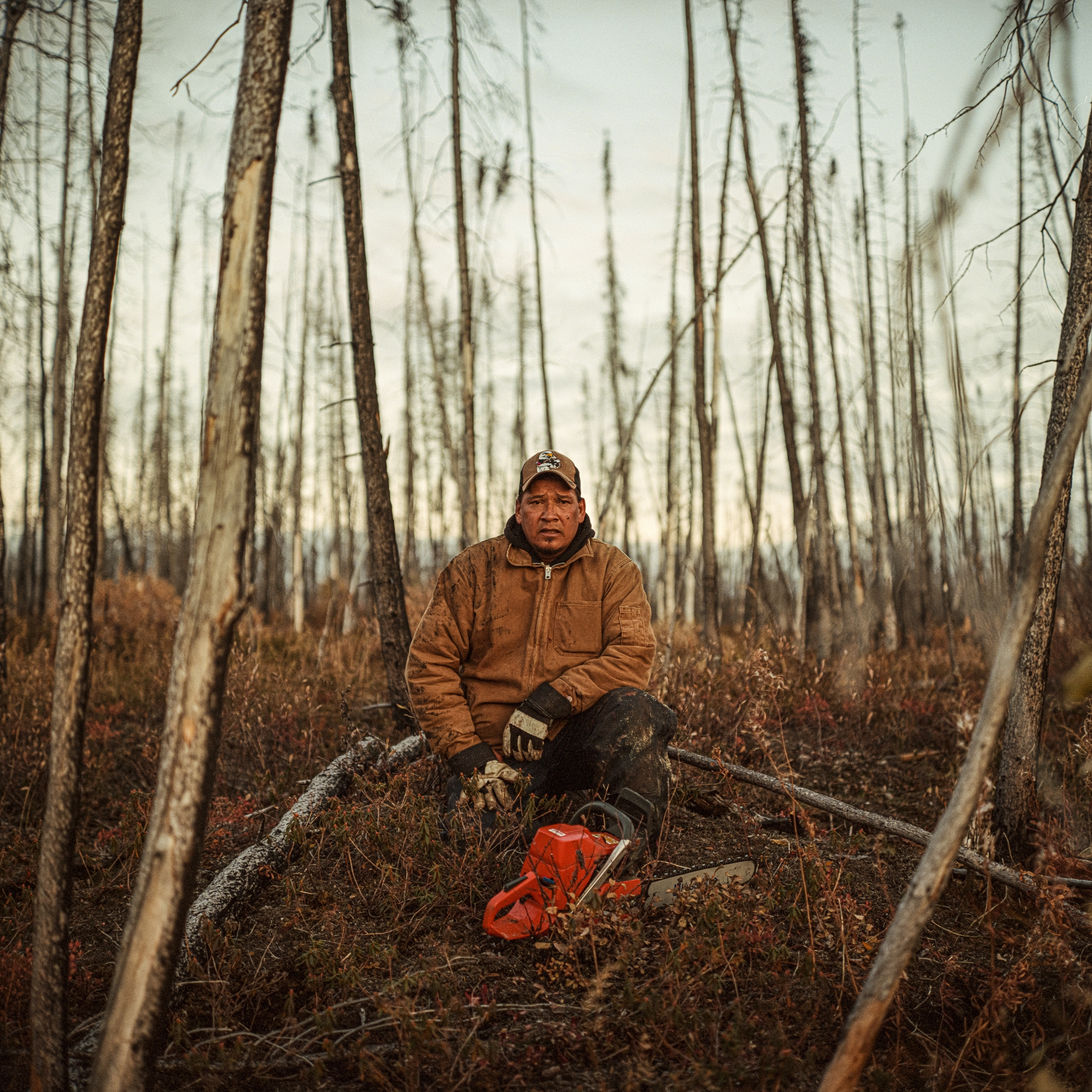
Robert Spence rests while cutting firewood near his trapline on the Churchill River, where he takes his family to hunt moose each fall. Spence is an elected councillor of the Tataskweyak Cree Nation, known as the community of Split Lake. At one time, Spence was able to provide for his family as a commercial fisherman and fur trapper, but he left the profession after the fishery became unprofitable due to declining stock and fish quality. Spence has long been a critic of Manitoba Hydro and yet, as a councillor, works closely with the utility provider in an effort to mitigate further impacts on the land, the river and his community.
A fisherman’s boat approaches Two Mile Channel, an artificial channel created by Manitoba Hydro between Playgreen Lake, upstream from the community of Norway House Cree Nation, and Lake Winnipeg. Historical construction activities in the 1970s resulted in soil and groundwater contamination and construction debris along the channel’s banks. Significant erosion continues around the artificial channel to this day, resulting in the sedimentation of Playgreen Lake, which impacts drinking water as well as prevents light penetration and oxygen production in the broader ecosystem.
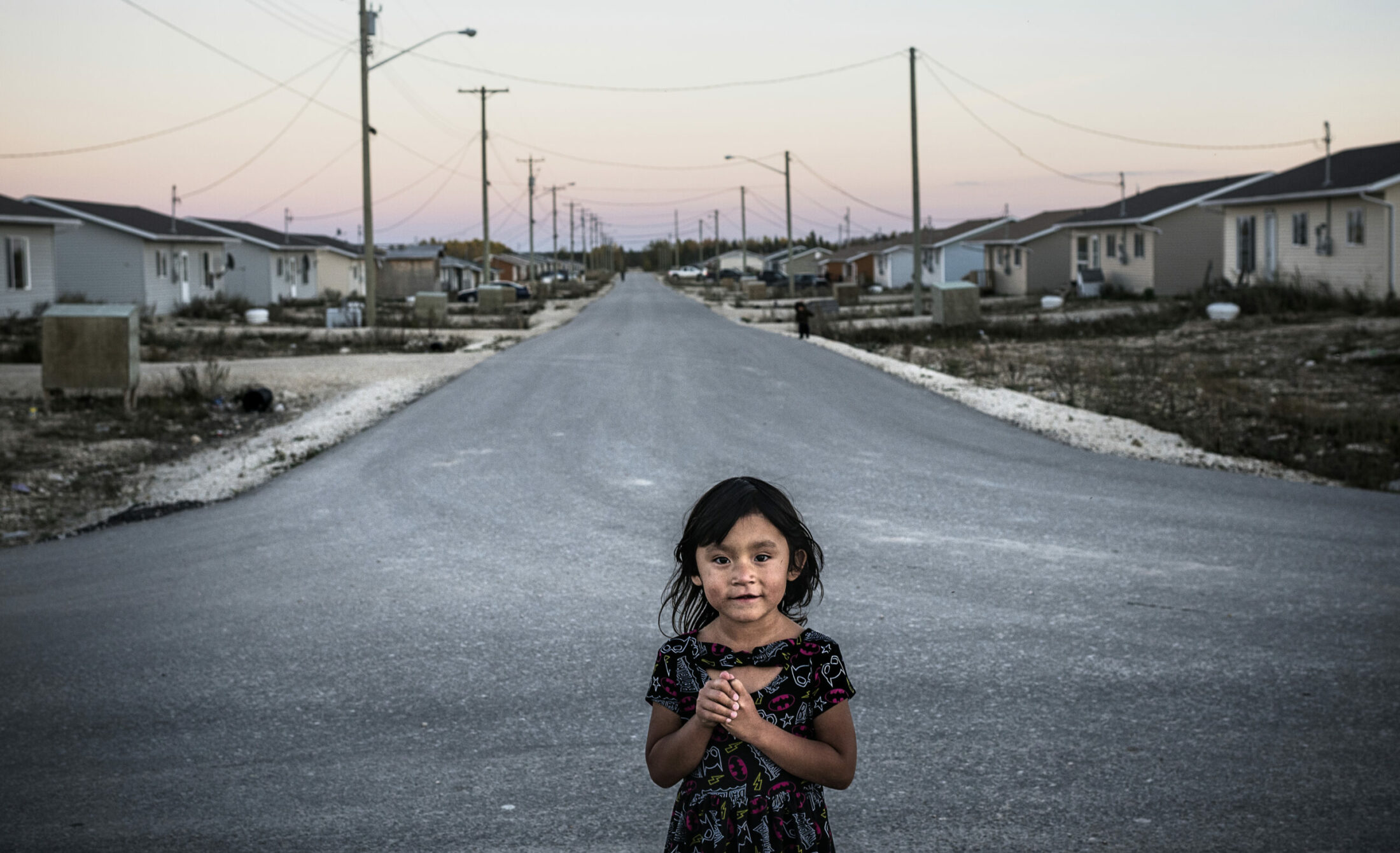
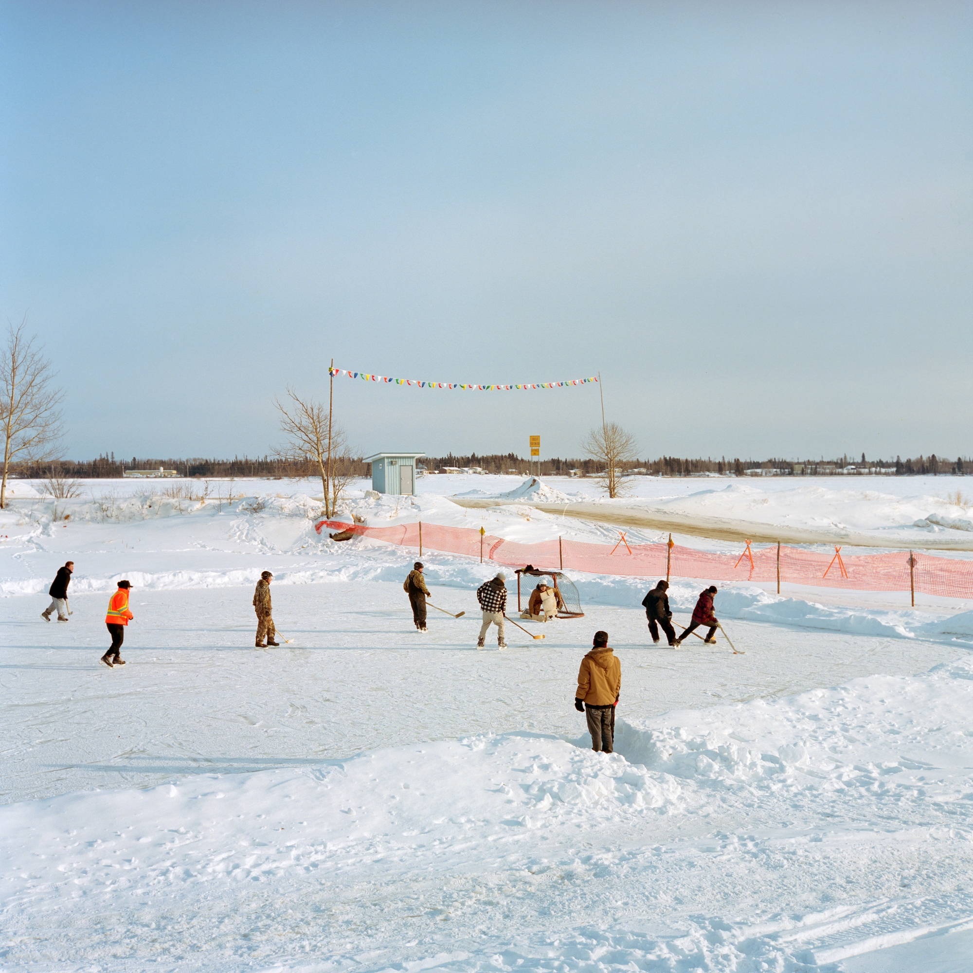
Aalaiyah wears a Keeyask hat while she plays on riprap-enforced river banks that surround the community of Split Lake, 60 kilometres upstream of the dam. Elders often speak about how they used to swim and play in the shallow waters, catching crayfish that are now rarely seen. They lament that their grandchildren are unable to do the same as the shoreline in normally flooded and the polluted waters are known to cause rashes.
Raymond Anderson of the Fox Lake Cree Nation fishes next to the Kettle dam near Gillam. His grandfather’s house was bulldozed during construction to facilitate development of hydroelectricity on the lower Nelson River in the 1960s. Anderson works for Manitoba Hydro. “I started working in 1988. I’d never thought I’d work at hydro for 25 years,” he says. “Hydro isn’t all bad, you know. They did a lot of bad in the past, but it’s changed — they can’t get away with what they used to.”
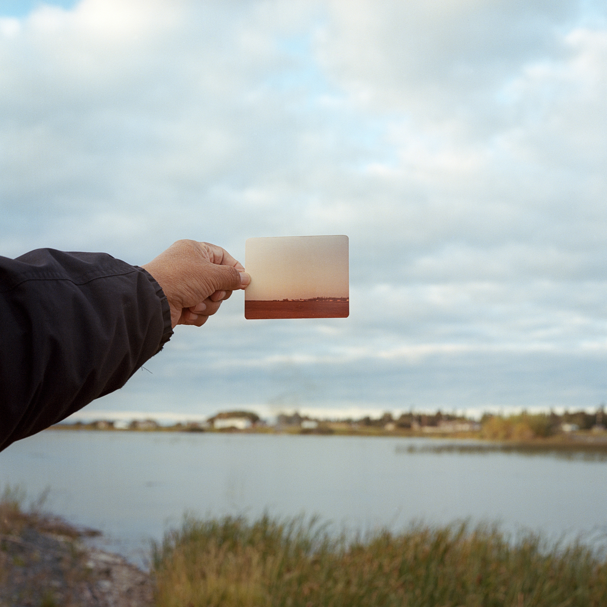
Jackson Osbourne holds an old image to compare a marshy bay near his home before and after it had been flooded by the nearby Jenpeg dam in the community of Cross Lake, home to the Pimicikamak Cree Nation. Regulated water flow from the Jenpeg dam has impacted the community through drastic and sudden fluctuations in water level, causing substantial long-term erosion, difficulty navigating the water by boat and dangerous ice conditions for travel in the winter months. The cumulative impacts have devastated wildlife and fish populations and eroded a cultural way of life.
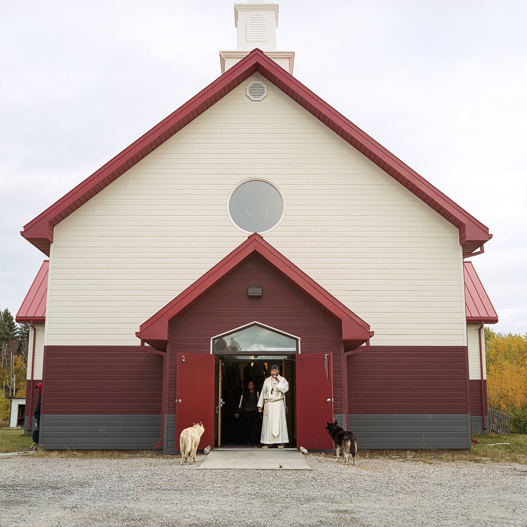
Father Kennith Kitchekeesik stands at the doorway to the church during a funeral for James Beardy, who died due to diabetes complications in Split Lake on Sept. 20, 2018. Diabetes has become a health crisis in many First Nations communities, where the problem is linked to changing diets that can no longer rely on traditional foods.
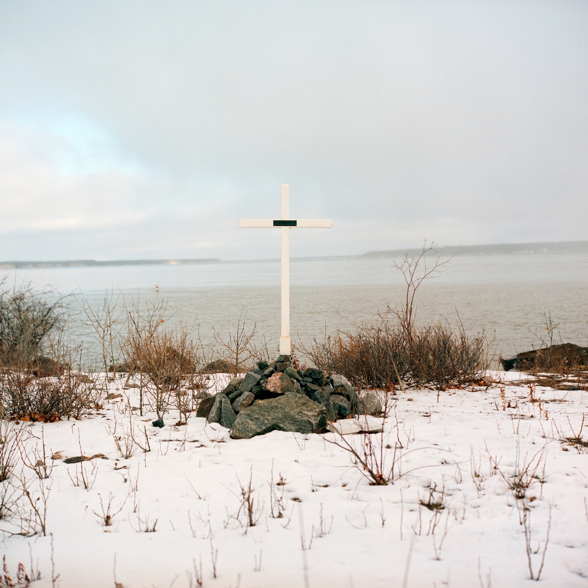
A cross marking the place where Fox Lake member “Big” John Henderson killed himself at age 42, directly below the Long Spruce dam on the Nelson River near Fox Lake First Nation. Henderson was employed by Manitoba Hydro at the time of his death. His sister Sarah says whenever her brother was off work, he was in the bush.
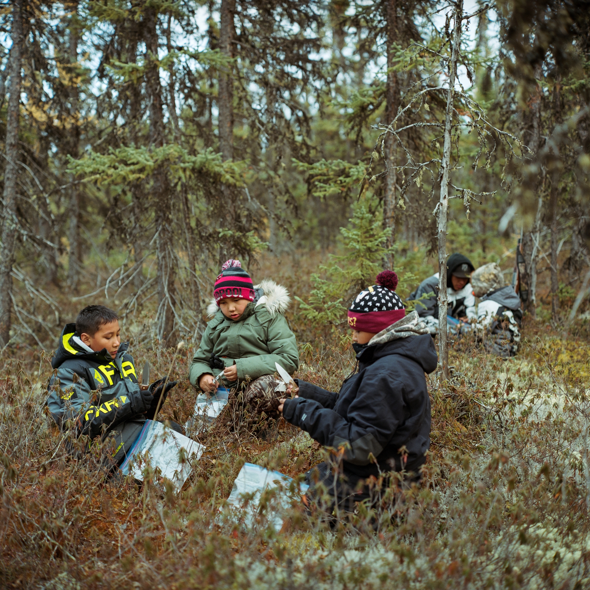
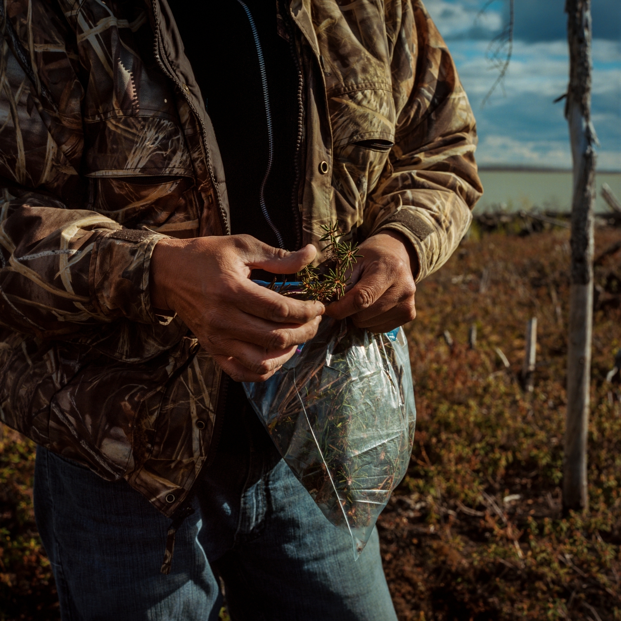
From left to right: Cohen, Carter and their cousin Richard harvest plants on an island in the Churchill River during a moose hunting trip. Annual hunting trips to the traplines are supported by funding from Manitoba Hydro, which covers the cost of flights under what is known as the Land Access Program. The program supports the cost of travel because hunting and fishing near their community of Split Lake on the Nelson River have been severely impacted by hydro development.
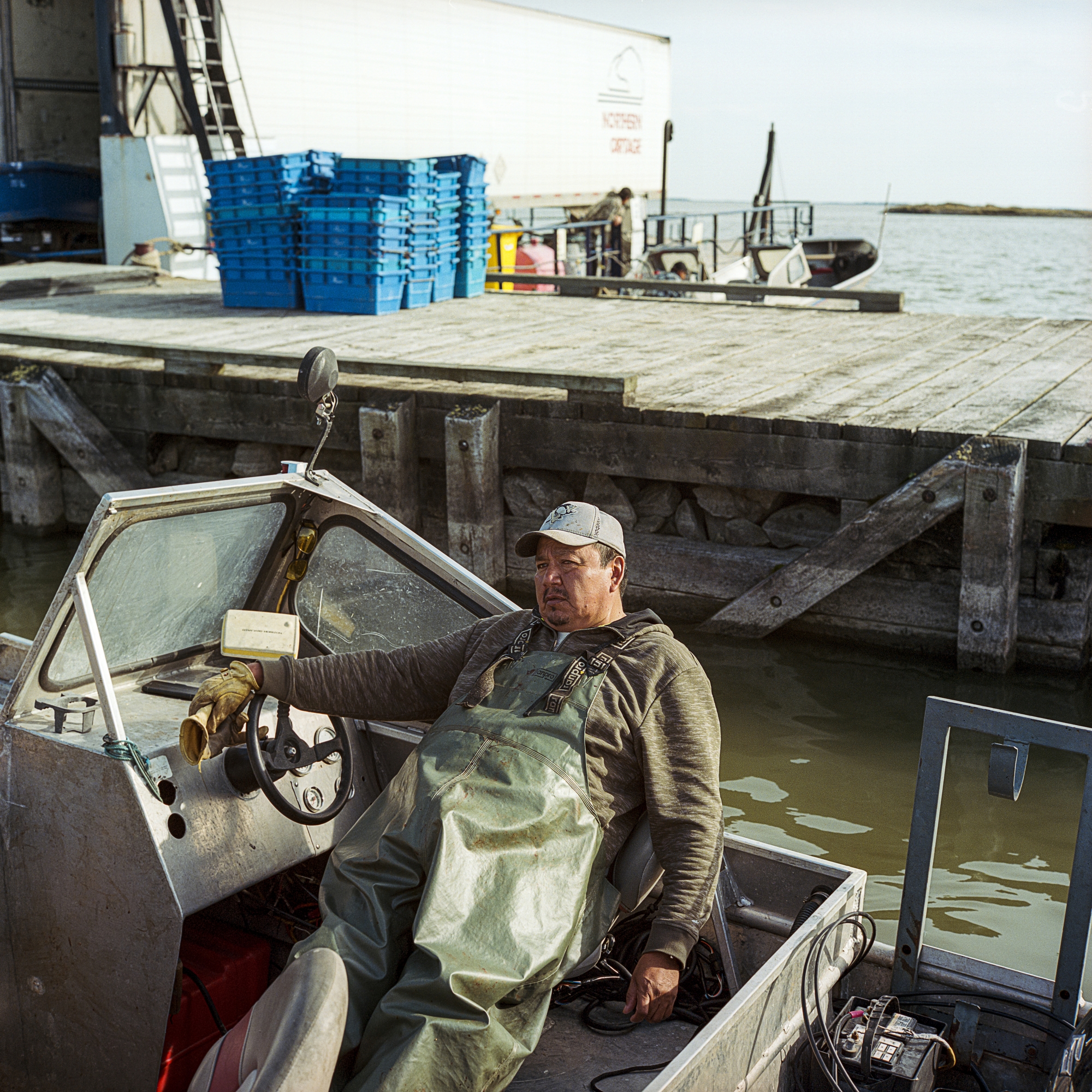
Langford Saunders, president of the Norway House Fisherman’s Co-op, rests in his boat after a day of commercial fishing on Lake Winnipeg in 2016. Many fisherman in Manitoba’s north complain of changes to their waterways due to hydro regulation, from a green slime that appears in the water to debris that gets caught in their nets. They also speak of catching more lower grades of fish, such as mullet, while noting a decrease in the abundance of valuable pickerel and whitefish.
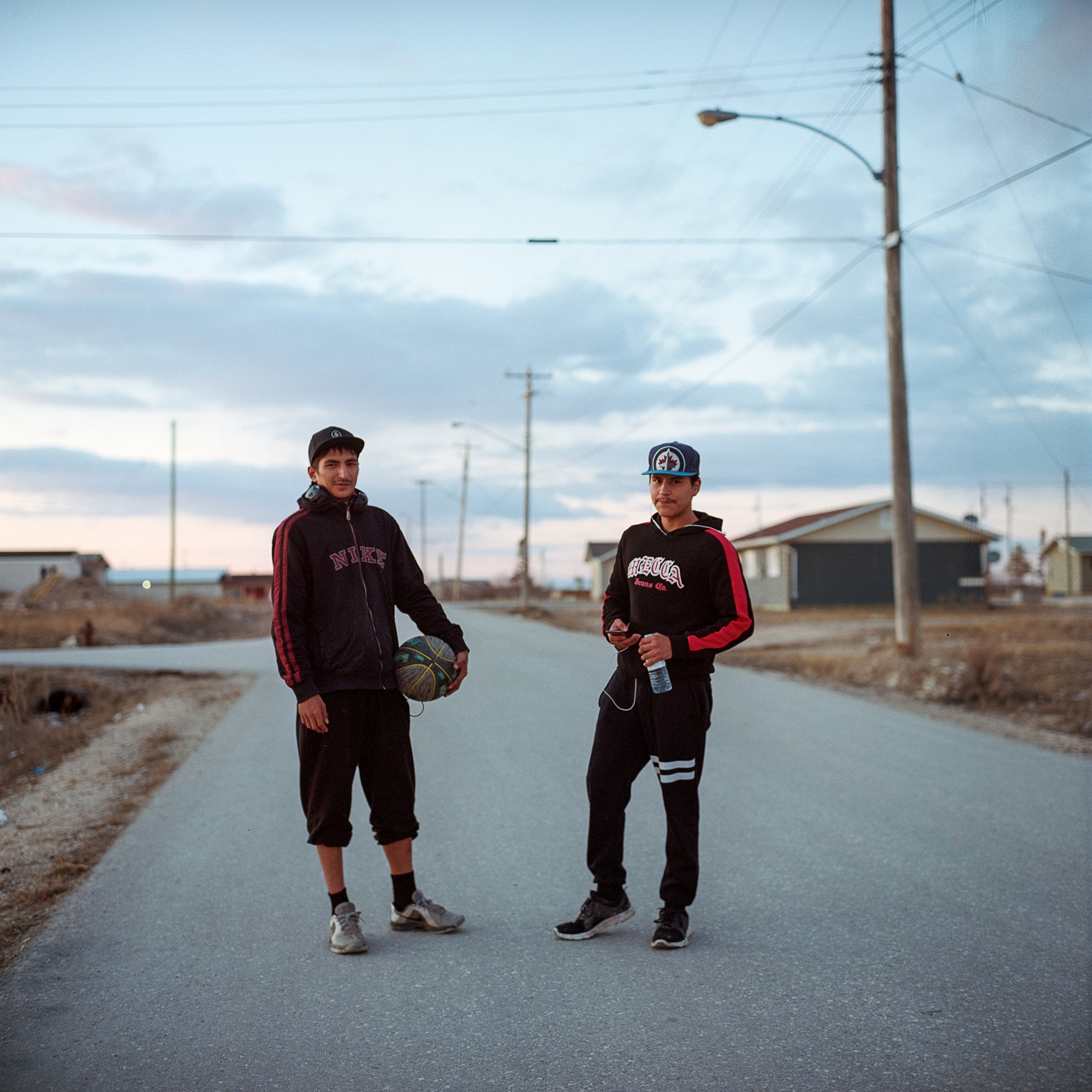
Jared Morde and Jared Lachose stand for a portrait on the streets of Easterville, Man. Easterville, the reserve community of the Chemawawin Cree Nation, was founded in 1962 after the nation was forcibly relocated from its original community closer to the mouth of the Saskatchewan River during the construction of the Grand Rapids dam.
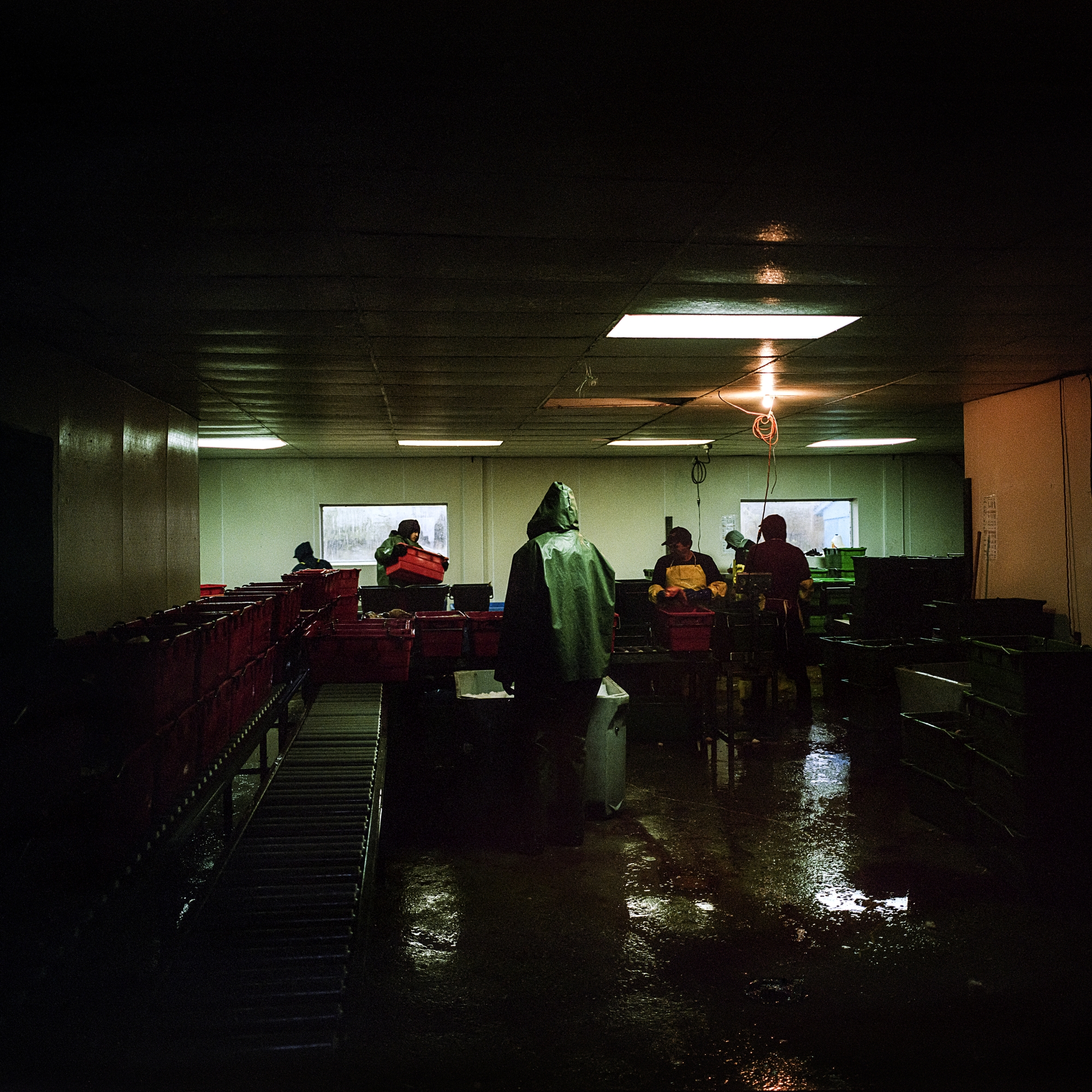
Fisherman pack their catch at the Playgreen Point Station processing facility near Norway House Cree Nation. Commercial fishing continues to be a main employer of northern First Nations communities in Manitoba, but impacts on water from hydroelectric development has negatively impacted the industry.
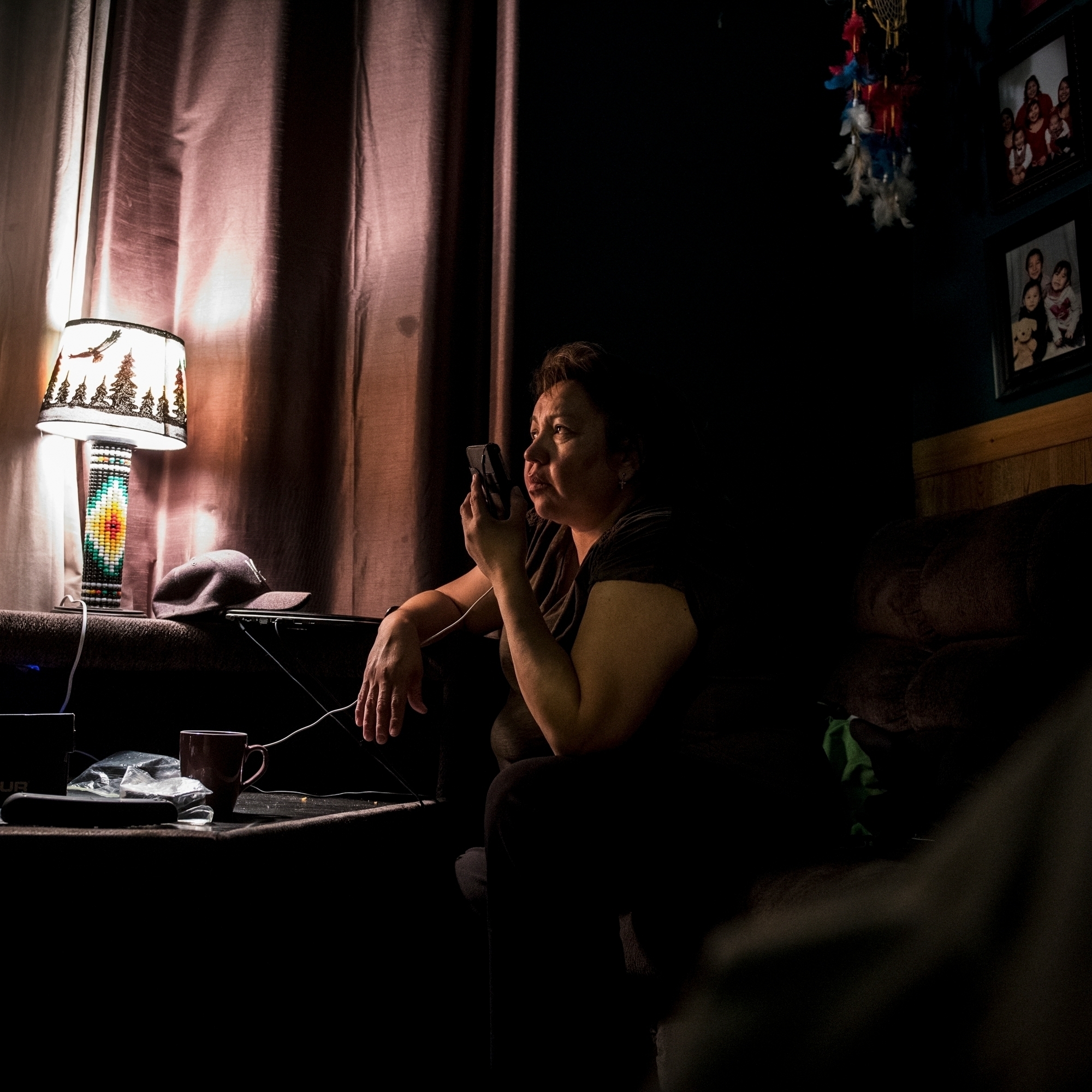
Former councillor for the Tataskweyak Cree Nation and teacher Melanie Spence is interviewed by a reporter about the Keeyask dam and hydro impacts to her community.
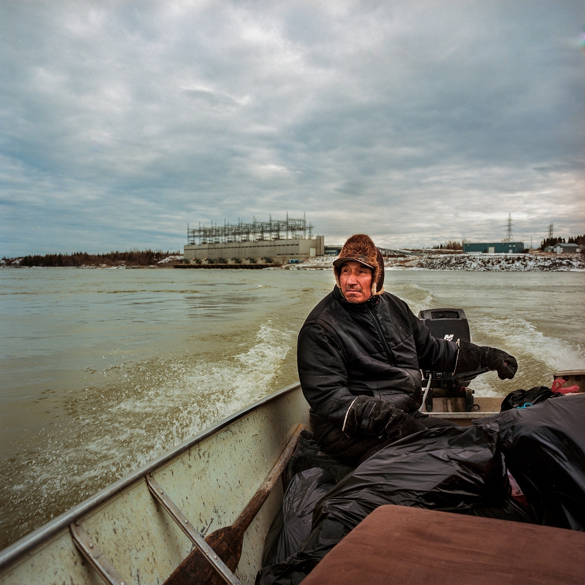
Able Flett, from the Tataskweyak Cree Nation, returns to the community after taking youth out on the land for a traditional knowledge program. To reach their camp, the group had to pass the Kelsey dam, the first dam built on the Nelson River. It was completed in 1960 to power the Vale Nickel mine and the new town of Thompson.
Fisherman’s helper Murdock Saunders during his work day fishing on Lake Winnipeg near Norway House First Nation.
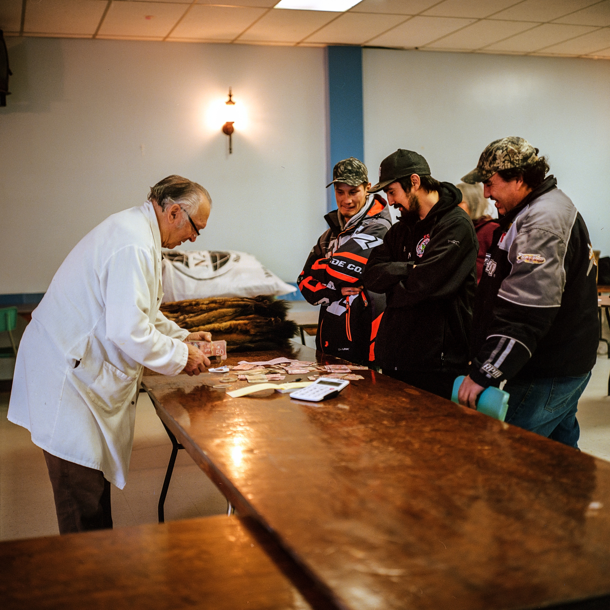
Bruno Decesco buys furs at the Thompson Fur Table from local trappers in December 2018. Decesco has been buying furs in Thompson since 1972. Many tappers depend on the income they generate from trapping to cover Christmas expenses.
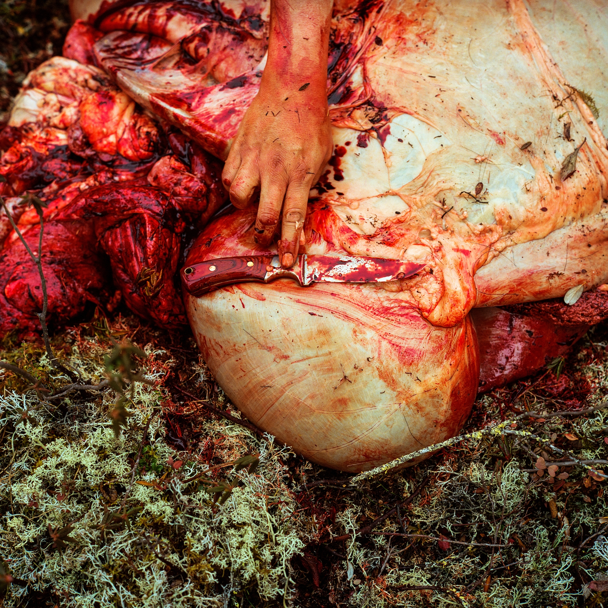
Split Lake Councillor Robert Spence reaches for a knife while butchering a moose during a hunting trip to his trapline on the Churchill River. The meat is flown back by plane and shared with Elders in the community of Tataskweyak Cree Nation. In recent years, fewer moose have been successfully hunted in and around the community and many believe it is due to the loss of willows, a favourite food source for moose, along the riverbanks due to erosion from hydro dams.

Community priest Martha Spence reads from a Bible written in the Cree language in her home in Split Lake. Spence spent a year as a cultural awareness assistant at the Keeyask dam site, working to reduce racism and prejudice toward First Nations workers. But she says she doesn’t approve of the dam. “Us Elders, we are sad in our hearts … each time I go there, I cry.”
Jonathan Kitchekeesik, from the community of Tataskweyak First Nation, collects plants for medicinal tea on an island in Gull Lake, which was recently flooded during the impoundment of the Keeyask dam in September 2020. Kitchekeesik participated in the environmental assessment for the Keeyask project and was one of the members of his community to support the dam, believing it would provide good jobs. But more recently, he has begun to speak critically about the project and worries fellow Tataskweyak Nation members have become spiritually sick because of the community’s involvement in the dam. “We have funerals every week. Something is going on. I think we are being punished for what we did.”
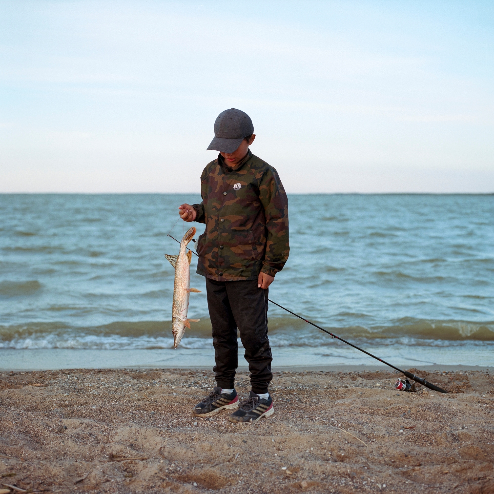
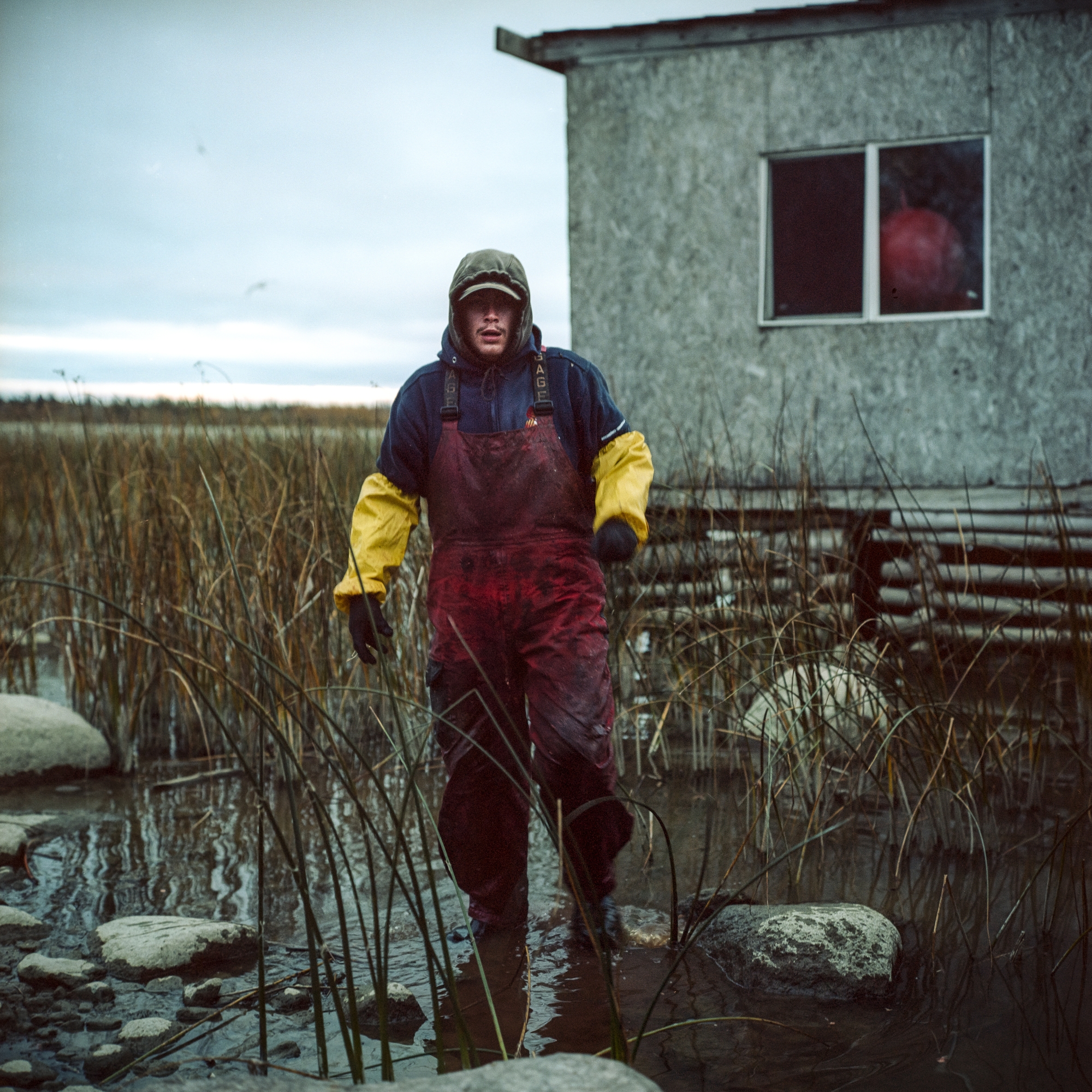
Caleb shows off his catch on a beach that is now lost to permanent flood waters from the impoundment of the Keeyask dam in August 2020.
Zachary Kitchekeesik carries wood for a bonfire on the beach with his friends in Split Lake.
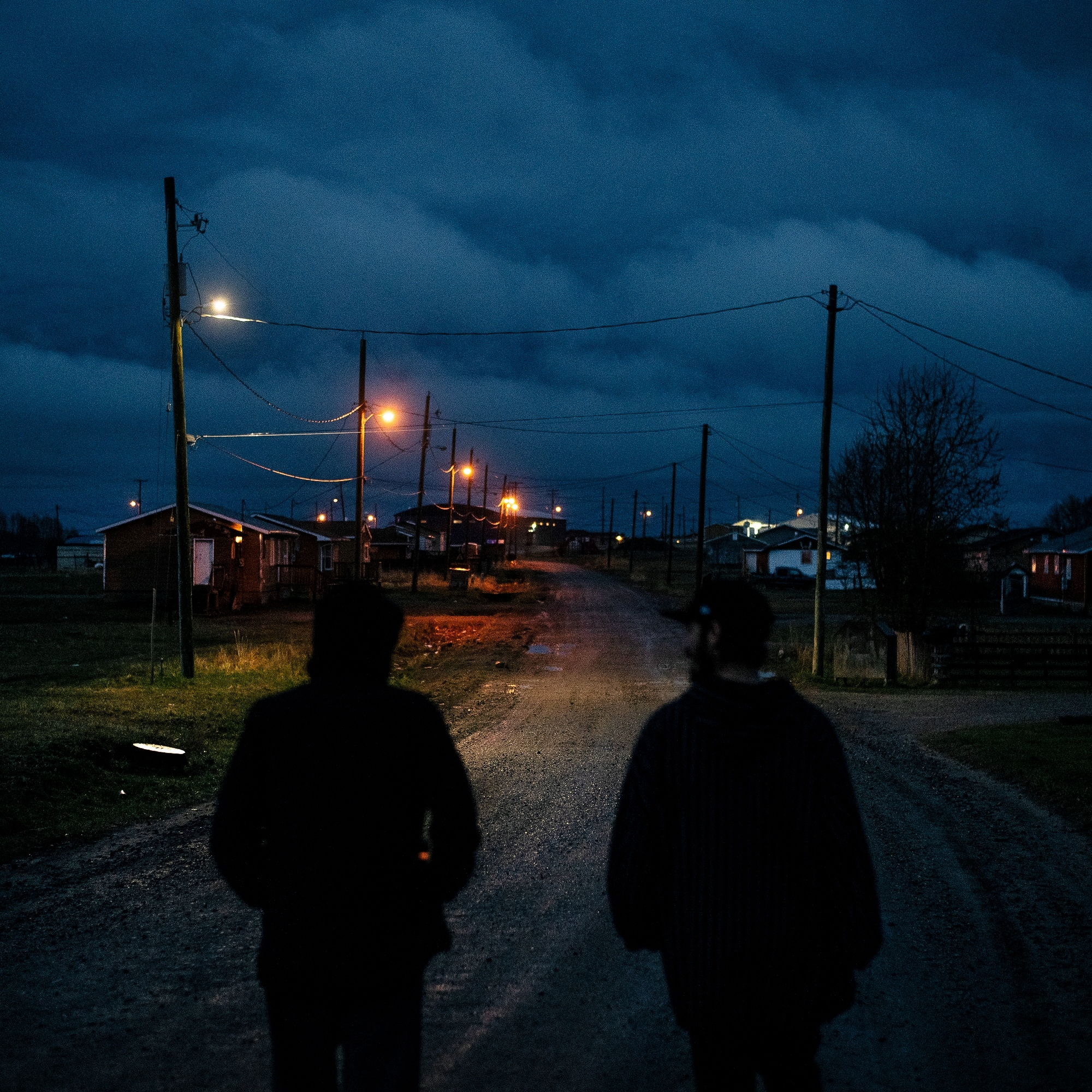
Hayden Flett and Marcus Gay walk the roads of Split Lake.
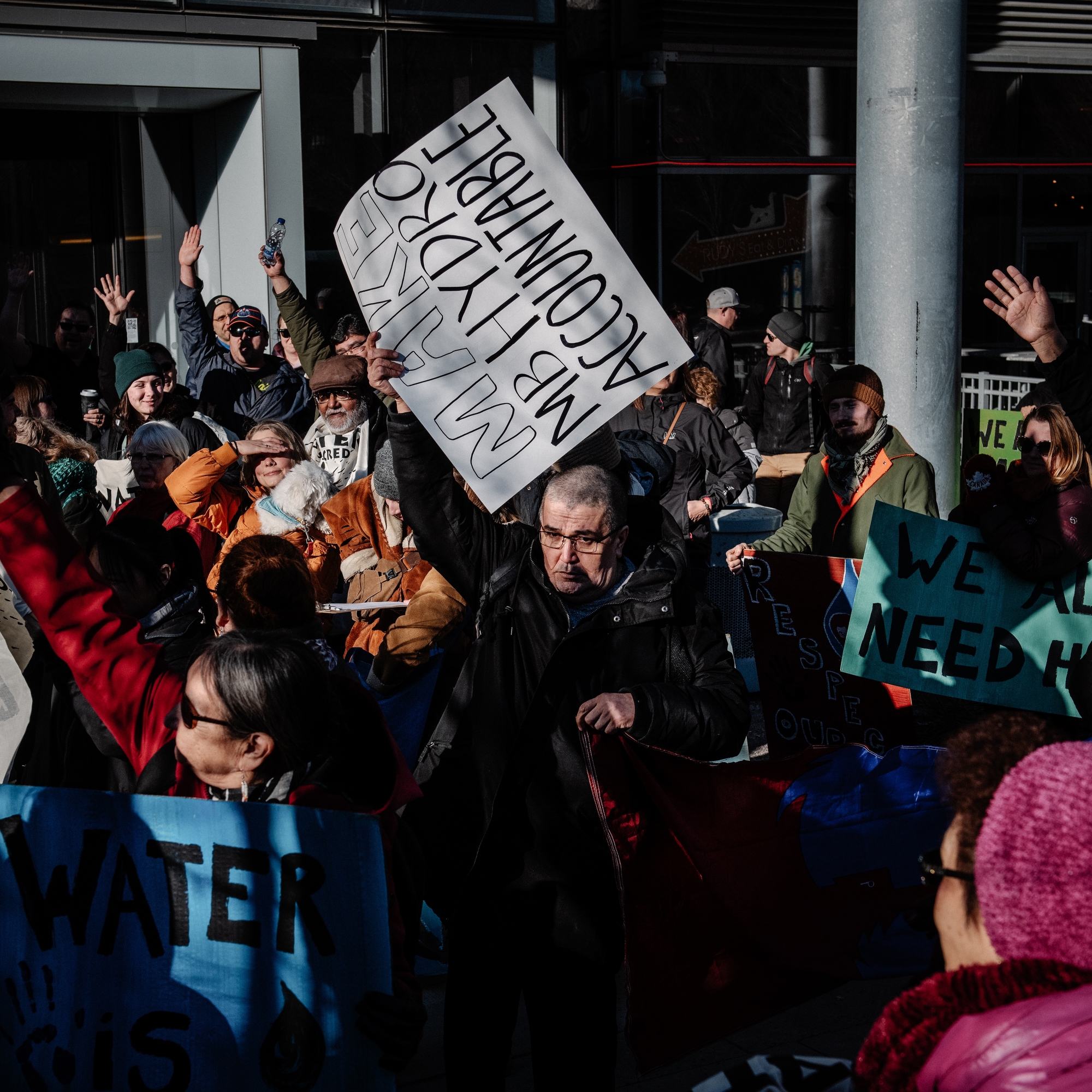
Protesters march outside the headquarters of Manitoba Hydro in Winnipeg during World Water Day on March 22, 2019.
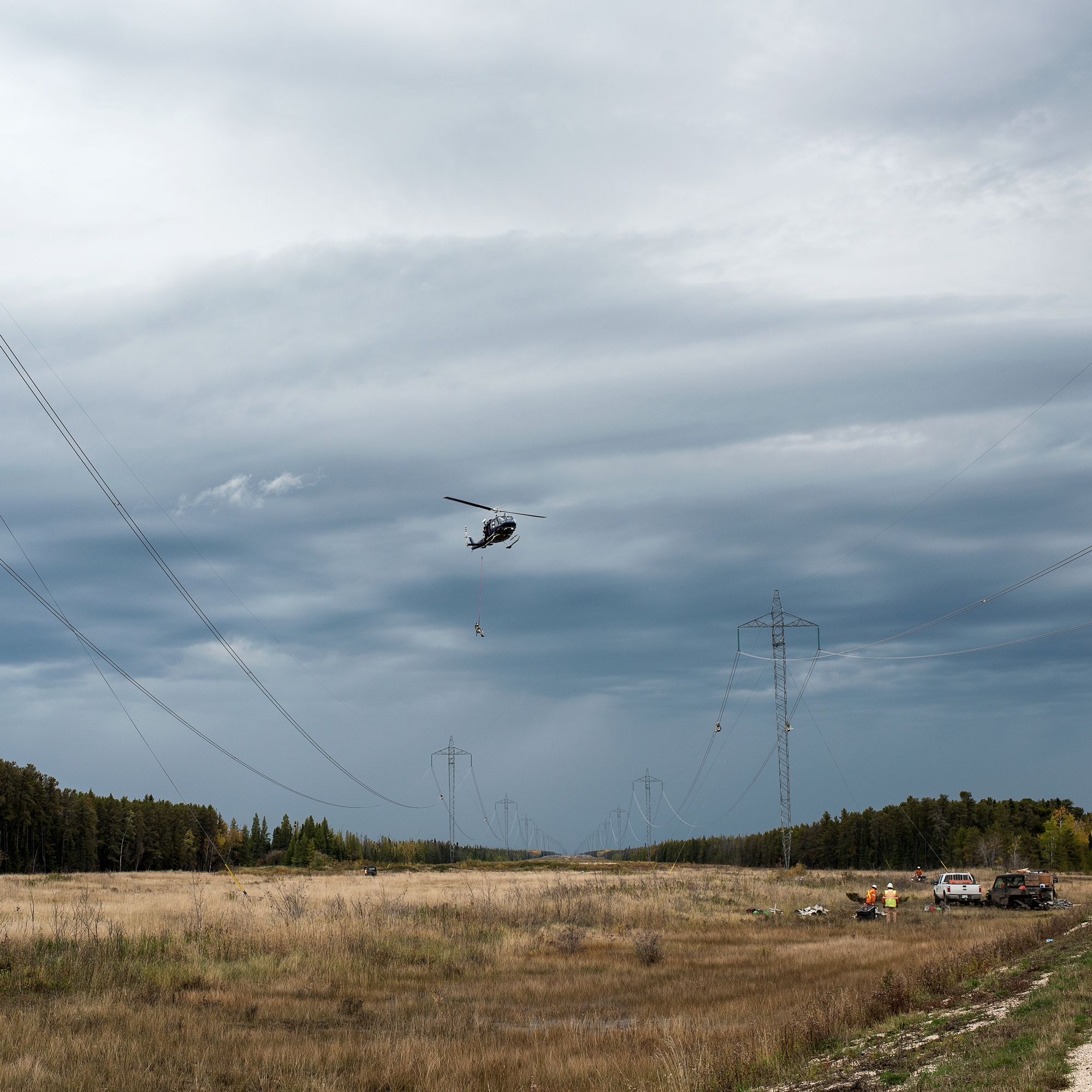
Hydro workers dangle above the ground as they build the Bipole III transmission line, which will carry energy south from the Keeyask dam once completed.
Delaney Mcgilvery, Keenan Young and Mitchell Turner of the Misipawistik Cree Nation work as fisherman’s helpers on Lake Winnipeg near Grand Rapids. The Grand Rapids dam on the mouth of the Saskatchewan River was the first dam built in northern Manitoba and severely impacted the fishing industry for years.
Players use homemade sticks to play hockey during the 60th anniversary of the Cross Lake Trappers’ Festival. The festival includes a dog sled race, square dancing, jigging, a talent show and a contest to name the king and queen trappers.
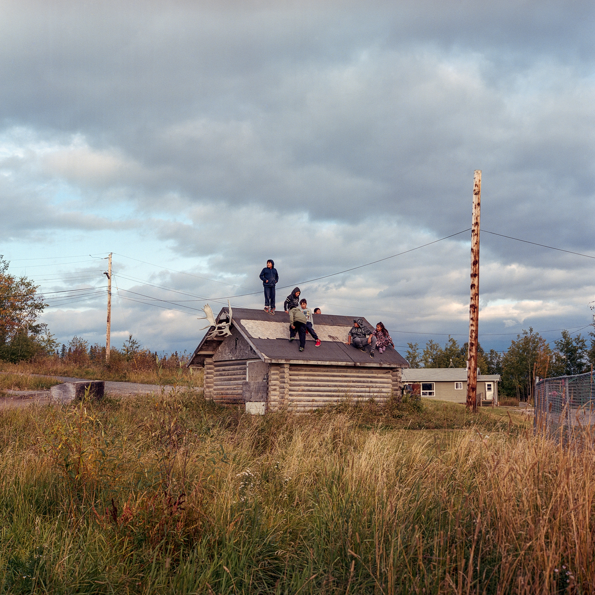
Children play on the roof of an old cabin in the community of Cross Lake, home to the Pimicikamak Cree Nation. In 1977 Cross Lake and four other First Nations signed the Northern Flood Agreement with Manitoba Hydro and the Government of Canada for compensation for the impacts of Lake Winnipeg regulation and diversion of the Churchill River. The broad agreement, which would last the life of the projects, stipulated that Manitoba Hydro and the federal government would offer economic stimulus to the communities and seek “the eradication of mass poverty and mass unemployment.” The agreement went unfulfilled by the province and Canada until four of the five First Nations settled on new agreements with large cash payments in the 1990s. To this day Cross Lake has refused to enter into any new agreements and continues to advocate for the implementation of the Northern Flood Agreement.
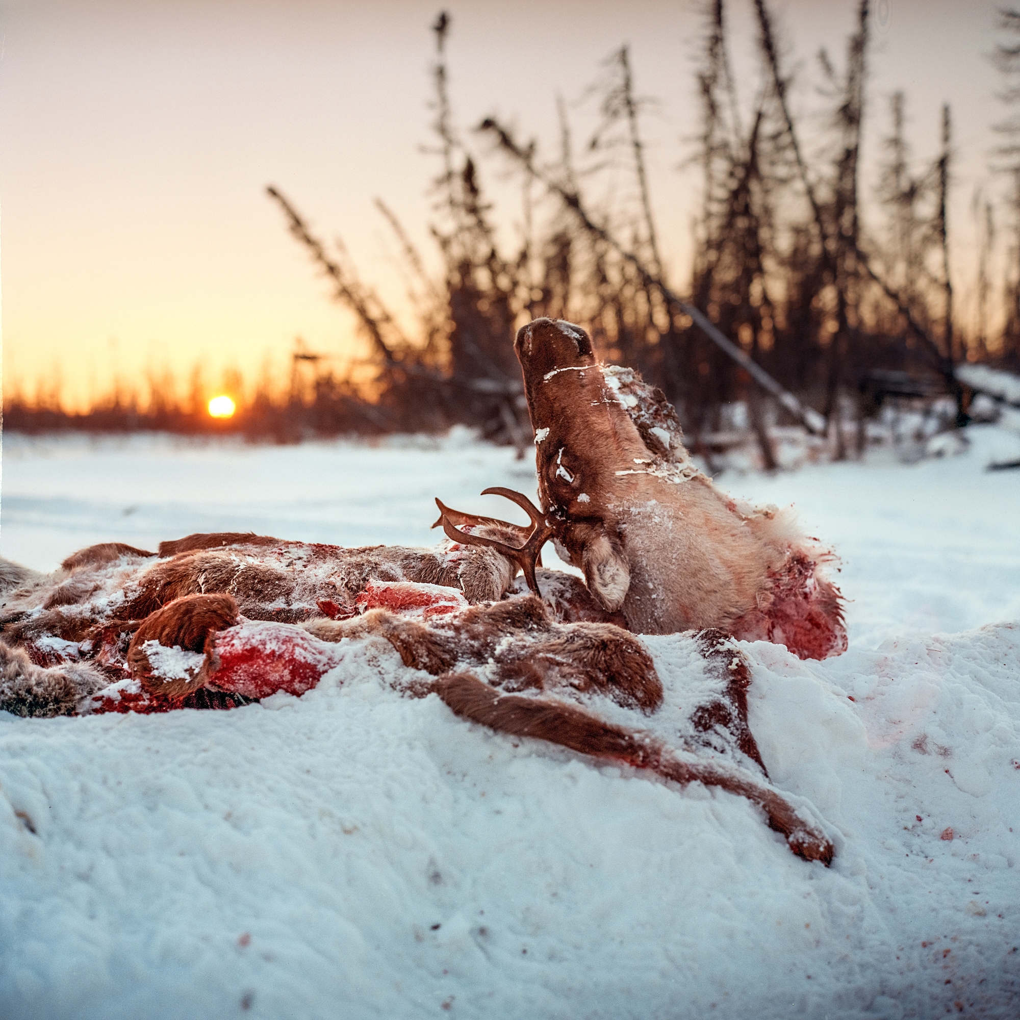
A caribou carcass sits on the side of a winter road during the caribou migration near Split Lake. The caribou hunt has always been vital for the survival of the communities in the north. In 2016 Canada’s barren-ground caribou herds were listed as threatened and are in decline.
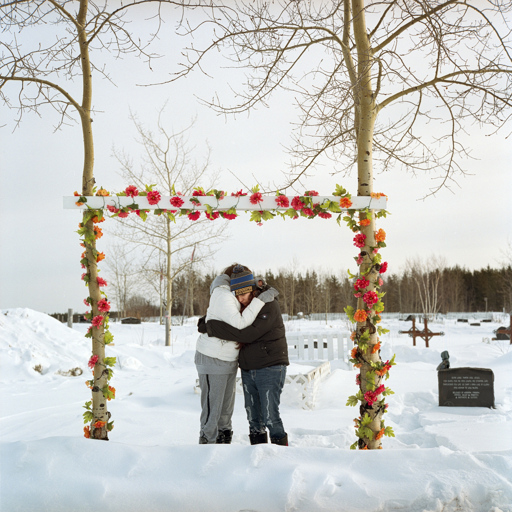
Kara Blacksmith, left, and her twin sister, Fara, embrace while visiting the grave of their late father, Abrose Thomas Ross. Ross died in 2015 after falling through ice while driving an ATV in the community of Cross Lake, home to the Pimicikamak Cree Nation. The water levels on Cross Lake fluctuate widely due to the nearby Jenpeg dam. The change in water levels causes unstable ice conditions and dangerous travel in winter, a common concern for many northern communities living near dams.
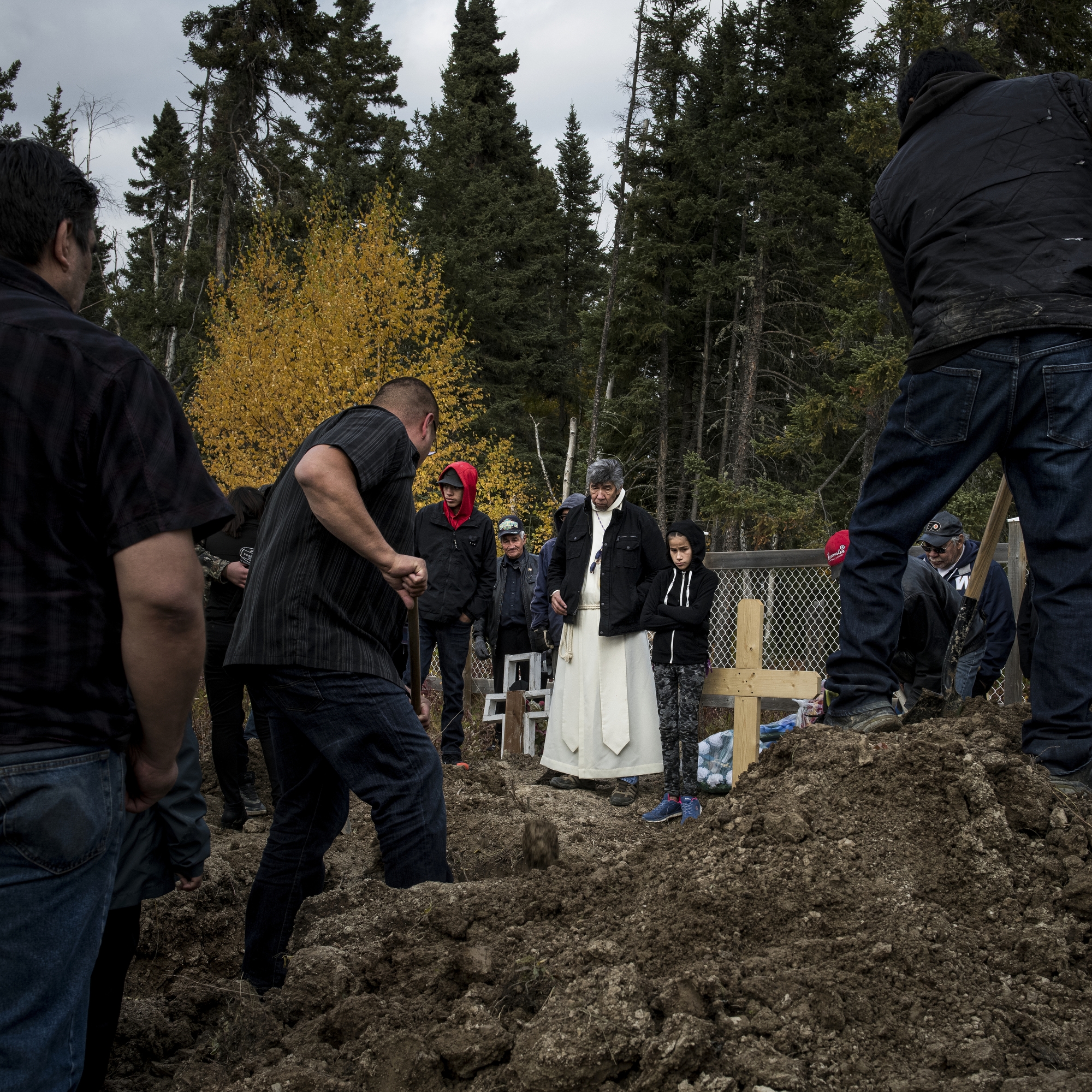
Father Kennith Kitchekeesik administers a funeral in Split Lake. The banks of the cemetery have been reinforced by riprap to prevent erosion after human remains were found exposed. “Skull and bones are starting to pop out here and there along the banks,” Kitchekeesik says. “Hydro is flooding our sacred grounds, where people were buried 50 or 100 years ago. They are now just drifting down the Nelson River.”
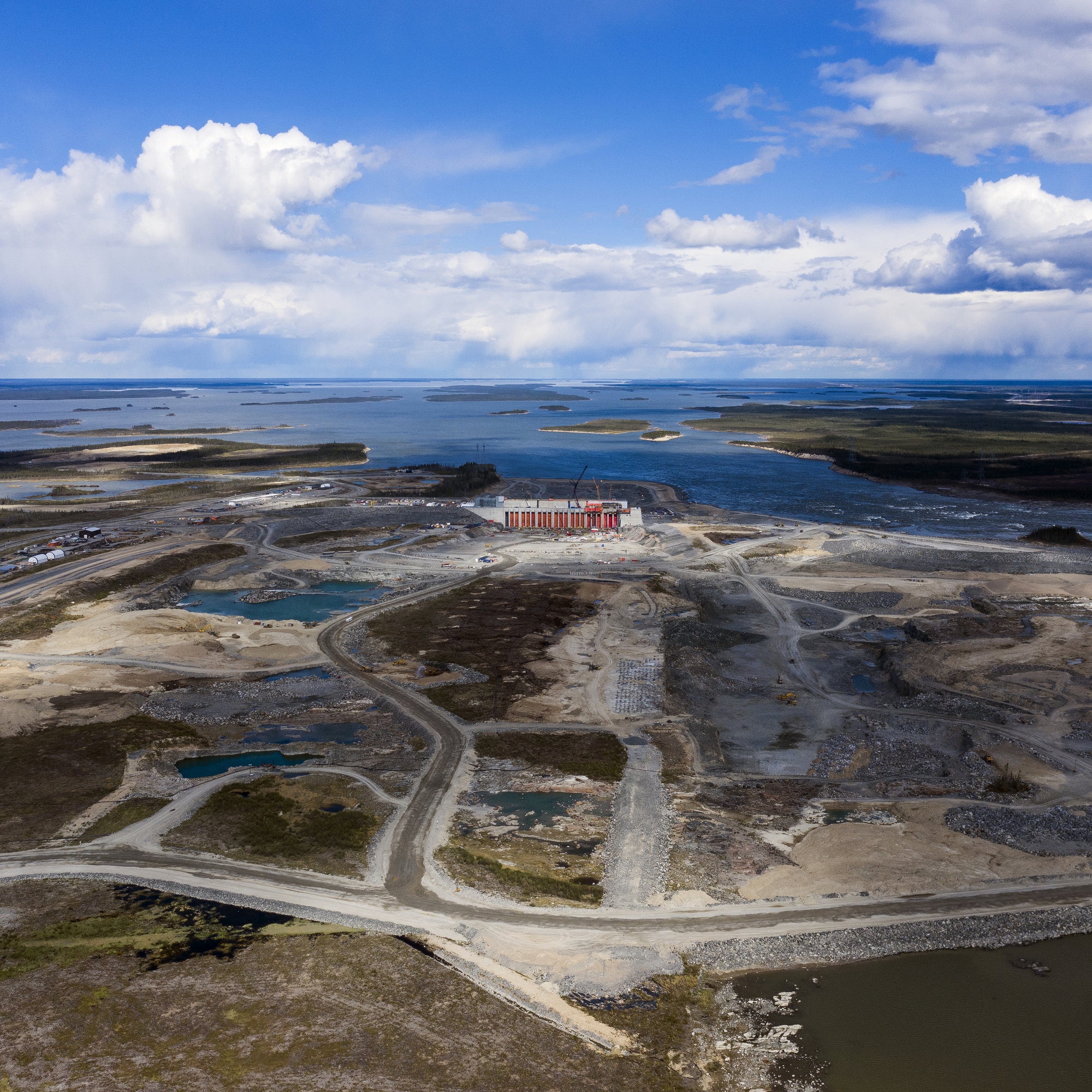
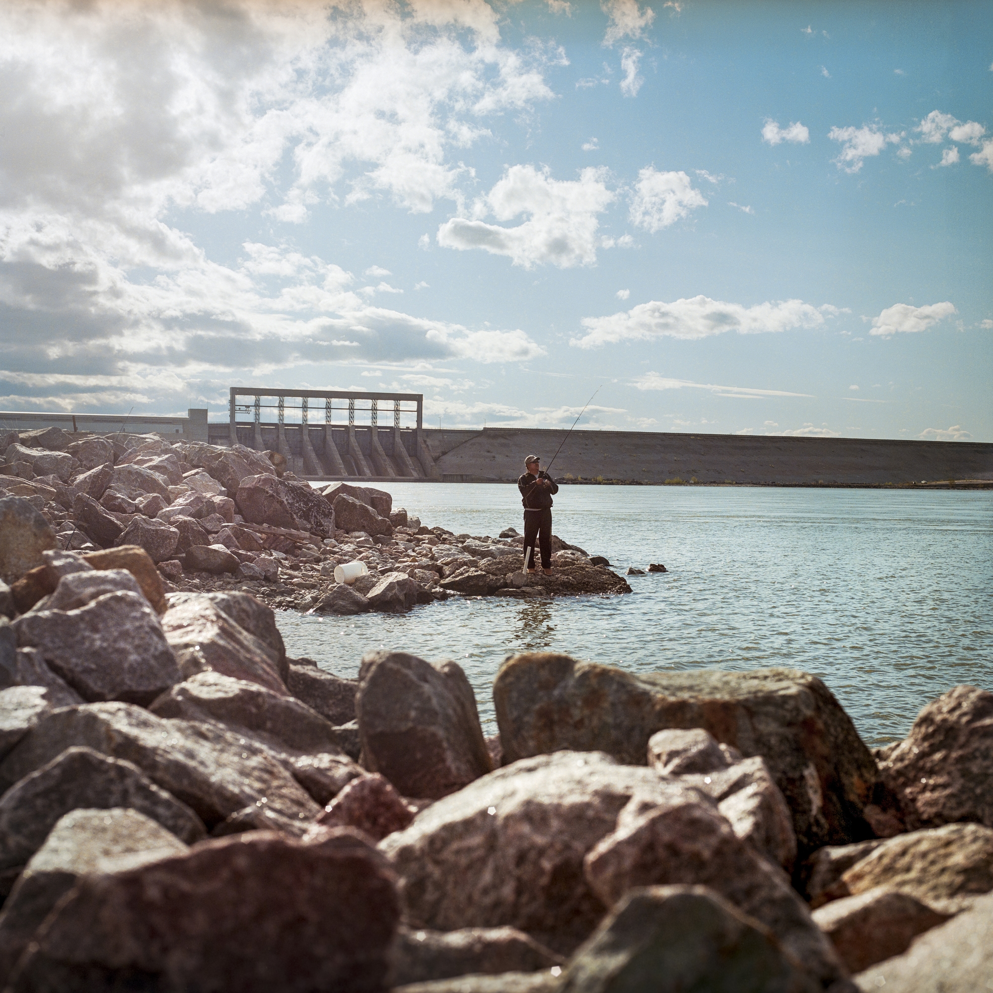
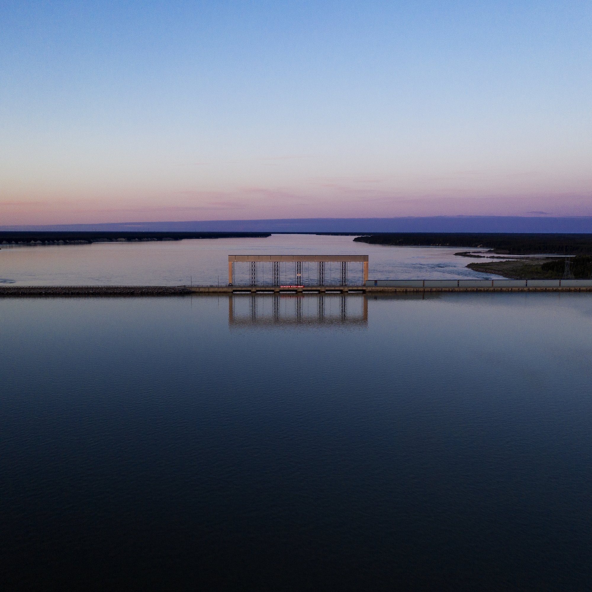
The Keeyask dam construction site at Gull Rapids on the Nelson River in June 2019. Since 2012, the cost of the dam and associated transmission lines has increased from $9.8 billion to almost $14 billion. The dam will create a flood reservoir that will cover 93 square kilometres. A hydro impact report for the Fox Lake Cree Nation notes that, due to more than 50 years of hydro development, the community has permanently lost the sound of “Kischi Sipi,” or the voice of the rapids, at each of the dam locations.

A mural commissioned by Manitoba Hydro depicting Indigenous children on the bank of a blue river is a visual landmark in the city of Winnipeg. Hydroelectric energy is often marketed as a reliable resource that is “clean and green” to consumers, but the story is more complicated for the communities near these dams. This is especially true for the Indigenous communities forced to contend with the province’s legacy of environmental and cultural degradation.
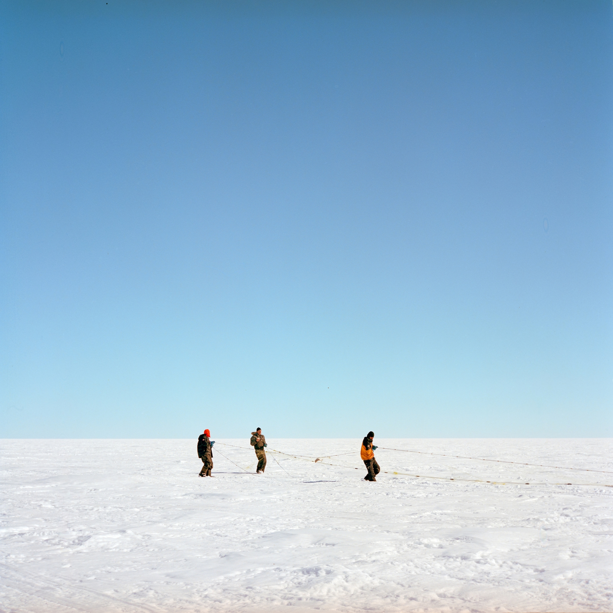
Hunters from Split Lake drive the winter ice roads looking for caribou crossing during the winter herd migration. The community of Split Lake has been severely impacted by hydro development’s degradation of the landscape for the better part of a century — despite long-standing efforts of the Split Lake Cree First Nation to prevent dam construction. In the 1960s, the Kelsey dam flooded 150 kilometres of land along the Nelson River upstream from Split Lake.
Commercial fisherman Leon Kencatch fishes with his grandson, James Walker, on Cedar Lake in the community of Easterville. When the new site of Easterville was created, a number of problems for the community arose. The soil thin and poor quality as a thick layer of limestone covered the area. This prevented the community from building pit toilets and eventually the well water the community depended on was contaminated with human waste. In 1970, the dam’s flooding was found to have caused mercury contamination in Cedar Lake, forcing the government to shut down the fishing industry many in the community depended upon. At the same time, the trapping industry declined due to the loss of beaver and muskrat habitat.
The Long Spruce dam was the fourth dam built on the Nelson River in the 1970s. It is near Gillam, about 745 kilometres northeast of Winnipeg. When the dam was built, water behind the structure rose by 26 metres, flooding the river and smaller estuaries over 13.7 square kilometres.
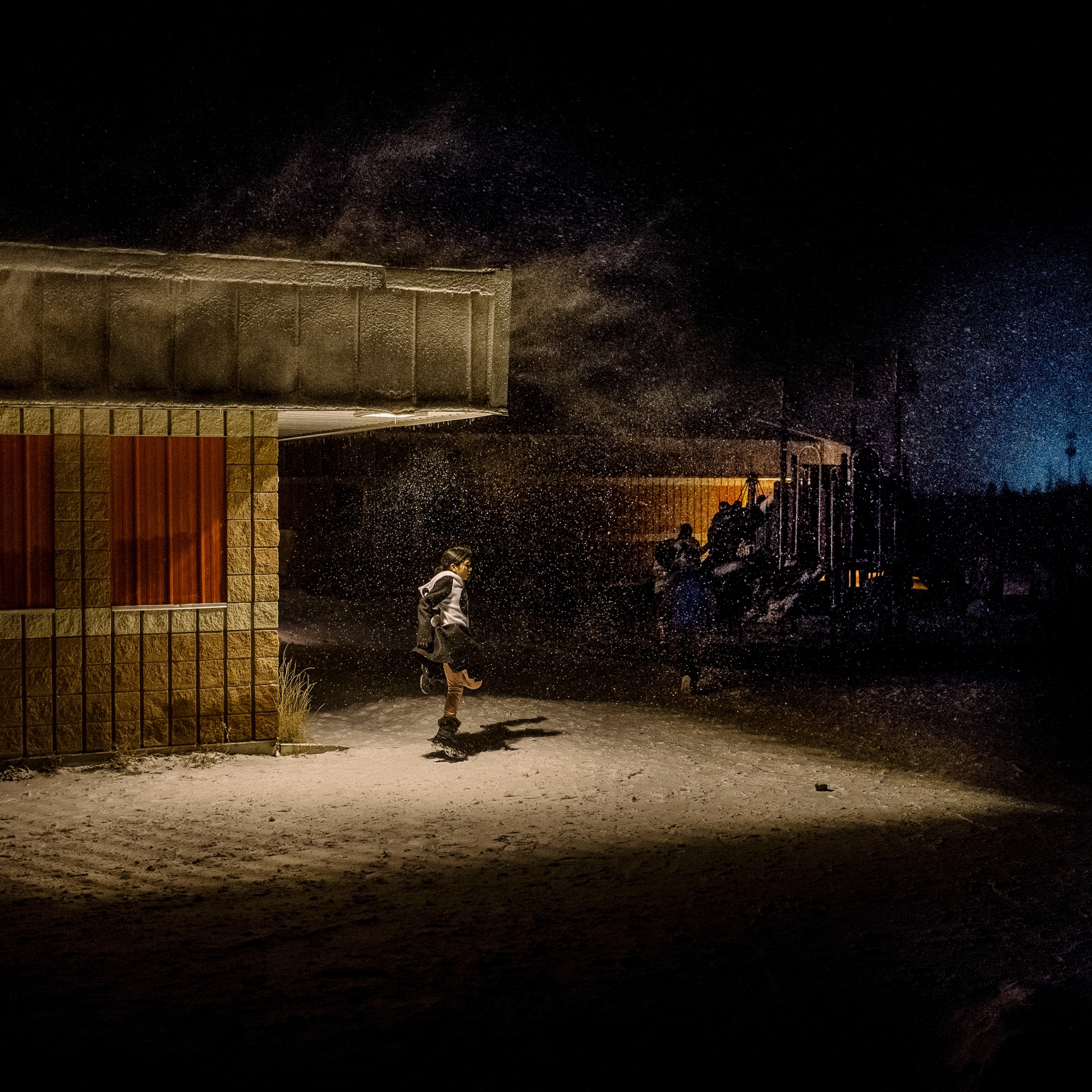
Students play outside the Split Lake School on Halloween night in 2018.
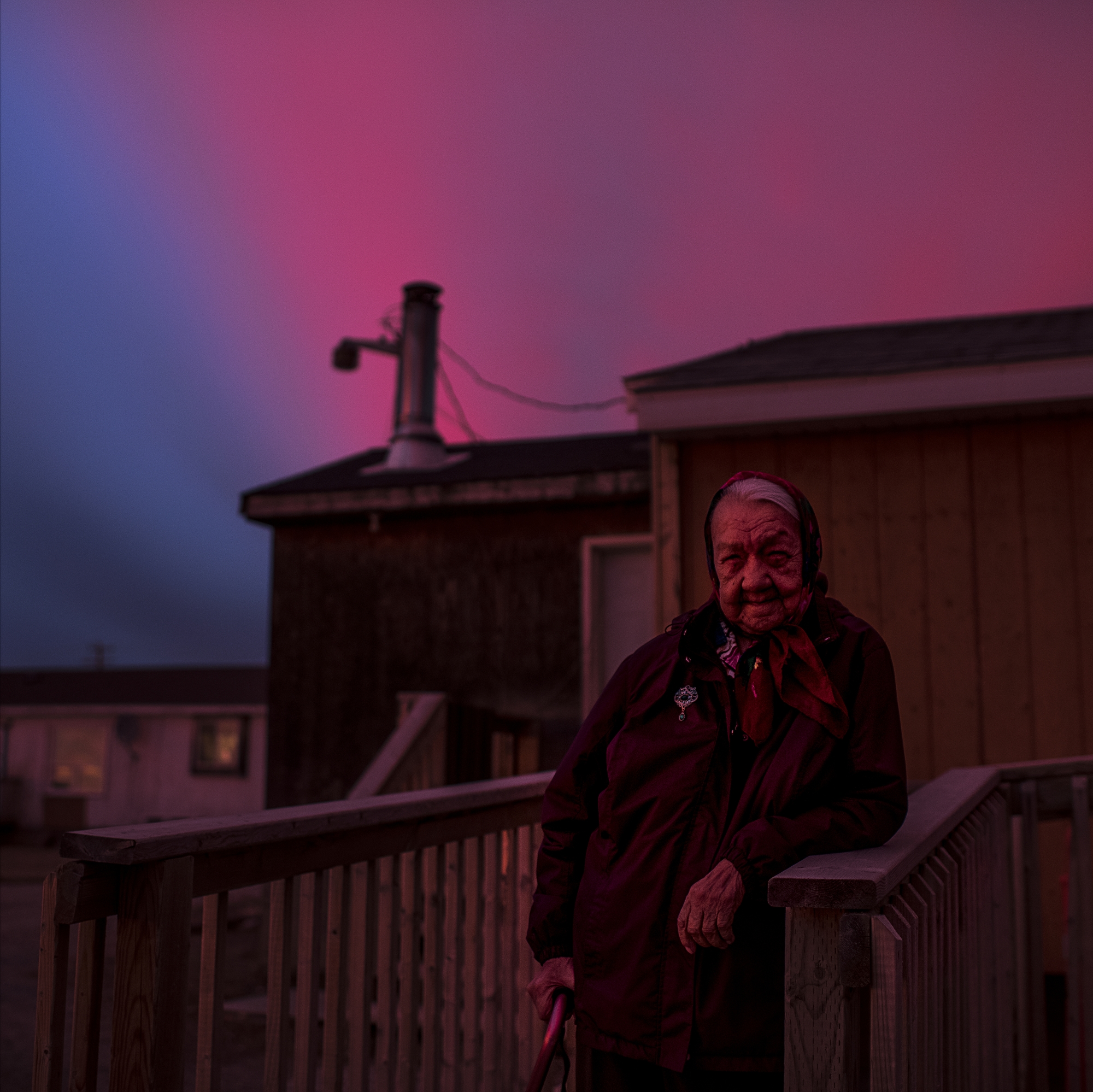
Tataskweyak Cree Nation Elder Betsy Flett stands outside her home in Split Lake. “I have no hope for the future,” she says. “You won’t be able to live here cause it’s gonna flood. It’s already flooded where our loved ones rest. I tell my kids, ‘When I die, why don’t you just throw me in the water, because that’s where I’m gonna end up anyways.’ ” Although Tataskweyak Cree Nation is an official partner in the new Keeyask dam, years of impacts, trauma and broken promises from Manitoba Hydro have eroded people’s trust in the provincial utility.
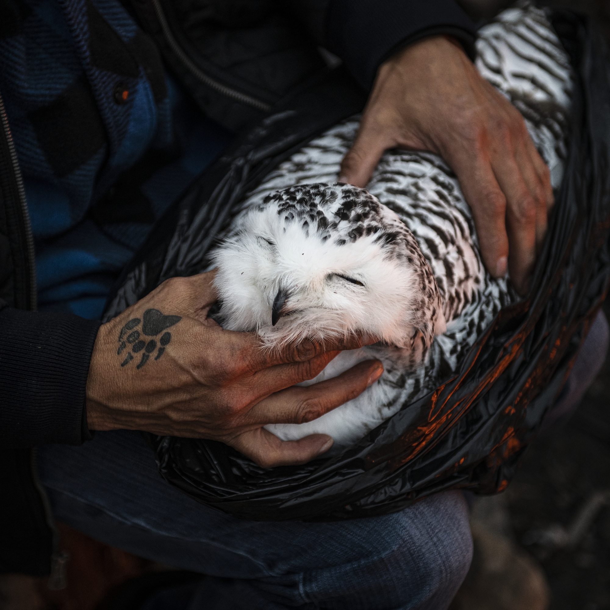
Indigenous spiritual teacher Allen Keeper holds a dead snowy owl that was found near the base of the Long Spruce dam. Snowy owls are a sacred animal to the Cree people and Keeper planned to use the creature’s feathers for ceremonial purposes.
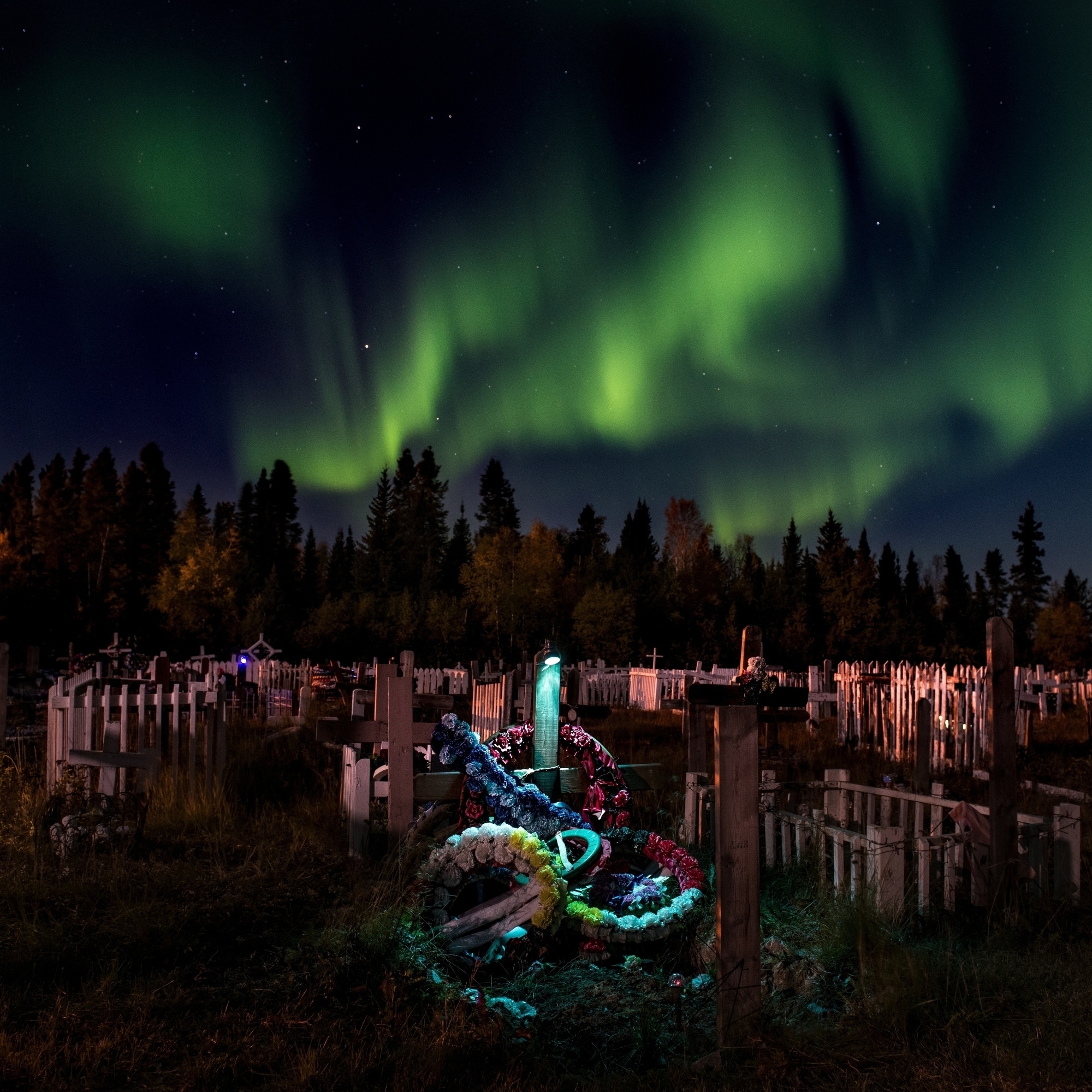
A cemetery is illuminated by the Northern Lights in the Tataskweyak Cree Nation community. Due to fluctuating water levels and erosion along Lake Winnipeg, Manitoba Hydro was forced to reinforce the banks surrounding the cemetery. Human ancestral remains from historical cemeteries have been found in the lake in recent years.
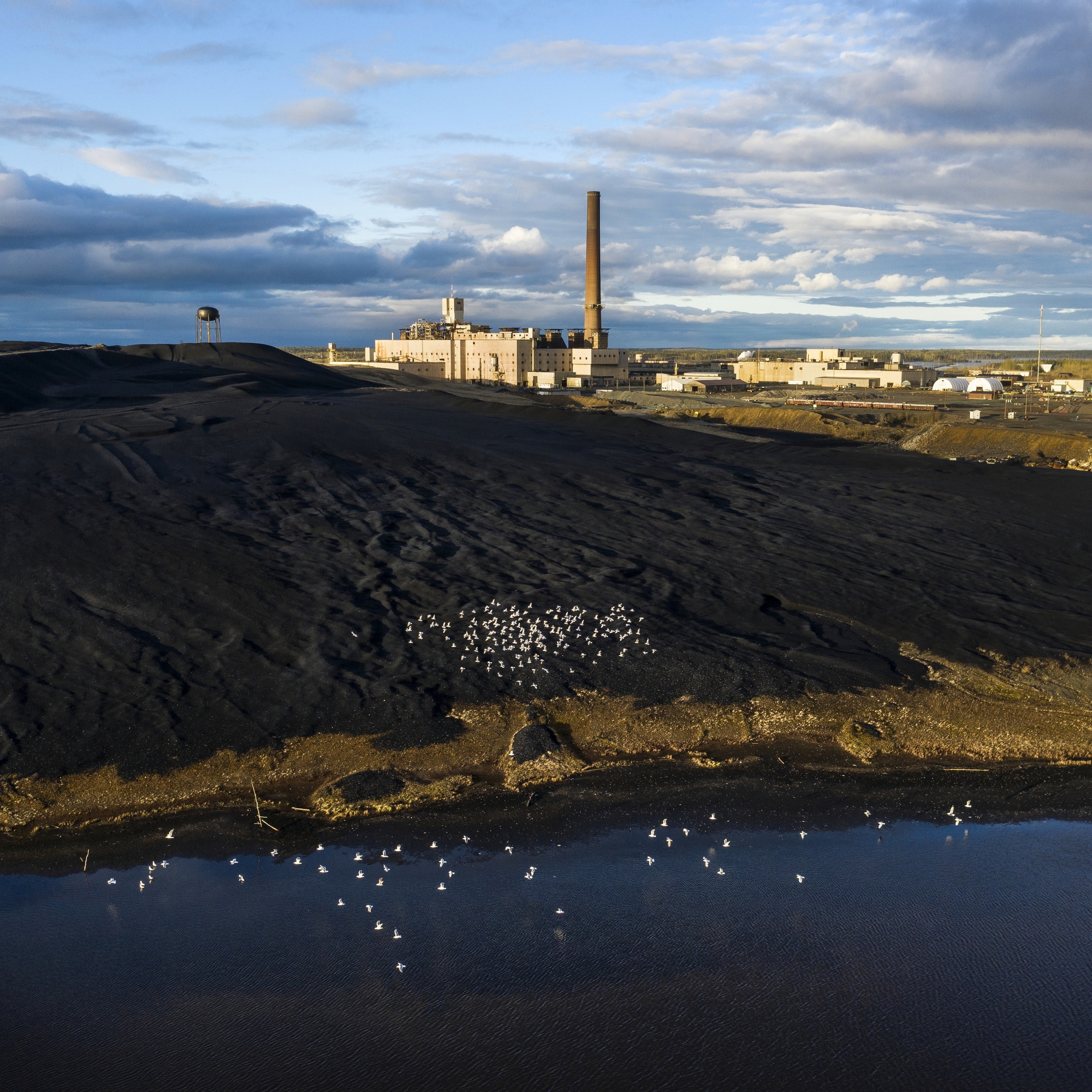
The Vale Nickel Mine near Thompson in northern Manitoba. The town of Thompson was originally founded in 1956 as a mining town and was the impetus for building the Kelsey dam, the first hydroelectric dam on the Nelson River. The Kelsey dam paved the way for more dams on the river system, which now produce 75 per cent of Manitoba’s electricity.
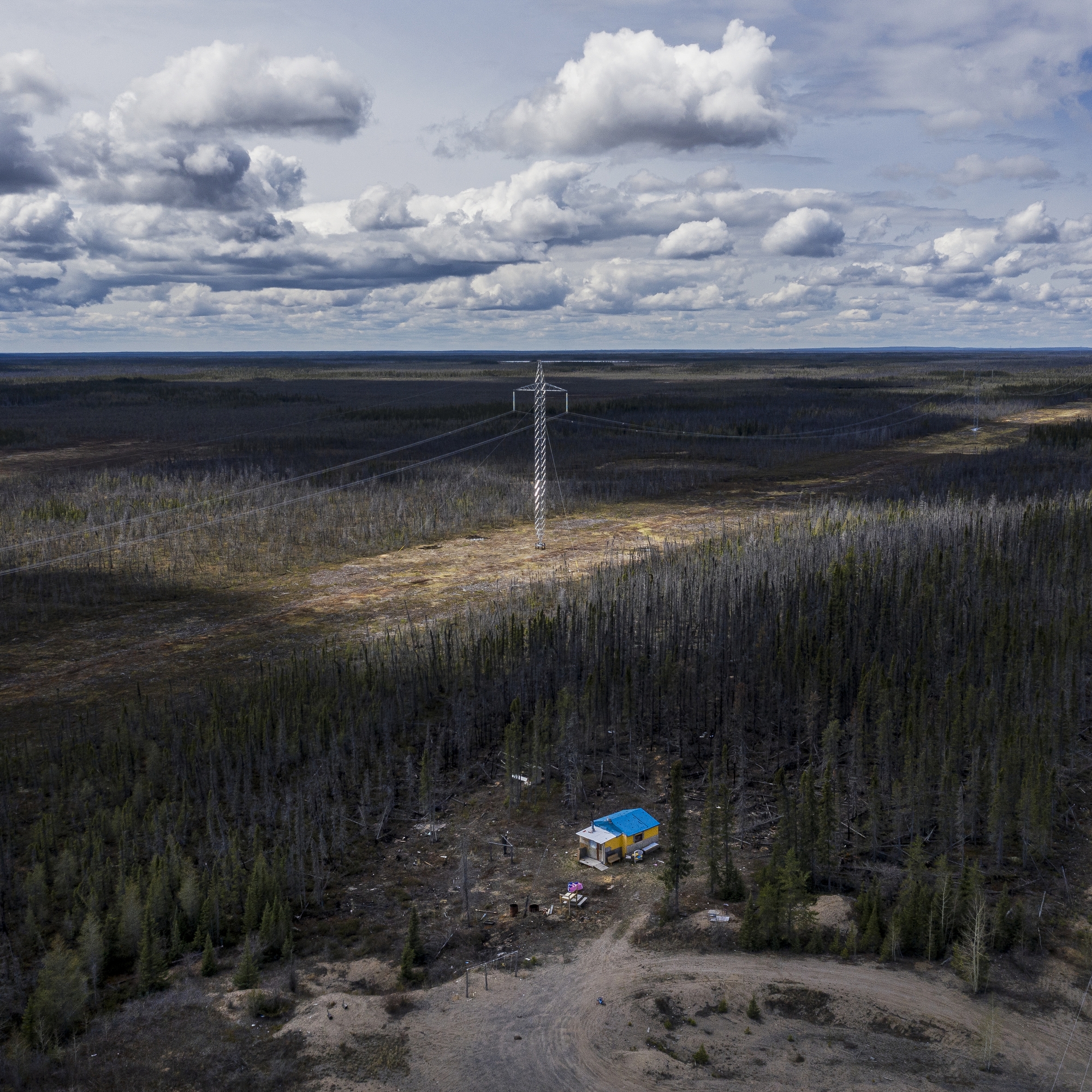
A trapline and cabin is seen next to the 1,384-kilometre Bipole III transmission line, which was completed in 2018 to transport energy from the Keeyask dam. The transmission line cuts through numerous First Nations territories and cost $5.04 billion, far more than its original price tag of $2.2 billion. Transmission lines add to the impacts of northern Manitoba’s remote hydroelectric dams by cutting through swaths of forest, muskeg and farmland. Herbicides are also applied to the land below the lines to prevent new growth.
With files from and edited by Carol Linnitt. Assigning editor, Emma Gilchrist. Cultural editor, Stephanie Wood. Copy editor, Raina Delisle.
Editor’s note: Aaron Vincent Elkaim’s documentary work in northern Manitoba was supported by funding from the Ontario Arts Council and the University of Manitoba’s Wa Ni Ska Tan, an organization that works with hydro-impacted communities. Neither organization had any influence on the production of this work.