


To the north of Dawson City, Yukon, lies a large swath of relatively undisturbed wilderness that caught the eye of Art Webster, the former vice-chair of the Dawson Regional Planning Commission.
But in order to protect the landscape, the commission would have to get to it before the miners — a race Webster increasingly felt like the Yukon government was setting him up to lose.
Faced with what felt like an impossible task, Webster recently wrote a letter to Premier Sandy Silver, tendering his resignation from the commission to place a spotlight on what he considers the Yukon government’s disappointing prioritization of mining.
“By allowing the staking of mineral claims, it basically sends out a message saying, ‘This is the highest value of this land, the extraction of minerals’ … at the expense of considering any other values for that land,” Webster told The Narwhal in an interview.
In his letter, Webster said Yukon’s actions are at odds with the “significant majority of Yukon people [who] want specific areas of our territory free of industrial activity and accompanying road infrastructure. They want development prohibited and wilderness protected.”
Mineral staking to be suspended when draft land use plan complete
Webster’s resignation is drawing new attention to the work of the commission, which is tasked with creating a plan that will manage and monitor lands, waters and industry within the Dawson region, a roughly 40,000-square-kilometre area that makes up about 10 per cent of the territory’s land mass. The Dawson is also home to the Indian River watershed, where more than 50 per cent of the territory’s gold from placer mines is produced.
In February, the commission, which was appointed in 2018, requested a meeting with the Yukon government to resolve calls from the Tr’ondëk Hwëch’in First Nation to temporarily halt mineral staking while a land use plan was developed. That meeting never happened and the government ultimately refused an interim withdrawal, according to Webster’s resignation letter.
Webster said land use contracts should be put on hold during the planning process.
“It kind of defeats the purpose of having a land use planning process if a placer miner can go in and usurp it,” he told The Narwhal.
Ranj Pillai, Yukon minister of Energy, Mines and Resources, said it would be inappropriate to shut down the entire planning area to mineral development but staking will be paused once the draft land use plan is complete in the spring.
In his letter, Webster noted that Yukon’s plan to implement a staking moratorium once the land use planning is complete “is at odds with … the commission.”
“Our view is that [mineral] exploration is important,” Pillai said. “It’s still important to the economy of Yukon.”
He said the government is working to find a balance between conservation efforts and bolstering the economy.
“We’re committed to getting this right,” Pillai said.
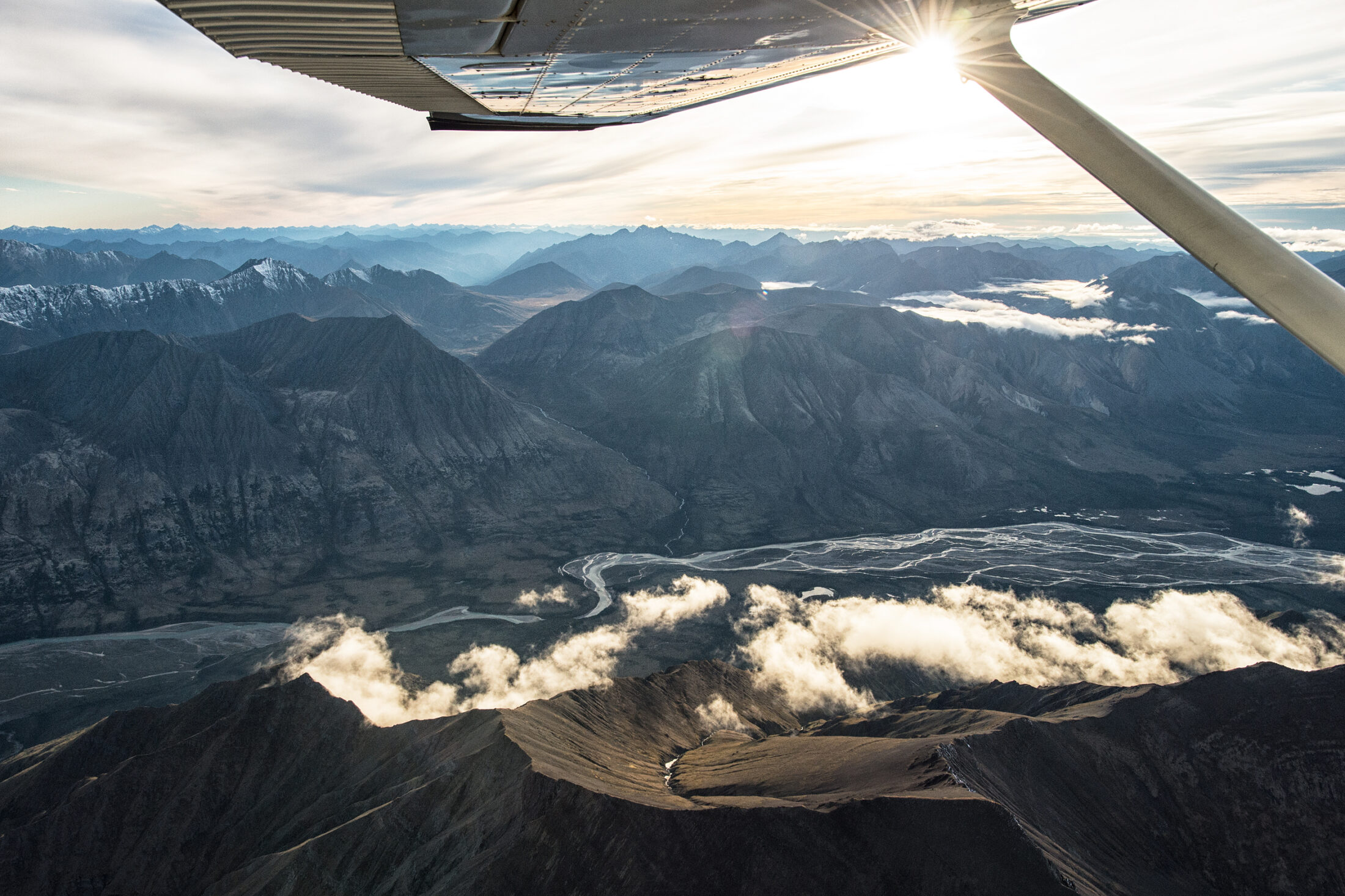
What does the Dawson region contain anyway?
The Dawson region in the territory’s central west is home to the mighty salmon-bearing Yukon River — the third longest in North America — and some old-growth forests that are upward of 140 years old.
According to a regional resource assessment report conducted by the commission, 10 per cent of the planning region is made up of rare wetlands.
“Due to their low abundance relative to other areas of Yukon, all wetland areas in the planning region are considered ecologically important,” the report states.
Sebastian Jones, wildlife analyst at the Yukon Conservation Society, said the area north of Dawson City is particularly important because it’s mostly undeveloped, a plus for wildlife.
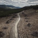
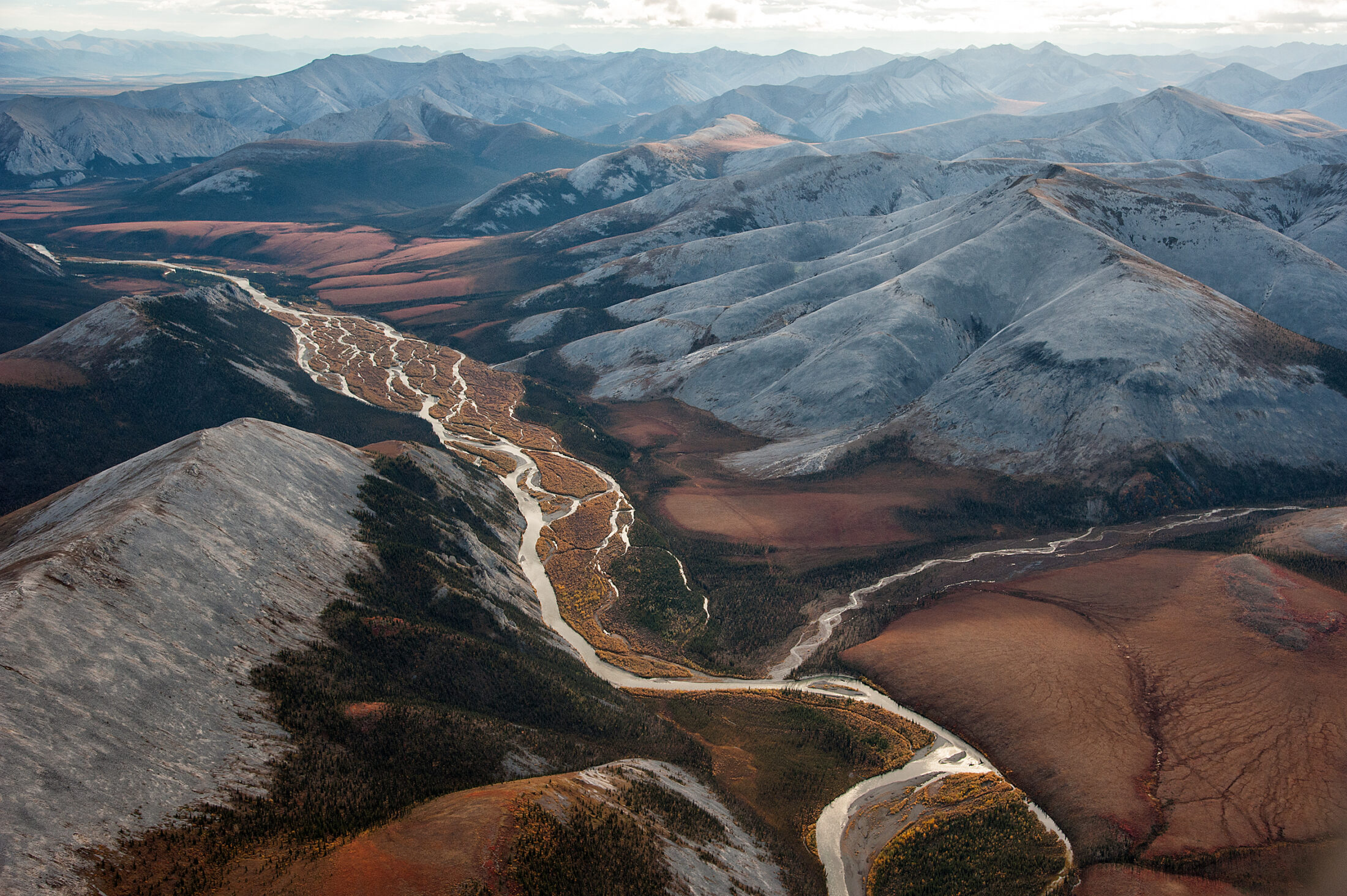
Compared to the heavily mined placer fields south of Dawson City, this northern part of the region has little to no mining. It’s also essentially roadless, aside from the Dempster Highway, which runs through an eastern portion of the region. This is good news for the Porcupine caribou — a transboundary herd threatened by potential oil and gas drilling in Alaska’s Arctic National Wildlife Refuge — which use this area as part of their winter range.
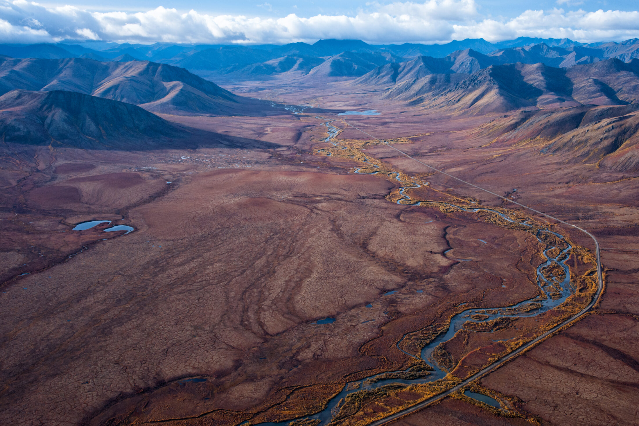
The Dempster Highway cuts through a portion of the Dawson region. Aside from the presence of this highway, the Dawson region north of Dawson City remains relatively free of development. Photo: Peter Mather
“The area north of Dawson fits the bill for conservation,” Jones said. “It would have been fairly easy for the government to have withdrawn those areas from mineral staking for the duration of the planning process.”
The planning region overlaps with the traditional territories of several First Nations, including Tr’ondëk Hwëch’in.
Chief Roberta Joseph told The Narwhal that citizens use much of the nation’s traditional territory for subsistence purposes, whether that’s fishing for salmon or hunting moose. Trapping concessions are common along waterways in the area, too, and there are certain heritage values such as ancient foot trails south of Dawson City.
“The [Yukon River] is important, for example, because it provides chinook salmon,” she said. “We have people who harvest, trap and hunt in many different areas. It’s very widespread.”
Thousands of mining claims already staked in Dawson region
While the planning region is ecologically and culturally rich, it’s also an area that has been extensively mined for well over 100 years, dating back to the Klondike Gold Rush.
There are already thousands of active placer and quartz claims in the planning region. Placer mines, which used to be small but now can be quite large, operate in the beds of rivers and streams and can have enormous impact on watersheds — as evidenced by the dramatic alteration of parts of the Yukon River near Dawson City.
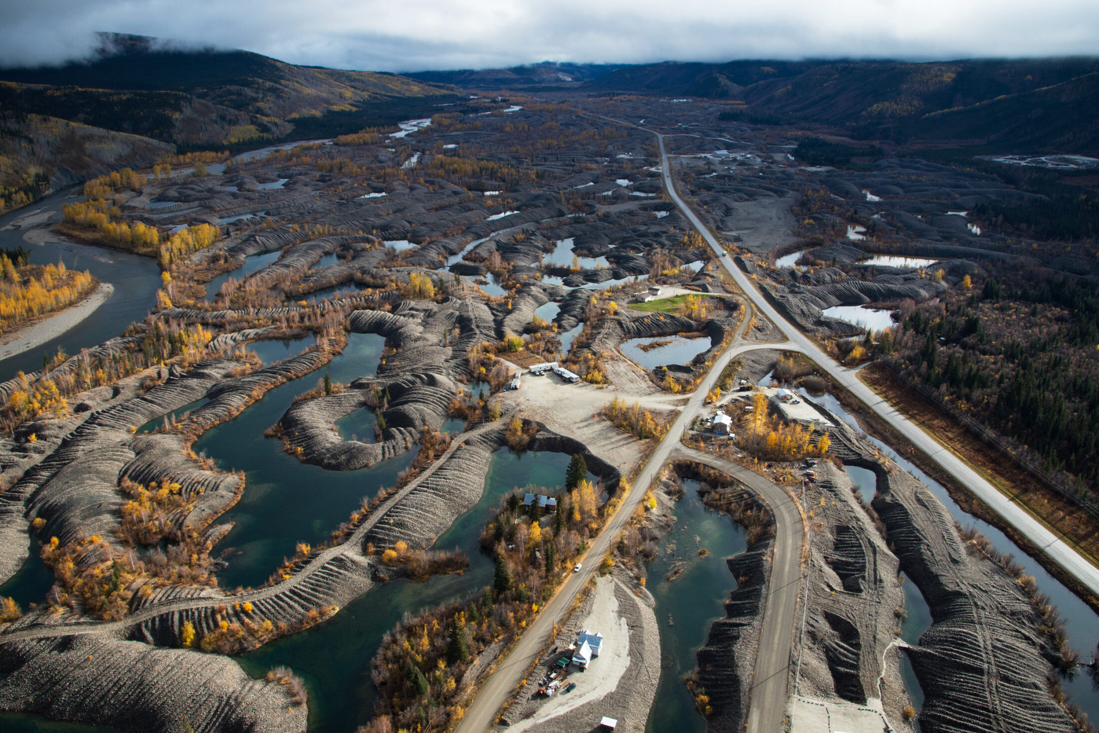
The impacts of placer mining are very visible in the unnatural pilings running throughout the Klondike Valley near Dawson City, Yukon. Before the Gold Rush, the Klondike River was one of the healthiest spawning rivers in the Yukon Watershed. However, placer mining throughout the Klondike devastated the salmon run in the region. Only in recent years has the river seen a return of Chinook salmon due to significant reclamation efforts. Photo: Peter Mather
Placer mining can damage riparian areas, water quality and fish habitat. Mining in rivers and streams can disturb sediment that can disrupt the growth of plants and insects. The presence of sediment in water can make life difficult for fish by negatively affecting their breathing, eating, movement and reproduction.
A 2002 report from the Klondike Placer Miners’ Association estimated five per cent of streams in Yukon have been impacted by placer mining and that for operations taking place in rivers and streams, “the disturbance or destruction of these wetlands usually cannot be avoided.”
Placer mining is regulated under the Placer Mining Act, which is largely based on laws written in the early 1900s, well before the ecological impacts of the practice were understood. Legislative reviews of the act, which does not prevent the staking of claims in sensitive environments like wetlands, have stalled since they were first promised in 2003.
According to data supplied by Energy, Mines and Resources, there are roughly 18,600 placer claims and 40,600 quartz claims as of Oct. 27, representing about 3.5 per cent and 19.5 per cent of the Dawson planning area, respectively.
The Yukon government invested in 102 mineral exploration projects this summer, 37 of which fall within the parameters of the planning region, said Sue Thomas, a spokesperson with Energy, Mines and Resources, adding that there could be more claims as not all claimholders applied for government grants.
But the number of claims in the planning area appears to be going down, with 5,000 fewer claims compared to 2018, when the commission started its work, Pillai said.
“When people start to say there is going to be an increase [of claims], that’s not what we’re seeing,” he said. “We actually have about eight per cent less claims that are now in that area.”
Pillai added that this likely has something to do with preliminary work on a land use plan for the region, with some miners perhaps anticipating more risk to their businesses.
If areas are identified for protection where claims are present, those claims could be relinquished and miners could be eligible for compensation, Pillai said.
“I am very encouraged and very comforted by the fact that the companies that are working in the Yukon understand how to be good corporate citizens,” he said. “They want to do the right thing because they want to continue to work here.”
Request for staking moratorium in Dawson isn’t new
Chief Joseph said the Tr’ondëk Hwëch’in First Nation has been calling on the Yukon government to halt staking in parts of the Dawson area since 2007.
She pointed out that the current work of the Dawson commission represents the second attempt to come up with a land use plan for the region.
The first regional planning commission was established in 2010 but put on hold four years later until litigation connected to land use plans for the Peel watershed, the region neighbouring the Dawson, was resolved.
Clouds and mountains above the Snake River in the Peel Watershed, Yukon’s largest wilderness area north of Dawson City. Photo: Peter Mather
The Yukon government faced a lengthy legal challenge from First Nations and conservation organizations over the question of how much land in the Peel should be open to development.
The 15-year Peel watershed saga brought a contested version of the regional plan to the Supreme Court of Canada in 2017. The court ruled in favour of First Nations and environmental groups and the plan was eventually amended and adopted in 2019.
The Tr’ondëk Hwëch’in have wanted a land use plan for the Dawson region since 1998, when the nation signed a final agreement with the federal government that settled a claim to their traditional territory.
Eleven of 14 First Nations in Yukon have signed final agreements, which can help pave the way for future land use plans.
Joseph said her nation anticipated they would enter into a land use planning process soon after they signed their final agreement.
“But it’s been 22 years and the plan is still not complete,” Joseph said, adding that the delayed land use plan in the Dawson region has resulted in more mineral development.
The goal now is simple, she said: the process for marking certain areas for protection should not be predetermined by the presence of mining. An interim suspension of staking before the draft plan is released would have helped with this, Joseph added.
“We wanted a much more fair process for the land use planning,” she said. “As it stands, there’s been a lot of activity that has taken place over the last number of years, which has already dictated a large part of the Dawson planning area.”