


The heat came first.
In late June, a blanket of sweltering hot weather settled over British Columbia. As temperatures climbed to heights never experienced before in the province, berries shrivelled on the stem, starfish, hermit crabs and mussels were cooked by the blazing sun and baby birds abandoned their nests desperate for relief. Hundreds of people died.
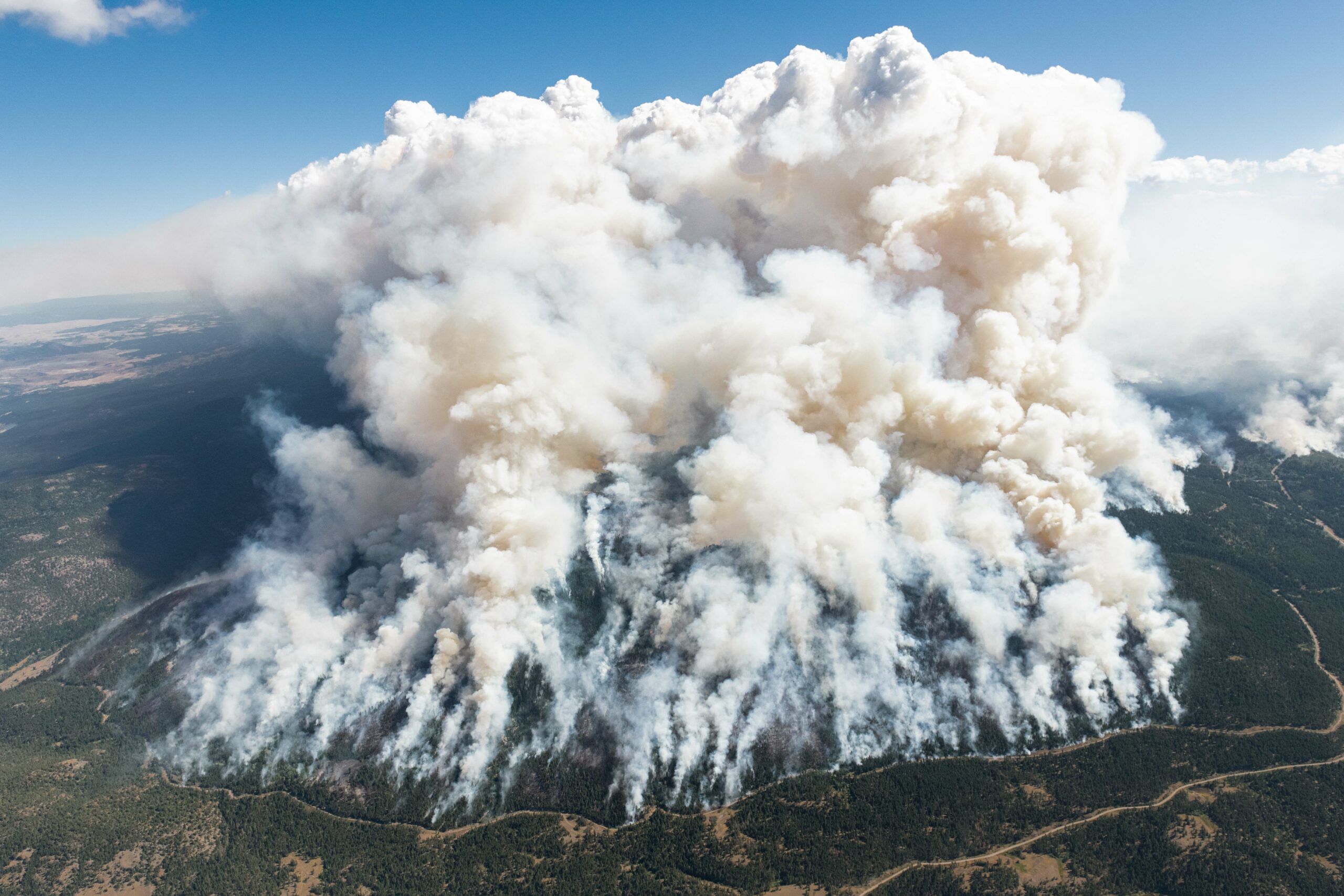
The fires came next.
Some people had just minutes to escape as a wall of flame bore down on Lytton, a small village in B.C.’s Fraser Canyon that burned to rubble. Thousands more people would be forced to flee as wildfires lit up across the province.
Then came the floods.
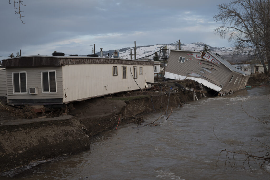
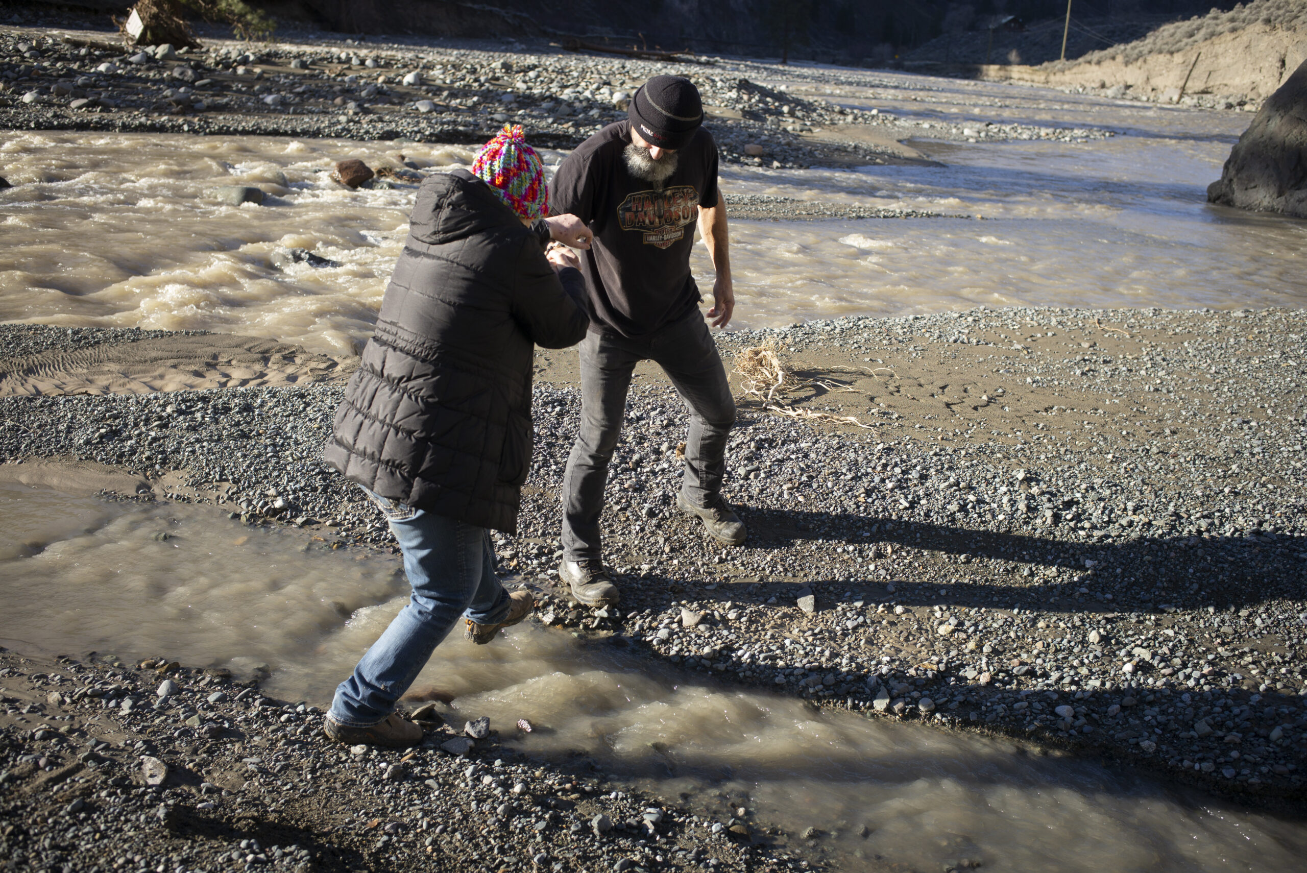
In mid-November a powerful, dayslong storm unleashed torrential rains on B.C. Landslides tore up highways, trapping cars full of people in remote areas and severing vital transportation corridors across the province. Sumas Prairie, an agricultural hub in Abbotsford, was inundated with so much water that people had to use boats to ferry supplies and rescue farm animals. The entire City of Merritt was evacuated when its wastewater treatment plant failed. And then more rain came, adding more and more water to an already overloaded system.
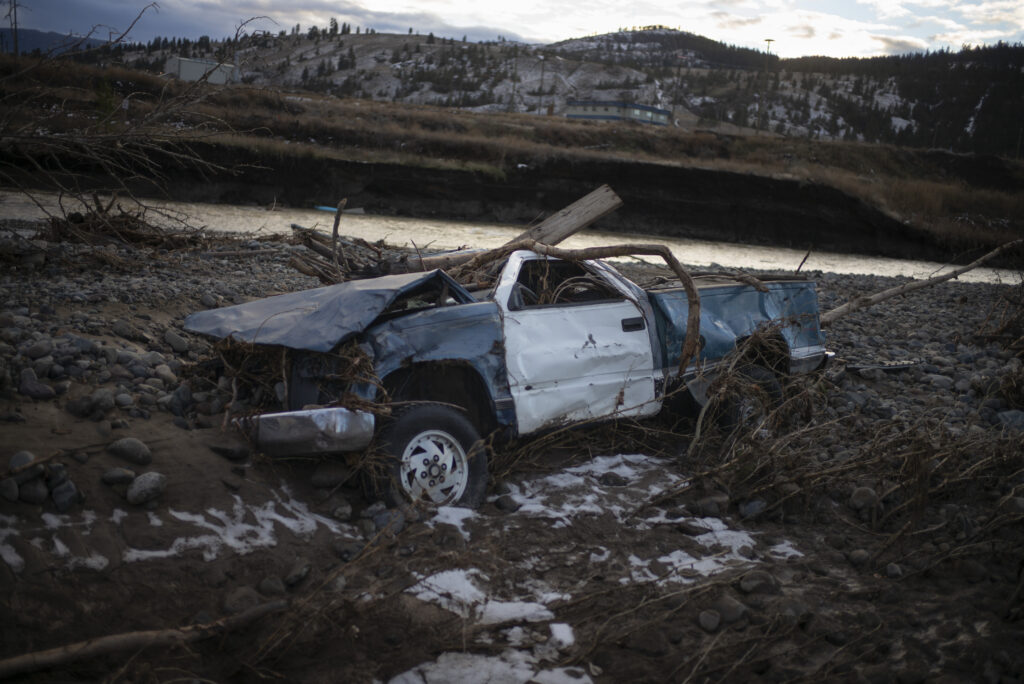

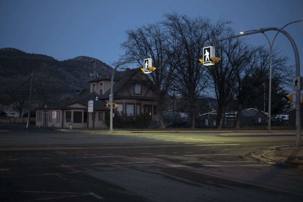
Evacuated houses slump into the river in Merritt on Nov. 23, 2021. The entire community of 7,000 was evacuated after floodwaters caused a complete failure of the city’s wastewater system. Photo: Ian Willms An empty street in Merritt in late November. Photo: Ian Willms
“Climate change is upon us,” John Clague, a professor emeritus of earth sciences at Simon Fraser University and an expert on natural hazards, said in an interview.
The heat wave that helped set the stage for the devastating Lytton fire “was virtually impossible without human-caused climate change,” according to a rapid analysis by a group of scientists with the World Weather Attribution initiative.
And the recent flooding was almost certainly “at least exacerbated by a warming climate,” as well, Clague said.
As the climate continues to warm, these extreme events are only expected to become more likely.
While in today’s climate, with global temperatures about 1.2 C warmer than pre-industrial times, the B.C. heat wave was a roughly 1 in 1,000 year event, the World Weather Attribution team found. But in a 2 C world, that kind of intense heat wave could occur every five to 10 years.
Extreme rain events, river and coastal floods are also expected to become more common in B.C.
“We’re not prepared for dealing with these events,” Clague said.
Investments in adaptation needed to prepare for future climate disasters
In its latest assessment of climate change science, the Intergovernmental Panel on Climate Change warned that the world is running out of time to prevent even worse effects of climate change than it’s already experiencing.
While global efforts to drastically cut greenhouse gas emissions are crucial, some degree of further warming is already baked in and action must be taken now to lessen the potential impacts.
This past summer the B.C. government held public consultations on a new Climate Preparedness and Adaptation Strategy that it says will build on work already underway to prepare for climate events through various programs, including early work on a B.C. flood strategy.
Among the measures outlined in the draft strategy, the province says it will support research organizations to expand climate data and modeling and enhance early warning capacity for floods and wildfires.
The strategy also lays out plans to help build community resilience to disasters, including a provincial floodplain mapping program to improve flood management, working with Indigenous communities to expand the use of prescribed burning to reduce wildfire risks, and working with B.C. Housing to support vulnerable populations at risk from extreme heat and wildfires. At the same time, the province says it will enhance the use of nature-based solutions for managing flooding, extreme heat and other climate risks.
But in August, as public consultations were wrapping up, 39 organizations, including West Coast Environmental Law, the Canadian Association of Physicians for the Environment and the Georgia Strait Alliance, expressed their disappointment with the plan in an open letter to the government.
“Your government, and not only the Ministry of Environment and Climate Change Strategy, must start treating the climate crisis with the seriousness it deserves,” the letter said, noting the draft strategy failed to outline clear deliverables or timelines
“This requires action to rapidly reduce B.C.’s greenhouse gas emissions … but it also requires an adaptation plan to keep our ecosystems and communities safe.”
The finalized adaptation strategy is set to be released in the spring of 2022.
A spokesperson for the B.C. government said it will include more details on specific actions and noted that decisions about funding will be made after the 2022 budget is released.
The province has already invested in upgrades to provincial highways to help them better withstand severe flooding and restored and conserved wetlands to help absorb flooding and storm surges, the spokesperson said.
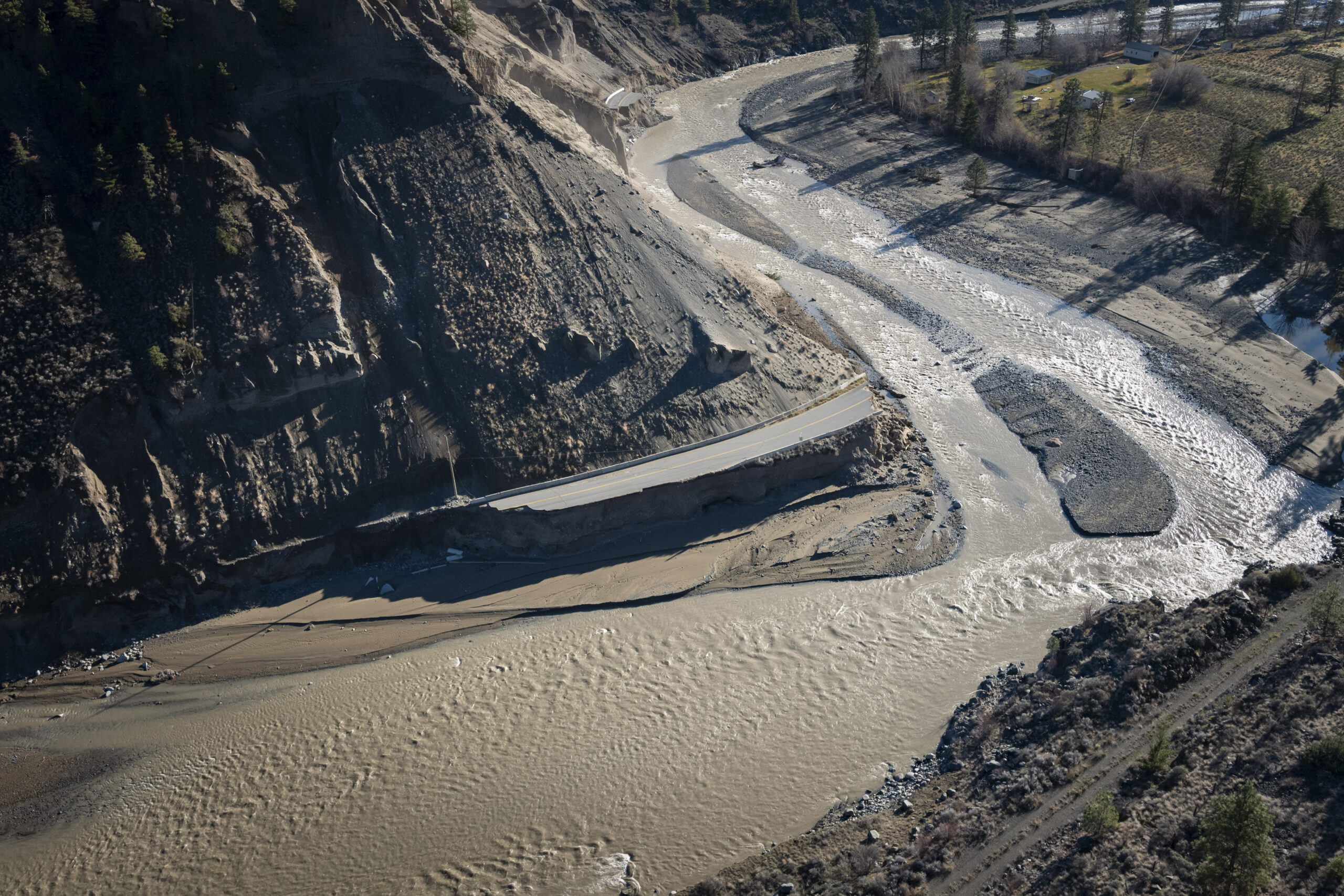
But after the recent extreme rainstorms resulted in major damage to critical highways, including the Coquihalla, it’s clear more work is needed.
“Absolutely the province is considering recent climate change-fueled extreme weather events as it works to finalize the Climate Preparedness and Adaptation Strategy, which will represent a significant enhancement of current adaptation programs,” the spokesperson said.
As B.C. looks to rebuild after a series of disasters this year, the federal and provincial governments have said they will form a joint recovery committee and ensure that the climate of the future is considered.
But the president of the Union of B.C. Municipalities, Laurey-Anne Roodenburg, wants to make sure local governments have a seat at that table.
On the front lines of climate change, local governments ask for support
Local governments are on the frontlines of climate change — their decisions can determine how prepared a community is to withstand extreme heat or rain, for instance — but they can’t do it alone.
This past year “has provided a graphic demonstration of why all B.C. residents need to be concerned with climate change,” Roodenburg, who is also a Quesnel city councillor, told The Narwhal.
“All levels of government need to turn our attention to our current state of readiness for climate change,” she said.
The Union of B.C. Municipalities is asking the province to direct a portion of the carbon tax every year towards a stable funding pot to support local governments to develop and implement local climate adaptation plans.
“This is something that really needs to move up the priority list,” Roodenburg said. “This is work that is very regional in its focus and it needs to be done across the entire province.”
While some municipalities, including larger urban centres like Vancouver, are already working to implement adaptation strategies, this work can be a particular challenge for smaller communities, which bring in less revenue from property tax.
In a statement, a spokesperson for the province said “municipalities and regional districts are critical partners in our efforts to prepare for climate change.”
While the provincial and federal governments have allocated millions to local and First Nation governments for infrastructure through various programs, including $136.5 million through the COVID-19 resilience infrastructure stream of the Investing in Canada infrastructure program and $243 million for infrastructure projects focused on drinking water, wastewater and stormwater under the environmental quality fund of the Investing in Canada program, considerably more is needed to guard against even costlier climate risks.
A recent analysis by Vancouver Sun reporter Gordon Hoekstra, for instance, found that about $3 billion is needed to upgrade dikes and other flood mitigation measures in just 15 B.C. communities.
A spokesperson for the province said the government is developing a new “predictable” funding program that will be rolled out next year to support climate action on a local level.
Premier John Horgan has also acknowledged the need for the provincial government to take more of a role in dike management, a responsibility that was downloaded to local governments in 2003.
From prescribed burning, to wetlands or dikes, adaptation may look a little different everywhere
What exactly climate adaptation looks like may vary depending on a community’s climate risks and how vulnerable the community is to those risks.
Vancouver, a city that’s expected to see 35 per cent more intense rainstorms by 2050, has developed a rain management plan as part of its climate change adaptation efforts. The plan includes investments in infrastructure such as sewers, community initiatives that ask residents to “adopt a catch basin” and keep it free of debris, and green infrastructure, such as green roofs, gardens and permeable sidewalks to help capture rain.
Many areas are also experiencing hotter, drier summers, Amy Cardinal Christianson, a fire research scientist with the Canadian Forest Service at Natural Resources Canada, said.
That’s on top of other issues that can make wildfires more dangerous, including more fuel for fire in areas where targeted fire suppression efforts have allowed some forests to grow denser and more people living on the edge of wilderness areas, she explained.
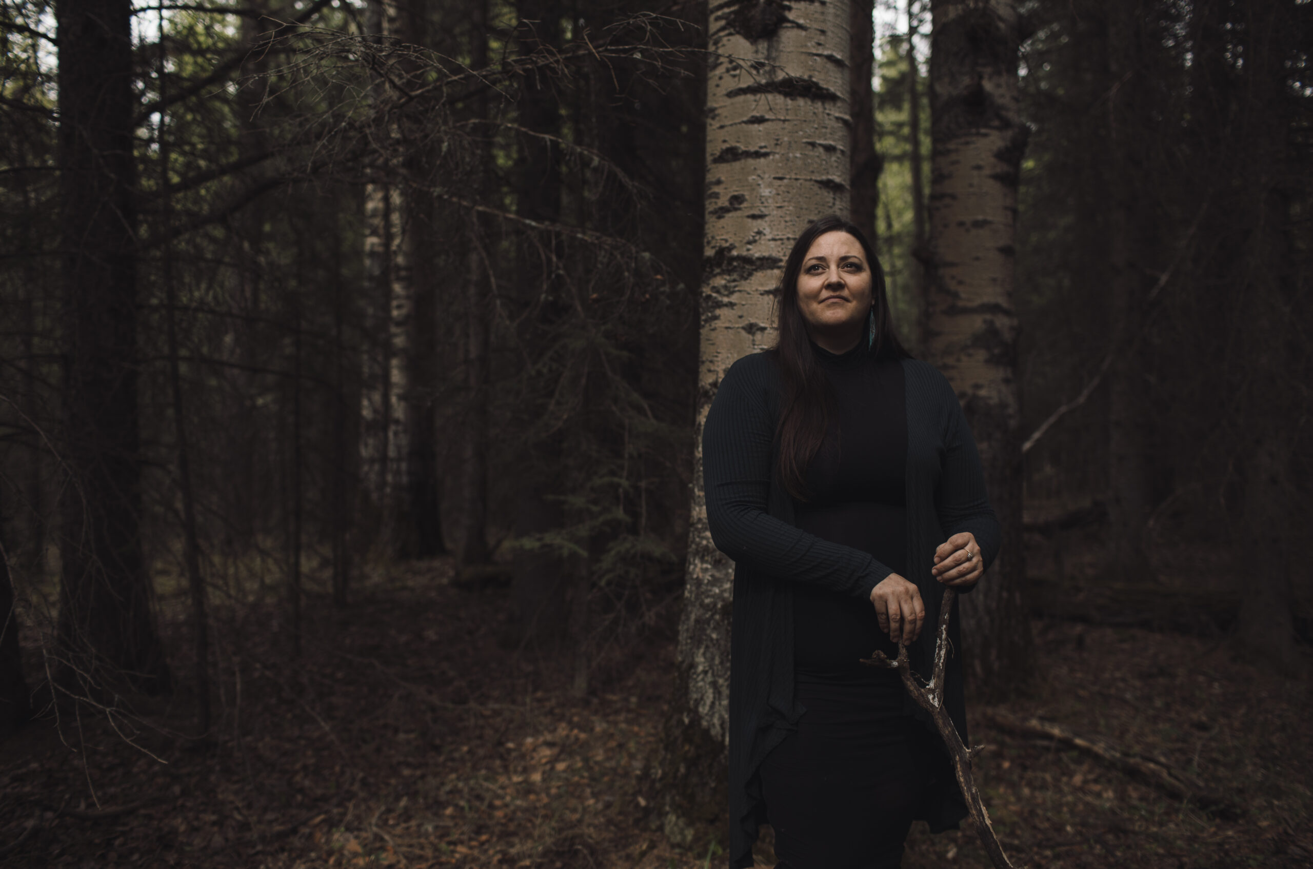
“The communities that I work with are calling for a return of cultural burning practices and Indigenous stewardship in their territories,” Cardinal Christianson said.
“They want to take a leadership role in decision making around how fire is managed in the forest around them,” she said.
Cultural burning involves using fire to help prevent more intense, damaging fires.
“Generally, that’s using low intensity fire in the understory or in grasslands or meadows to basically clean up the forest,” Cardinal Christianson said.
“So then when you get those big fire weather events happening, where it’s hot and dry and windy, if a fire doest start, there’s less fuel for that fire to consume and get bigger.”
In areas where flooding is a concern, flood plain mapping is a crucial piece of adaptation planning.
“For many years that was neglected and so many places have old information and you can’t make good decisions without [updated maps],” Jim Vanderwal, the senior program manager of climate change and air quality, at the Fraser Basin Council, a non-profit focused on sustainability, that’s been involved in flood plain mapping in different regions across the province.
Once those maps are in place and communities have identified areas vulnerable to flooding, there are several possible solutions they can employ, from dikes and pump stations to building structures higher off the ground to limit the impact of future floods and natural solutions such as wetlands that can act like sponges to help absorb water.
“Sometimes we also have to have those tough conversations … is a particular spot too vulnerable? And is it better to give some space for the river?” Vanderwal said.
What exactly adaptation looks like may vary from community to community but with significant climate change impacts already being felt in B.C., the need to act is urgent.
“Now, our task is to learn more lessons from what we’ve just experienced, and channel that into aggressive climate adaptation work,” a spokesperson for the provincial government said in a statement.