


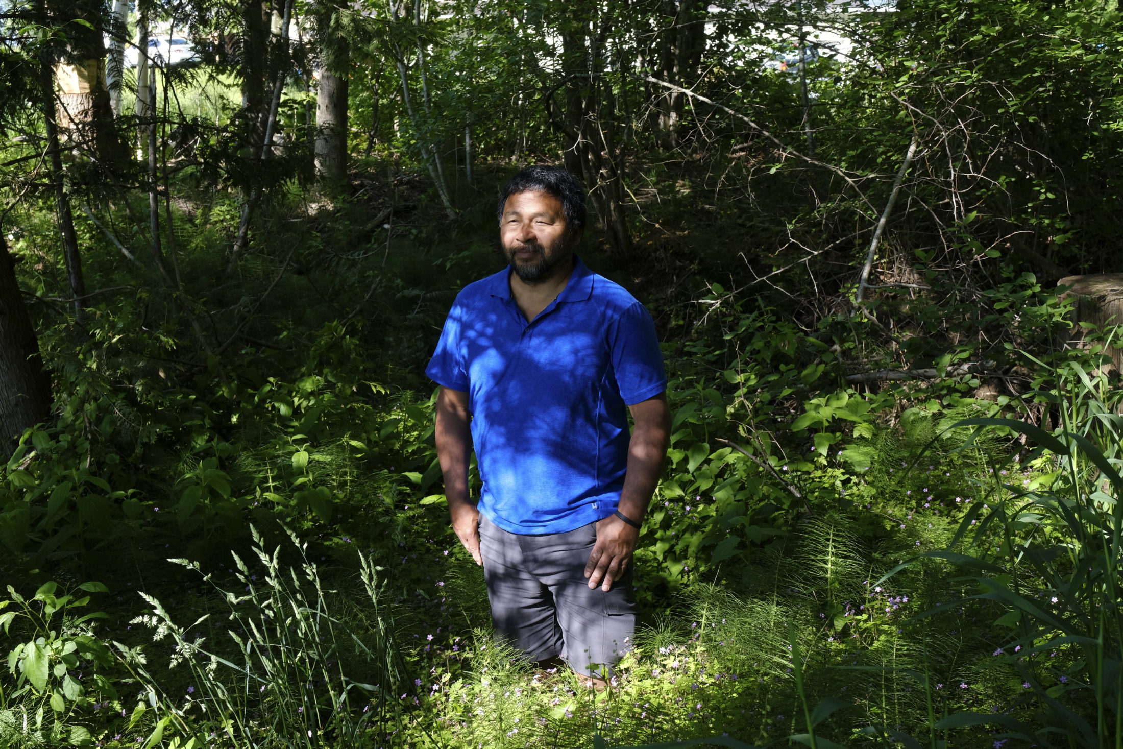
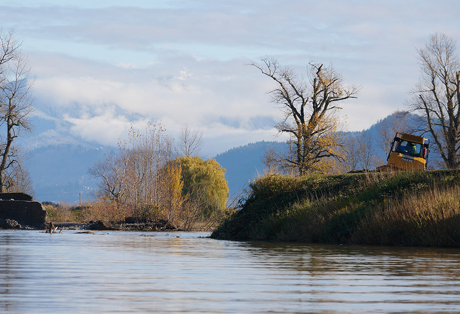
Semá:th (Sumas) First Nation councillor Murray Ned dragged a chair across his front yard to the water’s edge and sat down to take in the lake on Tuesday night. The water sat still under the moonlight.
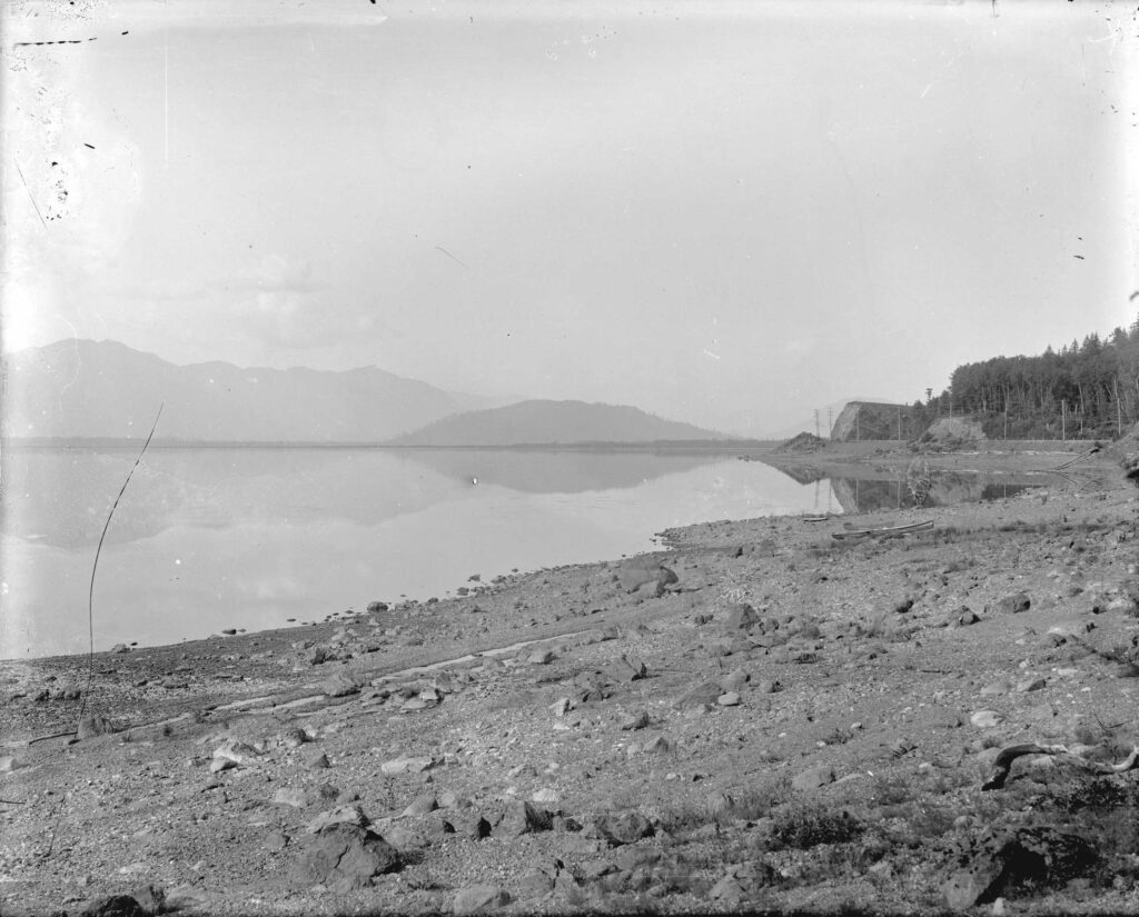
His home isn’t usually lake-front property. Sumas Prairie, a low-lying floodplain that was once Semá:th Xhotsa, or Sumas Lake, was drained 100 years ago by settlers to convert it to agricultural land.
“My intention was to go out and honour the lake, just take the time to rest and reflect,” Ned told The Narwhal over the phone from his property, the front of which was submerged during the intense flooding that has overtaken much of B.C. since Sunday.
Ned had been busy clearing the gutter at his mother’s house nearby, moving gear from the front of his property to higher ground, and helping his nation respond to the emergency.
It was a peaceful moment among chaos. Ned looked out at the partly reformed lake, seeing destruction and restoration at the same time.
He didn’t get to relax for long before hearing Barrowtown Pump Station was at risk of failing.
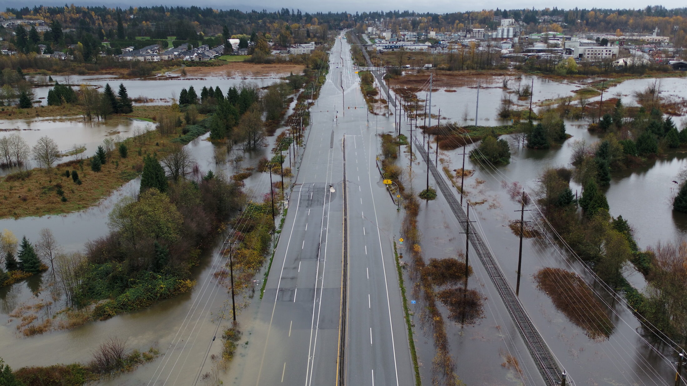
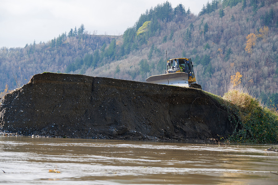
Since the Sumas was drained, the water that naturally gravitates to the former lake bottom has been held back by Barrowtown Pump Station and a series of dikes. It’s now home to farms that many people in the Lower Mainland rely on; a pump station failure would cause the lake to reflood in earnest. Everyone in Sumas Prairie was ordered to evacuate.

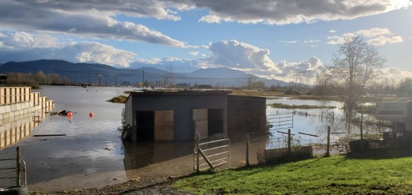
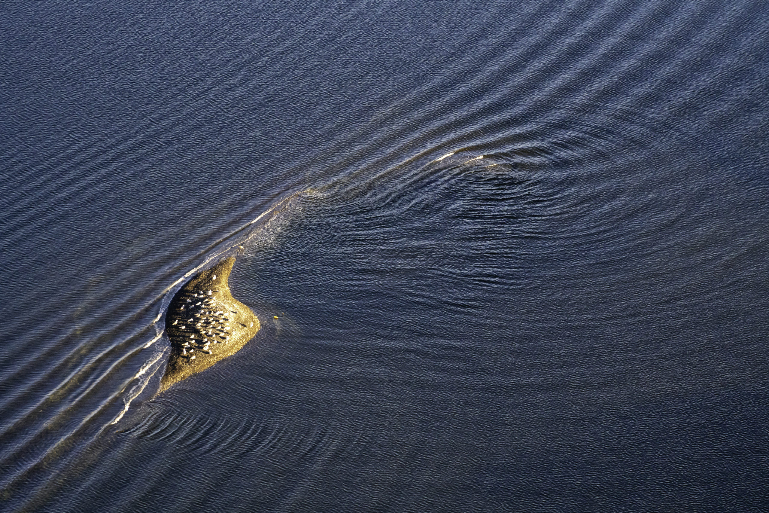
The view from Murray Ned’s property in the wake of the floods. Photo: Courtesy of Murray Ned 
Sumas Lake in 1913, before it was drained to create agricultural lands. Photo: City of Vancouver Archives
The catastrophic flooding was caused by an atmospheric river that brought strong winds and near-record amounts of rain. Flooding and landslides led to the evacuation of more than 17,000 people and the death of at least one person and thousands of animals. The torrential rainfall caused several dike breaches that led Semá:th Xhotsa to begin to reflood.
The Barrowtown Pump Station is still at risk of failure because water levels are too high. The City of Abbotsford, volunteers and the military are working to repair dike breaches that are causing water to gush across the Trans-Canada Highway and into the reformed lake. Abbotsford Mayor Henry Braun said on Thursday the Fraser River will need to drop another metre before the pump station can stabilize.
“This lake is expanding and it’s moving from west to east,” Braun told a press conference. He said it could reach a point it can cross into Chilliwack because there is no dike blocking its path.
“We have to stop this water.”
Ned said the city has done “amazing work” and has collaborated with the First Nation. But as he looks to a future with more flooding, heavy rainfall and extreme weather caused by climate change, he said it “may be time to start thinking about inviting the lake back,” buying the land from farmers and moving people to higher ground.
“It’s pretty out-of-the-box thinking … and it won’t be an easy thing,” he said. “Farmers have been there for several generations. I wouldn’t want to move.”
“As much as man wants to control Mother Nature, I think Mother Nature has another story. If we’re not listening, if we’re not observing what’s going on around us … to me, it’s imminent the lake will return. Maybe not in my lifetime, but maybe in a generation or two.”
The extreme weather event has First Nations leaders, experts and residents thinking about the future of flood management in the Fraser Basin and beyond, and how to build back and improve flood infrastructure.
“It’s very obvious our infrastructure is not built to withstand the climate crisis,” Lina Azeez, connected waters campaign manager for Watershed Watch Salmon Society, said in an interview.
“What happens next? What does it mean to build back better?”
Rather than try to contain the water, Azeez said the people of B.C.’s Lower Mainland have to learn to “live with water,” by prioritizing nature-based solutions and improving management of floodplains and watersheds, while respecting Indigenous leadership.
She’s also reflecting on how that could mean the return of Semá:th Xhotsa, intentional or not.
“It’s a wild idea,” she said. “It makes me think about where we’ve decided to live and what it means for our future.”
Nature-based solutions can absorb water like ‘sponges’
Azeez emphasized nature-based solutions, which empower the natural abilities of the landscape, such as creating more green spaces to act as “sponges,” and working with farmers to set back their farms from the edges of their fields and build up natural buffers. She said rewilding waterways, creating more natural buffers to high river levels, would also help. All of these projects require government funding, she said.
These updates would help with smaller rain storms, but Azeez said they still wouldn’t prevent the kind of extreme event B.C. experienced this week.
Some infrastructure will have to be built higher — for example, the portion of the Trans-Canada Highway running through Sumas Prairie that was submerged in water — but it’s not a solution on its own, Azeez said.
“It’s ridiculous to keep building larger and larger infrastructure. They will fail. It’s human-made infrastructure.”
Nature-based infrastructure has the benefit of not only avoiding disruption to wildlife, but even helping. Lakes and ponds can absorb freshet, while wetlands and vegetated areas absorb water and stabilize soil. A 2018 Insurance Bureau of Canada report found that natural infrastructure is “cost effective” by design but “underutilized.”
For example, the City of Surrey, City of Delta and Semiahmoo First Nation have partnered to create a “living dike,” depositing sediment to gently raise the marsh at Boundary Bay over three decades to protect both habitat and homes from sea level rise.
Insurance Bureau of Canada recommends halting new development in floodplains
More solutions to flooding are needed: a recent analysis by the World Resources Institute found that without major investments in flood protection, the number of people affected by coastal and river flooding each year could more than double by 2030.
About 350,000 people live in the Fraser River floodplain. A major flood in the area could cost up to $30 billion in damages, according to a 2016 study from the Fraser Basin Council.
“We’re going to have to ask really hard questions about where we’re going to live,” Azeez said. “It’s an incredibly sensitive discussion to have. And what does it mean for our future?”
There are examples of managed retreat and nature-based climate solutions to flooding around the world. In Washington state, Floodplains by Design funded 36 projects on 13 major floodplains between 2013 and 2018 using US$115 million in government funding. The projects have removed 700 residences from high-risk floodplain areas, restored 40 kilometres of salmon habitat and protected 200 hectares of agricultural land.
In the Netherlands, severe flooding in the 1990s forced more than 250,000 people to evacuate and prompted the government to develop a more innovative approach to flood management. The Room for the River project, launched in 2007 and completed in 2018, lowered floodplains, created water buffers, relocated levees, increased the depth of side channels and built flood bypasses.
In 2019, the Insurance Bureau of Canada advised the federal government to develop a national action plan on flooding, recommending homes be moved away from areas that repeatedly flood and the development of “affordable insurance protection for the remaining properties in high-risk flood zones.”
The federal government has promised to draft an action plan and created a task force on flood insurance and relocation in November 2020. In the 2021 budget, the Liberals committed $1.4 billion over 12 years to extend their government’s disaster mitigation and adaptation fund, with almost half of the budget reserved for smaller projects. It also committed $63.8 million to floodplain mapping high-risk areas.
The bureau also advised provinces and municipalities to immediately alter permitting processes to prohibit development on floodplains.
This is a difficult decision to make. Ned said even Sumas First Nation has development ongoing in the Sumas Prairie, because much of the reserve land they were allocated is in the prairie. They are building at higher elevations, but that means displacing part of the lake, he said.
“It’s an interesting thing we’re accounting for ourselves as a nation, and trying to find self-sustainability,” he said.
Ninety-six per cent of dikes in B.C.’s Lower Mainland are too low
Gillian Fuss, project co-ordinator for the First Nations Emergency Planning Secretariat, told The Narwhal she’s worried the province will still return to the “status quo” after the emergency subsides.
“This type of rainfall is going to be more common. This is climate change. We have to find a way to be resilient, and that’s not by building bigger dikes,” she said.
While she gives the provincial government credit for working on a flood strategy, she said the province needs a much broader watershed management strategy. She pointed to a 2015 provincial assessment that found 96 per cent of the Lower Mainland’s dikes are too low to meet B.C. standards and the costs to upgrade them are prohibitive, especially in cases where private land would have to be acquired in order to make the dike bigger.
“We know our dikes are not long-term solutions, we know they’re not in a good state,” Fuss said.

Crews are working to repair the Sumas dike in the wake of flood damage. Photos: City of Abbotsford / Twitter 
Rather than solely focusing on bigger infrastructure, she said it’s important to improve watershed management. Trees retain water and slow snowmelt, and their roots stabilize soil. Clearcuts destabilize soil, making valleys more susceptible to landslides. Meanwhile, monoculture tree-planting means it’s easier for wildfires to sweep through an area, which also destabilizes the soil and allows water to rush over the surface, whereas mixed-tree and old-growth forests are more resilient, Fuss said.
The secretariat is also trying to increase First Nations capacity to respond to emergencies on their own, since nations know about the impacts on their lands and possible risks, but don’t often have the staff or resources to prepare and plan to handle a disaster independently.
“First Nations are already leaders in terms of resilience and adapting to climate change,” she said. “I would like to see them be listened to more.”
First Nations in B.C. need capacity to respond to emergencies
Heather Murdock, a hydrotechnical engineer who has worked with the City of Vancouver and many First Nations on flood mapping and flood adaptation, said it’s critical for government and media not to frame these B.C. floods as unexpected.
“Floods happen in low elevation areas close to rivers … it’s important to communicate that the events that are happening are severe, catastrophic, impacting people, but not to suggest that they’re completely unexpected,” she said.
“What’s important is people get the warning and know what to do.”
First Nations, scientists and all levels of government have long known flooding in the Fraser would be disastrous. The province knew most dikes are too low, and the City of Abbotsford knew the Nooksack River could potentially cause flooding and had a mitigation plan. But few people, if any, felt prepared for this emergency and many contend the provincial government failed in sharing information.
Tyrone McNeil, citizen of Seabird Island Band and president of the Stó:lō Tribal Council, said his community by the Fraser River was lucky to only experience some basement flooding, but that they received “zero warning.”
“Monday night I could hear the landslides, huge boulders coming down … it sounded very similar to a jet engine taking off. It was that loud, just crashing, coming down the mountain,” he said.
McNeil is also on the First Nations Emergency Secretariat. He said part of building back better is improving the warning and response systems in the province. He wants First Nations to be more empowered in emergency planning.
“We’re often called stakeholders, but we’re rights holders,” he said.
He said people in the area are running out of food and essentials like toilet paper, hand soap and feminine hygiene products. On Wednesday he said people from Seabird Island took supplies by boat down the Fraser River to the nearby Sq’ewalaxm reserve, Ruby Creek, because they were low on supplies, the roads were blocked and there was no word on when supplies might be delivered.
“Can you imagine how dangerous that is with all that debris and logs in the river? If we had a choice, we would take a van load of goods into the community via the highway,” McNeil said.
He said First Nations need to be included in emergency planning equally, and any emergency planning needs to be aligned with the United Nations Declaration on the Rights of Indigenous Peoples.
Ned agreed First Nations “need to be at the front end of planning and design” in emergency preparedness, working equally with all levels of government.
“I’ve had a hard time with consultation these days, because it’s just a box to tick. Going down the road, we need to have a collaborative co-management approach,” he said.
New B.C. flood infrastructure has to be fish-friendly
Aaron Hill, executive director of Watershed Watch Salmon Society, said it only makes sense to build fish-friendly flood infrastructure when the federal and provincial governments are both pouring millions of dollars into salmon restoration, such as the $647 million Pacific salmon initiative.
“It would be absolutely nuts if we were spending all that money on salmon restoration and we missed the opportunity to open up all this habitat while improving flood control,” he said.
Flood pump stations have been called “meat grinders” because they suck up fish. Other flood infrastructure — such as dikes, floodgates and pumps — blocks fish passageways and makes potential spawning areas unreachable. Watershed Watch has identified 1,500 kilometres of current or potential fish habitat in the lower Fraser and its tributaries that is blocked by flood infrastructure.
“Most of our infrastructure was built without salmon or the health of aquatic ecosystems in mind,” Hill said.
The flooding had its own negative impact on salmon, washing out fish and an unknown number of nests. Salmon nests that weren’t washed out could be suffocated by debris, an especially damaging scenario for fish that are already grappling with warming oceans and record-low water conditions over the summer.
“It’s not just a matter of recovering from one flood event, they’re getting bombarded with those impacts,” he said.
Even salmon that make it through may find the bubbling streams they love to spawn in have been scoured out, Azeez said. The full impact on salmon won’t be apparent for three to four years when these salmon would return.
For Ned, the B.C. floods are a moment to consider the relationship between humans and the natural landscape.
“How do we live in harmony with what’s occurring now? How did the ancestors live in harmony? They found a way to coexist, and not only coexist, but thrive,” he said.