


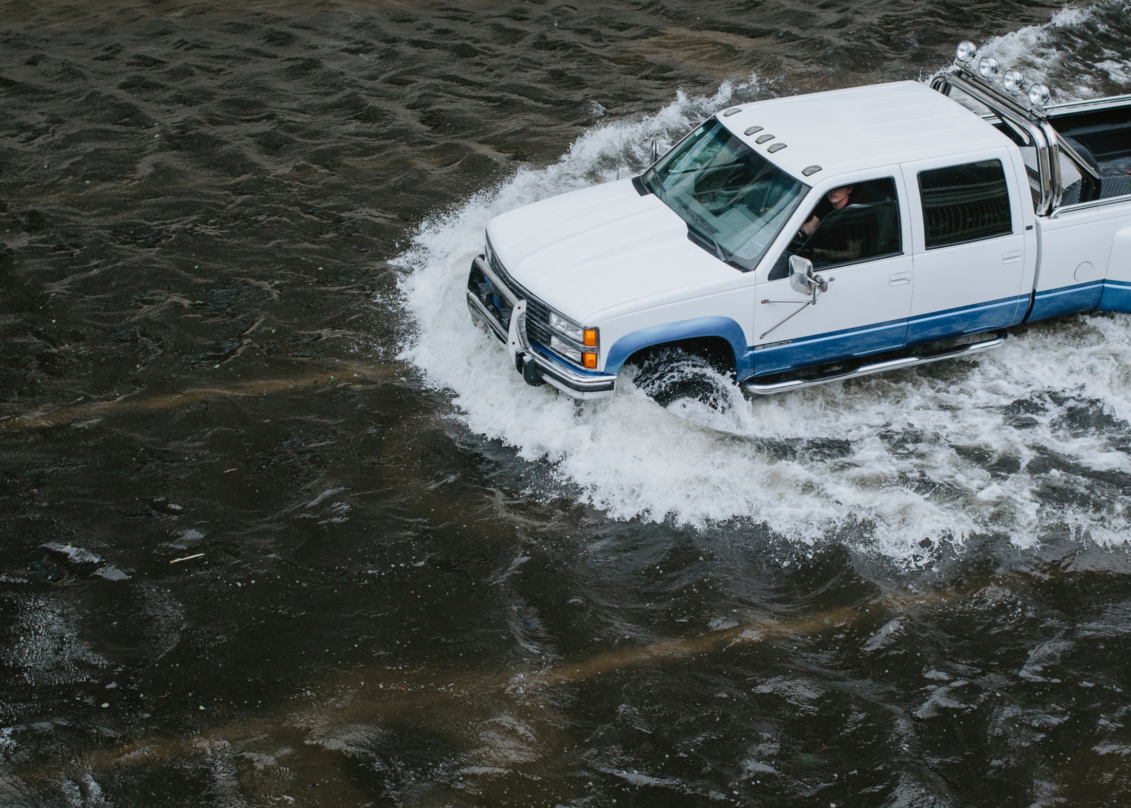
Without major investments in flood protection, the number of people affected by coastal and river flooding each year could more than double by 2030, according to an analysis released Thursday by World Resources Institute.
By 2030, coastal flooding is forecasted to affect 15 million people worldwide, while sea level rise and coastal storm surges could cause US$177 billion in urban property damage, according to data from the institute’s updated Aqueduct Floods, a tool that measures and maps flood risks around the world. River flooding, meanwhile, is expected to affect 132 million people each year and cause US$535 billion of property damage in urban areas.
This major increase in risk is driven by climate change, population growth, development in flood-plains and sinking land in coastal areas.
Now, as governments around the world consider measures to reignite struggling economies once the immediate threat of COVID-19 has been reduced, World Resources Institute says investments in flood mitigation infrastructure could serve a dual purpose of getting people back to work and preparing cities for damaging floods in the future.
“It could serve as this really incredible opportunity to protect our societies while investing in them as well,” said Samantha Kuzma, a geospatial analyst with World Resources Institute’s water program.
The importance of flood mitigation measures has become more evident as some communities face the prospect of flooding in the midst of the pandemic.
The updated Aqueduct Floods tool now includes data on coastal flood risk to people, urban property and GDP as well as information on existing flood protection levels at the state level around the world.
That’s “a huge improvement because it really is helping us understand what our current mitigation abilities are in different places,” said Kuzma.
Governments, researchers and the public can use Aqueduct Floods to see how drivers, such as climate change, population growth, development and sinking land, affect both coastal and river flood risk in different regions of the world.
Critically, it also allows users to analyze the costs versus benefits of investing in flood protection, whether that’s new dikes and levees or maintaining forested areas and wetlands that can help absorb water.
“Risk is not just the hazard but it’s how we respond to the hazard, and flood protection is a huge part of that,” Kuzma said.
In Indonesia — where tens of thousands of people were forced to leave their homes when torrential rains caused major flooding in Jakarta earlier this year — every US$1 invested over the next two decades in flood protection measures to guard against a 25-year flood event, a flood that has a four per cent chance of happening in any given year, by 2050 could avoid US$33 in damage over the course of the next 80 years, protecting millions of people and billions of dollars’ worth of infrastructure from the danger of a major flood, according to an Aqueduct Floods analysis.
In India, that cost-benefit ratio is even higher, with every US$1 invested in flood protection in the coming decades offering an estimated US$248 in avoided flood damages.
Meanwhile in Canada, every US$1 spent on flood protection to guard against a 100-year flood, a flood that has a one per cent chance of happening in any given year, by 2050 would avoid US$2.28 in damage over the next 80 years.
The institute’s analysis also forecasts that almost 340,000 people in Canada could be affected every year by river flooding alone as of 2030, up from almost 198,000 in 2010. Roughly 39 per cent of that increased risk is driven by climate change, while 61 per cent is driven by projected population growth and development.
Amid coronavirus pandemic, some B.C. communities brace for flooding as well
In B.C.’s Fraser River Basin, modelling by researchers at the University of Victoria and the University of Northern British Columbia shows flood risk could increase as a result of more extreme rainfall events under a “business-as-usual” emissions scenario.
Each winter atmospheric rivers, which form over the tropics and carry water vapour across the Pacific Ocean, unleash a torrent of rain when they collide with B.C.’s coastal mountains.
“That’s something we’ve dealt with forever,” said Charles Curry, a research associate with the Pacific Climate Impacts Consortium at the University of Victoria and lead author of a 2019 paper about the impact of atmospheric rivers on future flood risk in the Fraser River Basin.
But as the climate changes, B.C. can expect more intense rainfall from atmospheric rivers in the future, he said. The season for these heavy rainstorms is also expected to expand, with more atmospheric rivers striking in the spring and fall as well as the winter come the second half of the century.
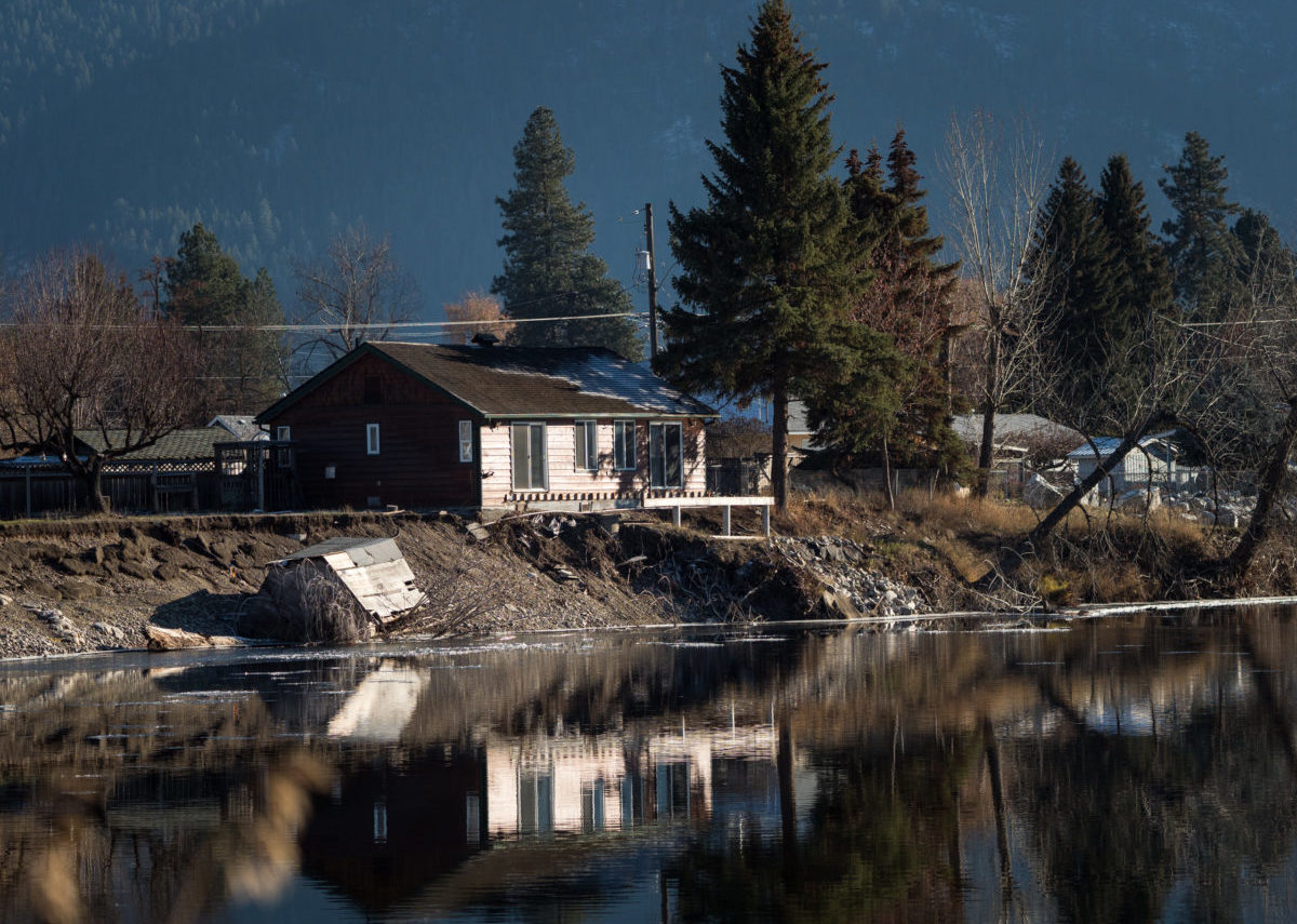
A house in South Ruckle, a Grand Forks, B.C., neighbourhood affected by a 2018 spring flood. Photo: Louis Bockner / The Narwhal
What that means, said Curry, is that there’s a strong possibility that repeated atmospheric river events in the fall could push river levels as high as they get during the spring melt in years with a high snowpack.
Some cities in the Lower Mainland also have sea level rise to contend with — a prospect that has become even riskier with population growth in coastal areas.
“This is a given that the sea level is rising, we have been measuring that now for decades and if anything, it’s accelerating,” said John Clague, Canada Research Chair in natural hazards research at Simon Fraser University.
“We do have time, it’s not like the COVID virus going through us at a warp speed, this is something that plays out slowly, but it is inevitable,” he said. “We’re going to have to spend money, there’s no doubt about it.”
Investing in needed improvements to flood protection infrastructure now is “one way to get people back to work,” he said, adding that he wouldn’t stop at the diking system.
There are numerous infrastructure upgrades needed across the country, including for storm water and sewage systems.
The challenge is it takes time to plan these types of projects, he said. “But I think we need to start that anyway. We should start now.”
Arctic tundra is 80 per cent permafrost. What happens when it thaws?
Like what you’re reading? Sign up for The Narwhal’s free newsletter.