


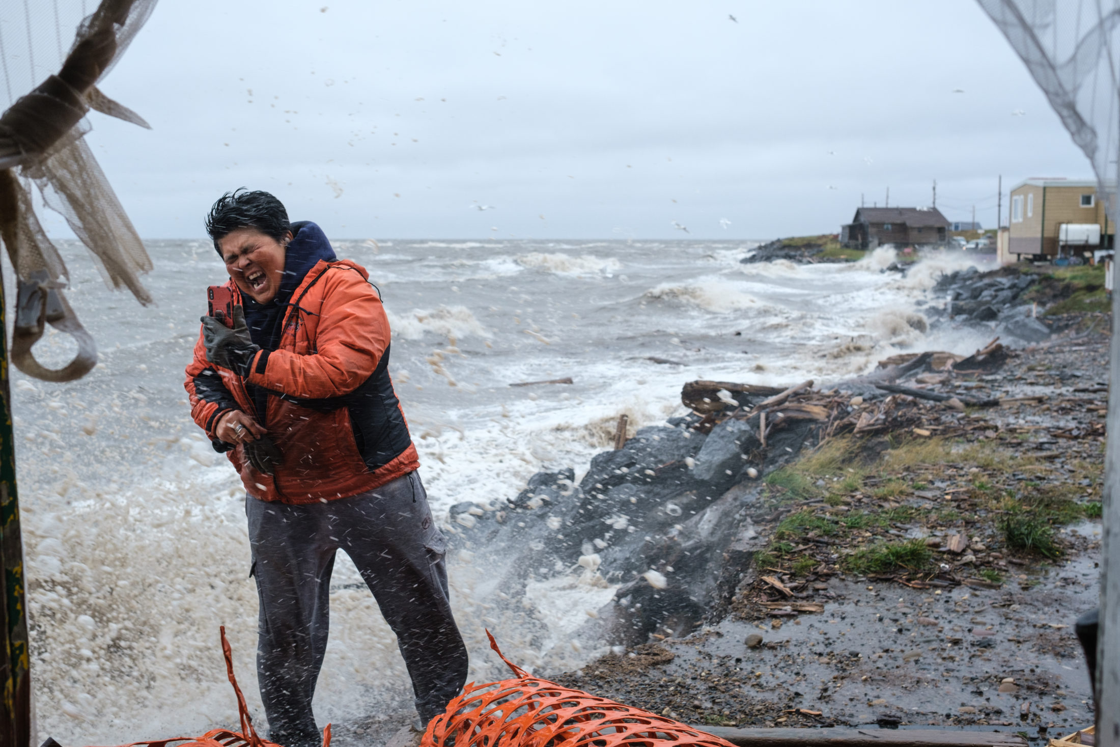
Waves that are projected to get much larger by the end of the century in the Arctic could be “catastrophic” to the hamlet of Tuktoyaktuk, according to the community’s mayor.
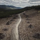
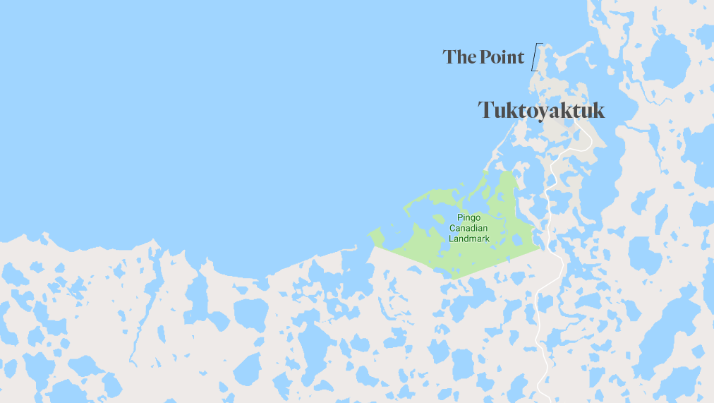
The Inuvialuit community of about 900 people in the Northwest Territories has been losing ground to the battering Beaufort Sea for decades. The hamlet has been forced to relocate houses on The Point, a peninsula jutting off the coast, as the shore crept closer and closer to residents’ doors.
Tuktoyaktuk has installed boulder walls, material coverings called “rip-rap” and cement slabs along the coast to try to prevent erosion, but another factor is working against them: permafrost thaw. Between the thawing frozen ground and crashing waves, the coastline in the area is eroding by an average of up to two metres per year — and much more in some areas.
And it could get worse.
New research published this month in the Journal of Geophysical Research: Oceans shows that maximum wave heights across the Arctic Ocean, which encompasses the Beaufort Sea, could be upward of six metres higher on average within this century, leading to even more erosion and flooding.
Along the Beaufort coast, wave heights could increase by two to three times, putting them in the range of one to four metres high by the end of the century, said Mercè Casas-Prat, the lead author of the study and researcher with Environment and Climate Change Canada’s research division.
“This is a pressing issue as it affects many Arctic coastal communities, as well as existing and emerging Arctic infrastructure and activities, with some of them having already suffered severe wave-induced damage in the past years,” the report said.
This includes the community of Tuktoyaktuk, which relies on those same powerful waters for hunting and fishing, and which, up until the opening of the Inuvik-Tuk Highway in 2017, was connected to the rest of the country only by air and ice road in the winter and water in the summer. Tuktoyaktuk’s harbour remains the hub of the community, an important access point for boats and is an area under increasing threat.
“I hope that we’re being taken seriously here,” said Tuktoyaktuk Mayor Erwin Elias.“At the end of the day, it’s the people we’re concerned about, but we also have a culture that we have to try to take care of and preserve.”
“It’s definitely worrisome for us here.”
Extreme wave events predicted to be more frequent and intense
Climate change is causing Arctic sea ice to gradually disappear, with the region projected to be entirely ice free by the end of the century, Casas-Prat said. Less ice means greater “fetch” — or larger areas of open water where waves are generated due to exposure to winds. And these waters are staying open for longer periods.
As well as increasing fetch across the ocean, less ice at the shoreline means that buttress for waves is lost, just when it’s needed.
“Potentially hazardous extreme wave events are projected to become significantly more frequent and more intense,” the report said.
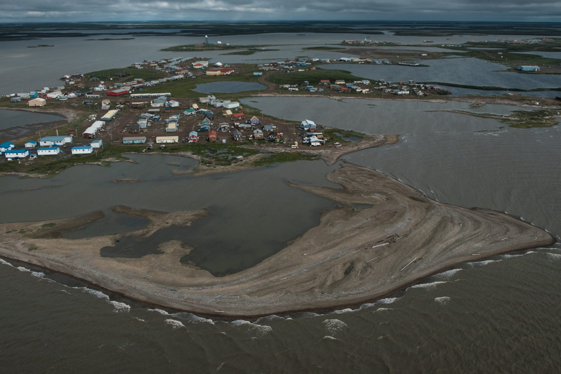
Tuktoyaktuk from air, August 2018. Photo: Weronika Murray
Extreme weather, considered a once-in-20-year event between 1979 and 2005, the report said, will occur every two to five years by the end of the century.
The study covers all latitudes above the 60th parallel, including the Beaufort Sea, which stretches from the Northwest Territories, over Yukon to northern Alaska. Researchers used wind and sea ice information from climate models to obtain historical wave conditions between 1979 and 2005 and to predict conditions between 2081 and 2100.
Strong winds will result in bigger waves in the future as more water opens up, Casas-Prat said. This will be particularly perilous during the fall, when storm surges typically hammer the region.
“The earth is becoming exposed to a new wave climate,” Casas-Prat said. “This can be an issue because Arctic coastlines are already experiencing a large rate of erosion. This gets worse in the future.”
“We need to start thinking seriously about possible adaptation strategies for those areas in the North.”
New funding announced to help Tuktoyaktuk adapt to climate change
Erosion in Tuktoyaktuk has been a problem for years and efforts to reinforce the coastline have seen varying success.
On July 10, the federal government announced $5.5 million in funding for climate change adaptation strategies and clean energy projects in the community. The bulk of it — $3.6 million — will go toward shoring up the community to erosion.
“But we’re only starting now,” Elias said, noting the community is playing catch-up in finding long-term solutions to the impacts of climate change it’s experiencing.

Concrete mat shore protection installed along Tuktoyaktuk’s coast in 2015. Photo: by S. Solomon / Arctic Coastal Dynamics
The community’s roads, for example, flood every year due to high water levels, Elias said. “It’s been over 30 years since we last did anything with our roads.”
Part of the money from federal coffers is going to raising roads in the community, he said, with construction beginning this week. The $1.2 million for roads this year doesn’t go far enough, however, Elias said, adding that the community needs about $12 million to complete road upgrades throughout the entire community.
This could take years to complete, he said, and the community is running out of time.
Just off the mainland shore, Tuktoyaktuk Island extends about a kilometre in the Beaufort Sea, acting as a natural breakwater for the community’s harbour. But it also hangs in jeopardy. As a result of waves and storm surges, the island erodes more than two metres per year, further exposing the land behind it to those forces.
“If we lose the island, then we will lose our harbour,” Elias said. “We’re trying to figure out a way to protect all that. That’s where we are today.”