


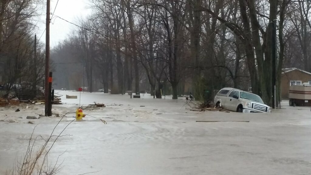
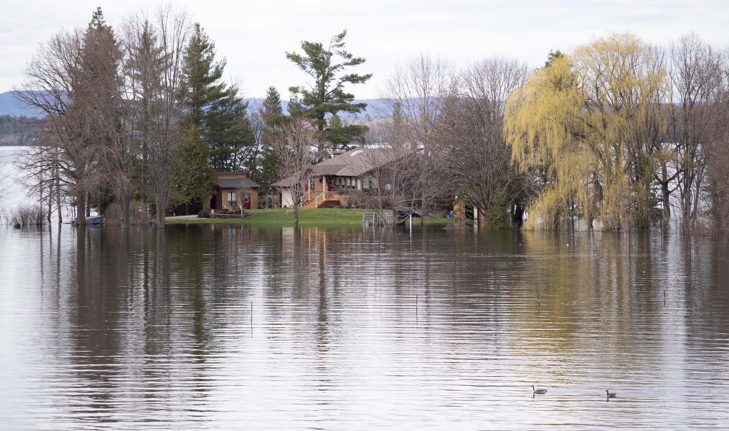
Here’s a thing I learned recently: developing a floodplain or wetland doesn’t just create new homes at high risk of floods. It also increases the flood risk of existing neighbourhoods, near and not-so-far.
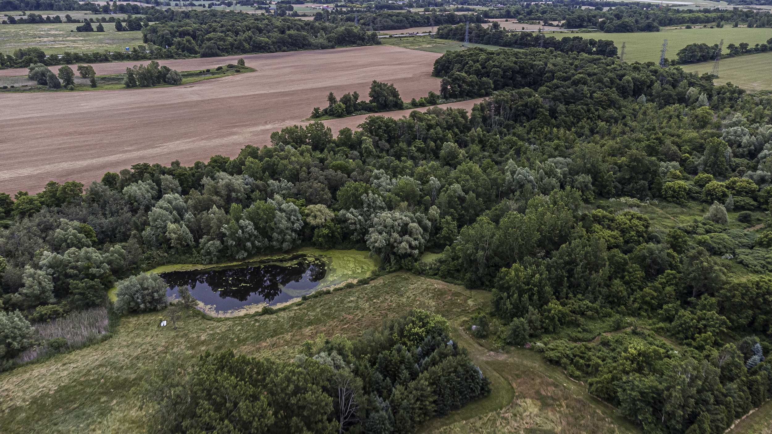
It makes sense when you think about it, I just hadn’t before — when spongy wetlands upstream from my house absorb heavy rain or melting snow, they keep that water from rushing down swollen rivers to the shores and sewers near me, perhaps right into my basement. Unpaved floodplains, or the flat areas around waterways, are similar: they go underwater so that everything around them doesn’t.
What this means is that brand new neighbourhoods on wetlands or floodplains aren’t just a concern for the people who live there, they’re a concern for everyone in the area, even the region. So if you live in southern Ontario, you should probably be concerned.
For months now, the provincial government has been making big changes to development processes — changes conservationists say are weakening oversight over flood risk. At the same time, the federal government is working hard to cut its ballooning disaster aid budget, which largely goes to the aftermath of floods. Its plan is to make Canadians more aware of their individual flood risk — and then get them to shoulder more individual responsibility.
Which is a tricky proposition: sure, I spent thousands fixing up my basement knowing full well I live a kilometre away from a river that often spills over in spring. But it’s not my choice to pave over land two hours away. A few years from now, water that’s no longer absorbed over there could start the chain reaction that fills my river up to the last drop, after which it flows into my house.
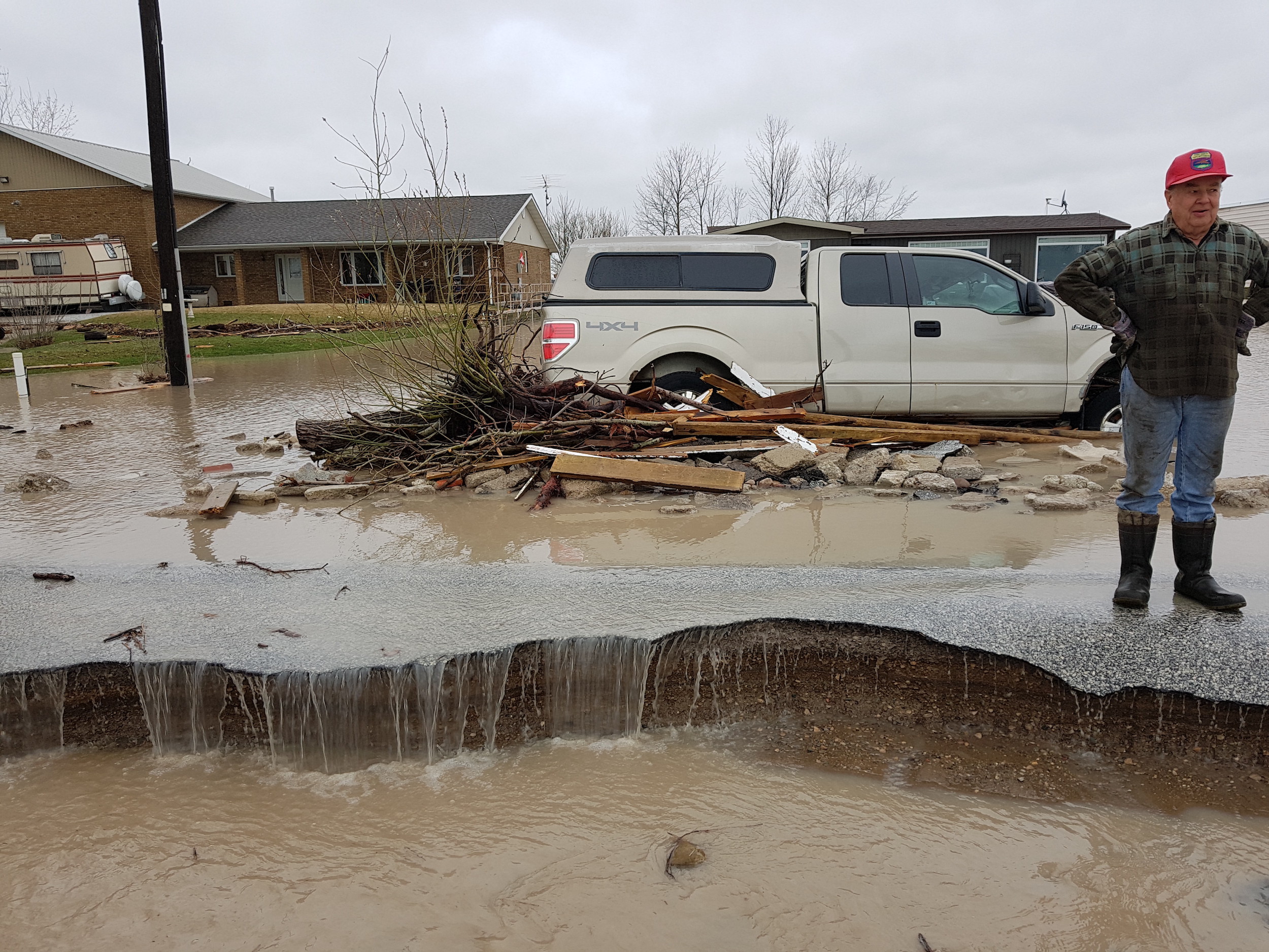
My mind has ridden a merry-go-round since I realized just how far the effects of environmentally short-sighted development could reach. It goes like this: it’s 2030, there’s a giant storm, and my basement fills up after the river overflows. Two big reasons are that the city I live in can’t adequately handle stormwater, and a town an hour away built houses on former farmland.
The municipal governments say they can’t afford to spend more money on stormwater management or environmental planning because the province eliminated the development charges they once used to fund those things. The provincial government says it killed those fees because federal population targets left no choice but to accelerate housing construction by any means necessary.
And the federal government says I shouldn’t be living so close to the river, even if a dramatic increase in low-density development paved over many of the spaces that used to absorb water when I first moved in. The one bit of assistance that the feds will hopefully be able to offer by 2030 is helping me get re-insured, because claiming these damages will raise my premiums, perhaps so high I can’t afford them.
At the end of the carousel ride, I land on two questions. First, just who should pay if environmentally unsound development causes floods? Second, have Canadian governments decided the answer to that question is individuals, even if we don’t have the information or power to protect ourselves?
Feds plan to make Canadians more aware of flood risk — and more responsible for recovery costs
Right now, no province or territory requires real estate sellers — whether developers or individuals — to provide flood risk information. And if a diligent buyer wanted to know the chance their dream home could go under water, it’s difficult to get a clear answer, said Jason Thistlethwaite, an associate professor in the school of environment, enterprise and development at the University of Waterloo. In most of the country, he said, floodmaps are outdated, confusing and hard for non-professionals to find.
Thistlethwaite is associate director of the research group Partners for Action, which aims to bring accessible flood prevention information to the public. A few years ago, it did a study where it “played the role of the average Canadian, trying to find information on flood risk to their property,” he said. Finding publicly available maps required “quite a bit of internet sleuthing and detective work,” Thistlethwaite said. Of those they found, over 62 per cent failed to meet “very basic criteria.”
It’s better if you pay, but even on the institutional level, there’s no set of flood maps considered the national standard. Researchers, insurers and lenders each buy maps from one of three companies, all of them based outside of Canada, Craig Stewart of the Insurance Bureau of Canada told me.
Stewart is the bureau’s vice president of climate change and federal issues, and said that because those maps are proprietary, insurers have limits on what information can be shared with potential clients. Some governments purchase the same flood maps, while others make their own. This means that when different organizations discuss risk or mitigation, they could be working off of different information.
This lack of accessible, standardized maps was one of two key problems identified last August by a federal task force on flood insurance and relocation, which Thistlethwaite advised. Led by Public Safety Canada, it included representatives from the B.C. and Ontario governments, the Canada Mortgage and Housing Corporation and the insurance industry, including the Insurance Bureau of Canada.
One of the task force’s main goals was to figure out how to cut the federal government’s ballooning bill for Disaster Financial Assistance Arrangements, the money it sends to provinces and territories to cope with the aftermath of natural disasters. Since the program was created in 1970, it’s paid out over $12 billion. And, as The Globe and Mail reported in November, the pace of eligible disasters keeps speeding up. The most common are storm-related floods.
The lack of flood mapping flows directly into the second key problem the task force dove into in its report: ignorant of their flood risk, a worrying number of homeowners lack adequate flood insurance. Most have decent sewer-back up insurance, said Stewart, but aren’t covered for overland floods. That’s essentially what it sounds like — when a big storm causes a lake, river or coastline to overflow, sending water over land into your house. “That’s the one we’re most concerned about,” he said.
The mapping problem has an obvious solution: the federal natural resources department is leading a three-year, $63.8 million flood hazard identification and mapping program, a Public Safety Canada spokesperson told The Narwhal in an email. Focused on the country’s “higher-risk areas,” the program is being done in collaboration with Public Safety and Environment and Climate Change Canada, as well as provinces, territories and Indigenous communities.
Public Safety said the federal government intends to build a public portal where this flood data is easy for citizens, smaller governments, researchers and businesses to find and understand. The department didn’t include a timeline, but as Stewart expected, funding for the portal was announced in the March federal budget: $15.3 million over three years, beginning in 2023.
Thistlethwaite said this mapping is a monumental task, and long overdue. In England and some American states, he said, it’s easy to plop an address into a government website to learn its flood risk. Some foreign sites also prompt users to buy better flood insurance.
Which leads us to the federal government’s attempt to solve the second problem: inadequate insurance coverage. Resolving this issue will be complicated. About 20 per cent of homeowners find overland flood insurance inaccessible, said Stewart. For about half, it’s unaffordable. The other half are simply ineligible.
“The risk is just too high. It’s predictable,” Stewart said. “We know these places are going to flood.” One sticking point, he said, is reinsurance: after a disaster payout, private insurance is often unavailable or unaffordable. The only way around this, he believes, is a national flood insurance program. This, too, was a line item in the March budget: $31.7 million earmarked for Public Safety, the Canada Mortgage and Housing Corporation and the Department of Finance to “stand-up a low-cost flood insurance program, aimed at protecting households at high risk of flooding and without access to adequate insurance.”
These exist in other countries, and the Public Safety report noted the pros and cons of various systems. In France, homeowners pay 12 per cent on top of their insurance policy towards natural disaster relief. Mortgage holders are required to have specific flood insurance, and the government underwrites reinsurance provided by private companies. The U.S. requires mortgage holders in designated flood-prone areas to have specific coverage from private insurers, which it underwrites. The U.K. has capped premiums in an attempt to keep flood insurance affordable: there, homeowners pay a levy on insurance policies, which private insurers put into a pool used for payouts in high-risk areas.
Public Safety told The Narwhal that “a suite of anticipatory financing tools, including insurance options, will be made available … to support those Canadians at medium and high risk,” but didn’t offer more information on possible timelines or structures. A month or so later, the March budget committed the government to “offering reinsurance through a federal Crown corporation and a separate insurance subsidy program.”
Throughout the report, the idea that homeowners need to be made aware of their risk and then become responsible for it is repeated, often. In other countries, subsidized insurance premiums will grow over time. The U.K.’s affordability caps are in place until 2039, after which the expectation is that “properties would be sufficiently de-risked by this time to move towards risk-based pricing.”
The message is that Canada relies too much on reactive measures — mainly expensive post-disaster government assistance — and needs to shift to proactive measures. High insurance premiums would be a “price signal” about neighbourhood-level flood risk that might just convince people to live somewhere drier. For some, the report says, de-risking will ultimately mean relocation, a whole other kettle of fish that will disproportionately displace Indigenous communities.
To Thistlethwaite, the federal goal of reducing costs by sharing risk makes sense. But it’s also somewhat unfair to the little guys — not just individuals but, sometimes, municipalities. On one hand, he said, cities need to think twice about allowing fancy development on waterfronts, factoring in flood recovery costs along with property tax revenues.
On the other, municipalities are often cut off from the decision-making that sets long-term environmental outcomes in motion. In its report, Public Safety notes that spreading Canada’s $2.9 billion in flood risks costs around doesn’t reduce it. Only prevention and mitigation can do that, and only higher levels of governments can do that meaningfully.
“Governments in Canada, for the most part, are finding being responsible for the recovery associated with flooding and climate risk, no longer socially … politically and economically sustainable, so [they’re] trying to find ways to get out of it,” Thistlethwaite said.
“And one of the principal ways that they’re doing that is by very quietly downloading responsibilities that were once handled by, let’s say, the federal government, provincial government, to municipalities, even homeowners.”
In its email, Public Safety Canada said its interest in insurance programs is “not necessarily focused on reducing costs, but rather making communities less vulnerable and ensuring Canadians have the support and resources they need to recover after a flooding event.” It also said that “While the Government of Canada completes its work on creating a low-cost national flood insurance program, Canadians living in high risk areas where flood insurance is currently unavailable are still fully eligible under the federal Disaster Financial Assistance Arrangements, though specific terms of eligibility are set by provinces and territories.”
Is Ontario repeating mistakes made prior to major flooding in B.C.?
A national insurance program could include carrots as well as sticks. The Public Safety report notes that this also happens elsewhere: the U.S. and France both reward local action, often offering communities that actively reduce flood risk cheaper insurance.
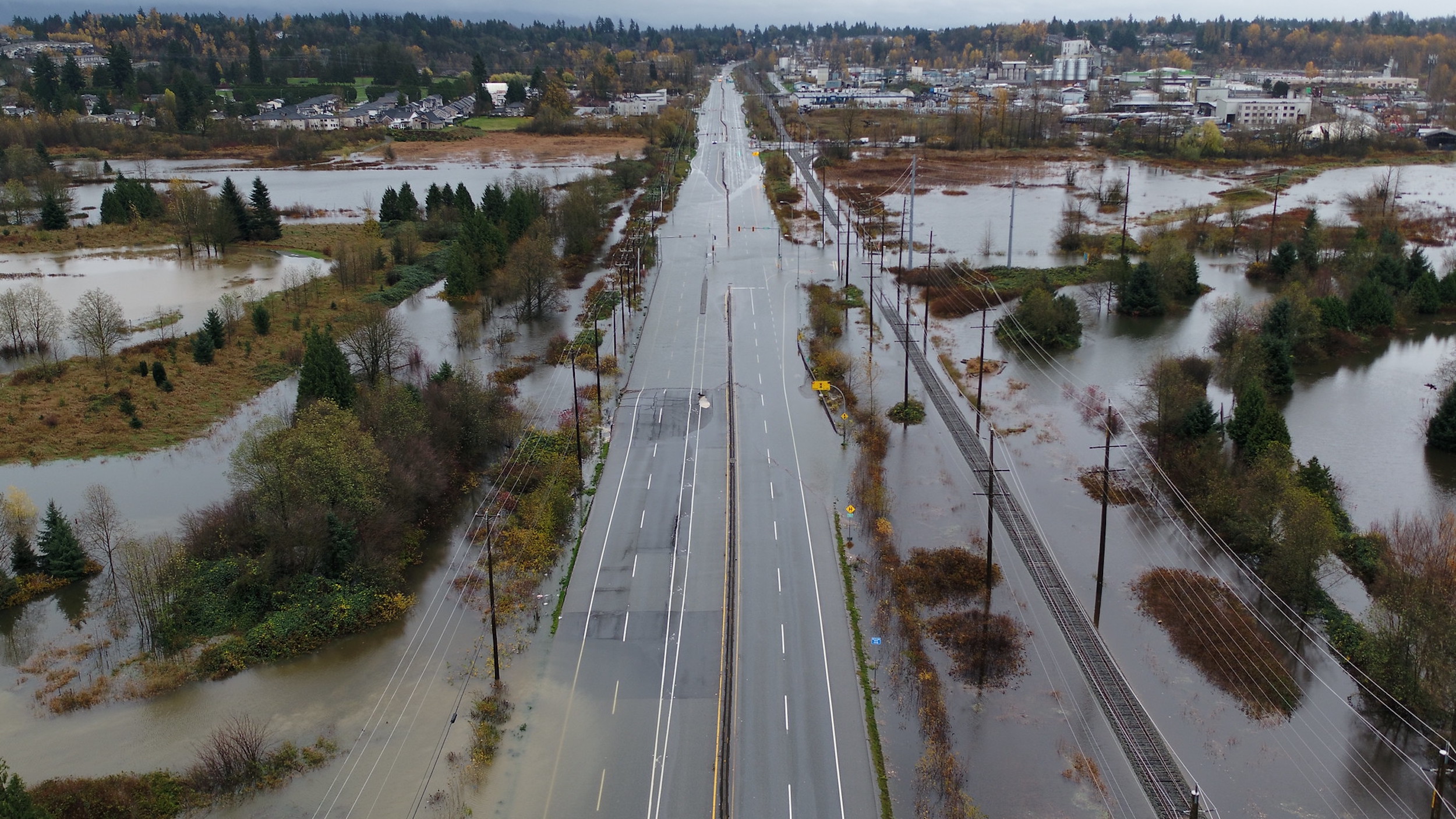
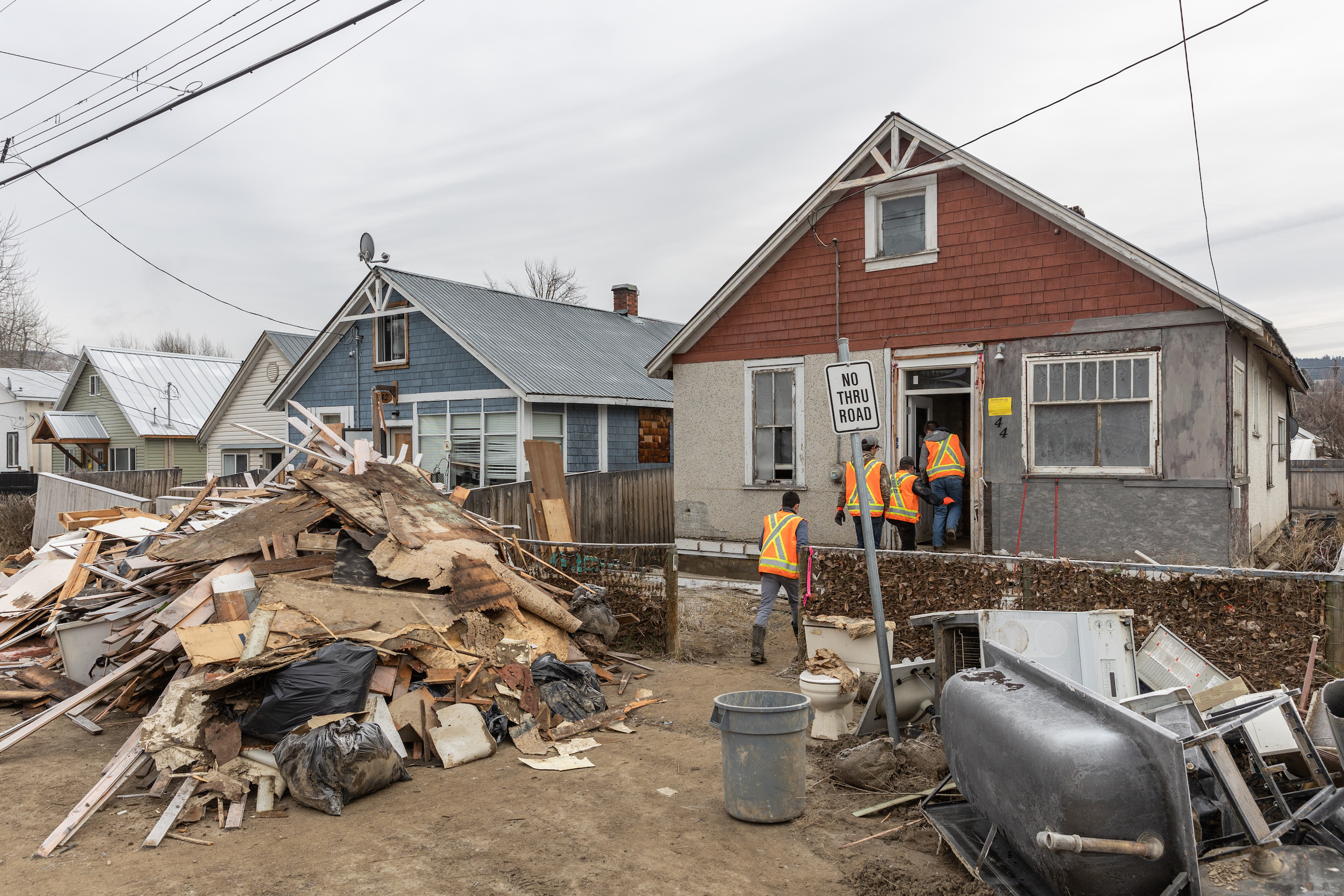
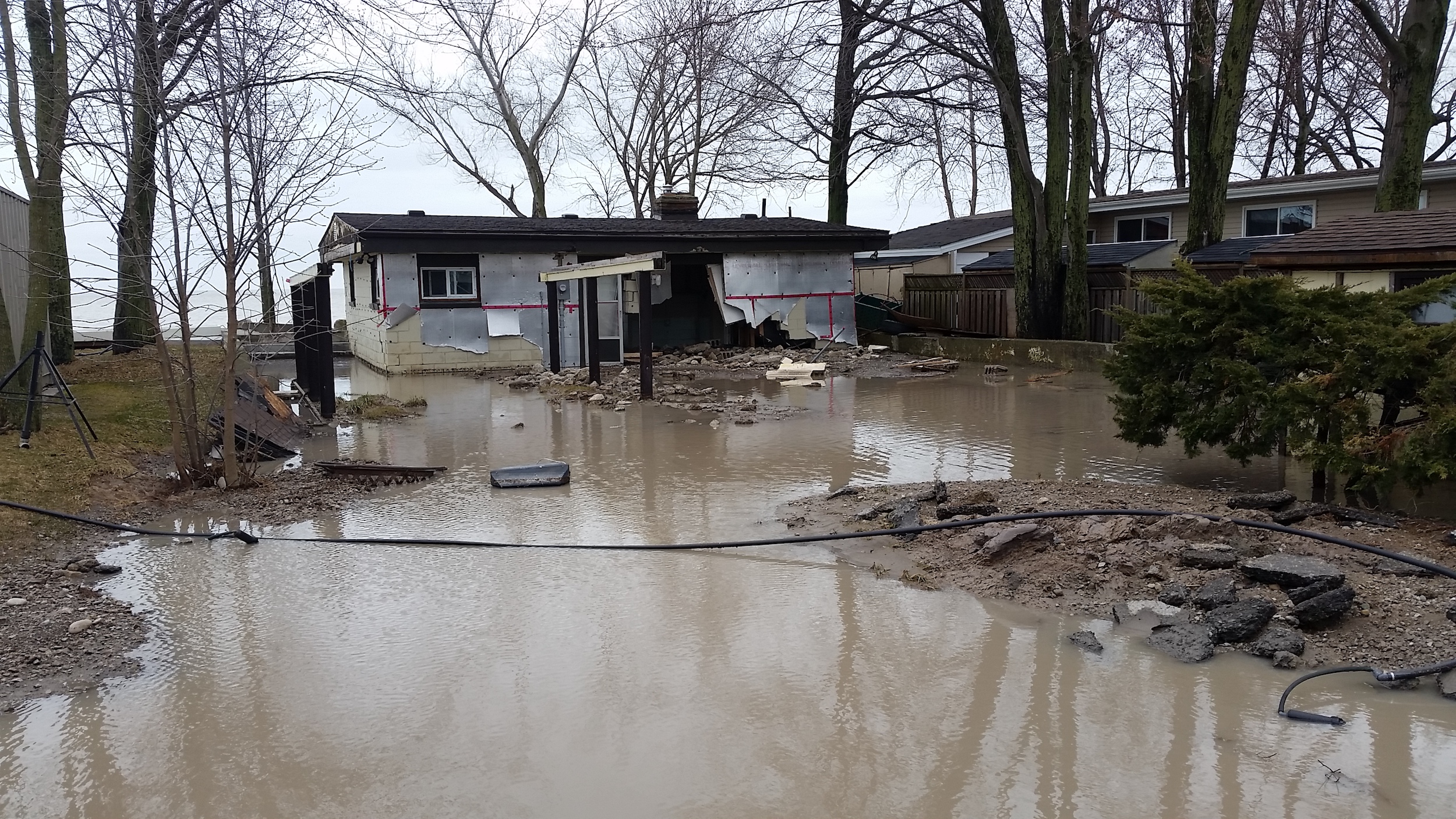
It’s a nice idea, if locals have the power and money to protect themselves. That wasn’t the case in British Columbia in the lead-up to the fall 2021 atmospheric river. Researchers and municipalities had long warned that many of the province’s dikes were on the verge of failure, as reported by The Globe and Mail and CBC. In fact, reported the Vancouver Sun, those warnings began soon after the B.C. government downloaded responsibility for dikes to municipalities in the early 2000s. By 2013, the province’s own reports noted that downloading had created a haphazard patchwork of maintenance. Small towns with low property tax revenues were especially under-resourced for the job.
In 2020, politicians in Abbotsford, population 150,000, noted the need for other levels of government, including south of the border, to help lessen the city’s flood risk. They didn’t receive it. So, in November 2021, the Sumas dike in Abbotsford failed. It put an entire region under water, resulting in floods and landslides that killed five people.
That storm and its aftermath catapulted B.C. to the top of the list for federal Disaster Financial Assistance Arrangement payments. As of November 2022, B.C. had been allotted nearly $5 billion since the program’s inception. More than half of that — $3 billion-plus — are costs incurred in late 2021.
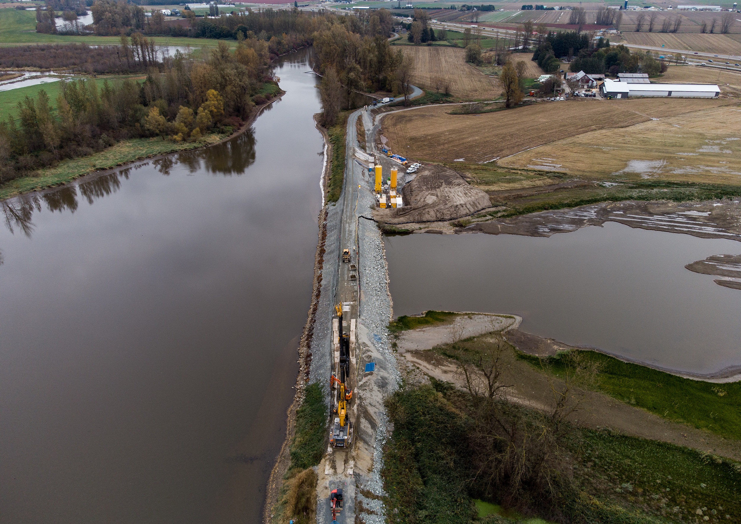
The B.C. government has committed more than $2 billion of its own budget towards flood recovery. It also updated its Emergency Program Act last year to state that compensation for future disasters will not include expenses “for which insurance was reasonably and readily available.” It’s a move that illustrates why the insurance industry supports a federally-backed program: the 2021 disaster resulted in $675 million in insurable losses, the province’s most costly weather event ever.
Over to Ontario which, as Premier Ford likes to mention, hasn’t received a Disaster Financial Assistance Arrangements payment from the federal government in 15 years. This is true. Canada’s most populous province has the lowest payments, per capita, than everywhere else.
As of last November, Ontario had received just under $239 million in assistance through the federal disaster program in the 50-plus years it’s been running. Even tiny New Brunswick, at $382 million, outstripped Ontario. And sure, we don’t have an ocean coastline, but neither does Saskatchewan, which sits at $902 million.
Some of it is luck, absolutely. But there’s broad consensus that our good luck has been made better thanks to conservation authorities, Ontario’s unique watershed management bodies. Thistlethwaite, Stewart, the Canada Mortgage and Housing Corporation, the federal government and — wait for it — the Ford government have all credited conservation authorities with dramatically reducing the risk and damage of floods, in part because of their commitment to accurate, regular flood mapping.
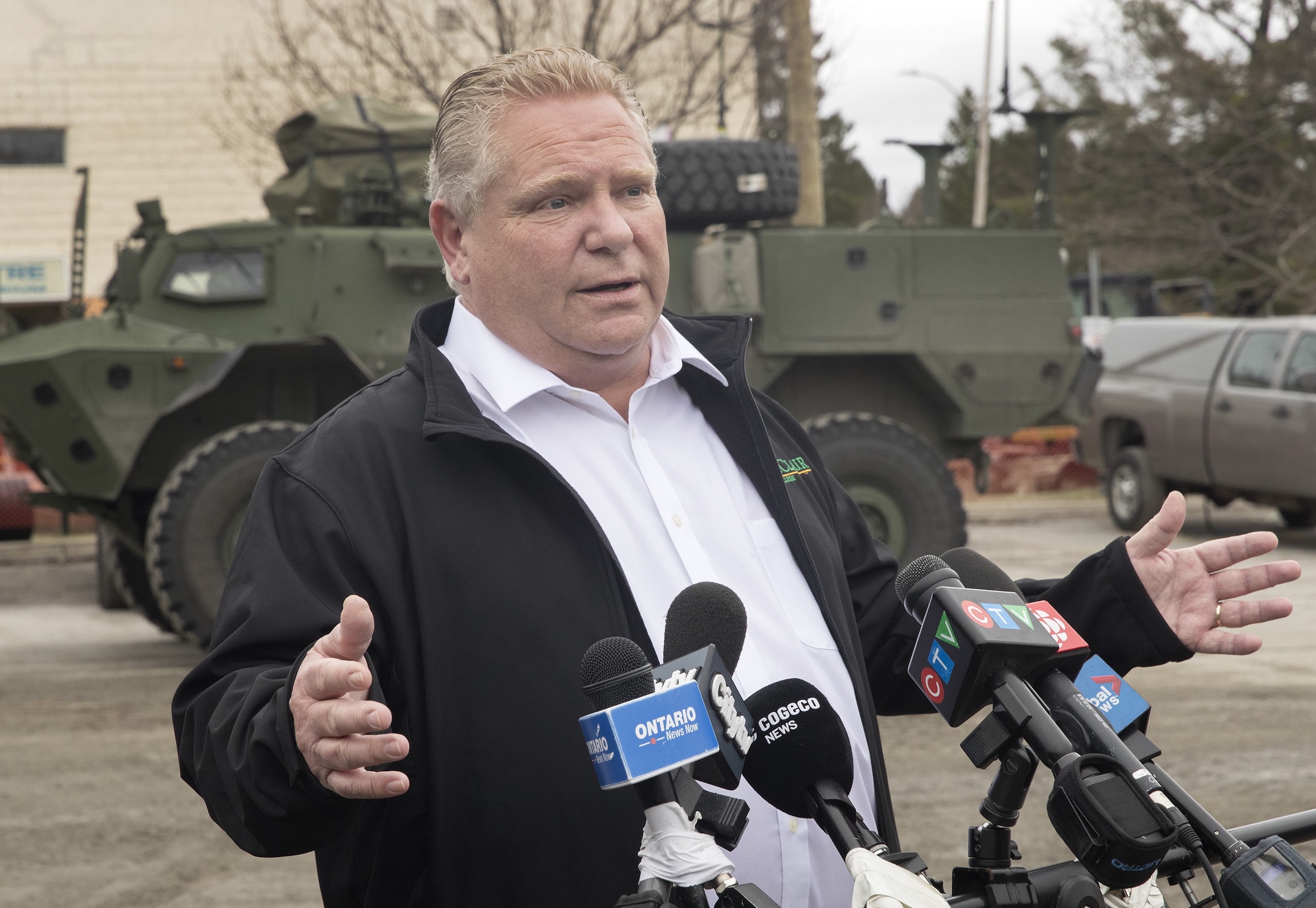
Yet, despite his own government’s acknowledgement of their importance, Ford is currently weakening or eliminating much conservation authority oversight of development.
More than two weeks before this story was published, The Narwhal sent a list of detailed questions to Ford, Natural Resources Minister Graydon Smith, Municipal Affairs and Housing Minister Steve Clark and staff in both ministries, including Helen Collins, an acting director in the housing ministry who was on the Public Safety task force.
None acknowledged receipt of the questions, which concerned changes to development policy and conservation authority oversight; whether the province accepts the findings of the Public Safety task force, including cautions against overdevelopment; what flood maps the government refers to in its policy-making; and how the Ford government believes developers should receive information on flood plains, flood maps and flood mitigation when planning new developments.
On February 27, Smith did answer questions in the legislature about Ontario’s flood strategy posed to him by a colleague, Progressive Conservative MPP Goldie Ghamari. When asked about the government’s mitigation of flood risk, Smith pointed to $30 million designated for “wetland recovery.” The Narwhal has previously reported that experts find this commitment contradicts the government’s dismantling of many wetland protections: when deciding which wetlands deserve provincially significant status, the province no longer considers species at risk or how small wetlands might contribute to a larger system.
“Here we are, recognizing the vital nature based solutions that wetlands provide on the one hand,” Rebecca Rooney, an associate professor at the University of Waterloo who researches wetland ecology, told The Narwhal last October. “But then we’re going to simultaneously greenlight a lot of irrevocable wetland loss … Right now I’m just reeling from the juxtaposition.”
During Question Period, Smith also told Ghamari that the government has given individuals, communities and businesses $26 million in disaster recovery funds, but did not specify the time period. He said the government has committed $4.7 million to “help” municipalities carry out flood forecasting, but didn’t specify what funding he is referencing.
Smith also said that the government has committed an extra $2 million to extend Build Back Better, a pilot project meant to help municipalities rebuild infrastructure after extreme weather. He did not clarify how that $2 million would be split up among the province’s 444 municipalities.
Meanwhile, the March budget committed $48.1 million over five years and $3.1 million “ongoing” to Public Safety Canada to “identify high-risk flood areas and implement a modernized Disaster Financial Assistance Arrangements program, which would incentivize mitigation efforts.”
Public Safety didn’t answer when asked what a modern disaster payments program could look like, or what it meant to “incentivize mitigation” on the ground. But it seems like a jargony way to say that places that build climate resilience and infrastructure might be rewarded, while those that stick their heads in the sand could find themselves breathing mud. As for citizens that might want to prepare for the climate emergency but can’t muster support or funds from the cities or province, that remains to be seen.
Environmental experts in Ontario are ‘demoralized and almost exhausted’
In the legislature earlier this week, Ghamari and Smith also referenced a flooding strategy the province released in 2020, a year after huge spring floods led municipalities in Smith’s riding of Parry Sound—Muskoka to declare a state of emergency. That strategy mentions the need to maintain wetlands and unpaved surfaces. It also states that “the most cost-effective and sustainable way of reducing risks is to keep people and property out of high risk areas.”
The province’s flood strategy also references conservation authorities 46 times, usually emphasizing the importance of cooperation between the province, municipalities and the watershed management bodies. But over the past few months, staff at conservation authorities all over southern Ontario have told The Narwhal that any cooperation that had been happening has essentially broken down, especially since the province announced massive reductions in the authorities’ powers last fall.
It was Tim Byrne, chief administrative officer of the Essex Region Conservation Authority on the southwest tip of Ontario, who clued me in that thoughtless development could increase flood risk for all homes. “I’m demoralized and almost exhausted,” he said in November, soon after the government unveiled a slew of changes that will affect the work he’s done for 38 years.
For nearly seven decades, conservation authorities like his have protected drinking water, preserved endangered species habitat and helped shield people from the worst effects of natural hazards like floods, largely through oversight of the development process. And, if federal disaster payments are an indication, much of what they’ve been doing works.
Yet the Ford government followed through with stripping many of their powers in late December. Now, conservation authorities can only review development applications that could cause flooding, erosion or other natural hazards. They can no longer review applications that could impact significant woodlots, valley lands, fish habitat or species at risk, even though many of those concerns are intertwined with leaving land able to absorb water.
Byrne said these limits set him up to fail. Imagine a subdivision proposal located on land that isn’t a known floodplain, but that Byrne still believes could increase flood risk: without proving direct cause-and-effect, he can’t mandate, or even suggest, specific stormwater infrastructure. Without oversight of full watersheds, he feels he’s being left to watch as water flows from newly paved-over areas to the small patches still under his purview.
“How am I going to mitigate the damaging effect of runoff from destroying natural heritage features as it bowls and runs towards my rivers, creeks and streams, aimed at me from development in the headwater region?” he said. “You limit my capability to comment ahead of time, then you still pretend — wink, wink — that I can issue a permit for it at the tail end of the planning process.”
The Windsor-Essex region, where he lives, is an example of poor planning, or lack of planning. It’s on the banks of the Detroit River and Lake St. Clair, with Lake Erie to the south and Lake Huron to the north. “We are this little blob that sticks right out into the Great Lakes,” Byrne said.
The region is very flat, and its low-lying coast is very developed. Wanting to live near a bustling shipping port, early European settlers drained wetlands for farming. Then came the post-World War II housing boom, and decades of sewer construction and engineering less sophisticated than it is today.
Long story short, water no longer has anywhere to go — except for basements, 6,000 of which were flooded in the city of Windsor after a two-day storm in 2017. Windsor-Essex is Ontario’s most flood-prone region, with the insurance premiums to prove it. Last year, the insurance site Rates.ca listed Windsor as the second most expensive place to get house insurance in Ontario, at $2,111 annually. The most pricey place is LaSalle, 13 km south of Windsor: at $2,400, annual premiums are more than double than in the province’s cheapest place, Ajax (where the push to develop the headwaters of a local creek has locals worried about their own increased flood risk).
Windsor-Essex is a sobering case study as Ontario gears up to build intensely across its southern regions. There are unsettling echoes of B.C.’s dike issue, too. Rural towns with smaller property tax bases will have the hardest time replacing conservation authority expertise. And some communities that want to protect themselves can’t — late last year, the province forced both Hamilton and Halton Region to allow development applications on land local governments wanted to protect.
Perhaps fearing the only reasonable line item on its disaster budget is about to spike, Canada has tried to slow Ontario down, a bit. In December, federal Environment Minister Steven Guilbeault told The Canadian Press that Ontario can’t count on federal help if areas known to flood are built on irresponsibly. In response, Ford shot back that no floodplains would be developed — though he also said the responsibility to ensure that lay with developers.
Leaving aside the eagerness of any industry to regulate itself properly — what floodplains are we talking about, exactly? While conservation authorities have provided Ontario with better flood maps than most provinces, there’s no guarantee those are the ones being used. Even when federal maps become available, Public Safety’s email only stated that provinces “may use” them, not that everyone has agreed to work off of the same set of material.
It seems a bit like “floodplain” is becoming a buzzword that reduces the scope of the problem. In a region with this many basements, other types of unpaved areas are needed to absorb water. That means wetlands and farmland and forests, yes, but even soccer fields can help, said Byrne. Well, another recent bit of policy decreed that playgrounds on top of buildings can fulfill development requirements to build “parks.”
Thistlethwaite said Public Safety’s flood portal will provide residents, communities and municipalities with data they can use to advocate for resilience-building, or push back against thoughtless development. But the federal flood mapping program is a three-year project, meaning a portal launch date is at least that far away: this leaves Ontario a bit of a “regulatory purgatory,” Thistlethwaite said.
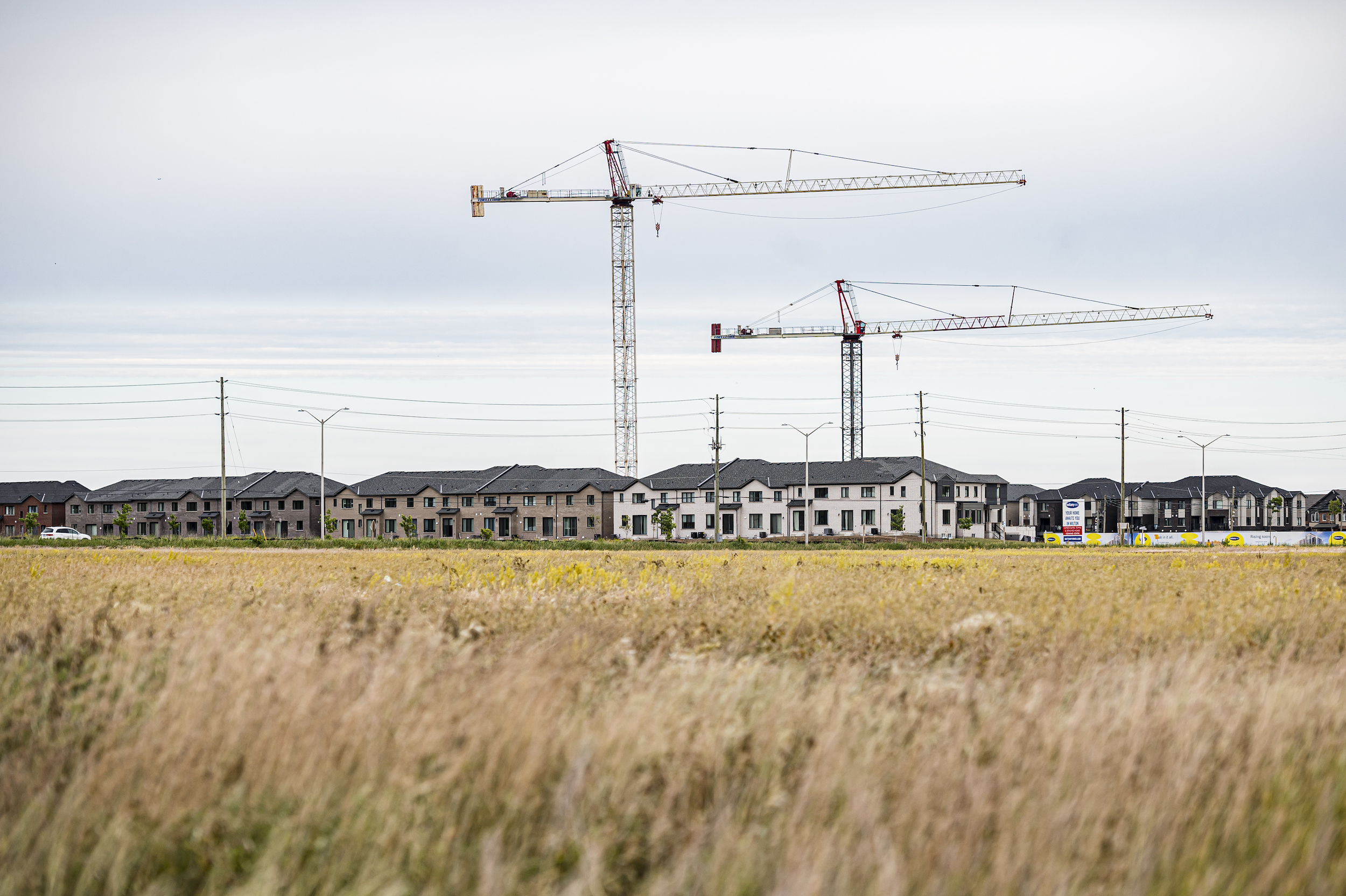
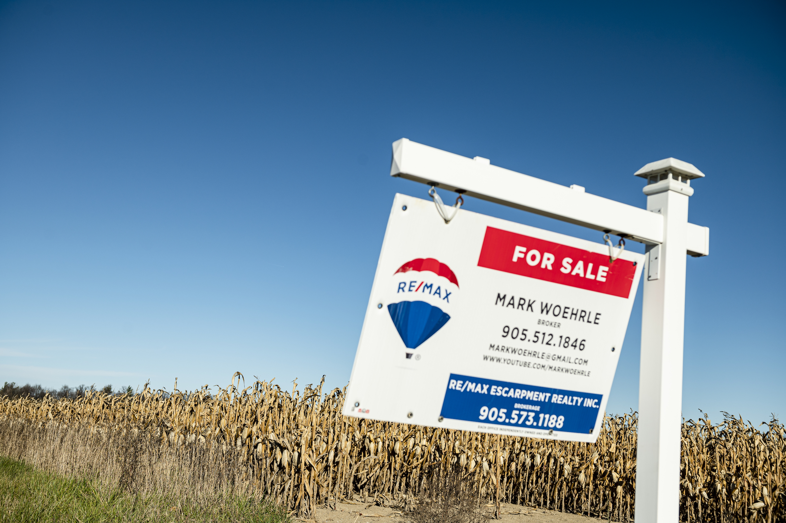
Three years is plenty of time for small, local governments to get overwhelmed by development applications that they don’t have the environmental expertise to analyze. It’s more than long enough for homebuyers to put down pre-construction dollars for a future that might turn out differently than they imagine. With 319 acres of Ontario farmland disappearing daily, it’s a totally plausible timeframe in which farmers whose fields are deluged as concrete gets poured around them could shrug, sell their land and leave.
Ten, 20 or 100 kilometres away from these decisions lies my basement and all the priceless and meaningless things I keep down there. In two, five or 10 years, if it all gets soaked, will there be anyone but myself to blame?
With files from Emma McIntosh.
Updated March 29 at 9:30 a.m. ET: This story was updated to include funding details for flood education and insurance included in the March 2023 federal budget.