


The Ontario government’s proposed Highway 413 would cut through not just one but three parcels of land set aside for conservation, according to an internal report obtained by The Narwhal.
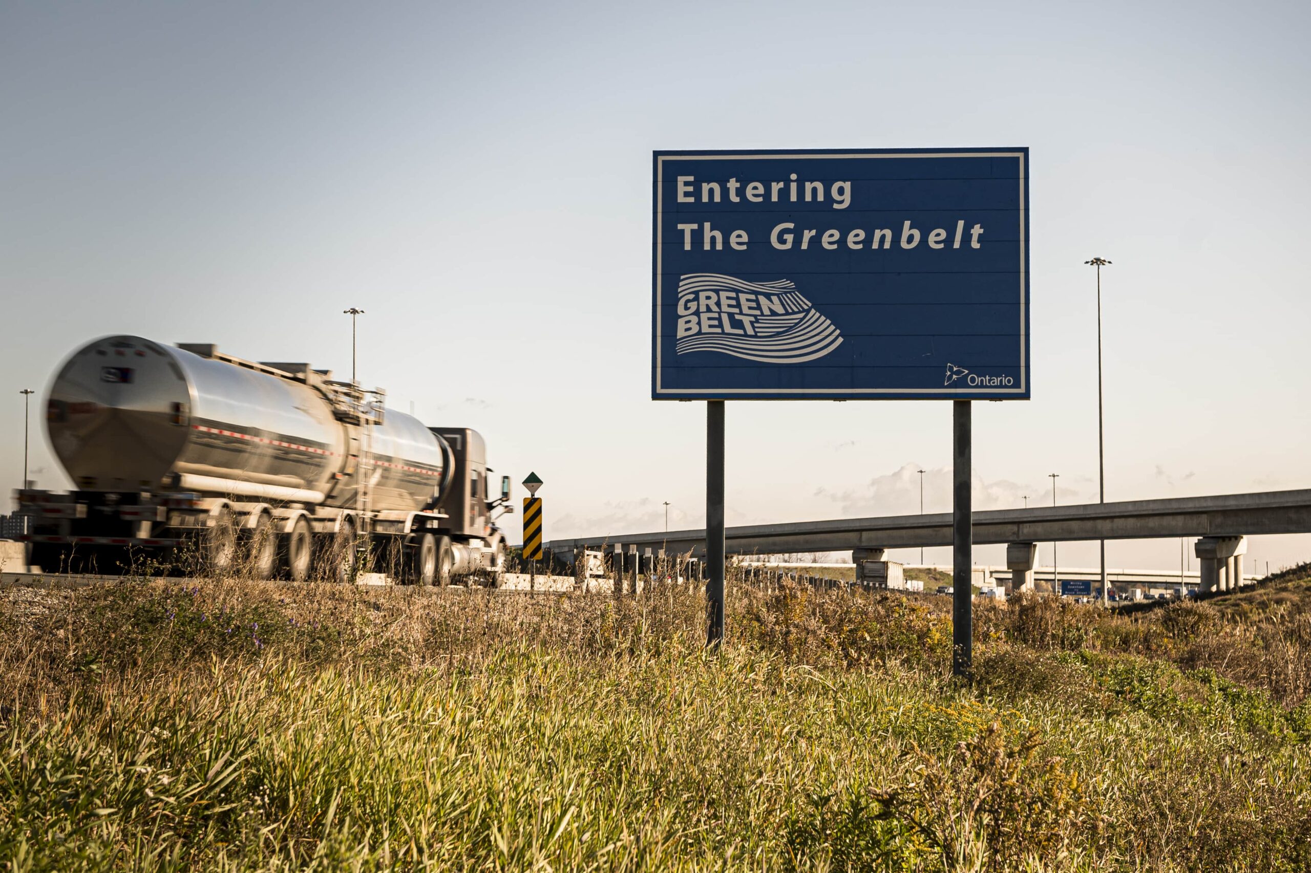
Much of the backlash to Highway 413 in recent months has centred on the Nashville Conservation Reserve north of Toronto, which is owned by the Toronto and Region Conservation Authority. The highway would pave part of the reserve, which is in the protected Greenbelt. But the document obtained by The Narwhal shows that the contentious project will cut through two additional properties owned by the conservation authority.
“The 413 is more destructive than we thought,” said Gideon Forman, a climate change and transportation policy analyst at the David Suzuki Foundation.
He and other environmentalists say it’s important to protect southern Ontario’s few remaining greenspaces, which naturally store carbon, mitigate floods and provide habitat for endangered species. Conservation authorities are mandated to oversee watersheds, and the land they hold is particularly crucial, often encompassing sensitive ecosystems. The highway project, if built, would disrupt protected wetlands, endangered species habitat, prime farmland and the Greenbelt. It would also worsen existing problems, including air pollution from fossil-fuel burning vehicles, which contributes to climate change, and waterway contamination from wintertime road salt runoff.
The report obtained by The Narwhal is a draft of a document called an initial project description, which Ontario’s Ministry of Transportation must submit to the federal government as part of the impact assessment process. Ontario hasn’t yet filed a final version.
The document doesn’t detail how Highway 413 will affect conservation land specifically. But generally, it says construction will involve “direct wildlife habitat removals” in wetlands, woodlands and meadows — including “confirmed significant wildlife habitat” and habitat for migratory birds and endangered species — along the route.
Ontario’s Ministry of Transportation did not answer detailed questions from The Narwhal about where the conservation authority land is located or how many acres of it would be disrupted or destroyed by construction. But Dakota Brasier, a spokesperson for Ontario Transportation Minister Caroline Mulroney, said the province is moving “full steam ahead” with Highway 413, which it says will create thousands of jobs per year during construction.
“Under Premier Ford’s leadership, the days of endless studies, debates and committees are over,” Brasier said.
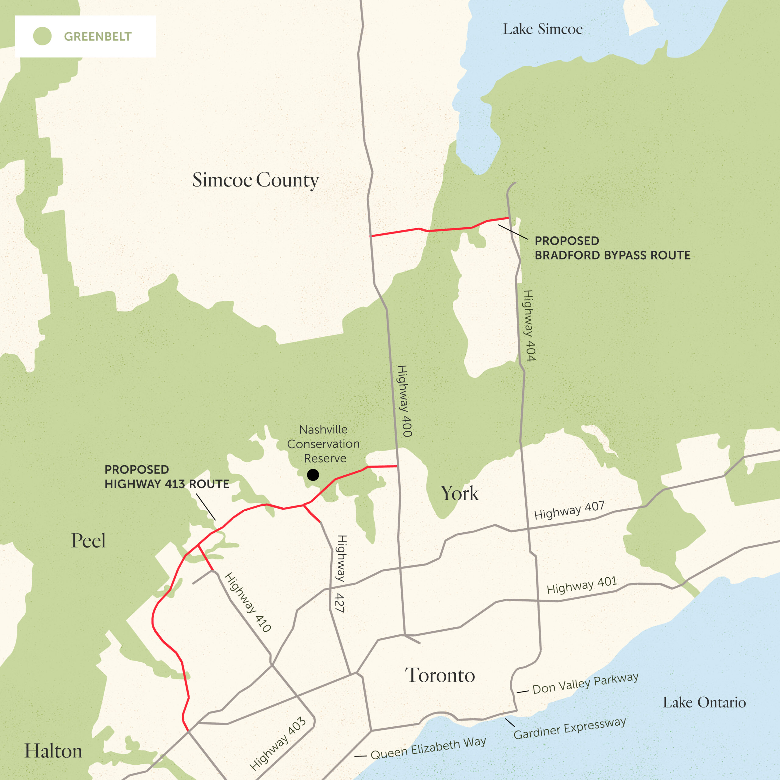
If built, Highway 413 would loop for 60 kilometres around the northwestern reaches of the Greater Toronto Area, connecting the Ontario suburbs of Vaughan and Milton. Also called the GTA West Corridor, the project was first sketched out decades ago. It was a major plank of the Tories’ re-election campaign in the 2022 Ontario election.
The previous Liberal government cancelled it after an independent panel concluded it would save drivers less than a minute. The Progressive Conservatives put Highway 413 back on the table in late 2018 after forming government, and now argue it would actually save drivers travelling the length of the route half an hour. (Studies have shown for decades that in the long term, new roads attract more traffic and don’t solve congestion.)
Last year, an investigation by Torstar and National Observer sparked more backlash with its finding that eight powerful developers, many prolific Progressive Conservative donors, own significant land that would skyrocket in value if Highway 413 is built.
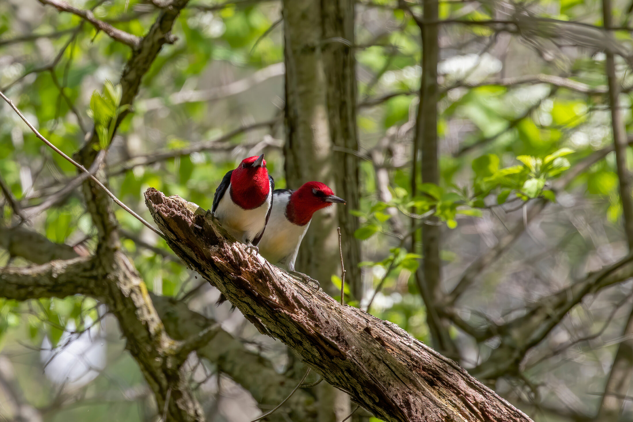
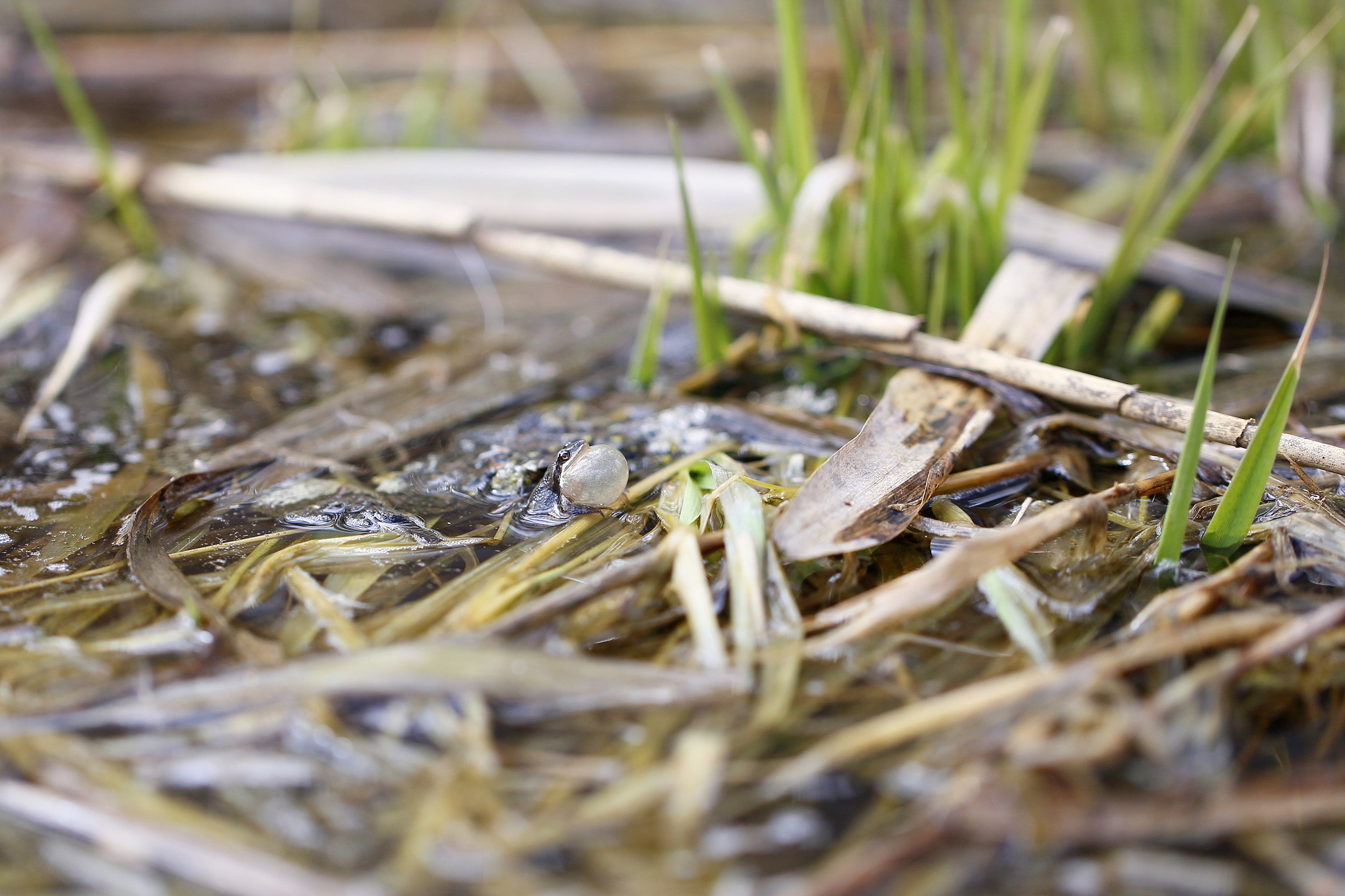
Amid a rising tide of public concern in 2021, Ottawa stepped in and decided to subject Highway 413 to a federal impact assessment, potentially delaying the project for years. The federal Impact Assessment Agency, which oversees the process, pointed to concerns about how Highway 413 could harm habitat for three species at risk in particular: the western chorus frog, red-headed woodpecker and a type of dragonfly called a rapids clubtail.

The report The Narwhal reviewed is an October 2021 draft prepared for the province by engineering consulting firms WSP and AECOM, obtained through an access-to-information request to the Impact Assessment Agency of Canada.
The draft is incomplete, and notes that Ontario’s Ministry of Transportation needs to do more fieldwork in summer 2022. It includes over 300 pages of research, including lists of endangered species living in the area and five nearby aquifers, along with 95 watercourses and 65 archaeological sites located on Highway 413’s proposed route that could also be disturbed.
In feedback for the Ontario government contained in the access-to-information request, Impact Assessment Agency staff said the draft lacks details on specific environmental damage that could be caused by the highway, and how the province plans to avoid or lessen that damage.
In an email, the Impact Assessment Agency confirmed the draft is the most recent version it has seen but redirected questions to Ontario’s Ministry of Transportation. The project cannot move into the next phase of the impact assessment process — or get much closer to construction — until Ontario submits a final version of the initial project description, and the agency confirms that final document meets its requirements.
Irene Ford, who lives in Vaughan and is part of the grassroots group Stop the 413, said she believes the Ministry of Transportation is releasing as little information as possible to the public about the new highway.
“I do think the public is entitled to know,” she said.
Brasier said in an email that “Ontarians voted overwhelmingly in favour of Premier Ford’s plan to build critical infrastructure,” including Highway 413, in the 2022 election. But that election, held just weeks ago, had the lowest voter turnout in Ontario’s history, with just 43 per cent of those eligible heading to the polls. The Tories won 40.8 per cent of those votes, with the New Democrats and Liberals taking 23.7 per cent and 23.6 per cent, respectively.
Conservation authority, province won’t say where properties affected by Highway 413 are located
The Nashville Conservation Reserve is an hour’s drive northwest of downtown Toronto, in Vaughan. It’s home to the headwaters of the Humber River, which drains into Lake Ontario to the south, as well as lush, ecologically important forest.
In 2020, the Ontario government decided on a route for Highway 413 that would avoid a future development project and send the new road through the Nashville Conservation Reserve instead, the Toronto Star reported in April.
The reserve is especially important because it’s one of the few remaining places in the region with enough forest to support species that are deterred by nearby human development, said Tim Gray, executive director of the non-profit Environmental Defence.
“A lot of birds won’t live in forest that is too small or too fragmented,” he said.
“And of course, having major amounts of forest cover on both sides of the river means that you have water filtration potential there for rainstorms and runoff, to keep these rivers clean, that doesn’t really exist [in] many other places in the watershed as it becomes urbanized.”

The Ontario government report refers to the other two Toronto and Region Conservation Authority properties along Highway 413’s route as “Kirby Lands” and “Etobicoke Creek Headwaters,” but doesn’t say where they’re located. Brasier didn’t answer when asked about the exact location of the properties.
Conservation authorities are watershed protection agencies, regulated by the province and mostly funded by municipalities. Some of the properties they own are open for public use, like the Nashville Conservation Area, which has hiking trails. But they can also hold other parcels to regenerate sensitive areas, or for flood control. The Toronto and Region Conservation Authority doesn’t have any public parks called Kirby Lands or Etobicoke Creek Headwaters, and it doesn’t maintain a public list of other land it owns, though it does say it holds some property near Etobicoke Creek, which is already under pressure from human development.
In response to questions from The Narwhal about the location and ecological value of the Kirby Lands and Etobicoke Creek properties, the Toronto and Region Conservation Authority pointed to other public documents where it expressed concern about Highway 413’s impact on the Nashville Conservation Reserve and two other pieces of land.
One property previously highlighted by the conservation authority is near a proposed interchange where Highway 413 would meet Highway 427. The other is a property near Heart Lake Conservation Area in Brampton, Ont., outside of Toronto — it includes protected wetlands that are connected by streams to wetlands within the conservation area, which would be paved for an interchange with Highway 410.
But the conservation authority wouldn’t confirm whether the two properties it had referred to before were the same as the ones listed in the provincial report.
“At this time TRCA is not able to accurately understand land impacts on our holdings until further information is communicated from [the province],” the conservation authority said in an email.
There’s not much conservation land left in southern Ontario, so those that remain are incredibly important, Forman said.
“Even if these areas are not open to the public, they are crucial, crucial sanctuaries for wildlife, whether it’s migratory birds, whether it’s local wildlife that doesn’t migrate,” he said.
“Southern Ontario has a lot of endangered species and not a lot of greenspace. So the idea that you would further compromise and pave our greenspace is just utterly irrational.”