


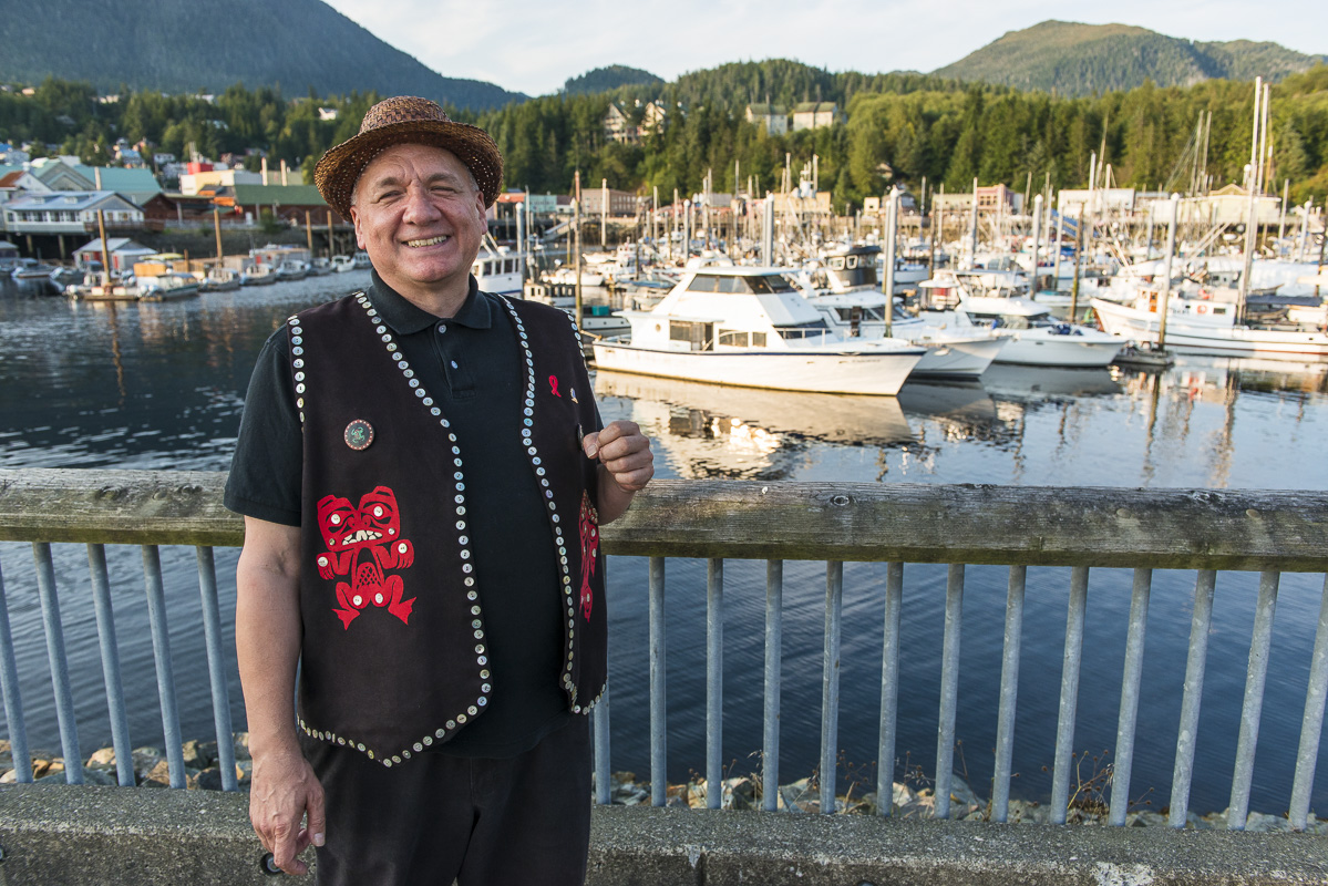
“If you’re in Vancouver this is way out in the middle of nowhere, but way out in the middle of nowhere is our backyard.”
Those are the words of Frederick Otilius Olsen Jr., the tribal president of a traditional Haida village on Prince of Wales Island, Alaska.
When I met him, he had travelled to Ketchikan, Alaska, to meet with officials about the risk posed by the mining boom across the border in British Columbia.
He stood on the boardwalk overlooking Ketchikan’s fishing fleet and waved his hands animatedly while he told me about how his culture — and southern Alaska’s economy — depends on salmon.
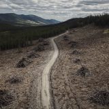
The week before, I’d spent several hours flying in a small fixed-wing plane over B.C.’s mining boom to capture never before seen images of the province’s largest and most remote mines.
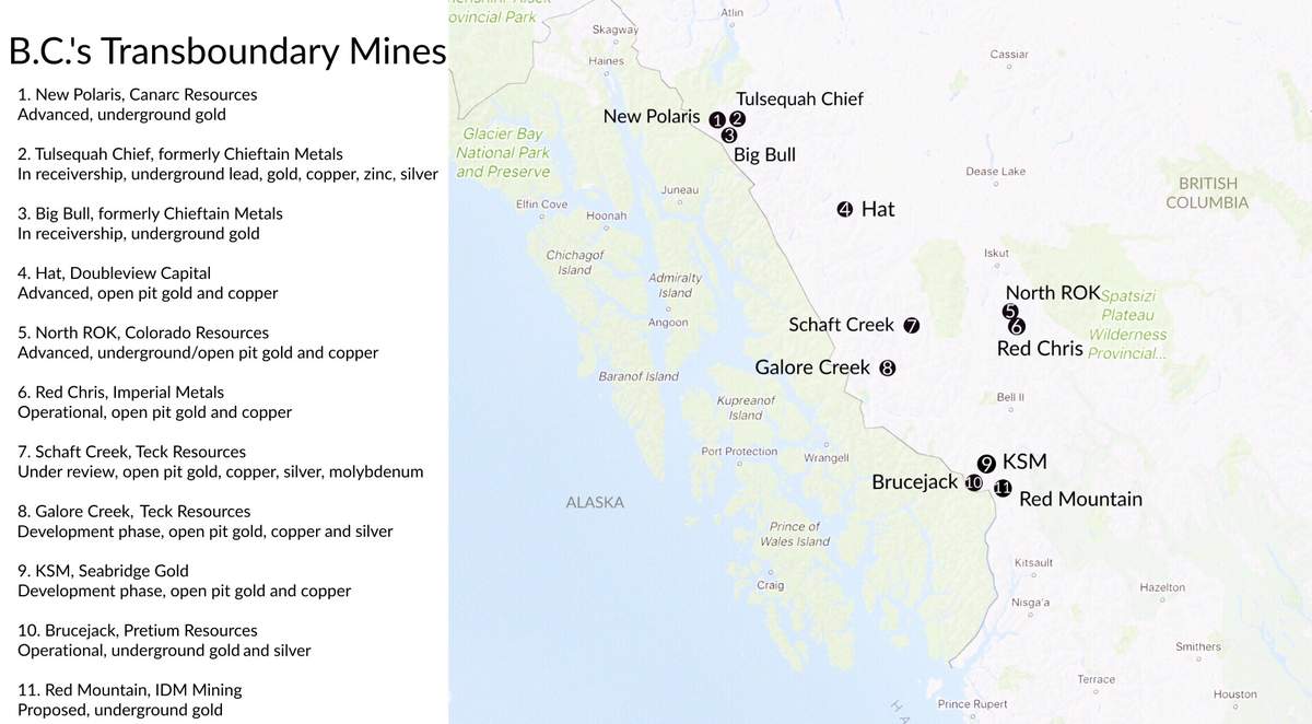
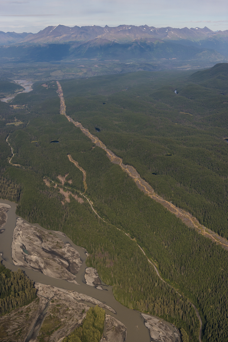
Door removed, I captured hundreds of frames as we passed over the Red Chris copper and gold mine, which began operation in late 2014. Its tailings pond and dam rises impossible and angular out of a soft, sloping valley.
Set within the vast and largely intact headwaters of northwestern B.C.’s greatest wild salmon rivers, the Red Chris mine is just one of 10 mines either in operation, in development or in advanced exploration stages in this region.
It is owned and operated by Imperial Metals, the company responsible for the Mount Polley mine disaster in central B.C. If the name seems familiar, it’s because in 2014, a tailings dam at Mount Polley collapsed, resulting in one of the worst environmental disasters in Canadian history. All told, 24 million cubic metres of contaminated mining waste flooded into a lake — a source of drinking water and salmon-spawning ground that feeds the Fraser River.
A new study from the United Nations Environment Programme notes Canada has had seven known mine tailings spills in the last decade, only one less than China, which tops the list.
“The increasing number and size of tailings dams around the globe magnifies the potential environmental, social and economic cost of catastrophic failure impact and the risks and costs of perpetual management,” says the report.
A view from the sky gives perspective on both the enormity of the mines but also their proximity to Alaskans who, living downstream, fear they may unfairly suffer the consequences of another Mount Polley style accident.
“This is our Amazon right here and they’re not making any more of it,” Olsen Jr. said.
The following photo essay was made possible by 103 readers, who donated more than $10,000 to bring this unprecedented assignment to life.
B.C. and Alaska share some of the world’s most productive salmon rivers. However, the region is also home to some of the largest untapped gold and copper reserves in the world. Gold is mined primarily for use in jewelry, while copper conducts both heat and electricity well, so has many uses, including in electrical equipment such as wiring, motors and solar panels.
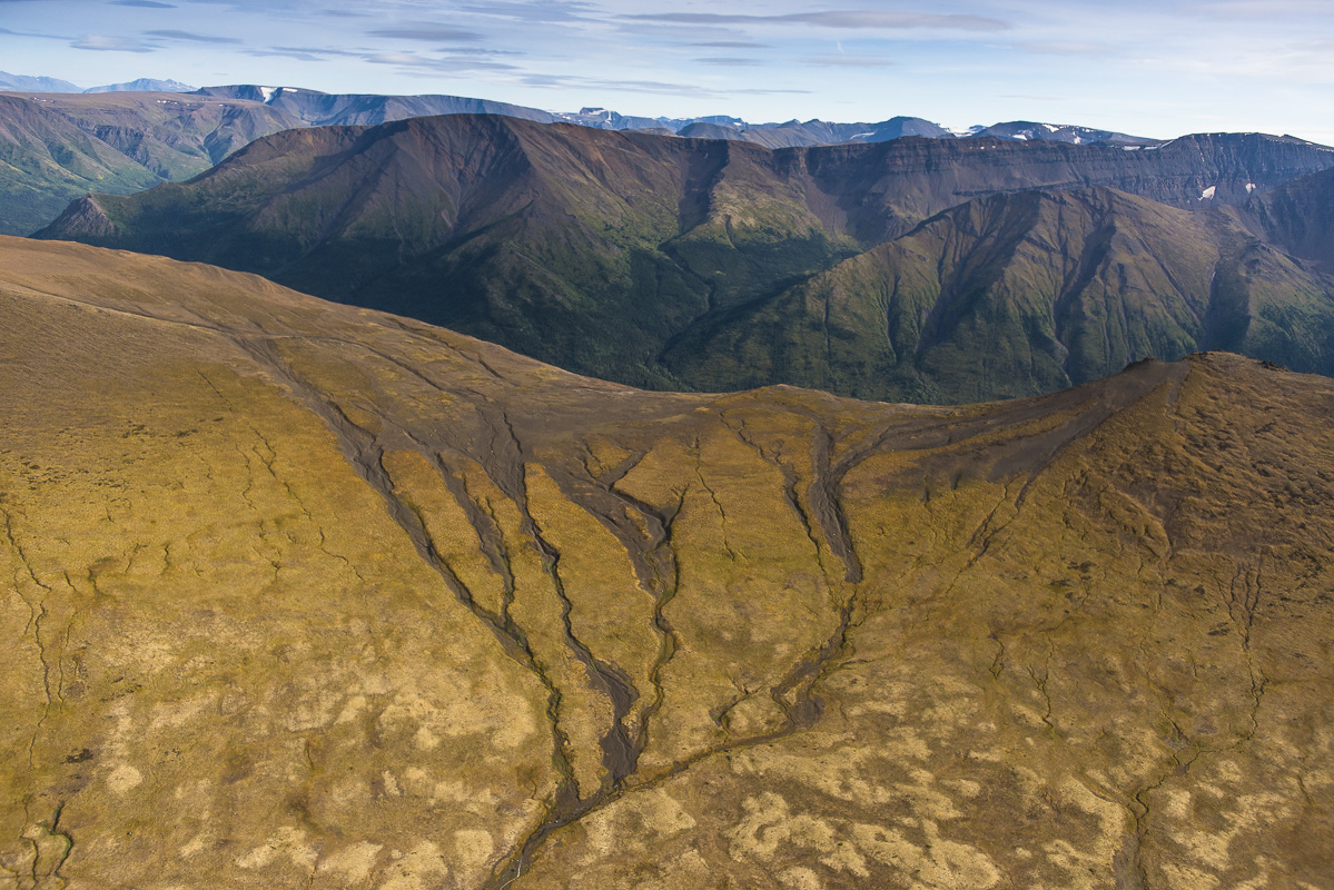
The Todagin Plateau on the edge of Imperial Metals’ Red Chris mine is thought to have the world’s highest density of stone sheep. It is the traditional Tahltan hunting grounds for moose, sheep, goats and caribou.
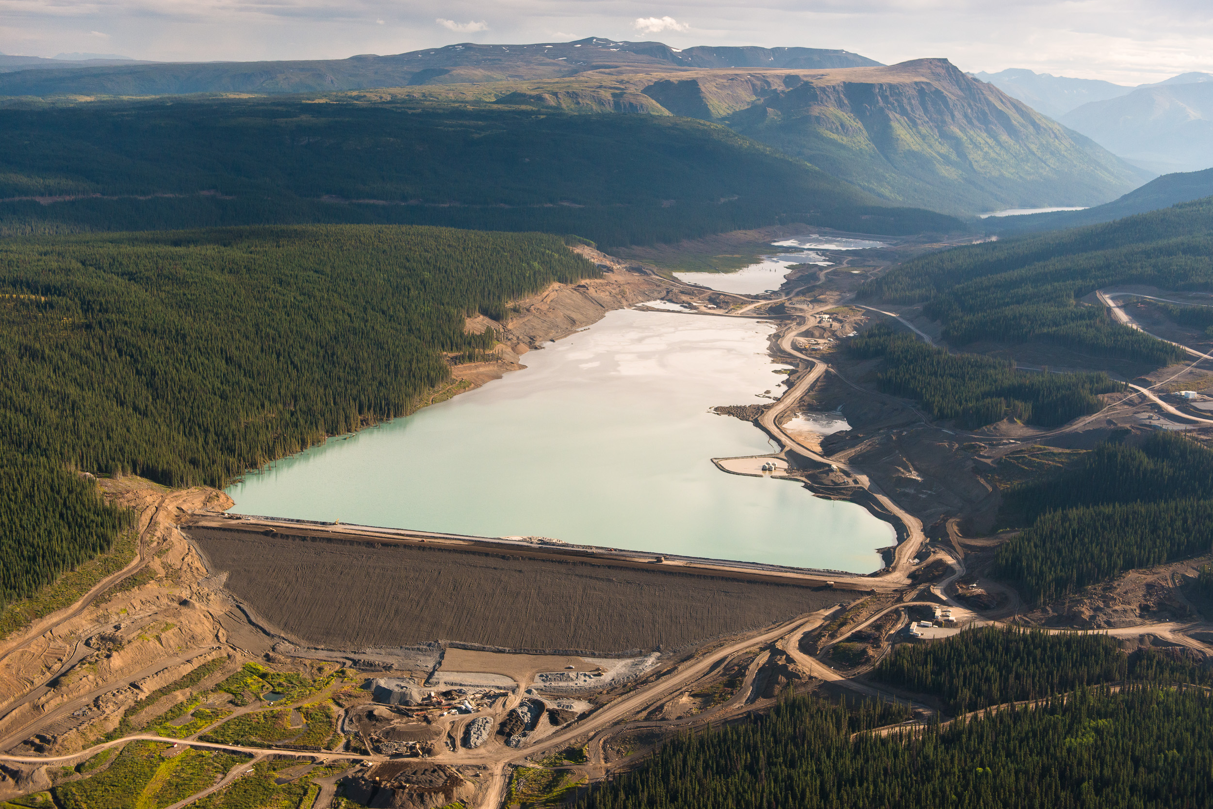
The wall of the Red Chris tailings dam is 105 metres high, about the height of a 35-storey building. Tailings are the byproducts left over from mining and include finely ground rock particles, chemicals and water. The rock particles and other chemicals sometimes undergo chemical reactions during storage that generate additional byproducts, such as acid, that can more easily leach into waterways.
In recent years, B.C. has experienced an explosion in mine growth on the Alaska border. Red Chris and Brucejack mines are now in operation, while KSM and Galore Creek have the required approvals and are in development. Schaft Creek is currently under review and four more mines are in the advanced exploration stages. Unlike Mount Polley, much of the waste in these transboundary projects will be potentially acid generating, making it much more toxic.*
The Red Chris tailings pond is an unlined, earthen centre-line type tailings dam — the same design Imperial Metals used at the ill-fated Mount Polley mine. An independent panel that reviewed the Mount Polley spill predicted two additional tailings dam failures could occur every 10 years in British Columbia if mine waste disposal practices aren’t improved. One of the panel’s key recommendations was for B.C. to move away from allowing liquid tailings ponds. There are currently more than 120 tailings dams across British Columbia.
When the Red Chris gold and copper mine opened in late 2014, it became the first mine of its type to operate in the transboundary region. The Narwhal (formerly DeSmog Canada) requested a tour of the Red Chris mine but was told by an official that Red Chris does not provide “unsolicited tours.” Red Chris is owned by Imperial Metals, the same company responsible for Mount Polley. The largest Imperial Metals shareholder is oilsands billionaire and Calgary Flames co-owner Murray Edwards, who organized a $1-million Calgary fundraising dinner for former B.C. premier Christy Clark’s 2013 re-election campaign.
The Mount Polley mine had a total tailings storage volume of 44 million cubic metres. B.C.’s massive transboundary mines require much higher volumes of waste storage. The tailings facility at Red Chris can store up to 305 million cubic metres of mine waste. Galore Creek will have a storage volume of 424 million cubic metres, Shaft Creek of 588 million cubic metres and KSM a staggering 1,213 million cubic metres.
Frederick Otilius Olsen Jr. is the Haida Tribal President of the Organized Village of Kasaan and chair of the Southeast Alaska Indigenous Transboundary Commission. “We have been trying for years to get the B.C. government to adequately address our interests and concerns, but other than nice words and vague promises, we seem to be getting nowhere,” Olsen Jr. said. “It takes a little wisdom, but sometimes to do something different, you have to do something you never did.”
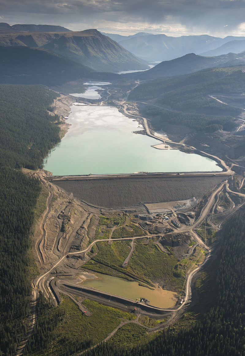
The tailings pond at the Red Chris mine has a capacity of 305 million cubic metres — seven times more than the Mount Polley tailings dam, which collapsed three years ago. In the case of Mount Polley, British Columbian taxpayers ended up on the hook for $40 million of cleanup costs. No fines were levied and no charges have been laid against Mount Polley.
The Red Chris mine has an expected daily throughput of 30,000 tonnes of ore for the 25-year lifespan of the project. The Canadian government did not conduct a comprehensive assessment of the environmental impacts of the project, a process that would have opened the mine proposal to public input.
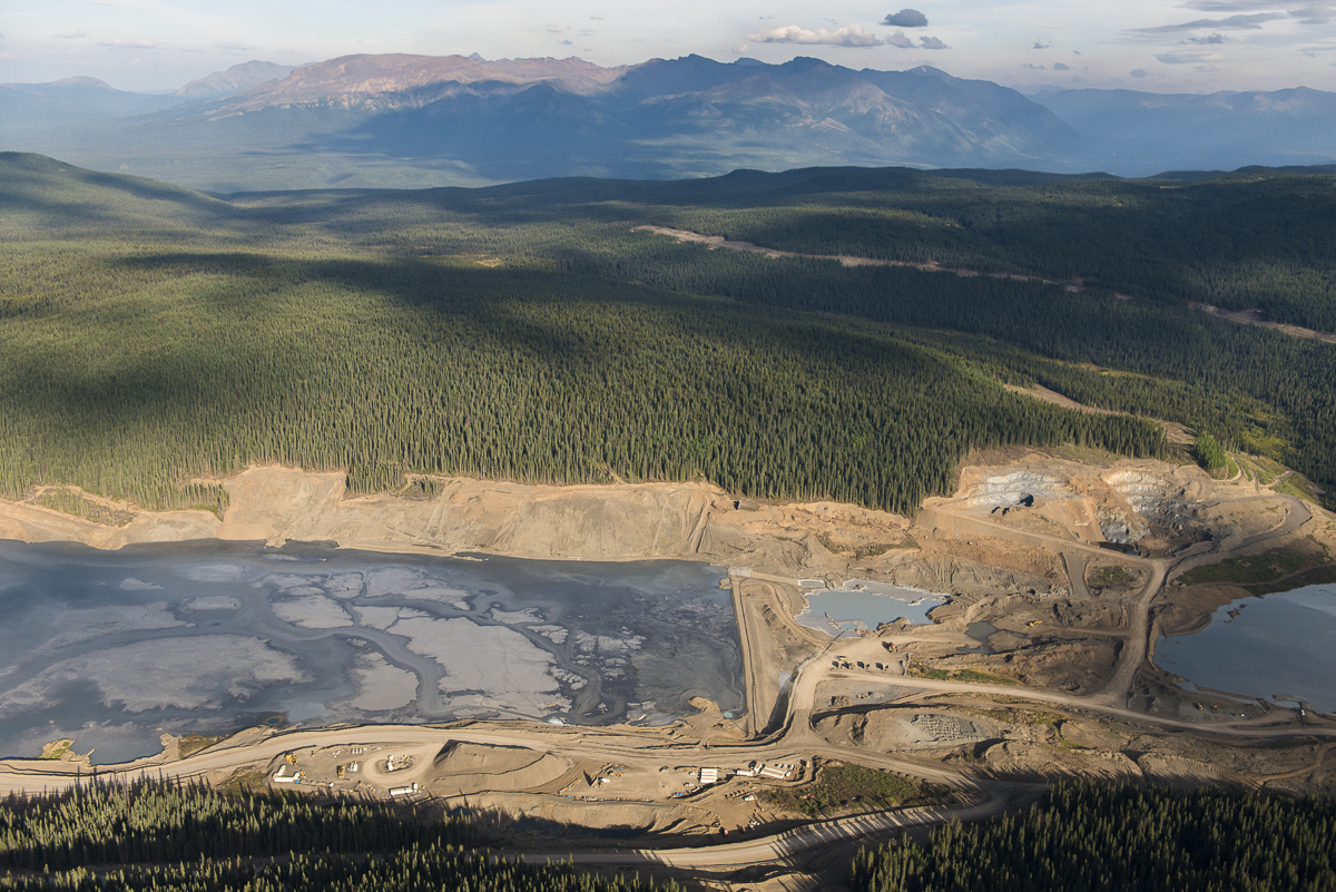
This is the view northeast across Todagin Creek, wetlands and Tatogga Lake with the road to Red Chris mine on the right. If any tailings escaped from the south dam of the Red Chris tailings pond, this is the point where the tailings would enter the Iskut river system.**
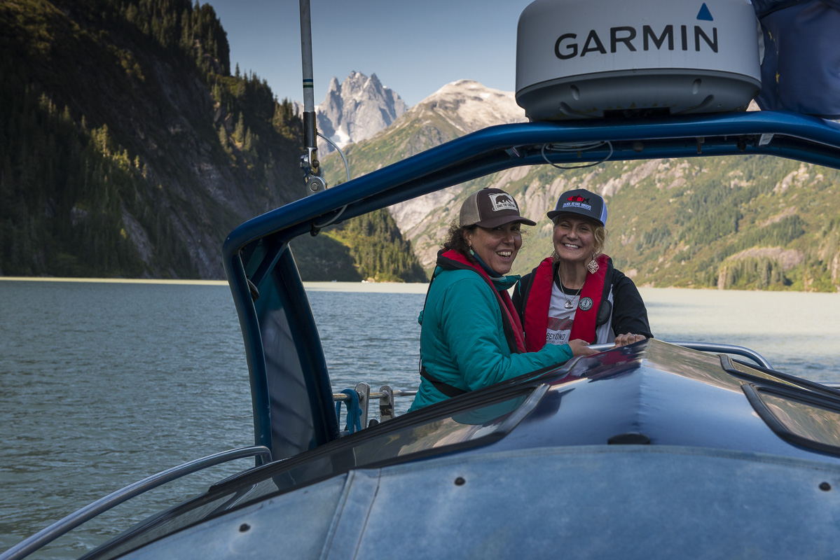
Melanie Brown, left, is a fourth generation commercial fisherman in Bristol Bay, Alaska. Heather Hardcastle, right, is director of the conservation organization Salmon Beyond Borders and a commercial fisherman in Juneau, Alaska. “We share these waters and we share these fish. There has to be an international solution,” Hardcastle said.
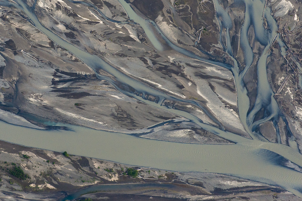
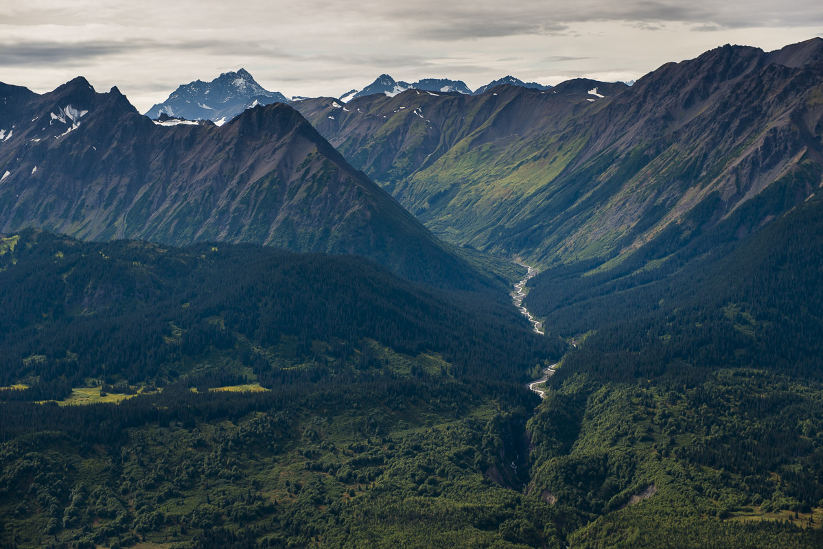
Massive braiding and bars from glacial sediment inputs on the Iskut river. Alluvial flood planes such as this are highly vulnerable to disruption.
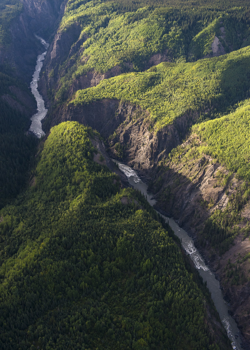
A view of what is called the “Grand Canyon” of the Stikine River. Considered one of the last truly wild rivers in British Columbia, its 600-kilometre length encompasses mountain peaks and glaciers and supports some of the continent’s richest salmon habitat and wildlife populations.
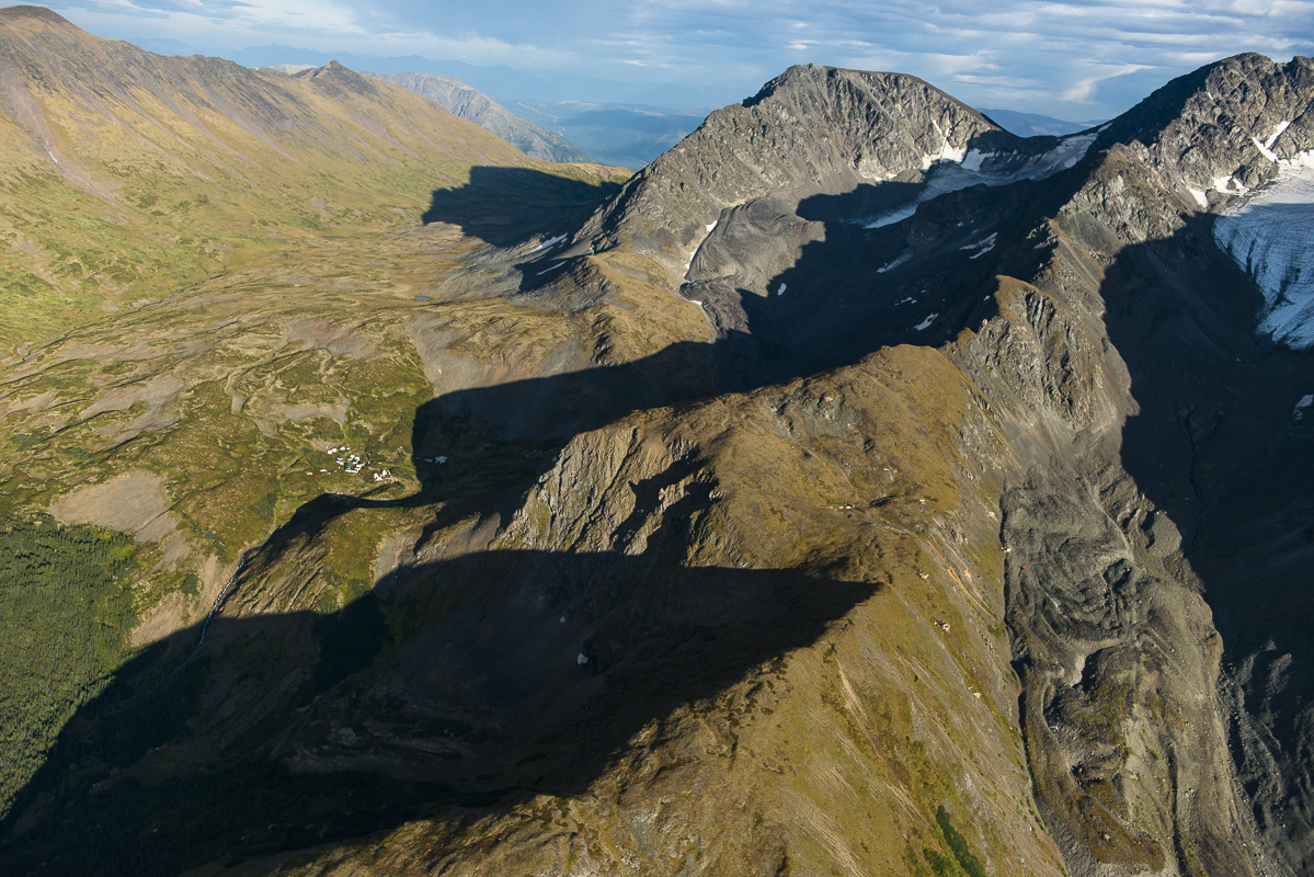
If you look closely at this photo, you’ll see the drill pads perched on the mountainside (low centre right) and camp (centre left) of the Spectrum GJ gold-copper project, located 30 kilometres west of the Red Chris mine. It is just one of many examples of the lengths mining companies are going to open new mines in the isolated region.
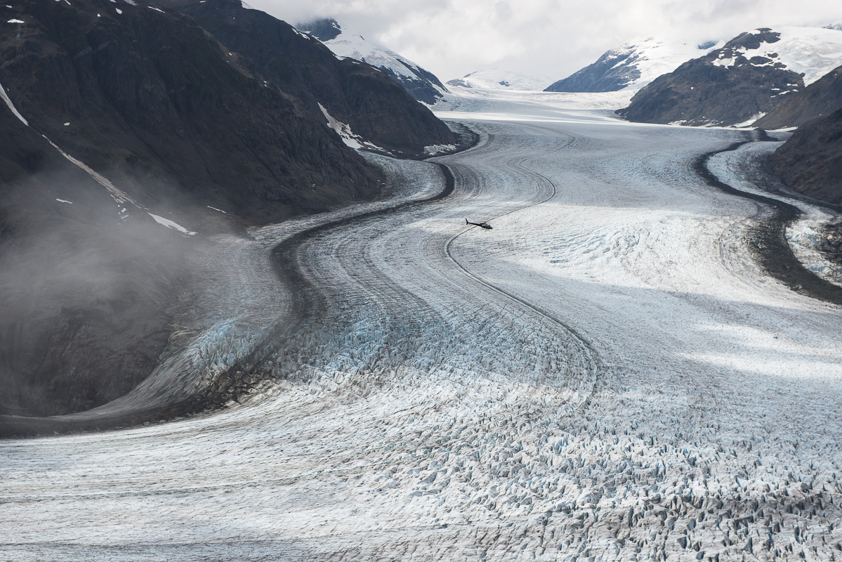
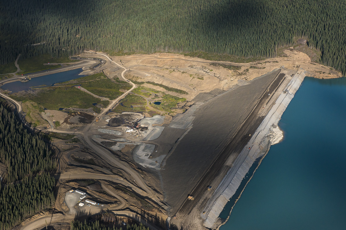
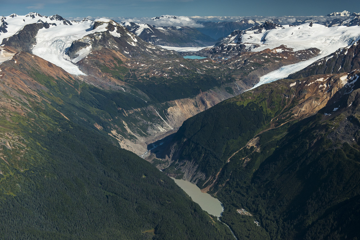
A helicopter nearly disappears in the expanse of this glacier near the Brucejack gold mine. B.C.’s glaciers lose an estimated 22 billion cubic metres of water every year, feeding the province’s rich river systems.
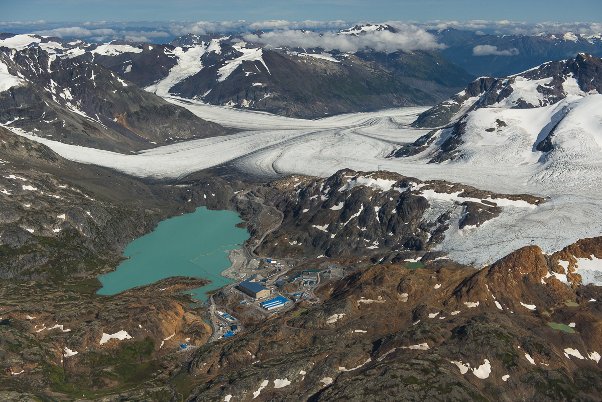
A view east across Brucejack mine site and Brucejack Lake. Brucejack is an underground gold and silver mine. It will create 300 permanent jobs during its 22-year life. Owner Pretium has taken steps to minimize tailings risks by backfilling about half its mine waste in a paste mixed with cement in the underground mine. The other half will be stored in Brucejack Lake.
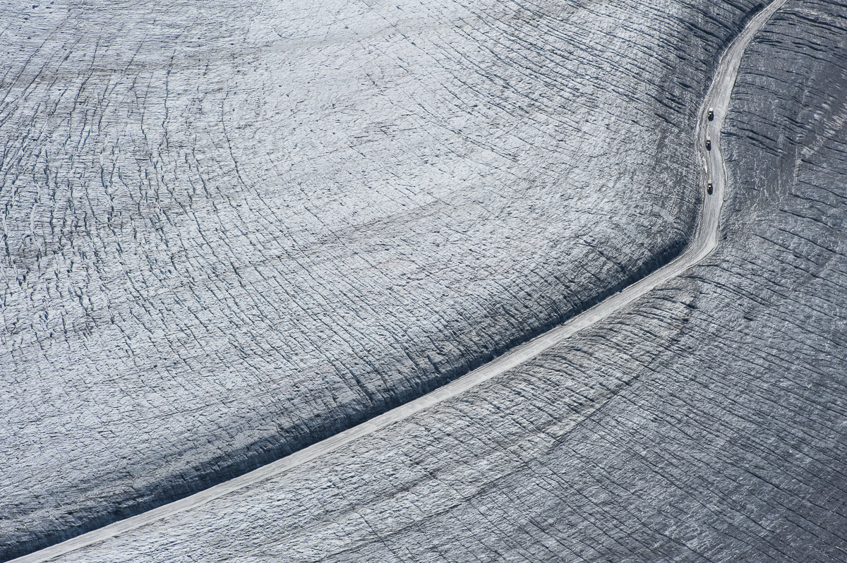
The Brucejack mine required the construction of an 11-kilometre glacial highway up the centreline of Knipple Glacier. The glacier retreated 300 metres between 2000 and 2011.
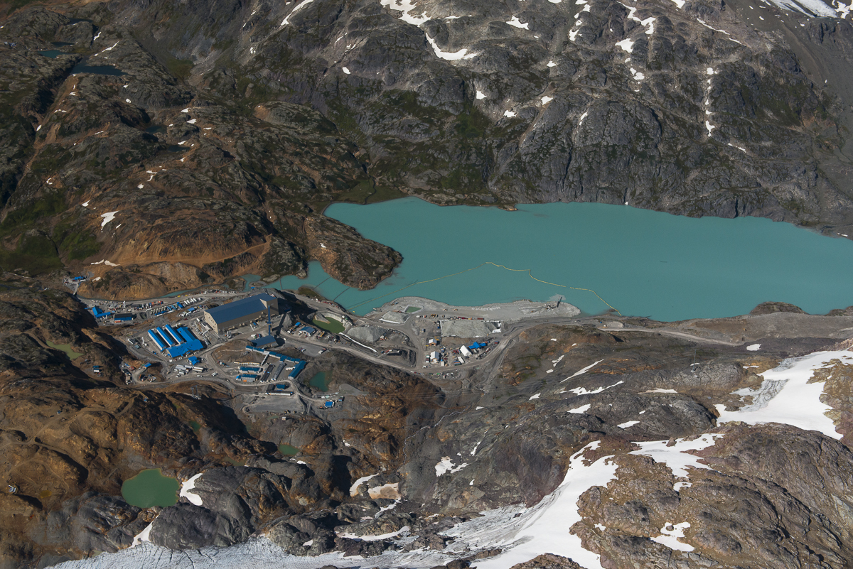
The Brucejack mine encampment. Potentially acid generating waste rock from the mine is stored underwater in Brucejack lake.
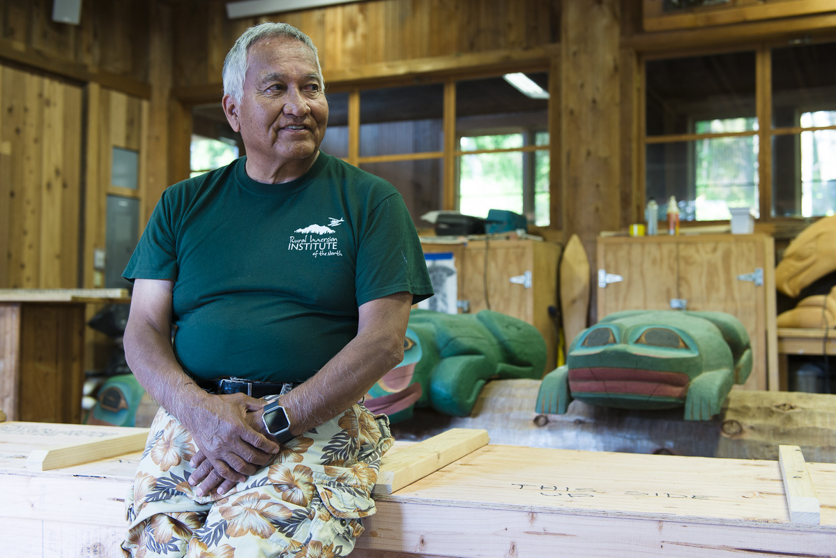
Joe Williams is a member of the Tlingit and former mayor of Ketchikan Borough, Alaska. He is also the owner and guide of Where the Eagle Walks, a walking tour business. Williams worries mining in the region has affected the health of oolichan populations. “The Department of Fish and Game say we can’t fish it anymore, even when it is out in the bay. It’s a sad thing. Now none of my kids know how to make oolichan oil and we can’t get it for me to teach them.”
Red Chris Mine went ahead after Imperial Metals’ largest shareholder Murray Edwards helped arrange $150 million in loans and crown corporation BC Hydro paid most of the costs for the $746-million Northwest Transmission Line into the region.
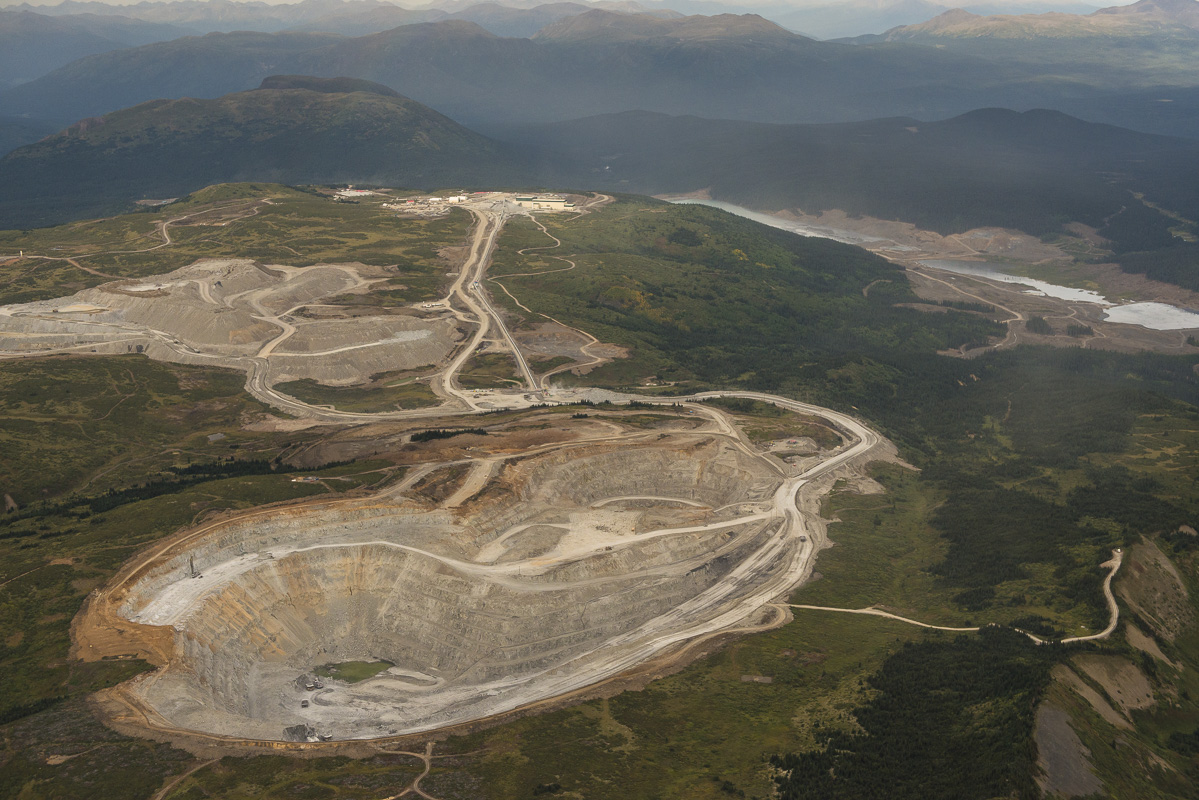
The proposed KSM mine site is in the foreground with Brucejack gold mine in the background. KSM sits atop one of the world’s largest undeveloped gold reserves. Once built, it will become one of the largest gold and copper mine in North America, with three open pits and two underground mines. The project initially entailed mining under an active glacier, but that glacier has now retreated. The project will require the construction of two 23-kilometre-long tunnels to deposit mine waste into a tailings impoundment. At 239 metres tall, the tailings dam wall for KSM will be higher than the Shangri-La, the tallest building in Vancouver and the tailings pond will hold 27 times more waste than was held in the Mount Polley tailings dam.***
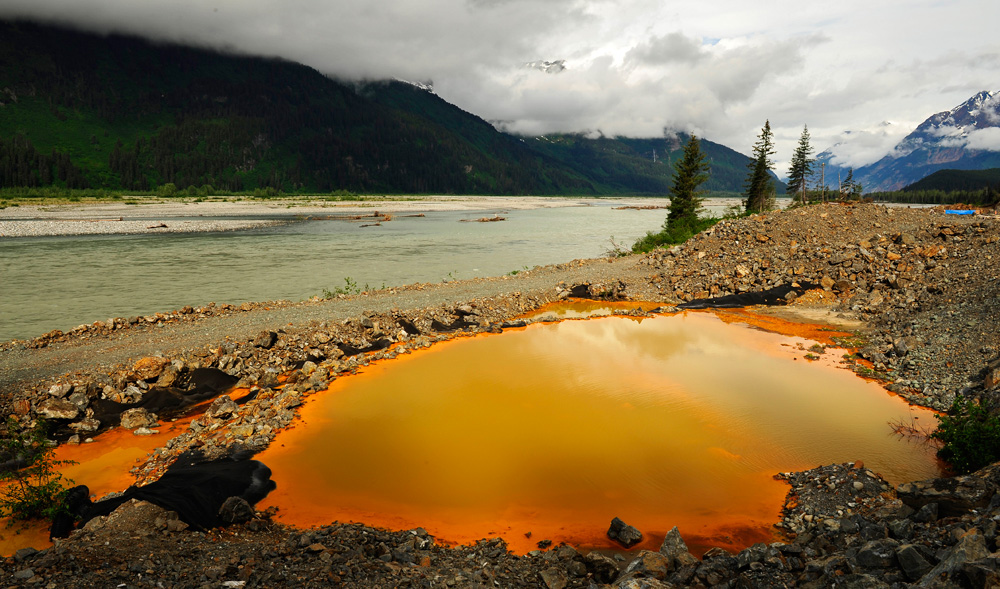
The Tulsequah Chief mine, a zinc and copper mine close to the Alaska border, has been leaking acid mine drainage into the Tulsequah River since it was first shut down in 1957. Attempts to re-open the mine have failed, along with several promises to clean up the site.
Other jurisdictions, such as Alaska and Quebec, demand large financial securities, paid up front to ensure companies are held responsible for any damage.
“If we were to put the bar higher and require payment of financial securities ahead of permitting and ahead of mining, this would be one one way to get rid of the mines that would be marginal and you would end up with the mines that are safest,” Ugo LaPointe of MiningWatch Canada told The Narwhal.
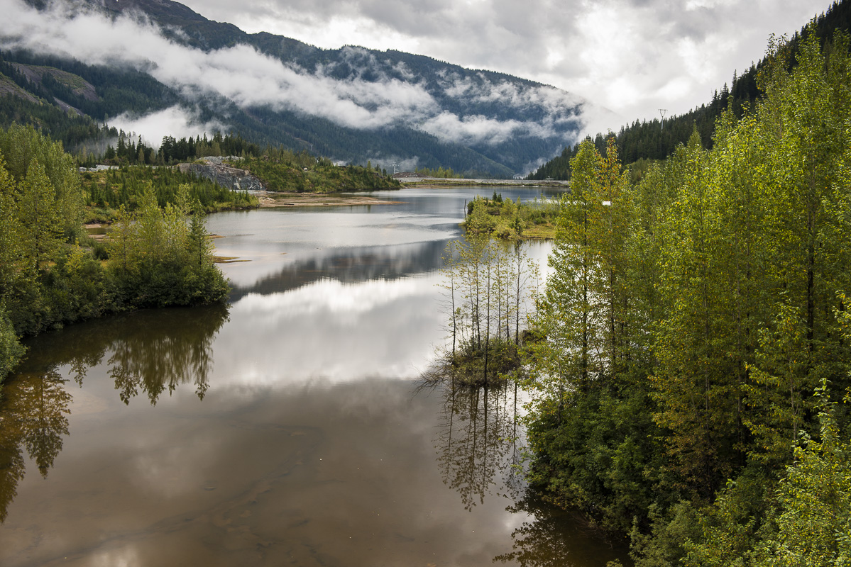
Although most of the mines in this region have a life expectancy of 20 to 50 years, their toxic legacy continues far beyond. This contaminated tailings pond of the Premier gold mine in the Salmon Valley is one example. Originally built in 1910, it operated steadily for 50 years and sporadically for a few years after that. It opened again in 1989 to close once again in 1996. This toxic tailings pound is currently being upgraded to today’s standards so it can be reopened in the future.
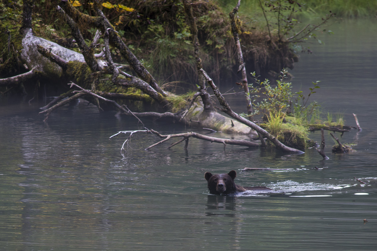
A grizzly bear fishes for salmon in Fish Creek, Alaska, just downstream of the Premier gold mine.
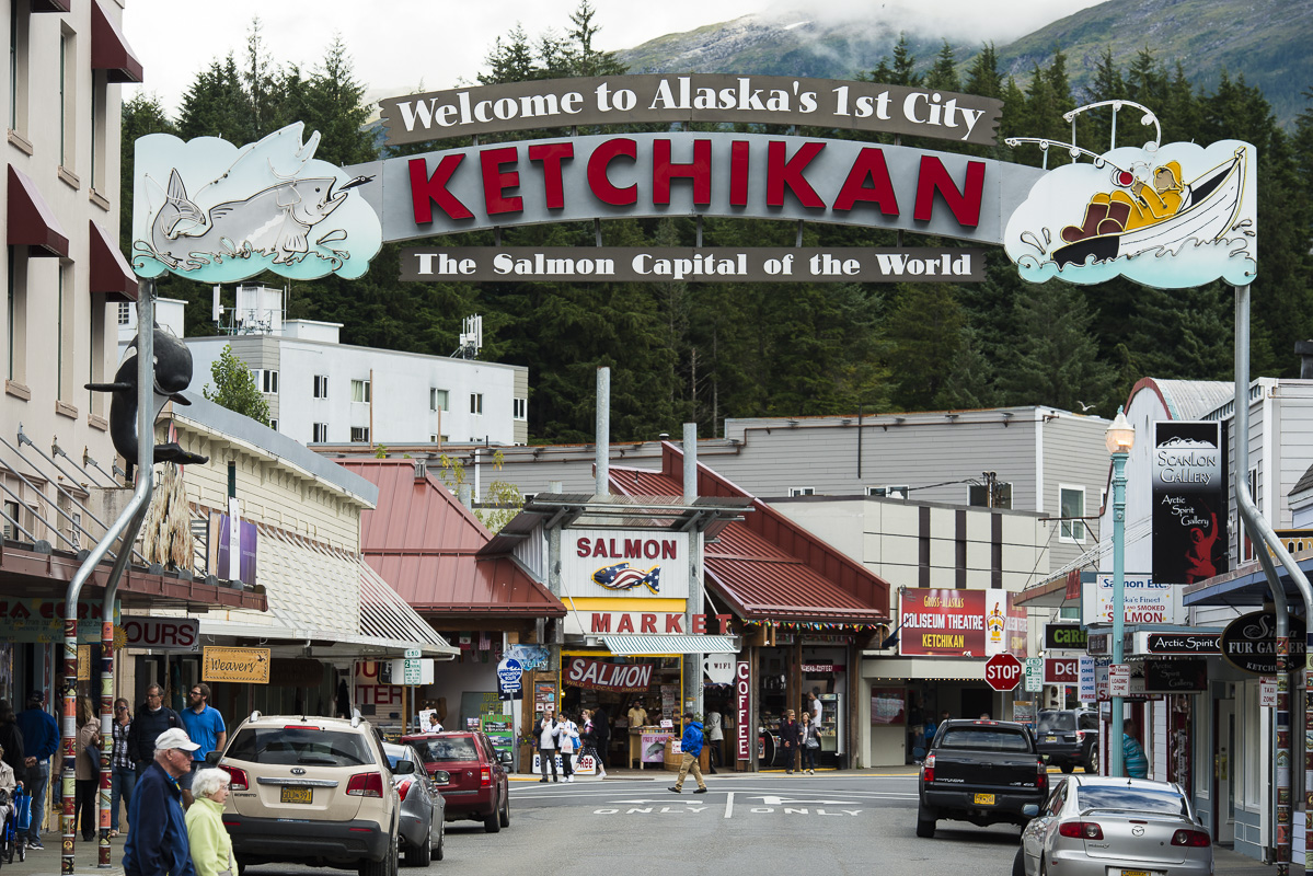
Ketchikan, Alaska, just across the border from British Columbia has dubbed itself the “salmon capital of the world.” Ketchikan’s economy is based upon government services, tourism and commercial fishing.
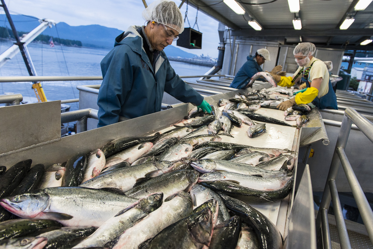
The last catch of the season is offloaded and processed at Alaska General Seafoods in Ketchikan. Alaska’s fishing industry employs nearly 60,000 workers, of which nearly half are fishermen.
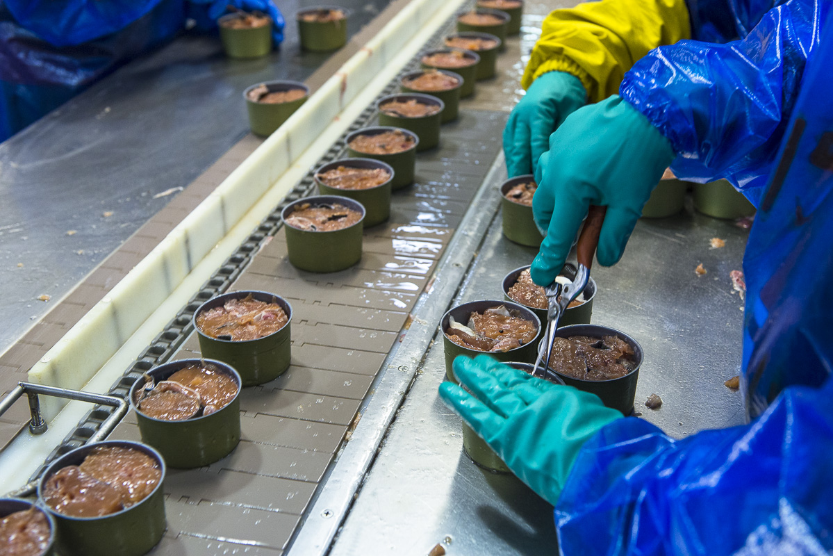
Salmon canning at Alaska General Seafoods processing plant in Ketchikan, Alaska.
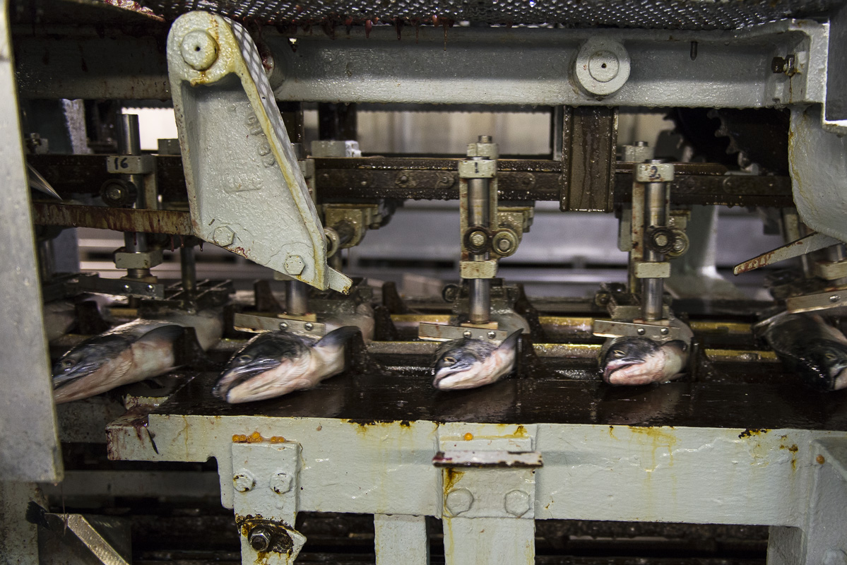
The initial mechanical processing and canning of salmon at Alaska General Seafoods in Ketchikan, Alaska.
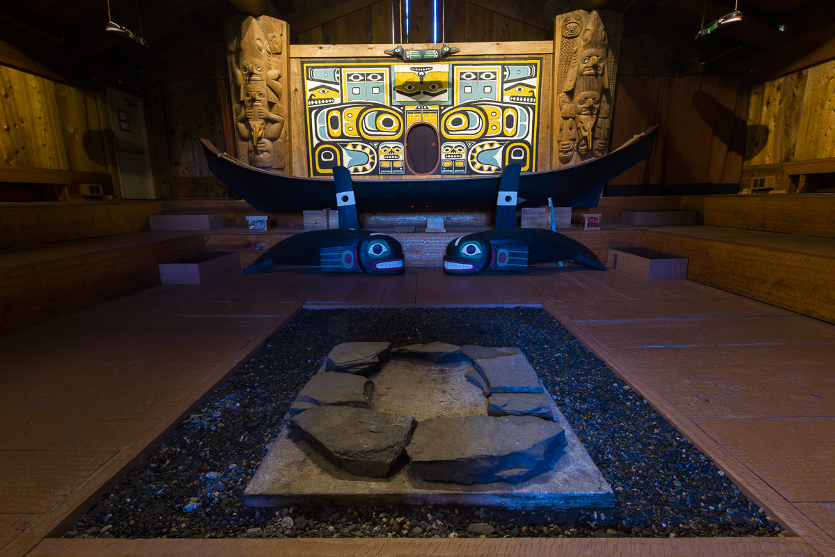
Chief Shakes Tribal House in Wrangell, Alaska. Coastal indigenous cultures are closely tied to salmon and have flourished here for more than 10,000 years.
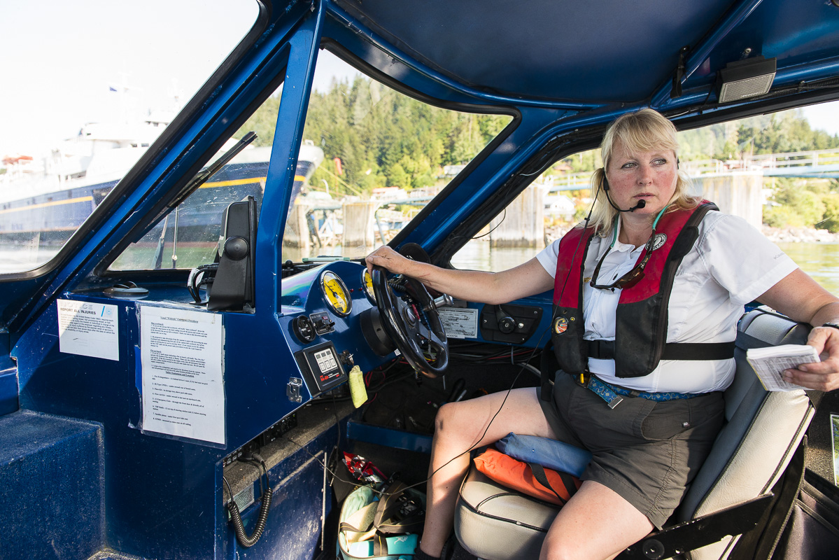
Brenda Schwartz-Yeager is a fourth generation Wrangell-based Alaskan. As the owner and operator of Alaska Charters and Adventures, Schwartz-Yeager is a confident navigator of the ever-changing Stikine River. “What makes the Stikine so special and unique is its vast wildness,” she said. “We just don’t have many places of this size, and scope, and wildness left on the earth.”
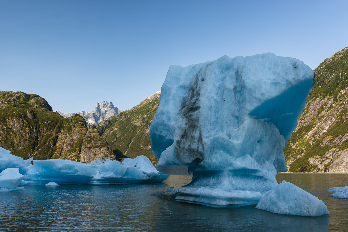
Icebergs and Castle Mountain as seen from Shakes Lake, which feeds the Stikine River in Alaska. Traveling the lower Stikine in 1879, American conservationist John Muir called it “a Yosemite 100 miles long.”
— With files and additional reporting from Emma Gilchrist and Carol Linnitt
This photo essay was funded by The Narwhal readers like you. Want more journalism like this? Become a member today.
Updated on Oct. 30, 2017, at 7:05 p.m. PST. The transboundary map in this article was updated to reflect the fact that the Galore Creek mine is in the development stage, rather than operational as previously stated.
Updated on Nov. 2, 2017, at 10 a.m. PST to correct the lake in the photo to Tattoga Lake, not Todagin Lake. Thank you to the reader with the sharp eye who pointed this out to us.
Updated on Oct. 31, 2017, at 10:45 a.m. PST. The article was updated to reflect the fact that the KSM mine will no longer require mining under an active glacier, as that glacier has now retreated from the proposed pit area. The description of of KSM has also been corrected to refer to the project as one of the largest undeveloped gold and copper mines in North America, rather than the largest undeveloped open-pit gold and copper mine in North America.