Site C Dam Contruction aerial.

In Photos: The Destruction of the Peace River Valley for the Site C Dam

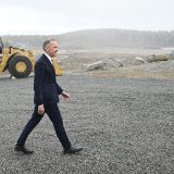
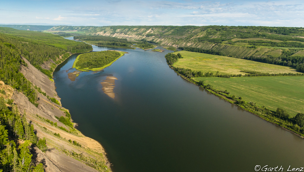
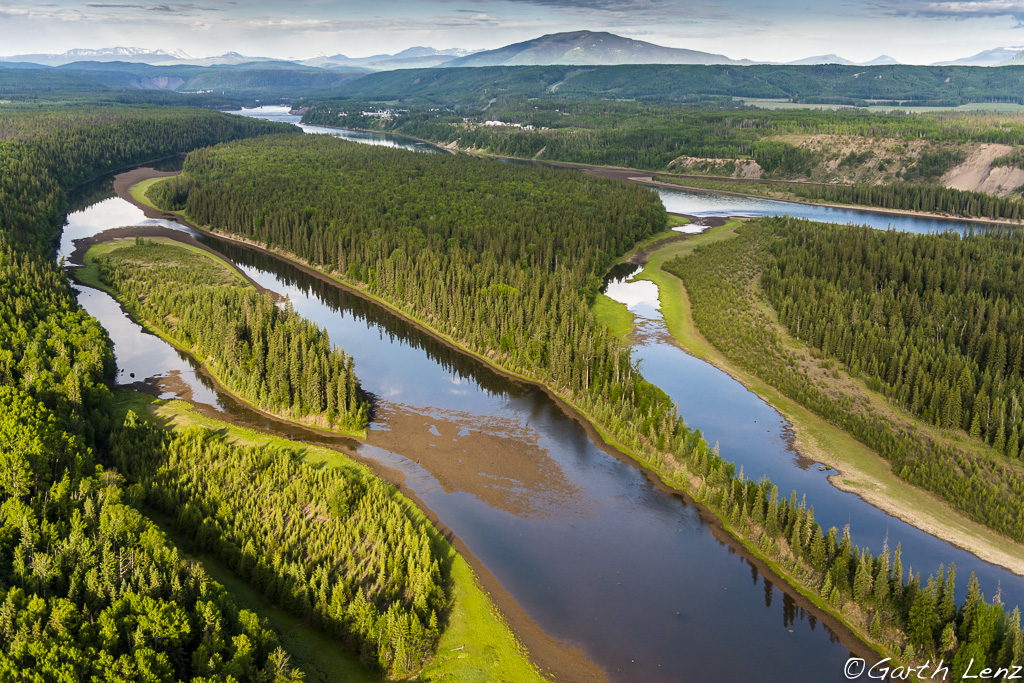
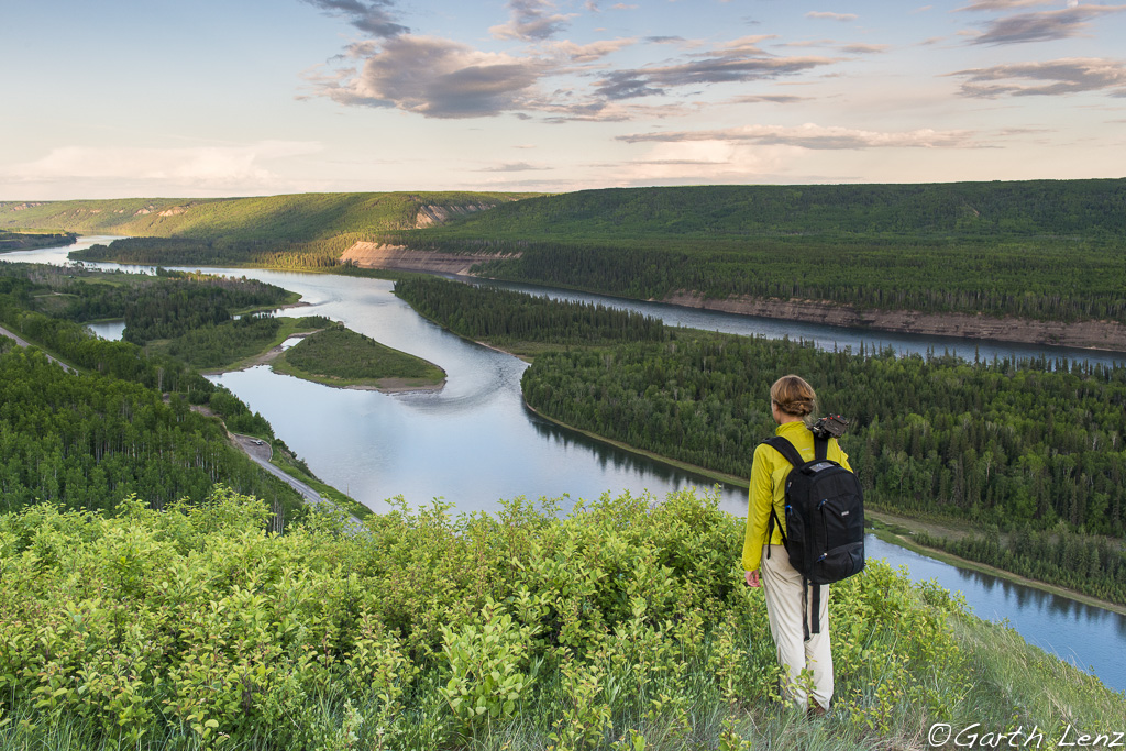
It was a little over a year since I had been in the Peace River Valley. Back in June 2014, I visited the region to take photographs and to produce a film on the land, farms and wildlife that would be forever altered, or completely destroyed, to make way for the biggest and most expensive mega-project in the province’s history.

At that time it all seemed so distant and abstract. Would we really flood more than 100 kilometres of some the richest agricultural land in the north and destroy farms that date back to the first non-native settlers in the region? Were we really willing to clearcut and flood key habitat for a wide range of wildlife? Were we really willing to turn our back on the rights of First Nations who have called this valley home for perhaps 10,000 years? These questions were answered for me in the most brutal fashion when I returned this past November.

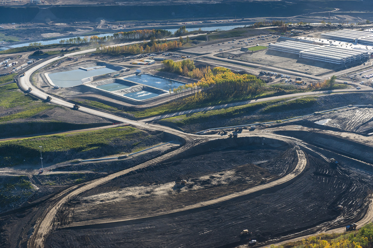
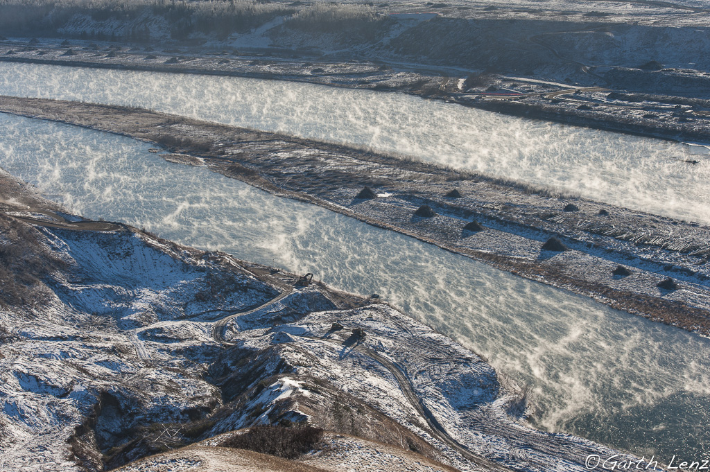
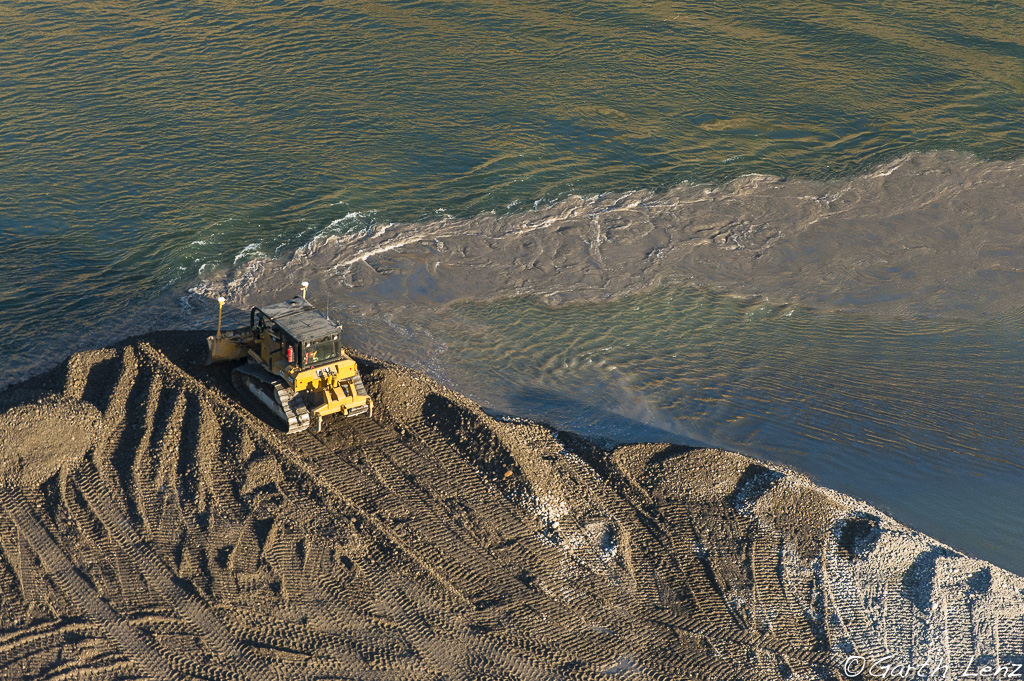
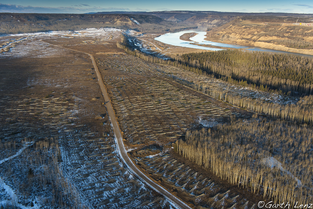
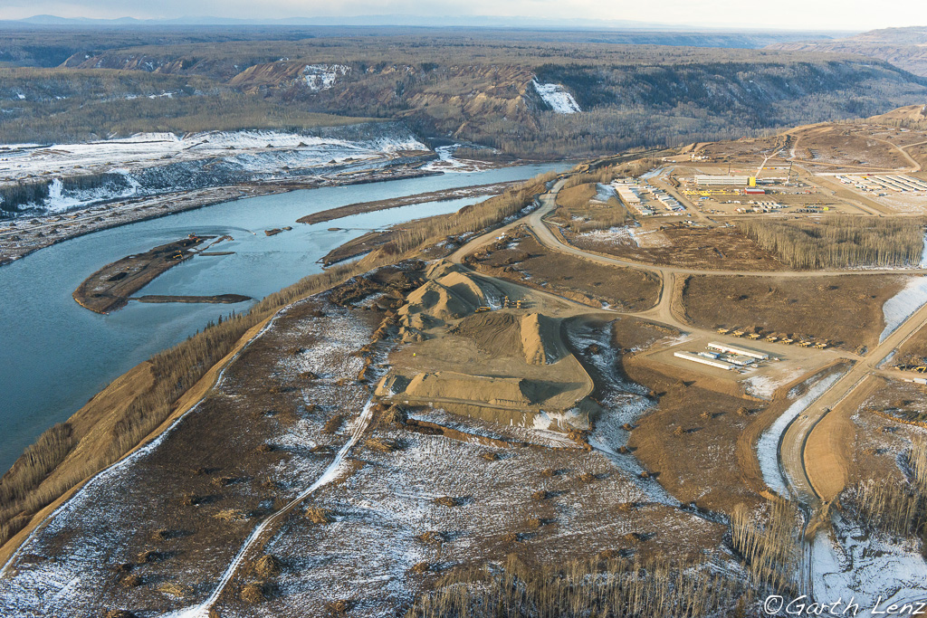
In just a few short months, the forests, islands and grazing lands of the proposed dam site were completely eradicated. Beautiful forests with massive cottonwood trees I had walked through had been reduced to clearcuts and slash piles. Machines dredged the river as bulldozers pushed debris and soil into it. When I took to the air, the true scale of the devastation could be seen clearly and extended far beyond the banks of the river.

Caterpillar dredging along an island in the Peace River. Site C construction site, June 2015. The construction site will include the dam, river diversion, a temporary bridge, a quarry and a large “man camp.”
The view of the construction zone from the north banks of the Peace River.
Bulldozer plowing gravel and dirt from a Peace River island into the river. Site C construction site, June 2015.
Wider view of the logging and construction operations along the south shore of the Peace River looking upstream. Site C contruction site, November 2015. Another plateau of clearcutting rises behind this.
The view from the south side of the construction zone of the Site C dam project. November 2015. The clearcut islands in the river as well as the dredging and other mid river operations are visible.
Logging activity on the south shore of the Peace River. November 2015.
View of the Site C construction site from the north shore of the Peace. A large “man camp” and other facilities are being developed to house the workers for the project. November 2015.

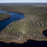
When I returned home, I sifted though my images from 2014 to find comparative views from before construction began. It was a more challenging task than I had assumed as virtually all points of reference had been completely obliterated.

When I managed to find “before” images, the difference was stark and sobering. The fact that this had all happened in just a few months was both awe inspiring and horrifying. Then the reality sunk in that this destruction that had occurred in just a few months and over a few kilometers is to be extended over a decade and will encompass over 100 kilometres of this remarkable river. I imagined what this process would look like as those many kilometers of forests, islands, wildlife habitat and farms I have photographed would be transformed to the same kinds of scenes.

Young black bear on the Ardill family ranch. This ranch, which was founded during the early days of non-native settlement in the area, will be entirely flooded. Many bear dens are found throughout the flood zone and on the islands in the Peace.
Deer in the flood zone. June 2014. As the east-west valley in the Alberta-B.C. Rockies, it is a major migratory route and critical habitat for a wide range of wildlife.
Red wing Blackbird. June 2014.
Flood zone. Low lying farms will be flooded. The forests on the islands will all be clearcut and flooded. June 2014.
Flood zone looking upstream towards Hudson’s Hope. All the islands, forests and low-lying areas will be flooded. The islands in the Peace River are exceptionally critical habitat for both resident and migratory wildlife. June 2014.
Close to midway along the 100+ kilometer floodzone. Photographed from the north shore of the Peace River looking downstream (east). All the lower lying areas in the photo would be flooded, forming the reservoir. June 2014.

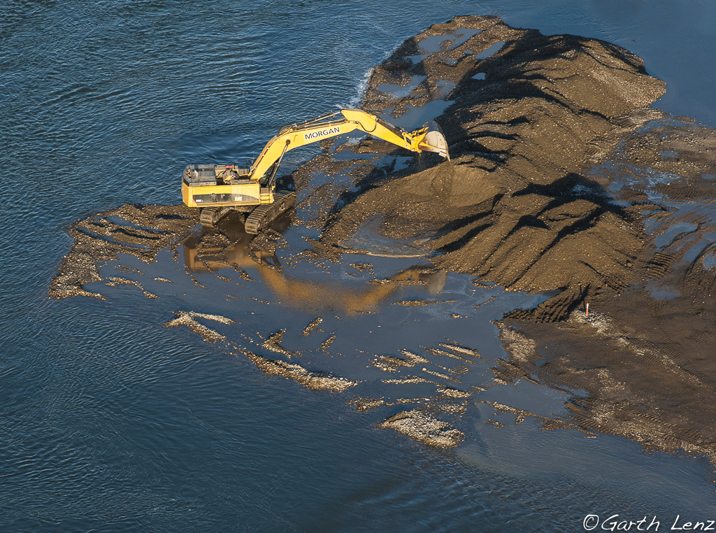
One day while photographing one of the clearcut islands in the middle of the river, I was visited by representatives of one of the Alberta-based contractors for the project. Despite the fact there were no machines, other people or any industrial activity on the island, I was told I would have to leave. When I asked why, I was told, “This is a hazardous zone.” I couldn’t agree more.

Editor’s Note: First Nations are still challenging the Site C dam in court, as well as meeting with the new federal government about pressing pause on the project. Learn more in our series on the Site C dam.

We’ve got big plans for 2024
Seeking out climate solutions, big and small. Investigating the influence of oil and gas lobbyists. Holding leaders accountable for protecting the natural world.

The Narwhal’s reporting team is busy unearthing important environmental stories you won’t read about anywhere else in Canada. And we’ll publish it all without corporate backers, ads or a paywall.

How? Because of the support of a tiny fraction of readers like you who make our independent, investigative journalism free for all to read.

Will you join more than 6,000 members helping us pull off critical reporting this year?
We’ve got big plans for 2024
Seeking out climate solutions, big and small. Investigating the influence of oil and gas lobbyists. Holding leaders accountable for protecting the natural world.

The Narwhal’s reporting team is busy unearthing important environmental stories you won’t read about anywhere else in Canada. And we’ll publish it all without corporate backers, ads or a paywall.

How? Because of the support of a tiny fraction of readers like you who make our independent, investigative journalism free for all to read.

Will you join more than 6,000 members helping us pull off critical reporting this year?

Thousands of members make The Narwhal’s independent journalism possible. Will you help power our work in 2024?
Will you help power our journalism in 2024?
… which means our newsletter has become the most important way we connect with Narwhal readers like you. Will you join the nearly 90,000 subscribers getting a weekly dose of in-depth climate reporting?
A line chart in green font colour with the title "Our Facebook traffic has cratered." Chart shows about 750,000 users via Facebook in 2019, 1.2M users in 2020, 500,000 users in 2021, 250,000 users in 2022, 100,000 users in 2023.
Overlay Image