


The oil and gas industry in Alberta has started to use remote sensing in order to certify old well sites are cleaned up.
The Alberta Energy Regulator says it does not have a tally on how many reclamation certificates have been issued for sites where remote sensing was used, but confirms Imperial Oil received the first two such certificates in 2021.
On its website, Imperial Oil says it “received the first reclamation certificates ever issued for reclamation assessment activities completed using remote sensing technology …. without setting foot on the ground.”
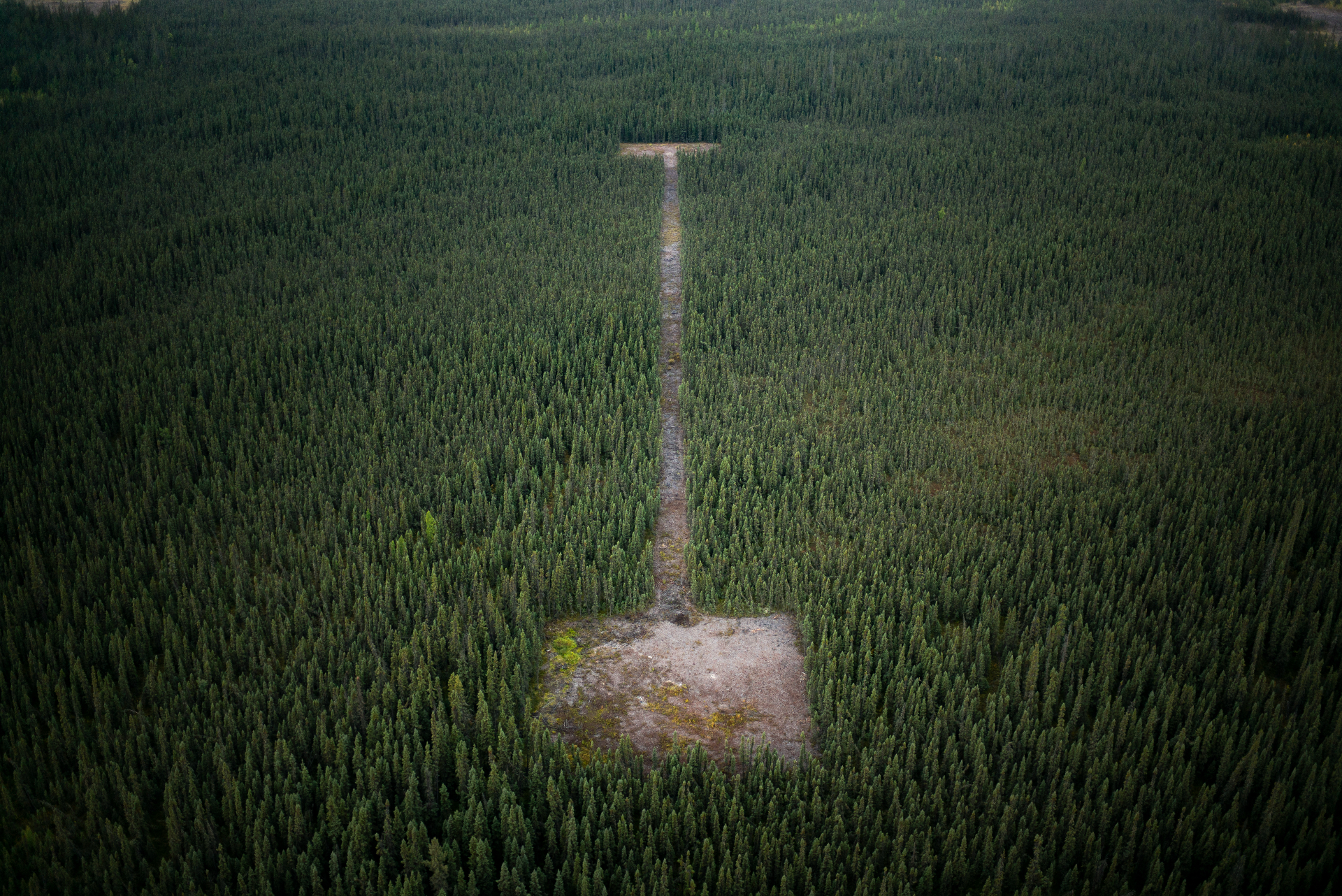
The process involves the use of satellite imagery and LiDAR — essentially laser mapping — mounted to aircraft or drones in order to assess plant cover, growth and health, instead of relying on observation from helicopter flyovers or in-person visits. Limited on-the-ground assessments must be used to verify results.
It’s a money saver for companies operating in remote areas such as Imperial’s leases near Cold Lake, Alta., where the first certificate was issued.
“The real benefit of remote sensing is that you can look at large areas quite easily,” Laura Chasmer, an associate professor of geography at the University of Lethbridge who studies land disturbance and works with remote sensing, says.
“But certainly, you can’t measure everything.”
Imperial Oil cites less disturbance, lower risks and lower costs
The Alberta Energy Regulator issues reclamation certificates to companies that apply for them. For the vast majority, no inspection by the regulator is necessary — just the required paperwork, signed off on by a certified practitioner. Most applications are approved by the regulator automatically.
Last year, the regulator received 2,296 applications for reclamation certificates, down from 2,623 the year before.
Remote sites in Alberta, including the oilsands exploration wells reclaimed by Imperial, require “either an aerial and/or ground assessment with recorded data to qualify for reclamation certification for the program,” according to provincial regulations.
Reclamation does not mean the land will go back to how it was before the exploration activities, but rather that it can “support various land uses” that are similar to what it could do prior to disturbance.
Those rules have not changed.
Remote sensing is meant to replace the need for helicopter flyovers that involve human observation and photographs to survey the land.
Imperial Oil received two reclamation certificates for two oilsands exploration projects that included 32 well sites in total.
The Calgary-based Canadian affiliate of Exxon declined an interview request, but spokesperson Lisa Schmidt said the company relied on LiDAR, satellite imagery and “advanced algorithms to identify plant species, estimate tree heights, and evaluate the landscape.”
The technology allowed the company to assess multiple remote sites at once, she said.
“By reducing or eliminating the need for helicopter fly-overs or mobilizing people to site we have been able to reduce safety risk and inspection time.”
Schmidt did say, however, that the remote sensing data was validated by ground assessments on a portion of the area.
The Alberta Energy Regulator says ground assessments take place on a “portion of the sites.”
The regulations stipulate that 10 per cent of all aerial assessed sites require on-the-ground verification.
The regulator said the only risk it was aware of with relying on remote sensing for assessment was that not all plant species would be adequately identified. It said the benefits included reduced risks to employees, reduced emissions and fuel consumption, reduced noise and landscape disturbance and detailed land mapping.
What remote sensing can and can’t do for oil and gas reclamation surveys
Chasmer has worked with other researchers and industry to study reclamation and says the Alberta Energy Regulator has flexible rules that allow companies to experiment with different methods to verify site reclamation. In one example, she’s used methods which measure carbon dioxide and water changes to indicate the productivity of the landscape.
Other techniques include studying changes in electromagnetic energy, which can indicate plant growth and health, but can’t determine whether that growth and productivity is coming from trees or grass, she says.
“We’re just kind of looking at different aspects of the environment that we can measure with remote sensing — but certainly you can’t measure everything,” Chasmer says. “So it’s important to recognize what you can measure, and then supplement with other kinds of methods like field methods.”
Other methods are more straightforward, measuring plant growth or plant ground cover over time. But even then, the analysis requires observations to take place at the right times.
“If they survey, for example, in spring in the first year, and then in year five they survey at maximum foliage cover in the middle of summer, well it’s going to look like that site is going bananas — It’s growing like crazy, right? So you have to be very consistent,” Chasmer says.
But even with the technological advances and a rigorous monitoring program in place, there are still certain things that require a human touch, she says.
“Remote sensing wouldn’t measure water chemistry, and, you know, how soil microbes are coming in and breaking down organic matter and things like that kind — some of the more process type things,” Chasmer says.
Technology evolving for well reclamation assessments
The Alberta Energy Regulator says the use of remote sensing is at the discretion of a licensee and that it’s open to increased use of the technologies for reclamation monitoring.
The regulator does not have access to its own remote-sensing capabilities, but says it consults with the Alberta Geological Survey to validate some information and points to its regular auditing process for reclamation.
“The [regulator] completes audits on a portion of the sites that are reclamation certified each year,” it said in response to emailed questions. “Some of those audits will be on site inspections. The application with the remote sensing data is reviewed prior to a reclamation certificate being issued.”
The regulator has faced criticism for issuing reclamation certificates on lands that did not meet requirements in Alberta and for a lack of inspections and auditing.
The vast majority of reclamation certificates, no inspection by the regulator is completed — just the required paperwork, signed off on by a professional consultant hired by an oil or gas company. Most applications are approved by the regulator automatically.
Professional associations whose members are involved in reclamation, including the Association of Professional Engineers and Geoscientists of Alberta or the Alberta Institute of Agrologists, regulate their members and can launch reviews or investigations into professional conduct.
Data provided to The Narwhal for a previous investigation shows more than 80 per cent of reclamation certificates were approved automatically between 2018 and 2021, with no review at all from Alberta Energy Regulator staff.
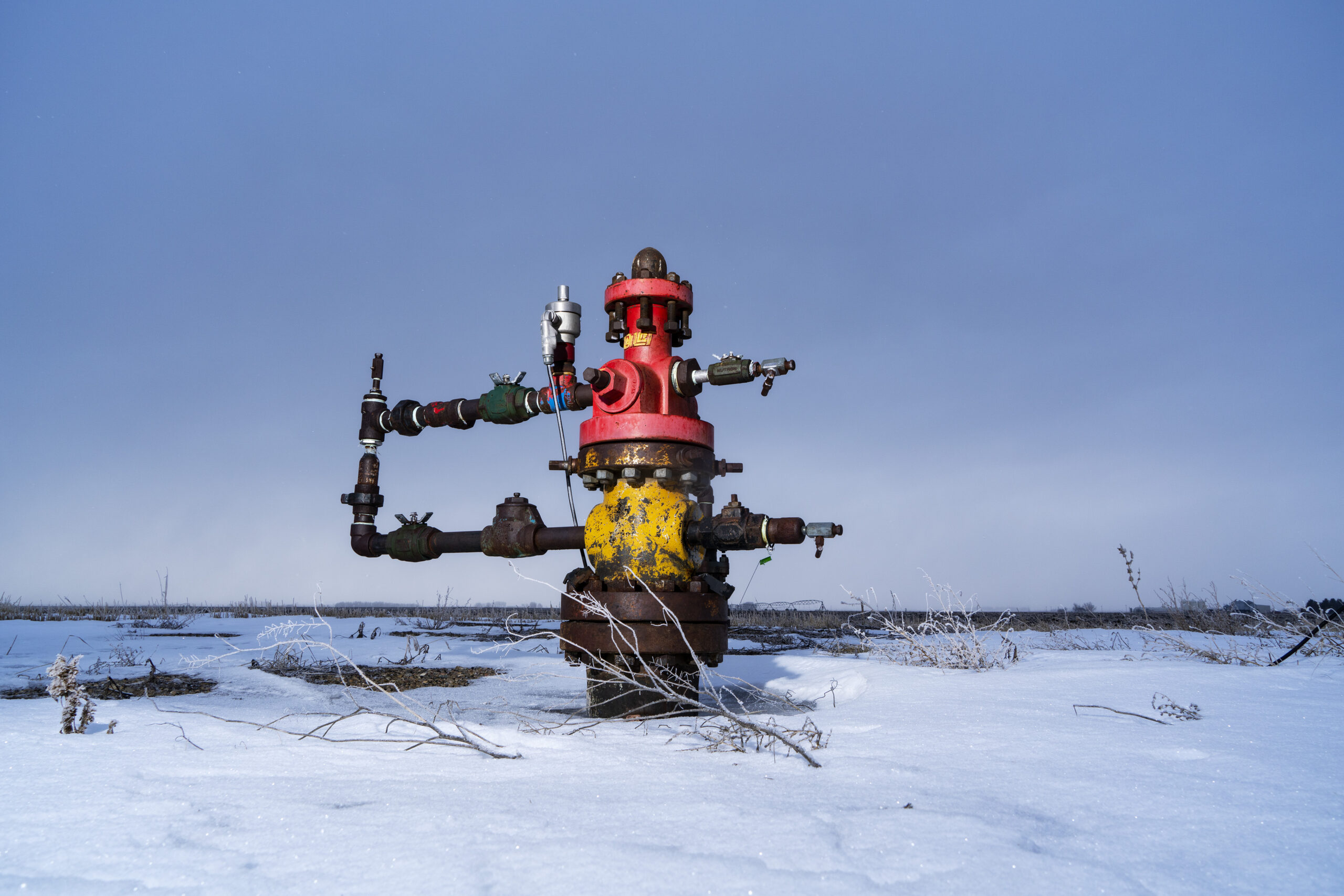
Old oil and gas wells can leave land and water contaminated, impacting both the environment and, potentially, human health. Since 2003, oil and gas companies are required to provide evidence that contamination has been cleaned up at a site in order to achieve a reclamation certificate.
However, even internal government documents show a majority of sites certified as reclaimed do not meet the province’s own standards, even if they are inspected.
The energy regulator says these certificates were discussed with the company ahead of time and were reviewed after being submitted into the system to “ensure completeness and accuracy.”
“The reclamation certificates were approved after manual review by a reclamation assessor,” the regulator said in response to emailed questions.
The practice is likely to grow and be spurred with advances in technology that could allow researchers to examine the individual branches on a single tree from their desktops, according to Chasmer. Or drones that can survey a site and upload the data to the cloud and have it automatically analyzed by an AI system.
“So it really is coming along and it’s a really exciting field to be in, you just have to understand there are some limitations and use the technology for what it’s good for and find other methods for things that are a little bit more hazy or gray in terms of accuracy,” she says.