


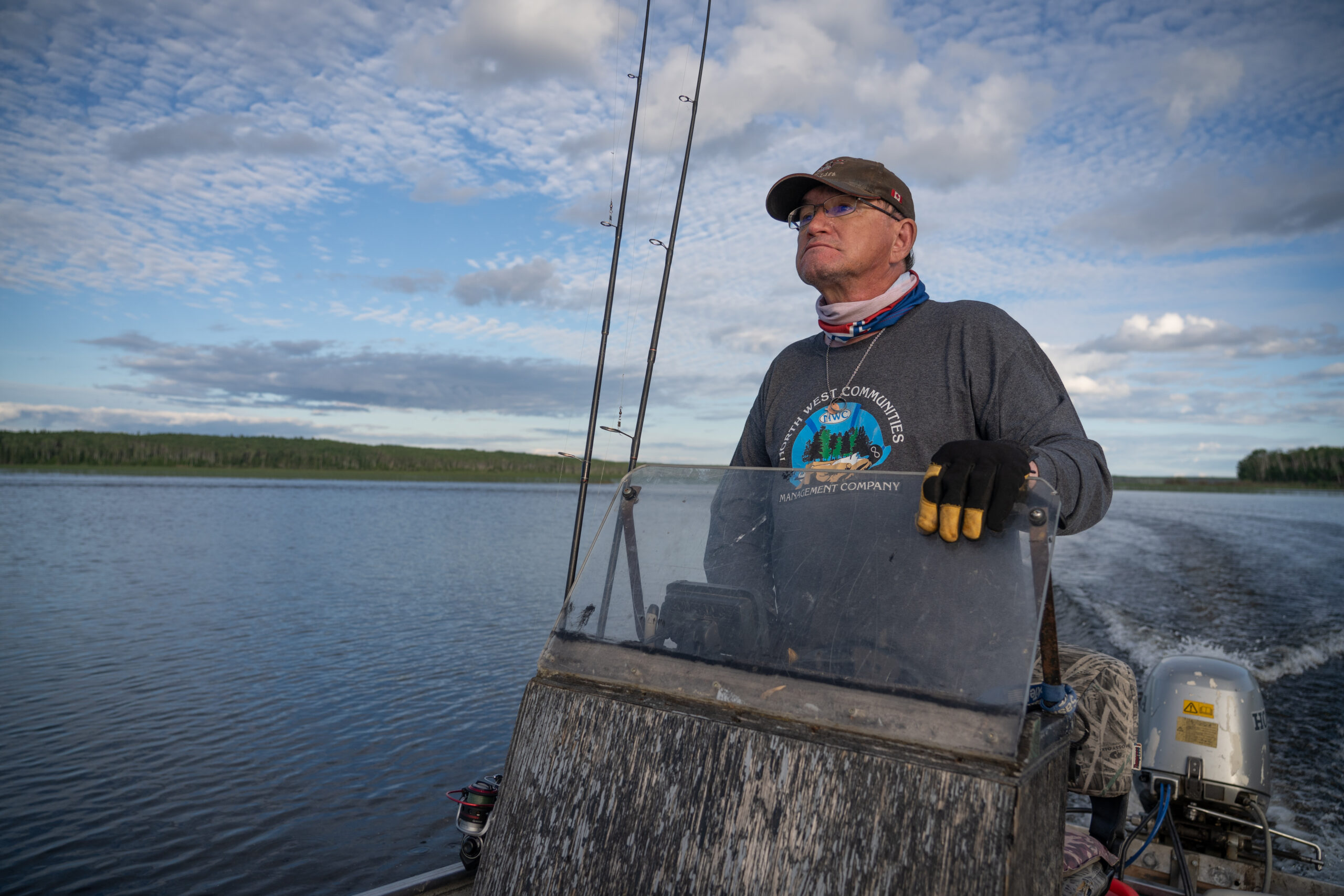
Peter Durocher has spent his life hunting in the boreal forests near Île-à-la-Crosse, Sask., along the traplines passed down to him by his grandfather. Under the tree canopy, he caught deer and sometimes moose. The 61-year-old hoped to pass on that inheritance to his own grandchildren, but in recent weeks, he has watched that dream literally go up in flames. “I can’t take my grandkids to my trapline, because it doesn’t exist anymore,” Durocher says on a Zoom call with The Narwhal, his eyes red from wildfire smoke, pausing now and then to cough.
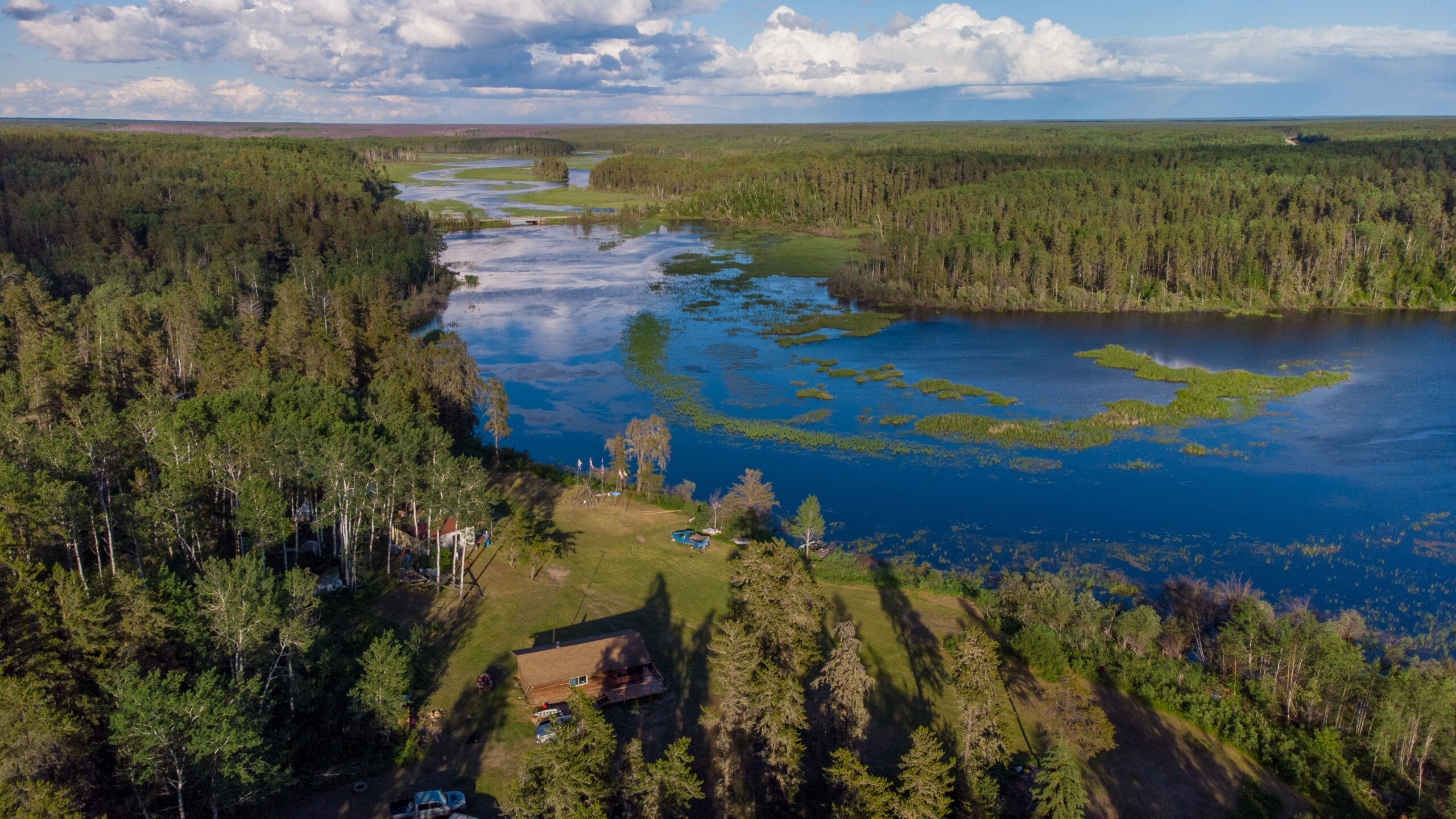
May was a devastating month for wildfires, which raged across northern Saskatchewan due to unusually hot, dry conditions. The Shaw fire first broke out on the tip of Kazan Lake, located south of Highway 155 between Buffalo Narrows and Île-à-la-Crosse. It devoured the forests of the Sakitawak Conservation Area Project, which was formed to establish an Indigenous Protected and Conserved Area, commonly referred to as an IPCA. Sakitawak, a Cree word that means “where the rivers meet” would encompass a 22,000-square-kilometre area known as the N-14 Fur Block, which is home to more than 300 species of plants and animals. Three river systems — Churchill, Canoe and Beaver rivers — converge at Île-à-la-Crosse, in the heart of the proposed protected area.
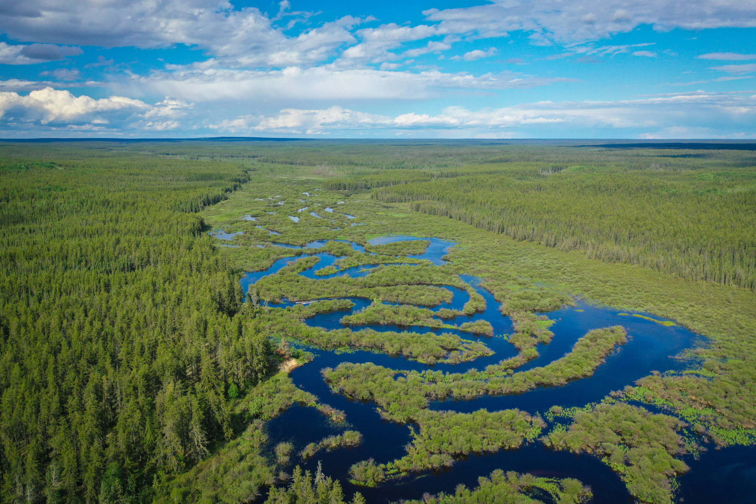
The community estimates half the proposed conserved area has been lost to the wildfire, although with fires still burning it’s hard to know what the full impact will be. The forests and watersheds surrounding Île-à-la-Crosse are an irreplaceable environmental and cultural resource, Durocher, who manages the conservation project, explains. The region stores an estimated 839 million tonnes of carbon, and is home to threatened woodland caribou, endangered piping plovers, great blue herons, moose and bears. But it’s more than that, Durocher says. “The forest is entwined with our culture, our Native culture,” he says. “It’s where we get our medicine, our berries, our food, our shelter.”
“And we’ve lost part of it now.”
Forests, including those that have been protected or conserved, are prioritized below commercial timber in the province’s fire management response, the Saskatchewan Public Safety Agency told The Narwhal via an emailed statement.
“Allowing wildfire to play its natural and beneficial role on the landscape is also taken into consideration when responding to wildfires affecting protected areas,” the agency added, noting that provincial parks and wildlife sanctuaries would fall under the umbrella of protected areas.
The federal government has committed to conserving 30 per cent of all land and water by 2030, and promised much of that conservation work will be led by Indigenous communities. “There is no path to fighting climate change and building a healthy future that does not involve forests,” Prime Minister Justin Trudeau said at COP27. But with what may be our worst-yet fire season just getting started and millions of hectares already burned, a question hangs in the air like smoke: what does it mean to protect an area if we plan to stand by and watch it burn?
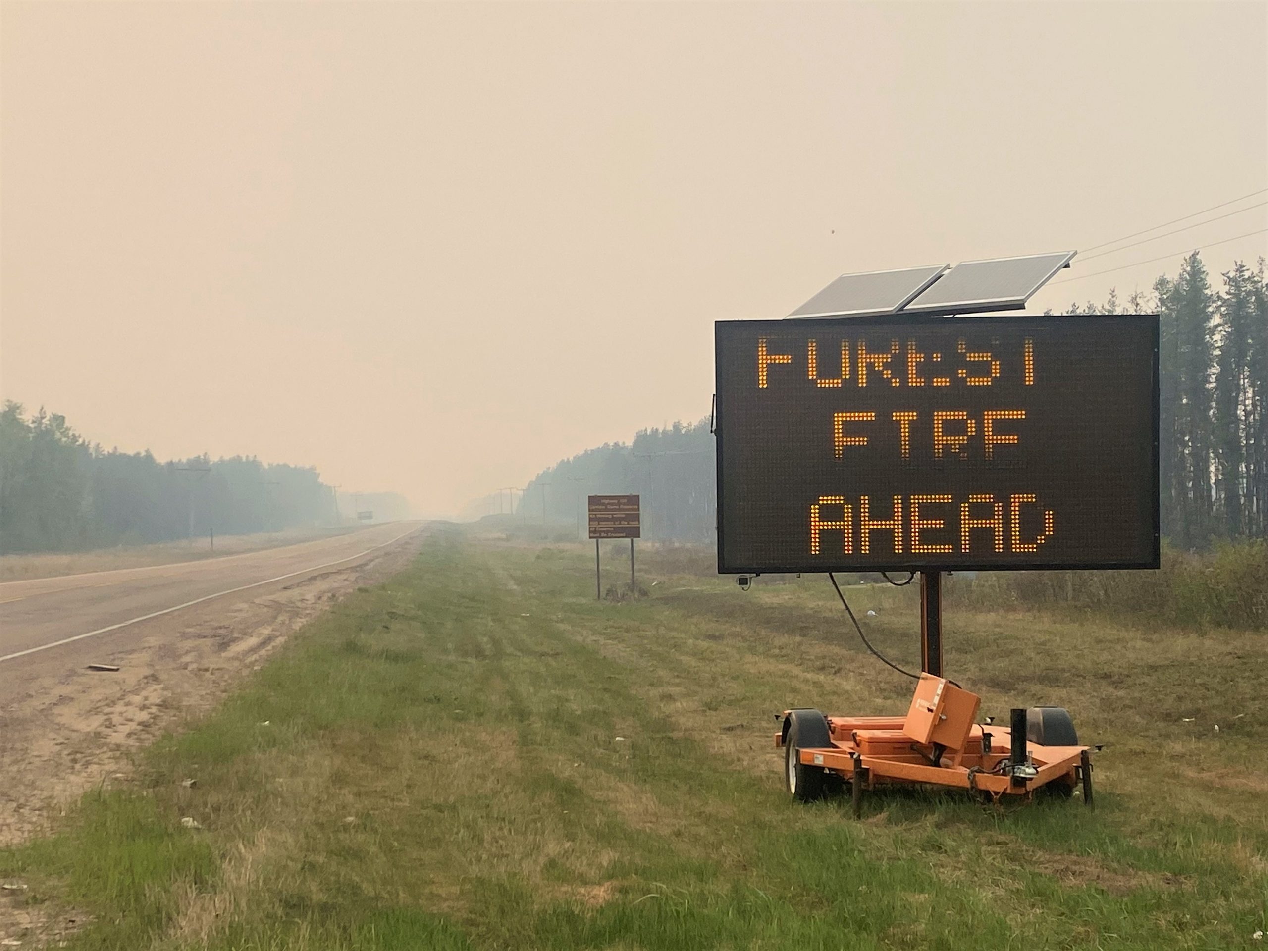
The growth of the Shaw fire
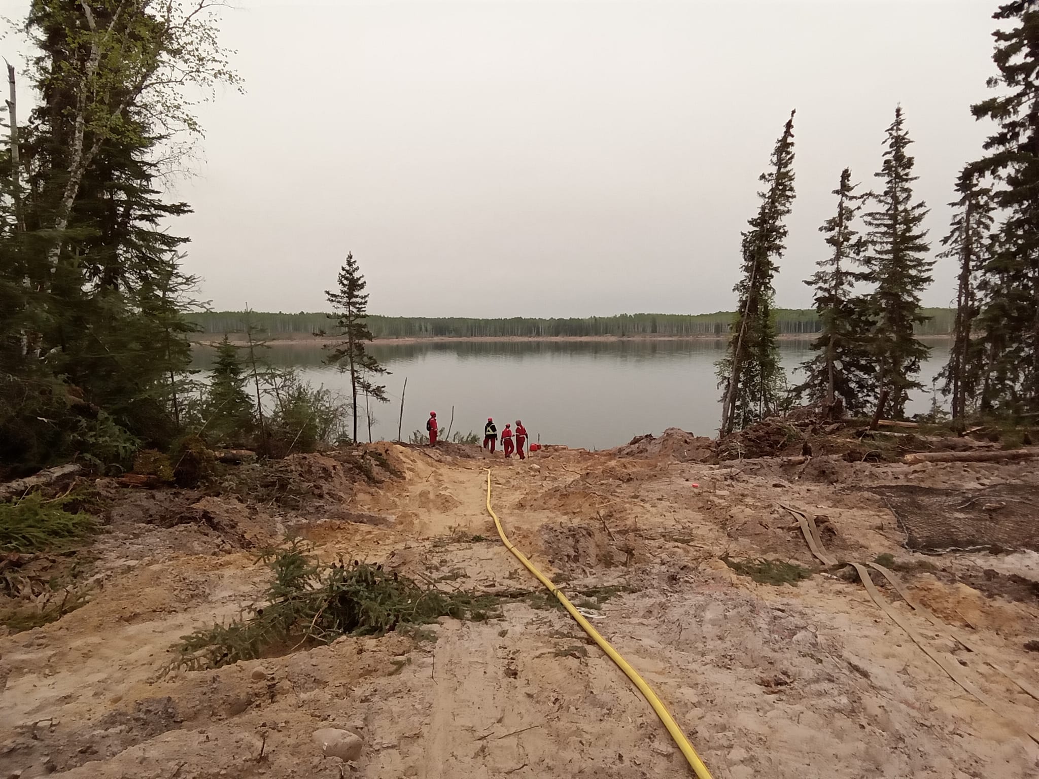
The Shaw fire began burning on May 4. Five days later, on May 9, the Saskatchewan Public Service Agency assessed the fire, and deployed firefighters, heavy equipment and helicopter and air tanker support.
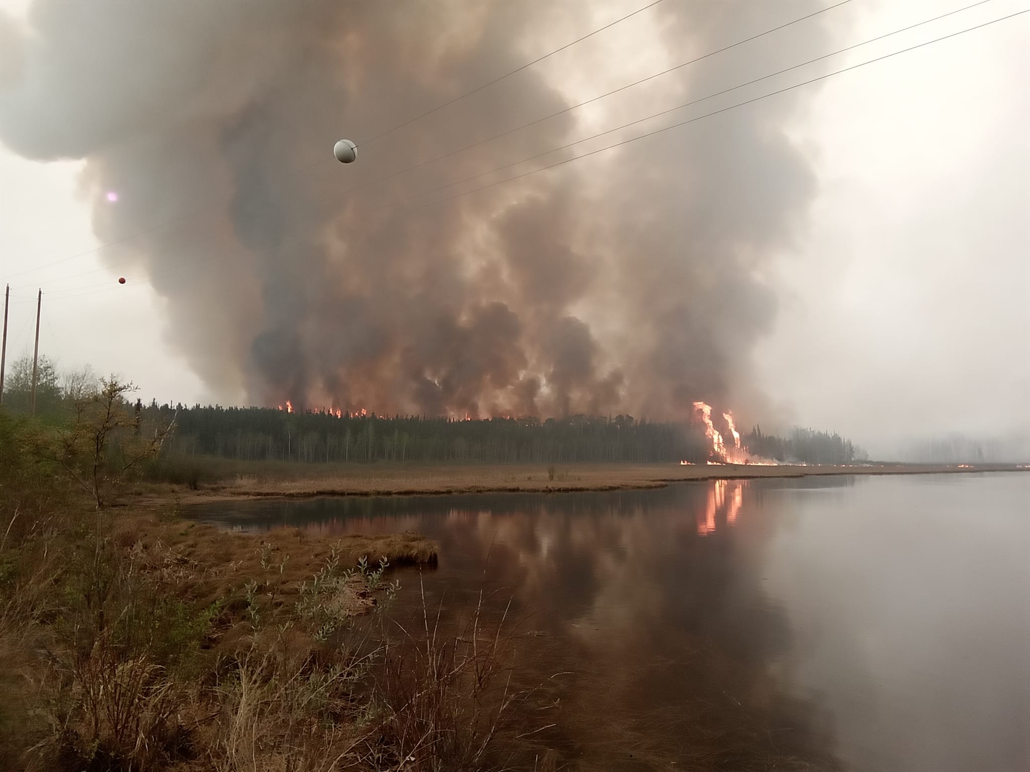
But residents of the nearby Buffalo Narrows, just north of Île-à-la-Crosse, believe the province didn’t act fast enough. It was small enough that the province could have contained it, Durocher says, but instead it was left to burn. On May 15, it was 25,000 hectares in size, but tripled within days. On May 30, when The Narwhal spoke with Durocher by Zoom, the fire was 147,076.6 hectares in size and categorized as uncontained. It has continued to grow, reaching more than 186,000 hectares by June 12, and is currently categorized as contained.
In an emailed statement to The Narwhal, the Saskatchewan Public Safety Agency wrote “Wildfires play a natural and necessary role in maintaining healthy boreal forest ecosystems, including in protected areas. Wildfire creates a mosaic of habitats that support many native plants and animals, all of which are well adapted to fire. Healthy, vibrant forests are naturally renewed by fire, so it makes ecological sense to allow some non-threatening fires to occur unhindered.”
A firefighter in the 1970s and 1980s, Durocher described this year as the worst season he’s ever seen. Over the past five years, Saskatchewan has seen an average of 120 wildfires — but already there have been 209 in 2023. As of June 12, there were 30 active fires in Saskatchewan, of which the Shaw fire was the largest by far.
“The last time I saw conditions like this was in 1981,” Durocher says. That summer, he recalls, he walked his trapline and heard the bone-dry ground crunching under his feet. More than 1.6 million hectares burned in Saskatchewan that year. It was the worst fire season he’d ever seen, until now. “The last few days, I’ve seen fire behaviour that I’ve never seen before,” he says. Even at night, the flames are visible across Lac Île-à-la-Crosse, just 20 kilometres from the community.
To Durocher, the fire was inevitable and predictable: northern Saskatchewan has been hot, dry and windy. Wildfire scientists have something called the 30-30-30 crossover rule: when temperatures reach 30 C, humidity falls below 30 per cent and winds pick up above 30 kilometres per hour, fire behaviour becomes extreme. Those conditions have contributed to the ravenous, rapid expansion of the fires.
“Everyone is saying, we don’t know what happened,” Durocher says, shaking his head. “Climate change happened. We never used to see 30 C weather in May.” According to Environment Canada, May 2023 was the hottest and driest month on record across much of Saskatchewan and Alberta.
At the beginning of May, the Saskatchewan Public Safety Agency forecast a slower start to the wildfire season, but predicted the unusually hot, dry conditions would lead to more fires than usual in 2023.
By mid-month, it was clear the start of the season was anything but slow. In an update to media on May 17, CEO and fire commissioner of the Saskatchewan Public Safety Agency Marlo Pritchard blamed the unusually dry conditions for the rapid spread of the Shaw fire.
Saskatchewan isn’t the only province grappling with a particularly volatile fire season: on June 1, Emergency Preparedness Minister Bill Blair told media 2.7 million hectares of Canadian forest burned in May. According to Blair, the 10-year average for hectares burned in May is 150,000 — making this fire season 18 times more destructive than usual.
But the natural processes that follow wildfires are changing too.
Lori Daniels, a professor of forest ecology at the University of British Columbia, says hotter, drier conditions are leading to more severe fire seasons, which release massive amounts of carbon into the atmosphere and make it challenging for the forests to recover.
“We are seeing, in some of our northern forests, after these high-intensity fires that are very large, we’re not getting immediate regeneration of forest trees. It’s not happening, or it’s not happening in a very effective way,” Daniels says, adding that some regions are also reburning within a few years. “So there’s concern that in some landscapes, in fact, forests are being gradually converted into non-forest, either shrub lands or Arctic tundra.”
“Many of the fires that we’re seeing in recent years, and again this summer, are very large, very intense, and their ecological effects are quite severe, which makes it difficult for the forest to recover in the ways we would have normally expected.”
Boreal forests like in Sakitawak are a cornerstone of Canada’s strategy to mitigate climate change and preserve biodiversity. An estimated 552 million hectares of boreal forests in Canada store more than 58 billion tonnes of carbon. “But in truth, our forests have been a net emitter of carbon because of insects and pathogens and wildfire for the last decade and a half, or two decades now,” Daniels says. If we don’t protect our forests, they can’t protect us.
Letting wildfires burn in Saskatchewan
Durocher and Louis Gardiner, president of A La Baie Métis Local 21, blame the inaction on the province’s rumoured “let it burn” policy, which restricts firefighting resources to fires burning within 10 kilometres of communities. The Saskatchewan Public Safety Agency has denied the existence of such a policy, though until 2016 they had a controversial policy to only fight fires within 20 kilometres of communities.
“They’re saying there’s no ‘let it burn’ policy, we’re saying, yes there is,” Gardiner says. “It’s a small town, Île-à-la-Crosse, and we have fire protection workers in the community. They were ready to go but told [the fire] was outside the danger zone. Then it was too late.”
“It’s not good,” Gardiner continues. “They used to see smoke and act on it right away. Nowadays, it seems like the decision has to come from Regina.”
“If this fire happened in Prince Albert, they’d have a thousand firefighters. They’d call in the army,” Durocher says. “Where is the help for us?”
The provincial wildfire bulletins, which include details on the communities and “values” impacted by each fire, lists the commercial timber threatened by the Wistigo wildfire near Pinehouse Lake, Sask. But no protected or conserved forest areas are listed for the Shaw fire or any others.
By email, the Saskatchewan Public Safety Agency wrote, “The [agency] always protects what’s most important with human life and communities always being the top priorities, followed by critical public infrastructure, major industrial infrastructure, commercial timber, remote structures and natural resources. Protected areas are included under natural resources.”
“Why?” Durocher asks. “That’s what the Elders are asking. Why didn’t they stop this fire?”
“That’s our way of life, and they’re letting it burn.”
Sakitawak IPCA: an incalculable loss, and unanswered questions
Kelly Patrick, the former director for the Sakitawak project, told The Narwhal that letting the funding lapse for Sakitawak was a portent of disaster. In 2020, the project team requested fire history maps of the N-14 Fur Block from the Saskatchewan Ministry of Environment, as they were concerned about the potential threat of wildfire.
“If they’d asked Elders, the people who live on this land, we could have told them that we were going to have a problem,” Durocher says. The fire was predictable — and preventable, he adds.
But the fire is just the latest hurdle in the journey to protect Sakitawak. In March of 2022, after having funding for three years, the project’s funding ran out.
In 2019, A La Baie Métis Local 21 received three years of funding from Environment and Climate Change Canada as part of the Target 1 Challenge, which set a goal of protecting and conserving at least 17 per cent of land and 10 per cent of marine and coastal areas by 2020.
According to Environment and Climate Change Canada, 50 Indigenous-led projects, as well as nine projects funded under Indigenous-led area-based conservation, have received funding through the Target 1 Challenge since 2018.
On their website, the Sakitawak project said it aimed to “build capacity and conduct planning for future potential protection of habitats of vulnerable species and to promote sustainable development practices and advance Indigenous way of life, knowledge systems and stewardship activities.”
By email, Patrick wrote that despite following up multiple times with Environment and Climate Change Canada through the end of June 2022, they were not given a reason why the funding for the project was not extended. However, they cite ongoing tensions with the Saskatchewan government, who hold the title to most of the Crown lands in the province, including Sakitawak.
In a June 2022 email shared with The Narwhal, a staff member at Environment and Climate Change Canada wrote: “Determining if the project will continue to be funded is not a simple request. As we discussed a few weeks ago, in order for the proposal to be considered eligible for further funding, there are certain elements that need to be refined and relationships have to be secured, namely with the province.”
Gardiner says a proposal for additional funding was submitted in the fall of 2022 through the federal Indigenous-led area-based conservation program. If successful, the funding will allow them to resume their efforts to protect Sakitawak.
By email, Environment and Climate Change Canada confirmed the funding for the Sakitawak project lapsed in March 2022. “[Environment and Climate Change Canada] is currently reviewing expressions of interest submitted through an open call for proposals in the fall of 2022 under Indigenous-led area-based conservation,” they wrote. Gardiner expects to hear if the proposal was successful in the next few months — more than a year after the initial funding ran out.
‘They have nowhere to go’
The day before we spoke on Zoom, Durocher visited the charred remains of his trapline to put down tobacco. If he wanted to shock people, he says, he would take photos of the burned bodies of animals who were trapped by the flames. “Indigenous people don’t do that,” he says. “We respect the animals.”
For Durocher, the loss of the animals is most devastating. “The reason I joined the IPCA was to protect the woodland caribou,” he says. He estimates the fire has decimated at least two of the remaining herds, and worries about the effects of the fire on the survivors and their young. “Maybe the bigger animals could run, but if you map the fire out, they have nowhere to go.”
“The Elders told me that the caribou will abort their pregnancies and abandon their babies to escape the fire,” he says. “Moose do the same, deer do the same.”
By phone, Gardiner tells The Narwhal he’s heard at least 60 caribou have been lost in the wildfire.
But since it’s still burning, it’s hard to know the full extent of the damage.
“I want people to understand … when we talk about losing our land, we’re not complaining. This affects everyone,” Durocher says. “It’s going to affect me and the Elders that are here, but it’s going to affect people in Toronto, in Ottawa. They need to know.”
“All I want is for people to know that we are in crisis,” he says. “It’s only May right now. The snow only left two weeks ago.
“Just imagine when we get into July.”
This story is part of Spirits of Place, exploring the many ways Indigenous communities and nations are enacting their responsibilities to their lands, waters and future generations. This coverage is made possible by funding from Metcalf Foundation and MakeWay Foundation. As per The Narwhal’s editorial independence policy, the foundations have no editorial input.