


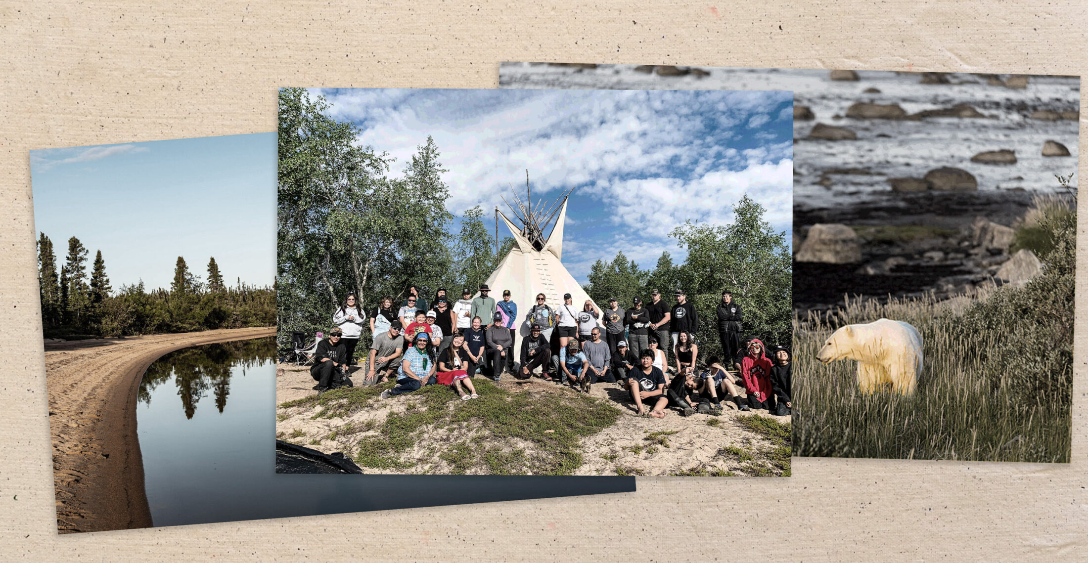
The steady rhythm of Northlands Denesuline drummers filled the air Thursday morning, as chiefs of four northern Manitoba First Nations led provincial, federal and Indigenous leaders into a historic ceremony that marked a formal step towards establishing Manitoba’s first — and Canada’s largest — terrestrial Indigenous protected area across the vast wilderness of the Seal River Watershed.
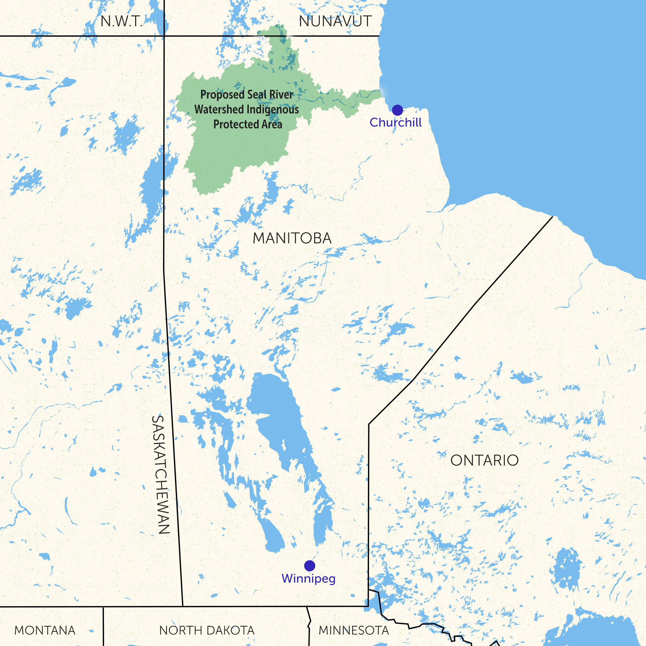
In the presence of Manitoba Keewatinowi Okimakanak chiefs and several dozen guests, leaders of the Sayisi Dene, Northlands Denesuline, Barren Lands and O-Pipon-Na-Piwin Cree Nations joined Manitoba Premier Wab Kinew and federal Environment and Climate Change Minister Steven Guilbeault. The parties were assembled to sign a long-awaited memorandum of understanding committing all parties to a feasibility study and mineral exploration moratorium across 50,000 square kilometres of culturally and ecologically vital lands.
“Together with their nations, we are leading the way,” Stephanie Thorassie, executive director of the Seal River Watershed Alliance, said during the signing.

“For so long, others have dictated where we lived, where we went to school, how we wash our clothes, our hair, what language we spoke. Now our communities are standing up in defining how we want to care for these lands and waters.”
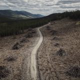
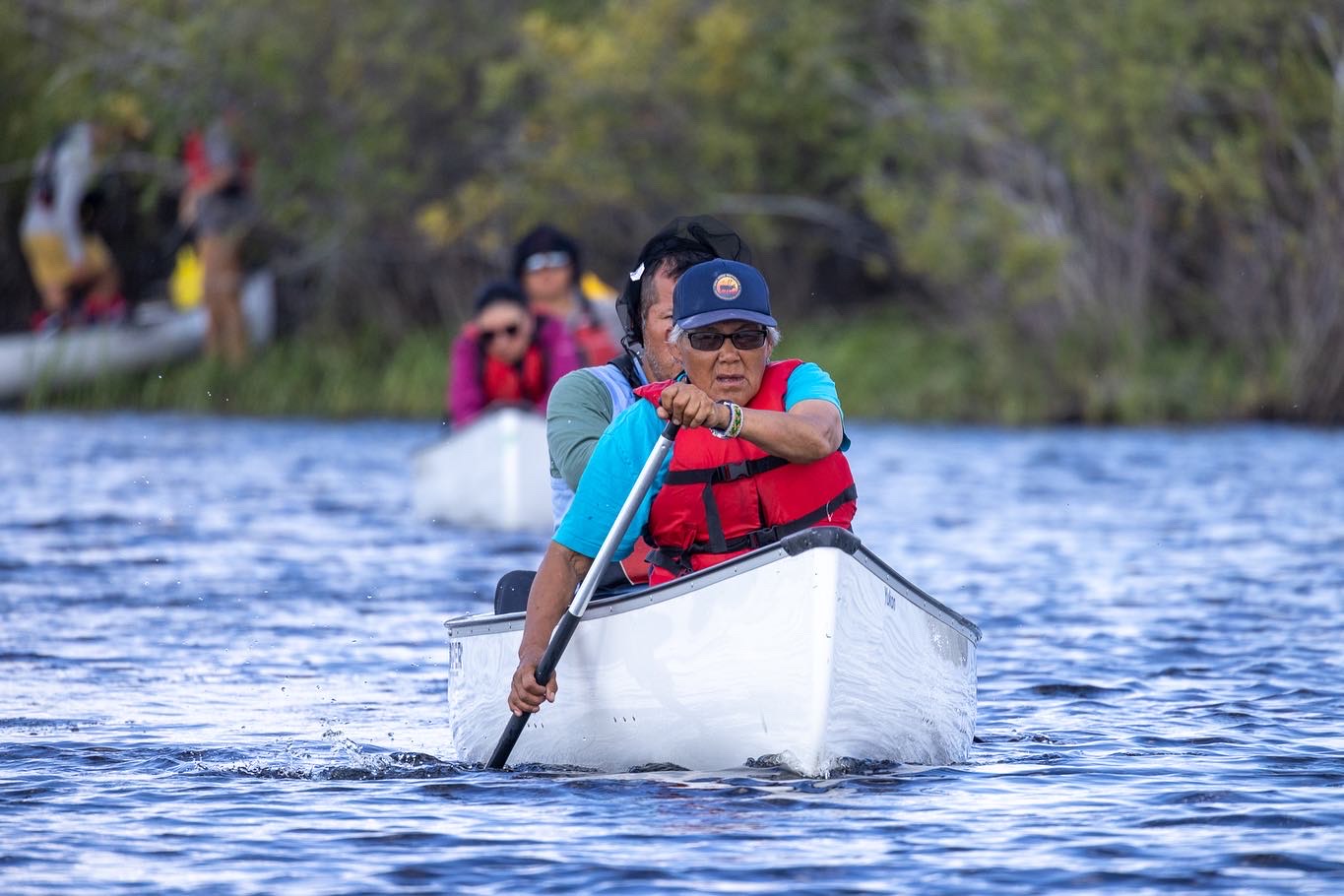
From its source at Shetanei Lake, the Seal River flows uninterrupted for 260 kilometres to Hudson Bay. It is the last river in Manitoba untrammelled by hydroelectric dams or developments; there are no permanent roads and no mineral developments across the pristine territory. The watershed is home to at least 25 at-risk animal species, including the culturally significant barren ground caribou, whose herds have been in decline for decades. It is also a significant carbon sink, storing 1.7 billion tonnes of carbon in the soil, according to a study from Ducks Unlimited Canada.
Such pristine lands are increasingly rare. Manitoba, like much of Canada, has seen a significant portion of its wetlands lost or degraded over the years owing to developments and agriculture. In 2019, Ducks Unlimited estimated that the province loses more than four football fields worth of carbon-storing wetlands per day.
After years of encouragement from Sayisi Dene member Ernie Bussidor, an alliance formed between the four First Nations in 2019 with a vision to preserve the health of Manitoba’s last undammed, uninterrupted river. Since then, they have completed several studies outlining the economic and ecological case for conserving the lands they have called home for generations. The new feasibility study will take that work a step further, helping parties decide what shape a protected area in the region could take — including working with Parks Canada to explore the possibility of a national park designation.
“We still want this pristine land to be there for our younger generations,” O-Pipon-Na-Piwin Cree Nation Chief Shirley Ducharme said in an interview. “We are looking to continue our ancestral ways and use the land with respect.”
The eventual Indigenous-led protected area will join just three other federally recognized Indigenous Protected and Conserved Areas across the country, all located in the Northwest Territories.
Whatever shape the protected area takes, leaders say Indigenous traditions, practices and knowledge will be at the centre of the conversation.
“We’re writing our own story by doing this,” Thorassie said in an interview.
“We’re stepping away from the narrative of this terrible history of residential schools and forced relocation. We know what story needs to be written from here on out, we know we are the ones who need to be responsible for that. We can’t have other people writing our stories anymore.”
The people in Thorassie’s community, the Sayisi Dene, were forcibly removed from their homelands on the watershed by the Government of Canada almost 70 years ago. Though the community returned to their home of Tadoule Lake 17 years later, one third of the population died during the relocation.
The people of the O-Pipon-Na-Piwin Cree Nation were forced to relocate to the shores of South Indian Lake after Manitoba Hydro developments flooded their traditional lands and decimated the community’s trap lines and fisheries in the 1970s.
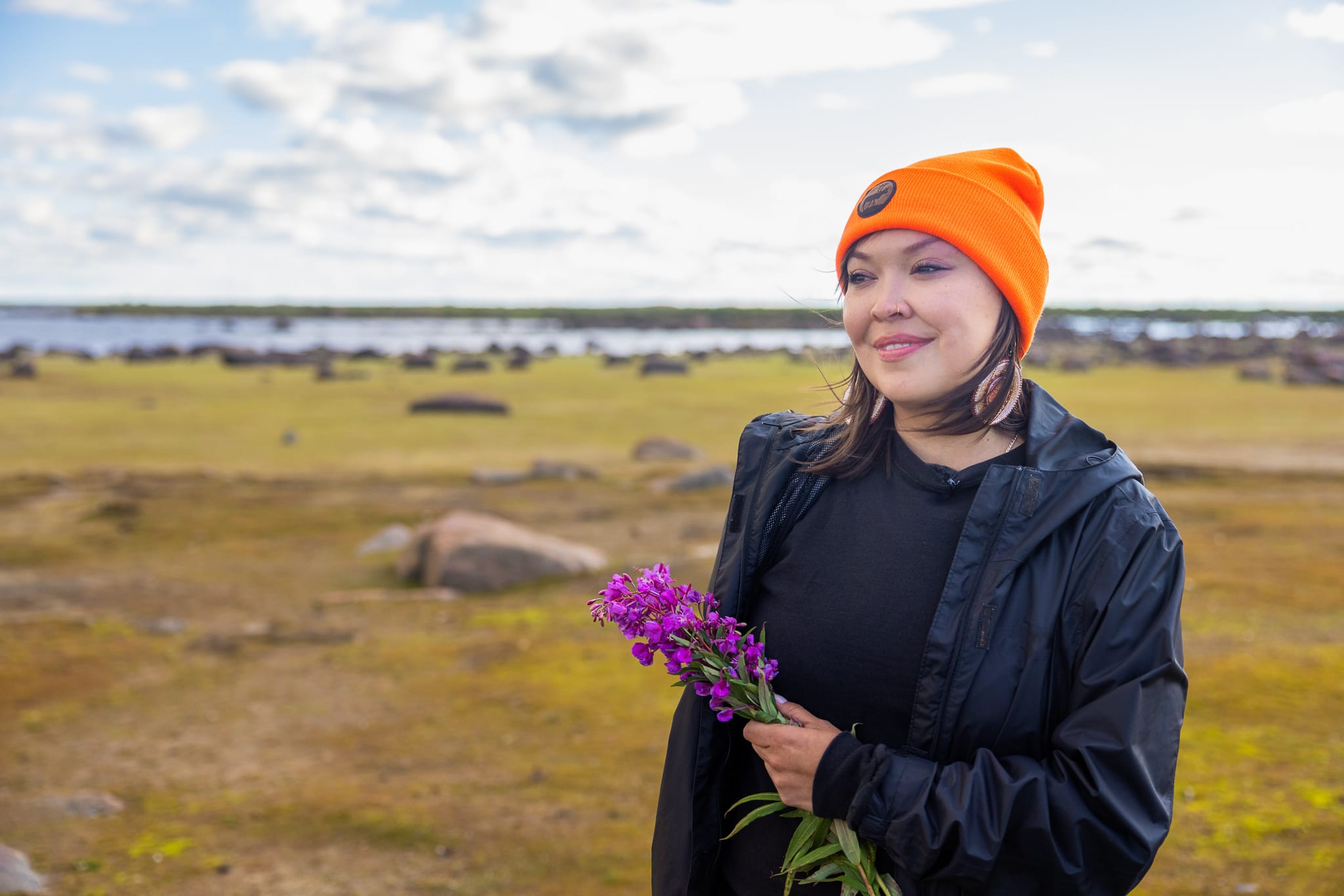
“The signing of the [memorandum of understanding] is a critical step towards reconciliation,” Lianna Anderson, a land guardian from O-Pipon-Na-Piwin, said in an interview.
“As we move forward there will be equality in all processes to ensure that our inherent and Treaty Rights will always be upheld. That’s the expectation now.”
Though it’s now her job title, Anderson considers herself a lifelong land guardian. Her father was a commercial fisherman and a trapper; she was raised “in the bush, living along the water and on the land.” For years, she’s monitored the water levels, the snowfall and the migration patterns of waterfowl and caribou, in constant communication with the community’s youth and Elders, as part of the nation’s way of life — and it’s that way of living she hopes the protected area will preserve for future generations.
“Right from the moment that we get up, we step out and our feet touch the ground upon which our ancestors walked, we look at everything around us and we know that this is our responsibility,” she said.
The alliance’s land guardian staff are currently going door-to-door interviewing community members in all four nations to gain an understanding of sacred and historically important locations throughout the watershed, information that will be used to inform the feasibility study.
“We have to combine western science with the Indigenous Knowledge that we’re carrying, and we’re aware that that’s a big part of the feasibility study,” Thorassie explained.
“What’s so beautiful about this is that we have a chance here to change the narrative and make the Indigenous Knowledge a priority in the work that we do.”
For the province, protecting the Seal River watershed is a significant step toward meeting the international conservation target of conserving 30 per cent of lands and waters by 2030. The watershed comprises about eight per cent of Manitoba’s land area, and once permanently conserved it will add more to the province’s network of protected areas than has been added in the last 25 years combined.
“If you’re somebody who is thinking about a safe, clean, healthy environment for the future generations, this is a really positive step,” Premier Kinew told reporters after the signing.
“We’re doing it in a way that is with community and with Indigenous Nations and we’re also doing it in a way that ensures that there’s going to be good economic developments in the future of our province.”
The memorandum of understanding was first announced during the United Nations biodiversity conference in December 2022 while the Progressive Conservatives were in government. According to Environment Minister Guilbeault, progress on the signing “unfortunately stalled for months — until Premier Kinew decided to withdraw the land from future mining.”
On Thursday, Manitoba’s cabinet passed an order to temporarily ban any claim staking or mineral exploration in the study area. Geological assessments will form part of the feasibility study, but Thorassie stressed it’s unlikely extractive industries will be able to conduct work on those lands in the future, provided community support for a protected area remains so high.
Instead, economic development opportunities across the Seal River watershed could include eco-tourism, similar to the tourism industry in nearby Churchill, and job opportunities — especially for the communities’ youth — as land guardians monitoring and documenting environmental changes.
“We can’t have healing in the community without this land and the land being protected,” Thorassie said.
“Having safe access to safe, protected lands — healthy lands — brings you healthy people. Making sure that this is something that’s set aside for the people to access is so important to the health and wellbeing of our nations.”
Updated Jan. 18, 2024, at 5:45 p.m. CT: This story was updated to include quotes and information provided at a press conference held midday on Jan. 18 to mark the signing of the memorandum of understanding.
Updated Jan. 19, 2024, at 12:45 p.m. CT: This story was updated to clarify Shetanei Lake is the source of the Seal River, not its mouth as previously stated.
Julia-Simone Rutgers is a reporter covering environmental issues in Manitoba. Her position is part of a partnership between The Narwhal and the Winnipeg Free Press.