
Overview of Forest Fires in British Columbia
At 944,735 square kilometers in total size, British Columbia composes a massive area of land (the entire country of France is only 643,801 square kilometers). Overall, 62 per cent of the province is forested and much of that forested land is not inhabited by humans. According to government statistics, British Columbia sees an average of 1,756 forest fires every year, with 39 per cent of those fires caused by human activity and 61 per cent caused by lightning strikes.
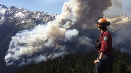
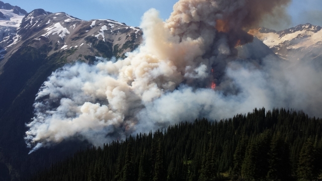
Given the vast uninhabited areas in B.C., many of these fires never interface with human habitat. However, the recent history of B.C. has seen larger fires more frequently coming into contact with humans (so called “interface fires”), destroying homes and temporarily displacing thousands of people. In some cases these fires have resulted in lost lives.
The summer of 2017 was a year of unprecedented wildfires in terms of the area impacted, the people displaced and the damage caused. As of August 2, more than 840 wildfires had burned approximately 4,200 square kilometers in British Columbia. According to government officials, 300 structures had been destroyed. Of those 300 structures, 71 were homes, three were businesses and the rest outbuildings (work sheds, barns etc.).
In the summer of 2003, the Okanagan Mountain Park fire was the most damaging human interface forest fire in the history of the province. The Okanagan Mountain fire was 25,600 hectares in size, destroyed or damaged 238 homes and resulted in the evacuation of 33,050 people.
Also in 2003, the McLure forest fire near Kamloops was measured at 26,420 hectares and destroyed 72 homes and nine businesses.
In 1998 a forest fire in Salmon Arm, B.C., measuring 6,000 hectares, caused the evacuation of 7,000 people and destroyed 40 buildings.
In 1994 a 5,500 hectare forest fire in Penticton caused the evacuation of 3,500 people and destroyed 18 homes and structures.
B.C. Forest Fires and Climate Change
For many years, scientists have been studying the links between climate change, rising global temperatures and forest fires. For instance, in a 2004 study titled, “Detecting the effect of climate change on Canadian forest fires,” published in the Geophysical Research Letters, the authors conclude that:
“The area burned by forest fires in Canada has increased over the past four decades, at the same time as summer season temperatures have warmed… We further show that human-induced climate change has had a detectable influence on the area burned by forest fire in Canada over recent decades.”
In reaction to a very active year for B.C. forest fires in 2015, former BC Premier Christy Clark said that the increased level of fire activity could be the “new normal.” Clark explained to media that, “she is concerned that climate change has altered the terrain, drying out the land and making it more vulnerable to fire, and as a result what B.C. is seeing isn’t unusual and will happen more often.”
As experts have pointed out, the three most catastrophic fires in modern Canadian history have all come in the past two decades and more communities will surely burn in the coming decade.
You can click here to learn the most up-to-date information on the current fire prohibitions and bans in B.C.
You can click here for B.C. forest fire emergency information and evacuations alerts and notices.
You can click here for the latest forest fire danger ratings for the entire province.