


Toxic heavy metals, including arsenic, barium, cadmium, lithium and lead, are flowing unchecked into the Peace River following a series of unusual landslides that may be linked to B.C’s natural gas industry fracking operations.
The landslides began nearly two years ago and show no sign of stopping. So far, they have killed all fish along several kilometres of Brenot and Lynx creeks just downstream from the community of Hudson’s Hope.
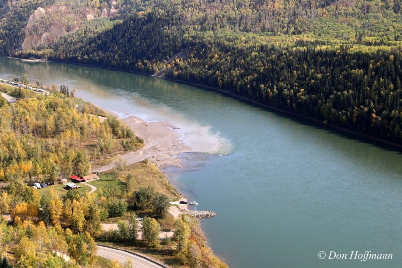
As plumes of muddy water laced with contaminants pulse into the Peace River, scientists and local residents are struggling to understand what caused the landslides and why they have not ceased.
Hudson’s Hope mayor Gwen Johansson is also worried about a broader question raised by the ongoing pollution. The toxic metals are entering the Peace River in a zone slated to be flooded by the Site C dam. That zone could experience nearly 4,000 landslides should the dam be built and the impounded waters begin to rise in the landslide-prone area.
The landslide estimate is contained in a voluminous consultant’s report to BC Hydro, which under the direction of Premier Christy Clark is rapidly advancing work at Site C in an effort to push the project past “the point of no return.”
“If this much damage can result from tiny Brenot Creek, what happens to the reservoir if we get thousands more landslides?” Johansson asks.
No definitive cause has yet been identified to explain what caused the Brenot Creek landslides. But one possibility is that they were triggered or exacerbated by natural gas industry fracking operations, in which immense amounts of water are pressure-pumped deep underground with enough force to cause earthquakes. Fracking is known to cause unanticipated cracks or fractures in underground rock formations, allowing contaminated water, natural gas, oil and other constituents to move vast distances undetected.
Such brute-force operations happened frequently in the years immediately before the first slides were noted at Brenot creek in August 2014.
Between July 2010 and March 2013, a dozen earthquakes ranging between 1.6 and 3.4 in magnitude occurred in the Farrell Creek fracking zone, about eight kilometres away from Lynx and Brenot creeks. (A small number of other fracking operations also occurred closer to the creeks, but do not show up in the seismographic record.)
Requests to B.C.’s Oil and Gas Commission or OGC, and information gleaned from non-redacted parts of Freedom of Information requests to BC Hydro, indicate that by March of 2013 both the provincial energy industry regulator and the Crown-owned hydro provider were increasingly concerned about “events” at Farrell Creek.
“Right now our focus is on getting the improved seismographic network up and running. We will continue to monitor and study all cases of induced seismicity [earthquakes] in NEBC [Northeast British Columbia],” Dan Walker, the OGC’s then senior petroleum engineer wrote in an email to Andrew Watson, BC Hydro’s engineering division manager, on March 7 of that year. The email was written two days after the last of the 12 earthquakes occurred at Farrell Creek.
By the time of that earthquake, Talisman Energy, the biggest natural gas company then operating at Farrell Creek, knew that wastewater was disappearing below one of four massive “retention ponds” that it had built to store millions of litres of highly contaminated water from its fracking operations.
A detailed investigation subsequently paid for by Talisman and conducted by Matrix Solutions, an environmental engineering firm, notes that Talisman’s “leakage management system” detected that contaminated water was escaping from between two liners that were supposed to trap and prevent Pond A’s toxic brew from polluting the ground and water around it.
Pond A had likely leaked for five months beginning in January 2013. In June of that year, Talisman drained Pond A and confirmed that the leaks had, indeed, occurred.
The wastewater ponds and gas reserves in the region are now owned by Progress Energy, owned in turn by Petronas, the Malaysian state-owned petro giant that the provincial government is eager to see build a liquefied natural gas terminal at Lelu Island near Prince Rupert. The Oil and Gas Commission, which regulates B.C.’s oil and gas industry, subsequently ordered Talisman to drain the remaining three ponds. At that point, it was discovered that Pond D was leaking toxic wastewater too.
Among the toxic substances found in water samples collected from groundwater sources underneath Talisman’s faulty storage pits were arsenic, barium, cadmium, lithium and lead, the same hazardous compounds that are found in the billions of fine sediments that continue to turn the waters of Brenot and Lynx creeks a muddy brown and enter the fish-bearing Peace River.
The Matrix Solutions report released in May 2015 noted that the release of toxic metals into the environment was predictable. By digging the huge pits and exposing massive amounts of unearthed material to the air, “surface and groundwater acidification” were potential risks, Matrix said.
“The primary concern for receiving environments related to acidic groundwater is the potential for release of trace metals,” the report warned.
Whether or not the fracking-induced earthquakes or the failures at Talisman’s waste ponds played any role in events at Brenot and Lynx creeks is unknown. To date, no studies have been done in the region to determine how and where water moves below ground. In its report of more than 2,200 pages, Matrix noted a troubling lack of such information. “Flow direction is not documented,” the Matrix report said. However, the report went on to say that groundwater generally moves from “topographic highs toward topographic lows.” In other words, it moves downhill.
Below the Farrell Creek fracking zone, the waters of Lynx and Brenot creeks continue to be so full of contaminants that a person’s finger placed just a millimeter below the surface disappears from view. The pollution caused one local farmer to quip at the time that his “cows are not supposed to chew the water.”
Martin Geertsema, a geomorphologist with the provincial Ministry of Forests, Lands and Natural Resource Operations in Prince George, says he has never seen anything quite like what has occurred at the slide site since August 2014.
“We’ve got a camera pointed at the landslide. I’d like to install a few more to try to figure out what the heck is going on. It’s very unusual. There’s nothing quite like this,” Geertsema said in an interview.
“At other slide sites the water flows finished in a few days. The difference here is it just keeps going. Water is coming out of the base and because the water is eroding soil from the base it leads to cliff collapse. And the cliff is composed primarily of sand and some clay. And when it collapses, the debris just flows.”
Geertsema notes that the region is known for naturally occurring landslides, many of which show signs of “considerable antiquity.” However, today’s slides are occurring in a region with some of the most extensive and intensive industrial land-uses anywhere in B.C., including two major hydroelectric dams and reservoirs and water-intensive natural gas fracking operations that the OGC has concluded triggered clusters of earthquakes in various locales in northeast B.C.
When the slides at Brenot Creek first began, the District of Hudson’s Hope advised local residents not to drink the water. The advisory was followed by a similar one issued by the provincial government. The town’s council later paid a hydrogeologist and consulting water expert, Gilles Wendling, to collect and test water samples at the slide site to determine how toxic the water was.
Mayor Johansson remains disturbed by the event’s duration, its origins and most of all its timing. At the time that the first landslide was discovered, the region had endured weeks of extremely hot and dry weather. A water-triggered landslide in August was, Johansson felt, highly unusual.
In January 2015, Johansson wrote an article in a newsletter published by the District. During a recent interview she said her views remain unchanged.
“I have contacted MoE [B.C.’s Ministry of Environment] to ask what further steps they are planning and to find out when the advisory might be lifted. The MoE representative said they have no plans to do anything further, other than file a report. He said he expected that eventually the creek would cleanse itself.”
“That seems pretty inadequate. Test results show levels of exotic metals such as lithium, barium, cadmium, and others to be significantly above guidelines. They are not normally found in shallow ground or surface water. They have not shown up at those levels in any previous testing in the area, and I am not aware of similar readings being found anywhere in the northeast of the province. Some of the metals are toxic. They pose a risk to human and animal health.”
The OGC, which visited the site shortly after the slides began, concluded that the contaminants in the water were commonly found in the soils in and around the creek and that a natural spring was the source of the groundwater.
“The 2014 landslide appears to be entirely natural, and is one of a number of similar landslides that have occurred along Brenot and Lynx creeks over the last few hundred years, resulting from natural geomorphic processes,” Allan Chapman, the OGC’s hydrologist reported in November, 2014.
Chapman added that the “landslide deposited a moderate volume of fine-grained silt into Brenot Creek and Lynx Creek. I would anticipate that these deposits along the stream channels will continue to release the elevated metals into the stream water, affecting the stream water quality, for an extended period of time.”
Wendling, however, has questions. For one, the slide was not a singular event. Slides continue to occur there regularly. In an interview from his Nanaimo office, Wendling said the only way to understand whether the presence of toxic metals in the water is natural or not would be to dig deep into the ground around where the slides have occurred and to see whether the metals are found there. If they are not, and are being carried into the creek by groundwater, then where is the groundwater flowing from and why does it continue flowing in such intensity so long after the first slides?
Such test wells might shed light on whether or not major changes to the landscape such as the nearby giant Williston reservoir and/or natural gas drilling and fracking operations played a role in altering the direction in which groundwater flowed, Wendling said.
Wendling, an independent professional hydrologist, works closely with First Nation governments in the northeast who are concerned about the gas industry’s impacts on water resources. He said the high volume of groundwater entering Brenot and Lynx creeks, the contaminated soils being carried in that water, and when the slides began are all of concern. Typically, he said, such events occur in the spring months following periods of intense rain and snowmelt. But this one appears to have occurred in the middle of a drought, he said.
Shortly after the slides began, Wending says he walked the area and was struck by the dramatically different water levels upstream and downstream of where Brenot creek enters Lynx creek. Upstream, Lynx creek was virtually dry. Downstream, the creek had 50 times the normal water discharge.
“Why do two similar steams have such a difference in flows?” Wendling asked, adding that it was “important to investigate” all possible explanations for “the discharge of larger flows of shallow groundwater in proximity to Brenot creek.”
However, no one is expecting any such investigations any time soon. Neither BC Hydro, the Oil and Gas Commission, provincial ministries such as Environment, or the natural gas industry have groundwater flow monitoring wells in place: a fact that Geertsema laments.
“I think it would be very useful to characterize groundwater flows,” Geertsema said. “It would help me and it would help the mayor whose backyard is where the problem is.”
It would also be extremely useful in light of another uncomfortable truth about earthquakes and their potential to alter groundwater flows and trigger landslides.
Hydroelectric reservoirs themselves can and do induce earthquakes. After the massive Three Gorges Dam was built in China, for example, more than 3,400 earthquakes were recorded between when the dam’s reservoir began to fill in June 2003 and the end of 2009. The frequency of earthquakes in the region during those seven years was 30 times greater than before the dam’s reservoir began to fill.
A network of groundwater testing wells would go some way to helping people in the region understand what might occur as the Site C dam goes from concept to potential reality over the coming years.
The reservoir that would be created by the dam would flood nearly 110 kilometres of the Peace River valley and side valleys.
Should the Site C dam be completed, steadily rising waters impounded by the dam are expected to cover ground vegetation that will react with the water to contaminate it with methylmercury, a substance that continues to poison fish in the massive Williston reservoir nearly 50 years after the first dam on the Peace River, the W.A.C. Bennett Dam, was completed in 1968. First Nations people and anglers are warned not to eat fish from the artificial lake, whose shores continue to erode and slide into the reservoir, causing further contamination.
Johansson’s worry is that any one of a number of other landslides like those at Brenot creek could occur in future years, leading to a steady increase in the amount and variety of other waterborne toxins that could one day accumulate in the Site C reservoir. Toxic water impounded by the future dam would have to be released to power the dam’s hydroelectric turbines, meaning that such water would then flow downstream toward the wildlife rich Peace-Athabasca Delta, one of the world’s largest freshwater deltas and a critically important staging area for migrating birds.
Meanwhile, as Site C construction activities accelerate, members of UNESCO’s World Heritage Committee are about to conduct a study into the impacts that the dam could have on Wood Buffalo National Park, a World Heritage Site. The investigation was prompted by a petition from Alberta First Nations concerned about the potential downstream impacts of the $9 billion hydroelectric project. The committee has asked the federal government to ensure that no irreversible work on Site C takes place until it has completed its mission and report.
This article originally appeared on Policy Note.